
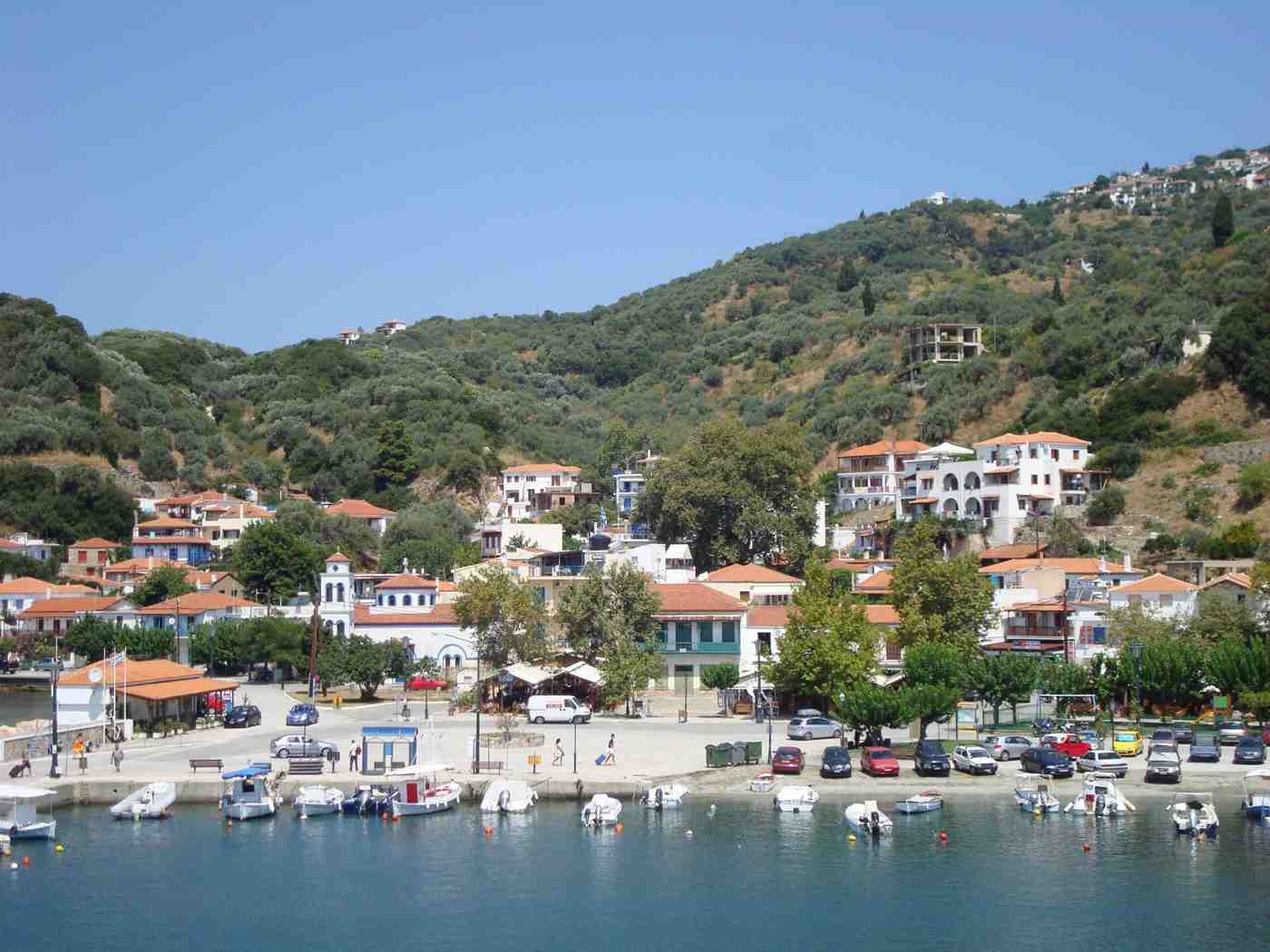
Hiking on Skopelos draws walkers across the Sporades, because pine forest covers close to two-thirds of the island and old cobbled paths still cross it. Waymarked footpaths and stone kalderimi link Skopelos Town with the monasteries of Mount Palouki, the Sendoukia rock-cut tombs, the northern village of Glossa and quiet coastal coves. The trails read as a working heritage network rather than a resort attraction. Plan the whole trip with Greece Tours.
The walking season centres on spring and autumn, when mild air and green hillsides make the climbs comfortable and the midday heat of high summer stays away. Routes range from a short stroll out of Skopelos Town to a half-day traverse across the pine ridge, and guided walks run for those who want a local guide. Water, sun protection and proper shoes suit every route on the island.
What makes Skopelos good for hiking?
Skopelos suits walkers because pine forest covers close to two-thirds of the island and old cobbled kalderimi still cross it.
Skopelos rewards walkers because forest, not development, covers most of the island. Pine woods of Aleppo pine cloak close to two-thirds of the roughly 96 square kilometres, giving shade that few Aegean islands can match on a hot day. Beneath the canopy run old cobbled mule paths, called kalderimi, that once linked the farms, monasteries and villages before roads reached them. Walkers on Skopelos follow these stone routes across ridges and down to the coast, passing olive terraces, plum orchards and springs on the way. The combination of dense pine, a network of surviving paths and a compact island scale means a walker can cross from town to monastery.
Ridge to cove, in a single morning without leaving marked ground. That density of green earns Skopelos its name as the greenest island in the Sporades chain.
Beyond the old mule paths, a network of waymarked footpaths now covers the island for visitors. Local volunteers and walking guides have cleared, signed and mapped routes that string together the monasteries of Mount Palouki. The ridge of Sendoukia, the villages and the coast. A walker no longer needs to guess where a track leads. Painted marks, wooden signposts and printed maps mark the main routes, and grade them from easy strolls near town to longer ridge crossings. The paths reuse the historic kalderimi wherever the stone survives, which keeps the walking on graded, drained surfaces built for mules rather than on rough scrambles.
This care makes Skopelos one of the more straightforward Greek islands to walk without a car, since the main trailheads sit within reach of Skopelos Town and the northern village of Glossa.
The forest itself shapes the experience of walking here. Aleppo pine, holm oak, arbutus and wild olive form a canopy that holds shade and scent through the day, and cyclamen, orchids and herbs line the paths in spring. The pine cover keeps the ground cooler than the bare hillsides of the drier Cyclades islands, so the walking stays comfortable later into the morning. Springs and old stone cisterns, built to water flocks and orchards, still surface along the routes, though walkers carry their own water rather than rely on them. Birds of prey ride the thermals over the ridges, and the pine resin scents the air after rain.
This living forest, rather than any single monument, is the setting that defines a day on the Skopelos trails and separates it from island walks over open, treeless rock.
Walking fits naturally into a wider Skopelos itinerary rather than standing apart from it. The island’s things to do in Skopelos guide places the trails alongside the beaches, the boat trips and the villages, since most walks end at a cove for a swim or at a monastery with a view. Distances stay short: the longest signed routes run hours rather than a full day, and shorter loops from Skopelos Town take an hour or two. This scale lets a visitor mix a morning on the paths with an afternoon on the water without long transfers. For travellers who want the green interior as well as the coast.
Hiking opens the parts of Skopelos that the road and the beach never reach, from ridge chapels to forgotten farm terraces.
What are the main hiking trails on Skopelos?
Skopelos trails fall into four groups: the monastery paths up Mount Palouki above the capital, the ridge route to the Sendoukia tombs, the northern descents around Glossa, and the coastal paths that link the southern coves.
The signed trails fall into a handful of clear groups across the island. The first climbs Mount Palouki, the wooded hill east of Skopelos Town, linking its monasteries on a set of connected paths. A second follows the central ridge to Sendoukia, the rock-cut tombs set on high ground near the middle of the island. A third runs in the north around Glossa, dropping through olive terraces toward the coast and the chapel of Agios Ioannis Kastri. A fourth group works the coast, joining coves such as Stafylos, Agnontas and Glysteri by cliff and beach paths. Each group starts from a road or a village. A walker can pick a route by area.
By length, and by whether it ends at a monastery, a viewpoint or a swim in the sea.
The Palouki monastery walks are the classic outing from the capital. From the edge of Skopelos Town, a road and older paths climb the pine-covered hill to a cluster of monasteries and convents, the best known reached in about an hour to ninety minutes on foot. Walkers string together Evangelistria, Metamorfosis, Prodromos and Agia Barbara on a route that gains height steadily and opens views back over the harbour and the sea. The full circuit of the main houses runs about three to four hours with stops, and shorter versions turn back at the first monastery.
This walk pairs the island’s densest concentration of religious buildings with the clearest outlook over the capital, which is why it heads most walkers’ lists on the island.
The Sendoukia route reaches the island’s most curious ancient site on foot. A track and path leave the main Skopelos Town to Glossa road near the centre of the island and climb to a rocky ridge at Karya. Where four graves lie cut straight into the bedrock. The walk from the road takes about 30 to 40 minutes each way over open, stony ground, with the pine giving way to low scrub near the top. From the tombs the view runs to both coasts of the island at once, north and south, a reward that matches the strangeness of the site.
This route suits the cooler hours and firm footwear. It works well as a short, high walk between longer days on the coast or at the monasteries.
The northern and coastal walks round out the network. Around Glossa, an old kalderimi drops from the ridge village to the port of Loutraki, and a further path leads toward the landmark chapel on its rock, giving the north its signature descent. On the south and west coast, shorter paths link the bays: a cliff path runs from Stafylos to the quiet cove of Velanio. Tracks reach the fishing anchorage of Agnontas. A coastal route joins Glysteri north of the capital. These walks stay close to the sea and end at a beach, so they suit a hot day when the ridge feels too exposed.
Together the town, ridge, north and coast groups give Skopelos a spread of routes for every length of walk and every level of effort.
What is the kalderimi network on Skopelos?
A kalderimi is a cobbled path built for people and pack animals, and Skopelos keeps one of the better-preserved networks in the Sporades. These stone routes once formed the island’s only land transport between town, villages and monasteries.
A kalderimi is a cobbled path built for people and pack animals, and Skopelos keeps one of the better-preserved networks in the Sporades. These stone-paved routes, laid with care to drain water and hold a mule’s footing, once formed the island’s only land transport. Connecting Skopelos Town and Glossa with the farms, monasteries and coastal landings between them. Master builders set the paving stones edge on, added kerbs and steps on the climbs, and bridged the ravines, work that has survived generations of use. Where the modern road bypassed the old line, the kalderimi remained, and walkers now follow these graded surfaces up the ridges and down to the coast.
The stonework itself, worn smooth in places by centuries of hooves and feet, forms part of what a walk on Skopelos passes through.
Much of the network survives because the paths kept working after the roads came. Farmers still reached terraces and olive groves by kalderimi, and pilgrims used them to climb to the monasteries, so the stone stayed clear rather than lost under scrub. Walking groups and island volunteers have since cleaned overgrown sections, rebuilt collapsed edges and signed the main lines, turning a working heritage into a marked trail system. The best-known stretches include the climb from Loutraki up to Glossa, the paths that thread the monasteries of Mount Palouki, and the descents that reach the southern coves.
These routes handle rain and steep ground better than a dirt track, which keeps them walkable across the shoulder seasons when the marked footpaths of the island see the most use.
Walking a kalderimi differs from following a modern trail. The stone underfoot sets a steady rhythm, the kerbs and steps guide the line. The old routes take the gentlest grade up a slope, since they were built for laden animals rather than for speed. Dry-stone walls, terrace edges, roadside shrines and the occasional arched bridge mark the way, small structures that record the farming and religious life the paths once served. The pine canopy shades most stretches, and springs or cisterns appear at intervals where the builders tapped water. This is heritage walking as much as exercise: the surface, the walls and the shrines carry the island’s pre-road history underfoot.
For a walker, the kalderimi turns a simple climb into a passage through the working landscape that shaped Skopelos before cars and asphalt arrived on the island.
Using the kalderimi network calls for a little care despite the sound stonework. Worn cobbles turn slick after rain or under dust, so shoes with grip help on the descents, and the steps ask for attention rather than pace. The routes are signed at the main junctions, but a printed map or a local guide keeps a walker on the historic line where newer tracks cross it. Distances stay modest, and most kalderimi routes end within reach of the coast, where the island’s Skopelos beaches guide sets out the coves that a path can reach for a swim.
Walking these paths also supports their upkeep, since the volunteer clearing that keeps them open depends on the routes staying in regular use across the walking season on the island.
How do you hike to the monasteries of Mount Palouki?
The Palouki walk climbs east from Skopelos Town on a road and older paths, reaching the convent of Evangelistria in about an hour. The route links the hill’s monasteries over roughly three to four hours there and back.
The walk up Mount Palouki starts on the eastern edge of Skopelos Town. From the harbour, a lane climbs past the last houses onto the pine-covered slope, joining the paved monastery road and the older kalderimi that shortcut its bends. The first major house, the convent of Evangelistria, stands about 4 kilometres from the centre and roughly 200 metres above the sea, reached in about an hour on foot. The route gains height steadily rather than steeply, with the harbour dropping away below at each turn. Detailed context on the hill’s religious buildings appears in the guide to the monasteries of Palouki, which sets out each monastery and its history.
On foot the climb doubles as the main viewpoint walk over the capital and its bay.
Above Evangelistria the path links the other houses of the hill. The route continues to the Metamorfosis, or Transfiguration, monastery, one of the oldest on Palouki. Then climbs toward Agios Ioannis Prodromos, set higher on the ridge with a long view over the sea toward Alonissos. The convent of Agia Barbara, fortified in form, and other smaller chapels lie along or just off the main line. Walking the full group takes about three to four hours there and back, with time to look inside those houses that stay open to visitors. The monasteries keep working religious lives, so modest dress and quiet respect apply at each door.
Between them the path runs through unbroken pine, so the walk alternates shaded forest with sudden openings onto the sea and the harbour far below.
The concentration of monasteries on Palouki gives the walk its character. The hill holds close to a dozen religious houses and chapels within kilometres. Built from the medieval centuries onward on a slope that faces the rising sun across the sea. Their position, above but within sight of Skopelos Town, tied the spiritual life of the island to its capital, and pilgrims climbed the kalderimi to reach them on feast days. Icons, carved screens and old stonework survive inside the houses that remain in use. Walking between them, a visitor reads the religious history of Skopelos in the landscape itself, house by house up the ridge.
This density of churches, repeated in miniature across the whole island, is part of why Skopelos carries a reputation for the sheer number of its chapels and monasteries.
Practical planning keeps the Palouki walk comfortable. The climb faces east and holds shade in the morning. An early start beats both the heat and the midday closing hours that most monasteries keep in the early afternoon. Walkers carry water, since the houses do not sell it, and wear proper shoes for the mix of asphalt, cobble and path. Covered shoulders and knees are expected for stepping inside. Drivers can shorten the outing by parking partway up the monastery road and walking the upper section, while walkers on foot from town treat the full climb as the day’s main route.
Timed for the morning, the walk combines the island’s densest cluster of monasteries with its clearest view over Skopelos Town and the harbour. Then returns downhill to the capital in time for a late lunch.
What are the Sendoukia rock-cut tombs and how do you reach them?
Sendoukia is a group of four graves cut into the rock of a high ridge near the centre of Skopelos. A signed track off the Skopelos Town to Glossa road reaches them in about 30 to 40 minutes on foot.
Sendoukia is a group of four graves cut directly into the rock of a high ridge near the centre of Skopelos. The name means chests or coffers, a description of the rectangular hollows carved into the bedrock, each once closed by a heavy stone lid. Their origin is debated: the graves are variously linked to the late Roman or early Christian centuries, and their isolated, commanding position adds to the puzzle. What is certain is the setting. The tombs lie on open rock at the Karya ridge, high enough that the ground falls away to both the north and south coasts of the island.
Few ancient sites in the Sporades match this combination of clear-cut stonework and panoramic position, which is why the short walk to Sendoukia features on most Skopelos walking lists.
Reaching Sendoukia is a short but exposed walk from the main road. The trailhead sits on the Skopelos Town to Glossa road near the centre of the island, where a signed track branches off toward Karya. Walkers follow the track and then a footpath for about 30 to 40 minutes, climbing gently through thinning pine onto open, stony ground. The final approach crosses bare rock with little shade, so the route suits the cooler hours and firm shoes rather than the middle of a summer day. A car or the island bus reaches the trailhead from Skopelos Town in about 15 to 20 minutes.
Sendoukia works as a half-day outing on its own or as one stop on a longer drive along the island’s central ridge toward the north.
The reward at Sendoukia is the position as much as the tombs. From the ridge the eye takes in both coasts of Skopelos at once, north toward Alonissos and the sea. South over the pine slopes toward the bays of the sheltered coast. The four graves lie close together on the flat rock, open to the sky, their cut edges sharp after the centuries. The exposure that makes the site memorable also makes it fierce in wind and sun, so walkers time the visit for the softer light of morning or late afternoon.
Standing on the bare ridge, a visitor grasps why the spot was chosen: it commands the waist of the island and the sea on either side. The walk delivers a rare mix of an ancient, human-made object set within a wide natural viewpoint over Skopelos.
Sendoukia pairs well with the rest of a day on the trails. Because the trailhead lies on the central road, walkers often combine it with a drive north to Glossa or a stop at one of the west-coast beaches on the way back. The site has no facilities, no water and no shade at the tombs themselves, so a walker brings all supplies and treats it as a self-contained outing. The bare rock underfoot and the drop on either side call for care with children and in strong wind. Timed for the cool of the morning, the short climb and the two-coast view make Sendoukia one of the most rewarding brief walks on Skopelos.
A high, quiet counterpoint to the shaded monastery paths and the coastal coves that fill the rest of a walking itinerary on the island.
Can you hike from Glossa to Agios Ioannis Kastri?
A footpath descends from Glossa through olive terraces to Agios Ioannis Kastri on the northeast coast, covering roughly 3 to 4 kilometres in about an hour to ninety minutes downhill. Most walkers arrange transport back rather than climb the ridge.
A footpath links the northern village of Glossa with the chapel of Agios Ioannis Kastri, one of the classic short walks in the north of Skopelos. The route leaves Glossa and drops through olive terraces and pine toward the northeast coast, following old field paths and stretches of kalderimi down toward the sea. The walk covers roughly 3 to 4 kilometres and takes about an hour to ninety minutes downhill, ending at the small cove beneath the landmark rock. Background on the chapel itself appears in the guide to Agios Ioannis Kastri.
Most walkers plan the return by car, taxi or the village bus rather than climbing back up to the ridge in the heat of the afternoon.
The chapel at the end gives the walk its draw. Agios Ioannis Kastri is a tiny white church set on the flat top of a rock that juts into the sea. Reached from the cove by a stone staircase of about 100 steps cut into the stone. The site gained international fame as the clifftop wedding church in the musical film shot across Skopelos and Skiathos, and it now anchors the Mamma Mia trail that links the film’s island locations. Arriving on foot from Glossa, rather than by the car park, lets a walker approach the landmark through the quiet countryside that frames it.
The climb up the rock, the small interior and the view from the summit over the northeast coast occupy about an hour before the cove below offers a swim.
The walk itself passes through the working landscape of the north. Leaving Glossa, the path threads between dry-stone walls, olive groves and plum orchards, the terraced farmland that has fed the northern village for generations. Views open across the northeast coast and out to sea as the ground drops toward the chapel. A related northern walk descends the old kalderimi from Glossa down to its port at Loutraki. A switchbacking cobbled route of about 40 minutes to an hour that gives the north a second classic descent. Both walks share the same pattern: a start high in the ridge village and a finish at the water, whether at the port quay or the chapel cove.
For a full day, a walker can combine the two, linking village, port and landmark on foot across the northern tip of the island.
Timing and transport shape the Glossa walks. The routes run largely downhill, so the effort is modest, but the return climb in the heat is not. Which is why walkers arrange a lift back or catch the bus from Loutraki. Spring and autumn suit the north best, when the terraces are green and the sun is gentler on the exposed lower slopes. Guidance on the seasons appears in the guide to the best time to visit Skopelos. Water, a hat and shoes with grip handle the loose sections of path, and an early start clears the walk before the midday sun.
Ending at the cove beneath the chapel, the descent from Glossa combines the island’s most photographed landmark with a quiet country walk and a swim. All within the northern tip of Skopelos.
When is the best time to hike on Skopelos?
Spring and autumn give the best walking weather on Skopelos, with mild air, green hillsides and swimmable sea. July and August bring hard midday heat on the exposed sections, so summer walking needs an early start.
Spring and autumn give the best walking weather on Skopelos. From about April to early June the hillsides run green, wildflowers and orchids line the paths, and daytime temperatures suit steady climbing without the fierce heat of high summer. September and October bring a second window, when the sea stays warm for a post-walk swim, the pine holds its shade and the crowds of high summer have thinned. In these shoulder months the trails, the monasteries and the coves all sit at their most comfortable for a full day on foot. The mild air lets a walker cover the longer ridge routes to Sendoukia or across Palouki that would be punishing at midday in July.
For most hikers, the spring and autumn weeks are the reason to time a walking trip to the island.
Summer walking calls for caution and an early start. Through July and August the midday heat on Skopelos climbs hard. The exposed sections of trail, the Sendoukia ridge. The bare approach to the tombs and the lower slopes above the coast, offer little shade at the hottest hours. Walkers who take to the paths in high summer set out at first light, finish the climb before mid-morning and keep the afternoon for the shaded coves and the sea. The pine cover helps on the forest routes, but it does not reach the open ridges. Water needs rise sharply in the heat, so a walker carries more than seems necessary.
Handled this way, summer still allows the shorter, shaded walks, but the long ridge traverses are best left to the cooler air of spring and autumn.
Winter turns Skopelos green and quiet but wet underfoot. From about November through February the rains restore the springs and the forest, and mild spells give clear, cool walking days with the island almost empty of visitors. The trade-off is the weather: cobbled kalderimi turn slick in the rain, streams run in the ravines the paths cross, and shorter daylight limits the longer routes. A number of rooms and tavernas along the trails close for the season, so a winter walker plans supplies and shelter with care. For the hardy, the cool months reward with solitude on paths that see steady traffic in spring.
With the forest at its greenest, though most walkers still choose the drier, warmer weeks on either side of high summer for a walking trip.
Matching the walk to the season keeps a Skopelos trip on the paths rewarding. Spring favours the long ridge routes and the wildflowers, autumn the mix of walking and warm-sea swims, and both avoid the peak heat and crowds. High summer suits early starts on the shaded monastery paths and short coastal links, kept clear of the midday hours. Winter belongs to walkers after solitude who accept wet stone and shorter days. Guided walks run mainly across spring and autumn, when local guides lead groups on the marked routes, so travellers who want company or route knowledge plan for those months.
Whatever the season, the pattern holds: walk the exposed ridges and monastery climbs in the cool of the day. Save the hot afternoons for the shaded coves and the sea along the coast of Skopelos.
What should you bring for hiking on Skopelos?
A hiker on Skopelos packs water, trail shoes with grip, sun protection and a hat, a light layer for the ridges, and a map or route. Swimwear turns the trails that end at a cove into a swim.
Walking on Skopelos calls for a short list of essentials whatever the route. Water heads it: the trails carry no reliable supply, so a walker packs at least a litre or two for a half-day and more for the ridge routes in heat. Proper shoes matter as much, since the kalderimi cobbles turn slick and the open ground at Sendoukia is loose and stony. Trail shoes or light boots with grip beat sandals on every route. Sun protection, a hat, sunglasses and a high-factor cream guard the exposed sections that the pine does not shade. A light layer handles the breeze on the ridges and the cool of a spring morning.
With these basics, most of the island’s signed routes stay within reach of any reasonably fit walker across the season.
Navigation aids turn a good walk into a safe one. The main routes carry paint marks and wooden signs at the junctions. The network is dense and old tracks cross the marked lines, so a printed walking map or a phone route keeps a walker on course. Local walking maps sold on the island mark the monastery paths, the Sendoukia track and the northern descents, and set out distances and times. Guided walks fill the gap for those who prefer not to navigate: island guides lead groups on the marked routes. Adding the history of the monasteries, the tombs and the kalderimi along the way.
A guide also carries local knowledge of which paths are freshly cleared and which have grown over, information that a map alone cannot give. For a first walk on Skopelos, a map or a guide is the sound choice.
A walker plans for food, timing and the heat as much as for the route. The trails pass shops, so a packed lunch, fruit and extra water cover a half-day out, and an early start clears the climbs before the midday sun. Letting someone know the route and the expected return time matters on the quieter northern and ridge paths, where other walkers are scarce outside high season. Basic first-aid supplies handle the scrapes of cobble and rock. Phone coverage reaches most of the island but drops in the deeper ravines, so a walker does not rely on it alone.
These simple precautions match the scale of Skopelos walking, which is rarely remote but often hot and exposed on the open sections between the shaded stretches of pine forest.
Beyond the basics, a walker packs for the swim that ends most routes. Swimwear, a towel and a dry bag let a hot climb finish in the sea at a cove such as Velanio, Glysteri or the beach below Agios Ioannis Kastri. The island’s Skopelos beaches guide sets out which coves lie at the foot of a trail. Guided walking groups often build a swim stop into the day, and carry the water and route knowledge that keep the walk safe. For photographers, the ridges and monastery viewpoints reward an early or late start, when the light is soft and the heat has eased.
Packed with water, shoes, sun protection, a map and swimwear, a walker meets everything the Skopelos trails ask across the walking season, from the monastery climbs to the coastal coves.
How do you combine hiking with beaches and swimming on Skopelos?
Walking and swimming pair naturally on Skopelos, since most paths run down to the coast. Walkers climb a ridge or monastery path in the cool morning, then descend to a cove for a swim once the afternoon heat rises.
Walking and swimming fit together naturally on Skopelos, because the island is small and most paths run down to the coast. A common pattern sets the walk for the cool morning and the swim for the warm afternoon: climb a ridge or a monastery path early. Then descend to a cove for the sea once the heat rises. The coastal walks make the link direct, ending at a beach where a hot walker steps straight into the water. Even the inland routes to Sendoukia or Palouki sit within a short drive of a bay, so the day closes at the shore. This rhythm, forest and ridge in the morning, sea in the afternoon.
Suits the island’s climate and turns a walking trip into a mix of shade, height and swimming rather than a single kind of day.
Certain routes join a walk and a swim in one line. On the south coast, a cliff path runs from the beach at Stafylos over the headland to the quieter cove of Velanio beach, a walk of about 15 to 20 minutes that ends on a pebble-and-sand shore backed by pine. North of the capital, a coastal track reaches Glysteri, a small bay used for swimming and for boat trips along the coast. In the north, the descent from Glossa finishes at the cove beneath Agios Ioannis Kastri, where a swim follows the climb up the chapel rock. Each of these walks is short enough to leave most of the day for the water.
A hot climb ends in the sea rather than back at a car park on the road.
Boat trips extend the same idea to coves that no path reaches. From the ports, small boats and organised trips run to beaches and sea caves along the coast that the trails leave out. A walker can pair a morning on foot with an afternoon afloat. This matters on the wild northern and eastern coasts, where cliffs cut off the shore from the ridge paths above. Walkers who want the remote coves without the boat follow the rough tracks that drop from the Glossa road to the northern beaches. Trading an easy path for solitude at the water.
Either way, the coast completes the walking: the height and shade of the interior in the morning, the clear water of a cove to finish. Few Aegean islands let a walker switch so easily between deep pine forest and sheltered swimming.
Building a walking-and-swimming week on Skopelos is a matter of rotating the areas. One day climbs the monasteries of Palouki above Skopelos Town and swims at a southern bay. Another walks the ridge to Sendoukia and cools off on the west coast. A third takes the northern descent from Glossa to the chapel and its cove. The things to do in Skopelos guide sets the trails within this wider mix of beaches, boat trips and villages. Spread across the shoulder-season weeks, when the walking is coolest and the sea still warm. This rotation shows the whole island: the pine interior, the ancient ridge, the monastery hill and the coast.
Hiking, in the end, is the thread that ties the green heart of Skopelos to the beaches that ring it.
Frequently Asked Questions
Do you need a guide to hike on Skopelos?
A guide is not required to walk the main trails on Skopelos, since the principal routes carry paint marks and wooden signposts at the junctions. Local walking maps set out the monastery paths, the Sendoukia track and the northern descents. Independent walkers with a map or a phone route handle the signed network comfortably. A guide adds value rather than access. Island walking guides lead groups on the marked routes, add the history of the monasteries of Mount Palouki. The rock-cut tombs and the old kalderimi. Know which paths have been freshly cleared and which have grown over since the last season.
Guided walks also build in a swim stop and carry the water and local knowledge that keep a group safe on the exposed ridges. For a first visit, for the longer or less-marked routes, or for walkers who prefer not to navigate. A guided walk is the straightforward choice. For the short town and coastal paths, a map serves well.
How difficult are the hiking trails on Skopelos?
The trails on Skopelos range from easy to moderate rather than demanding, which suits walkers of a reasonable fitness. Short coastal paths, such as the link from Stafylos to Velanio, and the descent from Glossa to Loutraki run an hour or less on graded ground. The monastery climb up Mount Palouki gains about 200 metres over kilometres and rates as moderate, a steady rather than steep ascent of an hour or more. The Sendoukia route is short but crosses open, stony ground with a modest climb. None of the island’s marked walks involves technical scrambling or exposure that would trouble a careful walker.
The main challenges are the heat on the exposed sections and the slick cobbles of the kalderimi after rain rather than the gradient. Proper shoes, water and a start in the cool of the morning bring the routes within reach of most visitors. Shorter versions of the longer walks turn back partway for those who want less.
Where do the Skopelos hiking trails start?
Most Skopelos trails start from Skopelos Town, from Glossa or from a point on the road between them. The monastery paths up Mount Palouki begin on the eastern edge of the capital, where a lane climbs from the harbour onto the pine slope. The Sendoukia route leaves the main Skopelos Town to Glossa road near the centre of the island, at a signed track toward Karya. In the north, the descent to Agios Ioannis Kastri and the old kalderimi to Loutraki both start from the ridge village of Glossa. The coastal walks begin at the bays they link, such as Stafylos on the south coast or Glysteri north of the capital, reached by car or the island bus.
A walker without a car can still reach the main routes by bus, though a hire car or scooter opens the coastal and northern paths that the bus does not serve directly.
Can you hike the Mamma Mia locations on Skopelos?
Walking reaches the best-known film location on Skopelos, the clifftop chapel of Agios Ioannis Kastri. By the footpath that descends from the village of Glossa through olive terraces to the northeast coast. The walk covers about 3 to 4 kilometres downhill and ends at the cove beneath the rock. From which a stone staircase of about 100 steps climbs to the little white church used for the wedding scene. Arriving on foot, rather than by the car park, approaches the landmark through the quiet countryside that frames it. The chapel anchors the wider Mamma Mia trail, which gathers the film’s locations across Skopelos and neighbouring Skiathos, including the southern beaches used for other scenes such as Kastani.
Those beach locations lie on the road rather than at the end of a hike, so a full tour of the film sites mixes the Glossa walk with short drives. For walkers, the descent to the chapel is the one that turns a film location into a genuine trail.
Is Skopelos good for hiking in summer?
Skopelos can be walked in summer, but July and August call for care because the midday heat climbs hard and the exposed sections of trail carry little shade. Walkers in high summer set out at first light, finish the climbs before mid-morning and keep the hot afternoon for the shaded coves and the sea. The pine forest that covers much of the island helps on the monastery and interior routes. Holding shade that the open ridge at Sendoukia and the lower coastal slopes do not offer. Water needs rise sharply, so a summer walker carries more than on a spring day and adds a hat and high-factor sun cream.
The shorter, shaded and coastal walks stay comfortable when timed for the morning, while the long ridge traverses are better saved for the cooler air of spring and autumn. Ending a summer walk with a swim at a cove such as Velanio or Glysteri makes the heat part of the plan rather than a problem to endure.
What footwear and gear do you need for Skopelos trails?
Footwear matters most on the Skopelos trails, where the kalderimi cobbles turn slick after rain and the open ground at Sendoukia runs loose and stony. Trail shoes or light boots with grip beat sandals on every route, on the climbs and the descents alike. Water comes next: the paths carry no reliable supply, so a walker packs at least a litre or two for a half-day and more for the ridge routes in heat. Sun protection, a hat, sunglasses and cream guard the sections the pine does not shade. A light layer handles the breeze on the ridges and the cool of a spring morning.
A printed walking map or a phone route keeps a walker on the marked line where old tracks cross it. For the walks that finish at a cove, swimwear, a towel and a dry bag turn the end of the route into a swim. Packed this way, a walker meets the demands of every signed route on the island.
How long do the walks on Skopelos take?
Walking times on Skopelos run from under an hour to about half a day, depending on the route. The short coastal links, such as Stafylos to Velanio, and the descent from Glossa to Loutraki take an hour or less on graded ground. The climb to the first monastery on Mount Palouki runs about an hour each way, and the full circuit of the main houses about three to four hours with stops. The Sendoukia route takes roughly 30 to 40 minutes each way from the road, a half-day outing once the drive to the trailhead is added. The descent from Glossa to the chapel of Agios Ioannis Kastri runs about an hour to ninety minutes downhill.
None of the marked walks fills a whole day, which is what lets a walker pair a morning on the trails with an afternoon at a beach. Shorter versions of the longer routes turn back partway for walkers who want a briefer outing in the heat.