
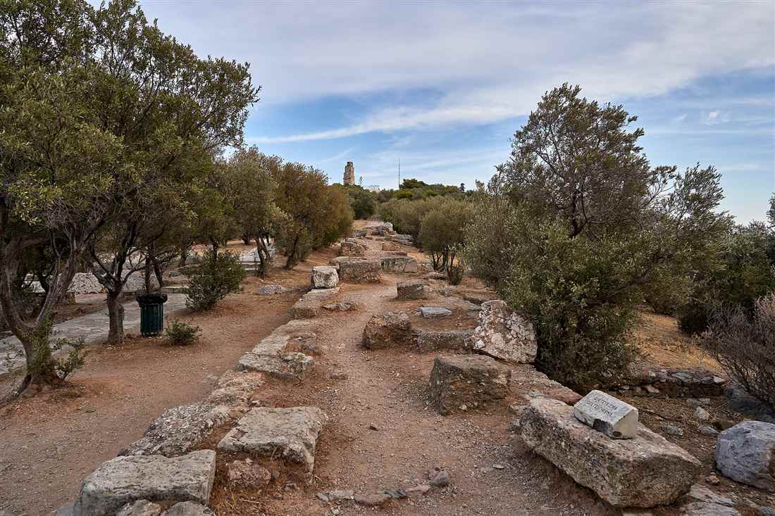
The Athens historical walking routes range from a 15 to 20 minute stroll under the Acropolis to a self-guided loop of 4 to 6 hours. Five metro stations on Lines 1, 2 and 3 start and end every leg.
The National Garden shuts at sunset, and the Acropolis gate closes at 20:00 on summer evenings and at 17:00 in winter, so hours shape every plan. Travellers still comparing Greek regions can start from the Greece Tours homepage before they settle on a city.
What are the Athens historical walking routes, and how long is each?
This page lays out seven Athens historical walking routes. One is a promenade of 700 to 900 metres under the Acropolis. Another is a self-guided loop of 5.5 to 6 kilometres. Where a source gives no length, this page says so.
The seven Athens historical walking routes cover the old centre of the city. Each one is a short leg that you can walk alone or join to the next. For the others, a source gives a walking time or a street name instead of a distance. This page says so plainly and does not guess a number.
- Promenade under the Acropolis: Hadrian’s Gate to the entrance of Philopappos Hill. Sources give 700, 830 or about 900 metres, and a local guide site gives a 15 to 20 minute walk.
- Plaka, Anafiotika and Monastiraki lanes: Plaka to Monastiraki Square. No source gives a distance or a time.
- Ancient Agora and Roman Agora route: from Monastiraki and Thiseio. Covered in its own section below.
- Hadrian’s Arch to the Panathenaic Stadium. Covered in its own section below.
- Kerameikos and Gazi, west along Ermou Street. Covered in its own section below.
- Hill route: Philopappos Hill, the Pnyx and the Areopagus. Covered in its own section below.
- Syntagma, the National Garden and the Zappeion. Covered in its own section below.
The long figure for these Athens historical walking routes comes from a self-guided walking article. It links thirteen stops between Syntagma and Psyrri and gives the length as 5.5 km in its summary. Its own text says about 6 kilometres, so the two numbers differ a little. For what each monument is, read the page on Athens historical sites.
The same article says to allow 4 to 6 hours at a comfortable pace. It adds that you need a full day if you enter the ticketed sites. That gap shows how any of the Athens historical walking routes changes once you go inside a site.
The gap between a short promenade and a long loop is the main point of these Athens historical walking routes. The promenade is flat and takes under half an hour. The long loop needs a full morning at least. The lane leg has steps and no stated time. Pick by effort, not by the number of stops.
The next two sections give more detail on the first two of the Athens historical walking routes. They name the streets in order, the metro station at each end and the surface underfoot. A length appears only where a source states it. The later sections cover the other five legs and how they join.
These Athens historical walking routes work as separate short walks. A visitor with a free morning can take one leg and stop. A visitor with two days can chain all seven. Both plans suit the legs. Each one starts and ends near a metro station or a main square.
Think of each of the Athens historical walking routes as a small product. It has four numbers: distance, time, slope and the station at each end. Where a number is missing, the leg is still usable. You only need to plan a little more time for it.
Which of the Athens historical walking routes follows the pedestrian promenade under the Acropolis?
The promenade of Dionysiou Areopagitou Street and Apostolou Pavlou Street is the flattest of the Athens historical walking routes. It runs along the Acropolis from Hadrian’s Gate to the entrance of Philopappos Hill in 15 to 20 minutes.
A local guide site gives 15 to 20 minutes for this promenade, one of the Athens historical walking routes. The same site calls the two streets together a one-mile promenade, known as the “Big Walk”. It also says the street has a gentle slope and suits cycling and running.
The length of this leg depends on the source. The city’s accessible routes page says Dionysiou Areopagitou extends for 700 metres. A Wikidata entry gives 830 metres. The local guide site says about 900 metres. No source says what each figure covers. Treat the main street as under a kilometre.
The accessible routes page also gives the climb and the surface. It lists 11 metres of elevation and stone paving. That is a small rise over the whole street. A pushchair or a slow walker can manage it. This promenade has the firmest ground of all the Athens historical walking routes on the page.
No source states the number of trees. Sources also leave out the benches and the gates to the theatre and the odeon. This page leaves those details out too. Check them on site. Look for shade yourself, because no source gives a figure for it.
The east start is Hadrian’s Gate, the arch at the end of the street. The west end is the entrance to Philopappos Hill, where the street meets Apostolou Pavlou Street. A guide site names these two points. A Plaka travel page places Acropoli station to the south of the district, which suits the east start.
No source names a station for the west end. So plan to walk back, or carry on over the hill. This promenade is a link between other legs. It joins the arch and stadium leg on the east to the hill route on the west.
Read the Acropolis one-day itinerary for a plan that puts the rock first and the walk after it. Walk the promenade slowly in the evening if you want the light on the rock. It is a public street, so the pavement stays open to walkers and needs no ticket.
As a route product, this leg scores well on every measure a sourced page can show. It is short, close to level and paved. A first-time visitor can start here, learn the pace, then add the harder legs of the Athens historical walking routes.
Which of the Athens historical walking routes links Plaka, Anafiotika and Monastiraki?
The lane route takes the highest effort per metre of all the Athens historical walking routes. It runs from Plaka up through Anafiotika and down Adrianou Street to Monastiraki Square, and no source gives its distance.
A Plaka guide names two main pedestrian streets that cross at the centre of the district, Kydathineon and Adrianou. The same guide says Adrianou begins in the Monastiraki flea market. It vanishes at the Roman Agora, next to Hadrian’s Library. It returns behind the library wall and Plaka Square.
The gradient of the lane leg among the Athens historical walking routes changes with the height. A Plaka travel page says the lower half near Monastiraki and Syntagma runs close to flat. The upper half climbs in ramps, marble slabs and open flights of steps.
Another guide says Mitropoleos and parts of lower Adrianou are easier. It adds that Upper Plaka and Anafiotika have serious limits.
Anafiotika is a cluster of small houses on the slopes of the Acropolis above Plaka. You reach Anafiotika by steps. A local guide names Mnisikleous Street as a stair route. Another page says to walk from Monastiraki metro to the Old Agora Square and look for that street. No source gives a count of steps.
The lanes are narrow. One source describes a lane the width of two people, with no road into it and no obvious entrance. You arrive through a gap between houses. People live there. Keep your voice low and never block the steps.
The end is Monastiraki Square, where metro Lines 1 and 3 meet. Syntagma, on Lines 2 and 3, sits at the other edge of Plaka. So you can start at one station and finish at the other. You do not need to retrace your steps.
Walk this leg downhill. Start high in the lanes, go down Adrianou and finish at the square. That order keeps the steps going down. It saves your legs for the next route.
The surface is a mix of ramps, slabs and stairs, so wear shoes with grip. Among the Athens historical walking routes, this one gives the least predictable ground. It rewards a slow pace and an early start, when the lanes are quiet.
Sources give no time for the leg. Plan for stops and photographs, not for a fixed number of minutes. If the steps are hard for you, stay on the lower half. A source calls that half close to flat, and it sits near Monastiraki and Syntagma.
Both metro stations at the edges of this leg help with planning. Monastiraki has Lines 1 and 3 and Syntagma has Lines 2 and 3. Choose the one that fits your next stop, and the lane route becomes a simple link between two lines.
Which of the Athens historical walking routes passes the Ancient Agora, Roman Agora and Tower of the Winds?
This leg of the Athens historical walking routes starts at Monastiraki or Thiseio. It crosses the Ancient Agora, then goes on to the Roman Agora. Sources give minutes, not kilometres: ten minutes between the two agoras.
The Ancient Agora has two gates. A ticket-guide site puts the northern entrance at Adrianou Street 24, near Monastiraki Square. It says the turnstiles are a 150-metre walk south along Adrianou Street from Monastiraki metro station.
The second gate sits on Thiseio Square. The same ticket-guide site places it on the Apostolou Pavlou pedestrian street, near Thissio metro station. So the walk can run in either direction. Pick the end that suits your train. Both ends suit these Athens historical walking routes equally well.
Inside, the ground slopes gently, with gravel and stone paths, a visitor site says. That holds for this leg of the Athens historical walking routes. Nothing is paved like a street. Here you walk on loose ground for the first time, so wear shoes with a good grip.
A travel page notes shady trees and winding pathways. That helps on a hot day. A lower-level museum sits inside the site too. The temple of the smith god lies on the north-west side, close to Market Hill. A travel page gives its size as 13.7 by 31.8 metres.
The next stop is the Roman Agora. A public tourism site gives its address as the corner of Pelopida and Eolou Streets, in Plaka. It says the site is 3 minutes from Monastiraki Square. It puts the Ancient Agora 10 minutes away on foot.
The Tower of the Winds is an octagonal marble building. It stands in the north-eastern corner of the Roman Agora site, so you meet it last. The same tourism site says to allow 30 to 45 minutes for a focused visit.
The tourism page also links the Roman Agora with Hadrian’s Library next door on these Athens historical walking routes. It calls the pair, with the Ancient Agora, a circuit of 2 to 3 hours. No page states a visit time for the Ancient Agora. Each site has its own separate ticket, says a visitor site.
Getting to the start is simple. A visitor site names Monastiraki, on Lines 1 and 3, and Thissio, on Line 1. A ticket-guide site adds that bus lines 025, 026 and 227 stop at Monastiraki. It also says Syntagma Square is around fifteen minutes away through Plaka.
The agora leg can end here, or it can carry on into the other Athens historical walking routes. For the history of the site, read the guide to the Ancient Agora.
- Leg 1: Monastiraki station to the Adrianou Street gate.
- Leg 2: through the Agora to the Thiseio gate, or back out the same way.
- Leg 3: Monastiraki Square to the Roman Agora, ending at the tower.
Which of the Athens historical walking routes runs from Hadrian’s Arch to the Panathenaic Stadium?
Of the Athens historical walking routes, this stretch follows Vasilissis Olgas Avenue. It runs from Hadrian’s Arch past the Temple of Olympian Zeus to the Panathenaic Stadium. Sources give eight minutes for one gap and about 1 km for another.
Start the temple leg of the Athens historical walking routes at Akropoli station on Line 2. A tourism site says the temple is a 5-minute walk south along Vasilissis Olgas. A guide to the temple gives 600 metres from the station. These are two separate sources.
The same tourism site gives other starts. It lists 12 minutes from Syntagma Square, 10 minutes from Plaka and 8 minutes from the Acropolis south entrance. The temple’s own visitor page lists one main entrance. It lies on Vasilissis Olgas Avenue, near Hadrian’s Arch.
The gap between temple and stadium on this route needs care. A guide to the stadium says the temple is eight minutes’ walk from it. The temple’s own visitor page lists about 1 km and a 15-minute walk. Read it as 8 to 15 minutes. Your pace and the crossings decide.
Shade is thin on the avenue itself, and no source states a percentage. The garden side is different. A booking page describes leafy paths, fountains and statues around the Zappeion. A blog says the stadium is visible straight ahead from the Zappeion side. You cross Vasileos Konstantinou Avenue to reach it.
Budget time at the end. The stadium guide says to allow 60 to 90 minutes. The temple guide asks 30 to 45 minutes for a focused visit and 60 to 90 for a thorough one. These figures come from sources.
A blog describes a way back. Walk along Vasileos Konstantinou Avenue. After about 500 metres, or 7 to 8 minutes, you reach the corner of Vasilissis Amalias and Vasilissis Olgas Avenues. The blog also says a walk through the National Garden takes 10 to 15 minutes.
Tram riders can use the Zappeio stop. The temple page gives a 5-minute walk from it. One tourism page builds a morning plan around the Acropolis and this avenue. It lists a 45-minute walk down Dionysiou Areopagitou to the temple. Then it adds 60 minutes for the garden, the Zappeion and the stadium.
That plan shows how the Athens historical walking routes chain together. See the Panathenaic Stadium page for the visit itself.
Which of the Athens historical walking routes leads to Kerameikos and Gazi?
The westward one of the Athens historical walking routes follows Ermou Street from Monastiraki to Kerameikos, then on to Gazi. A travel site gives 15 minutes from Monastiraki Square to the site. No source gives a length in kilometres.
The start of this leg of the Athens historical walking routes can be Monastiraki or Thiseio. A travel site lists the site at Ermou 148. It names Thiseio and Kerameikos as the nearest metro stations. From Thissio the walk is 5 to 10 minutes. From Monastiraki it is 15 to 20 minutes, says another page.
A third page gives 15 to 20 minutes from the Ancient Agora and Hadrian’s Library. So this leg can join the agora leg of the Athens historical walking routes. Walk west from the Thiseio gate and you reach the cemetery site.
Ermou changes character along the westward stretch of the Athens historical walking routes. A guide site says it is a pedestrian shopping street that begins at Syntagma. Just before Athinas Street and Monastiraki Square, it turns back into a traffic street. That stretch runs on until the Byzantine church of Ag Assomaton.
After the church, the street has stopped, but the walk goes on. The guide describes a park that runs beside the metro tracks on one side. The Kerameikos site lies on the other side. This is the quietest part of the leg.
A blog says the site is planted with native Mediterranean vegetation. It has views of the Acropolis and Lycabettus Hill. A travel site calls the museum on site small but excellent. This leg of the Athens historical walking routes has a museum right beside the path.
The end is Gazi. A travel page says Gazi is 5 to 10 minutes from Kerameikos on foot. To go back without walking, take the Blue Line, Line 3. A travel site says it stops at Kerameikos station, in the heart of Gazi.
Read the Kerameikos page for what lies inside the gate. This westward walk follows Ermou Street out of the centre and gives the Athens historical walking routes their western end.
- Leg 1: Monastiraki Square, west along Ermou Street.
- Leg 2: the park beside the metro tracks to the Kerameikos site.
- Leg 3: on to Gazi, or Line 3 from Kerameikos station.
Which of the Athens historical walking routes climbs Philopappos Hill, the Pnyx and the Areopagus?
The hill route is the one among the Athens historical walking routes that climbs three rocky hills. A travel site puts the round trip from the Philopappos monument to the Pnyx at 45 minutes to an hour.
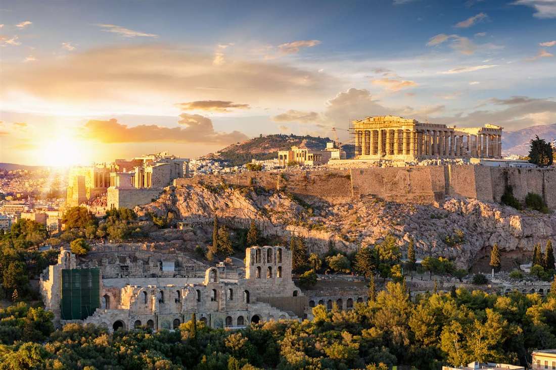
The hill route has five legs, listed here in the order a walker meets them:
- Start at the Areopagus, just off the western slope of the Acropolis.
- Walk on to the foot of Philopappos Hill.
- Climb the stone paths to the top and the monument.
- Walk the extra stretch west to the Pnyx, which one site puts at hundreds of metres.
- Go back down by the same hill paths.
A blog on Athens says the Areopagus sits at the end of the western path from the Acropolis. The same blog gives the top of the hill as 115 metres. An encyclopedia entry gives 113 metres. The two figures are close.
Philopappos Hill is higher. Three travel sites give 147 metres above sea level. One travel site says the climb from the base takes 15 to 25 minutes on gentle dirt and paved paths. Another gives about 15 minutes from the main Acropolis entrance or the Areopagus. For the visit itself, see the Philopappos Hill page.
The paths on the hill leg of the Athens historical walking routes are not all alike. A travel club guide describes a stone path with steps that runs straight to the top. A tourism site describes shady paths among pines and olive trees.
The Areopagus has steps too. A roadside marker there shows the stairs that lead to the summit.
Getting to the foot of the hill is a walk of its own on the Athens historical walking routes. One site says it is a 10 to 15 minute stroll from the metro exit. Another travel site says the whole hill, with the forest park on its lower slopes, takes about two hours.
That is the long version of this walk.
The view is the draw of this leg. A travel site calls Philopappos Hill a good place for photography and sunset views. Wikipedia’s article on the Pnyx places that hill about 2 km south-west of Syntagma Square.
The sources give no total in kilometres for the hill loop of the Athens historical walking routes. The times above are the only figures a source states. Treat them as a guide and add time for rests on the steps. The paths mix dirt, pavement and stone steps.
Think of the hill route as the climbing leg among the Athens historical walking routes in the centre. The three summits give three lookouts in one outing. The hills are close together, so the walk between them is short. Bring water, because the shade a source names is under the pines.
Timing changes the hill walk of the Athens historical walking routes. A travel site calls the hill good for sunset. That suits an evening finish. Start the loop in the late afternoon and carry a light. The same climb in the early evening also keeps the walker off the open slope at midday.
Which of the Athens historical walking routes crosses Syntagma Square, the National Garden and the Zappeion?
The garden route is among the Athens historical walking routes that stays flat and green. It runs from Syntagma Square into the National Garden and out to the Zappeion. The garden is open every day from sunrise to sunset.
The legs of these Athens historical walking routes run in a line through the city centre:
- Start at Syntagma Square, by the Parliament building.
- Watch the guard change on the hour at the square.
- Enter the National Garden, which has its address on Amalias Avenue.
- Follow the garden paths south.
- Leave the garden and reach the Zappeion.
A heritage network page says planting began with a small plot of 2.5 hectares. It says the garden had grown to 15.8 hectares by the early 1850s. A tourism site says the garden covers almost 16 hectares today.
The sources agree on the hours. A regional tourism page says the garden is open every day from sunrise to sunset. The same page says hours can change in an emergency or for security reasons. So the loop needs daylight. A night walk cannot include the garden. The National Garden page covers the visit in more detail.
The guard change is easy to fit into the start. A travel site says the Evzones swap places every hour, on the hour, all year. Another site says Sunday has a larger parade at 11:00, with the band. Plan around the hour if you want to see it. The ritual takes a number of minutes.
The sources give no distance or walking time for the garden walk, one of the Athens historical walking routes. No source describes the surface of the garden paths either. A plain statement is better than a guess.
This leg also works as a short break between two heavier ones. A walker who has done the lanes of Plaka can finish on a flat green path. That is the reason the plans below place it late in the day. The Athens historical walking routes reward a mix of hills and level ground.
How do the Athens historical walking routes combine into a half day, a day or two days?
The Athens historical walking routes join into four plans: a half day, a full day, two days and an evening. Each plan adds the times that sources state and leaves the rest for stops and gate hours.
- Half day: the promenade under the Acropolis, then the hill route. The stated times are 15 to 20 minutes and 45 minutes to an hour, which add up to 60 to 80 minutes before any stop.
- One day: the Plaka lanes in the morning, the Ancient Agora next, the hill route in the afternoon, and the garden route at the end. The garden closes at sunset, so it comes before dark.
- Two days: the hill route and the Plaka lanes on day one. The garden route and the walk from Hadrian’s Arch to the stadium on day two, where sources give 8 to 15 minutes for the gap.
- Evening: the hill route at sunset, then a walk back along the promenade. The garden is closed after dark, so leave it out.
Rest where the ground is flat and shaded when you join legs into one day. The hill route has pines and olive trees on its paths, according to a tourism site. The garden is a green stop at the end of a day. Syntagma Square is the place to watch the hourly guard change.
Full totals of the Athens historical walking routes need times that sources do not give. That covers the lanes, the garden and the Agora paths. Where a source states a time, the sum is easy. The hill circuit is 45 minutes to an hour, and the climb alone is 15 to 25 minutes.
Break for water after each hill. Sit in the garden before the gates close at sunset. Leave the long steps of the lanes for a fresh morning.
With a single day in the city, the guide to one day in Athens shows where the Acropolis visit sits. Keep the hill route for late in the day. Keep the garden route for when the gates are open. Both fit these Athens historical walking routes without a rush.
Which metro stations start and end the Athens historical walking routes?
Five stations anchor the Athens historical walking routes. Acropoli sits on Line 2 and Thiseio on Line 1. Monastiraki serves Lines 1 and 3, Syntagma serves Lines 2 and 3, and Kerameikos sits on Line 3.
Acropoli is the start for the promenade leg of the Athens historical walking routes. A page from the Acropolis Museum names Line 2 and calls Akropoli the nearest station. A travel site says the station sits right below Dionysiou Areopagitou Street. You step out and the walk begins.
- Acropoli – Line 2 – the promenade under the Acropolis
- Thiseio – Line 1 – the Agora side and the hill routes
- Monastiraki – Lines 1 and 3 – the lanes of Plaka and Anafiotika
- Syntagma – Lines 2 and 3, plus the tram – the square and the garden
- Kerameikos – Line 3 – the western walk towards Gazi
Two stations are interchanges. Wikipedia’s article on Monastiraki calls it an interchange between Lines 1 and 3. Syntagma is the transfer point between Lines 2 and 3 and the tram. With these two, the Athens historical walking routes link up without a trip back to your hotel.
The stations on the Athens historical walking routes also sit next to each other. On Line 1, Thiseio is the stop before Monastiraki. On Line 3, Kerameikos is the stop before Monastiraki, and Syntagma follows on the other side. A walker can cut any leg at one of these stops and finish by metro.
Evangelismos is the stop after Syntagma on Line 3, according to Wikipedia. No source ties it to a walking leg, so the page treats it as a spare exit. A travel site also names a bus stop called Mousio Akropolis on bus line 230.
For the full network, read the Athens metro guide. Wikipedia’s list says the network has 66 stations on three lines. Only these five matter for the legs in the centre. Pick the start by the leg you want, and the end by where you want to rest.
Thiseio has a long record. Wikipedia calls it an old station on Line 1. It takes its name from the nearby Temple of Hephaestus. That makes it a natural gate for the western legs. Line 1 from Piraeus reaches Thiseio before Monastiraki.
So the choice of station shapes the whole day. Start at Acropoli for the promenade. Use Thiseio or Monastiraki for the lanes and the Agora, and Syntagma for the garden. These five stops cover every leg of the Athens historical walking routes in this plan.
How steep, shaded and step-free are the Athens historical walking routes?
No source gives a slope in percent for the Athens historical walking routes. The ministry does state that the Acropolis rock is 160 metres high and has a lift. The promenade and the streets are the flattest legs.
Gradient is where the legs differ. The ministry’s visitor page describes the Acropolis as a rocky outcrop 160 metres high. A travel blog says Areopagus is free to climb. No page gives a gradient in percent for the hills. None counts the steps of Anafiotika or the Agora paths. So this page gives none.
Surface and shade need the same plain answer. No source states how slippery the marble is. None says where trees give shade. What the ministry does say is clear. It recommends footwear suitable for walking on archaeological sites. Wear shoes with grip, then judge the ground yourself.
Step-free options exist at the main sites on the Athens historical walking routes. The ministry says the Acropolis has a lift for people with mobility difficulties. At the Ancient Agora, both levels of the museum in the Stoa of Attalos are wheelchair accessible. A visitor can ask the guards for the lift to the upper floor.
Step-free access to the Agora site goes through the entrance on Adrianou Street, as the ministry’s page states. Plan the Athens historical walking routes around that gate if you use a wheelchair or push a pushchair. Street legs have kerbs and crossings that no source describes, so check them on the day.
The ministry also lists accessible toilets outside the South Slope entrance. They stand at the Information Centre, 18-20 Dionysiou Areopagitou Street, 50 metres east of that entrance. That is a useful break point on the promenade leg. The Agora museum offers tactile plans and Braille brochures for blind and partially sighted visitors.
For a wider view of the rock itself, see the Acropolis accessibility information page. Use the street legs when your legs are tired. Keep the hill legs for a day with energy and time.
Bags are not a problem on the open sites of the Athens historical walking routes. The ministry says visitors can enter the Acropolis with small backpacks and handbags. Carry water in one of those, because the same page bans food and drink inside the site.
A short summary helps. The flat, step-free end of these Athens historical walking routes is the street and museum legs. The hard end is the rock and the hills, where no source gives a gradient. Choose by your own pace.
Shade is the open question. Since no page maps the trees, carry a hat in every season. Sunshine is long here, as the next section shows. Plan a rest in a museum or a station when the sun is high.
Which hours and seasons suit the Athens historical walking routes?
Sites open from 08:00 along the Athens historical walking routes. The ministry lists a closing time of 20:00 for the Acropolis in summer and 17:00 in winter. July highs reach 33 degrees Celsius and December highs sit near 14.6.
Street legs of the Athens historical walking routes have no gate, so you can walk them whenever you like. The sites do have a clock. The ministry’s Acropolis page lists last entry at 19:30 in summer. Winter closing is 17:00. A page for the Ancient Agora shows the closing time stepping down in two-week stages through September and October.
Closed days matter on the Athens historical walking routes. The ministry says all archaeological sites, monuments and museums stay shut on Easter Sunday and on the labour holiday. A ministry page for the Agora adds hours for Good Friday, 12:00 to 17:00. Holy Saturday runs 08:30 to 15:30. Check the ministry site before you fix a date.
Summer is hot. A weather site gives a July daytime high of 33 degrees Celsius and a night low of 23. It counts one rainy day in the month. Another page says the July day lasts about 14 hours. Long daylight lets the Athens historical walking routes run into the evening.
Winter is short and wetter. One weather site gives a December high near 14.6 degrees and a low near 7.5. It counts 13 days of rain, days of about 10 hours and about 4 hours of sunshine. Plan one site-heavy leg a day, and finish before the gates close.
A climate site reports almost 2,800 hours of sunshine a year. That is a strong reason to carry a hat and water in every season. No source states the hottest or quietest hours on the open sites. This page does not guess.
For month-by-month detail, see Athens weather. Use it to choose a week, then use the ministry site to choose a day. Fit the leg you want into the hours you have left.
One travel site offers a rushed plan of three hours that skips ticketed sites. It calls a classic self-guided walk a 4 to 6 hour outing. Use those numbers to match a leg to the time before closing. The Athens historical walking routes work well when you start at 08:00.
The start time is a choice, not a rule from a source. Still, the ministry opens the sites at 08:00. A walker who begins at the gate has the full day for the stops. A late start leaves less time before closing, especially in winter.
In short, the season sets the heat and the daylight, and the ministry sets the gates. Pair the two before you choose a date. The Athens historical walking routes then fit into a day without a rush, whether you pick one leg or three.
How do guided tours and self-guided walks follow the Athens historical walking routes?
A guided tour walks a fixed line with a person who explains each stop. A self-guided walk follows a map or an app on your phone. Both use the same streets on the Athens historical walking routes. Sources give lengths from one kilometre to 5.5 kilometres.
Self-guided versions of the Athens historical walking routes are easy to find as app pages. One app page lists a short Acropolis walk of one hour and one kilometre. It says the route map can be downloaded to a mobile device.
A second audio-guide page gives a longer figure. It calls its Acropolis walk a two-kilometre route with an average time of 120 minutes. It asks you to install an app with automatic GPS playback and offline maps.
The longest self-guided figure comes from a route article. It lays out 13 stops across 5.5 km from Syntagma to Psyrri. The same article says the walk works in any season. In summer it advises an early start and water.
Guided tours of the Athens historical walking routes have thinner public facts. A ticket-seller page shows one listing that adds an old-town audio guide to Acropolis and museum tickets. The public page gives no group size, language list or meeting point. Check those details on the booking page before you pay.
What does a guide add to the Athens historical walking routes? One guest review on a tour page says the guide found shade at every stop. That helps on bare rock in summer. The same review tells visitors to bring water, sunscreen and a hat.
A walker without a guide needs a map, a charged phone and the same water and hat. An offline map helps, because the audio-guide page names offline maps as a feature. A guide does the navigating for you. An app does it with a voice.
The page on the Athens walking tour covers one classic walk in detail. It is the simplest way to follow the Athens historical walking routes on a first visit. For a walk with no booking, read about a free walking tour as well.
To choose, start from the time you have. The one-hour app walk is the shortest figure in the sources. The 5.5 km route article is the longest. Between them sits the two-kilometre audio walk. Pick the plan that fits your legs and your day.
Whichever format you pick, the Athens historical walking routes stay the same on the ground. Only the way you find your turns changes. A guide speaks, an app plays audio and a paper map waits in your pocket.
Which tickets and site rules shape the Athens historical walking routes?
Legs that enter the Acropolis, the Agoras, Kerameikos or the Olympian Zeus site need a site ticket. Sources say the old five-day combined ticket has been withdrawn, so each site sells its own entry. Street stretches on the Athens historical walking routes need none.
The older combined ticket matters because it shaped how people planned the Athens historical walking routes. A tourism-board page says the ministry’s five-day ticket covered seven sites. They were the Acropolis, Ancient Agora, Roman Agora, Hadrian’s Library, Kerameikos, the Olympian Zeus temple and Aristotle’s Lyceum.
Two sources say it is gone. One says it has been withdrawn and each site now sells its own ticket. A travel site says the official government combination ticket has been discontinued. Our page on the Acropolis multi-site pass covers passes sold by others.
So a leg that touches three paid sites on the Athens historical walking routes needs three entries. That is a planning point for every day of walking. Count the gated sites on your leg list first. Then count the open streets between them.
Opening hours differ by site. A travel site says the Panathenaic Stadium is open daily, from 8am to 7pm between March and October. It lists 8am to 5pm from November to February. A tourism page gives the Acropolis summer schedule as 8:00 am to 8:00 pm, with last entry at 7:30 pm.
Closing days matter too. A travel site lists closures on 1 January, 25 March, Orthodox Easter Sunday, Christmas Day and 26 December. It adds the labour holiday in spring.
The ministry page names Easter Sunday and Labour Day as closed. It gives Good Friday as 12:00 pm to 5:00 pm. For Holy Saturday it gives 8:30 am to 3:30 pm. Check these dates before you fix a day for the Athens historical walking routes.
Rules apply on every paid leg of the Athens historical walking routes. One ticket-seller page says flash photography, tripods, drones and professional gear need special permission. It also says large backpacks, suitcases and bulky bags are not allowed inside. Travel light.
The ministry page recommends footwear suitable for walking. It says rule breakers can be sent out. It asks you to walk along marked routes, avoid restricted areas and not touch any work of art. A news article adds that high-heeled shoes are prohibited at archaeological sites.
A ticket-seller page also advises sturdy walking shoes for the uneven marble paths and rocky ground. Shoes are the one rule that suits both the street legs and the site legs.
The sources name the paid sites only. Treat any stretch outside a gated site as open street.
What do visitors ask about the Athens historical walking routes?
How long is the walk from the Acropolis to Monastiraki?
A local guide site puts the promenade under the Acropolis at 15 to 20 minutes. The lane route then ends at Monastiraki Square. No source gives one time for the whole link, so add the two legs yourself.
Is the promenade under the Acropolis open all day?
It is a public street with no gate, so it needs no ticket. The sites beside it keep set hours. The ministry lists 20:00 as the summer closing time for the Acropolis and 17:00 as the winter one.
Can you walk the routes with a pushchair?
The promenade is paved and rises 11 metres over its whole length. The Ancient Agora has a step-free entrance on Adrianou Street. The lanes above Plaka climb in steps, so a pushchair suits only the flat lower half.
Where do the routes start by metro?
Five stations serve the legs: Acropoli, Thiseio, Monastiraki, Syntagma and Kerameikos. The metro section above pairs each station with its line. It also names the leg each one serves among the Athens historical walking routes.
Are the routes safe at night?
No source rates night safety on the Athens historical walking routes. The facts are about hours. The garden closes at sunset. The stadium closes at 7pm or 5pm by season, and the Acropolis at 8:00 pm in summer.
Which routes fit into one day?
The one-day plan joins four legs: the Plaka lanes, the Ancient Agora, the hill route and the garden. A route article fits 13 stops over 5.5 km into one walk. Pick two or three legs of the Athens historical walking routes and keep the rest for another day.