
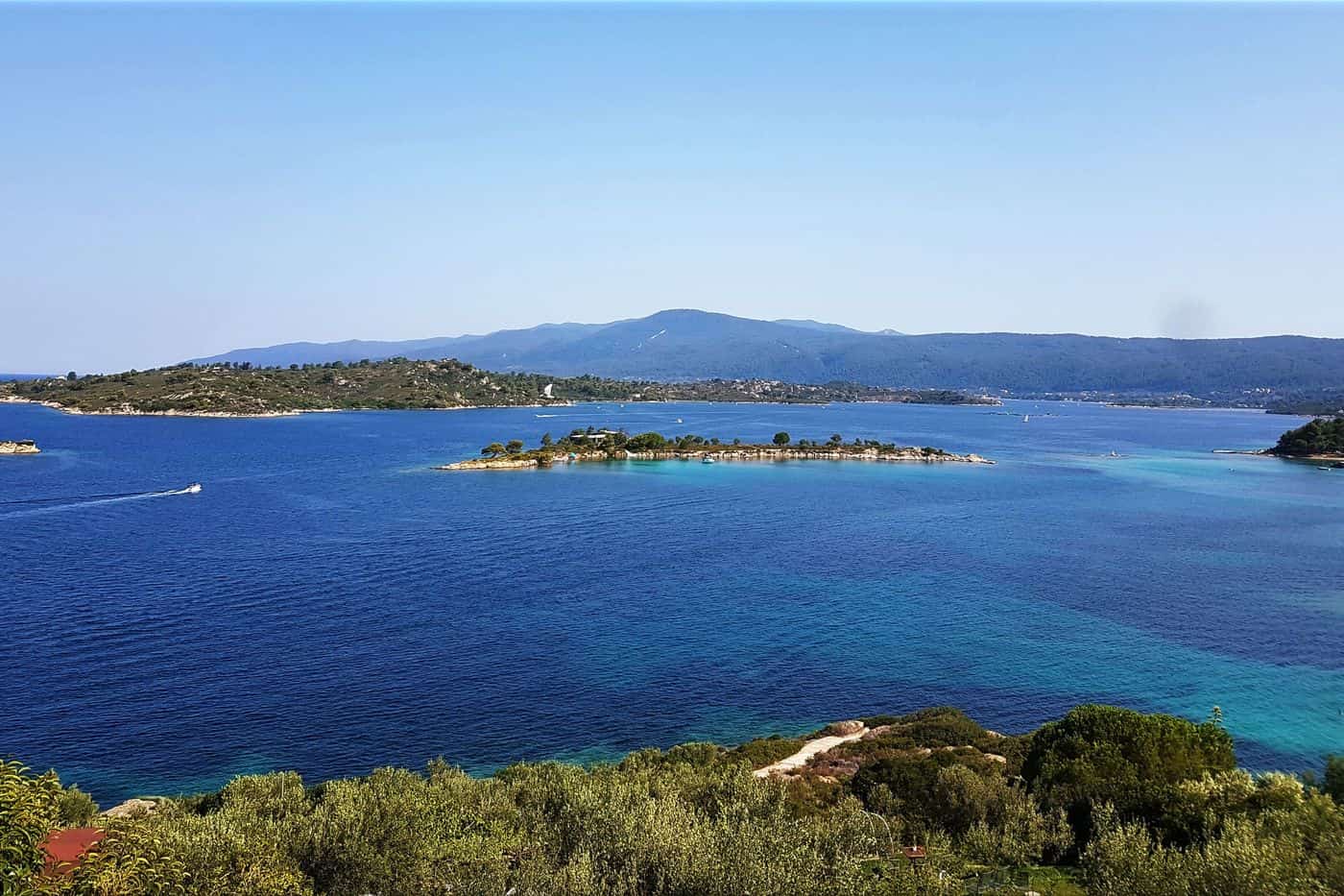
Vourvourou tours start in a seaside village on the east coast of the Sithonia peninsula in Halkidiki, facing a sheltered bay scattered with small islands, the largest of them Diaporos. The routes cover boat trips to the Blue Lagoon of Diaporos, the islets of the bay, the beaches of the coast, kayaking, e-bike rides and cruises towards Mount Athos. Greece Tours lists the boat trips that leave from Vourvourou and the nearby harbours.
This page covers what Vourvourou tours see at sea and on the shore, which activities and longer cruises they add, how visitors reach Vourvourou, and which season suits each route. The tours below are checked on GetYourGuide and Viator and leave from Vourvourou, Ouranoupoli and other harbours of Halkidiki.
What do Vourvourou tours cover?
Vourvourou tours cover boat trips across a calm bay on the east coast of Sithonia, where nine islands lie opposite the village. Choices run from private skippered cruises and self-drive boats without a licence to 6-hour group cruises with lunch.
Vourvourou lies between Ormos Panagias and Sarti, and its islands shelter the bay from the open sea. GetYourGuide lists 15 results for Vourvourou tours, from Blue Lagoon cruises and private cruises to Diaporos Island to snorkelling and scuba diving trips that start in Nikiti. For trips elsewhere on the peninsula, see our Sithonia tours.
A private skippered cruise books the whole boat, and the skipper handles navigation, anchoring and the choice of coves. A self-drive rental gives you a small motorboat with a safety briefing, a digital map, GPS tracking and a cool box. Explore Boat Trips runs both kinds of Vourvourou tours from the beach in front of Ekies Resort, open to hotel guests and outside visitors alike.
- Private cruises: 2 to 7 hours, with skipper, fuel, water, towels, life jackets and port fees included.
- Boat sizes: the private fleet runs from the Brig 22 Navigator for 6 guests to the Cranchi 26 eRider for 9.
- Self-drive rentals: the Explorer 15ft, Navigator 17ft and Voyager 19ft need no licence; the Skipper 20–22ft does.
- Day trips: an 8-hour private boat day covers Vourvourou and the Sithonia coast for up to 7 guests.
Which Vourvourou tours sail to Diaporos island and the Blue Lagoon?
Vourvourou tours reach Diaporos on the 3-hour Classic and 5-hour Premium cruises of Explore Boat Trips, both with a stop at the Blue Lagoon. A 5-hour private cruise carries up to 7 guests, and Albatros Cruises runs a 7-hour snorkelling trip.
Diaporos also carries the names Vourvourou and Dimitris, so the Albatros trip to “Vourvourou Island” lands on Diaporos as well. The 2021 census recorded no permanent residents on the island, and its buildings are mainly private holiday homes. In summer, visitors arrive by private boat and on organised Vourvourou tours to swim in the shallow water around it.
The Blue Lagoon is a narrow strait between Diaporos and the islet of Agios Isidoros. Its shallow water over a white sandy seabed turns a pale glacier blue, and a Vourvourou boat rental firm calls it a natural pool for snorkelling. Beyond the Vourvourou tours that start in the village, GetYourGuide lists two 6-hour group cruises that pair the Blue Lagoon with Ammouliani Island, and the top pick leaves from Ormos Panagias with a meal included. For a sail around the peninsula, see our Sithonia sailing tour.
- Classic, 3 hours: the Blue Lagoon, Hawaii Beach, Mesopanagia Cove and Dimitri’s Cove.
- Premium, 5 hours: the Classic stops plus Karydi Beach, Krifto Bay, Ampelitsi and Peristeri.
- Sunset, 2 hours: Karydi Beach, the Blue Lagoon, Hawaii Beach, Mesopanagia Cove and Vourvourou Bay.


What do Vourvourou tours see on the islets of the bay?
Vourvourou tours pass nine islands in the bay: Diaporos, the largest, and smaller islets such as Agios Isidoros, Peristeri, Elia and Ampelitsi. Diaporos holds the ruins of the pre-Byzantine church of Agios Andreas and Krifto, a bay over 700 metres long.
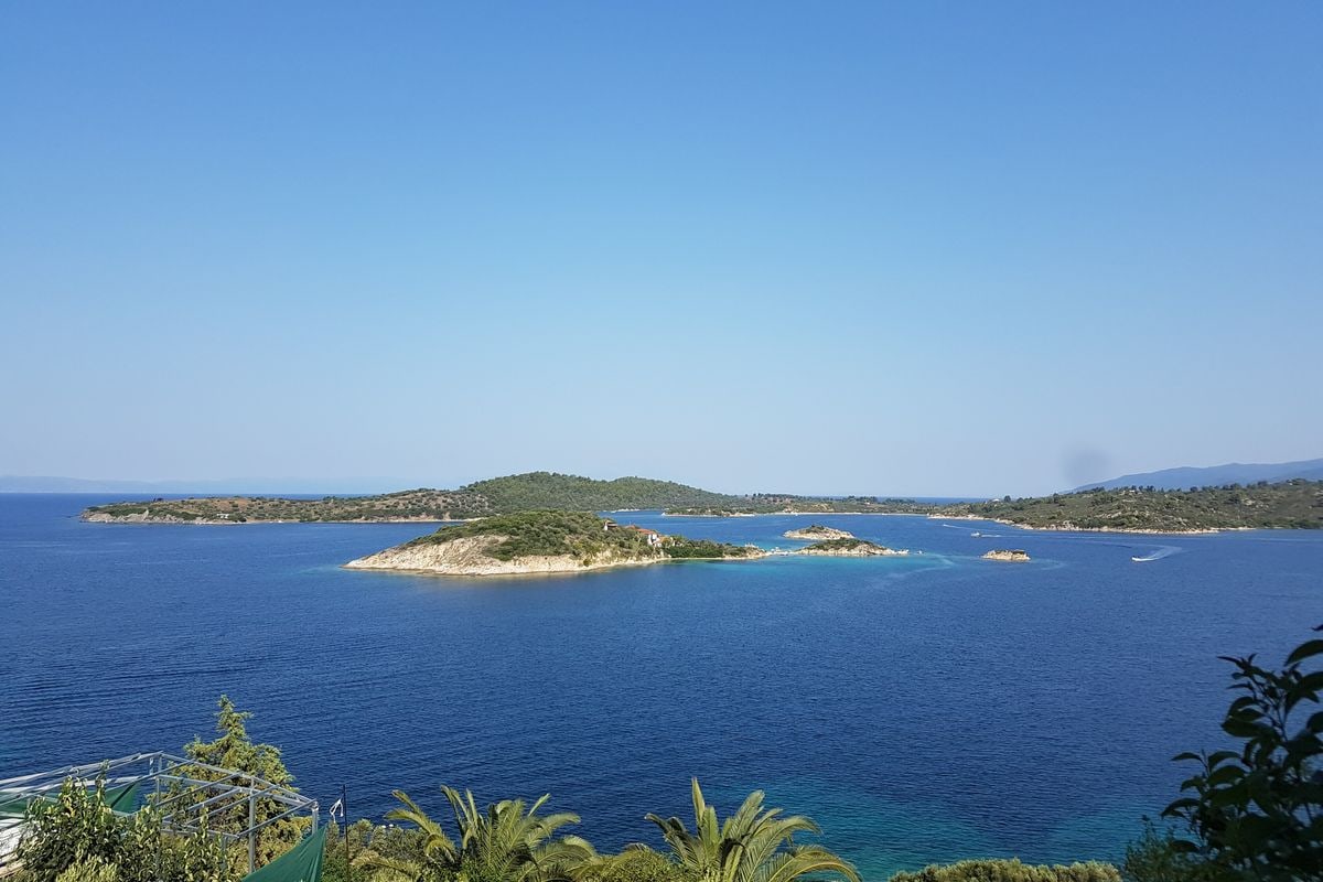
Krifto serves as a harbour for boats when the sea turns rough, and it ends in shallow water that stays warm and suits winter swimmers. Diaporos first appears in an official census in 1918, attached to the community of Agios Nikolaos, and it counted 2 residents in 2011. The islands and their beaches can only be reached by boat, on Vourvourou tours or rented boats.
On Agios Isidoros stand the ruins of a small Byzantine church, thought to be dedicated to Agios Isidoros. Its walls survive to about 2 metres, the plan measures 5.95 by 4.35 metres, and a single niche at the altar let in light, because the church had no windows. It was built, in all probability, by a hermit who lived on the islet.
- Diaporos: 3.2 square kilometres, a high point of 53 metres and pine forest over the greater part.
- Agios Isidoros: a rocky islet of 0.1 square kilometres, east of Diaporos.
- Peristeri: an islet with a double-faced beach.
- Ampelitsi: an islet with a double-sided beach.
- Elia: a smaller islet close to Diaporos.
Which beaches do Vourvourou tours reach?
Vourvourou tours reach Karidi, a shallow beach of powdery sand at the south end of the village, and Galana Nera and Myrsini Beach on Diaporos. A 4-hour cruise runs south to Orange Beach, also called Kavourotrypes, known for orange-tinted sand.
Karidi lies past the narrow peninsula of Xifara, in an isolated bay with a beach bar. It ranks with Livrochios, Kavourotripes and Platanitsi among the popular beaches of the east coast of Sithonia, and it gets crowded in summer. On Diaporos, the best-known beaches are Galana Nera and Myrsini Beach, called the “Hawaii of Sithonia” for its shallow turquoise water.
Vourvourou tours heading south follow the Sithonia Riviera to Orange Beach, past secluded bays open only to the sea, and the beach sits below pine-covered cliffs. Explore Boat Trips and a GetYourGuide private cruise for up to 7 guests both run this route in 4 hours.
The village’s own beaches are Vourvourou, Livari, Xifara, Karidi, Bara and Fava. Self-drive Vourvourou tours reach these mainland beaches as well as the islands.
- Fava: a little south of Karidi, with coarser sand and better swimming.
- Livari: a narrow strip of sand that cuts the bay in half, known for its sunrise.
- Zografou: south of the village, in a beach bar zone with Bahia, Rodia and Oneirou.
- Lagonisi: a family beach to the north, towards Ormos Panagias.
Which Vourvourou tours go kayaking, paddleboarding and windsurfing?
Vourvourou tours on the water leave from Surf Vourvourou, a station on a quiet beach near Karidi that offers guided kayak trips, stand-up paddle rentals and windsurfing courses on a flat bay with moderate winds, facing Diaporos and the other islets.
Surf Vourvourou calls its shallow, crystal-clear water “swimming pool conditions”, and its special kids equipment brings whole families onto Vourvourou tours by board. Instructor Kostas started sailing at the age of 9 and has won national awards in windsurfing and sailing, while Stefanos has taught watersports since the age of 15.
Kayak Vourvourou tours follow a route set to the level of the group. Visit Halkidiki lists sunset, yoga, wine-tasting and fishing kayak trips around Diaporos, the largest of the 9 islets. Guided day trips run daily until the end of October, and independent paddlers rent one-seater or two-seater kayaks.
Stand-up paddle Vourvourou tours cross smooth water that the station rates beginner friendly, even for first-timers. The Visit Halkidiki page on Sea & Mountain sports at Karidi beach adds dinghy and catamaran sailing, surf lessons, snorkelling kits and 4-seater paddle boats with a water slide.
- Kayak tour: half a day of 4 hours with a local guide.
- Windsurf course: 1, 3 or 6 hours for beginners, 1 hour for advanced riders.
- Windfoil: lifts the board above the water in 7 to 10 knots of wind.
- Mega SUP: one giant board for 2 to 10 persons.
- Catamaran tour: about 2 hours along the islands with a stop at the Blue Lagoon.
Which Vourvourou tours ride e-bikes or hike on Sithonia?
Vourvourou tours on land ride e-bikes and mountain bikes through the pine forest of Mount Itamos, the 817-metre spine of Sithonia, and out to Ormos Panagias and Agios Nikolaos, while marked hiking paths climb to the traditional village of Parthenonas.
E-Bike Halkidiki, based in Vourvourou, runs five e-bike routes of 4 hours each in small groups led by local guides, and no driving licence is needed. Its fleet includes the Giant Roam E+ GTS and the KTM Macina Race 291, and every ride includes a helmet, snacks, water and coffee.
- Vourvourou route: 22 km of beaches, swim stops and small villages.
- Mount Itamos route: 30 km with panoramic views of Sithonia and the Aegean Sea.
- Ormos Panagias route: 35 km to the harbour village and the traditional village of Agios Nikolaos.
- Sarti route: 26 km of mountain and sea views with the Metochi Monastery.
- Nikiti route: 27 km to the old village and the Techochoros art gallery.
Surf Vourvourou adds guided e-bike Vourvourou tours with a certified MTB guide, on bikes with 85 Nm of torque and up to 340% support to 25 km/h, even on steep mountain rides. Its mountain bike Vourvourou tours last 2 to 4 hours on routes matched to the rider’s level, on set days each week or on group request. Compare them with our Halkidiki e-bike tour.
Bike Vourvourou tours climb Mount Itamos, a range of about 27,000 hectares, mostly conifer forest inside the Oros Itamos – Sithonia Protected Area, whose dirt roads draw mountain bikers. Karvounas, a 567-metre peak, rises southeast of Vourvourou, and from the top of Itamos the view takes in the whole of Halkidiki and the Aegean. Walkers on the Itamos paths look down on Vourvourou bay and, with luck, spot wild deer.
Sithonia’s marked hiking paths run from M1 to M15, their biggest altitude difference is 730 metres, and the Hiking Team of Neos Marmaras promotes the trail network. Path M2 runs 10 km from Anigmata to Parthenonas, a protected traditional settlement at 320 metres with 6 permanent residents, a folklore museum in the restored school and the church of Agios Stefanos, built in 1837. Each year the Dragoudelis Passage event ends 8 walking routes and 1 cycling route in its square.
Which Vourvourou tours continue to Ouranoupoli and Mount Athos?
Vourvourou tours to Mount Athos sail from Ormos Panagias, 5 km from Vourvourou, on a cruise of almost 6 hours that passes eight of the twenty Athos monasteries on the west coast, then stops at Ammouliani island or at the port of Ouranoupoli.
Athos Vourvourou tours follow the shore of Sithonia, cross the Singitic Gulf and pass the west coast of the Athos peninsula, while an audio commentary tells the story of the 1,000-year-old monuments. Boats leave Ormos Panagias up to twice a day, and Visit Halkidiki tells passengers to watch for dolphins swimming along the boat.
Women join these Vourvourou tours because cruise boats are not allowed to pass within 500 metres of the Athos coastline, and entry to the monastic land is limited to men. Men who want to land take the daily pilgrim ferry from Ouranoupoli to Dafni with a diamonitirion permit from the Mount Athos Pilgrims’ Bureau.
Ammouliani Vourvourou tours run all day from 15 April to 15 October on the boats Saint George and Prophet Elias, with live bouzouki on the way back. Ammouliani is the only permanently inhabited island of Chalkidiki. Mount Athos rises to 2,033 metres, and its monastic community joined the UNESCO World Heritage List in 1988. For departures straight from the harbour town, see our Ouranoupoli tours.
- Monastery of St. Paul: the first destination on the Athos coast.
- Prosforios Tower: the Byzantine tower of Ouranoupoli, built under Emperor Andronikos II Palaiologos in the 13th century.
- Drenia islets: a 2-hour stop for swimming and lunch on the Ammouliani cruise.
- Ammouliani port: the Mount Athos style church and the Folklore Museum.
- Lagonissi bay: the last swim stop, among the Vourvourou islets.
How do visitors reach Vourvourou on Vourvourou tours?
Vourvourou tours begin at Thessaloniki Airport “Makedonia”, the main airport of Northern Greece, 13 km southeast of the city in Thermi. Vourvourou lies 103 km from the airport, less than 1.5 hours by car, on the east coast of Sithonia.
Self-drive Vourvourou tours follow the A24 motorway from Thessaloniki and the airport toward Nea Moudania. Past the airport exit, drivers continue for about 80 kilometres to the Halkidiki peninsula; at the crossroads before Nea Moudania, one road leads to Kassandra and the other to Sithonia.
Every driver to Sithonia passes Nikiti, 100 kilometres southeast of Thessaloniki. From Nikiti, the east road runs toward Vourvourou and Sarti, and the west road toward Neos Marmaras. The east road passes Agios Nikolaos; Vourvourou sits 10 km southeast of that village and 5 km from the port of Ormos Panagias. The same motorway serves a Halkidiki day trip from Thessaloniki.
Bus-based Vourvourou tours rely on KTEL Chalkidikis, the intercity bus service of Chalkidiki.
- Bus station: KTEL buses leave from the 9th kilometre of the Thessaloniki to Nea Moudania road.
- Airport link: city bus 79 runs to the IKEA stop, where bus 36 continues to the KTEL station.
- Journey time: KTEL buses reach Sithonia in 2 to 3 hours.
- Railway: Chalkidiki has no railway, so buses carry public transport.
When do Vourvourou tours run best?
Vourvourou tours run best from early June to mid-September, the long beach season of Greece. Chalkidiki has a Mediterranean climate with hot, relatively dry summers, and the weeks from mid-September to mid-October bring a warmer sea and shorter days.
The climate of Chalkidiki is classed as Köppen Csa, with cool, wet winters and snow that does not last long. Neos Marmaras, the largest settlement and main commercial centre of Sithonia, has winter highs around 13 °C and summer highs around 32 °C.
Sea days on Vourvourou tours fall in the season of the etesian winds, called meltemia in Greece, which keep temperatures and daily swings in the Aegean Sea lower than in the Ionian Sea or mainland Greece.
- Meltemi months: the etesian winds blow from late spring to October.
- Meltemi peak: July and August record the highest wind frequency.
- Autumn turn: rainy spells start in October, when the meltemi stops blowing.
Summer also sets the crowd size on Vourvourou tours. The Agios Nikolaos community counted 1,965 residents in the 2021 census, and its population can rise to 10,000 in the holiday season. In summer, at least 3 buses a day link Agios Nikolaos with Thessaloniki; winter service is less frequent.
What history do Vourvourou tours tell?
Vourvourou tours tell a story that starts in the 10th century, when the area was known as the “land of the Vourvourioi” and granted to the Xenophontos monastery of Mount Athos. In the 1960s, teaching staff of the University of Thessaloniki developed a holiday resort.
In 1615 the people of Agios Nikolaos acquired the land. At the end of the 19th century, the monks of Simonopetra monastery sold the area to Russian monks, but residents of Agios Nikolaos drove them away by force and still own the area today.
Vourvourou tours reach the Mega Teichos, a wall of large stones still visible on the Livari peninsula by Vourvourou bay. The wall, of unknown date, cut communication between Sithonia and the rest of Chalkidiki. Ancient Singos, dated to 454 BCE and source of the name of the Singitic Gulf, is placed near this bay, but no excavation has confirmed the site.
In 1913, residents of Mikro Souli in Serres, Palaiokomi, Amfipoli and Lakovikia fled to Vourvourou to escape Bulgarian violence in Eastern Macedonia. A cholera epidemic killed more than 110 of them, and the survivors returned home shortly before the First World War. Professor Thales Argyropoulos later designed the university settlement, known for its environment-friendly design.
Vourvourou sits inside this administrative chain:
- Community: Agios Nikolaos, which recorded 98 residents in Vourvourou in the 2021 census.
- Municipal unit: Sithonia, with the communities of Agios Nikolaos, Metagkitsi, Neos Marmaras and Nikiti.
- Municipality: Sithonia, formed in the 2011 reform from the former municipalities of Sithonia and Toroni, with its seat at Nikiti.
Frequently Asked Questions
Which chapels do Vourvourou tours pass?
Vourvourou has a group of country chapels. The main one honours the Virgin Mary and is known locally as Panagouda; its feast falls on 8 September. Two smaller chapels honour the Prophet Elias and Agios Theonas. In Agios Nikolaos, a cultural association named “Vourvourou” is active, and the village keeps three local feasts.
What memorial do Vourvourou tours show at Zografou?
Zografou, a settlement of the Agios Nikolaos community, holds the Monument of the Airmen. It was erected in 2001 in memory of three pilots who died in a 1995 aircraft collision. The settlement counted 1 resident in the 2021 census, and Zografou Beach lies within the territory of Agios Nikolaos.
What local products do Vourvourou tours offer?
The Vourvourou area produces olive oil, honey, tsipouro, wine and fish. Its fishermen’s settlement is still inhabited, and visitors buy fresh fish there. Chalkidiki is known for olive oil and green olives, and nearby Nikiti ranks among the top honey-producing towns in Europe, with a beekeeping cooperative founded in 1952.
Where do Vourvourou tours find a pharmacy or bank?
Agios Nikolaos has a health centre, pharmacies, a police station, a post office and an ATM. The health centre works like a very small hospital, and volunteer firefighters keep a station in the village. Agios Nikolaos has no bank: the nearest one is in Nikiti, 9 km away, so travellers draw cash at the ATM.