
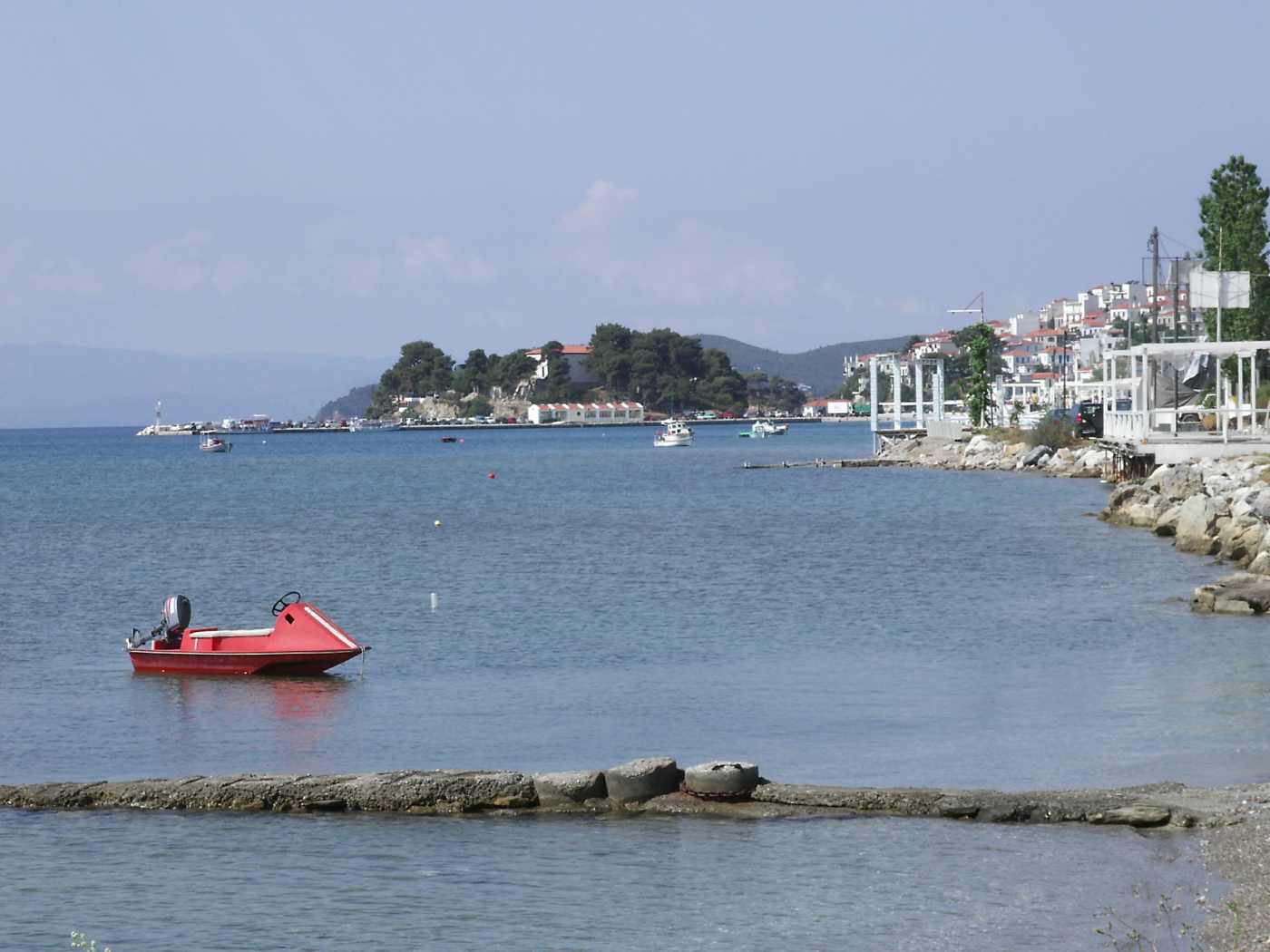
Hiking on Skiathos runs through one of the greenest landscapes in the Aegean: stone pines cover the island’s hills. Signed. Numbered footpaths cross beneath them from Skiathos Town to the northern cliffs. The network links three monasteries, the medieval Kastro and beaches that no road reaches. Routes measure about 3-8 km one way, distances that fit a single morning, and shade holds along the paths even in high summer. Plan the whole trip with Greece Tours.
This guide maps the trail network, the signature routes to Evangelistria, Kastro, Kechria and Mikros Aselinos. The flat lagoon loops at Koukounaries. The practical side: seasons, footwear, water and the bus and boat connections that carry walkers home. Every route described here starts from a point reachable by bus, taxi or a short drive on the island’s single paved south-coast road.
What makes hiking on Skiathos different from other Greek islands?
Skiathos pairs a full pine canopy with a compact trail network: signed, numbered footpaths cross an island about 12 km long, linking monasteries, the medieval Kastro and north-coast beaches, so walkers stay shaded on routes of 3-8 km.
Stone pines cover most of the interior of Skiathos, an island of roughly 48 square kilometres in the Northern Sporades, and the walking network threads directly beneath that canopy. Shade separates the island from bare Cycladic hiking: paths from Skiathos Town toward the north coast run under trees for most of their length. Resin scent hangs over the trail on warm mornings. The terrain stays gentle, with the highest ground around 430 metres at the island’s spine, so climbs remain moderate. Footpaths follow old mule tracks between monasteries, olive terraces and springs, the routes islanders used before the coastal road existed.
Walkers cross the island from the harbour to the northern cliffs in a single morning, a scale suited to half-day plans and beach afternoons.
Variety compresses into the island’s 12 by 6 kilometres. A single route crosses olive terraces near town, climbs through pine forest, passes a working monastery and ends above white cliffs on the north coast. Views reach the Pelion peninsula to the west and Skopelos to the east from the high ground near 430 metres. The south side is settled and organised; the north drops through ravines to sand and pebble coves without road access. Wetland birdlife gathers behind Koukounaries at the Strofilia lagoon, one flat loop away from the busiest beach on the island. That range. Farmland, forest, cliff, dune and lagoon. Sits inside walks of under three hours each.
Which is the compression that makes the island work for walkers squeezed into a beach holiday week.
The island’s reputation rests on beaches and nightlife, yet the walking is a distinct attraction with its own following. Hikers land at the airport beside package travellers and head inland within an hour, trading the numbered bus stops of the south-coast road for numbered trail posts. The contrast defines a Skiathos day: a morning ridge walk past two monasteries, then a swim below the trail’s end. Photographers walk the routes for the light through the pines and the sudden openings onto the Aegean. Birdwatchers follow the wetland edge at Strofilia. Trail runners use the same network at dawn in July and August, finishing before the heat.
Walking widens the island far beyond the 12-13 km strip that most visitors see from the bus window on the coastal road.
History shaped the network. Islanders lived at the cliff-top Kastro through the pirate centuries and moved on foot between the fortress. The farms and the island’s monasteries, wearing in the kalderimia. Cobbled mule paths. That today’s routes follow. Sections of original cobbling survive on the descent toward Kechria and on the spine track north of the Evangelistria hillside. Chapels punctuate the older routes, whitewashed and small, marking the rest points that shepherds and monks used between settlements. Olive terraces and stone field walls line the lower slopes near town, the farming layer of the same story.
Walking the trails therefore reads as island history: each route once carried monks, farmers or refugees, and the boards still point to the destinations they served in the Ottoman era.
Which signed trails cross the Skiathos pine forest?
Signed routes radiate from Skiathos Town and the inland junctions: the spine track to Evangelistria and on to Kastro, the Kechria descent, the Kounistra path toward Mikros Aselinos, and flat dune loops around Koukounaries and the Strofilia lagoon.
Wooden posts with route numbers stand at trailheads and junctions, backed by red-and-white paint marks on rocks and tree trunks between them. Direction boards name the next monastery, beach or junction and give distances, so navigation needs no specialist skill on the main lines. The signage covers the busiest corridors best. The Evangelistria climb. The spine toward Kastro and the Kounistra side. While fainter goat paths branch off unmarked, which makes staying on the numbered line the safest habit. Printed walking maps of the island sell in bookshops near the old port, and the common navigation apps carry the main routes.
Waymarks fade under resin and weather in places, so careful walkers cross-check the paint against the map at each junction they pass.
The spine corridor is the island’s classic line: it leaves the ring road above Skiathos Town, climbs to the Evangelistria plateau at about 4 km. Then continues north across wooded high ground before dropping to the fortress rock of Kastro on the northern tip. The full crossing measures about 10 km and takes around three to four hours of walking, plus stops. Height gain stays moderate because the trail rides the ridge instead of cutting across ravines. Openings in the canopy frame the harbour behind and, further north, the white limestone of the Lalaria coast ahead.
The corridor carries the most foot traffic of the network from June to September, which keeps its waymarks maintained and its surface clear of seasonal overgrowth. Dust stays low under the trees even in August.
The character changes west of the Troulos junction: routes leave the paved monastery road and slope down through farmland and pine to the north-coast coves. The Kounistra path reaches Mikros Aselinos in about 3-4 km, and a rougher continuation links toward Kechria along the coastal hills. On the southwest tip, flat sandy tracks lace the Koukounaries reserve, circling the Strofilia lagoon and crossing juniper dunes to Mandraki and Elia in about 25-30 minutes from the road. These western walks suit mixed groups because bail-out points sit close: the bus turnaround at Koukounaries, stop 26, lies minutes from the dune trailheads.
Afternoon light on this side falls toward the Pelion peninsula across the strait, which rewards walkers who save the west for late in the day.
Old kalderimi surfaces. Cobbled mule tracks laid centuries back. Survive on segments of the Kechria descent and the spine route. Their worn stones slick after rain and uneven underfoot in dry weather. Linking segments builds loops: walkers climb to Evangelistria on the signed track, cross to the Kastro corridor. Descend to Kastro beach, then return along a second line toward the Kechria road for a taxi or an arranged pickup. Distances stay honest — most single routes run 3-8 km one way — so a two-segment day totals about 12-14 km at the outside.
Route planning off the island’s scale works simply: no point on the trail network lies more than about 6 km from a road, a bus stop or a harbour.
How do you hike from Skiathos Town to the Evangelistria monastery?
The walk from Skiathos Town to the Evangelistria monastery climbs about 4 km on a signed track through olive groves and pine forest; walkers reach the gate in around one hour to ninety minutes at an easy pace.
The route starts on the ring road above the town, where signs point inland past the last houses onto a dirt-and-cobble track. Gradients stay steady rather than steep, and the surface holds firm through the dry months. Olive terraces give way to pine within the first kilometre, and the harbour view opens behind at each clearing. The track meets the paved monastery road twice; painted marks carry walkers back onto the footpath both times. The Evangelistria monastery appears suddenly on its plateau, bell tower first, past the final bend. Drivers reach the same gate by car in about 10-15 minutes, which makes a one-way walk with a taxi return the low-effort option for mixed-ability groups.
Morning walkers finish the climb before the heat builds, and the gate area has shade for a rest.
Monks from Mount Athos founded the monastery in the late eighteenth century, and the complex still functions with services, cells and gardens around the domed katholikon. Its history carries national weight: an early version of the Greek flag. A white cross on a sky-blue field. Was woven and raised here. Fighters of the independence struggle swore their oath inside the walls. A small museum displays ecclesiastical and folk items, and the shop sells products from the monastery vineyards, wine included. Modest dress is required for entry, with shoulders and knees covered. A courtyard tap offers the most dependable water refill on the whole trail network, a practical detail that shapes route planning across the island.
Quiet behaviour is expected during services. The monastery remains active, so visits fit around its rhythm.
Pines surround the plateau about 4 km north of the harbour. The terrace outside the gate looks south over Skiathos Town. The Bourtzi and the runway isthmus, with aircraft climbing over the strait below. Early morning is the calm window: tour vehicles arrive from mid-morning through early afternoon in July and August, and the courtyard fills. Birdsong dominates outside those hours. The air runs noticeably cooler than the coast, a product of altitude and canopy, which matters on summer walks. Photographers time the terrace for late afternoon, when low light crosses the harbour and the hills turn gold.
Walkers who start at dawn stand at the gate before the first vehicles and share the plateau with the resident cats and the bells. Evenings return the plateau to silence.
Onward options fan out from the monastery. The spine track continues north toward Kastro, a further 5-6 km across the island’s high ground. A second signed line loops east and descends back to town by a different valley, turning the climb into a circuit of about 9-10 km. The paved road offers the flattest retreat for tired legs, with taxis reachable by phone from the gate. Cyclists use the same road, so walkers keep to the edge on the blind bends. Families with young children commonly drive up, walk the level paths around the plateau. Then picnic under the pines.
The monastery works both as a destination on foot and as the main trailhead for the island’s longest walks. Signposts at the gate mark every onward line clearly.
What does the hike from Evangelistria to Kastro involve?
The trail from Evangelistria to Kastro crosses the wooded spine of Skiathos for about 5-6 km, then drops to the fortified promontory on the north coast; walkers need around two hours plus time among the ruins.
Islanders built Kastro on a sheer rock above the sea during the pirate centuries, abandoning the ancient harbour town for a fortress reached only by drawbridge. Roughly 300 houses and more than 20 churches once crowded the promontory. Ruins, gates. Cannons and a handful of restored churches survive, including Christos with its post-Byzantine frescoes and carved wooden iconostasis. The population moved back to today’s Skiathos Town after the War of Independence, leaving the rock to the wind and the seabirds. Arriving on foot suits the place: the trail delivers walkers to the old land approach. Where the drawbridge once hung. The whole story of the island’s defensive centuries reads from the final steps.
Wind moves through the ruined lanes now, and the site stays open and unfenced for walkers to explore.
The path north from Evangelistria rides high ground where the canopy thins and the route alternates between pine shade and open scrub with sea views on both sides. Waymarks and cairns hold the line across the exposed sections. The descent begins about two-thirds of the way in, dropping through switchbacks toward the north coast, with the white cliffs toward Lalaria visible east on clear days. Underfoot the trail mixes packed earth, loose stone and surviving cobble, hardest on the knees in the final drop. The meltemi hits this side in July and August, cooling walkers while it roughens the sea below.
The last stretch crosses the saddle to the promontory, where steps climb through the old gate into the ruins. Poles with paint marks confirm the final descent line.
Kastro beach lies directly below the rock, a pebble-and-sand cove where excursion boats on round-the-island routes pause in summer. The swim after the crossing is the route’s reward: clear water, cliff scenery and the fortress overhead. Facilities are absent, so walkers carry their own water and shade — the standard rule for the whole north coast. Currents stay manageable on calm days, and the cove shelters from westerly wind, though a strong meltemi sends swell straight in and empties the beach. The climb back up to the ruins takes about 10-15 minutes on a clear stepped path.
Timing the descent between boat calls gives the cove to walkers alone, a contrast with the organised south coast that defines the north side. Shade at the cove is limited to the cliff line.
Return choices shape the day. Retracing the spine to Evangelistria and town doubles the distance to about 20 km in total — a full day for strong walkers. The gentler plan uses the road: a rough vehicle track climbs from the Kastro area to the paved network, where a pre-arranged taxi meets walkers at an agreed hour. The most satisfying exit is by sea: round-the-island boats calling at Kastro beach carry passengers back to the old port past Lalaria and the caves. Turning the crossing into a loop of trail and water. Confirm the boat plan at the harbour before setting out, since calls depend on weather and season.
Whichever exit applies, walkers budget daylight generously; the north side empties by late afternoon. Strong walkers still rate the double crossing.
How do you walk to Kechria beach and the Panagia Kechria monastery?
The Kechria route descends from the inland monastery road to Kechria beach on the north coast, passing the Panagia Kechria monastery and its frescoes; the walk covers about 4-5 km of pine forest and olive terraces downhill.
The trail leaves the paved road between Evangelistria and the island’s interior, signed toward Kechria, and drops north through terraced hillside into a green ravine. Cobbled kalderimi sections alternate with earth path, and a stream bed — dry by midsummer, running in spring — accompanies the lower half of the route. The gradient works better downhill: walkers descending to the coast lose about 300 metres in comfortable stages, while the reverse climb in afternoon heat tests fitness properly. Shade holds for most of the way, breaking only near the shore. The valley feels emptier than the spine corridor; on weekday mornings outside August, walkers commonly meet no one between the road and the sea.
Goat bells and woodpigeons supply the soundtrack the whole way down.
Panagia Kechria, the small monastery on the descent, keeps post-Byzantine frescoes inside a modest chapel. Their colours darkened by candle smoke across the centuries yet still legible: saints, scripture scenes and decorative bands across the vault. The courtyard holds an old olive press and a water tap, and the setting — terraces, cypress, valley walls — explains why monks chose the spot for retreat. The chapel is small and frequently unattended, so visits stay quiet and short by custom. The frescoes rank among the island’s oldest surviving artworks, and reaching them requires the walk or a rough drive, which keeps visitor numbers low year-round.
Photography without flash is the accepted practice inside painted chapels, here as everywhere in Greece, to protect the pigments. A visit adds about 20 minutes to the descent.
Kechria beach closes the route: a quiet pebble-and-sand cove facing north, backed by pines and a valley mouth, with clear water and open space even in August. A seasonal taverna operates behind the shore in high summer; outside those months the cove offers nothing but sea and shade, so provisions travel in the pack. Swimming stays comfortable on calm days and turns rough when the meltemi runs, the standard north-coast pattern. The neighbouring cove of Ligaries sits a short scramble east and stays quieter still. Snorkelling works along the rocky edges of the bay, where the water clears to visible depth.
The beach marks the trail’s finish line, and the swim before the return climb is the reason walkers time this route for late morning.
Logistics favour a morning start. Drivers leave vehicles at the signed pull-off on the monastery road and walk down and back. Walkers without a car take a taxi to the trailhead, since no bus serves the interior. The full down-and-up round trip covers about 8-10 km with a return climb of around 300 metres, two and a half to three and a half hours of walking. A rough dirt track also reaches the beach for quads and jeeps, so a two-vehicle party positions one at the bottom and walks the trail one-way.
Water needs run higher here than the distance suggests because the return climbs in the warmest hours; carrying about 1.5 litres per person in summer is the working baseline. Spring turns the ravine green and loud with birdsong.
What does the Kounistra trail to Mikros Aselinos offer?
The Kounistra trail leaves the road above the Troulos junction, passes the Kounistra monastery where the island’s patron icon was found hanging in a pine tree, and drops to Mikros Aselinos cove in about 3-4 km.
Kounistra monastery anchors the island’s west-side walking. Tradition holds that a monk found the icon of the Panagia hanging and swaying in a pine here. The name Kounistra derives from the Greek word for swinging. And the icon became the island’s patron. Kept today in the cathedral of Skiathos Town and carried out in procession on her feast. The small monastery keeps a frescoed chapel, a pine-shaded courtyard and a terrace looking over the western hills toward the sea. The paved road from the Troulos junction reaches the gate, so the site doubles as a drive-to stop and a trailhead.
Walkers arriving on foot from the junction cover about 3 km of quiet asphalt and track before the signed path drops north. The terrace holds the best light before noon.
The descent to Mikros Aselinos runs short and direct. A signed path of about 1-1.5 km from the monastery area down to a pocket cove of coarse sand and pebbles that stays near-empty outside the peak weeks. The bigger prize sits east: Aselinos beach. Megas Aselinos. Spreads long, dune-backed sand along the open north coast, reached by its own rough road from the Troulos junction and by a linking track on foot along the coastal slope. Together the two Aselinos beaches give the west side its wild finish: real waves under the meltemi, space in August and a seasonal taverna behind the big beach.
Walkers who plan the full link cover about 5-6 km from the monastery to Megas Aselinos. Both coves stay swimmable on calm mornings.
North-coast character defines this route. The sheltered south of the island reads as resort Greece. Sunbeds, water-ski buoys. Numbered bus stops. While ten walking minutes over the watershed the coast turns to open sea, wind-bent pines and surf. Swimmers treat the difference with respect: waves at the Aselinos beaches build fast when the north wind runs, and calm-day swimming here still carries more pull than the south side. The trade is space and rawness that the developed strip cannot offer at any hour. Photographers work the contrast — dunes, empty sand, weathered farm buildings inland — and walkers meet more goats than people on the connecting tracks.
The west side rewards those who carry everything and expect nothing to be provided. Empty sand in August is the payoff.
Access logistics stay simple. The island bus stops at the Troulos junction on the south-coast road, and the walk to Kounistra begins there, making this the network’s most bus-friendly monastery route. Drivers shorten the day by parking at the monastery gate. The round trip from Troulos to Mikros Aselinos and back covers about 7-8 km. Adding Megas Aselinos stretches the day to about 11-12 km. At which point a pre-arranged pickup on the Aselinos road saves the return climb. Morning outbound walking keeps the sun behind, and the taverna behind the big beach anchors a lunch turnaround in high season. The route works in either direction, but finishing at a swimmable beach beats finishing on asphalt every time.
Walkers check the return bus times in town before starting out.
Which easy walks circle Koukounaries and the Strofilia lagoon?
Flat sandy paths circle the Strofilia lagoon behind Koukounaries beach, a loop of about 3 km through stone pines and juniper dunes, with side trails crossing to Mandraki and Elia beaches on the northwest coast.
The Strofilia lagoon loop is the island’s easiest walk: level sandy track the whole way. Full shade from the stone-pine forest. The wetland on one side with the back of Koukounaries beach on the other. Herons, egrets and migrating waterfowl feed on the lagoon, and a channel links the water to the sea beside the beach’s western end. The full circuit measures about 3 km and takes under an hour at a stroll. The area is a protected natural reserve, so the paths are established and the forest floor stays off-limits.
Early morning gives the best bird activity and an empty track; by late morning in August the loop carries a steady flow of walkers escaping the sunbeds for the shade. Binoculars earn their weight on this loop.
The dune trail to Mandraki leaves the road near the reserve and winds about 25-30 minutes northwest through stone pines and juniper, soft with fallen needles underfoot. Mandraki bay carries the name Xerxes’ harbour: Herodotus records the tradition that the Persian fleet anchored here before the battle at Artemisio. Pale dunes open onto clear water, a seasonal canteen operates in high summer, and the smaller cove of Elia sits a short walk east, often near-empty even in peak weeks. Both bays face north, so calm days are glassy and meltemi days bring waves. The dune ecosystem is protected, which makes staying on the marked sand paths part of the deal.
The walk itself, more than the destination, is the reason to come. Footing stays soft and easy the whole way.
Families use this corner of the island hardest because gradients barely exist. Children manage the lagoon loop from about age four, the sand paths forgive falls. The finish line is the island’s most serviced beach. Sunbeds. Tavernas and water sports at Koukounaries in season. The bus makes it car-free: stop 26, the Koukounaries turnaround, sits minutes from every trailhead in the reserve at the end of the numbered line from Skiathos Town. Buggies with large wheels manage the firmer lagoon-side stretches, though the soft dune sections stop them cold. Shade cover keeps the loop walkable even in the mid-afternoon heat window that closes the rest of the network.
Water fountains are absent, so bottles travel even on this short loop. Ice cream at the beach closes the deal for children.
Pairings turn the easy walks into full days. The classic sequence runs the lagoon loop at opening light, the Mandraki dunes before the heat, a swim and canteen lunch at Mandraki. Then the return through the pines for an afternoon on Koukounaries or the west-facing sand of Agia Eleni over the headland. Sunset chasers reverse it, walking out late so the dune return catches low gold light toward the Pelion peninsula. Photographers time the lagoon for still dawn water and mirror reflections of the pines. Runners loop the reserve before breakfast from the Koukounaries hotels.
The corner concentrates dune, lagoon, forest and organised beach inside about 2 square kilometres, the tightest such cluster on the island and the gentlest walking it offers. Wind rarely troubles this sheltered corner of the island.
Which season gives the best hiking on Skiathos?
Spring and autumn give the best hiking on Skiathos, with temperatures around 18-26°C, wildflowers or golden light and empty trails; midsummer walking works at dawn under the pine shade, and winter turns quiet, mild and wet.
Spring leads the calendar. Wildflowers. Poppies, cyclamen, orchids and broom. Line the terraces from March into early June. The Strofilia wetland runs at its fullest. The stream beds on the Kechria descent still carry water. Daytime temperatures sit around 18-24°C, the sea remains cool for swimming until June, and the trails belong to walkers because beach tourism has barely started. Ferries run before the charter flights begin, so spring hikers arrive via Volos or Agios Konstantinos on the mainland. Green covers ground that August bleaches to straw. Birdsong peaks with the migration season over the lagoon. The trade-off is patchy services: north-coast tavernas and beach canteens stand closed, and the island’s rhythm runs local rather than touristic.
Walkers carry a light layer for the cool mornings.
Summer compresses walking into the early hours. July and August daytime highs reach about 30-33°C, and the network’s saving grace is canopy: the pine shade drops felt temperature well below open-island conditions on the Cyclades. Walkers start at first light, finish the effort by mid-morning and end every route at water. The meltemi doubles as the summer walker’s ally on the ridgelines, moving air across the spine while it roughens the northern sea. Trail traffic peaks, waymarks get their heaviest use, and every seasonal taverna and canteen operates, which shortens the supplies a pack carry.
Dawn starts also beat the tour vehicles to Evangelistria and the boats to Kastro beach, giving high-summer walkers the island’s sites briefly to themselves. Shade and sea keep the season workable.
Autumn balances the ledger. September holds summer’s sea temperature — the Aegean stays warm for swimming into October — while air temperatures ease back to about 22-27°C and crowds thin week by week. Light softens and lengthens, the angle photographers wait for on the west-facing beaches. Trails stay dry until the first real rains, typically late October, and every route remains fully open while the season’s businesses wind down gradually rather than closing at once. The meltemi fades, calming the north coast and reopening reliable swimming at Kechria, Aselinos and Mandraki following the windy weeks.
Walkers rate the first half of October as the sweet spot: warm sea, empty paths, working tavernas in town and quiet ferries across to the mainland ports. Photographers call it the island’s best month.
Winter narrows but never closes the walking. The climate stays mild — daytime around 10-15°C — with rain arriving in spells that leave the ravine paths muddy and the kalderimi stones slick. Locals walk the network year-round, and the island in its off-season shows a different face: green hills, an empty harbourfront, ferries as the only link once the charter flights stop. Accommodation and food concentrate in Skiathos Town, so winter walkers base there and day-walk the spine and Evangelistria routes. Short daylight — about ten hours in midwinter — sets the turnaround times. Storm days rule out the exposed Kastro approach entirely.
The reward is solitude that summer cannot supply: whole routes, monasteries included, without another visitor from start to finish. Boots replace trainers on the wet stone.
What equipment does hiking on Skiathos require?
Hiking on Skiathos requires closed shoes with grip for the stony kalderimi surfaces, about 1.5 litres of water per person in summer, sun protection, and swimwear for the trail-end coves; navigation apps cover the main routes.
Footwear decides comfort more than any other choice. The trails mix packed earth, loose stone, worn cobble and beach pebble. The kalderimi sections polish slick after rain, so trainers with real tread or light hiking shoes outperform sandals everywhere beyond the lagoon loop. Ankle support matters most on the Kastro descent and the Kechria switchbacks, where loose stone rolls underfoot. Beach shoes earn their space in the pack at the pebble coves — Kechria and Kastro beach punish bare feet at the waterline. Socks that shed sand save the dune walks. The island demands no mountaineering kit of any kind. The heaviest technical requirement on the entire network is grip.
The price of ignoring it is a turned ankle an hour from the road.
Water planning outweighs distance planning. Fountains are scarce outside the monasteries. Evangelistria’s courtyard tap is the network’s one dependable refill. So walkers carry their full need from town: about 1.5 litres per person on summer routes. More for the Kechria round trip with its heat-of-the-day return climb. Salty snacks, fruit and a filled bottle cost little weight against the alternative. Seasonal canteens at Mandraki, Kechria and Megas Aselinos operate in high summer only, and nothing sells on the spine or the Kounistra path at any season. Dehydration, not navigation, is the realistic summer risk on this island.
The rule scales with the month: spring walkers halve the load, August walkers add a reserve half-litre and drink before thirst starts. Electrolyte tablets weigh nothing and help on the climbs.
Navigation runs on two layers. The signed posts, boards and paint marks handle the main corridors. The common hiking apps carry the island’s principal routes with reasonable accuracy, so a charged phone covers most needs. Paper backup still earns its place: bookshops near the old port sell island walking maps. Useful where pine cover weakens satellite fixes in the ravines and where faded waymarks meet unmarked goat paths. Phone signal reaches most ridgelines and the developed south, with weak pockets in the northern valleys. A power bank matters more than a compass here.
Walkers photograph the junction boards as they pass — a ten-second habit that resolves most on-trail doubt an hour later without any data connection at all. Screenshots of the route work where the apps lose signal.
Safety on Skiathos is undramatic but real. The island holds no dangerous large animals; the hazards are sun, cliff edges at Kastro, slick stone after rain and rolled ankles on loose ground. Long sleeves or high-factor sunscreen handle the exposed spine sections, and a hat is non-negotiable from June to September. Walkers tell their accommodation the route and the expected return, the standard courtesy for the north-coast lines where foot traffic thins. Sturdy shorts beat bare legs where broom and juniper crowd the path edges. Daylight budgeting closes the list: the north side of the island empties by late afternoon. The boat and taxi options thin with it.
Dusk under the pine canopy arrives earlier than on the open coast. A basic first-aid kit covers the blister risk.
How do buses and boats help hikers return on Skiathos?
The south-coast bus, running numbered stops between Skiathos Town and Koukounaries, plus summer excursion boats calling at Kastro beach and the old port, let hikers walk one-way routes and ride home instead of retracing.
The bus line is the network’s return spine. One route runs the paved south-coast road between Skiathos Town and the Koukounaries turnaround, serving stops numbered roughly 1-26. With departures every 15-30 minutes at the height of summer and thinner frequency in the shoulder months. Hikers use it in both directions: out to the Troulos junction for the Kounistra route, out to stop 26 for the dune walks, and home from either. The end-to-end ride takes about 30 minutes along the coast. The numbered-stop system doubles as the island’s addressing, so trail directions translate directly — walk down to stop 18 functions as a real instruction.
No bus crosses the interior or reaches the north coast, which is where taxis and boats take over. Stops carry visible number signs beside the road.
Boats extend the reach. Round-the-island excursions from the old port call at Kastro beach in summer. Letting spine walkers descend to the cove and ride home by sea past Lalaria and the caves. The single best hiker’s exit on the island. Water taxis shuttle between the old port and the south-coast beaches, useful when a dune walk ends at Koukounaries with tired children in tow. Walking slots naturally into the wider menu of things to do in Skiathos: a trail morning pairs with a boat afternoon, and both leave from within 300 metres of each other at the harbour. Weather governs everything on the north side, so boat-dependent plans always carry a road backup in the pocket.
Morning departures suit walkers aiming for an afternoon return.
Taxis close the gaps the bus and boats leave. The rank sits by the harbour in Skiathos Town, drivers know every trailhead pull-off by name. Pre-arranged pickups at the Kechria road. The Aselinos track or the Kastro vehicle track turn hard out-and-backs into easy one-ways. Phone coverage supports calling from most trail ends, though the north-coast valleys drop signal, which is why the pre-arranged time beats the on-demand call there. Rental cars serve the same purpose for pairs of walkers running a two-vehicle shuttle between trailheads. The strategy that repeat visitors settle on is consistent: start high or start far, walk toward the populated south. Let the island’s short distances shrink the logistics to almost nothing.
A saved phone number for the rank removes the last uncertainty.
Model days show the system working. Day one: bus to the ring road, climb to Evangelistria, cross the spine to Kastro, swim below the ruins. Boat back to the old port. About 11 km of walking and a full loop of the island’s history. Day two: bus to the Troulos junction, walk Kounistra to Mikros Aselinos, link across to Megas Aselinos, taxi home from the beach road — about 8 km with two swims. Day three: bus to stop 26, lagoon loop and Mandraki dunes, afternoon on Koukounaries, bus home — about 7 km at family pace.
Three days cover the island’s best walking without one retraced kilometre, and every evening ends back among the tavernas of the old port. Each plan fits between breakfast and dinner.
Frequently Asked Questions
How long does it take to hike across Skiathos?
The full crossing from Skiathos Town to Kastro takes about three to four hours of walking, covering roughly 10 km via the Evangelistria monastery and the wooded spine. Fit walkers manage it comfortably in a morning with a dawn start. A relaxed pace with monastery and viewpoint stops stretches the day to five or six hours including the swim at Kastro beach. The return multiplies the plan: retracing on foot doubles the distance to about 20 km, while the summer excursion boats that call at Kastro beach, or a pre-arranged taxi from the vehicle track, cut the return to under an hour.
Elevation stays moderate throughout — the trail tops out near the island’s high ground around 430 metres and gains height gradually rather than in steep pulls. Walkers base in Skiathos Town either way, since no accommodation operates on the north coast, and the island’s small scale makes the single-day crossing the standard choice.
Are the hiking trails on Skiathos waymarked?
The main routes carry proper waymarking: numbered wooden posts at trailheads. Direction boards at junctions naming the next monastery or beach with distances. Red-and-white paint marks on rocks and trunks between them. Coverage is strongest on the busiest corridors. The Evangelistria climb, the spine to Kastro. The Kounistra side and the Koukounaries reserve loops. And weakest on the connecting tracks, where unmarked goat paths branch off and faded paint demands attention. Walkers back the signage with two layers: the common hiking apps, which carry the island’s principal routes. Printed walking maps sold in bookshops near the old port of Skiathos Town. Photographing each junction board on the way past resolves most later doubt without a data connection.
Navigation difficulty stays low overall because the island measures about 12 by 6 kilometres. No trail point lies more than about 6 km from a road. A bus stop or the sea. Even a wrong turn corrects quickly.
Is hiking on Skiathos suitable for beginners and children?
Beginners handle most of the network because distances run 3-8 km one way, gradients stay moderate and shade covers the majority of every route. The Strofilia lagoon loop behind Koukounaries is the entry point: about 3 km, completely flat, sandy underfoot and finishing at a serviced beach, manageable for children from about age four. The Mandraki dune trail adds 25-30 minutes each way at the same easy grade. The Evangelistria climb suits regular walkers of any experience level. About 4 km up a steady track with a monastery, a water tap and a taxi option waiting at the top.
The demanding end of the scale is the spine crossing to Kastro and the Kechria round trip, both requiring proper shoes. Carried water and three-plus hours of effort. Achievable for active families with older children, unwise with toddlers. The honest constraint is heat rather than terrain: in July and August, beginners walk at dawn and finish by mid-morning.
Can you hike to Lalaria beach on Skiathos?
No trail reaches Lalaria beach; the white-pebble cove under the limestone cliffs is accessible only by sea, and the surrounding cliff terrain permits no safe descent on foot. Excursion boats and water taxis from the old port of Skiathos Town serve it through the summer season. Round-the-island trips combine it with the sea caves and a stop below Kastro. Hikers still earn views of the Lalaria coast from the land: the spine trail’s northern sections open onto the white cliffs east of Kastro. The fortress promontory itself looks along the coastline toward the pebble bay on clear days. The practical combination is the one the geography suggests. Walk the spine to Kastro.
Descend to Kastro beach for a swim. Board a round-the-island boat that continues past Lalaria before returning to the harbour. That single day joins the island’s best walk with its most famous boat-only sight, and it needs no retraced steps.
Where do walkers find water and food on Skiathos trails?
Reliable refills are limited to the monasteries: the courtyard tap at Evangelistria is the network’s dependable water source, and Panagia Kechria and Kounistra offer taps when the gates stand open. Nothing sells on the spine route, the Kounistra path or the Kechria descent at any season. Walkers leave town carrying their full requirement. About 1.5 litres per person on summer routes. More for the Kechria round trip with its climb in the warm hours. Food follows the same logic: bakeries and minimarkets around the harbour in Skiathos Town open early enough for dawn starts. Pack-friendly staples. Cheese pies. Fruit, nuts, bread. Cover a full trail day. Seasonal canteens and tavernas operate in high summer at Mandraki.
Kechria beach and Megas Aselinos. The organised beaches at the trail ends, Koukounaries above all, serve full taverna lunches in season. Spring and autumn walkers assume every north-coast facility is closed and plan accordingly.
What wildlife lives along the Skiathos trails?
Birdlife leads the list. Herons, egrets and migrating waterfowl feed on the Strofilia lagoon behind Koukounaries. With peak variety during the spring and autumn migration windows. Woodpigeons, jays and warblers fill the pine canopy island-wide. Goats graze the northern hillsides and outnumber people on the western tracks. Hedgehogs, hares and stone martens move at dusk, and lizards work every sunlit wall and cobble through the warm months. The Aegean below the trails adds its own sightings: shearwaters skim the north-coast swell. The waters east toward Alonnisos belong to the marine park that protects the Mediterranean monk seal.
Flora carries equal interest — stone pines dominate, with juniper on the dunes at Mandraki, broom and cyclamen on the terraces, and orchids in spring on the inland slopes. Nothing on the island poses a meaningful threat to walkers. The sensible habits are keeping a respectful distance from grazing herds and staying on the marked paths through the protected dunes.
Can you combine hiking on Skiathos with swimming?
Every signature route on the island ends at swimmable water, and the combination defines hiking here. The spine crossing finishes at Kastro beach below the ruins. The Kechria descent ends on a quiet pebble-and-sand cove. The Kounistra route drops to Mikros Aselinos with Megas Aselinos a linked walk east. And the dune trails from the Koukounaries reserve finish at Mandraki. Elia or the organised sand of Koukounaries itself. The working formula is walk early, swim at the far end, then ride home by bus, boat or taxi. Swimwear and a light towel therefore count as standard trail kit from June to October, when the Aegean holds comfortable temperatures.
The one caveat is wind: the north-facing coves at Kastro, Kechria, Aselinos and Mandraki turn rough when the meltemi blows in July and August, while the south coast stays sheltered. So wind direction, checked in the harbour each morning, decides which trail-and-swim pairing wins the day.