
Kefalonia carries a longer buried record than any other Ionian island, and the layers sit close enough together to visit within three days of driving. Rock-cut chamber tombs of the Bronze Age lie in the fields of the Livatho and in the valley behind Poros. Four separate classical city-states left walls of cyclopean blocks on hills above Argostoli, Sami, Lixouri and Poros. Rome took the island by siege and covered it with country villas whose mosaic floors survive at Skala and Fiskardo. Byzantine governors ruled from inland strongholds, and Venetian ones ruled from a castle above the southern plain. Plan the whole trip with Greece Tours.
The mid-twentieth-century earthquake removed most of what stood above ground in between, which makes the surviving stone unusually easy to date at a glance. The sequence runs unbroken from the Bronze Age to the twentieth century.
This guide follows that sequence in order, from the Mycenaean tombs to the earthquake that reshaped the island’s towns. Each section names the places where the period is visible on the ground. Explains why the site sits where it does. Reports what the finds show about the people who lived there. Distances run from Argostoli, since the capital sits within forty minutes of nearly every major site on the island. Names recur across periods on Kefalonia, because Sami, Pali, Pronnoi and Krani serve as cities, districts and modern villages in turn, so the text flags which meaning applies each time.
The result is a working chronology for travellers who want the island’s monuments in the order they were built. The order matters, because each period reused what the previous one had built.
What historical layers can you still see on Kefalonia today?
Kefalonia carries five visible historical layers: Mycenaean chamber tombs in the southeast, the walls of four ancient city-states, Roman villa mosaics at Skala and Fiskardo, Byzantine inland settlements, and Venetian castles above the coast.
Kefalonia covers about 773 square kilometres of the Ionian Sea as the largest island of the group. That ground holds traces of every era that shaped western Greece. The Bronze Age left rock-cut chamber tombs across the southeast and the central plains. The classical centuries left four separate city-states, each with its own walls, coinage and treaties. Rome arrived by sea and took the island after a siege on the east coast. Byzantine administrators governed from inland strongholds, and Venetian governors ruled from a castle above the Livatho plain for centuries after them.
Reading that past means moving between museum cases, hillside walls and rebuilt village squares rather than following one continuous street of old houses through a preserved town centre. Every period is legible somewhere on the island, in stone rather than in reconstruction.
The Archaeological Museum in Argostoli holds the portable half of the record: Mycenaean pottery from Mazarakata, bronze weapons, Roman glass and coins struck by the four ancient cities. The immovable half lies outdoors and free to walk. Cyclopean masonry survives on the twin hills of Krani above the Koutavos lagoon. Walls also stand behind the east-coast port and on the ridge inland from Poros where Pronnoi stood. Roman mosaic floors sit under a shelter at Skala in the far south. The Castle of Saint George rises about eight kilometres southeast of the capital. Each of these sites lies within a forty-minute drive of Argostoli, which makes the island’s chronology unusually easy to cover in a single day.
Argostoli therefore works as the natural base for anyone tracing the island’s archaeology on a short stay.
The earthquake of the mid-twentieth century explains why so little medieval fabric survives outside the far north. Argostoli, Lixouri and the villages of the Livatho collapsed and were rebuilt low, in concrete, on a modern grid designed to ride out the next shock. Fiskardo escaped with its Venetian-style harbour houses standing, and that one village now carries the visual weight of the whole pre-earthquake island. Travellers reading about Kefalonia expect stone lanes everywhere and find them mainly in the north and in the inland hamlets above Sami. The stone that did survive belongs mostly to fortifications and churches, whose thick walls and low vaults outlived the tall houses they once stood beside.
Understanding that break prevents the mistake of judging the island’s age by its architecture, because the buildings are young while the settlement pattern beneath them is old.
Chronology gives the island’s sights an order that a plain sightseeing list lacks. A morning at Mazarakata and Tzanata covers the Bronze Age. An afternoon on the walls of Krani and the east-coast acropolis covers the classical tetrapolis. Skala’s mosaic floors cover Rome, and the Castle of Saint George with the fortress above Assos covers the medieval and Venetian centuries. Visitors planning things to do in Kefalonia can thread those five stops between beaches and caves without doubling back. The sites sit along the same two coastal roads, which link Argostoli, Sami, Poros and the north. History here works as a route rather than as a separate excursion.
Each stop also sits near water, so a swim at Antisamos, Myrtos or Lourdas closes almost every one of these historical mornings without adding distance to the drive.
What do the Mycenaean tombs at Mazarakata, Tzanata and Poros reveal about Kefalonia?
Mycenaean Kefalonia supported a substantial Bronze Age population, shown by rock-cut chamber tomb cemeteries at Mazarakata and around Poros and by the large tholos tomb at Tzanata, the biggest monument of its kind in northwestern Greece.
Mazarakata lies about seven kilometres southeast of Argostoli, on a low ridge in the Livatho, and it remains the largest Mycenaean cemetery excavated on the island. Its tombs are chambers cut into soft limestone, each reached by a sloping entrance passage called a dromos and sealed with a rough stone wall. Families reused the chambers across generations, laying the dead with painted stirrup jars, bronze knives, seal stones and beads. The cemetery came to light early in the history of Ionian archaeology, and its finds anchor the Mycenaean rooms of the Argostoli museum.
The scale matters more than any single object, because dozens of chambers in one field imply a settled farming community large enough to bury its dead formally over centuries. Little marks the site from the road, yet the rock-cut chambers remain clearly visible.
Tzanata sits inland from Poros in the southeast, in a valley of olives and cypresses about three kilometres from the sea. The tomb there is a tholos, a circular chamber roofed by a corbelled stone dome and entered through a long walled passage. Its diameter of roughly seven metres makes it the largest tholos known in northwestern Greece, and the burials inside held gold jewellery, seal stones and bronze weapons. A tomb of that type and cost belongs to a ruling family rather than to a village. Its position controls the route from the eastern harbour at Poros into the island’s interior.
Bronze Age power on Kefalonia tracked the same passes and river gorges that the modern road network still uses. Excavation of the chamber recovered burials of both sexes and of different ages, spanning generations.
Chamber tombs cluster in the southeast around Poros, at Kokkolata and Metaxata in the Livatho, and at Lakkithra on the plateau above Argostoli bay. That distribution covers both the fertile plains and the eastern harbours. The Lakkithra chambers are cut with benches and pits inside, an arrangement built for repeated burial. Grave goods repeat across the sites: stirrup jars for oil, drinking cups, bronze daggers and razors, spindle whorls, and imported beads of glass and carnelian. That mix describes a population which farmed, wove, fished and traded across the Ionian Sea rather than one living in isolation.
Tomb types on the island also stay in use later than on the mainland, running into the closing phase of the Bronze Age. That late survival gives Kefalonia an unusually full sequence for the end of Mycenaean Greece.
Homer places Odysseus at the head of a kingdom containing Same, Doulichion, Zakynthos and wooded Ithaca. Same is the name that later belongs to the city on Kefalonia’s east coast. Ancient readers took the Kephallenes, the island’s people, as Odysseus’s followers. The island’s size and Bronze Age wealth fit a centre of that weight better than any smaller neighbour. Scholars have argued for more than a century over which modern island answers to which Homeric name. The Tzanata tholos and the geology of the Paliki peninsula both feed the debate. The literary question stays open. The archaeological one does not, since the tombs prove a dense, organised Bronze Age society during exactly the centuries the epics describe.
Excavation across the island continues to add to that picture each decade.
Which four city-states divided ancient Kefalonia between them?
Four independent city-states divided ancient Kefalonia: Sami on the east coast, Krani above the Argostoli lagoon, Pali on the Paliki peninsula, and Pronnoi in the southeast. Each minted its own coins and defended its own circuit of walls.
The east-coast city held the deep bay facing Ithaca, which made it the wealthiest of the four and the one Rome later had to besiege. Its walls climb the two hills of Palaiokastro and Kyatis behind the modern port. Stretches of the circuit stand to shoulder height in polygonal masonry, with gate lines and tower footings still readable. The enclosed area is wide, with room for an acropolis, cisterns and farming terraces. Modern Sami still works the same harbour, and ferries to Ithaca and the mainland leave from a quay directly below the ancient defences. Melissani and Drogarati caves lie within four kilometres, so the classical site sits inside the island’s busiest visitor corridor.
Walking the lower circuit takes about an hour from the port road, with the bay in view for most of the climb.
Krani controlled the head of the Koutavos lagoon, two kilometres from modern Argostoli, and its walls are the most photographed classical remains on the island. Blocks laid in cyclopean style survive on the hills of Kastelli and Rakli, individual stones running over two metres long. A stretch beside the road toward the Agios Georgios castle shows the technique at eye level. The city guarded the fertile Livatho plain behind it and the sheltered water that the De Bosset causeway later crossed. A spring-fed sanctuary of Demeter stood within its territory. Krani’s position also explains the modern capital, because the same lagoon that protected the ancient city gave Argostoli its harbour when administration finally moved down from the castle.
The walls stand beside a public road, so the site needs no ticket and no guide.
Pali occupied the Paliki peninsula in the west, where Lixouri stands now. Its territory covered the flat grain land and the red-sand coast on that side of the bay. Coins of Pali circulated widely enough to show a city trading across the Ionian and Adriatic seas. Its citizens fought alongside Corinthian and Athenian fleets during the wars of the fifth century BC. The wall circuit barely survives above ground, because the Paliki soil is soft and the mid-twentieth-century earthquake struck this peninsula hardest of all. Finds from the area sit in the Lixouri collections. Geography carries the argument instead, since the peninsula commands the western approach to the great bay that every ship had to enter.
Lixouri today still faces Argostoli across that water, and the short ferry keeps the two halves of the island tied together.
Pronnoi held the southeast, from the ridge above Poros across the hills toward Skala, and it was the smallest and most defensible of the four states. Its acropolis crowns a steep hill inland from the port, and the surviving walls use the same polygonal blocks as the circuits at Krani and the east coast. Its territory included the Tzanata valley with the Bronze Age tholos, which gave the classical city a far older centre of power to inherit. The four cities kept separate coinages, treaties and armies, and ancient writers describe the island as a tetrapolis rather than a single state.
That division of one island into four rival powers set up everything that followed, because Rome dealt with each city separately. Coins from all four mints sit together in the Argostoli museum today.
How did Rome take Kefalonia, and what happened at the siege of Sami?
Rome absorbed Kefalonia during its wars in the Greek east, and three of the four cities surrendered quickly. Sami resisted behind its hilltop walls and fell only after a siege of roughly four months, which ended the island’s independence.
Roman fleets moved into the Ionian Sea during the campaigns against Macedon and the Aetolian League, and Kefalonia’s harbours mattered as much as its farmland. The island sits astride the sea lane between Italy and the Corinthian Gulf, so whoever held the eastern ports controlled that crossing. The four cities had backed different sides in earlier Greek wars, and the habit of separate foreign policy left them exposed to a single large power. Roman commanders accepted the surrender of Krani, Pali and Pronnoi without a fight, treating each as a distinct community with its own terms. The east-coast city refused.
Its citizens judged their walls strong enough and their harbour valuable enough to defend, which turned that coast into the island’s only Roman battlefield. The decision cost the city everything it had built over four centuries.
The siege ran through a summer, roughly four months, and Roman engineers worked against the lower town and the two acropolis hills at the same time. Siege sheds, rams and an earth ramp pressed the wall on the flatter northern side, while the defenders answered with sorties, counter-mines and night repairs. The city held far longer than the Roman command expected, and the capture came at last through a stretch of wall the garrison had worn thin. Rome sold the population into slavery and left the site broken, a punishment aimed at the wider Greek world rather than at one town alone.
The ruined circuit on the hills preserves the shape of the city at the moment it fell, and nothing later overbuilt it. Roman writers recorded the siege closely, which is why its sequence is known.
Roman Kefalonia settled into a quiet provincial life under the administration that governed Achaea, and its wealth shifted from city walls to country estates. The villa at Skala in the southeast keeps mosaic floors with geometric panels and an altar scene, sheltered beside the pine woods above the beach. A second Roman building with mosaic pavements has been excavated near Fiskardo in the north, together with a cemetery of built tombs and a small bath complex. Roman-era graves also appear around Argostoli and on the Paliki peninsula. The pattern stays consistent across the island.
Coastal estates produced oil, wine and grain for export, served by small landing places rather than by the fortified urban centres of the classical period. Rural production, not urban politics, defined the island through the Roman centuries.
Trade under Rome tied the island to Italy more tightly than to the Aegean, and the excavated material shows it plainly. Amphorae from Italian and Adriatic workshops, glass vessels, lamps and coins from western mints turn up throughout the island’s Roman levels. The old city territories survived as administrative districts long after their walls stopped being maintained. That is why the names Sami, Pali and Pronnoi outlive the states that carried them. Christianity reached the island along the same sea routes, and early basilicas rose over Roman foundations at the east-coast port, at Skala and near Fiskardo.
By the closing Roman centuries the island had stopped being four rival powers and had become one province’s coastline, governed from far away and defended by the fleet.
What did the Byzantine centuries leave behind on Kefalonia?
Byzantine rule gave Kefalonia a naval and administrative role in the Ionian Sea, then pushed its people off the exposed coast into fortified inland settlements as raiding increased, a retreat that fixed the island’s village map for centuries.
Constantinople treated the Ionian islands as a frontier facing Italy, and Kefalonia became the seat of a military province, a theme, covering the whole island group. Its governor answered directly to the capital, and the island supplied ships, crews and timber to the imperial fleet. Mount Ainos, forested far more heavily then than now, produced the Cephalonian fir that shipwrights valued for masts and hulls. The theme’s role was defensive: to watch the strait toward Italy, to escort convoys and to hold a base for operations along the western coasts. That administrative weight explains why the island appears in Byzantine documents far more often than its size alone justify, and why officials of rank were exiled there.
Naval service, timber and grain formed the island’s contribution to the empire.
Raiding changed where people lived. Arab fleets, then Norman squadrons and later corsairs, made the open harbours dangerous. Communities that had lived at the east-coast port, at Poros and along the west coast moved uphill. Villages took root in folds of ground out of sight of the water, on the slopes of the Livatho, in the Omala valley and across the Paliki interior. The pattern repeats around the Ionian and Aegean, but the mountains of Kefalonia make it especially clear. The coast keeps its churches and cemeteries, while the population centres sit two to eight kilometres inland, at 200 to 500 metres of altitude. That distribution held until the modern era pulled people back down to the ports.
Ruined hamlets on those slopes still mark the older, higher line of settlement.
The hill above the Livatho plain became the island’s refuge and then its capital. A fortress stood there through the later Byzantine centuries, and Venetian engineers rebuilt it as the Castle of Saint George. The walled settlement inside served as the administrative seat through the medieval and early modern period. Its position, about 320 metres above sea level and eight kilometres from Argostoli, commands the southern coast, the bay and the approaches from Zakynthos. Smaller fortified sites watch the north above Assos and the inland passes toward Sami. The logic is identical at every one of them: high ground, a spring or cistern, and a stretch of sea long enough in view to give warning.
The view from the gate covers the whole southern plain in one sweep.
Byzantine church building left the most durable ordinary heritage on the island. Single-aisled stone chapels with barrel vaults survive in the inland villages, plainly built, often reusing ancient blocks, and their walls keep fragments of painted plaster. Monasteries followed the same inland logic, standing in sheltered valleys rather than on shores. The tradition continued unbroken into later centuries. The monastery of Agios Gerasimos in the Omala valley, dedicated to the island’s patron saint, reads as part of the same landscape rather than as a later import. Norman raiders and then Angevin and Orsini lords ended imperial rule from the sea. The Venetian centuries that followed inherited the castle, the inland villages and the church network already in place.
Continuity of worship, rather than of building, carries the island’s medieval memory.
How did Venice govern Kefalonia from the Castle of Saint George?
Venice ruled Kefalonia for centuries and governed from the Castle of Saint George above the Livatho plain, a fortified hilltop seat holding the administration, garrison and cathedral until the capital moved down to Argostoli.
The Castle of Saint George stands on a hill above the Livatho plain, about 7 kilometres southeast of the capital. With a view that reaches the Lixouri shore and the sea approaches from the south. Venetian engineers rebuilt an earlier fortress into a polygonal circuit of bastions and thick curtain walls suited to gunpowder warfare. Inside the walls stood the governor’s residence, barracks, cisterns, a prison and churches, so the entire apparatus of island government sat behind one gate. Farmers from the surrounding villages carried produce up to the castle market, and the garrison controlled the approach roads across the plain.
The height gave early warning of raiders in the channel between Kefalonia and Zakynthos, which mattered while corsairs worked the Ionian Sea and coastal villages kept watch towers.
Venetian rule organised Kefalonia around registers, notaries and a council of landowning families who answered to a provveditore sent from Venice. Records of land, dowries and olive groves were kept inside the castle, and Italian served as the language of law beside Greek in the villages. The fortified town below the walls held merchants and craftsmen, but water shortages, plague outbreaks and the pull of the harbour drained it steadily. Trade wanted a quay rather than a hilltop, so families moved down to the sheltered bay where Argostoli was growing around its lagoon. The seat of government followed the merchants. The castle slid from capital to garrison post while the new town took the customs house.
The market and the shipping trade, leaving the hill to soldiers and to the farming villages of the plain.
Venetian building habits shaped the look of Kefalonia far beyond the castle gate. The fortress at Assos, set on a pine-covered headland above a narrow isthmus, was raised as a refuge for the northwest villages when raiders threatened that coast. Bell towers, arched doorways with carved lintels, stone staircases climbing to first-floor entrances and pastel plaster over rubble walls all belong to the same period. Fiskardo in the far north still shows the pattern intact, since its harbour houses escaped later destruction. Village churches kept Italian-influenced facades with Orthodox interiors, and monastery courtyards used the same round arches.
Field walls, threshing floors and stone-lined wells across the Livatho and the Paliki peninsula follow shapes that were standard under Venice and stayed in use long after the flag changed.
Agriculture under Venice tied Kefalonia to markets far from the Ionian Sea. Currants, olive oil and wine left the island in barrels and sacks bound for Venice and northern Europe, and landowners planted terraces high onto the slopes to increase the crop. The Robola grape took hold in the stony Omala valley below Mount Ainos, where thin limestone soil and altitude suited it. Ship timber mattered as much as fruit, and the Cephalonian fir on Ainos was cut for the Venetian arsenal until the forest thinned badly. Shepherds moved flocks between plain and mountain by season, and villages in the Pylaros and Erisos districts sent oil down to Sami and Fiskardo for loading.
That export economy paid for the stone mansions whose ruins still stand across the Livatho.
What did the French interval and the British protectorate leave on Kefalonia?
French forces took the Ionian Islands after Venice fell, a British protectorate followed and built roads, quays, courthouses and the De Bosset bridge across the Argostoli lagoon, and the islands united with Greece in the nineteenth century.
French troops arrived on Kefalonia after the fall of Venice and governed the Ionian Islands as departments of a republic. The tree of liberty was planted in the squares, the Libro d’Oro that listed noble families was burned in public, and inherited titles lost their legal force. Greek gained standing in administration, and public schooling was discussed for the first time as a duty of the state. The interval stayed short and unsettled: Russian and Ottoman fleets took the islands. A septinsular republic followed under nominal protection. French forces returned for a second spell before the wars ended. Kefalonia changed flags repeatedly within one generation, which left the countryside taxed hard and the harbours watched by blockading squadrons.
Each administration reused the castles, customs posts and village headmen it inherited.
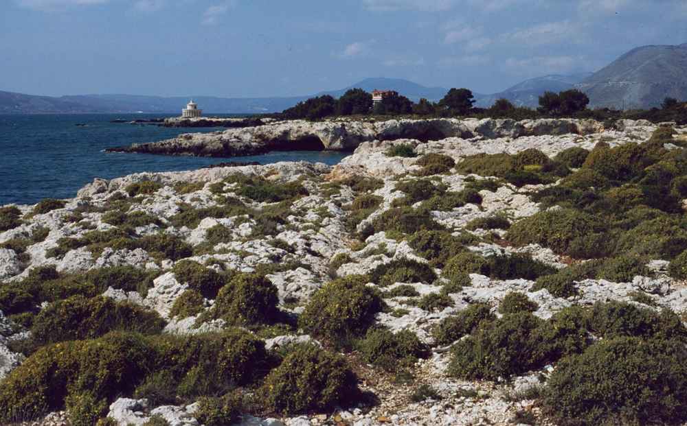
The British protectorate of the Ionian Islands turned Kefalonia into a construction site. Resident officials built carriage roads across the mountains, quays at Argostoli, Lixouri, Sami and Poros, courthouses, markets. Schools and a prison. The lighthouse of Saint Theodore rose as a white Doric rotunda on the point north of the capital. Charles Napier, who served as resident of Kefalonia, pushed road building and drainage works and gave his name to the Napier Garden above the town. Engineers drained marshland around the lagoon to cut malaria, laid out grid streets and imported a colonial style of public building in cut stone.
The protectorate also brought British courts, currency and garrison life, which sat uneasily with an island population that read Greek newspapers and followed events on the mainland.
The De Bosset bridge crosses the Koutavos lagoon and remains the clearest object left by British engineering on Kefalonia. Charles Philippe De Bosset, a Swiss officer in British service. Drove a timber causeway across the shallow water to link the capital with the road east. The structure was later rebuilt in stone arches. The crossing runs about 700 metres, which places it among the longest stone bridges standing over seawater in Europe, and an obelisk rises from a plinth partway along it. The bridge cut hours off the journey between the town and the villages of the Livatho and the port of Sami.
Motor traffic now uses a modern road, and the old crossing carries walkers, with turtles and herons feeding in the lagoon below.
Union with Greece came in the nineteenth century, when Britain transferred the Ionian Islands to the Greek kingdom. Pressure had built for a generation: Kefalonian deputies in the Ionian parliament argued for enosis. Radical newspapers circulated in Argostoli and Lixouri. Rural unrest in the south of the island was put down by troops. Kefalonia entered the Greek state with roads. Harbours and public buildings ahead of much of the mainland. With an educated professional class that supplied lawyers, doctors and teachers to Athens and Patras. Emigration to the mainland and abroad began in that period and never fully stopped. Which explains the Kefalonian family names scattered through the Greek diaspora and the shipping offices of Piraeus.
The protectorate century therefore shaped both the island’s stonework and its people.
What happened on Kefalonia during the Second World War?
Italian troops garrisoned Kefalonia during the occupation, German forces took the island after the Italian armistice, and men of the Acqui Division were killed once the fighting ended. Monuments above Argostoli commemorate them today.
Italian forces occupied Kefalonia after the German invasion of Greece, and the Acqui Division garrisoned the island with artillery posts covering the bays at Argostoli, Lixouri and Sami. Occupation life meant requisitioned food, curfews and a currency that lost value week by week, while island families lived on olive oil, wine, garden vegetables and whatever the sea gave. Resistance networks carried messages between the mountain villages and the ports, and reprisals followed. Fuel, medicine and grain ran short, and the villages of Pylaros and Erisos absorbed families who left the towns for the interior. German units held the northern approaches and the coastal roads.
The two armies shared the island uneasily until the alliance between them collapsed and the guns on the bay turned around.
Italy signed an armistice with the Allies, and the Italian garrison on Kefalonia refused to hand its weapons to the German forces on the island. Fighting broke out around Argostoli and along the Lixouri road, with aircraft striking the Italian batteries from the air. The Italian troops were defeated after days of combat, and men of the Acqui Division were killed after the fighting stopped. Further deaths came at sea when transport ships carrying prisoners were lost. Italy treats the episode as one of the darkest chapters of its war, and Greek and Italian authorities have investigated and commemorated it since.
Accounts of the toll differ between sources, and the island’s memorials avoid that argument by naming the division and its garrison rather than counting the dead.
Memorials to the Acqui Division stand in and above the capital. A monument on the hill marks the events. An Italian memorial garden holds plaques left by veterans’ associations and by Italian towns. Delegations cross from Italy to lay wreaths at the site. Ossuaries returned remains to Italy after the war, and the ground above the bay keeps the ceremony. Kefalonian families sheltered Italian soldiers who escaped into the hills, and Greek and Italian accounts both record that help. The war also cost the island its shipping, its stored food and part of a generation of young men.
Village war memorials in the Livatho, Pylaros and Paliki carry the names of Kefalonia’s own dead, and the two sets of monuments sit within a short drive of each other.
Captain Corelli’s Mandolin placed those events in front of a worldwide audience. Louis de Bernieres set his novel on Kefalonia. Built the plot around an Italian officer of the occupation garrison and a village doctor’s daughter. Closed it with the earthquake that flattened the island. The film adaptation was shot on location. With the Sami waterfront dressed as a period village and Antisamos beach used for the camp scenes. The production left a mark on local tourism that has not faded. Kefalonian readers argue with the book’s treatment of the resistance, and historians have published correctives.
Visitors still ask for the filming locations at Sami, Antisamos and Myrtos, so the novel now works as an entry point to the island’s documented wartime record.


How did the earthquake change Kefalonia and why did Fiskardo survive?
The Ionian earthquake levelled most towns and villages on Kefalonia, emptied parishes through emigration, and spared the far north, where Fiskardo kept its Venetian-era harbour houses and still shows the island’s older architecture.
A sequence of shocks in destroyed Kefalonia within minutes. Argostoli and Lixouri collapsed, village churches fell with their bell towers, and fires followed through the rubble of the capital. The ground shifted so violently that coastlines and springs changed, and the Katavothres sea mills near the capital altered their flow. Ships from the Greek navy and from British, Israeli and other foreign fleets anchored in the bays and took off the injured, while tents covered the olive groves for months afterwards. Nearly every stone mansion in the Livatho, the neoclassical waterfront of the capital and the arcaded streets of Lixouri were lost in a single day.
Water systems, roads and harbour works failed together, so relief arrived by sea long before it moved inland.
Emigration followed the rubble. Families who lost houses, workshops and orchards left for Athens, Patras and destinations abroad, and Kefalonian communities grew in Australia, Canada, the United States and southern Africa. The island’s population fell sharply and never returned to its earlier level, which is why villages across Erisos, Pylaros and Paliki hold more roofless houses than occupied ones. Remittances paid for much of the rebuilding that did happen, and returning migrants raised the concrete houses that line the approaches to the towns. Seamen from Kefalonia already crewed the Greek merchant fleet, and that network gave departing families a destination and immediate work.
Village feasts in August still fill squares that stand quiet the rest of the year, because descendants return for the saint’s day and the family houses reopen.
Fiskardo in the far north came through the shaking with its houses standing. Distance from the epicentre, which lay off the southern part of the island. Spared the Erisos peninsula the worst energy. The bedrock under the village differs from the softer ground beneath the southern towns. The result is a harbour of two-storey Venetian-era houses in ochre, pink and cream, with tiled roofs. Shuttered windows and stone quays, protected now by conservation rules that control colours and materials. Assos, on its isthmus below the castle, kept part of its older fabric as well.
A visitor who wants to picture Kefalonia before the earthquake walks the northern waterfront and the lanes behind it, then compares that scale with the rebuilt grid of the capital.
Rebuilding started at speed and under new rules. Engineers imposed low building heights, reinforced concrete frames and wider streets in the plans for Argostoli. Lixouri, Sami and Poros. The towns went back up in two or three storeys rather than the tall blocks that had fallen. Prefabricated relief housing arrived first, and permanent concrete houses replaced it through the following decades. The capital kept its street lines and its waterfront promenade, and rebuilt its churches, its theatre and the Korgialenios library and museum, which preserve photographs of the vanished town. Kefalonian towns therefore look modern to arriving visitors, and the age of the island shows in its monasteries, castles, tombs and countryside instead of its shopfronts.
The earthquake explains that contrast better than tourism does.
Where do visitors see each layer of Kefalonia history today?
Kefalonia shows each historical layer in a different corner: Mycenaean tombs at Mazarakata, Roman mosaics at Skala, Venetian castles at Saint George and Assos, protectorate works in Argostoli, and earthquake ruins across the countryside.
Prehistoric and Roman Kefalonia sits in the south and the east. The Mycenaean chamber-tomb cemetery at Mazarakata, on the Livatho slopes near the capital. Holds rock-cut tombs entered by long passages. The vaulted tholos tomb at Tzanata near Poros ranks as the largest of its kind in northwestern Greece. Roman Kefalonia appears at Skala, where a villa’s mosaic floors survive under a shelter beside the pine wood. In the far north. Where a Roman-era cemetery and an early Christian basilica ruin stand near the harbour. Archaeological collections in the capital and at Lixouri display grave goods, coins and bronzes from those sites.
A visitor with one day covers Mazarakata and Skala on a southern loop, then adds Tzanata on the road to Poros.
The Venetian layer concentrates on two hills. The Castle of Saint George opens to walkers who climb through the gate to the bastions. The ruined church and the view across the Livatho. The village below keeps tavernas and the shell of the old settlement. The castle at Assos takes a stepped path from the isthmus through pines to walls, gates and a ruined governor’s house on the peninsula. Monasteries add a third stop: Agios Gerasimos in the Omala valley holds the relics of the island’s patron saint. Kipoureon on the west cliffs of Paliki keeps its terrace above the sea.
Bell towers, carved doorframes and arched cisterns in the villages of Paliki and Erisos complete the picture without an entrance fee or a guided tour.
British works remain in daily use around the capital. The De Bosset bridge carries walkers across the lagoon, the obelisk stands midway along the crossing. The lighthouse of Saint Theodore turns above the rocks north of town. The Napier Garden shades a square in the centre. Stone quays at Lixouri, Sami and Poros rest on protectorate foundations, and mountain roads still follow protectorate alignments over the passes toward Sami and the north. The Korgialenios Historical and Folklore Museum sets out furniture, clothing, tools and photographs from that era, which makes it the strongest single stop for understanding what the earthquake removed.
A walk of two hours links the bridge, the garden, the museum and the waterfront quay in one flat circuit through the town centre.
The wartime and earthquake layers ask for a short drive and a slower eye. The Acqui Division memorial above the capital, the Italian memorial garden and the village war monuments mark the occupation years. Roofless stone houses on the road between Sami and Agia Efimia. In the Livatho villages and across the Paliki peninsula show what left behind. The northern harbour shows what it spared. Museum photographs of the vanished waterfront complete the comparison. Antisamos and Sami serve the film connection, and Myrtos supplies the coastline the story used.
Kefalonia rewards a visitor who reads the towns as reconstruction and the countryside as survival, because the ruins standing in the fields carry the older architecture that the rebuilt town streets no longer show anywhere.
Frequently Asked Questions
Who ruled Kefalonia before it joined Greece?
Venice ruled Kefalonia for the longest stretch, governing from the Castle of Saint George above the Livatho plain and shaping the island’s law, land ownership, architecture and export farming. Byzantium held it earlier as a province and naval station, and Norman, Angevin and Italian lords ruled it between those periods. French administrations took over after Venice fell, followed by a Russian and Ottoman arrangement, a septinsular republic and a second French spell. Britain then held the Ionian Islands as a protectorate through much of the nineteenth century, building carriage roads. Quays, courthouses, the lighthouse of Saint Theodore and the De Bosset bridge across the Argostoli lagoon.
Union with Greece came in the nineteenth century, when Britain transferred the islands to the Greek kingdom, and Kefalonia entered the state with infrastructure ahead of much of the mainland. Each administration left something visible: Venetian castles and bell towers, protectorate stone bridges and public buildings, and Greek civic architecture raised after the earthquake.
Can you visit the Castle of Saint George on Kefalonia?
The Castle of Saint George is open to visitors and stands about 7 kilometres southeast of Argostoli, above the village of Peratata on the Livatho plain. A road climbs to a parking area near the gate. The route inside covers a polygonal circuit of Venetian bastions. Curtain walls, cisterns, a ruined church and the outlines of the governor’s buildings. The circuit takes about 45 minutes at a slow pace, and the view runs across the Livatho plain, the bay of Argostoli, the Lixouri shore and Mount Ainos behind. Footing on the walls is uneven, so flat shoes work better than sandals, and shade is limited in the middle of the day.
The village below has tavernas and a square, which makes the castle a natural anchor for a southern loop with the monastery of Agios Gerasimos. The Robola vineyards of the Omala valley and the Mycenaean tombs at Mazarakata. Opening hours change with the season, so confirm before a late-afternoon visit.
What is the De Bosset bridge in Argostoli?
The De Bosset bridge is a stone causeway crossing the Koutavos lagoon at Argostoli. Built during the British protectorate and named after Charles Philippe De Bosset, a Swiss officer in British service who directed the first timber crossing. The structure was later rebuilt in stone arches and runs about 700 metres, which ranks it among the longest stone bridges standing over seawater in Europe. An obelisk rises from a plinth partway across, raised by the islanders during the protectorate period. The bridge linked the capital with the road east toward Sami and removed a long detour around the head of the lagoon.
Motor traffic uses a modern road nearby, and the old crossing now carries pedestrians and cyclists only. Loggerhead turtles, herons and cormorants feed in the shallow water below, and the walk from the Argostoli waterfront across and back takes about 30 minutes at an easy pace. Evening light over the lagoon draws walkers out from the town square, and the far bank leads on to the Krania side of the water.
What happened to the Italian Acqui Division on Kefalonia?
The Acqui Division garrisoned Kefalonia during the occupation. Its men were killed after Italy signed an armistice with the Allies and the garrison refused to hand its weapons to the German forces on the island. Fighting ran for days around Argostoli and along the Lixouri road, with air attacks on the Italian batteries, and killings followed the surrender. Further deaths came at sea when transport ships carrying prisoners were lost. Estimates of the toll differ between Italian, German and Greek sources, and the island’s monuments name the division rather than a figure.
Memorials stand above the capital, including an Italian memorial garden with plaques left by veterans’ associations and by Italian towns, and delegations cross from Italy for commemorations at the site. Kefalonian families sheltered Italian soldiers who escaped into the hills, and both national accounts record that help. Louis de Bernieres used the episode in Captain Corelli’s Mandolin, and the novel and its film adaptation carried the story to readers and audiences worldwide.
Why do most Kefalonian towns look modern?
The Ionian earthquake destroyed most of Kefalonia’s towns and villages, which is why the island looks modern at street level. Argostoli and Lixouri lost their neoclassical waterfronts, arcaded streets and stone mansions in a sequence of shocks, and fires finished parts of the capital. Rebuilding ran fast and under strict rules: low heights. Reinforced concrete frames and wider streets. The towns returned in two or three storeys instead of the tall blocks that had stood before. Relief housing arrived first and permanent concrete houses replaced it over the following decades, funded partly by remittances from families who had emigrated. Older Kefalonia survives outside the rebuilt grids.
Fiskardo in the far north kept its Venetian-era harbour houses, Assos held part of its fabric, and roofless stone houses stand in fields across the Livatho, Pylaros and Paliki. Museum photographs in the capital show the vanished waterfront of the capital. The contrast between those images and the present streets explains the island’s architecture better than any guidebook label.
How long does a history-focused trip around Kefalonia take?
Three days cover the main historical layers of Kefalonia without rushing. Day one works the south: the Mycenaean chamber tombs at Mazarakata, the Castle of Saint George above the Livatho plain. The monastery of Agios Gerasimos and the Robola vineyards of the Omala valley, then the Roman villa mosaics at Skala and the tholos tomb at Tzanata near Poros. Day two stays in and around Argostoli for the De Bosset bridge, the obelisk, the Napier Garden. The lighthouse of Saint Theodore, the Korgialenios museum and the Acqui Division memorials above the town. Day three runs north through Sami and Agia Efimia to Assos castle and Fiskardo.
With Myrtos beach on the coast road and the Roman cemetery and early Christian basilica ruin beside the northern harbour. Distances stay short, roughly 50 kilometres from the capital to the north coast. Mountain roads and coastal bends slow the driving, so allow about 90 minutes each way and start the northern day early. A rental car handles the whole route comfortably.