
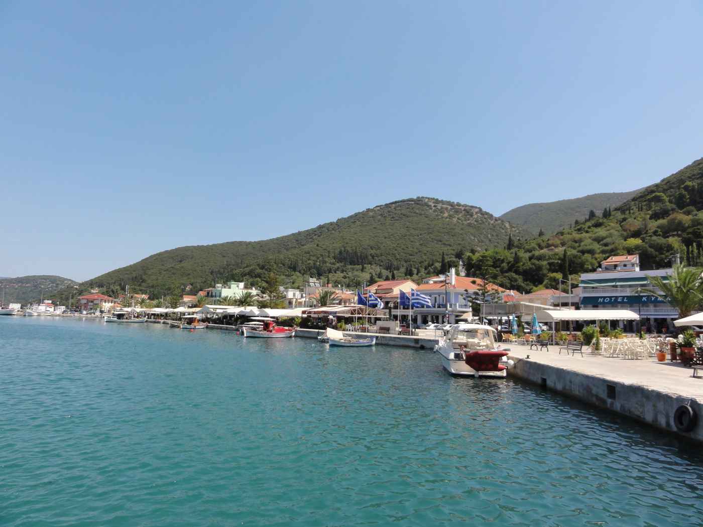
Sami sits on the east coast of Kefalonia, about 25 kilometres by road from the capital at Argostoli. The low town spreads around a wide bay below green hills, rebuilt on a flat plan after the earthquake. Sami works as the second port of the island, sending ferries east to Ithaca and south to the mainland at Patras. Behind the waterfront lie two of the most visited caves in the Ionian, the Melissani and the Drogarati. Plan the whole trip with Greece Tours.
This guide covers the harbour, the ferry routes, and the underground lakes and chambers that draw day-trippers from across the island. It also reaches the pebble sweep of Antisamos over the eastern headland, the town square and its tavernas, and the Cyclopean walls of the ancient acropolis above the bay. Distances, orientation, and named neighbours such as Karavomylos and Agia Efimia place Sami inside the wider map of Kefalonia’s east coast.
Where is Sami and what kind of port is it on Kefalonia?
Sami sits on the east coast of Kefalonia, about 25 kilometres by road from Argostoli, spread around a wide bay below green hills. The town serves as the island’s second port and the ferry gateway toward Ithaca.
Sami occupies the east coast of Kefalonia, roughly 25 kilometres by road from the capital at Argostoli. The drive crosses the mountainous interior and drops toward a wide bay that opens east toward Ithaca. The low town wraps around the shoreline in a shallow crescent, with the waterfront road running the length of the harbour. Green hills rise directly behind the buildings, and the water stays sheltered by the surrounding headlands. Travellers reaching the wider island of Kefalonia by sea often arrive first at this port before continuing inland. The bay measures around 600 metres across, and fishing boats share the quay with the larger ferries.
Sami holds the rank of second port on the island, after Argostoli, and works as its main east-coast entry point for visitors and vehicles.
The bay of Sami forms a natural harbour, protected on its northern and southern sides by low headlands that break the open sea. Water depth at the quay allows car ferries and small cruise tenders to berth close to the town. The main waterfront runs for about 500 metres, lined with a single road, a paved promenade, and a row of two-storey buildings. Behind this front, the streets climb gently toward the hills in a grid laid out after the earthquake. Karavomylos, a small village with a coastal spring, sits about 1 kilometre north along the shore. The harbour keeps a working feel, with nets, ropes. Moored caiques between the ferry berths.
Rather than a purely resort character seen at the built-up beaches on the western side of the island.
The town of Sami stands almost entirely on flat ground at sea level, a direct result of the earthquake that levelled most of Kefalonia. The rebuild used single and double-storey concrete houses on wide streets, so the modern town looks newer than its ancient roots suggest. Green hills covered in olive, cypress, and scrub rise behind the settlement to about 300 metres. The ancient acropolis once stood on two of these hills, Palaiokastro and Agios Fanentes, above the present town. Rain and mountain streams keep the land around Sami greener than the drier south of Kefalonia.
The bay faces east, so the harbour catches the morning sun while the hills throw shade across the water in the late afternoon. The greenery marks the whole east coast around Sami, unlike the barer slopes of the drier south.
Sami connects to the rest of Kefalonia by a main road that runs west to Argostoli and north along the coast. Agia Efimia, a smaller harbour village, lies about 9 kilometres north of Sami by this coastal road. The route south leads toward Poros, the other east-coast ferry port, about 40 kilometres away. The airport at EFL sits near Argostoli, roughly 30 kilometres from Sami by road, so most fly-in visitors reach the port by car or coach. Coaches on island tours often halt at Sami to visit the caves before boarding at the ferry berth. Sami acts as a base for reaching the two caves inland and Antisamos beach over the eastern hill.
The wide bay, the flat town, and the ferry links together make Sami the practical centre of the island’s east coast rather than a single-attraction stop.
Which ferries run from Sami to Ithaca and to the mainland at Patras?
Ferries from Sami cross east to Ithaca in under an hour and run south to the mainland port of Patras, linking Kefalonia to the Greek road network. The quay handles both foot passengers and vehicles.
Sami holds the main ferry berth on the east coast of Kefalonia, and its routes reach both Ithaca and the Greek mainland. The short crossing east to Ithaca covers roughly 15 kilometres of open channel and takes under an hour in normal weather. Boats usually land at Piso Aetos, the main vehicle port of Ithaca, from where roads run to Vathy and Frikes. The longer route south connects Sami to Patras, the large port on the northern Peloponnese. That crossing covers a much greater distance and takes about four hours, giving the island a direct sea link to the motorway network of the mainland.
Sailings run more often in the summer months and thin out in winter, so the exact pattern changes across the year. Both routes leave from the same quay on the southern side of the town front.
The ferry quay sits on the southern side of the Sami waterfront, within walking distance of the town square and its tavernas. Cars, motorbikes, and coaches board through a ramp at the stern, while foot passengers walk on separately. A ticket office near the quay sells tickets for the day’s departures, and boarding usually opens about 30 minutes before sailing. Drivers taking a vehicle to Ithaca or the mainland arrive early, since car space is limited on each crossing. The port has no long queues of the scale seen at Patras, but summer sailings to Ithaca fill quickly on peak mornings.
Approximate fares and timetables change by season and operator, so travellers check the current schedule locally rather than relying on a fixed printed list. Signs at the quay list the day’s boats to Ithaca and the mainland.
Ithaca lies directly across the strait east of Sami, and the ferry is the standard way to reach the neighbouring island for a day trip. From Piso Aetos the island’s capital at Vathy is about 10 kilometres by road, set at the head of a deep bay. Visitors based in Sami often cross in the morning, tour Ithaca, and return on an afternoon boat the same day. The strait between the two islands stays sheltered, so the short crossing runs in most summer conditions. Sami’s position makes it the closest Kefalonia port to Ithaca, a shorter hop than the routes from the western side of the island.
This link ties the two islands together in the mind of most travellers exploring the northern Ionian. The boat is the only public way across, since no bridge spans the strait.
The Patras route gives Kefalonia a direct sea road to the mainland motorway system, avoiding the shorter Kyllini crossing used by ferries on the island’s south coast. Patras stands about 100 kilometres of open water south of Sami, and the ferry runs for about four hours across the Gulf of Patras approaches. From the Patras port, the national road reaches Athens in roughly three hours by car. Drivers bringing a car to Kefalonia from Athens sometimes choose this long crossing to skip the coastal drive to Kyllini. Sami thus works as a long-haul port as well as a short-hop one, handling both the quick Ithaca boats and the slower mainland service.
The mix of routes keeps the quay busy through the summer and connects the east coast to the rest of Greece.
What is the Melissani cave near Sami and why does its water turn blue?
Melissani is an underground lake in a cave near Sami, roughly 2 kilometres from the town. Its roof collapsed long ago, so at midday sunlight falls straight onto the water and turns the lake a deep blue.
The Melissani cave lies about 2 kilometres from Sami, near the village of Karavomylos on the road north. The cave holds an underground lake of brackish water, a mix of seawater and fresh spring water that seeps through the rock. Part of the cave roof fell in long ago, leaving an open oval about 40 metres across above the water. Visitors reach the lake down a sloping tunnel cut into the rock, then board small rowing boats that circle the two chambers. When the midday sun stands high, its light falls straight through the open roof onto the Melissani cave and turns the water an intense blue.
The colour fades in the early and late hours, so the timing of a visit changes what you see. The cave sits about 2 kilometres inland from the Sami waterfront.
The lake inside Melissani sits about 20 metres below ground level and stretches for roughly 160 metres across its two chambers. Water depth reaches close to 30 metres in places, and the surface stays calm because the cave shelters it from wind. The brackish water comes partly from the Katavothres sea mills near Argostoli, where seawater sinks into the rock and travels underground across the island. This flow re-emerges at Karavomylos spring and inside Melissani after a journey of about 15 kilometres beneath Kefalonia. Boatmen row visitors on a short circuit of both chambers, pointing out rock formations and the light shaft overhead.
The second chamber keeps its roof intact and stays dark, so guides carry the boats between the bright open pool and the shaded inner cavern. The water stays cool and clear the year round.
Sunlight is the reason Melissani draws crowds at midday rather than early morning. The open roof faces upward, so only near noon does the sun stand high enough to send its rays straight down onto the lake. At that hour the light passes through the clear water and reflects off the pale rock floor, so the whole pool glows blue and turquoise. The effect weakens on cloudy days and outside the middle hours, when the water reads darker and greener. Guides time the boat trips to cluster around noon in summer for this reason. Photographers aim for a clear sky and a high sun to catch the strongest colour.
The cave stays open through the main season, and the visit itself lasts about 15 to 20 minutes on the water.
The Melissani cave carries a name tied to old legend, linked in local tradition to a nymph of the same name. Archaeologists have recovered objects from the site connected to the worship of Pan and the nymphs, pointing to use in ancient times. The cave lies within easy reach of Sami, Karavomylos, and Agia Efimia, so most visitors pair it with the nearby Drogarati cave on the same trip. A ticket office and car park sit at the surface entrance, and the descent to the boats runs down a short stepped tunnel. Boats leave in a near-constant rotation through the busy hours, so waits stay short outside peak days.
The combination of the open shaft, the blue water, and the short boat ride makes Melissani the single busiest inland site around Sami.
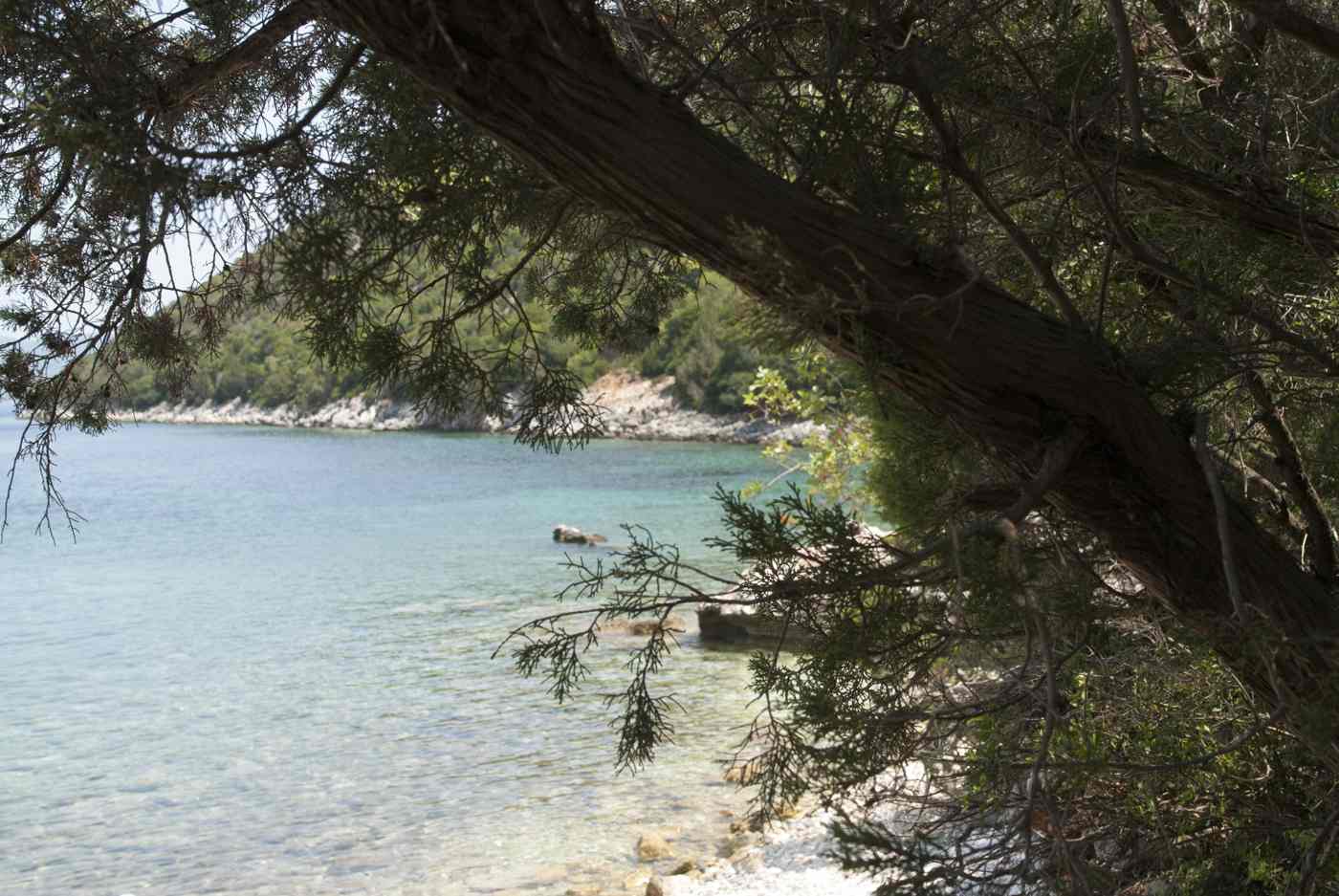
What can you see inside the Drogarati cave near Sami?
Drogarati is a large stalactite cave near Sami, about 4 kilometres from the town. Its main chamber holds thousands of stalactites and stalagmites, and its acoustics have carried concerts held on a natural rock platform inside.
The Drogarati cave lies about 4 kilometres from Sami, off the road that runs toward Argostoli. Unlike Melissani, Drogarati is a dry cave with no underground lake, formed of chambers full of stalactites and stalagmites. Visitors descend a steep flight of steps about 60 metres down into the main hall, called the Chamber of Exuberance for its dense rock formations. The temperature inside stays around 18 degrees Celsius through the year, cooler than the summer air outside. Water dripping through the limestone over a very long span built the columns, curtains, and spires that fill the space.
The cave sits close enough to the two other main sites that most day trips combine Drogarati, Melissani, and Sami town in a single loop. A ticket office and car park stand at the surface above the entrance stairway.
The main chamber of Drogarati measures roughly 900 square metres, with a ceiling that rises about 20 metres above the floor. Thousands of stalactites hang from the roof, while stalagmites grow up from the ground where the mineral-rich water drips. Certain formations have joined top to bottom to form full columns, and thin sheets of rock hang like curtains along the walls. Coloured lighting picks out the shapes as visitors follow a marked path across the uneven floor. The formations still grow by tiny amounts each year, since water continues to seep through the rock overhead. Part of the cave remains closed to the public to protect the more fragile sections.
The scale of the single open hall makes Drogarati one of the larger show caves reachable in the Ionian Islands.
Drogarati is known for its acoustics as much as its rock formations, thanks to the shape and size of the main chamber. A natural rock platform inside the hall has served as a stage for occasional concerts and recitals held underground. The chamber’s walls reflect and hold sound, so voices and instruments carry without amplification across the space. Performances happen only rarely, since protecting the cave limits how often crowds gather inside. On ordinary days, guides point out the platform and demonstrate how a clap or a note rings through the hall. The steady cool air and the still atmosphere add to the effect for anyone standing on the cave floor.
This mix of scale, sound, and dense formations sets Drogarati apart from the water-filled Melissani a short drive north.
Reaching Drogarati is straightforward from Sami, since the cave sits just off the main road inland toward Argostoli. The descent involves the steep entrance staircase, so the visit suits those comfortable with about 60 metres of steps down and back up. Inside, the marked path crosses damp, uneven rock, and handrails guide visitors past the main formations. A visit on the walking route lasts around 20 to 30 minutes, longer than the boat circuit at Melissani. The two caves together form the core of the inland sightseeing around Sami, often paired with a stop at Antisamos beach or the town waterfront.
Cool air, low light, and dripping water give Drogarati a very different feel from the bright, open lake at Melissani only a short drive north. Signs on the Argostoli road mark the turn to the cave car park.
Where is Antisamos beach and what is its link to Captain Corelli’s Mandolin?
Antisamos is a long pebble beach about 4 kilometres east of Sami, set in a green bay below wooded hills. The beach served as a filming location for the Captain Corelli’s Mandolin film set on Kefalonia.
Antisamos lies about 4 kilometres east of Sami, reached by a road that climbs over the headland and drops into the next bay. The beach is a long curve of white and grey pebbles fronting clear water that shades from turquoise to deep blue. Green hills covered in pine and scrub rise straight behind the shore, an unusual backdrop among the mostly bare coasts of the Ionian. The bay faces east across the strait toward Ithaca, so the water stays sheltered from the prevailing summer winds. Antisamos ranks among the best-known of the Kefalonia beaches, drawing day visitors from Sami and beyond.
A couple of beach bars and sunbed rows sit along the pebbles in summer, while the northern end stays quieter and more open for those who walk along.
The road from Sami to Antisamos runs for about 4 kilometres and offers wide views over the bay from the top of the headland. The climb passes olive groves and pine slopes before the descent to the shore, and a car park sits behind the beach. Because the beach has pebbles rather than sand, water shoes help on the shoreline and the seabed. The water deepens quickly a short way out, so the bay suits swimming and snorkelling over the clear stony bottom. There is no village at Antisamos, only the beach itself with seasonal bars, so most visitors bring what they need for the day.
The green setting, the pebble curve, and the sheltered water make Antisamos a common half-day trip paired with the caves inland from Sami. The car park behind the shore fills early on summer mornings.
Antisamos gained wide fame as a filming location for the film of Captain Corelli’s Mandolin, the novel by Louis de Bernières set on Kefalonia during the Second World War. The production built a period village set on and around the bay for the shoot, later removed once filming ended. Scenes filmed at Antisamos and elsewhere on the island brought Kefalonia to a wide audience and lifted visitor numbers to the east coast. The green hills and the enclosed bay stood in for the wartime island landscape on screen. Today no film structures remain on the beach, and the site has returned to its natural state.
Signs and local guides still point out the connection, and the film remains a common reason travellers first hear the name Antisamos. The bay keeps its natural pine backdrop, free of buildings on the sand.
The bay of Antisamos sits within the same green corner of the east coast as Sami, Karavomylos, and the two caves. Its position over the headland keeps it separate from the town, so the beach feels removed from the working harbour. The northern end runs to a rocky point, while the southern end holds most of the sunbeds and the bars. Snorkelling along the edges reveals a stony seabed and clear shallows before the drop to deeper water. The beach has no natural shade beyond the hillside, so visitors bring umbrellas or rent sunbeds in the marked rows.
Antisamos, the caves, and the town square together fill an easy day around Sami, with short drives linking each stop across the island’s greenest coastline. Each stop lies within a short drive of the next around the bay.
What is the town of Sami like along its waterfront and square?
Sami spreads low along its bay, with a waterfront road, a paved promenade, and a central square set back from the quay. Tavernas, cafes, and shops line the front, keeping a working-harbour feel rather than a resort one.
The waterfront of Sami runs for about 500 metres along the southern arc of the bay, from the ferry quay toward the northern end of the town. A single shore road carries traffic, backed by a paved promenade where cafes and tavernas set out tables in summer. The buildings stand two storeys high in most of the town, a direct result of the low rebuild after the earthquake. Fishing boats and small yachts moor along the front, and the ferry berth anchors the southern end. The promenade stays busy in the evening as ferry passengers, day-trippers, and residents gather along the water.
Sami keeps the feel of a working port rather than a purpose-built resort, since the harbour trade and the ferries still shape daily life along the quay.
The central square of Sami sits a short block back from the waterfront, ringed by cafes, a church, and public buildings. The square forms the social heart of the town, where families gather in the evening and children play in the open space. Streets run from the square in a grid up the gentle slope toward the hills behind. Small shops, bakeries, and two markets supply both residents and visitors passing through on the ferries. The grid layout, wide and regular, again reflects the planned rebuild after the earthquake flattened the old town. Compared with the tight lanes of Fiskardo in the north, Sami reads as an open, modern town on a flat plan.
The scale stays small, so the waterfront and the square lie only a couple of minutes apart on foot.
Tavernas and cafes line both the waterfront and the square, serving the ferry crowds and the summer visitors who base themselves in the town. Menus lean on the local catch and standard Greek dishes, with fish and seafood common given the working harbour. Prices along the Sami front tend to sit below those of the resort villages on the western coast, though they still rise in peak season. The evening rhythm follows the ferries and the sunset, with the promenade filling after the heat of the day. Bakeries and small grocers open early for those catching morning boats to Ithaca or the mainland.
The mix of everyday shops and seasonal tavernas keeps Sami functional year-round rather than shutting down entirely once the summer season closes on the island. Tables spill onto the promenade as the evening ferries come and go.
Sami works well as a base for the east coast, since the caves, Antisamos beach, and the ferries all lie within a short drive or walk of the town. Accommodation ranges from small hotels and rooms near the waterfront to studios in the surrounding villages of Karavomylos and Agia Efimia. The flat town suits walking, with the quay, the square, and the shops all close together on level ground. Buses link Sami to Argostoli and other parts of the island, though a car gives easier reach to the caves and beaches. The town stays quieter than the western resorts, which draws travellers who want a working port over a built-up strip.
Sami’s central position on the east coast makes it a natural hub for exploring this green quarter of Kefalonia.
What ancient history lies above Sami, and how did the earthquake reshape it?
Sami was an important ancient city-state, and Cyclopean walls of its acropolis still crown the hills above the bay. The earthquake destroyed the modern town, which was rebuilt low on a flat plan below the ruins.
Ancient Sami ranked among the four city-states of Kefalonia in classical and Hellenistic times, alongside Pale, Krane, and Pronnoi. The city stood on and around two hills above the modern town, Palaiokastro and Agios Fanentes, which held its fortified acropolis. Long stretches of the ancient defensive wall survive on these heights, built in the Cyclopean style from large, roughly shaped blocks fitted without mortar. The circuit once ran for about 4 kilometres around the acropolis and lower city, guarding the harbour and the fertile plain. Sami controlled the east-coast approaches and traded across the Ionian in antiquity. Roman writers record the siege of the city by Roman forces, when the acropolis held out on the hilltop.
The walls above the bay remain the clearest trace of this ancient power on the east coast of Kefalonia.
The Cyclopean walls take their name from the myth that only the giant Cyclopes were thought able to move such heavy blocks. On the hills above Sami, sections of this masonry stand to a height of two or three courses, tracing the line of the old acropolis. A path leads up from the town toward the ruins on Palaiokastro, passing the remains of towers and gates along the circuit. From the heights the view takes in the whole bay, the strait toward Ithaca, and the green hills inland. Foundations of buildings, cisterns, and a later Roman phase lie scattered within the walls.
The site sees far fewer visitors than the caves or Antisamos, so the ruins stay quiet even in summer. The climb of about 300 metres in height rewards walkers with both the archaeology and the wide coastal view.
The earthquake struck the Ionian Islands and hit Kefalonia hardest of all, levelling nearly every town on the island. Sami collapsed almost entirely, along with Argostoli, Lixouri, and most villages across Kefalonia. Only Fiskardo in the far north escaped major damage and kept its older Venetian houses. The rebuild that followed used low concrete buildings of one or two storeys, designed to resist future shocks. Wide, straight streets replaced the older tangled lanes, giving Sami the open grid plan seen today. This is why the modern town looks newer than its ancient roots suggest, a flat settlement below hills crowned with ruins thousands of years older.
The contrast between the young town and the old walls defines the character of Sami on the east coast. The scale of the loss reshaped every town on Kefalonia at once.
The ancient and modern layers of Sami sit close together, the acropolis on the hills and the rebuilt town on the flat below. Karavomylos, Agia Efimia, and the caves lie within a short radius, tying the archaeology to the wider sights of the coast. Visitors who climb to the walls gain a view that explains the site’s history, since the acropolis guarded both the harbour and the routes inland. Below, the flat streets and the low houses tell the more recent story of the earthquake and the rebuild. Together they show how Sami has held its position on the east coast down the centuries, from a walled city-state to a modern ferry port.
The layered past, the two caves, and the green bay give Sami a depth beyond its role as a place to catch a boat.
What is the Karavomylos spring and lake walk near Sami in Kefalonia?
Karavomylos sits about 1 km north of Sami, a small hamlet with a coastal spring where the Katavothres water resurfaces into a shallow lake beside the sea, ringed by an easy flat path.
Karavomylos lies about 1 km north of Sami, a walkable 15-minute stroll along the shore road. The hamlet centres on a round coastal lake fed by a spring, where water rises after crossing the island underground. This is the same water that sinks at the Katavothres sea mills near Argostoli, about 25 km west; dye tests traced the flow beneath Mount Ainos to Karavomylos and Melissani. The lake sits at sea level and mixes fresh and salt water, staying clear and cool through summer. A working waterwheel turns beside the outflow, a reconstruction of the old mill that ground grain here. Ducks and small fish gather in the shallows, and reed beds edge the northern bank.
The whole basin measures only about 100 metres across, an easy loop on foot.
A flat gravel path circles the Karavomylos lake, taking about 10 minutes to walk at a gentle pace. Plane trees and eucalyptus shade the water’s edge, and a small taverna sits beside the wheel, popular for a coffee stop rather than a full meal. From the lake it is roughly 1.2 km back to Sami harbour, and the two link into a single flat walk of under an hour. The path continues north a short way toward the pebble coves below Karavomylos, where the water reaches the same clarity as Antisamos. Cyclists use the quiet shore road, which carries little traffic outside the ferry arrivals.
For families this stretch works well, with firm ground, shade and no climbing, and benches spaced along the northern bank for a rest in full shade.
The Karavomylos lake connects naturally to the two caves that make Sami famous. Melissani sits about 2.5 km northwest, a short drive or a 30-minute walk, and Drogarati lies about 4 km southwest toward Argostoli. Planning the spring, the lake and both caves as one morning is among the easiest ways to sample the things to do in Kefalonia without long transfers. The underground water at Melissani rises from the same system that feeds Karavomylos, so the two places share a single hydrology. A car covers all three stops inside two hours, leaving the afternoon for Antisamos beach, about 4 km east of Sami.
Signposts on the Sami Agia Efimia road mark each turn, and parking near the lake is free along the shore. The lake stays open with no gate and no fee.
Fishing once drove Karavomylos, and the reconstructed watermill recalls a time when the spring powered grinding stones. The name itself means ship mill, a reminder that boats and water shaped daily work here. Today the hamlet holds about eight houses, the lake, the taverna and the coastal path, so it stays quiet even when Sami fills with ferry passengers. Loggerhead turtles occasionally drift into the calm water near the outflow, following the same species seen in Argostoli harbour, about 25 km west. Egrets and herons hunt the shallows at dawn. The setting suits a slow start before the caves open, and the flat ground makes it reachable for wheelchairs and pushchairs.
Sunset light falls across the lake from the west, catching the wheel and the still surface through the reeds.
What is Agia Efimia, the harbour village north of Sami in Kefalonia?
Agia Efimia lies about 9 km north of Sami on the same east coast, a small fishing harbour with a horseshoe quay, tavernas along the water and clear pebble coves that draw sailing boats and day visitors.
Agia Efimia sits about 9 km north of Sami, roughly a 15-minute drive along a coastal road that hugs the shore. The village wraps around a natural harbour where fishing boats and yachts share the quay, and the water inside the bay stays calm and clear. A short seafront strip carries the tavernas, a bakery and three shops, all within a 200-metre walk. Across the strait the mountains of Ithaca rise, about 4 km away over the water, close enough to trace their ridgelines. Agia Efimia serves as a sailing stop on the route between Kefalonia, Ithaca and Lefkada, so masts fill the harbour through summer.
The village escaped total ruin in the earthquake better than Sami, keeping older stone houses on the wooded slope behind the quay. Pines shade the upper lanes.
Two pebble coves flank Agia Efimia within easy reach of the harbour. A pebble cove lies a 5-minute walk south of the quay, a small strip of white pebbles under a low cliff. Where the water turns deep blue only a metre from shore. Just north, the coves toward Makryammos catch afternoon sun and stay sheltered from the meltemi wind. The seabed drops quickly, so snorkelling reveals rock and fish close in, and the clarity matches Antisamos, about 12 km south. Sunbeds and umbrellas cover part of the main cove, while the smaller inlets stay natural with no facilities. Shade is limited on the pebbles, so an umbrella helps by midday.
The road between Sami and Agia Efimia passes lay-bys where a short scramble reaches quieter water. Boats anchor offshore through the calm afternoons.
Agia Efimia works as a quieter alternative to Sami for a harbour base. The village keeps a slow rhythm, with fishing boats leaving at dawn and returning by mid-morning to sell the catch on the quay. Ferries do not dock here, so anyone weighing how to get to Kefalonia usually lands at Sami, 9 km south, then drives up the coast. A car reaches Fiskardo in about 40 minutes, roughly 26 km north through Divarata and past the Myrtos viewpoint. Argostoli lies about 34 km southwest, close to an hour by road over the hills.
The harbour car park fills by late morning in peak season, so an early arrival secures a space near the tavernas and the coves. Yacht crews restock at the small market before crossing to Ithaca, about 4 km east across the strait.
Evenings in Agia Efimia centre on the waterfront, where tavernas set tables at the edge of the quay. Grilled fish, octopus and local greens fill most menus, priced by the kilo for the day’s catch. The pace stays unhurried, and boats bob three metres from the diners. A small church of Agia Efimia gives the village its name, standing back from the harbour on the lower street. Cyclists and walkers use the coast road early, before the sun climbs over Ithaca. The village lacks a large beach of its own, so most swimmers walk to the pebble cove or drive 12 km south to Antisamos.
Water taxis and small rental boats leave the quay for the hidden coves along this shore, reachable only from the sea, giving an easy half-day on the water.
What beaches lie around Sami in Kefalonia besides Antisamos?
Sami town beach stretches along the harbour, a long pebble strand with clear shallow water, while smaller coves at Karavomylos, Agia Paraskevi and the road north give quieter swimming within about 4 km of the port.
Sami town beach runs directly north of the harbour, an easy 5-minute walk from the ferry quay. The strand stretches about 1 km along the bay, backed by tamarisk trees that give patches of shade over the pebbles. The water stays shallow and calm near shore, so families with young children use this beach through the day. Grey and white pebbles cover the shoreline, and the seabed shelves gently, holding the clear turquoise seen across the east coast. A paved promenade lines part of the back of the beach, linking to the town’s tavernas and cafés within 300 metres. Sunbeds and umbrellas cover the central stretch, while the northern end toward Karavomylos stays open and quiet.
Boats moor offshore, and the mountains behind Sami frame the bay to the west.
Antisamos sits about 4 km east of Sami, over a low headland reached by a paved road that climbs then drops to the bay. The beach is white pebble with deep clear water, framed by green hills, and it served as a filming location for the Captain Corelli’s Mandolin film. Two beach bars, sunbeds and a car park sit behind the shore, so it draws steady crowds by midday. Beyond Antisamos, smaller unnamed coves dot the coast toward the cape, reachable on foot or by rented boat from Sami harbour. The road to Antisamos passes a viewpoint over the bay, worth a short stop for the colour of the water.
Swimmers who want quiet often arrive before 10am or after 5pm, when the sunbeds thin and the light softens on the pebbles.
North of Sami, the coast toward Karavomylos and Agia Efimia holds a string of small pebble coves. Just past the Karavomylos lake, about 2 km from the port, low rocks step down to clear pockets of water with room for ten towels. The road hugs the shore, so lay-bys let drivers pull in and scramble down to the sea. These coves lack facilities, so bring water, an umbrella and food for the day. Agia Paraskevi, a small chapel cove south of the town, gives another quiet option within 3 km. The east-coast water here holds the same clarity across every cove, shelving into blue within three strides, so any of them rewards a short drive from Sami.
Local buses skip these coves, so a car links three or four in one afternoon.
Pebbles define every beach around Sami, so water shoes make entry and swimming easier on the feet. The clear water rewards a snorkel mask, with rock, sea urchins and fish visible close to shore across the east coast. Shade is thin on most coves, so an umbrella earns its space by midday. Antisamos and the town beach both hold car parks, while the smaller coves rely on lay-bys that fill by late morning in July and August. The east-facing shore catches morning sun and falls into shadow earlier than the west coast, so mornings suit sunbathing best. Currents stay gentle inside the bays, though the open coves past the cape feel the meltemi wind.
A short boat rental from Sami harbour opens the coves that the road cannot reach, spreading swimmers along the coast.
Where visitors stay in and around Sami in Kefalonia as a base for the east coast?
Sami itself offers harbour-front rooms and studios within walking distance of the ferry, tavernas and town beach, while Karavomylos, Agia Efimia and the hills behind town add quieter apartments and villas within about 9 km.
Sami town puts visitors within a short walk of the ferry, the tavernas and the pebble beach, so a car is optional for those staying central. Rooms, studios and small apartments line the streets behind the harbour, most within 300 metres of the water. This base suits travellers arriving by ferry from Ithaca or the mainland who want to reach the caves without a long transfer. Melissani sits about 2.5 km away and Drogarati about 3 km, both a short drive or a moderate walk. Antisamos beach lies 4 km east over the headland. The town stays busiest around ferry arrivals, then quiets in the evening once the day boats leave.
Staying here keeps everything on foot, from morning coffee on the front to a late dinner beside the moored boats.
Karavomylos, about 1 km north of Sami, offers a quieter base beside the coastal lake, with studios and small apartments among the trees. The hamlet keeps the caves and the town within a 15-minute walk, yet trades the harbour bustle for the still water and the reed beds. A short walk south reaches Sami’s tavernas, while the pebble coves start just beyond the lake. The hills behind Sami hold villas with pools and views over the bay, set 2 to 3 km inland along quiet lanes. These need a car, since the roads climb and the town lies downhill. Families often choose the hillside for space and calm, then drive down for dinner.
The setting works for a week that mixes cave visits, beaches and slow mornings by the lake or the pool.
Agia Efimia, about 9 km north, suits travellers who want a working harbour and easy reach of the north. The village puts Myrtos beach and Assos within a 30-minute drive, and Fiskardo about 40 minutes up the coast. Studios and apartments cluster around the quay and on the slope behind, most within a 5-minute walk of the tavernas. The sailing crowd fills the harbour in summer, giving evenings a lively edge without the ferry traffic of Sami. A car helps here, since the coves and the north lie along winding roads. Argostoli sits about 34 km southwest, close to an hour away.
This base leans toward those touring the whole east and north coast, using Agia Efimia for dinner and sleep while spending days at Myrtos, the caves and the coves between.
Choosing between Sami, Karavomylos and Agia Efimia comes down to pace and mobility. Sami keeps the ferry, tavernas and caves on foot, ideal without a car. Karavomylos adds calm beside the lake, 1 km from town. Agia Efimia opens the north but needs a car for most trips. All three sit on the east coast, so Argostoli and the airport lie about 25 to 34 km southwest, roughly an hour by road. Rooms fill fast in July and August, so booking ahead secures the harbour-front and the hillside villas. A hire car widens the choice, since it reaches Myrtos, Assos and Fiskardo from any of the three.
Travellers on ferries from Ithaca often stay a night in Sami for the caves before moving west to Argostoli or north to Fiskardo, splitting the island into two bases.
What food and tavernas can visitors find in Sami in Kefalonia?
Sami’s waterfront tavernas serve fresh fish, octopus and Kefalonian dishes like meat pie and garlic-heavy skordalia, with tables along the harbour, while bakeries and cafés on the front cover breakfast, coffee and evening drinks.
Sami’s tavernas cluster along the harbour front, setting tables within metres of the moored boats. Fresh fish and octopus lead most menus, grilled simply and priced by the kilo for the day’s catch. Kefalonian cooking appears in kreatopita, a spiced meat pie, and in aliada or skordalia, a garlic and potato dip served with fried cod. The waterfront runs about 300 metres, so an evening stroll passes every taverna before choosing. Cafés and bakeries open early for coffee, spinach pie and fresh bread, feeding ferry passengers before the first boats. The pace stays relaxed, and diners linger as the light fades over the bay.
Prices track the coast, with fish the costliest plate and vegetable dishes, salads and pies keeping a meal affordable for families. Local Robola white wine often accompanies the grilled fish.
Kefalonian food carries island signatures worth seeking in Sami. Robola, the island’s white wine from the high Omala valley about 30 km west, pours crisp and dry beside the fish. Local honey, thyme-scented, and the island’s feta appear on the tables, alongside cooked wild greens gathered from the hills. Kreatopita, the meat pie, mixes minced meat with rice and herbs under a thin pastry, a dish tied to Kefalonia rather than the mainland. Fresh sardines and small fish come fried whole, while larger catch is grilled and dressed with oil and lemon. Bakeries sell paximadia rusks and cheese pies for a beach lunch. The tavernas source vegetables locally, so tomatoes, cucumbers and peppers fill the summer salads.
A meal here leans on the sea and the surrounding hills rather than imported menus.
Mornings in Sami run on coffee and pastry along the front, where cafés open before the first ferry. Greek coffee, freddo espresso and fresh orange juice sit beside spinach and cheese pies from the bakery. The harbour fills briefly as boats arrive from Ithaca, then empties as passengers drive on toward the caves or the beaches. Tables spill onto the promenade, and the view runs across the moored fishing boats to the mountains behind town. Ice-cream shops and bars stay open late, giving families a slow evening walk after dinner. The town keeps a working feel rather than a resort strip, so fishermen mend nets on the quay beside the diners.
A day here often starts with coffee on the front, breaks for the caves, and ends with fish beside the water.
Dining spreads beyond Sami along the east coast within a short drive. Karavomylos, 1 km north, holds a taverna beside the lake, popular for a quiet lunch under the trees. Agia Efimia, 9 km up the coast, lines its quay with fish tavernas that fill with sailing crews in summer. Antisamos beach, 4 km east, keeps two beach bars for a swim-and-snack day. Visitors often pair a cave morning with a harbour lunch, ordering fish after Melissani and Drogarati. The tavernas open from midday, then run through to late evening, with the busiest hour after sunset. Reservations rarely matter outside the peak of August, though a harbour-front table fills first.
Portions run generous, and shared plates of grilled fish, salad and pie suit a family after a day on the water and in the caves.
How do visitors get around Kefalonia from Sami by car?
A hire car from Sami reaches Argostoli in about 40 minutes over roughly 25 km, Fiskardo in about an hour over 35 km, and Assos in about 50 minutes, opening the whole island from the east coast.
Argostoli sits about 25 km southwest of Sami, roughly a 40-minute drive on a road that climbs over the island’s spine. The route passes the turn for Drogarati cave, then crosses wooded hills before dropping to the capital on its bay. Argostoli holds the De Bosset stone bridge across the lagoon, the Katavothres sea mills and the main shops, museums and ferry to Lixouri. Loggerhead turtles gather in the harbour, often seen from the waterfront in the morning. The airport lies about 9 km south of Argostoli, so the Sami-to-airport run takes around 50 minutes. This drive links the east and west coasts in under an hour.
Letting a visitor base in Sami yet spend a day in the capital before returning for dinner on the harbour. Buses also run this route, though less often than a car allows.
Fiskardo lies about 35 km north of Sami, roughly an hour by road up the east coast through Agia Efimia and Divarata. The village survived the earthquake, keeping its Venetian-style harbour of pastel houses where most of the island had to rebuild low. Assos sits about 30 km north, close to 50 minutes, on a narrow isthmus below a Venetian castle on a pine-covered peninsula. The road between them passes the Myrtos viewpoint, high above the famous white-pebble beach between Assos and Divarata. This northern run rewards a full day, pairing Myrtos, Assos and Fiskardo in one loop from Sami. The coastal road twists and climbs, so the driving time stretches beyond what the distance suggests.
Parking in Fiskardo and Assos fills by midday, so an early start helps in July and August.
Car hire opens Kefalonia from Sami, since the island stretches about 773 square kilometres with sights far apart. Rental desks operate at the airport, in Argostoli and in the main resorts, and a car collected at the port covers the east and north without transfers. The roads are paved but narrow and winding through the hills, so average speeds stay low and journeys run longer than the map suggests. Fuel stations sit in Sami, Argostoli and the larger villages, though the north thins out, so filling up before Fiskardo helps. Mount Ainos, at about 1,628 metres, rises inland, and its national park road climbs from the Argostoli side.
Driving on the right, seatbelts and headlight rules follow standard Greek practice. A scooter suits the coast in summer, though the mountain roads reward a car with air-conditioning.
Sami’s central position on the east coast makes it a natural hub for day loops by car. One route runs south to Argostoli, 25 km, then on to Lixouri by the short ferry or the beaches of Makris Gialos and Skala. Another climbs north to Myrtos, Assos and Fiskardo, 35 km at the far end. A third stays local, linking Melissani, Drogarati, Karavomylos and Antisamos within 5 km. Sami also runs ferries to Ithaca, about 4 km across the strait, and to the mainland, so a car can leave the island from the same port. Poros, another east-coast port with a mainland ferry, lies about 40 km south.
This spread of roads and boats lets a Sami base reach every corner of Kefalonia, from the caves to the castle at Assos, inside a week.
When is the best time to visit Sami in Kefalonia, and what practical tips help?
May, June, September and early October give warm sea, thinner crowds and open caves at Sami, while July and August bring the hottest weather, the busiest harbour and the fullest beaches along the east coast.
May and June bring warm days, sea around 22 degrees and long light, with Melissani at its bluest as the summer sun climbs. July and August run hottest, often above 30 degrees, filling the harbour with ferries and the beaches with crowds. September holds the warmest sea of the year, near 25 degrees, as the ferry traffic eases and prices soften. Early October keeps swimming weather and open tavernas, though tavernas thin out by mid-month as the season winds down. Winter turns quiet, with cool rain, closed beach bars and reduced ferries, though the caves and villages stay reachable. Spring greens the hills and fills Mount Ainos with wildflowers.
The shoulder months of May, June, September suit the caves best, since Melissani’s blue depends on midday sun through the open roof.
Melissani rewards a midday visit, since the sun must stand high to light the water through the open cave roof and turn it deep blue. Between roughly 11am and 1pm the colour peaks, so the boats then draw the longest queues. Arriving at opening or in the shoulder hours trades part of the blue for a shorter wait. Drogarati stays constant underground, so its stalactite chamber suits any hour and cool relief on a hot afternoon. Both caves sit within 3 km of Sami, so pairing them with Antisamos beach fills an easy day. Peak-season mornings see tour buses reach Melissani from Argostoli and the resorts, so an early start beats the crowd.
The caves stay open through the main season, then run shorter hours as autumn closes in on the east coast.
Sami runs ferries to Ithaca, about 4 km across the strait, and to the mainland ports, so timing a visit around the boats helps those island-hopping. Bring water shoes for the pebble beaches, a hat and sunscreen for the thin shade, and a light layer for the cool cave air. Cash still helps in the smaller tavernas and cave kiosks, though cards work on the main front. A hire car pays off, since the caves, beaches and northern villages spread far apart. The harbour car park fills around ferry arrivals, so parking early near the front saves a walk.
Sun hits the east coast hardest in the morning, so beach visits suit the earlier hours before the heat peaks. Booking rooms ahead for July and August secures the harbour-front, which fills first.
Sami suits travellers who want caves, clear water and a working harbour over a resort strip. The town keeps the ferry, tavernas and town beach on foot, while a car opens Argostoli, Fiskardo and Assos within an hour. May, June, September and early October balance warm sea with room on the beaches and short cave queues. Families use the shallow town beach and the flat Karavomylos walk, while sailors and hikers reach Ithaca and Mount Ainos from the same base. Ferry timetables shift by season, so checking the boats before travel matters for island-hopping. The east coast catches morning sun and evening calm, so days start early and end slow on the harbour.
Two nights in Sami cover the caves, the coves and the north before the island’s west and south.
Frequently Asked Questions
How far is Sami from Argostoli in Kefalonia?
Sami sits about 25 km east of Argostoli, the capital, a drive of about 40 minutes across the wooded central hills. The paved road climbs from the east coast, passes the turn for Drogarati cave, then drops to Argostoli on its southwest bay. This route links the two main ports of Kefalonia, since Sami handles ferries to Ithaca and the mainland while Argostoli holds the capital’s shops, museums and the De Bosset stone bridge. A hire car covers the distance easily, and buses also run the route, though less often than a car allows. Kefalonia Airport lies about 9 km south of Argostoli, so the full Sami-to-airport run takes around 50 minutes.
Visitors often base in Sami for the caves, then drive to Argostoli for a day among the Katavothres sea mills, the waterfront and the loggerhead turtles in the harbour. The under-an-hour link between the east and west coasts lets a single base reach both sides of the island without a long transfer or a change of hotel. The drive itself passes green ridges worth the time.
Is Sami a good base for visiting the Melissani and Drogarati caves?
Sami is the closest town to both caves, so it works as the natural base for visiting Melissani and Drogarati. Melissani, an underground lake with an open roof and blue water reached by boat, sits about 2.5 km northwest of the town. Drogarati, a large stalactite cavern, lies about 3 km southwest toward Argostoli. Both fall within a 10-minute drive or a moderate walk, so a car staying in Sami reaches them before the tour buses arrive from Argostoli and the resorts. Melissani rewards a midday visit, since the sun must stand high to light the water through the roof and turn it deep blue. With the colour peaking between roughly 11am and 1pm.
Drogarati stays constant underground, so its chamber suits any hour and gives cool relief on a hot afternoon. Pairing both caves with Antisamos beach, 4 km east, fills an easy day from a Sami base. The harbour tavernas serve a fish lunch between the caves and the beach. No other town on the island puts both caves this close to a bed.
What is there to do in Agia Efimia near Sami?
Agia Efimia offers a working fishing harbour, clear pebble coves and waterfront tavernas about 9 km north of Sami on the same east coast. The village wraps around a natural bay where fishing boats and yachts share the quay, and the water inside stays calm and clear. A pebble cove, a small strip of white pebbles under a low cliff, lies a 5-minute walk south of the harbour, while quieter coves spread north toward Makryammos. The seabed drops fast, so snorkelling reveals rock and fish close to shore. Sailing crews fill the harbour in summer, since Agia Efimia sits on the route between Kefalonia, Ithaca and Lefkada, giving the evenings a lively edge.
Fish tavernas line the quay, serving the day’s catch by the kilo beside the moored boats. Small rental boats and water taxis leave for the hidden coves along the shore, reachable only from the sea. The village makes an easy half-day trip from Sami, or a quieter base for touring the north. A small church gives the village its name on the lower street.
Which beaches are near Sami in Kefalonia?
Antisamos is the best-known beach near Sami, about 4 km east over a low headland. A strip of white pebble and deep clear water that served as a filming location for the Captain Corelli’s Mandolin film. Sami’s own town beach runs north of the harbour, a 1-km pebble strand with shallow calm water and tamarisk shade, ideal for families. North of town, small coves line the coast toward Karavomylos and Agia Efimia, reached from lay-bys along the shore road within about 4 km. A pebble cove, a small strip of white pebbles under a low cliff, lies a 5-minute walk south of the Agia Efimia quay.
Every beach here is pebble, so water shoes ease the entry, and the clear water rewards a snorkel mask. Shade stays thin on most coves, so an umbrella helps by midday. A short boat rental from Sami harbour opens the hidden coves that the road cannot reach, spreading swimmers along the east coast beyond Antisamos and the busy town beach. Sunbeds cover the central stretches, while the smaller inlets stay natural and quiet.
How far is Fiskardo from Sami by car?
Fiskardo lies about 35 km north of Sami, roughly an hour by road up the east coast through Agia Efimia and Divarata. The village survived the earthquake, keeping its Venetian-style harbour of pastel houses, while most of Kefalonia had to rebuild low after the shock. The coastal road twists and climbs through the hills, so the driving time stretches beyond what the distance alone suggests. On the way north the road passes the Myrtos viewpoint. High above the famous curve of white pebbles between Assos and Divarata, worth a short stop for the colour of the water.
Assos, a small village on a narrow isthmus below a Venetian castle, sits about 30 km from Sami, close to 50 minutes. Pairing Myrtos, Assos and Fiskardo in one loop rewards a full day from a Sami base. Parking in Fiskardo and Assos fills by midday in July and August, so an early start helps. Fuel thins out in the north, so filling up before the drive is wise. Buses reach Fiskardo less often than a car allows.
When is the best time to visit Sami in Kefalonia?
May, June, September and early October give Sami the best balance of warm sea, open caves and thinner crowds. May and June bring warm days, sea around 22 degrees and long light, with Melissani at its bluest as the summer sun climbs. September holds the warmest sea of the year, near 25 degrees, as ferry traffic eases and prices soften. Early October keeps swimming weather and open tavernas before the season winds down. July and August run hottest, often above 30 degrees, filling the harbour with ferries and the beaches with crowds, so those months suit travellers who want the fullest scene.
Melissani depends on midday sun through its open roof, so the shoulder months still deliver the deep blue between roughly 11am and 1pm. Winter turns quiet, with cool rain, closed beach bars and reduced ferries, though the caves and villages stay reachable. Spring greens the hills and fills Mount Ainos with wildflowers, a fine time for walking before the beaches warm up along the east coast. Booking rooms ahead secures the harbour-front.
Can you take a ferry from Sami to Ithaca?
Sami runs ferries to Ithaca, about 4 km east across the strait, along with services to the mainland, since it serves as the second port of Kefalonia after Argostoli. The crossing to Ithaca is short, so Sami works as a hub for island-hopping between Kefalonia, Ithaca, Lefkada and the mainland ports. The harbour sits at the centre of town, within a 5-minute walk of the tavernas, cafés and the pebble town beach. Ferry timetables shift by season, running fuller through summer and thinner in winter, so checking the boats before travel matters for planning a hop. A car can board the ferry, letting drivers carry a hire vehicle between the islands.
Poros, another east-coast port about 40 km south, also runs mainland ferries, giving a second option from Kefalonia. For anyone weighing how to reach the island by sea, Sami’s boats connect it to the Ionian network and the ports of Kyllini. Patras and Astakos. The town suits travellers arriving or leaving by water. Foot passengers and vehicles both board from the central quay.