
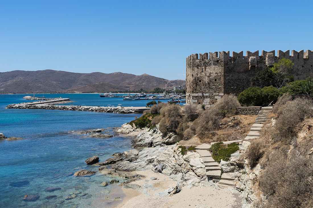
Evia tours cover the second largest island in Greece, a 180 km ridge of mountain and coast reached from Athens across a bridge rather than by ferry. They take in Chalkida on the Euripus strait, where the current reverses about every six hours, ancient Eretria with its theatre and mosaics, the dragon houses and Venetian castle of Karystos, the chestnut forests under Dirfys, and the hot springs of Edipsos in the north. Plan the rest of the trip with Greece Tours.
This page covers the Evia tours you can book from Athens, Chalkida and Eretria, what each part of the island holds, the beaches, gorges and boat trips, the monasteries and pilgrimages, the food, and how the bridges, ferries and seasons shape the route. Fishing cruises, sailing trips and rib tours to sea caves appear on our Evia boat trip page. Evening sailings out of Eretria and Karavos are on our Evia sunset cruise page.
What do Evia tours cover?
Evia tours cover the second largest island in Greece: Chalkida and the Euripus strait that reverses its current, ancient Eretria, the dragon houses and Venetian castle of Karystos in the south, the chestnut forests of Dirfys in the centre, and the hot springs of Edipsos in the north.
Evia, also written Euboea, runs 180 km from north-west to south-east along the coast of central Greece, and its width moves between 6 and 50 km. A mountain chain crosses it end to end. The Euripus strait separates it from Boeotia and narrows to 40 m at Chalkida, where two bridges carry the road, so the island is reached from Athens without a ferry.
That road link changes the shape of a trip. Evia tours run as day trips from Athens, as drives down the island over two or three days, and as walking, canyoning and boat days out of Chalkida, Eretria and Karystos. The island holds more than 200,000 people, farms its own plains and works its own quarries, so it stays open through the year.
Which formats do Evia tours take?
- Day trips from Athens to Chalkida, the strait and the nearest beaches, 90 minutes by road.
- Grand island tours that run the length of Evia from Chalkida to Karystos or Edipsos.
- Walking tours of Chalkida old town, its Ottoman, Venetian and Jewish quarters.
- Private day trips to the dragon houses of Styra and the ancient marble track.
- Canyoning in the Manikia gorge and hiking on Dirfys and Ochi.
- Boat cruises from Eretria to the islets of the South Euboean Gulf.
Our pages on the Evia day trip from Athens and the Chalkida walking tour cover the two commonest routes, and Greece Tours sets out the rest of the country.
Where is Evia and how big is it?
Evia lies along the east coast of central Greece, separated from Boeotia by the Euripus strait, which is 40 m wide at Chalkida. The island runs 180 km long and covers 3,684 square kilometres, second in Greece only to Crete.
The island reads as a piece of the mainland set slightly apart, and the ancients thought exactly that: Thucydides and Strabo both record earthquakes in the north, and the tradition held that Evia had been split from Greece by one. The mountain range that crosses it continues the chain east of Thessaly and reappears south of the island in Andros, Tinos and Mykonos. Evia tours drive onto it without a boat.
The name comes from the words for good and ox, the land of well-fed cattle. Antiquity also called it Macris and Doliche for its length, and the Middle Ages called it Negroponte, an Italian rendering of the Greek for the Euripus, while the Ottomans called it Egriboz. All four names are on the maps that hang in the Chalkida museum.
- Length: about 180 km from Cape Lichada in the north-west to Cape Kafireas in the south-east.
- Width: 6 km at the narrowest, 50 km at the widest.
- Highest point: Dirfys at 1,743 m, in the centre of the island.
- Second peak: Ochi above Karystos, at about 1,400 m.
- Capital: Chalkida, on the strait, with about 60,000 people.
- Regional unit: Euboea, which also takes in Skyros and a strip of the mainland.
Evia tours plan by section rather than by island, because the drive from Chalkida to Karystos runs 129 km and the drive to Edipsos about 150 km. Two days cover one end, four cover both.
Which Evia tours leave Athens and Chalkida?
Evia tours leave Athens by road for Chalkida in about 90 minutes, run private day trips to Chalkida, Eretria and Styra, and work out of Chalkida and Eretria for the grand island tour, the Steni chestnut forest, the Manikia canyon and the boat cruises of the south gulf.
No ferry is needed for the main crossing. The old sliding bridge at Chalkida opens for shipping and carries the traffic the rest of the time, and the high bridge south of it takes the national road, which puts the island within an hour and a half of central Athens. That is why the day trip works and why Athenians keep second houses along both coasts. Evia tours out of Athens use that road every morning.
From Chalkida the tours split by direction. “Evia: Grand Tour” runs the length of the island; “Evia: Private Tour Chalkida, Eretria and Styra” takes the south coast and the dragon houses; “Private Tour in the Chestnut Forest of Steni, Evia” climbs to Dirfys. Out of Eretria, “Eretria: 3-Hour Sightseeing Tour of Theater, Temples and Harbor” covers the ancient city, and “South Evia Fishing Boat Cruise” takes the gulf.
Evia tours also reach the island from the other side. Ferries cross from Rafina to Marmari, from Agia Marina to Nea Styra, from Arkitsa to Edipsos and from Glyfa to Agiokampos, each in 25 to 60 minutes, and Kymi on the east coast is the port for Skyros. Our page on Rafina port covers the southern crossing.
What do Evia tours see in Chalkida?
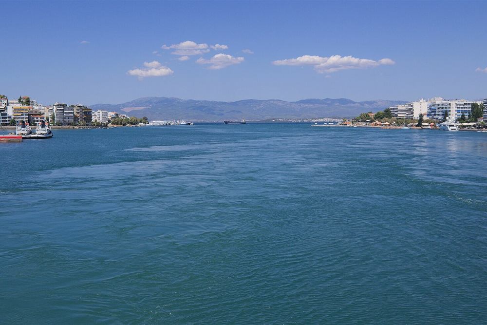
Evia tours in Chalkida see the Euripus strait with its current that reverses direction about every six hours, the sliding bridge that opens for ships, the Ottoman fortress of Karababa above the town, the Emir Zade mosque, the church of Agia Paraskevi and the archaeological museum.
The strait is the sight. At its narrowest the water between the island and the mainland measures 40 m, and the tidal current running through it changes direction roughly every six hours, then falls slack and turns again, at speeds that reach 12 km per hour. The pattern breaks into irregular changes for a few days each month. Aristotle studied it, and a tradition, unproven, says he died in Chalkida in 322 BC in frustration at failing to explain it. Evia tours stand on the old bridge to watch the turn.
The town grew on that crossing. Chalkida means the bronze city, and in the 8th and 7th centuries BC its colonists founded thirty settlements on the Chalcidice peninsula and cities in Italy and Sicily, among them Cumae, Rhegion and Zancle. The Chalcidian alphabet travelled with them to the Etruscans and then to Rome, which is why letters such as C, D, F, P, R, S and X follow Euboean forms. Evia tours read that history in the museum above the quay.
Above the mainland end of the bridge stands Karababa, the Ottoman fortress of 1684, with the full view of the strait and both gulfs. In the old town the Emir Zade mosque, the aqueduct fountain, the synagogue that served one of the oldest Jewish communities in Greece and the basilica of Agia Paraskefi, rebuilt by the crusaders in Gothic form, stand within a few streets of each other.
Evia tours walk that quarter in an hour and a half. The archaeological museum holds the pediment sculptures of the temple of Apollo Daphnephoros from Eretria and finds from the Lelantine plain. Our page on the Chalkida walking tour covers the route street by street.
What do Evia tours see at Eretria?
Evia tours at Eretria see the ancient theatre with its underground passage, the House of Mosaics, the sanctuary of Apollo Daphnephoros, the west gate and the acropolis, and the museum built by the Swiss School of Archaeology, which has dug the site since 1964.
Eretria means the city of the rowers. Homer lists it among the towns that sent ships to Troy, and in the 8th century BC it and Chalkida were the two rich trading cities of the Aegean, founding Pithekoussai and Cumae in Italy together. Then they fought each other for the Lelantine plain between them, and Eretria lost; the defeat cost it Andros, Tinos and Keos and ended the first age of both cities. Evia tours give the site a half day.
The ruins lie inside and under the modern town. The theatre kept a vaulted passage that runs from the orchestra under the stage, used to bring actors up as if from the underworld. The House of Mosaics, of about 370 BC, keeps pebble floors showing griffins, panthers and a Nereid on a hippocamp, protected under a shelter. The temple of Apollo Daphnephoros stood by the harbour, and its pediment is in Chalkida. Evia tours walk between them in an hour.
The Persians burned Eretria in 490 BC on their way to Marathon and carried its people to Mesopotamia, which the Greeks never forgot. The town recovered under Macedon and Rome, then faded. Excavation began in the 1890s and the Swiss School has worked it since 1964, with its museum on the main road holding the finds.
Evia tours combine the site with the harbour. Boats run from the quay to the islets of the gulf and to the coves east of the town, and the ferry to Oropos on the mainland takes 25 minutes, which makes Eretria the second way onto the island from Attica.
What do Evia tours see in southern Evia?
Evia tours in the south see Karystos under Mount Ochi, the Venetian Castello Rosso above it, the dragon houses of Styra and Ochi built of massive unmortared blocks, the ancient cipollino marble quarries, and the ferry beaches of Marmari and Nea Styra.
Karystos sits 129 km south of Chalkida on a bay under the mountain, with a grid of 19th-century streets laid out by the Bavarian engineer Bierbach after independence. The reconstructed Bourtzi tower of the 13th century stands on the eastern beach, and Castello Rosso, the red castle built in 1030 and held in turn by Franks, Byzantines, Catalans and Venetians, looks down from Myloi 4 km inland. Evia tours base the southern day here.
The dragon houses are the mystery of the island. About twenty of them stand in the south, built of huge stone blocks laid without mortar and roofed with stone slabs. The one on Mount Ochi is the most complete; others sit at Palli-Lakka and Kapsala. No ancient text mentions them, no date is agreed, and the first outside account came from the British geologist John Hawkins in the 18th century. Local folklore gave them to dragons, meaning beings of superhuman strength. Evia tours climb to the one on Ochi with a guide.
The marble made the region rich. Karystian cipollino, green-veined and white, was cut from the slopes of Ochi and shipped to Rome for the Forum and the imperial buildings; half-finished columns still lie in the quarries at Aetos and Kylindroi where they cracked. The ancient track down which they were dragged is walked on guided tours. Evia tours walk the quarries above the town.
Evia tours in the south use the Rafina ferry to Marmari, 30 minutes from Karystos, or the Agia Marina boat to Nea Styra. Cape Kafireas at the south-east tip, the Cavo Doro of the sailors, takes the worst wind in the Aegean and is now lined with turbines.
What do Evia tours see in central Evia?
Evia tours in the centre see Steni under Dirfys at 1,743 m, the chestnut and fir forests on its slopes, the wild beach at Chiliadou, the canyon at Manikia, and Kymi on the east coast above its harbour, the birthplace of George Papanikolaou.
Steni Dirfyos lies 31 km from Chalkida at 450 m, a village of plane trees and running water that serves as the base for the mountain. Dirfys is the highest ground on the island, with forest on the lower slopes, grassland above and snow through the winter; the marked path to the summit takes about three hours from the refuge, and the view runs from Skyros to Parnassos. Evia tours stop here for lunch under the plane trees.
North of the ridge the land drops to the Aegean coast. Chiliadou is a long beach of white pebble under cliffs, reached by a rough road and a footpath; Stomio and Agali lie along the same shore. The Manikia gorge, inland from there, is the island’s canyoning ground, with a guided descent through pools and small waterfalls that runs from spring to autumn.
Kymi stands on a terrace 250 m above its harbour, looking east to Skyros. Its plain grows the figs that are dried and exported under the town’s name, and its harbour takes the ferry to Skyros in about an hour and 45 minutes. George Papanikolaou, who devised the cervical smear test, was born here in 1883, and the house is a museum with the folklore collection beside it. Evia tours reach it on the east-coast drive.
Evia tours in the centre also take the Lelantine plain between Chalkida and Eretria, the fertile ground that the two cities fought over, and the Ritsona wine trail on its western edge, where an organic winery works the slopes above the old road. Our page on Sporades tours covers the islands across the water from Kymi.
What do Evia tours see in northern Evia?
Evia tours in the north see the thermal springs of Edipsos, where 80 of the 752 hot springs of Greece rise, the seven islets of Lichadonisia, the pilgrimage church of Saint John the Russian at Prokopi, the olive coast at Rovies and the bay of Limni.
Boat trips to the seven Lichadonisia islets off north-west Evia are covered on the Lichadonisia boat trip page.
Edipsos has been a spa since antiquity. Sulla came for the waters, and the guest list since has run through Churchill, Venizelos, Onassis, Maria Callas and Kostis Palamas. The springs surface at up to 80 degrees along the shore, run into the sea in steaming channels, and feed the hotel spas of Loutra Aidipsou; the ruins of the ancient town of Aedepsus stand nearby. Evia tours in winter run on that season.
Lichadonisia lies off the north-west cape, a complex of seven islets formed, tradition says, when the land between them sank in the earthquake of 426 BC. Manolia, the largest, has a sand beach and day boats from Kamena Vourla and Agios Georgios; Strongyli carries a lighthouse. The water over the shallows turns the colour of the Caribbean, which is how the islets are sold. Evia tours reach the islets by day boat.
Prokopi, inland on the road from Chalkida, holds the shrine of Saint John the Russian, whose relics were brought from Cappadocia by refugees in 1924. The pilgrimage on 27 May fills the village, and buses come from across Greece. Nearby stand the monastery of Osios David the Elder and the wooded gorge below it.
The north-west coast runs through Rovies, with its olive groves and its medieval tower, and Limni, a white town of tiled roofs on a bay with the Galataki convent above it. Wildfires burned much of the northern forest in August 2021, and the replanting and the recovery of the pine are visible from the road. Evia tours in the north pair the springs with the coast in one day.
Which beaches do Evia tours reach?
Evia tours reach Chiliadou and Agali on the Aegean coast, Kalamos and Korasida in the south-east, Marmari and Nea Styra facing Attica, Agia Anna and Angali in the north, and the sheltered coves of the South Euboean Gulf around Eretria and Amarynthos.
The island has two coasts and they differ. The west, on the gulfs, is sheltered, shallow and lined with the summer houses of Athens, from Eretria and Amarynthos down to Nea Styra. The east faces the open Aegean, takes the wind and the swell, and keeps the wild beaches: Chiliadou, Agali, Kalamos, Thapsa and the long sand at Agia Anna. Evia tours pick the sheltered side when the meltemi blows.
- Chiliadou – white pebble under cliffs on the east coast, reached on foot from the road end.
- Agia Anna and Angali – long sand and dune in the north-east, the widest beaches of the island.
- Kalamos and Korasida – sand and tamarisk on the south-east coast below Karystos.
- Marmari and Nea Styra – the ferry towns opposite Attica, with shallow bays.
- Lichadonisia – the islet beaches of the north-west, reached by day boat.
- Eretria and Amarynthos – the sheltered gulf coast within a short drive of Chalkida.
Access decides the crowd. The gulf beaches lie on paved roads and fill with Athenian families in August; the Aegean beaches sit at the end of dirt tracks or footpaths and stay empty even in high summer. Chiliadou has a seasonal canteen and nothing else, Thapsa and Kalamos have none, and the sand at Agia Anna runs for two kilometres with room on it in July.
Cavo Doro, the strait off Cape Kafireas, sets the weather for the south-east: when the meltemi blows, the beaches on that shore close and the swimming moves to the gulf side. Evia tours read the wind before they pick the coast.
Which outdoor Evia tours run on foot and by water?
Outdoor Evia tours climb Dirfys from Steni and Ochi from Karystos, descend the Manikia canyon, walk the ancient marble track and the dragon-house paths of Styra, cruise the islets from Eretria, and follow the Ritsona wine trail on the western slopes.
Dirfys is the long day. The path leaves Steni at 450 m, climbs through chestnut and fir into open grass, and reaches 1,743 m in about three hours, with the refuge at Liri as a base. Ochi above Karystos is shorter and stranger: the route passes the dragon house near the summit, the quarries with their abandoned columns and the Agia Triada cave in the gorge below. Evia tours start it early from the village.
- Manikia canyon – a guided canyoning descent through pools, rappels and small falls.
- Dirfys summit – three hours up from Steni, snow on the top from December.
- Mount Ochi and the dragon house – a four-hour circuit from Myloi above Karystos.
- Ancient marble track – the drag road for the cipollino columns above Karystos.
- Dimosari gorge – the walk from Lenosei down to Kallianou on the east coast.
- Eretria boat cruises – islets, coves and swim stops in the South Euboean Gulf.
The Dimosari gorge on Ochi carries running water through the summer, which is rare in the Aegean, and the descent ends at a beach. Evia tours book these with local guides, since the paths are marked but the road access is rough.
Which museums do Evia tours visit?
Evia tours visit the Archaeological Museum of Chalkida with the pediment of the temple of Apollo Daphnephoros, the Eretria museum of the Swiss School, the Yokaleion collection at Karystos, the Papanikolaou house at Kymi and the folklore museum inside Karababa fortress.
Chalkida holds the island’s main collection. Its rooms carry the marble group of Theseus carrying off Antiope from the west pediment of the Eretrian temple, Bronze Age finds from the chamber tombs at Trypa and Vromousa, and material from the Lelantine plain that the two cities fought over. The folklore museum sits across the strait inside the Karababa fortress of 1684, with weaving, costume and the history of the crossing. Evia tours open the day there.
The Eretria museum stands beside the excavation. The Swiss School of Archaeology has dug the ancient city since 1964 and built the museum to hold what it found: the terracotta gorgon from the temple roof, grave goods from the heroon at the west gate, and the finds from the House of Mosaics, which is shown on site under a shelter a few streets away.
- Archaeological Museum of Chalkida – the Eretrian pediment, Mycenaean tombs and the Lelantine plain.
- Archaeological Museum of Eretria – the Swiss School collection beside the ancient city.
- Karababa folklore museum – inside the Ottoman fortress above the strait.
- Yokaleion Cultural Centre, Karystos – Hellenistic and Roman sculpture and pottery.
- Papanikolaou house, Kymi – the birthplace of the doctor who devised the smear test, with the folklore collection beside it.
- Drakospita interpretation, Styra – the site displays that explain the dragon houses.
Chalkida also keeps its 20th-century record. The town was bombed in the Second World War for its bridge and its factories, rebuilt along the waterfront, and its promenade now runs the length of the strait with the current sliding past the tables. The Red House and the neoclassical mansions on the front date from the 1880s, when the railway reached the town and the first factories opened on the mainland bank.
None of them takes more than an hour, and all sit on the main roads. Evia tours pair the Chalkida museum with the old town walk and the Eretria museum with the ancient theatre.
Which villages do Evia tours reach?
Evia tours reach Steni and Stropones under Dirfys, Kymi above its harbour, Prokopi and Limni in the north, Rovies on its olive coast, Marmari and Styra in the south, and Amarynthos and Eretria on the gulf.
The mountain villages sit where the water is. Steni Dirfyos, at 450 m in plane trees, feeds on springs and serves walkers and Athenians who drive up for lunch; Stropones, on the far side of the ridge, looks down at the Aegean and the Chiliadou coast. Both keep tavernas that cook goat and mountain greens through the winter. Evia tours climb to them from the coast road.
Kymi is the town of the east coast, built on a terrace with the harbour 250 m below it and a view across to Skyros. Its fig plain, its neoclassical square and its ferry make it the natural stop on a drive down that shore. North of it, Metochi and Vitalo hold the coast road.
- Steni Dirfyos – 31 km from Chalkida, the base for the highest mountain.
- Stropones – on the north side of the ridge, above the wild beaches.
- Kymi – the east-coast town, its figs and the Skyros ferry.
- Prokopi – the pilgrimage village on the northern road.
- Limni and Rovies – the white town on its bay and the olive coast beside it.
- Marmari and Styra – the southern ferry ports facing Attica.
- Amarynthos – the gulf village east of Eretria, with a long waterfront.
The plains between them carry the working island. Psachna and Nea Artaki grow vegetables for Athens, Aliveri holds the power station and the cement works that give the island its industry, and Mantoudi mined magnesite until the 1980s and now ships timber and marble. Farming, quarrying and the Athenian weekend keep these villages open when the beaches are empty.
Evia tours string them by coast rather than by list. The gulf road runs Chalkida, Eretria, Amarynthos, Aliveri and on to Styra and Karystos; the northern road runs Chalkida, Prokopi, Mantoudi, Limni, Rovies and Edipsos; and the mountain road crosses between them at Steni.
Which mainland sites combine with Evia tours?
Evia tours combine with Athens 80 km from Chalkida, the sanctuary of Amphiaraos at Oropos across the gulf, Thebes and the Boeotian plain to the west, Thermopylae and Kamena Vourla off the northern coast, and Skyros by the ferry from Kymi.
The island touches the mainland at four points, and each opens a different region. Oropos, 25 minutes from Eretria by ferry, holds the Amphiareion, the healing sanctuary with its theatre and long stoa where patients slept for their cures. Aulis, on the mainland bank south of Chalkida, is where Agamemnon’s fleet was held by contrary winds and where the temple of Artemis stood. Evia tours use each of them as a door.
Thebes lies 50 km west of Chalkida, with a museum that carries the Mycenaean palace finds and the Boeotian collection. Thermopylae, on the coast road north of the Arkitsa crossing, keeps the monument to Leonidas and the hot springs beside the pass, and Kamena Vourla sits on the same shore with the boats to Lichadonisia.
- Athens – 80 km from Chalkida, about 90 minutes by road.
- Amphiareion of Oropos – the healing sanctuary, 25 minutes by ferry from Eretria.
- Aulis – the fleet’s anchorage and temple site on the strait south of Chalkida.
- Thebes – the Mycenaean capital of Boeotia, 50 km west.
- Thermopylae – the pass and the Leonidas monument, north of the Arkitsa ferry.
- Skyros – the Sporades island reached from Kymi in under two hours.
Our page on Sporades tours covers Skyros and the islands beyond it, and the Kymi crossing is the only regular link between them and Evia.
Which landscape and wildlife do Evia tours cross?
Evia tours cross fir and chestnut forest on Dirfys, the bare wind-blown ridges of Cape Kafireas, the olive and pine coast of the north-west, the wetlands at Psachna and Dystos, and the shallow blue water around the Lichadonisia islets.
The island carries more forest than any Aegean island except Thasos and Samothrace. Fir and chestnut cover Dirfys above 800 m, pine runs down the northern coast, and the plane trees follow the streams at Steni, Prokopi and Agia Anna. The fires of August 2021 burned a large part of the northern pine, and the replanting, the erosion barriers and the new growth are visible along the road from Prokopi to Limni. Evia tours drive through it for an hour at a time.
Lake Dystos in the south is a shallow wetland under an ancient acropolis, a stop for herons, egrets and migrating waders, and the marshes at Psachna hold the same birds closer to Chalkida. Golden eagles and Bonelli’s eagles nest on the cliffs of Ochi and Kafireas, and Eleonora’s falcons hunt the coast in late summer.
Cape Kafireas, the Cavo Doro of the sailors, is the windiest ground in the Aegean; the wind farms along the ridge work on it, and the strait below keeps a reputation among skippers. The Lichadonisia at the other end sit in water so shallow and clear that the islets read as a lagoon.
Evia tours that run the length of the island cross all of it in a day: forest, wetland, bare ridge and spa coast within 150 km of road.
What do Evia tours eat and drink?
Evia tours eat the dried figs of Kymi, the olive oil of Rovies and Limni, goat and pork from the Dirfys villages, fish at Eretria and Karystos, and drink the wine of the Ritsona and Lelantine slopes and the tsipouro of the mountain kafeneia.
Kymi figs are the island’s export. The plain above the harbour grows them, they are split and dried in the sun, and the town’s name goes on the box. Honey follows: thyme from the bare south, fir and chestnut from Dirfys, and pine from the northern forests that are growing back after the fires. Evia tours buy them at the town square.
The north-west coast lives on olives. Rovies and Limni press an oil that carries a protected designation for north Evia, and the groves run from the road to the water for kilometres. Mountain tavernas at Steni and Stropones cook goat in the oven and pork with quince, and the villages of the south grill the lamb of the Ochi pastures.
- Kymi figs – sun-dried and packed, the island’s best known product.
- North Evia olive oil – from the groves at Rovies, Limni and Mantoudi.
- Honey – thyme, fir, chestnut and pine, sold at the roadside.
- Cheese – kefalotyri and fresh goat cheese from Dirfys.
- Fish – at Eretria, Karystos, Limni and the Kymi harbour.
- Wine – the organic vineyards of Ritsona and the Lelantine plain, tasted on the wine hike.
The tavernas of Chalkida line the strait and serve the fish caught in the current, which the locals hold to be firmer for it. Evia tours time lunch at the water there and dinner in the hills.
What history do Evia tours tell?
Evia tours tell of Chalkida and Eretria, the two trading cities that colonised Italy and Sicily and then destroyed each other in the Lelantine War, of Persian destruction in 490 BC, of Venetian Negroponte, of Ottoman Egriboz from 1470, and of union with Greece in 1830.
The island was rich before Athens. Chalkidian and Eretrian ships founded Pithekoussai on Ischia about 770 BC, then Cumae, Rhegion, Zancle and thirty towns on the Chalcidice peninsula that still carries the name. The alphabet they carried west became the Latin one. The Lelantine War at the end of the 8th century BC ended that period: Eretria was defeated and both cities dropped out of the front rank. Evia tours follow that trade west to Italy and Sicily.
In 490 BC the Persians burned Eretria and deported its people before crossing to Marathon. Athens then held the island through the classical centuries, Macedon and Rome after it. Byzantium ruled from Chalkis, and after the Fourth Crusade the island was divided into three baronies, the triarchies, under Lombard lords.
Venice took control and called the island Negroponte, from a folk reading of the Greek for the Euripus. It held Chalkida as one of its chief eastern possessions until 1470, when Mehmed II took the town after a siege and the Ottomans renamed it Egriboz. Karababa fortress on the mainland bank dates from 1684, in the war with Venice that followed.
Evia joined the Greek state in 1830 with the rest of Central Greece, and the new government laid out Karystos on a grid. The 20th century brought magnesite mining at Mantoudi, the figs of Kymi and the spa season at Edipsos. Evia tours read the sequence in the buildings: a Gothic basilica, an Ottoman mosque, a Venetian tower and a Bavarian town plan within one island.
Which monasteries and pilgrimages do Evia tours visit?
Evia tours visit the shrine of Saint John the Russian at Prokopi, the monastery of Osios David the Elder above Rovies, the Galataki convent near Limni, the Taxiarches and Agios Georgios monasteries above Karystos, and the Gothic basilica of Agia Paraskevi in Chalkida.
Prokopi draws the largest crowd. Refugees from Cappadocia settled the village in 1924 and brought the relics of Saint John the Russian, an 18th-century soldier taken prisoner and venerated for his patience under captivity. The church built for him fills on 27 May, and coaches arrive through the year from every part of the country. Evia tours stop at the shrine on the northern road.
Osios David sits in the forest above Rovies, founded in the 16th century around the cell of its hermit saint; the monastery held the skull of the founder and became known through the ascetic Iakovos Tsalikis, who lived there until 1991. The fire of 2021 came close and the buildings survived. Galataki, above Limni, is the oldest convent on the island, built on the site of a temple and rebuilt in the 16th century, with a courtyard of orange trees.
Agia Paraskevi in Chalkida is the strangest church of the island: an early Christian basilica rebuilt by the crusaders with Gothic arches and a pointed apse, standing in the middle of the old town. The southern monasteries, Taxiarches, Agios Georgios and Agia Mavra, sit in the hills around Karystos and open to visitors in the morning.
Evia tours fold these into the driving day, since all of them stand on the main roads. The 27 May pilgrimage at Prokopi and the 15 August feasts fill every room on the island, so tours in those weeks book early.
How do visitors reach Evia?
Visitors reach Evia by road from Athens across the two bridges at Chalkida in about 90 minutes, or by ferry from Rafina to Marmari, Agia Marina to Nea Styra, Oropos to Eretria, Arkitsa to Edipsos and Glyfa to Agiokampos, each between 25 and 60 minutes.
The land route is the reason the island is busy. The national road runs from Athens to the high suspension bridge south of Chalkida, and the old sliding bridge crosses the 40 m channel in the middle of the town. Buses leave the Liosion terminal in Athens for Chalkida through the day and continue down the island to Karystos and up to Edipsos. Evia tours from Athens take it in 90 minutes.
- Athens to Chalkida – 80 km by road, about 90 minutes, no ferry.
- Rafina to Marmari – about an hour, the fastest way to Karystos and the south.
- Agia Marina to Nea Styra – 45 minutes across the South Euboean Gulf.
- Oropos to Eretria – 25 minutes, the shortest crossing from Attica.
- Arkitsa to Edipsos – about 40 minutes to the northern spa coast.
- Glyfa to Agiokampos – 25 minutes from the Thessaly shore.
- Kymi to Skyros – about an hour and 45 minutes to the Sporades.
A car is the practical choice, since the island is 180 km long and the bus timetable is built for residents. Evia tours with a driver cover the length in two days. Our page on the Evia day trip from Athens sets out the shortest version.
When do Evia tours run, and where do they stay?
Evia tours run through the year, with the beaches from June to September, the walking in spring and autumn and the Edipsos spa season in winter. They stay in Chalkida for the strait, Eretria and Amarynthos for the gulf, Karystos for the south, Steni for the mountain and Loutra Aidipsou for the springs.
The island does not close. Chalkida is a working city of 60,000 people with hotels open in February, the spa hotels of Edipsos take their main season in winter and early spring, and the mountain villages keep their tavernas for the Athenian weekend trade. The summer crowd is domestic, and August fills the west coast. Evia tours run in February as readily as in July.
- March to May – wildflowers on Dirfys and Ochi, the gorges running, the sea still cold.
- June to September – the beach season, with the east coast exposed to the meltemi in August.
- October and November – the chestnut harvest at Steni, the olive picking in the north.
- December to February – the spa season at Edipsos and snow on Dirfys.
Base choice follows the section. Chalkida covers the strait, the museum and the day trips, and it is 90 minutes from Athens. Eretria and Amarynthos suit a family week on the gulf. Karystos is the base for Ochi, the dragon houses and the marble. Steni suits walkers, and Loutra Aidipsou suits the springs and the northern coast.
Two nights cover one end of the island, four cover both. Evia tours that take the whole length run Chalkida, Kymi or Steni, and then Karystos or Edipsos, with the drive between them as the day.
Frequently Asked Questions
Where is Evia?
Along the east coast of central Greece, separated from Boeotia by the Euripus strait, which narrows to 40 m at Chalkida. Two bridges carry the road, so no ferry is needed from Athens.
How big is Evia?
About 180 km long and between 6 and 50 km wide, 3,684 square kilometres in all. It is the second largest Greek island after Crete and the sixth largest in the Mediterranean.
How long do Evia tours take?
A day for Chalkida and the strait from Athens, two days for one end of the island, and four for the whole length from Karystos to Edipsos.
Why does the current at Chalkida change direction?
The tidal flow through the 40 m Euripus channel reverses roughly every six hours, reaching about 12 km per hour, then falls slack and turns again. Aristotle studied it, and the pattern breaks into irregular changes for a few days each month.
What are the dragon houses of Evia?
About twenty buildings in the south of the island, made of massive unmortared blocks with stone slab roofs. The one on Mount Ochi is the best preserved. No ancient text mentions them and no date is agreed.
What is Edipsos known for?
Thermal springs: 80 of the 752 hot springs of Greece rise there. Sulla came for the waters, and Churchill, Venizelos, Onassis and Maria Callas followed.
How do you get to Evia from Athens?
By road to Chalkida in about 90 minutes over the old sliding bridge or the high suspension bridge, or by ferry from Rafina to Marmari, Agia Marina to Nea Styra and Oropos to Eretria.
Which Evia beaches are the best?
Chiliadou and Agali on the wild Aegean coast, Agia Anna and Angali in the north-east, Kalamos and Korasida in the south, and the sheltered gulf beaches around Eretria and Amarynthos.
What is there to see in Eretria?
The ancient theatre with its underground passage, the House of Mosaics of about 370 BC, the sanctuary of Apollo Daphnephoros, the west gate and the museum of the Swiss School of Archaeology.
Which mountain is the highest on Evia?
Dirfys, at 1,743 m, above the village of Steni. Mount Ochi in the south reaches about 1,400 m and carries the best known dragon house near its summit.
Which food do Evia tours try?
The dried figs of Kymi, the olive oil of Rovies and Limni, thyme and fir honey, goat from the Dirfys villages and fish from the Euripus current.
When is the best time for Evia tours?
April to June and September to October for walking and driving, June to September for the beaches, and winter for the Edipsos spa season, which runs when the coast is empty.