
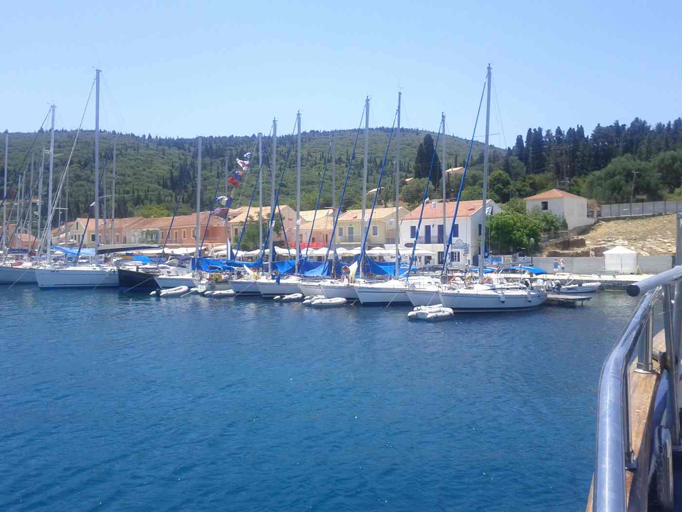
Skala Kefalonia is the main resort of the island’s southeastern corner, spread along a beach that runs roughly 3 km below low pine-covered slopes. The village itself is modern and low-rise, laid out on flat ground about 40 km by road from the island capital. Rooms, shops and tavernas sit in a short grid one street back from the sand. Arrivals notice the scale of the shoreline first. The beach is long enough that walkers lose the sunbed rows within ten minutes and reach open stretches where the only structures are pine trunks and the water line. That combination of an organised centre and empty edges shapes how the resort works through the summer season. Plan the whole trip with Greece Tours.
History sits close to the sunbeds here, which separates Skala from newer coastal developments elsewhere on the island. On the southern edge of the village, excavations uncovered a Roman villa whose floor mosaics survive under a protective shelter. The foundations of an ancient temple of Apollo lie a short distance away on rising ground. Behind the shore, a hillside inland carries the roofless walls of the old settlement, abandoned after the earthquake that levelled it and rebuilt down by the sea. Pine woods link these places together and give shade for the walk between the archaeological site, the ruined village and the quiet ends of the beach.
This guide covers the geography, the shoreline, the antiquities, the rebuilt village and the woodland paths.
Where is Skala on Kefalonia and what kind of resort is it?
Skala sits at the southeastern tip of Kefalonia, about 40 km from Argostoli by road, and works as the island’s main southern beach resort, a low-rise modern village set behind roughly 3 km of sand and pebbles.
Skala occupies the southeastern corner of Kefalonia. The coastline flattens here, after the cliffs that shape the east coast further north. The drive from Argostoli covers about 40 km and takes around 50 minutes. It runs through Peratata and Vlachata before dropping to the shore. Poros, the nearest east-coast ferry port, lies about 12 km north. That road faces the channel towards Ithaca for much of its length. Kefalonia Airport sits roughly 35 km to the west, so arrivals reach the village by car, taxi or transfer bus. The setting is level ground. A coastal shelf of olive groves, farmland and pine spreads behind the sand, backed by hills that rise gently.
The flat approach gives Skala a different feel from the north of the island, where roads twist high above the water.
The village plan is simple and walkable. One main street runs parallel to the shore, about 200 metres inland. It carries the mini-markets, bakeries, car-hire desks and tavernas that serve the resort. Side lanes drop from that street to the beach road. Rooms, studios and small hotels fill the blocks between them. Nothing rises above three storeys, so the pine ridge behind the village stays visible from the sand. Walking from the far end of the built-up area to the central beach access takes about ten minutes. No accommodation in the village core sits more than 500 metres from the water. Signposting is limited.
The grid is small enough that visitors learn it within a day, and orientation comes from the beach road rather than from street names.
Southeastern Kefalonia holds a run of resorts, and Skala is the largest of them. Katelios lies about 8 km west along the coast, a smaller village behind a narrower beach. Poros, to the north, works as a ferry port with a shingle shore. Skala combines the longest sand in this part of the island with the widest choice of rooms and tavernas. That makes it the base most visitors pick for the south. Travellers who want the caves at Sami, the wine villages of the Omala valley or the north-coast viewpoints treat it as a starting point. The island overview of Kefalonia shows how the southern coast connects with the rest of the shoreline.
Driving distances stay manageable, because the main road network runs inland along the spine of the island.
The resort runs on a summer rhythm. Businesses open from spring and reach full capacity in July and August. They wind down through October, after which the village returns to a quiet farming community. Families make up a large share of the summer arrivals. The shallow entry to the water and the flat streets suit pushchairs and bicycles equally well. Car hire is available in the village, and driving is the practical way to reach the rest of the island. Bus services along this coast run only a small number of times each day. Distances from Skala stay moderate by Kefalonian standards.
Sami is about 40 km north, Fiskardo about 75 km, and the airport lies within a 45-minute drive of the village centre. Taxis wait near the main street through the season.
What is Skala beach like along its 3 km of sand and pebbles?
Skala beach runs roughly 3 km east to west, mixing fine sand with small pebbles and shelving gently into clear water. The central stretch carries sunbeds, umbrellas, watersports and beach bars, while both far ends stay quiet and largely undeveloped.
The shore at Skala reads as one continuous line rather than a series of coves. Sand dominates the surface, with bands of small pebbles near the water. Patches of coarser shingle mark the points where streams once cut down to the sea. The seabed slopes away slowly. Waders reach chest depth around 20 to 30 metres out on a calm morning, which explains the resort’s reputation with families. Water clarity stays high, because the bottom is stone and clean sand rather than silt. The open aspect faces southeast towards the Peloponnese. Afternoon breezes build small waves along the exposed centre, while the ends behind low rock spurs keep flatter water.
Pine trunks stand directly behind the sand for long sections and give natural shade without any structure.
The organised zone occupies the central kilometre in front of the village. Sunbeds and straw umbrellas run there in double rows, spaced with walking corridors down to the water. Beach bars operate behind them at intervals along the sand. Watersports concessions rent pedalos, canoes and paddleboards through the summer. Towed rides run from jetties placed clear of the swimming area. Showers, changing cabins and rubbish bins line the access points, and the sand is groomed through the season. Prices for a pair of beds with an umbrella vary between operators. Walking 50 metres to compare rates before settling costs nothing at all.
Behind this strip, the beach road carries cafes and tavernas that face the water across a low wall, with parking along the inland side.
The two ends of the beach change the experience completely. Walking east from the village, the sunbed rows stop after about 800 metres. The shoreline then continues towards the low headland, with pine, dune grass and driftwood behind it. West of the centre the pattern repeats. The sand narrows as it runs towards the coastal flats that loggerhead turtles use for nesting further along that shore. Neither end carries facilities, so walkers take water and their own shade with them. Both stay quiet even in August. The majority of visitors stop at the first free space they find near a bar.
Twenty minutes on foot buys a stretch of sand with under a dozen people on it, and the water there is identical. Both edges also stay clear of the beach-bar music.
Comparison with the island’s headline shores puts Skala in context. Myrtos, on the northwest coast, draws crowds for its cliffs and white pebbles. It offers no shade and a steep drop into deep water. Antisamos near Sami is similar in structure, a pebble bay under wooded slopes. Skala trades drama for length, sand and gradient. It works as a swimming beach across a full day rather than as a photo stop on a driving tour. Anyone building an itinerary around the coast can compare it with the rest of the Kefalonia beaches before choosing a base. The southern shore also stays usable when the north-coast bays turn choppy under a summer meltemi.
Shade matters over a long stay too, and the pines behind Skala supply it free of charge.
What can visitors see at the Roman villa and the temple of Apollo in Skala?
The Roman villa on the southern edge of Skala preserves floor mosaics under a protective shelter, including figured panels and geometric borders. Foundations of an ancient temple of Apollo stand nearby, marked by cut stone blocks on a low terrace.
The Roman villa lies on the southern edge of the village. A short walk from the beach road leads there through pine and olive ground. Excavation exposed the plan of a wealthy country house. Rectangular rooms stand around a central space, with stone thresholds, wall footings preserved to knee height and drainage channels running downslope. A permanent roof now covers the excavated area. A raised walkway lets visitors look down onto the floors without stepping on them. The site is fenced, and entry follows the archaeological service’s summer opening hours. Interpretation panels near the gate explain the layout and the dating of the building.
The visit takes about twenty minutes, which makes it an easy break between a morning swim and lunch in the village.
The mosaics are the reason the villa matters. Two floors survive in good condition. Both are laid in small tesserae of white, black, red and ochre stone, cut from local rock. Geometric borders of interlaced bands and wave patterns frame the central panels. The figured scenes inside them show ritual subjects. One floor carries an altar with attendants, and the other a figure set upon by wild animals. A Greek inscription runs beside one panel and names the craftsman responsible for the work. That signature is uncommon in provincial mosaic floors. The colours have faded where the surface stood exposed before the shelter went up, yet the drawing stays legible.
Standing above them gives a clear sense of the scale of the reception rooms. The shelter keeps rain off the surface through the year.
The temple of Apollo occupies rising ground a short distance from the villa. What survives is foundation work rather than standing architecture. Squared limestone blocks sit in courses on a levelled terrace cut into the slope. Fragments of column drums and worked stone lie scattered in the surrounding scrub. Builders of the Roman house reused material from the earlier sanctuary. Part of the villa sits over the older structure, so the two phases occupy one continuous archaeological area. The position makes sense for a temple, with a view down across the coastal plain to the open sea. Detailed signposting is absent on the ground.
Visitors reach the spot by following the track uphill from the villa fence for about 100 metres. The scrub grows back fast, so the blocks show best in spring.
Finds from the site left the village long ago. Pottery, coins and small bronzes from the excavation entered the island’s museum collections. The archaeological museum in Argostoli holds objects from this coast alongside material from the rest of the island. Visiting the museum after the site gives context that fenced remains alone cannot supply. The Skala antiquities fit a wider pattern. The southeastern plain was farmed and settled through the Roman period, because it holds the flattest arable land on a mountainous island. Olive presses, tombs and building debris have surfaced across the fields between Skala and Ratzakli. That evidence points to a landscape of estates and working farms rather than one isolated house above the beach.
The drive to the museum takes about 50 minutes from Skala.
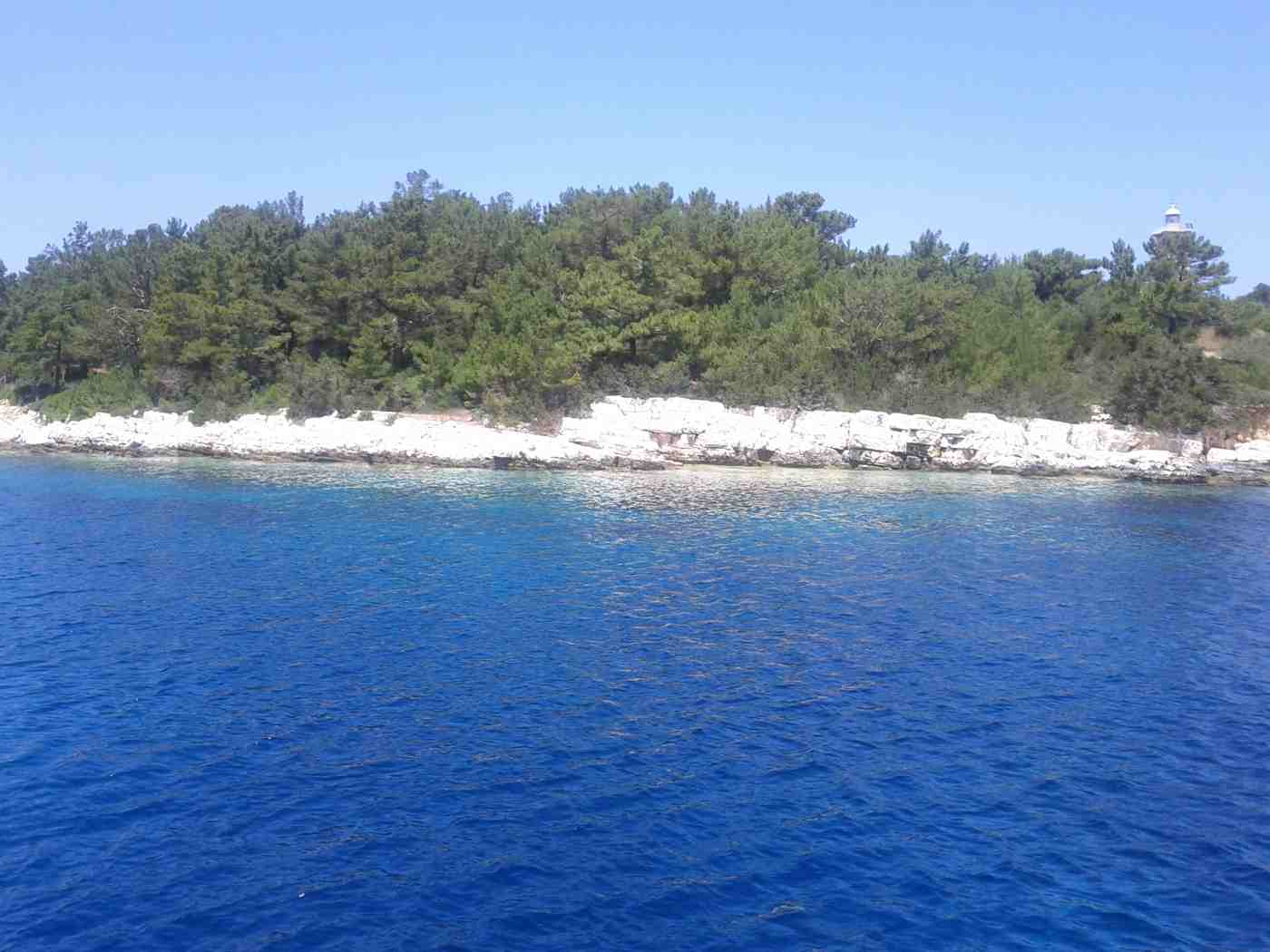
Why does Skala stand on the shore instead of on its old hill site?
The earthquake destroyed the old village of Skala on the hill inland, and residents rebuilt on flat ground beside the beach in low, simple houses. The abandoned upper settlement survives as roofless stone walls, lanes and a church shell.
Old Skala stood about 2 km inland and uphill from the present resort. Ionian villages traditionally took that position: away from the exposed shore, on a defensible slope with a view over approaching boats. Stone houses with tiled roofs lined narrow lanes on terraces. Cisterns, olive presses and a parish church stood at the centre of the settlement. The earthquake flattened that fabric within seconds. Walls built of rubble and lime mortar had no capacity to absorb the shaking, and the collapse left the village uninhabitable. Rebuilding on the same slope offered nothing that the coastal flat did not.
The sea by then carried more economic promise than the hillside terraces, so the community moved down to the plain and started again. Families carried salvaged timber and tiles down to the coast.
The new village went up on the plain behind the beach, and its architecture records that moment. Houses stand one or two storeys high, built with reinforced concrete frames and infill walls. Straight streets run square to each other, with gardens and low boundary walls between the plots. Roof lines stay level, balconies are shallow, and decoration is minimal. Nothing in the village core predates the reconstruction. Visitors looking for stone lanes and Venetian doorways find none of that here. What the plan gained is space: wide streets that take modern traffic, room for oleander and bougainvillea, and building plots close to the water. Tourism then developed from the seafront inland.
The result reads as a planned settlement rather than a historic one. Shade in the streets comes from planted trees instead of narrow lanes.
The ruins of the old village stay accessible on foot or by car. A minor road climbs from the western side of the resort through olive terraces and pine. The last section runs as a rough track. Roofless walls stand to varying heights among the trees. Doorways and window openings frame empty ground, and stone stairs climb to floors that vanished. The church shell remains the clearest structure on the site, with parts of its apse intact. Fig trees and brambles have taken the interiors, so walkers keep to the lanes instead of entering buildings. From the upper terraces the southeastern coastline opens up.
The beach shows as a thin pale line about 2 km below, with open sea beyond it. Sturdy shoes matter, because loose stone covers the last climb.
Skala’s story repeats across Kefalonia, which explains the island’s modern appearance. The same disaster levelled Argostoli, Lixouri, Sami and dozens of villages. Reconstruction followed anti-seismic rules, and those rules produced the low concrete architecture seen almost everywhere on the island. Fiskardo, in the far north, escaped the worst of the shaking. It kept its pastel Venetian harbour, which is why it looks unlike the rest of Kefalonia. Travellers who arrive expecting Cycladic-style stone villages read the landscape wrongly until they know this history. In Skala the contrast is available within a single afternoon. The ruined stone village sits above, the rebuilt concrete village lies below, and decades of coastal tourism separate the two.
Fiskardo draws day visitors from the whole island for its architecture alone. Photographers head north for that reason.
What walks lead through the pine woods behind Skala beach?
Pine woods cover the low slopes behind Skala beach, crossed by dirt tracks and footpaths that link the resort with the old village, the Roman villa and the quieter eastern sand. Shade under the canopy keeps midday walking comfortable.
The pine belt starts directly behind the sand and climbs the slope inland for about a kilometre. Aleppo pines dominate, growing on thin soil over limestone, with trunks leaning seaward where the wind shapes them. Needle litter, mastic bushes, thyme and cistus cover the ground under the canopy. The air holds resin through the hot hours of the day. This woodland does more than provide scenery. It shades the back of the beach, so towels laid under the trees stay usable at midday. Fire risk runs high through the dry months, and open flames are banned across the whole belt.
The trees also screen the resort from the coastal road, which keeps traffic noise away from the shoreline and the swimming area. Pine needles also soften the sand along the treeline.
Tracks through the pines make three practical routes. The first runs parallel to the shore behind the beach. It links the eastern end of the village with the quiet sand beyond the sunbed rows, a walk of about 25 minutes each way. The second climbs from the western edge of the resort towards the ruins of the old village. That route gains around 150 metres of height over 2 km on a stony track. The third connects the archaeological site with the coastal path through olive terraces. It turns the villa visit into a loop rather than an out-and-back walk.
Surfaces are dirt and loose stone throughout, so trainers work better than sandals on every one of the three routes. None of them needs a guide. A hat helps on the open stretches.
The woodland changes through the season. Spring brings orchids, anemones and asphodel to the clearings. Warblers and finches moving through the canopy give the strongest birdsong of the year. Summer belongs to the cicadas, whose noise fills the whole belt from mid-morning until dusk. Autumn rain triggers cyclamen along the shaded banks and revives the thyme scent after the dry months. Wildlife stays discreet: lizards on the warm stone, tortoises crossing the tracks in the cooler hours, and hawks working the thermals above the ridge. Hunting takes place inland during the winter season, well away from the resort and its beach. Anyone walking at first light stands a good chance of having the entire pine slope alone.
Goats graze the terraces on the inland edge of the wood, and their bells carry through the trees at dusk.
Timing and preparation decide how the walks go. Early morning before nine and late afternoon after five give workable temperatures. Midday on the exposed sections of the hill track is heavy going in July and August. Carry at least a litre of water per person, because no springs or taps exist between the village and the ruins. Marking is minimal, and farm vehicles have cut side tracks that branch off without signs. A downloaded offline map removes the guesswork on the upper slopes. Ticks live in the undergrowth, which argues for long socks on the overgrown sections. The reward at the top of the hill track is the full sweep of the southeastern coast.
The pine slope drops away to the beach below. Phone signal holds across the ridge.
Where do loggerhead sea turtles nest near Skala in Kefalonia?
Loggerhead sea turtles nest on the sand beaches of Kefalonia’s southern coast, including Mounda and Kaminia within about 6 km of Skala. Nesting protections cover that shoreline through the warm months of the season.
Loggerhead sea turtles, Caretta caretta, return each summer to the sand of Kefalonia’s southeast, and the shoreline between Skala and Katelios carries the island’s main nesting activity. Females come ashore after dark, dig a chamber above the waterline, lay a clutch of eggs and slip back into the sea before dawn. Incubation runs about two months, and hatchlings emerge at night and crawl toward the brightest horizon over the water. Mounda beach, around 6 km west of Skala along the coast toward Katelios, and Kaminia beach beside it hold the densest concentration of nests on the island.
That sand stays open and undeveloped, without ranks of sunbeds, because the nesting season overlaps exactly with the months that fill the resort with visitors. Nesting runs from late spring into midsummer, and the last hatchlings leave in early autumn.
Protection rules on the nesting sand are short and enforced across the season. Lights facing the beach stay off after dark, because artificial glow pulls hatchlings inland instead of down toward the water. Umbrellas, sunbeds and parasol poles stay off the marked nesting zones, since a pole driven into the sand punctures an egg chamber. Vehicles stay off the sand entirely, and walking the beach with torches at night is not permitted on Mounda and Kaminia. Marked nests carry stakes or protective cages, and passing them by a wide margin keeps the surface loose enough for hatchlings to climb out. Camping and fires on those two beaches break the same rules that hold the nesting colony in place.
Signs at the track entrances set out the same rules in Greek and English.
Mounda beach runs as a long open arc of fine sand near Cape Mounda, the southernmost point of Kefalonia. The sand lies about 6 km from the centre of Skala on the coast road. Kaminia beach sits immediately west of it, closer to Katelios, and both are reached by short unsurfaced tracks that drop off the Skala to Katelios road. Neither beach carries organised facilities, so swimmers carry water, shade and food from the shops on Skala’s main street. The seabed shelves gently, the water stays calm on windless mornings, and the sand holds its heat into the evening.
Daytime swimming above the high-water line stays open to everyone; the restrictions bite at dusk, when the beaches belong to the turtles. Parking is a roadside verge rather than a car park, with shade only from low scrub.
Turtles appear in the water as well as on the sand along this coast. Swimmers off Skala and Kaminia meet adults surfacing to breathe, and boat crews working the southeast pass them on calm days. Holding about 5 metres of distance, staying quiet and never touching or riding an animal protects the turtle and the swimmer together. Argostoli harbour, about 40 km northwest, holds the island’s best-known daytime sightings, where adults gather near the fishing quay in the morning. Reporting a stranded turtle or a disturbed nest to the authorities in Skala or Katelios brings trained handlers to the spot within the same day. Kefalonia’s southern coast keeps its colony because visitors hold these limits summer after summer.
Boats keep their engines slow near surfacing animals, which lowers the risk of propeller strikes.
What is the eating and evening scene like in Skala, Kefalonia?
Skala concentrates its tavernas, cafes and bars along the main street and the beach road, a walkable strip of about 700 metres. Evenings run to long dinners, low-volume music and drinks near the sand rather than clubbing.
Skala’s eating places line one main street that runs from the village centre down to the beachfront, a stretch covered on foot in about 10 minutes. Taverna terraces face the road on one side and the sea on the other, and tables spill onto the pavement from early evening. Grilled fish, octopus, lamb and slow-cooked beef anchor most kitchens, alongside the Greek staples of village salad, tzatziki and fried courgette. Kefalonian dishes appear on the same menus: kreatopita, the island’s spiced meat pie, riganada bread rubbed with tomato and oregano, and thyme honey served with yoghurt. Portions arrive family style, and one shared table of dishes feeds four people without ordering per person.
Prices sit close to the island average rather than the premium of Fiskardo’s harbour.
Robola, the white grape grown in the high Omala valley about 45 km northwest, carries the local wine list in Skala and pairs with grilled fish and cheese. House wine arrives by the half-litre or litre carafe in most tavernas, and the bottled Robola from the Omala cooperative sits beside it. Greek spirits follow the meal, with tsipouro and ouzo poured cold and served with small plates. Local goat and sheep cheeses, cured pork and honey from the hills behind Skala fill the mezze end of the menu. Seafood comes off the boats working the southeast coast between Skala and Poros, so the fish board changes with the weather rather than the calendar.
Vegetarian eating works easily here, since Greek Lenten cooking already builds whole dishes from pulses, greens and vegetables.
Mornings in Skala start slowly at the cafes on the main street, where coffee, fresh orange juice and bakery pastries serve the beach crowd before 10:00. Bakeries sell spinach and cheese pies by weight, and mini-markets stock bread, fruit, water and sun cream within about 300 metres of the sand. Beach bars along the front pour cold drinks through the afternoon and hand out shade with a sunbed pair. The rhythm shifts at about 18:00, when swimmers walk back into the village and terraces reset for dinner. Families eat between 19:00 and 21:00, and Greek visitors sit down later, which spreads demand and keeps waits short.
A late walk along the seafront closes most evenings for guests staying in the resort. Boat trips and water sports fill the middle of the day for guests who leave the sunbeds.
Bars in Skala run to open terraces, cocktail lists and recorded music at a volume that leaves conversation intact. The strip holds a handful of late venues rather than clubs, so the noise stays inside the bar rather than crossing the village. Live Greek music appears on scattered evenings through the season, usually bouzouki and guitar rather than amplified sets. Argostoli and Lassi, about 40 km away on the southwest coast, carry the island’s louder nightlife for anyone chasing it. Skala trades that for quiet streets after midnight, which is precisely why families and couples return.
The seafront empties well before dawn, and the beach is silent by the small hours, which also serves the nesting turtles on the coast west of the village. Sunset falls behind the hills, so the seafront lights come on before dinner.
Who does staying in Skala suit on a Kefalonia holiday?
Skala suits families, couples and travellers who want a walkable beach resort with shallow water and short drives. The village keeps a low-rise layout, so most accommodation sits within about 10 minutes on foot of the sand.
Accommodation in Skala splits into studios, self-catering apartments, small family-run hotels and villas set back in the pine belt behind the beach. Buildings stay two or three storeys high, a pattern set across Kefalonia after the earthquake and kept in the resort ever since. The core of the village holds the shops, tavernas and bus stop, so a room on the main street puts everything within about 300 metres. Properties toward the eastern end sit closer to the quiet stretch of sand and further from evening noise. Villas in the hills behind Skala, about 1 to 2 km inland, trade walking distance for space, pools and views over the Ionian Sea.
Comparing districts across the island first helps, and the guide to where to stay in Kefalonia sets Skala against the alternatives.
Families choose Skala for the shallow entry to the water, the flat walk from village to sand and the short evening distances between room and taverna. Parents with toddlers manage without a car for whole days, since the beach, shops and food sit inside one compact grid. Couples use the same base differently, driving out in the morning and returning for a slow dinner near the sea. Older travellers value the flat terrain, because Skala avoids the steep steps that define Assos and Fiskardo in the north. Groups renting a villa gain a kitchen and a pool for about the price of separate rooms in the centre.
The resort works across a one-week stay without repetition, and a two-week stay covers the whole south and east of the island.
Skala fills through July and August, when Greek and northern European visitors overlap on the same beach. Booking accommodation early for those weeks secures the rooms nearest the sand, which go first every season. Late spring and early autumn bring warm sea temperatures with thinner crowds, and tavernas stay open through the quieter weeks. Most properties close for the winter, since the resort trade concentrates in the warm half of the year. Sea temperature in the southeast climbs through June and holds into October, which stretches the swimming season beyond the peak.
Wind matters more than heat here, because the beach faces east and picks up morning breeze rather than the strong afternoon gusts of the exposed west coast. Rooms with air conditioning matter through July and August, when night temperatures stay high.
Skala works as a southern base rather than a compromise between all corners of Kefalonia. The village stands about 40 km from Argostoli, about 12 km from Poros and about 25 km from Lourdas, which puts the south inside a short drive. Travellers who want Myrtos, Assos and Fiskardo on the doorstep book in the northwest instead, since those villages sit about 75 to 90 km away by mountain road. A split stay solves it for two-week trips: about one week in Skala for the southern beaches, then a move north for the cliffs and harbours.
Guests who prefer a town rather than a resort choose Argostoli, which holds the bus network, the De Bosset bridge and the museums. Ferry links from Poros and Sami make Skala workable as the last stop of an island-hopping route.
Which day trips and drives work best from Skala in Kefalonia?
Skala reaches Poros in about 12 km, Lourdas in about 25 km and Argostoli in about 40 km, so the south and east of Kefalonia open up on day drives. Sami sits about 45 km north.
Poros, about 12 km north of Skala on the east coast, makes the shortest run and doubles as a working ferry port for boats to Kyllini on the mainland. The road climbs over the crest of the hills and drops to the harbour, with the Poros gorge cutting inland behind the village. Pebble beaches sit either side of the port, and the seafront tavernas face Ithaca across the strait. A morning in Poros pairs with the drive up the coast to Sami, about 45 km from Skala. The Melissani cave there holds an underground lake reached by rowing boat, and the Drogarati cave opens as a stalactite chamber.
Antisamos beach lies about 4 km beyond Sami below green hills. Ithaca stands across the strait, close enough to pick out its villages on a clear morning.
The southern coast road west of Skala passes Katelios at about 9 km and reaches Lourdas at about 25 km. A long sand and pebble beach under the slopes of Mount Ainos. Lourdas village sits high above its beach, and the descent road gives a clear view over the bay toward Zakynthos on a clear day. Trapezaki and Kaminia Bay break the same drive with smaller beaches and quiet parking. The route continues to Argostoli, so the coastal road works as a single loop out and back. Planning the stops in advance saves the day, and the roundup of things to do in Kefalonia sorts the southern coast from the northern highlights.
The road surface is asphalt the whole way, with tight bends on the descent to Lourdas beach. Parking sits at the beach end of each access road.
Argostoli, about 40 km from Skala and roughly 50 minutes by road, carries the island’s capital sights in one walkable centre. The De Bosset stone bridge crosses the lagoon, the Katavothres sea mills show seawater draining into the rock, and the Napier Garden sits above the town. Loggerhead turtles gather near the fishing quay on the waterfront, which gives a daytime sighting without disturbing any nest. Lassi, Makris Gialos and Platis Gialos beaches sit about 4 km beyond the town on the southwest coast. Lixouri, the second town on the Paliki peninsula, is reached by a short ferry across the bay. Xi beach and its red-orange sand sit about 8 km further on.
Museums in the town cover the island’s history and the rebuilding after the earthquake. Cafes line the Lithostroto pedestrian street through the centre.
Mount Ainos rises to about 1,628 metres inland from Skala and holds the highest ground in the Ionian Islands. The national park road climbs from the Argostoli to Sami route and reaches the ridge, where the endemic Cephalonian fir covers the slopes and semi-wild horses graze the clearings. The Omala valley on the way holds the monastery of Agios Gerasimos, the island’s patron saint, and the Robola wine cooperative. Myrtos beach, about 75 km northwest of Skala below its cliffs between Divarata and Assos, works as a full-day drive rather than an afternoon.
Fiskardo in the far north, about 90 km away, keeps the Venetian houses that survived the earthquake and closes the longest day trip from the resort. The climb from the coast to the ridge takes about 40 minutes by car from the main road.
How do you reach Skala from Kefalonia Airport and Argostoli, and get around?
Skala sits about 35 km from Kefalonia Airport and about 40 km from Argostoli, roughly 45 and 50 minutes by road. Hire cars, taxis and a thin bus network cover the route across the island’s southern interior.
Kefalonia Airport, coded EFL, sits about 9 km south of Argostoli and about 35 km from Skala by road. The drive runs east across the southern interior through the villages behind the coast and joins the shore near Katelios before the final run into the resort. Hire-car desks operate in the terminal, and pre-booked transfers and taxis meet flights through the season. Driving time sits near 45 minutes, longer on peak changeover days when arrivals cluster. The route holds one lane in each direction with bends through the hills, so night arrivals take it slowly.
Skala’s compact grid means the final approach is simple: the main road enters the village from the west and ends at the beach road. Signposting for Skala begins on the main road east of the airport turn.
Argostoli, about 40 km northwest, connects to Skala by bus as well as by car. The KTEL network runs from the Argostoli terminal on the waterfront to Skala through Poros or along the southern coast. Departures are limited each day, and the service thins outside the summer months. Bus travel from Skala works for a single day in the capital, not for chasing beaches on a schedule. Taxis cover the same route door to door, and drivers wait at the rank in Skala’s village centre. Ferry arrivals reach Skala from two directions. Poros, about 12 km north, takes boats from Kyllini, and Sami, about 45 km north, takes boats from the mainland and Ithaca.
Poros to Skala takes about 20 minutes by road. Both ports handle car traffic as well as foot passengers.
A hire car unlocks the south and east from Skala, since the beaches that matter here spread across the coast road rather than clustering in the village. Mounda, Kaminia, Katelios and Lourdas all sit on the same westward route, and the drive to Lourdas takes about 35 minutes. Scooters and quad bikes rent in the resort and suit short coastal hops rather than the mountain roads to Myrtos or Fiskardo. Fuel stations sit in and around Skala and along the road toward Argostoli, so a full tank covers a whole day of touring. Parking in Skala is free and on-street, with dedicated spaces near the beach entrance that fill by about 11:00 in high summer.
Roads inland from the coast narrow quickly, so a compact car handles the village lanes better than a large one.
Skala itself needs no transport at all. The village runs roughly 700 metres from the top of the main street to the sand, and every taverna, shop and bar stands on that line. Pavements are flat, which suits pushchairs and travellers with limited mobility better than the stepped villages of the north. The beach path continues east along the shore for about 3 km toward the pine woods and the Roman villa site, an easy walk in the early evening. Boat trips leave the coast for the southeast bays and, on longer days, run toward Ithaca. Cycling works on the flat coastal stretch west of the village, though the inland roads climb steeply within about 2 km.
The walk from the top of the village to the sand takes about 10 minutes at an easy pace.
Frequently Asked Questions
Is Skala beach in Kefalonia good for families with young children?
Skala beach suits families through its long shallow entry, its clean sand mixed with fine pebbles at the waterline and its flat walk from the village. The seabed deepens gradually for about 20 metres out, so young children stand comfortably well away from the shore. The beach runs roughly 3 km east from the resort toward the pine woods, which spreads the crowd thinly even at midday in August. Sunbeds and umbrellas cover the organised section in front of the village, while the eastern end stays open sand for towels. Pine trees behind the shore throw natural shade through the late afternoon, useful for babies and toddlers.
Shops, bakeries and mini-markets sit within about 300 metres of the sand, so a forgotten sun hat costs five minutes. Morning water stays glassy on the east-facing coast, and the afternoon breeze raises small waves on the exposed eastern half. Families with the youngest children swim early and use the sheltered end nearer the village.
Can you see sea turtles at Skala in Kefalonia?
Loggerhead sea turtles are seen along the coast at Skala, most often in the water rather than on the sand. Adults surface to breathe off the beach and off Kaminia, and swimmers meet them on calm mornings without going looking. Nesting happens after dark on Mounda and Kaminia beaches, about 6 km west of the resort toward Katelios. Those nests are marked and protected rather than opened for viewing. Watching a nesting female or a hatchling run is not a scheduled activity, because lights and noise on the sand disorient both.
Daytime sightings work best from a boat trip along the southeast coast or from the water itself, holding about 5 metres of distance and never touching an animal. Argostoli harbour, about 40 km northwest, gives the island’s most reliable daytime views, where adults gather near the fishing quay. Reporting a stranded turtle to the authorities in Skala or Katelios brings trained handlers out the same day. Nesting protections cover the sand at night against lights, vehicles and umbrella poles.
Do you need a car when staying in Skala, Kefalonia?
A car is needed for exploring Kefalonia from Skala, and unnecessary for the resort itself. The village covers about 700 metres from the top of the main street to the beach. Every taverna, shop, bar and stretch of sand sits on that walk. Families spend whole days without driving. The picture changes past the village limits. Mounda and Kaminia lie about 6 km west, Katelios about 9 km, Poros about 12 km, Lourdas about 25 km and Argostoli about 40 km. The KTEL bus links Skala with Argostoli on a limited daily service that thins outside the summer months. That service covers one day in the capital rather than a touring schedule.
Taxis run from the rank in the village centre for point-to-point trips. Hiring a car for part of a week is the common compromise. With beach days on foot and driving days for the south coast, Mount Ainos and the caves near Sami. Fuel stations sit in and around Skala, and parking in the village is free and on-street.
How far is Skala from Kefalonia Airport and Argostoli?
Skala sits about 35 km from Kefalonia Airport, coded EFL, and about 40 km from Argostoli, the island’s capital. Driving time from the airport runs near 45 minutes and from Argostoli near 50 minutes. Both routes cross the southern interior on single-lane roads with bends through the hills. The airport itself lies about 9 km south of Argostoli, so arriving passengers cover the same ground in one direction. Hire-car desks work in the terminal, and pre-booked transfers and taxis meet flights across the season. Bus travel between Argostoli and Skala exists on the KTEL network, running through Poros or the southern coast with a small number of daily departures.
Poros, the nearest ferry port to Skala at about 12 km, takes boats from Kyllini on the mainland. Sami, about 45 km north, handles boats from the mainland and Ithaca. Arriving by ferry at Poros cuts the transfer to about 20 minutes. Skala’s road entrance sits at the western edge of the village and ends at the beach road.
What is there to do in Skala besides the beach?
Skala holds a Roman villa site with preserved floor mosaics at the eastern edge of the resort, a short walk along the shore path from the village centre. The remains of an ancient temple stand on the headland nearby, above the sea. Walking trails run inland through the pine woods behind the beach and up toward the hills, and the flat coastal stretch west of the village suits cycling. Boat trips leave the coast for the southeast bays, with longer runs toward Ithaca across the strait. Old Skala, the abandoned village damaged in the earthquake, sits in the hills about 2 km inland and is reached on foot or by car.
Water sports operate off the organised section of sand through the season, and the shallow protected water suits paddleboarding in the morning calm. Evenings run to slow dinners and drinks on terraces along the main street, with live Greek music on scattered nights. The mosaics sit under a shelter and show floor panels from a Roman house.
Does Skala in Kefalonia have nightlife?
Skala keeps a relaxed evening scene rather than heavy nightlife. Bars along the main street and the beach road pour cocktails on open terraces, with recorded music at a volume that leaves conversation intact. The resort holds a handful of late venues instead of clubs. Dinner drives the evening here. Families eat between 19:00 and 21:00, Greek visitors sit down later, and the terraces stay busy until the small hours without spilling noise into the residential lanes. Live Greek music appears on scattered evenings through the season, usually bouzouki and guitar.
Travellers who want loud, late nights base themselves in Argostoli or Lassi on the southwest coast, about 40 km away, where the bar strip runs later and larger. Skala trades that for quiet streets after midnight. Which serves both the families who fill the resort and the nesting turtles on the dark beaches west of the village toward Mounda and Kaminia. The beach itself stays dark after sunset, since lighting on the sand is kept off.
How long does a trip to Skala in Kefalonia be?
Skala fills a week comfortably and repays a longer stay through its position in the southeast. Three days cover the essentials: the resort beach, the Roman villa mosaics on the eastern edge, and the coast west through Katelios to Lourdas. A full week adds Poros at about 12 km and Argostoli at about 40 km, with the De Bosset bridge and the Katavothres sea mills. The caves at Sami sit about 45 km north, where Melissani holds an underground lake and Drogarati opens as a stalactite chamber. Mount Ainos, at about 1,628 metres, takes most of a day with the Omala valley, the monastery of Agios Gerasimos and the Robola cooperative on the same route.
Myrtos beach at about 75 km and Fiskardo at about 90 km each need a full day of driving from Skala. A two-week trip works best as a split: one week in the south, then a move north toward Assos. Skala also works as a one-night stop between the Poros ferry and a northern base.