
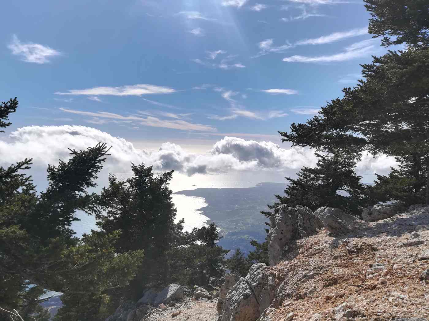
Mount Ainos rises about 1,628 metres over the southeast of Kefalonia and stands as the highest mountain in the Ionian Islands. Its dark fir forest covers the upper slopes, and the whole massif carries protection as Ainos National Park, the smallest national park in Greece. The mountain sits roughly 25 kilometres east of Argostoli, close enough for a half-day trip from the island capital. Drivers reach the summit ridge on a road that starts at sea level, and walkers cross open ground where a herd of semi-wild horses grazes among the rocks. Plan the whole trip with Greece Tours.
The mountain earns a visit for three things: the endemic Cephalonian fir that clothes its flanks. The free-roaming horses of the plateau. The view from the summit ridge at Megas Soros. From the crest the eye follows the whole island, from the Paliki peninsula in the west to the harbour of Sami in the east. Then across the channel to Ithaca and south toward Zakynthos. Clear air brings the mainland mountains of Aetolia-Acarnania into the same frame, along with the entrance to the Gulf of Patras.
What is Mount Ainos and where does it sit on Kefalonia?
Mount Ainos rises about 1,628 metres in southeast Kefalonia, making it the highest summit in the Ionian Islands. The mountain sits roughly 25 kilometres from Argostoli and dominates the island skyline from every stretch of coast.
Mount Ainos forms the mountainous spine of the southeast of the island. Its bulk separates the western coast around the capital from the eastern ports of Sami and Poros. The ridge runs northwest to southeast for about 15 kilometres. Megas Soros marks the high point at around 1,628 metres, near the middle of that line. Visitors basing themselves anywhere on Kefalonia see the same dark crest on the horizon. No other summit in the Ionian Sea comes within 500 metres of that height, so the mountain fixes the island skyline.
The mountain is built of limestone, the same rock behind the island caves at Melissani and Drogarati. Rainwater drains straight into that stone rather than running off. The upper slopes therefore carry no permanent streams, and the forest lives on winter snow and mist. Karst hollows called dolines pit the plateau below the ridge, and shallow depressions hold water after storms. Loose grey scree covers the steepest flanks. The treeline thins at around 1,500 metres into open rock and low cushion plants that hug the ground against the wind.
The western foot of the mountain drops into the Omala valley. Robola vineyards and the monastery of Agios Gerasimos stand there on flat ground at about 500 metres. The climb from that side to the ridge takes barely 20 minutes by car. The eastern foot reaches almost to the sea near Poros and Sami. The ground there rises from close to zero to 1,628 metres within a horizontal distance of about 8 kilometres. That gradient explains the abrupt change in vegetation between the olive terraces and the fir belt.
Weather on the summit differs sharply from the weather on the beaches. Temperatures at 1,628 metres run about 8 to 10 degrees Celsius below the coastal reading, and cloud caps the ridge on days when the shore stays clear. Snow lies on the upper slopes through parts of winter and early spring, and wind sweeps the bare crest even in July. Walkers carry a windproof layer whatever the forecast at sea level, and drivers meet fog on the last 3 kilometres of the summit road.
What does Ainos National Park protect above Kefalonia?
Ainos National Park protects the endemic Cephalonian fir, Abies cephalonica, across the upper slopes of the mountain.
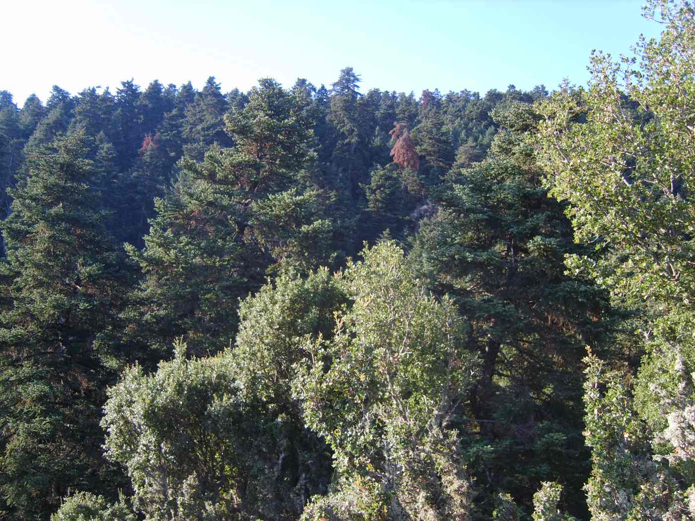
Abies cephalonica, the Cephalonian fir, grows on Mount Ainos and on parts of the Greek mainland, and the Ainos population is the reference site for the species. The trees reach about 25 to 30 metres, with stiff dark needles set around the shoot and upright cones that break apart on the branch instead of falling whole. The forest starts near 700 metres on the wetter northern flank and continues almost to the ridge. Old trunks stand bare and silver where wind and lightning have stripped them.
Venetian sailors named the mountain Monte Nero, the black mountain, because the fir canopy reads as near black from the sea. The effect peaks in late afternoon, when the western slopes fall into shadow while the limestone coast below stays pale. Crews approaching from Zakynthos or the Gulf of Patras used the dark mass as a landmark long before lighthouses marked the headlands. The Greek name Ainos, also written Enos, is far older and appears in ancient sources beside an altar of Zeus on the summit.
The national park covers the fir zone above roughly 1,000 metres and ranks as the smallest of the Greek national parks, with a core of about 28 square kilometres. Fire is the main threat, because resin-rich firs burn fast on steep dry ground, and grazing pressure once held back natural regeneration. Forestry staff keep firebreaks open along the ridge track and run a lookout near the masts. Wire fencing shields replanted patches on the southern slope, where young firs stand about knee high after ten years.
Wildlife on the mountain stays modest in scale. Foxes, hares, martens and hedgehogs live in the forest. Short-toed eagles and buzzards hunt the plateau on thermals rising off sun-warmed rock. Spring brings crocuses, violets and wild orchids to the clearings, and the endemic Kefalonian violet holds on in rock crevices near the top. Cicadas fall silent above about 1,200 metres, so the high forest sounds quiet compared with the coastal pines. The fir dominates that canopy with little competition, and botanists rank the massif among the richest limestone habitats in western Greece.
Where do the semi-wild horses of Mount Ainos graze?
Semi-wild horses roam the open upper slopes of Mount Ainos, above the fir line and around the clearings near the summit road. The herd counts about 30 animals, and it moves across the plateau each day in search of grazing.
The horses of Ainos descend from working animals that farmers released once tractors replaced them in the villages around the Omala valley. They belong to the small Greek mountain type related to the Pindos horse. Standing about 1.2 to 1.3 metres at the withers, with a heavy mane and dark bay or black coats. Decades on the mountain have made them hardy and shy of people. They carry no owner brands, and no stable feeds them, so the herd lives entirely on what the plateau produces.
Sightings concentrate on the open ground between the forest edge and the summit ridge, above all in the grassy hollows either side of the last 4 kilometres of road. Early morning and the two hours before sunset give the strongest chance, because the horses shelter under firs through the midday heat. In winter the herd drops to lower clearings where snow lies thinner. Drivers who stop at the pull-ins along the ridge and walk 200 metres from the road find them far more reliably than those who stay behind the wheel.
The herd splits into family groups led by a mare, each holding a loose range of about 2 square kilometres. Numbers have stayed near 30 for years, held down by drought, hard winters and traffic on the ridge track. A local association monitors the animals, records the foals and clears water points on the plateau through dry summers. Park signage asks visitors to keep at least 20 metres back, to skip feeding them bread or fruit, and to drive under 30 kilometres per hour on the gravel.
Photographers work best with a lens of about 200 millimetres, which holds distance without pushing the animals off their grazing. Approaching on foot from downwind and staying low keeps disturbance to a minimum, while sudden movement scatters a group across the plateau within seconds. Foals appear in late spring and stay tight to the mares through summer, so the groups turn nervous in that season. Leaving gates and firebreak barriers exactly as found matters, because an open gate draws the herd toward the forest road and passing cars.
How do you drive up Mount Ainos to Megas Soros?
A paved road leaves the Argostoli to Sami highway at the pass below the mountain and climbs about 12 kilometres to the masts on Megas Soros. The drive from the coast takes around 40 minutes in dry weather.
The turn for the summit leaves the main Argostoli to Sami road at the pass below the mountain, signed for Ainos and the national park. Asphalt runs through the first stretch and gives way to a graded gravel track that climbs steadily through the fir forest in wide bends. The full ascent covers about 12 kilometres and gains close to 900 metres of height. An ordinary rental car handles the track in dry weather at about 20 kilometres per hour, and passing places come every 300 metres.
Most drivers start from Argostoli, about 25 kilometres away. The trip reaches the ridge in around 50 minutes, including the slow climb on gravel. Sami lies a similar distance on the eastern side, and the road up from Poros joins the same pass. Fuel stations sit in the coastal towns rather than on the mountain. A full tank before the turn saves a long descent back to the coast. No shop, tap or café operates on the ridge, which puts water, food and a charged phone on the packing list.
Megas Soros carries a cluster of telecommunication masts and a service compound, reached by the final section of track. Walkers park below the aerials and follow a stony path for about 15 minutes to the true high point. Where a marker and the remains of a stone altar sit among low scrub. The crest stays narrow, and the ground drops steeply on the eastern side toward Sami. Wind funnels along the ridge at speed, and the thermometer reads well under the figure on the coast.
The view from the crest takes in the whole of Kefalonia in one sweep. Argostoli bay and the Paliki peninsula fill the west, and the Omala vineyards sit directly below the slope. The coastline from Sami down to Poros lines the east. Ithaca lies about 5 kilometres across the channel, its ridge running parallel to the horizon. Zakynthos shows to the south beyond open water. Clear air adds the mainland mountains of Aetolia-Acarnania to the east, along with the entrance to the Gulf of Patras well beyond the strait.
What do the marked walking trails on Mount Ainos in Kefalonia cross?
Marked footpaths on Mount Ainos climb through Cephalonian fir forest toward the 1,628-metre summit ridge, leaving from the park entrance road above the Argostoli–Sami turn-off, where an information point marks the routes.
The paved access road leaves the Argostoli–Sami highway and climbs to a gate at around 1,000 metres, where an information point stands near the park entrance. Walkers park on the verge and continue on foot along the ridge track. The first stretch runs under Cephalonian fir, with the trunks close together and the ground covered in needles. Views open west toward Argostoli, about 25 km away, and east toward the Ionian Sea. Signposts mark the junctions, and painted blazes on tree trunks keep the line of the path clear.
The main route follows the ridge for about 4 km, gaining around 600 metres between the gate and the summit area at about 1,628 metres. Walkers cover the climb in about two hours at a steady pace. The path crosses open rock and low scrub between stands of fir, so the horizon stays in view. The ridge walk counts among the longer things to do in Kefalonia that need no boat. Firm boots help on the loose limestone, and the return follows the same line back to the gate.
Cephalonian fir covers the upper slopes, and the species takes its scientific name, Abies cephalonica, from the island. Trunks stand tall and narrow, and the canopy filters the light to a dim green. Clearings hold bleached dead wood and open ground where wind and lightning have thinned the stand. Views from the gaps take in Ithaca and the Gulf of Patras, and on clear air the mountains of the mainland stand out beyond the water. The forest floor carries needles, cyclamen and thin grass rather than dense undergrowth.
Semi-wild horses graze the open clearings on the higher slopes, and walkers meet small groups near the ridge track. The animals move freely across the park and keep their distance from people. Shorter loops of about 2 km stay close to the entrance and suit walkers with limited time. No shops or cafes stand on the mountain, so every group carries water up from Argostoli or Sami. Wind funnels along the crest through the afternoon, and temperatures on the ridge sit well below those on the coast.
What wildlife, plants and night skies does the Mount Ainos National Park hold?
Birds of prey ride the thermals above the fir canopy, small mammals live in the forest, and wildflowers open across the clearings in spring, while the dark skies over the park carry stars far more clearly than the coast.
Birds of prey hunt over the ridge, using the warm air that lifts off the southern slopes through the middle of the day. Walkers watch them circle above the fir canopy without a wingbeat, then slide north along the crest. The open clearings give the birds a clear line to the ground, and the mountain’s height of about 1,628 metres puts them at eye level from the summit path. Early morning brings the steadiest sightings. Binoculars turn a distant shape into a recognisable bird across the valley.
Small mammals live inside the fir forest, moving through the leaf litter and the gaps between fallen trunks. Sightings come at dawn and dusk, when the light is low and the ridge is quiet. Tracks in soft ground near the clearings show where animals cross the walking line. Visitors who plan an early start book a base near Argostoli or in the eastern villages, and the guide to where to stay in Kefalonia sets out the options. Quiet walking and a slow pace raise the chance of a sighting.
Wildflowers open across the clearings in spring, and the colour lasts on the higher ground into early summer as the snowmelt drains away. Orchids, cyclamen and thyme grow along the edges of the fir stands where light reaches the soil. The Cephalonian fir itself dominates from about 900 metres upward, and the belt thins near the summit where wind shapes the crowns. Botanists visit the park for the endemic plants that grow on the limestone. Spring walkers also find the ridge greener and the air markedly cooler than the beaches.
Dark skies cover the park after sunset, with no coastal lighting on the ridge and the nearest towns about 25 km away. Stargazers drive up the access road in the evening and set up in the clearings near the entrance. The Milky Way stands out on moonless nights from spring through autumn. Cold air and wind arrive quickly after dark on the summit ridge, so warm layers matter as much as a torch. Drivers switch off headlights on arrival, and eyes adjust to the darkness within about twenty minutes.
When is the best season to visit Mount Ainos and how do you reach it from Argostoli?
Late spring through early autumn gives the clearest conditions on Mount Ainos, and the drive takes about 45 minutes from Argostoli, around 25 km away, or about 30 minutes from Sami, around 20 km away.
May, June, September and October bring the steadiest walking weather on the ridge, with clear air and moderate temperatures. July and August stay hot on the coast, and the mountain runs cooler, which makes the climb workable through the middle of summer. Winter brings snow to the upper slopes and closes the higher track for stretches at a time. Spring adds wildflowers across the clearings and the greenest fir along the whole access road. Morning starts beat the afternoon cloud that builds over the summit ridge.
Cloud closes the summit without warning, and the ridge disappears into grey within minutes. Wind rises through the afternoon and cuts across the open crest, where nothing breaks it. Temperatures on the mountain sit well under those at Myrtos or Antisamos, and the difference grows with height. Walkers who start the climb in shorts turn back cold, so a windproof layer travels in every pack. Visibility returns as quickly as it goes when the cloud lifts off the ridge. Groups check the forecast for the interior, not for the coast.
Water tops the packing list, because no shop or cafe operates anywhere on the mountain. Two litres per person covers a summit walk in summer heat. Boots with grip handle the loose limestone better than trainers, and a hat and sunscreen matter on the open ridge. Food comes up from Argostoli or the villages below, and rubbish goes back down in the same pack. A paper map or an offline route helps where phone signal drops behind the crest. A torch covers late returns and evening stargazing trips.
The road from Argostoli runs east for about 25 km, climbing away from the coast at the turn for the national park. Drivers reach the entrance in about 45 minutes on a route with tight bends near the top. From Sami the distance drops to around 20 km, and the drive takes about 30 minutes on the western road out of the port. No bus serves the mountain road, so a hire car or taxi covers the last stretch. Fuel up in town, because the mountain road carries no services.
Frequently Asked Questions
How high is Mount Ainos in Kefalonia?
Mount Ainos rises to about 1,628 metres, which makes it the highest point on Kefalonia and in the Ionian Islands. The summit ridge sits in the southeast of the island, about 25 km from Argostoli and around 20 km from Sami. The access road climbs to roughly 1,000 metres, and marked footpaths cover the remaining height along the crest. Walkers gain around 600 metres on the main route to the top. The altitude changes the conditions sharply: air on the ridge runs cooler than at sea level. Wind crosses the open sections. Cloud settles on the summit while the beaches stay clear.
The height also opens long views over the Ionian Sea toward Ithaca and the mainland coast on days with clean air.
Are there wild horses on Mount Ainos?
Semi-wild horses live inside the Mount Ainos National Park and graze the open clearings on the higher slopes. The herd moves freely across the mountain, so sightings depend on where the animals feed on the day of a visit. Walkers meet them most often along the ridge track above the park entrance, and in the grassy openings between stands of Cephalonian fir. The horses keep their distance from people, and visitors watch from the path rather than approaching or feeding them. Early morning and late afternoon bring the animals into the open, while the middle of the day pushes them into shade.
Anyone driving the access road slows on the bends, because the herd crosses the tarmac without warning. Binoculars help at range across the clearings.
Do you need a guide to walk the trails on Mount Ainos?
Marked footpaths cross the park, so independent walkers follow the routes without a guide. Signposts stand at the junctions and painted blazes mark the trees along the main line to the summit. The information point near the entrance sets out the network before the walk starts. Navigation gets harder when cloud drops onto the ridge. The fir stands look alike from inside, so a paper map or an offline track on a phone earns its place in the pack. Groups tell someone at their base which route they take and when they expect to return. Phone signal drops behind the crest in places.
Walkers with limited hill experience stay on the shorter loops near the entrance rather than pushing to the summit in poor visibility.
What do visitors bring to Mount Ainos?
Water heads the list, because no shop or cafe operates anywhere inside the park. Two litres per person covers a summit walk in summer, and refills come from Argostoli or Sami before the drive up. Boots with grip suit the loose limestone on the ridge better than trainers. A windproof layer matters even in July, since the crest runs cooler and windier than the coast, and cloud arrives fast. Sun protection, a hat and food for the day complete the pack, along with a torch for late returns or evening stargazing. Rubbish travels back down the mountain in the same bag it came up in.
A paper map or a downloaded route covers the sections where phone signal fails. Layers beat a single thick jacket on the climb.
How dark are the night skies over the Mount Ainos National Park?
Dark skies cover the Mount Ainos National Park, because no settlement lights the ridge and the nearest towns sit about 20 to 25 km away. Stargazers drive the access road in the evening and set up in the clearings near the park entrance, where the fir stands frame open sky. The Milky Way shows clearly on moonless nights from spring through autumn. Conditions turn cold quickly after sunset at around 1,000 metres and above, so warm layers, a red torch and a blanket go in the car. The same cloud that closes the summit by day also blocks the stars, so clear evenings decide the trip.
Drivers take the bends slowly on the way down, because horses cross the road in darkness.
How do you get to Mount Ainos from Argostoli or Sami?
The drive from Argostoli covers about 25 km east and takes around 45 minutes, with the last stretch climbing in tight bends to the park entrance road. From Sami the distance falls to about 20 km and the drive runs around 30 minutes. No public bus serves the mountain, so a hire car or a taxi covers the route. Drivers fill the tank in town, because no fuel station stands on the climb. Parking sits on the verge near the gate at roughly 1,000 metres, and walking starts there. Visitors staying in the north at Fiskardo or Assos add about an hour each way.
Combining the mountain with Sami, Melissani and Antisamos makes an efficient day on the eastern side of Kefalonia.