
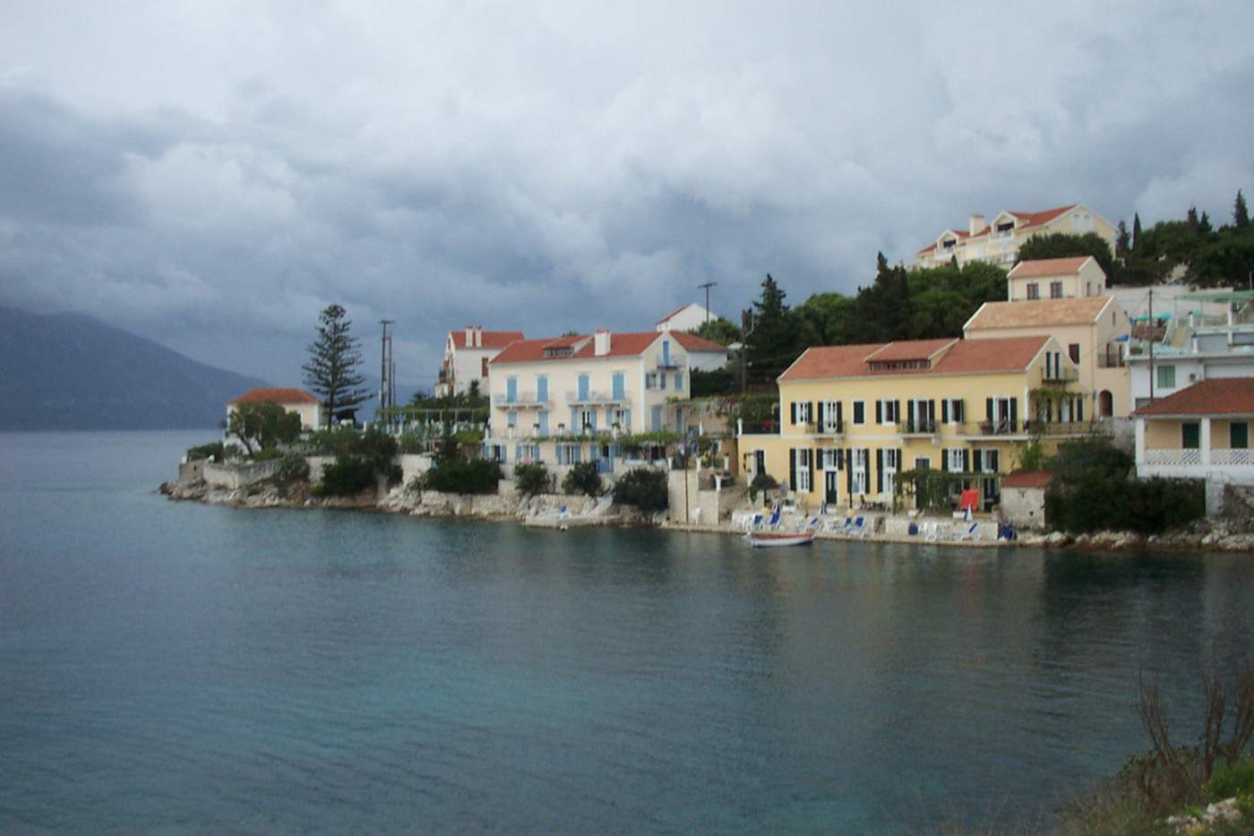
Petani beach lies on the west coast of the Paliki peninsula. Lixouri stands about 10 km southeast, and Argostoli about 40 km away by the road around the bay. A long arc of white pebbles curves under steep cliffs, and deep blue water shelves quickly from the shoreline. The bay faces west, so the sun drops into the sea straight in front of the beach. Sunbeds, umbrellas and two or three tavernas hold the northern end, beside the parking area. The rest of the shoreline stays open pebble, with no development behind it. Plan the whole trip with Greece Tours.
The road to Petani falls from a ridge in tight switchbacks, and a viewpoint near the top takes in the whole bay at once. Travellers compare the scene with Myrtos, since both beaches pair pale stone, cliffs and hard turquoise colour. The exposure carries a cost: the open western bay picks up wind and swell through the afternoon, and the pebble bank drops away fast underfoot. Drivers who use the Argostoli to Lixouri ferry cut the approach to well under an hour. That crossing turns the beach into a half-day trip from the capital.
Where is Petani beach in Kefalonia and what kind of beach is it?
Petani beach occupies a wide west-facing bay on the Paliki peninsula, about 10 km northwest of Lixouri and roughly 40 km from Argostoli by road. White pebbles, cliffs and deep clear water define the whole shoreline.
Petani sits on the outer western edge of the Paliki peninsula, the broad lobe of land that closes the bay west of Argostoli. The beach forms a single arc backed by cliffs and green slopes rather than by a village. Kefalonia holds larger and busier bays on the south coast, yet this corner of Paliki keeps its shoreline undeveloped. No settlement stands directly behind the pebbles. The bay reads as one unbroken curve from the northern car park to the southern headland. The arc measures roughly 500 metres from end to end.
The bay opens to the Ionian Sea with nothing between the shore and the horizon, which explains both the colour and the exposure. Depth builds within four or five metres of the waterline, turning the near water a hard blue that darkens fast offshore. Headlands close the arc at north and south, and each one drops in bare rock straight into the sea. Swimmers reach clear open water seconds after leaving the pebbles, without wading across sand flats or weed beds. Boats anchor offshore in calm weather, well clear of the swimming line.
Lixouri works as the base for the beach, since the drive north and west covers about 10 km and takes around 20 minutes. The route climbs inland through Soulari and Mantzavinata before the ridge road turns toward the coast. Petani carries no shop, no bank and no fuel station, so drivers stock up in town first. Visitors treat the bay as a half-day trip from Lixouri rather than as a place to base themselves overnight. Fuel stations, groceries and a pharmacy stand around the town square, about 10 km back to the east.
Petani belongs to the same west-coast family as Myrtos and Assos further north, all of them cliff-backed and pebbled. The difference is traffic. The Paliki peninsula sits off the main circuit between Argostoli, Sami and Fiskardo, and the extra 40 km of road filters out casual passers-by. Visitors based in Fiskardo rarely cross to this side for a swim. Two or three tavernas at the northern end handle the whole beach. The southern half stays open ground, with no rows of loungers, no bar and no music carrying along the water.
What are the pebbles and the water like at Petani beach?
White pebbles cover the whole shoreline at Petani, worn smooth and sized between a coin and a palm. The seabed keeps the same pale stone, which holds the water clear and gives the bay its deep blue tone.
The pebble bank runs the full length of the bay and rises into a low ridge just above the waterline. Stones sit loose and rounded, pale grey to white, and they shift underfoot on the slope down to the sea. Water shoes make the walk in easier, because bare feet slide on the steeper section where the bank falls away. The same pebbles continue under the surface for the first ten metres, then give way to darker rock and open blue. Larger stones gather at the two ends of the bay, below the rock walls.
Clarity at Petani comes from that stone bottom, which stirs up nothing when swimmers push off from the shore. Fish stay visible at four or five metres, and the outline of submerged rock reads clearly from the surface. Other Kefalonia beaches such as Xi and Makris Gialos trade that clarity for soft sand and a gentle entry. Petani takes the opposite side of the bargain: harder walking on the shore, sharper water colour, and real depth within two strokes. Masks and fins earn their space in the bag here, since visibility holds through the day.
Colour across the bay shifts through the day with the angle of the sun. Morning light keeps the near water pale turquoise over the pebble shelf, with a hard line marking where the bottom drops. Afternoon sun swings west and floods the bay, deepening the blue and cutting glare off the surface. The cliffs on both sides throw shade onto the ends of the beach late in the day. The centre of the arc stays lit until sunset. Cloud cover flattens the whole bay to steel grey within a matter of minutes.
Water temperature follows the open Ionian rather than a sheltered inlet, so the sea warms later in the season and stays cool on entry. Depth arrives fast: three metres of water sits within about ten metres of the shoreline along the arc. Snorkellers work the rocky edges below the headlands, where the pebble floor meets broken stone at four to six metres. The centre of the bay falls into open blue with little to see beyond the light itself. Sea urchins cling to the submerged rock, so entry over the clear pebbles works better.
How steep are the cliffs above Petani and where is the viewpoint?
Cliffs and green slopes drop straight to the shore at Petani, closing the bay on three sides.
The ridge behind Petani carries the road that links Kaminarata and Havriata with the coast. Slopes below the tarmac stay green with low scrub, wild sage and thorny bush, then steepen into bare limestone near the water. No path climbs the cliffs from the beach, so the road holds the only route down. Drivers meet three tight hairpins on the descent, each with a short straight between them. The tarmac stays narrow enough that two cars pass with care. Oncoming traffic appears late on the blind bends, so a horn helps.
The viewpoint sits at the top of the descent, on a widening beside the road with space for four or five cars. From there the whole arc reads at once, the pebble line pale against the water and the headlands closing both ends. Photographers rank the outlook with the pull-off above Myrtos beach on the northwest coast. Both look down a cliff wall onto the same combination of white stone and blue sea. Late afternoon light suits this western aspect best. Space at the pull-off runs out near sunset, when cars line the verge above.
The descent covers roughly two kilometres from the ridge to the parking area at the northern end. Gradient stays steep throughout, and low gear handles the return climb better than braking hard on the way down. Guardrails cover the outer edge on the tightest bends, though not along the whole road. Camper vans and coaches struggle on the hairpins. That limit keeps large groups away and holds visitor numbers close to what the small parking area allows. Brakes overheat when drivers ride them for the whole descent. Motorcycles handle the gradient without trouble.
Erosion shapes the slope on both sides of the bay, and loose stone gathers at the foot of the rock walls. Signs at the north end warn against sitting directly beneath the cliff face. Walkers who follow the shoreline south reach the base of the southern headland in about ten minutes over the pebble bank. The rock there drops sheer into the sea and closes the beach, with no way around it on foot. Winter storms shift the pebble bank and reshape the shoreline every year.
Why is Petani beach known for sunsets on Kefalonia’s west coast?
Petani faces due west across open sea, so the sun drops into the water in front of the beach rather than behind a headland. The cliffs on both sides hold colour long after the sun disappears.
The western aspect separates Petani from the beaches around Argostoli and the east coast, where the sun sets behind high ground. Nothing blocks the horizon here, so the last hour of light runs straight down the bay and across the pebbles. The water turns from blue to copper as the angle drops, and the cliffs on the northern side catch the final colour. Evening crowds stay small, because the drive back up the hairpins deters visitors who plan to leave before dark. Photographers set up on the pebble ridge about an hour before the sun lands.
Timing shifts with the season. Midsummer keeps the sun above the horizon until close to nine in the evening. Spring and autumn bring it down about two hours earlier, and winter light goes by around five. The tavernas at the northern end work through the evening service, so a table above the pebbles doubles as the viewing point. Arriving about forty minutes before the sun reaches the water leaves time to park and walk down the slope. Settling on the bank before the colour builds costs nothing but that short margin.
The bay holds an advantage over cliff-top viewpoints: the sun sets at eye level from the shoreline rather than far below. Swimmers stay in the water through the last of the light. The pebble bank keeps its heat, and the sea holds temperature into the evening. Towels and a light layer earn their place once the sun leaves the water. Wind normally drops around sunset, flattening the swell that builds through the afternoon. The surface goes glassy for a short window, and the reflection runs unbroken from the shore to the horizon.
Petani pairs with Lixouri for an evening plan that needs no rush. Drivers reach the town in about twenty minutes once the light goes, in time for dinner on the waterfront square. Visitors ranking things to do in Kefalonia put the west-coast sunsets alongside the Melissani cave and the walk up to the Assos castle. Petani gives the version that needs no ticket, no boat and no opening hours, only a car and the road down. The drive back climbs two kilometres to the ridge, then runs level toward town.
What facilities does Petani beach have and where are the quiet stretches?
Sunbeds, umbrellas and two or three tavernas occupy the northern end of Petani, next to the parking area. The rest of the bay stays open pebble, without rentals, showers or shade, and it empties within a short walk south.
The organised zone runs about 150 metres from the point where the road meets the shore. Rows of loungers under straw umbrellas fill the front line, with a walkway of packed pebble behind them. Tavernas stand on the slope just above, built low, with terraces that look straight down the bay. Kitchens work through lunch and into the evening. Those terraces double as the sunset platform for anyone unwilling to sit on stones after the light goes. Loungers in the front row nearest the water fill first, before noon in high season.
Walking south from the loungers changes the beach within two hundred metres. The pebble bank widens, the umbrellas end, and the noise drops to water working on stone. Couples and families spread along this stretch with mats and their own shade, since no natural cover exists below the cliffs. The far southern end, close to the headland, holds the fewest people at any hour. Reaching it on foot from the parking area takes about ten minutes. Footprints thin out past the halfway point of the arc.
Shade forms the main constraint on a long day at Petani. The cliffs sit behind the beach rather than above it, so shadow arrives only in the late afternoon on the northern side. Visitors without an umbrella rent one in the organised zone or carry a beach tent for the open stretch. Fresh water comes from the tavernas. No public tap or shower serves the shoreline, and the nearest shops sit back in Lixouri, 10 km away. Ice and cold drinks travel well in a cool box for the open stretch.
Petani carries no lifeguard post, no first-aid station and no hotel behind the beach. Accommodation clusters inland around Havriata and Mantzavinata, or back in town, and rooms above the bay itself number in the low dozens. That absence of development keeps the arc clean in the frame and keeps evening traffic light on the ridge road. Bins stand only at the northern end, so anyone settling on the open stretch carries waste back to the car. Mobile signal reaches the beach from the ridge, though it weakens under the cliffs.
Is swimming at Petani beach safe when the wind and swell pick up?
Swimming at Petani works well on calm mornings and turns demanding by mid-afternoon, when the western exposure drives wind and swell into the bay. The pebble bank falls away fast, and waves break directly on the steep shoreline.
The prevailing summer wind on this coast blows from the northwest and builds through the middle of the day. Mornings hold flat water, with the surface unbroken until about eleven. Swell arrives from open sea with nothing to slow it. Waves of half a metre break on the pebbles by four in the afternoon. Flags on the taverna terraces show the strength at a glance. The same wind falls away toward evening, which is why the sunset hour often finds the bay calm again after a rough afternoon.
Entry and exit demand the most attention here. Waves running up a steep pebble bank drag stones back with them, and the backwash unbalances swimmers standing in knee-deep water. Facing the sea on the way out, and timing the exit between sets, handles the problem. Children need close supervision on any afternoon with white water. The drop to head depth arrives within three or four metres of the waterline along the whole arc. Swim fins give control in moving water and speed the exit. Goggles keep spray out of the eyes on choppy afternoons.
No lifeguard covers Petani, and no flag system marks conditions on the day. Judging the state of the sea from the viewpoint above works well, since the whole bay reads at once from the road. A line of white breaking along the arc signals an afternoon better spent on the sheltered south coast at Xi or Makris Gialos. Calm days show a flat edge where the water meets the pebbles and no foam offshore. Taverna staff watch the bay every day, and their reading of the swell beats a forecast app.
Currents run along the shore rather than out to sea in normal conditions, and they strengthen near both headlands. Strong swell pushes water sideways down the bay, so swimmers drift toward the southern end without noticing the movement. Checking a fixed point on the cliff every minute or two keeps that drift visible. Snorkellers working the rocks under the headlands leave the water first when the wind rises, because the swell breaks hardest against stone. Weak swimmers stay inside the line of the loungers, where the water runs calmest.
How do you reach Petani beach from Lixouri and Argostoli, and where do you park?
Drivers reach Petani from Lixouri in about 20 minutes over roughly 10 km. Argostoli lies about an hour away by road, or half that with the ferry. A small parking area sits at the northern end of the beach.
The road from Lixouri runs west through Soulari and Mantzavinata, then turns north along the ridge toward Petani. Signposts mark the beach at each junction, and the surface stays paved the whole way. Total distance covers about 10 km, with the last two kilometres on the descent from the ridge. Driving time runs to about 20 minutes at the speed the bends allow. The return climb takes slightly longer with a full car and warm brakes. Fuel comes from the stations in Lixouri, since the ridge road carries none.
The Argostoli to Lixouri ferry cuts the journey sharply. Boats cross the bay in about 25 minutes, carrying cars and foot passengers. Sailings run through the day between the Argostoli waterfront and the Lixouri quay, which sits in the centre of town. Driving around the bay instead covers roughly 40 km through Kardakata and takes about an hour. The ferry turns Petani into a straightforward half-day trip from the capital. Only about 10 km of road remain on the Paliki side of the water.
Parking sits on the flat ground where the road reaches the shore, with space for roughly forty cars in bays and along the verge. The area fills by late morning in high season, and later arrivals leave vehicles on the last stretch of the descent road. No attendant manages the ground and the bays carry no markings, so cars park close together. Arriving before eleven or after five secures a place beside the pebbles rather than a walk down the hill. Shade over the ground is absent, so cars heat through the day.
Public buses on Paliki serve the villages rather than the beach, so a car or a scooter handles the trip best. Taxis run out from Lixouri, and drivers charge for the return leg because they come back empty. Cyclists face a hard climb to the ridge in afternoon heat, with no shade on the road. Rental scooters cover the route comfortably, though the descent demands steady braking. Loose gravel on the outer bends deserves attention, especially after rain.
Frequently Asked Questions
Is Petani beach better than Myrtos beach?
Petani and Myrtos share the same ingredients and differ in scale and traffic. Myrtos forms a wider curve under taller cliffs on the northwest coast, between Assos and Divarata. It draws coach tours through the middle of the day. Petani sits on the Paliki peninsula, off the main circuit, with a shorter arc and a fraction of the visitors. Both hold white pebbles, deep water and a fast drop from the shoreline. Petani adds the sunset, because it faces due west across open sea. Myrtos wins on the view from the road above; Petani wins on quiet and on evening light.
Travellers with one day on the island reach Myrtos more easily from Argostoli, Sami and Fiskardo, while Petani rewards a dedicated half-day trip.
Can young children swim at Petani beach?
Young children swim at Petani on calm mornings, with close supervision at every stage. The pebble bank drops steeply, and head depth arrives within three or four metres of the waterline, so no shallow zone exists for paddling. Waves build through the afternoon on this west-facing bay and break directly on the slope, dragging stones back with the backwash. Families with toddlers do better on the sheltered south-coast sand at Xi, Makris Gialos or Platis Gialos. Petani then works as an evening stop for the sunset. Water shoes protect small feet on the loose pebbles, and armbands handle the sudden depth. The organised northern end keeps umbrellas and a taverna within twenty metres of the water.
That corner suits a short visit with children better than the open southern stretch.
How much time does a visit to Petani beach take?
A visit to Petani runs from two hours to a full day, depending on the plan. Two hours cover a swim, a walk along the pebble bank and a stop at the viewpoint on the way back up. Half a day adds lunch at one of the tavernas at the northern end and time on the quieter southern stretch. A full day works best when it ends at sunset, since the bay faces west and the light lasts. Drivers from Lixouri add about 40 minutes of road in total. Drivers from Argostoli add a ferry crossing of about 25 minutes each way.
Arriving before eleven secures parking and calm water, while leaving after the sun drops means driving the hairpins in the dark.
Does Petani beach have sunbeds and tavernas?
Sunbeds, umbrellas and two or three tavernas operate at the northern end of Petani, next to the parking area. The organised strip runs about 150 metres, and the loungers sit in rows on the pebble bank with a walkway behind them. The tavernas stand on the slope just above the beach, with terraces that look straight down the bay. Kitchens serve through lunch and into the evening. The rest of the shoreline carries no rentals, no showers and no shade structures. Visitors heading south along the pebbles bring their own umbrella or beach tent. The cliffs sit behind the beach and cast shadow only late in the day.
Fresh water and toilets come from the tavernas, and bins stand only at the northern end.
Can you reach Petani beach without a car?
Reaching Petani without a car takes planning, because the buses on the Paliki peninsula serve the villages rather than the beach. Taxis run from Lixouri and cover the 10 km in about 20 minutes. Booking the return leg in advance matters, since the road carries little passing traffic. Rental scooters and quad bikes handle the route well, though the descent from the ridge drops through three hairpins and demands steady braking. Visitors staying in Argostoli combine the ferry crossing to Lixouri with a taxi from the quay. That pairing removes the 40 km drive around the bay. Walking in from Havriata covers about four kilometres of exposed ridge road with no shade.
That approach works in spring and autumn rather than in the heat of high summer.
What is the best time of day to visit Petani beach?
Early morning and the last two hours before sunset suit Petani best. Mornings bring flat water. The northwest wind on this coast builds through the middle of the day and pushes swell into the open bay by mid-afternoon. Parking at the northern end fills by late morning in high season, so an early arrival also secures a space beside the pebbles. Evening delivers the bay’s strongest asset. The shore faces due west, and the sun drops into the water in front of the beach. Wind normally falls away at the same hour. Midday works for swimming when the sea reads flat from the viewpoint above.
Shade is absent, and the pebbles hold heat until the cliffs throw shadow late in the afternoon.