
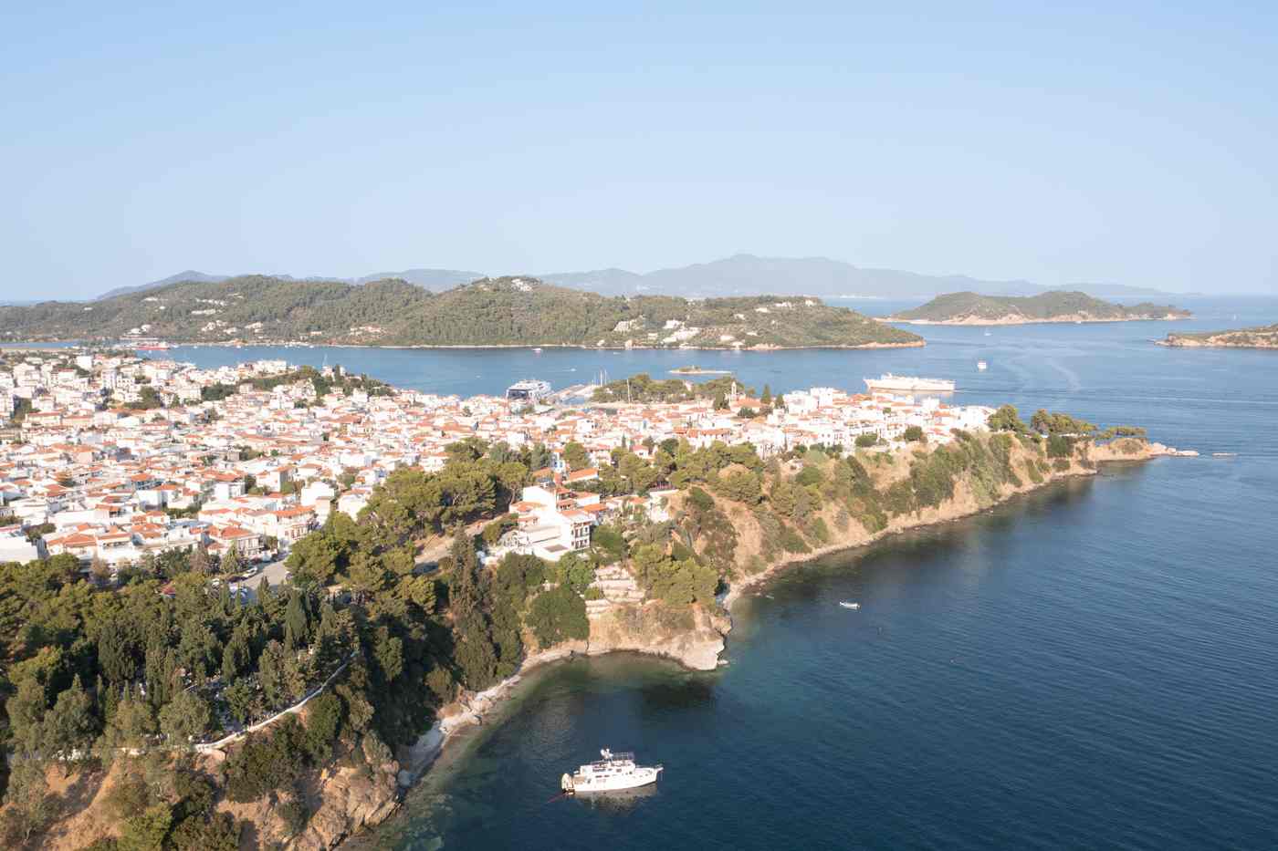
Koukounaries beach stretches about 1,200 metres of fine golden sand across a sheltered bay at the southwest end of Skiathos, roughly 12 km from Skiathos Town. A protected stone-pine forest and the Strofilia lagoon stand directly behind the sand, and the island bus terminates here at stop 26. This guide covers the sand, the forest, the lagoon, the facilities and every access route. Plan the whole trip with Greece Tours.
The name means stone pines in Greek, after the umbrella pines whose cones ripen behind the dunes. The bay faces south, the seabed shelves gently, and the water stays calm through the meltemi season. Sunbeds, tavernas, water-sports stations and beach bars line the sand, while both ends keep free space for towels.
What makes Koukounaries beach the most famous beach on Skiathos?
Koukounaries beach earns its fame from the pairing of about 1,200 metres of fine golden sand with a protected stone-pine forest and the Strofilia lagoon directly behind it, a combination no other beach on Skiathos matches.
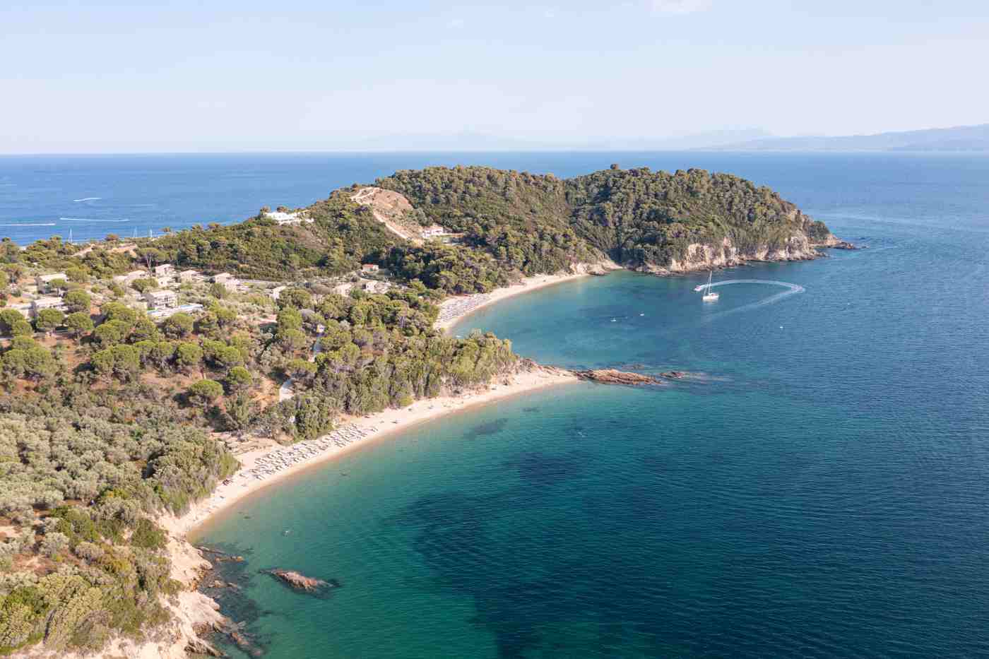
Koukounaries anchors the southwest tip of Skiathos, the westernmost island of the Northern Sporades, about 12 km from the harbour capital along the single south-coast road. The bay opens to the south between two low, pine-covered headlands that block the northerly meltemi wind. Fine golden sand runs the full arc, and the grains stay small and soft from the waterline back to the dune belt. The seabed continues that sand underwater, shelving so gradually that the water reaches waist depth around 30 metres out. Turquoise shallows deepen to blue at the centre of the bay.
Travel guides across Europe rank the beach among the finest stretches of sand in Greece, and the entire area also carries protected-reserve status. Bus stop 26 marks the end of the island’s public transport line.
The forest of stone pines gives the beach its name, because koukounaria is the Greek word for the umbrella pine and its edible cone. Pines grow to within metres of the high-water line, so shade falls on the back of the sand through the afternoon. Behind the trees spreads the Strofilia lagoon, a brackish wetland connected to the sea by a narrow channel at the western end of the bay. This sequence of sand, forest and lagoon in one compact site made the area a protected biotope, and building restrictions cover the whole headland. Visitors walk from open beach into deep pine shade within one minute.
A transition that separates Koukounaries from every other organised beach on the island’s south coast and draws photographers at first light.
Fame changes the rhythm of the bay through the day. Excursion boats from the old port of Skiathos Town arrive mid-morning, the bus delivers passengers to stop 26 every 15 to 20 minutes in high season. Central sunbed rows fill completely by early afternoon. The beach absorbs the crowd because of its length: about 1,200 metres of sand gives each visitor far more room than the 150-metre coves elsewhere on the south coast. Numbers thin sharply after 5 p.m., when day-trippers return to town for the evening.
Peak weeks fall in late July and August, while June and September deliver the same water temperature of around 23 to 25 degrees Celsius with roughly half the visitors on the sand. September water stays warmer than June water by about one degree.
Recognition also rests on measurable protection. The Strofilia wetland behind the sand holds official biotope status, the pine forest stands under state management. Signs at each entrance path list the rules that keep the dune line intact. Wooden walkways cross the dunes at fixed points, so foot traffic concentrates on marked routes instead of trampling the sand grass. No hotel, bar or road breaks the tree line along the full length of the bay. Every building serving the beach stands behind the forest or at the two road ends. The result reads clearly from the water: a continuous green wall of pines behind golden sand.
An image that appears on postcards, brochures and airline magazines across the Greek travel market. That discipline keeps the site photogenic decade after decade.
How long is Koukounaries beach and how is the bay shaped?
Koukounaries beach runs about 1,200 metres in a near-continuous crescent between two pine-covered headlands, with a sand strip about 25 to 40 metres deep from waterline to dunes and a gently shelving sandy seabed.
The crescent curves symmetrically, with both tips pointing south into open water and the deepest point of the arc facing directly down the bay. The eastern headland separates Koukounaries from the Banana coves, while the western headland shelters the channel that drains the Strofilia lagoon into the sea. The sand strip measures about 25 metres deep at the narrow eastern end and widens to around 40 metres near the centre, where the main sunbed concessions operate. Dunes rise about 1 to 2 metres behind the open sand and carry marram grass and sea daffodils.
The full walk from tip to tip takes about 15 minutes at a steady pace along firm wet sand, and the arc stays visible end to end from every point. Both headlands carry footpaths to small rock platforms.
Water depth increases gently across the whole bay. The bottom stays pure sand for about 100 metres offshore, without rocks, weed beds or sudden drops, and reaches a depth of about 2 metres roughly 50 metres out. Children stand comfortably within the first 20 metres, and the gradient stays constant along the entire crescent rather than changing between sectors. Water clarity holds at 10 metres and more of visibility on still mornings, because no river discharges into the bay and the sandy bottom releases little sediment. The colour shifts in bands: pale turquoise over the shallows, a green-blue mid zone, then deep blue past the 4-metre line.
Swimmers cross the bay mouth between the headlands in about 25 minutes of steady front crawl. Masks reveal the rippled sand bottom in full detail.
Orientation defines the calm. The bay faces due south. The meltemi, the dry northerly wind that blows across the Aegean from mid-July to late August, passes over the island and leaves the surface at Koukounaries nearly flat. North-coast beaches such as Mandraki and Aselinos take waves of 1 metre and more on the same days that Koukounaries holds ripples of under 20 centimetres. A southerly blow, rarer in summer, pushes short chop straight into the bay and stirs the shallows for a day at a time. The two headlands add shelter at each end. The extreme tips stay swimmable even during the strongest southerly conditions. And morning hours before 11 a.m. deliver the stillest water of the day.
Flags on the lifeguard towers signal the rare rough days.
Geology explains the sand quality. The headlands consist of soft sedimentary rock that weathers into fine quartz-rich grains. The south-flowing currents deposit that material in the sheltered arc of the bay instead of carrying it along the coast. Grain size stays small and uniform, closer to powder than to the coarse mixed sand of Megali Ammos near town. The dune system stores sand through winter storms and releases it back to the beach face in spring, a natural cycle that keeps the crescent stable without artificial replenishment. Wet sand near the waterline packs firm enough for running and beach games.
Dry sand above the tide line stays loose and deep, which is exactly where the concession rows and private towel zones spread out. Bare feet cross the dry sand comfortably before 10 a.m.
What is the stone-pine forest behind Koukounaries beach?
A protected forest of stone pines, the umbrella-shaped Mediterranean pine that produces edible pine nuts, stands directly behind the full length of Koukounaries beach and gives the site its Greek name.
Stone pines dominate the strip between the sand and the Strofilia lagoon, forming a canopy that reaches about 15 to 20 metres in height. The species, Pinus pinea, carries a flat umbrella crown on a straight trunk, and its cones hold the edible seeds sold across Greece as koukounaria. Aleppo pines mix into the stand on the drier headlands, but the stone pines own the flat ground behind the dunes. The forest floor stays open and walkable, carpeted with needles and cones rather than undergrowth, so light filters through in moving patches.
Resin scent hangs in the air on hot afternoons and carries onto the back rows of the beach whenever the breeze turns offshore, one of the site’s signature sensations. Cicadas sing in the canopy from June to September.
Sandy paths cross the forest from the road side to the beach, and the two main entrances channel visitors past the tavernas and the concession kiosks. The walk from the bus turnaround at stop 26 to the open sand takes about 3 to 4 minutes under continuous canopy. A longer path follows the northern edge of the lagoon, linking the eastern road end with the western channel mouth in about 20 minutes of flat walking. Wooden signboards at the entrances map the routes and mark the protected zones where access closes. Cyclists use the perimeter track but dismount on the beach paths.
The shade under the trees runs 5 to 8 degrees cooler than the open sand at midday. Benches near the eastern entrance overlook the lagoon through the trunks.
Protection governs everything inside the tree line. The forest holds status as an aesthetic forest and protected natural monument under Greek environmental law, one of the few beach-front pine stands in the Aegean with that designation. Open fires, camping, and cutting or removal of any plant material stand strictly prohibited, and wardens patrol the paths in July and August. The rules exist because stone pines regenerate slowly: a seedling needs about 40 years to reach cone-bearing maturity, so a single careless fire erase the landscape for two generations. Signs list the prohibitions in Greek and English at every entrance.
The prohibition on fires extends to portable barbecues and camp stoves, and rangers direct picnickers to the designated clearings near the road. Compliance stays high because the stakes read plainly on the boards.
The forest shapes how the beach works day to day. Back rows of sunbeds sit within 10 metres of the tree line. Visitors alternate between full sun on the sand and deep shade under the pines without leaving the bay. Families park pushchairs and cool boxes at the forest edge, where the needle floor stays about 10 degrees cooler than open sand. Photographers work the boundary at first and last light, when low sun cuts under the umbrella crowns and strikes the trunks orange. Birdsong from the canopy replaces beach-bar sound within 50 metres of the tree line.
The pines also anchor the dune system, their roots binding the sand that winter storms otherwise strip from the beach face. Fallen cones collect along the path edges in late August.
What is the Strofilia lagoon behind Koukounaries beach?
Strofilia is a brackish coastal lagoon of about 80,000 square metres lying between the pine forest and the road behind Koukounaries beach, connected to the sea by a narrow channel and protected as a wildlife biotope.
The lagoon fills a shallow basin directly behind the stone-pine belt, separated from the bay by no more than 100 metres of forest and dune at its closest point. A channel at the western end of the beach links the lagoon to the sea, and the exchange of salt and fresh water keeps the basin brackish through the year. Water levels rise with winter rain and drop through August, exposing muddy margins that feed wading birds. Reeds and tamarisk ring the shoreline, and the still surface mirrors the pine canopy on windless mornings. The perimeter path gives walkers a full circuit of about 2 km, with open views across the water from the northern bank beside the road.
Dragonflies patrol the reed margins through the warm months.
Birdlife concentrates on the lagoon in numbers unmatched anywhere else on the island. Herons and egrets stalk the shallows through summer, cormorants dry their wings on dead branches, moorhens and coots nest in the reed beds. Migrating waterfowl rest on the basin in spring and autumn, following the flyway between Africa and the Balkans. Kingfishers hunt from the tamarisk overhangs, and swallows work the surface for insects at dusk. Terrapins bask on the mud margins, and eels move between lagoon and sea through the western channel. Dawn and the last hour before sunset deliver the highest activity.
The northern bank beside the road serves as the practical viewing line because the forest side stays closed to protect nesting cover. Binoculars turn a beach day into a birding session here.
Biotope status places the lagoon at the core of the Koukounaries protected area. Fencing and signage close the reed beds and the forest-side bank to visitors, boats and inflatables stay banned from the water, and fishing inside the basin is prohibited. The protection exists because coastal lagoons of this type have nearly vanished from the Aegean islands, drained decades ago for building land almost everywhere else. Strofilia survives as one of the last intact examples, which is why the site carries listing in national inventories of protected wetlands. School groups from Skiathos Town visit in spring for guided ecology walks along the permitted bank.
Visitors keep to the perimeter path, and wardens enforce the closures through the high season. Information boards name the resident species with photographs.
The lagoon also does silent engineering work for the beach. The basin absorbs winter flood water draining off the hills behind the coast, releasing it slowly through the channel instead of letting torrents cut across the sand. Fresh groundwater seeping under the dunes keeps the stone pines alive through rainless summers. The water table under the forest floor sits high enough that the trees never brown even in drought years. The reed beds filter sediment before it reaches the sea, which contributes to the clarity swimmers notice in the bay. Remove the lagoon and the pine forest dies within a decade, the dunes destabilise. The crescent of sand begins to thin.
Which is the ecological argument printed on the information boards at the entrances.
Which facilities and water sports does Koukounaries beach offer?
Koukounaries beach operates full seasonal infrastructure: rows of sunbeds with umbrellas, beach bars, tavernas behind the forest, showers, changing cabins, lifeguard posts, and water-sports stations offering waterskiing, wakeboarding, jet skis, parasailing, banana rides, pedalos, canoes and paddleboards.
Sunbed concessions divide the central 800 metres of the crescent into organised sectors, each pairing two beds with an umbrella in rows two to three deep. Beach bars anchor the sectors and serve coffee, drinks and snacks from morning until sunset, with waiter service to the front rows in high season. Freshwater showers and changing cabins stand at the main entrances, and wooden walkways lead from the forest paths across the dunes to the sand. Tavernas cluster behind the tree line near both road ends, serving full meals within a 3-minute walk of the water. Lifeguard towers cover the central bay from morning to early evening through July and August, with flags marking the swim zone boundaries.
Umbrella rows leave walking lanes to the waterline every 50 metres.
Water-sports stations operate from marked corrals at both thirds of the beach, keeping motor traffic away from the central swim zone. The menu runs from towed rides on bananas and sofas to waterskiing, wakeboarding and parasailing flights that lift customers about 50 metres above the bay. Jet skis leave through buoyed lanes and follow a circuit outside the swimmer line. Slower options include pedalos with slides, sit-on-top canoes and stand-up paddleboards, all rented by the half hour or hour. Instructors give beginner waterski lessons in the flat morning water before 11 a.m.
The stations post their prices on boards at the corrals, and demand peaks between noon and 4 p.m., so early sessions skip the queues that build after lunch. Life jackets come standard with every towed ride.
Practical services extend beyond the sand. A mini-market beside the eastern entrance sells beach basics, sunscreen and cold water, and the taverna kitchens handle families from midday onward. Card payments work at the established concessions, though the smaller kiosks run cash-only days when the connection drops. Sunbed sectors fill by 11:30 a.m. in late July and August, so visitors targeting front-row shade arrive before 10 a.m. or reserve through their sector’s bar. Both ends of the crescent stay concession-free for towels. Toilets attached to the tavernas serve customers, and the public facilities stand by the bus turnaround. Phone signal covers the whole bay, and the beach bars run their own connections for customers who ask.
Sector staff answer questions about daily terms at the entrance boards.
Koukounaries earns its place near the top of every list of things to do in Skiathos because it packs a full resort day into one bay. A family swims the flagged zone in the morning, eats a taverna lunch under the pines. Rents a pedalo mid-afternoon and walks the lagoon path before the bus back to town. Couples split the day between front-row sunbeds and the quiet western end past the concessions. Water-sports customers treat the bay as a base, moving from waterski runs at 9 a.m. to parasailing after lunch. The infrastructure supports stays of 8 hours and more without a car, which no other single beach on the island manages at the same scale.
The bay also hosts swimmers training long laps each morning.
How do you get to Koukounaries beach from Skiathos Town?
The island bus runs from Skiathos Town harbour to Koukounaries in about 30 minutes, terminating at stop 26 directly behind the beach; drivers follow the same 12 km south-coast road, and water taxis cross from the old port in summer.
The bus provides the standard route. Services leave the harbour terminus in Skiathos Town and follow the single south-coast road past every resort area. With stops numbered from 1 in town to 26 at the Koukounaries turnaround. Frequency rises to every 15 to 20 minutes in July and August, dropping to hourly in the shoulder months. The ride takes about 30 minutes when traffic flows, stretching toward 45 minutes on August middays when the road fills. Passengers buy tickets from the conductor on board, and the fare stays under the price of a coffee. Stop 26 sits about 200 metres from the sand, a flat walk through the forest entrance path.
Return buses queue at the same turnaround, with the last departures after sunset in high season.
Drivers cover the 12 km from town in about 20 to 25 minutes outside peak hours. The road runs paved and two-laned the whole way, climbing over low headlands between Troulos and the Koukounaries descent. Parking areas spread along the road behind the lagoon: a large unsurfaced lot at the eastern entrance, roadside bays along the northern bank. A smaller lot near the western end. Spaces fill by 11 a.m. in August, and illegally parked cars on the road shoulder collect fines during patrol sweeps. Scooters and quads, the standard Skiathos rentals, park closer to the entrances in dedicated rows.
Taxis from town charge a fixed-zone fare, take the same 20 minutes, and drop passengers at the eastern entrance beside the mini-market. Fuel stations sit back in town, not near the beach.
Water taxis add the scenic route in summer. Boats leave the old port of Skiathos Town on a published morning schedule. Run the south coast in about 40 minutes. Land passengers directly on the sand at the centre of the bay. The crossing passes Megali Ammos, Achladies, Kanapitsa and Troulos, giving a preview of the whole resort coast from the water. Afternoon returns leave the beach between 4 and 6 p.m. Excursion boats on round-the-island routes also pause in the bay for swim stops, though they land nobody ashore. Seas stay calm on this coast through the meltemi, so cancellations are rare on the south-coast water-taxi runs, in contrast to the north-coast trips toward Lalaria.
Deck space fills fast on the first two morning departures.
Arrivals connect smoothly with the island’s entry points, covered fully in the guide to how to get to Skiathos. The airport sits at the northeastern edge of Skiathos Town, about 14 km and 35 minutes by road from Koukounaries, and taxis meet every arriving flight. Ferry passengers from Volos and Agios Konstantinos disembark at the new port, 300 metres from the bus terminus, and connect to stop 26 without changing services. Luggage travels in the bus hold, so day-one transfers straight from ferry to beach hotel work without a car. Hotels along the Koukounaries road arrange minibus pickups for booked guests.
The last practical connection back to a late ferry means leaving the beach about 90 minutes before departure. Signage at stop 26 lists the full timetable for returns.
Which beaches lie near Koukounaries on Skiathos?
Banana and Little Banana sit directly over the eastern headland from Koukounaries, Agia Eleni faces west about 1 km away, Mandraki and Elia lie north across the dunes, and Troulos waits 3 km back toward town.
The Banana coves form the closest alternative and rank among the best-known Skiathos beaches in their own right. A paved lane climbs from the Koukounaries bus turnaround over the eastern headland and drops to Banana in about 10 minutes on foot. The main cove holds golden sand, sunbeds and two beach bars with a party lean, and the crowd skews younger than at Koukounaries. Little Banana, the smaller cove beyond a rocky spur, operates as the island’s recognised naturist beach, a role it has held for decades. Both coves face southwest, so the afternoon sun lasts longer there than on the main crescent, and sunset watchers cross the headland at the end of beach days.
Banana’s bars run music into the early evening. Towel space stays easier to find there before noon.
Agia Eleni occupies the next bay west of the Koukounaries headland, about 1 km by road from the bus turnaround or 15 minutes on foot. The beach faces due west toward the Pelion peninsula on the mainland, whose ridgeline fills the horizon across the channel. Sand mixes with fine gravel at the waterline, sunbeds and one canteen cover the back of the cove, and the water deepens faster than at Koukounaries. Sunsets land directly in front of the beach, which makes Agia Eleni the standard end-of-day move for visitors with wheels. Waves rise here on meltemi afternoons because the western exposure catches wind bending around the island.
Windsurf hire operated from this cove long before the sport spread along the coast. Evening light holds on the sand until the sun touches Pelion.
Mandraki and Elia stretch along the north side of the same peninsula, reached by a sandy track that leaves the Koukounaries road near the western parking area. The walk crosses pine forest and open dune for about 25 to 30 minutes, arriving at a coast with no road access at all. Mandraki, also called Xerxes bay because the Persian fleet anchored in these waters before the battle of Artemisium, holds wide dunes and a seasonal canteen. Elia continues east with fewer visitors again. Both face north, so the meltemi raises real waves here on the same days Koukounaries stays flat.
The contrast within a 30-minute walk, from full resort infrastructure to empty dune coast, defines this corner of the island. Sturdy sandals beat flip-flops on the sandy track.
Troulos and the mid-coast bays fill the gap back toward town. Troulos beach sits about 3 km east of Koukounaries at bus stops 19 and 20. A 250-metre arc of sand with tavernas and calm water in front of a small islet. Kanapitsa and Achladies follow further east, each with hotel strips and water-sports stations. Vromolimnos, inland of stop 13 on the Kalamaki peninsula, draws a younger crowd with wakeboarding and late-afternoon music. Day planners combine bays easily because the bus line strings them together: mornings on the big crescent, afternoons at Banana or Agia Eleni, an evening swim at Troulos before dinner.
Every transfer between these beaches costs less than 15 minutes of travel on the single coastal road. Bus tickets cover each hop for pocket change.
Where are the quietest corners of Koukounaries beach?
The western 200 metres beside the lagoon channel and the eastern 100 metres under the Banana headland stay concession-free and hold the fewest visitors, with early mornings and the months of June and September quiet across the whole crescent.
The western end past the last sunbed sector runs about 200 metres to the lagoon channel, and towel space stays open there through the busiest August afternoons. Pines lean close to the sand at this end, throwing natural shade from mid-afternoon, and the dune belt behind rises high enough to screen the beach from the road entirely. The channel mouth marks the boundary: shallow, warm water moves slowly between lagoon and sea, and sandbars shift across it through the season. Walkers continue around the western point on a fisherman’s path for rock-platform swimming in deeper water.
Sound from the beach bars fades to nothing over the final 100 metres, which is why late-day readers and couples concentrate at this end of the bay. Driftwood lines the channel mouth after winter storms.
The eastern corner under the Banana headland offers the second quiet zone, about 100 metres of sand beyond the final concession row. Rocks from the headland shelter this pocket from the afternoon breeze, and the water in the corner warms 1 to 2 degrees above the open bay by late afternoon. Snorkellers work the rock line where the sand meets the headland, finding wrasse. Sea bream and octopus dens in 2 to 4 metres of water, the only underwater relief on an otherwise pure-sand bay. The eastern entrance path arrives close to this corner, so it fills earlier than the western end on peak days.
The corner clears again after 4 p.m., when the light angles behind the headland pines. Rock pools at the base hold blennies and anemones.
Timing beats geography for real quiet. The beach before 9:30 a.m. belongs to walkers and swimmers doing lengths along the crescent. With the first bus arrivals landing about 10 a.m. and boat groups following an hour later. Water at that hour lies at its flattest, holding the overnight stillness before day breezes ruffle the surface. Evening quiet begins after 5:30 p.m., when day-trippers catch return buses and the sunbed sectors empty row by row. June and September halve the visitor numbers while keeping water above 23 degrees, and October mornings still reach swimming temperature in warm autumns.
Locals from Skiathos Town swim the bay in late spring and October, treating the crescent as a private pool bracketed by the package season. Empty sand stretches the full 1,200 metres at sunrise.
Off-sand escapes multiply the quiet options within the reserve. The lagoon perimeter path carries a fraction of the beach crowd on any given day, and its western reach beside the channel stays silent apart from birdsong. Forest clearings behind the dune belt hold shaded ground for picnics away from the concession zones. The track toward Mandraki empties within 5 minutes of the road, climbing through pines where the only sound is wind in the crowns. Photographers use the western dune crest for the full-crescent panorama, best in raking morning light.
Visitors who combine one hour on these paths with beach hours in the quiet corners experience the reserve as its designation intends: a natural site first, an organised beach second. Bird calls replace bar playlists within two minutes of walking.
Is Koukounaries beach good for families with children?
Koukounaries beach suits families better than any other beach on Skiathos: the sandy seabed shelves gently for about 30 metres, lifeguards watch the flagged zone in season, and food, toilets, showers and shade all sit within 200 metres of the.
The water profile does the main work for parents. Sand extends underwater without rocks or weed, depth reaches only chest height on an adult about 40 to 50 metres from shore. The gradient stays even along the whole crescent, so no sector hides sudden holes. The southern orientation keeps surf minimal through the meltemi weeks, meaning toddlers stand in the shallows on days when north-coast bays run dangerous. Water temperature holds between about 23 and 26 degrees from late June to mid-September. Lifeguard cover runs through the high season over the flagged central zone, and the flags plus buoyed swim lines keep motorised water sports outside the family water.
Paddling distance from towel to waterline stays short even at the wide central section. Floats and armbands sell at the mini-market.
Logistics stay simple with small children. The bus terminates at stop 26, so families never stand mid-route with folded pushchairs. The walk from turnaround to sand runs about 200 metres on a flat forest path. Wooden walkways cross the dunes, sunbed sectors rent shade by the day, and the pine line offers free natural shade for cool-box camps at the back of the beach. Tavernas behind the trees serve from midday with children’s portions on standard Greek menus. Toilets and freshwater showers stand at both main entrances, and the mini-market covers forgotten sunscreen, hats, floats and snacks.
Pedalos with slides and the calm shallows fill the afternoon, and the lagoon path serves as a pram-friendly walk when the sand overheats. High chairs stand ready at the family tavernas.
Age ranges divide the bay naturally. Small children stay best in the central flagged zone under lifeguard view, where other families concentrate and the shallows stretch widest. Pre-teens gravitate to the pedalo and canoe rentals. Banana rides run from the water-sports corrals for confident swimmers. Teenagers walk over the headland to Banana beach and report back on the music. The forest adds a non-beach layer: cone hunting under the stone pines. Terrapin spotting from the lagoon bank. The short dune boardwalks work as evening entertainment when the swim day ends. Rainy-day fallback sits 30 minutes away in Skiathos Town, where the Papadiamantis House museum and the Bourtzi peninsula absorb a half day with children out of season.
Ice cream freezers at the kiosks settle most negotiations.
Family accommodation clusters within reach of the sand, detailed in the guide to where to stay in Skiathos. Resort hotels stand along the road behind the lagoon and on the slopes above the western end, placing breakfast within a 10-minute walk of the beach. Troulos and Kanapitsa, 5 to 10 minutes back up the bus line, hold family-run apartment blocks at lower rates with their own smaller beaches. Skiathos Town works as a base for families who want evening life, accepting the 30-minute bus ride as the daily commute to the big sand. High-summer availability near Koukounaries sells out first on the island, so families booking the school-holiday weeks reserve months ahead.
Ground-floor rooms with fridges suit families with babies. Distances stay short everywhere on this coast.
Which rules protect the Koukounaries nature reserve on Skiathos?
Reserve rules prohibit camping, open fires, removal of plants or sand, and access to the closed lagoon banks and reed beds; visitors keep to marked paths and boardwalks, and wardens patrol the site through the high season.
The protected area covers the full sequence of beach, dunes, pine forest and the Strofilia lagoon as one unit. Managed under Greek environmental law as an aesthetic forest and wetland biotope. Signboards at the bus turnaround, the parking areas and each entrance path map the zones and list the prohibitions in Greek and English. The core rules stay constant: no camping anywhere in the reserve, no fires of any kind including barbecues and stoves. No removal of sand, cones, plants or animals. No vehicles beyond the parking areas. Drones face restrictions over the lagoon during nesting months.
The rules protect a site that took the forest two generations to grow and that a single August fire erase in an afternoon. Fines apply, and the wardens issue them on the spot.
Fire control dominates the enforcement effort because stone-pine forest burns explosively in dry summers. Smoking bans apply under the trees, warden patrols circulate on foot and by motorbike through July and August. A fire-watch point operates above the western end during the danger season. Visitors report smoke to the European emergency number 112, posted on every signboard. The needle floor stays tinder-dry from June, which is why even disposable barbecues in the parking areas trigger intervention. Skiathos has lost pine forest to wildfire elsewhere on the island within living memory, and that history explains the zero-tolerance posture at Koukounaries. The forest’s survival as an intact beach-front stand owes as much to this enforcement as to its legal designations.
August patrols run from morning until after midnight.
Dune and lagoon rules channel people onto hardened routes. Boardwalks cross the dune belt at fixed points, and cutting private shortcuts through the marram grass counts as damage to the protective vegetation that anchors the sand. The lagoon’s reed beds and its forest-side bank stay fenced and closed year-round to protect nesting birds, with viewing limited to the northern perimeter path beside the road. Boats, paddleboards and swimming stay banned inside the lagoon, and fishing in the basin is prohibited. Dog walkers keep animals leashed on the paths.
The channel mouth at the western beach end carries its own notice, because the sandbars there double as resting ground for waterbirds moving between lagoon and sea at dawn and dusk. The fences carry explanatory panels rather than bare prohibitions.
Concession rules shape the commercial layer on the sand. Sunbed operators work inside licensed sectors with fixed boundaries. The law reserves a share of the beach for free public use, which is why both ends of the crescent stay open for towels. Beach bars operate behind the first sand line rather than on it. Tavernas and shops stand behind the forest edge, and no permanent structure interrupts the tree line along the bay. Water-sports corrals hold their buoyed lanes so that motor craft never cross the flagged swim zones. Season end brings a visible reset: concessions dismantle and store their equipment. The reserve winters as bare sand.
Forest and water, ready for the cycle to restart when the boats return. Winter walkers get the crescent entirely to themselves.
Frequently Asked Questions
How far is Koukounaries beach from Skiathos Town and how long does the bus take?
Koukounaries beach lies about 12 km southwest of Skiathos Town at the far end of the island’s single south-coast road. The public bus covers the route in about 30 minutes under normal traffic. The line starts at the harbour terminus beside the new port and ends at the Koukounaries turnaround, stop 26, about 200 metres from the sand through the forest entrance path. Buses run every 15 to 20 minutes in July and August, roughly every 30 minutes in June and September, and hourly in the shoulder months. Tickets sell from the conductor on board. August middays stretch the journey toward 45 minutes as the road fills with rental cars and scooters.
Taxis cover the same distance in about 20 minutes for a fixed-zone fare. Drivers park in the unsurfaced lots behind the lagoon, and water taxis from the old port land directly on the beach in about 40 minutes. Stop numbers make navigation simple for first-time visitors.
Does Koukounaries beach have a free area without sunbeds?
Both ends of the crescent stay free of concessions, so visitors with their own towels and umbrellas use them without paying anything. The western free zone runs about 200 metres from the last sunbed sector to the lagoon channel, backed by leaning pines that throw natural afternoon shade onto the sand. The eastern free zone covers about 100 metres under the Banana headland, where rocks shelter the corner and snorkelling starts at the sand’s edge. Greek beach law reserves a share of every beach for free public use, and the concession sectors at Koukounaries hold only the central portion of the 1,200-metre arc.
The back line of the beach along the forest edge also stays open, and the pine shade there substitutes for a rented umbrella through the hottest hours. Arrive before 10 a.m. in August to claim the best free positions, because the shaded pockets at both ends fill first on peak days. Free-zone sand stays as clean as the concession sectors.
What does the name Koukounaries mean?
Koukounaries means stone pines in Greek: koukounaria is the everyday word for the umbrella pine, Pinus pinea, and for the edible cone it produces. The plural names the beach after the forest standing behind the sand. The trees carry broad, flat crowns on straight trunks and reach about 15 to 20 metres over the dune belt. Forming the continuous green wall that defines the bay from the water. Their cones ripen into the pine nuts sold across Greece for cooking and baking, and dropped cones litter the needle floor behind the beach through late summer. The name distinguishes the site precisely, because stone pines rarely grow in a pure stand directly on an Aegean beachfront.
No other bay on the island holds one. Locals shorten the name in speech, and the bus conductors call the final stop by it, so the word is the first Greek most visitors to the island learn. The word appears on bus timetables and road signs alike.
Is there parking at Koukounaries beach?
Parking spreads along the road behind the Strofilia lagoon on the beach’s north side. The largest area is an unsurfaced lot at the eastern entrance near the mini-market. A second smaller lot serves the western end. Marked roadside bays line the northern lagoon bank between them. Scooters and quads park in their own rows closer to the entrance paths, which shortens the walk for two-wheel arrivals. Spaces fill by about 11 a.m. in late July and August, after which drivers circle or fall back to verge spots further up the road. Shoulder parking on blind bends collects fines during patrol sweeps. Late arrivals lose time rather than risk it.
From every legal parking position the walk to the sand runs 3 to 6 minutes on flat forest paths. Outside the six peak weeks, parking stays straightforward at any hour. The bus removes the problem entirely, terminating at stop 26 beside the entrance path every 15 to 20 minutes in season.
When is the best time of day to visit Koukounaries beach?
Morning visits before 10 a.m. deliver the best combination on the crescent: the flattest water of the day. Open choice of sunbeds or free-zone sand, cool walking temperatures on the forest paths. The bay’s colours sharpening as the sun climbs. The first bus groups land about 10 a.m. and excursion boats follow an hour later, so the beach reaches full density between noon and 4 p.m. in August. Late afternoon rewards a second visit pattern: crowds drain from 5 p.m. as day-trippers catch return buses. The water holds its afternoon warmth of about 25 to 26 degrees. Low light turns the pine wall and the sand gold.
Morning swimmers get the added bonus of waterski wakes absent before the stations open. Photographers work first light from the western dune crest and last light from the Banana headland. June and September compress this logic, because midday density then matches an August morning across the whole bay.
Can you walk from Koukounaries to Banana beach?
A paved lane connects the Koukounaries bus turnaround to Banana beach over the eastern headland, and the walk takes about 10 minutes at an easy pace. The route leaves the turnaround beside the signposted junction, climbs about 40 metres of gentle gradient through pines and villa gardens, then descends directly onto the Banana sand. Footwear beyond flip-flops helps on the final slope but nothing on the route counts as rough ground, and families do it with children constantly through the season. Little Banana, the naturist cove, sits one rocky spur beyond the main Banana sand, adding 5 minutes. The return climb faces west, so walkers time it outside the 1-4 p.m. heat in August or carry water.
The headland lane also works as the sunset route, because Banana and Little Banana face southwest and hold direct sun after the main Koukounaries crescent falls into pine shadow. No bus serves Banana separately; the walk is the standard connection.
Is the water at Koukounaries beach calm and safe for weak swimmers?
The bay ranks among the calmest swimming water on Skiathos because it faces due south. The meltemi wind that raises waves on the north coast through mid-July and August passes overhead without touching the bay. Surface conditions on typical summer days stay at ripples under 20 centimetres, and the sandy bottom shelves so gently that an adult stands about 40 to 50 metres from shore. Weak swimmers stay inside the flagged central zone, watched by lifeguards through the high season, where buoyed lines keep jet skis and towed rides outside the swim area. No currents cross the inner bay, and the lagoon channel at the western end moves water slowly except after heavy winter rain.
The exception is a southerly blow, uncommon in summer, which pushes short chop straight into the bay for a day at a time. On those days the sheltered corners under both headlands keep usable water. Morning hours before 11 a.m. offer the stillest surface for nervous swimmers year-round.