
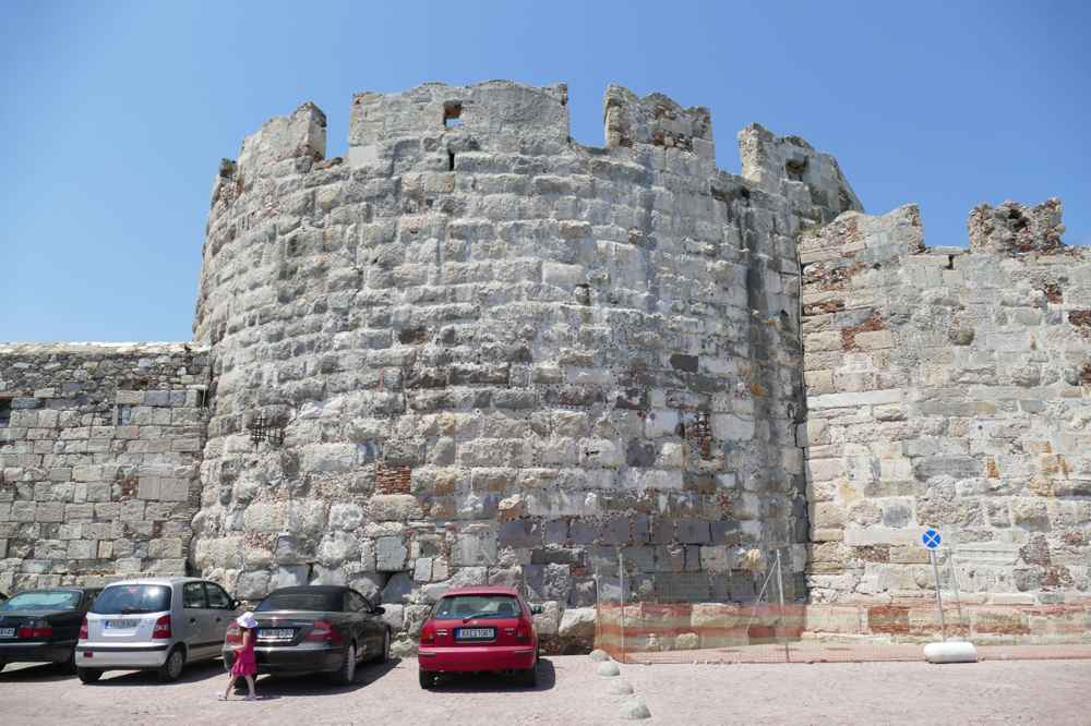
Kos ranks as the third-largest island in the Dodecanese, lying in the eastern Aegean off the Turkish coast near Bodrum. Its 40-kilometre coastline holds beaches for every visitor, from the shallow family sands of Tigaki to the volcanic bubbles of Paradise Beach in Kefalos Bay. Plan the whole trip with Greece Tours.
Kos beaches combine swimming and sunbathing with windsurfing, snorkelling, and boat trips to nearby islands. The north coast catches the meltemi wind, while the southwest bay of Kefalos shelters calmer water, and each shore carries its own character.
What makes Tigaki Beach in Kos special?
Tigaki Beach stands out for its shallow waters and family-friendly atmosphere along the north coast. The 10-kilometre sandy stretch sits about 11 kilometres from Kos Town and suits swimming, sunbathing, and windsurfing in the meltemi wind.
Tigaki Beach stretches about 10 kilometres along the north coast of Kos, ranking among the island’s longest sandy shores. The soft golden sand slopes gently into shallow water, which reaches waist height 30 metres from the shoreline. Families with young children reach the beach by car or bicycle along a paved road. That road links Tigaki to Kos Town, roughly 11 kilometres to the east. Small tavernas and cafes line the beachfront road, serving grilled fish, Greek salad, and cold drinks through the day. Sunbeds and straw umbrellas fill the central section, while the northern end stays quieter and less organised. The flat approach and firm sand make Tigaki practical for strollers and wheelchairs.
The gradual depth reassures parents who watch swimmers near the calm water’s edge.
The Alyki salt-pan lagoon backs Tigaki Beach, forming a shallow wetland separated from the sea by the sandy strip. Flamingos gather on the lagoon between autumn and spring, feeding in the brackish water alongside herons, avocets, and black-winged stilts. Birdwatchers walk the 4-kilometre track around the salt pan at dawn, when the light stays soft and the birds feed close to the bank. The lagoon dries into white salt crusts through high summer, then refills with the first autumn rains. A dirt path connects the lagoon to both Tigaki and Marmari, letting cyclists loop the wetland in under an hour. The mix of open water, reed beds, and dunes supports a food chain.
It draws migrating birds crossing the Aegean between Europe and Africa each season.
Windsurfers favour Tigaki Beach because the meltemi wind sweeps the north coast from June through September, driving steady cross-shore breezes. Rental stations near the central beach hand out boards, rigs, and wetsuits, and instructors run lessons for first-timers on the flat inshore water. Beginners practise close to shore where the depth stays below one metre, while stronger sailors reach across to deeper water beyond the sandbar. Stand-up paddleboards and sea kayaks suit the calmer early mornings before the wind builds after midday. The wide, obstacle-free bay gives riders room to fall and recover without hazard. Kitesurfers use the eastern end, where the beach broadens and space opens for launching lines.
The consistent afternoon wind turns Tigaki into a training ground for sailors building confidence across a full week.
Accommodation around Tigaki ranges from small family-run studios to mid-sized beach hotels set back from the sand. The resort strip holds supermarkets, bakeries, bike-hire shops, and a bus stop with regular services to Kos Town. Guests use Tigaki as a base for day trips across the island. They cycle the coastal path east toward the capital or drive inland to the mountain village of Zia for sunset. The flat terrain and short distances suit travellers who prefer bicycles over cars. Evening life stays relaxed, centred on tavernas serving Dodecanese dishes rather than late clubs. Visitors comparing districts across the island find guidance in our guide on where to stay in Kos.
The mix of quiet nights, shallow water, and easy transport makes Tigaki a practical choice for families travelling together.
Why is Paradise Beach in Kefalos Bay famous?
Paradise Beach earns its fame from volcanic bubbles rising through the sand into the shallows of Kefalos Bay. The southwest cove sits about 7 kilometres from Kefalos village and draws swimmers, snorkellers, and sunbathers to its wide golden shore.
Paradise Beach, known locally as Bubble Beach, occupies the southwest shore of Kefalos Bay on the island’s quieter end. Volcanic gas escapes from vents in the seabed and rises as strings of warm bubbles that break the surface near the shoreline. Snorkellers float above the vents to feel the fizz against their skin, a trace of the volcanic system that shaped the wider Dodecanese arc. The gas warms patches of the shallows, creating pockets of hotter water within the cool Aegean. The wide bay of pale sand runs about 500 metres, backed by low scrub and dunes rather than buildings. The bubbling stays gentle and safe, drawing curious swimmers who wade out to find the active spots.
The geothermal activity links Kos to neighbouring Nisyros, a young volcano visible across the water.
Kefalos Bay lines up a chain of beaches beside Paradise, each reached from the same coastal road running below Kefalos village. Camel Beach sits over a rocky headland to the north, named for the hump-shaped rock above its small cove. Magic Beach and Sunny Beach fill the sand between them, both organised with sunbeds, showers, and beach bars through summer. Paradise itself carries the fullest facilities, with a large sunbed field, water-sports hire, and tavernas set behind the sand. The 3-kilometre string of coves lets visitors walk or drive from one to the next in minutes. Boat trips from Kardamena and Kos Town anchor offshore, ferrying day-trippers who spend an afternoon swimming and eating in the bay.
The bay faces southwest, holding warm light and calm water late into the evening.
Access to Paradise Beach runs along a sealed road that drops from Kefalos village, about 7 kilometres uphill to the west. A gravel car park sits directly behind the sand, filling by mid-morning through July and August. Public buses connect Kos Town with Kefalos across a route of roughly 40 kilometres. The beach lies a short taxi or walk below the hilltop village. Drivers reach the bay in about 50 minutes from the capital along the island’s southern road. Boat excursions offer a car-free alternative, cruising the coast from Kos Town harbour and mooring off the beach. The final descent to the sand passes low dunes and a beach-bar terrace overlooking the whole bay.
Early arrival secures parking and a front-row sunbed before the midday crowds fill the shore through peak season.
Kefalos village crowns the hill above the bay, holding a windmill, a Byzantine chapel, and views across the water to Nisyros. The wider peninsula holds the ancient site of Astypalaia, birthplace of the physician linked to early Koan medicine. The basilica ruins near Agios Stefanos sit within the same headland. Tavernas in the village square serve Dodecanese specialities well after the beach empties for the day. Walkers reach the tip of the Kefalos peninsula, where a lighthouse marks the island’s southwest point above steep cliffs. The square above the bay supplies groceries and bakeries for a beach picnic. Travellers planning a full day in the area find beaches, ruins, and viewpoints described in our page on Kefalos.
The combination of geothermal shallows, sheltered water, and hilltop heritage makes the southwest bay a full-day destination.
How does Marmari Beach cater to visitors?
Marmari Beach welcomes visitors with a wide sandy stretch and calm, shallow water on the north coast. The organised shore sits about 15 kilometres from Kos Town, backing onto the Alyki lagoon and offering windsurfing alongside family swimming.
Marmari Beach spreads across a broad band of pale sand on the north coast, west of Tigaki and sharing the same shallow gradient. The water stays waist-deep well offshore, giving children a wide safe zone under the eyes of parents on the sand. Sunbeds and umbrellas line the central beach, with a paved promenade behind holding showers, changing rooms, and lifeguard posts in high season. The open aspect faces north across the Aegean toward the islands of Pserimos and Kalymnos. Fine sand and gentle depth make Marmari a match for families who want space rather than crowds. The beach broadens at its western end into dunes fringed with tamarisk trees that throw natural shade.
A run of tavernas behind the promenade serves lunch a short barefoot walk from the water’s edge.
Marmari Beach lies about 15 kilometres west of Kos Town along a well-surfaced coastal road served by regular island buses. Drivers park in free gravel lots behind the dunes, and cyclists follow the flat coastal track that links Marmari with Tigaki in under 20 minutes. The bus route from the capital runs through the day in summer, dropping passengers at the resort edge a short walk from the sand. Marmari village sits just inland, holding a supermarket, bakeries, and bike-hire outlets for visitors staying nearby. The short distance from the airport near Antimachia, about 20 kilometres to the south, suits arriving travellers heading straight for the coast.
The flat approach and firm parking make the beach reachable for wheelchair users and families pushing strollers across the promenade.
Windsurfers and kitesurfers work the eastern half of Marmari Beach, where the meltemi wind funnels along the exposed north coast through summer. A watersports centre on the sand rents boards, rigs, and kites, and instructors coach beginners in the shallow inshore zone. The steady cross-shore breeze builds through the afternoon, letting riders plane across flat water inside the sandbar. Wide beach frontage gives kiters clear space to lay out lines away from swimmers, who keep to the sheltered western end. Stand-up paddleboarding and pedalos suit the calmer mornings before the wind rises after midday. The consistent conditions draw returning windsurfers who base a full week around the north-coast beaches of Marmari and Tigaki.
Rescue cover and marked swimming lanes keep the sailing zone separate from the family bathing area.
Marmari sits at the western edge of the Alyki salt-pan lagoon, a short cycle from the wetland where flamingos feed between autumn and spring. Bird hides along the lagoon track let visitors watch waders and ducks without disturbing the flocks. The resort holds studios, apartments, and beach hotels set back from the dunes. The bus stop and shops sit within walking distance of the sand. Evenings stay quiet, centred on family tavernas rather than nightlife. Travellers looking to fill days beyond the sand find hikes, boat trips, and cultural sites in our guide on things to do in Kos. The pairing of a broad swimming beach with a protected lagoon makes Marmari a base for families.
Visitors combine beach days with birdwatching and cycling along the flat north coast.
What activities are available at Mastichari Beach?
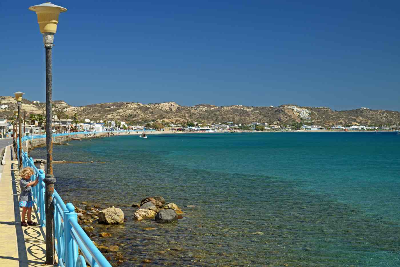
Mastichari Beach combines windsurfing, a working harbour, and ferry links to nearby islands on the north coast. The fine-sand shore sits about 22 kilometres from Kos Town and 7 kilometres from the airport, mixing beach life with island-hopping.
Mastichari Beach fronts a fishing and ferry village on the north coast, where a sheltered bay meets a working harbour. Fine white sand runs west of the port in a long shallow curve, organised with sunbeds, umbrellas, and beach bars. The water stays clear and calm inside the bay, deepening slowly and suiting swimmers who prefer a gradual entry. Fishing boats and day ferries fill the harbour on the eastern side, giving the beach a livelier backdrop than the quieter north-coast sands. Tamarisk trees behind the beach throw shade over the free section beyond the sunbed field. The village square holds fish tavernas that grill the morning catch steps from the mooring lines.
The blend of harbour bustle and sheltered swimming sets Mastichari apart from Tigaki and Marmari along the same coast.
Windsurfers reach Mastichari for the same meltemi wind that powers the whole north coast through the summer months. A watersports base on the western sand rents boards and offers lessons, using the flat inshore water for beginners. The bay stays sheltered enough for first-timers yet catches clean wind once riders pass the harbour wall. Kitesurfers rig on the open western beach, where frontage widens away from swimmers and moored boats. Steady afternoon breezes let sailors plane across the bay toward the horizon, with Kalymnos rising to the north. Morning calm suits kayaking and paddleboarding before the wind fills in after midday. The mix of protected water and reliable wind makes the beach a training spot for sailors.
Riders build skills across consecutive days on the same forgiving bay.
Mastichari harbour runs daily passenger ferries and water taxis across the strait to Kalymnos, the island of sponge divers, in about 30 minutes. Boats also cross to tiny Pserimos, a low island with one sandy bay and a cluster of tavernas, ideal for a slow day. Timetables thicken through summer, letting day-trippers sail out in the morning and return by evening. The short crossings turn Mastichari into a launch point for island-hopping without a long sea journey. Fishing caiques tie up alongside the ferries, selling the day’s catch on the quay. The harbour cafes fill with travellers watching the boats load between swims.
The combination of a swimming beach beside an active port lets visitors alternate beach hours with a half-day escape to a neighbouring Dodecanese island.
Mastichari lies about 22 kilometres west of Kos Town and roughly 7 kilometres north of the airport near Antimachia. Island buses connect the village with the capital and the southern resorts through the day, and drivers park in lots behind the beach. The short hop from the runway suits arriving travellers who want sand and a ferry on their first afternoon. The central location places Kefalos Bay, Zia village, and the Asklepion within a 30-minute drive. Travellers weighing airport transfers, bus routes, and car hire find the options set out in our guide on how to get to Kos. The pairing of a calm swimming bay, reliable wind, and short ferry crossings makes Mastichari a hub.
Visitors combine beach days and island-hopping from one base on the north coast.
What can visitors expect at Agios Stefanos Beach?
Agios Stefanos Beach blends early-Christian history with swimming in Kefalos Bay. Ruins of two basilicas stand beside the sand, and the islet of Kastri rises just offshore, about 4 kilometres from Kefalos village.
Agios Stefanos Beach carries the ruins of two early-Christian basilicas on the low headland above the sand, dating from the 5th century. Mosaic floors, marble columns, and baptismal fonts survive on the terrace, fenced but open to view steps from the sunbeds. The basilicas served a Byzantine settlement that overlooked the same sheltered bay used by swimmers today. Archaeologists uncovered the geometric and animal mosaics that still edge the nave outlines on the platform. The ruins sit directly between the road and the beach, letting visitors combine a swim with a walk through the columns. The stone terrace gives a raised view over the bay and the islet beyond.
The pairing of ancient worship and open water makes Agios Stefanos one of the most storied beaches on the Kefalos peninsula.
Kastri islet rises from the sea about 200 metres off Agios Stefanos, a rocky pyramid topped by a small white chapel. Strong swimmers cross the calm channel to land at the base and climb to the chapel for a view back over the bay. Boats and pedalos hired on the beach carry those who prefer not to swim the gap. The water between the shore and the islet stays clear and sheltered, holding rocky reefs that draw snorkellers. Fish gather around the islet’s submerged ledges, making the crossing a snorkelling route as much as a swim. The sand-and-pebble beach shelves gently before deepening near Kastri.
The framed view of the chapel-topped rock across the turquoise channel defines the beach and marks the southern anchor of Kefalos Bay.
Agios Stefanos Beach lies about 4 kilometres from Kefalos village, reached by a road that drops past the Club Med resort to the shore. A car park sits behind the ruins, and steps lead down to both the organised sunbeds and the free sand. Buses from Kos Town run to Kefalos, roughly 40 kilometres to the northeast, and a short taxi or downhill walk covers the final stretch. The beach faces west across the bay, catching warm afternoon light and calm water in the lee of the peninsula. Boat excursions from Kardamena and Kos Town moor offshore for swimming stops. The sheltered position keeps the water flat even when the meltemi stirs the north coast.
Early arrival secures parking beside the ruins before the beach fills through the middle of the day.
Agios Stefanos offers beach bars, sunbed hire, and toilets behind the sand. The wider Kefalos peninsula holds tavernas, a windmill, and hilltop viewpoints above the coves. The nearby coves of Paradise, Camel, and Magic beach line the same bay within a short drive. Walkers combine the ruins with the Astypalaia archaeological site and the lighthouse at the island’s southwest tip. The village square above supplies groceries, bakeries, and Dodecanese cooking after a beach day. Visitors mapping a full circuit of the peninsula find the beaches and monuments described in our guide on Kefalos. The mix of 5th-century mosaics, a swimmable islet, and sheltered water gives Agios Stefanos real depth.
The beach rewards a slow half-day rather than a quick swim and departure from the bay.
How does Therma Beach differ from other beaches?
Therma Beach differs through its natural hot springs, where thermal water meets the sea in a rocky cove east of Kos Town. The geothermal pool sits about 8 kilometres from the capital and warms bathers year-round.
Therma Beach holds a natural hot spring where geothermal water flows from the rocks into a stone-walled pool at the water’s edge. The spring runs at about 40 degrees Celsius, mixing with the cooler Aegean where the sea washes over the low barrier. Bathers sit in the pool to feel the temperature shift with each wave, a free open-air spa on the shoreline. The mineral water carries sulphur, tracing the same volcanic system that bubbles at Paradise Beach and erupts on nearby Nisyros. Winter and shoulder seasons draw the steadiest crowds, when the warm water contrasts sharply with the cool air. The pool sits directly on the pebble beach below a rocky slope.
The blend of hot mineral water and open sea sets Therma apart from every sandy beach on Kos.
Therma Beach shelves in grey pebbles rather than sand, backed by a steep rocky headland that shelters the cove. Bathers move between the hot pool and the clear open sea, alternating warm and cool water along the shore. The sulphur-rich spring draws visitors treating aches and skin conditions, a use recorded on Kos since the era of Hippocratic medicine. The clear water over the pebble bed suits snorkelling around the rocks at the cove’s edges. Water shoes help on the stony beach and the slick pool rim. A single beach bar behind the shore sells drinks and snacks through the season. The rugged setting, warm mineral pool, and open-sea swimming form an experience unlike the organised family sands.
Therma draws visitors after quiet and wellness rather than beach games.
Therma Beach lies about 8 kilometres east of Kos Town, past Psalidi along the coastal road toward the island’s eastern cape. A steep gravel track drops from the parking area to the pebble shore, so sturdy footwear helps on the descent. Drivers park in the lot above the cove, and cyclists reach the turn-off along the flat coast road from the capital. Facilities stay minimal, limited to one beach bar, so bathers carry their own water, snacks, and shade. The cove faces east, catching early sun before the headland shades it late in the day. Peak season fills the small beach by late morning despite its distance from town.
The short drive from Kos Town makes Therma an easy half-day trip that pairs a hot-spring soak with a swim in the open sea.
Therma rounds out a coast that ranges from windswept sands to a geothermal cove. That range shows the variety packed into a single island. Bathers combine the springs with a visit to the Asklepion, the ancient healing sanctuary 4 kilometres southwest of Kos Town. The link ties the beach to the island’s medical heritage under Hippocrates. The eastern cape beyond Therma stays wild, with walking trails above the sea. Walkers follow the coast path toward the cape’s rocky inlets past the cove. Kos Town’s harbour, castle, and agora sit a short drive west for an afternoon of sightseeing. Travellers planning an island-wide itinerary find beaches, sites, and villages gathered in our guide on Kos.
The sulphur spring and the healing tradition give Therma a place in the island’s story beyond a warm winter swim.
What is unique about Lambi Beach in Kos Town?
Lambi Beach stands apart through its walking distance from Kos Town and its lively seafront. The northeast shore stretches beside the capital, offering jet skiing, beach bars, and easy access on foot or by bike.
Lambi Beach runs along the northeast coast of Kos directly beside the capital, forming the town’s own long sandy seafront. The beach starts a 20-minute walk north of the harbour and stretches for over 2 kilometres toward the island’s tip. Sunbeds, umbrellas, and a paved promenade line the sand, backed by a strip of hotels, cafes, and beach bars. The water shelves gently and stays clean, patrolled by lifeguards through the summer season. Cyclists reach Lambi in minutes along the flat coastal path that defines Kos Town’s grid. The mix of urban convenience and open sand draws both residents and visitors staying in the capital.
The proximity to shops, restaurants, and the ferry port makes Lambi the most accessible organised beach on the island for anyone without a car.
Lambi Beach operates a full watersports scene, offering jet skiing, banana-boat rides, ringos, and pedalos from stations along the sand. Beach bars space out behind the promenade, serving cocktails, coffee, and light meals from morning until after sunset. The lively strip draws a younger crowd than the quiet family sands of Tigaki, with music and loungers filling the central section. Sun terraces and showers line the paved walkway, and shops behind the beach hire bikes and sell beach gear. The 2-kilometre promenade doubles as an evening walking route, busy with strollers and cyclists at dusk. Restaurants along the front cook fresh fish and Dodecanese dishes steps from the water.
The concentration of hire stalls, bars, and eateries makes Lambi a beach for activity and social hours rather than seclusion.
Lambi’s position beside the capital places Kos Town’s monuments within a short walk of the sand. The ancient agora, the largest excavated marketplace in the Dodecanese, lies near the harbour alongside the Roman odeon and the Casa Romana villa. The Knights’ Castle of Nerantzia guards the port entrance, built by the Knights of St John from reused ancient stone. The Plane Tree of Hippocrates stands by the harbour, where tradition holds the physician taught his students. Beachgoers pair a morning swim at Lambi with an afternoon among the ruins and Italian-era squares. The flat grid makes the whole circuit walkable or rideable within an hour.
The overlap of a working beach, a medieval castle, and classical ruins within one district gives Lambi a setting no other Kos beach matches.
Lambi holds the densest cluster of hotels and studios on the island, running from the harbour north along the seafront strip. Guests reach the beach, the port, and the town centre on foot, making the district a match for travellers without a hire car. Supermarkets, pharmacies, bike shops, and bus stops fill the streets behind the promenade. Evening life spreads through the tavernas and bars of Kos Town a short walk inland. Visitors weighing the capital against the resort villages find the districts compared in our guide on where to stay in Kos. The blend of a long organised beach, walkable monuments, and ferry links suits a first visit.
Lambi works best as a base centred on the capital rather than a remote resort bay.
How does Psalidi Beach cater to visitors?
Psalidi Beach serves visitors with organised facilities and steady wind for watersports just east of Kos Town. The pebble-and-sand shore sits within 4 kilometres of the capital, backed by hotels, beach bars, and windsurfing hire.
Psalidi Beach lines the coast just east of Kos Town, a mixed pebble-and-sand shore backed by a strip of larger resort hotels. The water turns clear and deep quickly, drawing snorkellers to the rocky patches near the eastern end. Sunbeds and umbrellas fill the organised sections in front of the hotels, with free stretches between them. A paved coastal path links Psalidi to the capital, walkable or rideable in about 40 minutes. The beach faces east across the strait toward the Turkish coast near Bodrum, visible on clear mornings. Showers, beach bars, and hire stalls line the promenade behind the sand. The blend of quick-deepening clear water and full facilities close to town suits swimmers.
Snorkellers who want depth over shallow family sand favour Psalidi.
Psalidi catches the meltemi wind along its exposed eastern shore, feeding a watersports scene of windsurfing, kitesurfing, and kayaking. A hire centre on the sand rents boards and rigs and runs lessons for beginners on the inshore water. The steady afternoon breeze suits improvers who plane across the bay once the wind builds past midday. Kayakers and paddleboarders use the calmer mornings to explore the rocky coast toward the eastern cape. The quick-deepening water lets sailors reach clean wind close to shore without a long walk out. Marked lanes separate the sailing zone from the swimming area in front of the hotels.
The reliable wind and organised hire make Psalidi a training beach within a short ride of the capital. Riders pair lessons with a swim on the same afternoon.
Psalidi lines its promenade with beach bars and hotel restaurants serving drinks and meals from morning through the evening. The resort strip runs a relaxed daytime scene, busier than a remote cove yet calmer than the party sands of Lambi. Loungers, music, and sea-view terraces fill the central beach through the afternoon. The Therma hot springs sit about 4 kilometres further east along the coast road, an easy add-on to a Psalidi beach day. Snorkellers explore the rocky reefs at the eastern end, where fish gather over the ledges. Walkers follow the promenade back toward Kos Town for evening dining. The nearby geothermal cove pairs well with a facility-rich beach.
Visitors combine organised sunbeds, watersports, and a hot-spring soak within a single stretch of coast.
Psalidi’s edge-of-town position places the capital’s ruins, the Asklepion, and the eastern cape trails within a short drive of the sand. The ancient healing sanctuary lies about 4 kilometres southwest across town, while the hot springs of Therma sit an equal distance east. Hotel guests reach the beach, the town, and the ferry port without a long transfer. The mix of deep clear water, steady wind, and full facilities suits active travellers over families seeking shallow sand. Visitors planning trips beyond the beach find sites, hikes, and boat tours in our guide on things to do in Kos. Watersports, snorkelling reefs, and a hot-spring cove sit nearby along the eastern shore.
Psalidi suits visitors who fill their days with activity around the eastern coast of Kos, close to the capital.
What are the transportation options to Kos beaches?
Kos beaches connect through buses, hire cars, bicycles, and boats across a flat, well-signed road network. Public services link Kos Town with Tigaki, Mastichari, and Kefalos, while the cycle-friendly terrain reaches both busy and quiet shores.
Public buses run from Kos Town to every major beach, forming the backbone of car-free travel across the island. Blue urban buses serve close-in beaches like Lambi, Psalidi, and Agios Fokas, while the KTEL regional buses reach Tigaki, Marmari, Mastichari, and Kefalos. Frequencies rise through summer, with departures roughly every hour on the busiest routes. Fares stay low, and tickets sell at kiosks or on board for the longer runs. The main bus station near the harbour posts timetables for each destination. The 40-kilometre trip to Kefalos takes about an hour, while Tigaki lies 20 minutes out. The dense bus network reaches north-coast sands, the southwest bay, and the town beaches without a car.
One base spreads across the whole coastline through a single week.
Car hire gives visitors the range to reach quiet coves that buses skip, from Therma in the east to the Kefalos peninsula in the southwest. Rental desks cluster at the airport near Antimachia and along the Kos Town waterfront, stocking small hatchbacks suited to the narrow village lanes. The island’s roads stay well surfaced and clearly signed, with the main artery running the 40-kilometre length from the capital to Kefalos. Drivers reach the far beaches in under an hour and park in free gravel lots behind most shores. A car opens the mountain village of Zia, the Asklepion, and the Antimachia castle alongside the coast.
The freedom to chase the sheltered side of the island when the meltemi blows makes hire cars the choice for travellers covering ground each day.
Cycling defines travel around Kos Town, where a flat grid and dedicated bike lanes link the centre with Lambi, Psalidi, and Agios Fokas. Hire shops across the capital rent city bikes, e-bikes, and mountain bikes by the day or week. A paved coastal path runs west toward Tigaki and Marmari, letting riders reach the north-coast sands in under an hour. The gentle terrain near the coast suits families and casual riders, while the climb toward Zia challenges stronger cyclists. Bikes load onto the regional buses, extending a ride into the hills. Kos ranks among the most cycle-friendly Greek islands thanks to its length of level ground.
The combination of bike lanes, rental fleets, and flat coastal routes turns cycling into a practical way to reach the beaches closest to the capital.
Boat trips add a fourth route to the beaches. They run from Kos Town and Kardamena harbours to the coves of Kefalos Bay and the islet stops offshore. Day cruises moor off Paradise and Agios Stefanos for swimming, while ferries from Mastichari cross to Kalymnos and Pserimos. Water taxis shuttle along the northeast coast in high season. The airport near Antimachia sits central on the island, roughly 25 kilometres from both the capital and Kefalos. Travellers comparing transfers, bus routes, car hire, and boats find the full picture in our guide on how to get to Kos. The mix of buses, cars, bikes, and boats lets visitors match transport to each beach.
An in-town swim or a remote southwest cove sits within reach either way.
How does the meltemi wind affect Kos beaches?
The meltemi wind shapes Kos beaches by driving strong summer breezes along the exposed north coast. Windsurfers and kitesurfers ride the steady air at Tigaki and Marmari, while sheltered Kefalos Bay keeps calmer water for swimmers.
The meltemi is a dry north wind that sweeps the Aegean from June through September, driven by pressure differences between the Balkans and Turkey. It builds through the morning, peaks in the afternoon, and eases at night across the Dodecanese. Kos feels the meltemi most on its exposed north coast, where Tigaki, Marmari, and Mastichari face the open sea. Wind strength ranges from a steady breeze to gusts near gale force on the strongest days. The wind clears haze and holds humidity down, keeping the summer air dry and the skies bright. Sailors track the daily pattern to plan their sessions around the afternoon peak.
The reliable timing and direction of the meltemi turn the north-coast beaches into a dependable arena for windsurfing and kitesurfing across the whole high season.
The meltemi churns the north-coast shallows into chop on its strongest afternoons, pushing swimmers to time their bathing for the calmer mornings. Beach flags and lifeguards mark the safe zones, and red flags close the water when gusts raise a swell. Bathers seeking flat water on windy days cross to the southwest, where the Kefalos peninsula shelters Paradise and Agios Stefanos beaches in its lee. The town beaches of Lambi and Psalidi on the northeast catch a lighter, angled wind than the fully exposed north. Children and weaker swimmers stay inside the marked shallows on breezy days. Checking the daily forecast and the beach flags guides the choice of shore.
The wind’s habit of favouring one coast at a time lets visitors always find calm water somewhere on Kos.
The meltemi cools Kos through the peak of summer, carrying dry northern air that holds daytime highs near 30 degrees Celsius rather than higher. The breeze lifts humidity off the coast, making the heat feel milder than on mainland Greece or the sheltered southern islands. Nights turn pleasant as the wind drops, easing sleep without constant air conditioning. The dry air keeps mosquitoes down along the exposed beaches. Sun protection still matters, since the cooling wind masks the strength of the summer sun and hides the risk of burning. Farmers and sailors have read the meltemi for millennia, and it shaped the seafaring rhythm of the ancient Aegean.
The wind’s cooling effect adds to the appeal of a Kos summer, tempering the heat that bears down elsewhere in the region.
The meltemi rewards visitors who plan around it, pairing morning swims with afternoon watersports on the north coast. Windsurf and kitesurf schools at Tigaki, Marmari, Mastichari, and Psalidi run lessons timed to the building breeze. Non-sailors use windy afternoons for inland trips to Zia, the Asklepion, or the Antimachia castle. They return to the beach as the wind eases at dusk. Boat trips shift to the sheltered southwest of Kefalos Bay when the north coast roughens under the breeze. Travellers matching activities to the daily wind find beaches, watersports, and inland sites in our guide on things to do in Kos. The predictable rhythm lets visitors build each day around calm mornings and breezy afternoons.
A strong wind becomes part of the island’s appeal rather than a drawback.
Frequently Asked Questions
What are the best family-friendly beaches in Kos?
Tigaki Beach and Marmari Beach rank as the best family shores on Kos, both set on the shallow north coast. Tigaki stretches about 10 kilometres of soft sand roughly 11 kilometres west of Kos Town, and its water stays waist-deep far from the shoreline. Marmari, about 15 kilometres from the capital, offers the same gentle gradient with organised sunbeds, showers, and lifeguard cover in summer. Both beaches provide umbrellas, beach bars, and free parking behind the dunes, and buses link each to Kos Town through the day. The Alyki salt-pan lagoon backs both shores, where flamingos feed between autumn and spring, adding birdwatching to a beach day. Firm sand and flat approaches suit strollers and wheelchairs.
Windsurfing hire operates at the eastern ends, kept clear of the family swimming zones. The pairing of shallow water, full facilities, and short bus rides from the capital stands out. Tigaki and Marmari suit families with young children better than any other shores on Kos.
Which beaches in Kos are best for water sports?
Tigaki Beach, Marmari Beach, and Mastichari Beach lead the island for watersports, all set on the wind-swept north coast. The meltemi drives steady cross-shore breezes from June through September, building through each afternoon into ideal windsurfing and kitesurfing conditions. Tigaki offers flat inshore water where instructors teach beginners below one metre of depth before riders reach across the sandbar. Mastichari shelters first-timers inside its harbour bay while catching clean wind past the breakwater, and Psalidi east of Kos Town adds a fourth reliable option. Hire centres on each beach rent boards, rigs, kites, and wetsuits, and run lessons for every level. Kitesurfers use the wide eastern ends where frontage opens away from swimmers.
Calm mornings suit kayaking and paddleboarding before the breeze fills in. Marked lanes keep sailing zones clear of bathers. The combination of dependable wind, shallow launch water, and full rental support stands out. The north-coast beaches form the base for watersports across a whole week on Kos.
How do I get to the beaches in Kefalos Bay?
Kefalos Bay lies in the southwest of Kos, about 40 kilometres from the capital. The drive along the southern road takes close to an hour. Regional KTEL buses run from the main station in Kos Town to Kefalos village through the day in summer, dropping passengers above the coves. Hire cars give the most freedom, opening Paradise, Camel, Magic, and Agios Stefanos beaches along the same coastal road below the village. The route stays well surfaced and clearly signed, with free gravel car parks behind most beaches. Drivers reach the bay in about 50 minutes along the island’s southern artery.
Boat trips offer a car-free route, cruising from Kos Town and Kardamena harbours to moor off the beaches for swimming stops. Travellers based in Kefalos reach the sands on foot, by taxi, or by bike within a short ride. The mix of buses, hire cars, and boats makes the southwest bay reachable whether or not visitors drive.
What I know about visiting Therma Beach?
Therma Beach lies about 8 kilometres east of Kos Town, past Psalidi along the coastal road toward the island’s eastern cape. Its natural hot spring flows at around 40 degrees Celsius into a stone-walled pool where thermal water meets the sea. The pool forms an open-air spa on the pebble shore below the headland. A steep gravel track drops from the car park to the beach, so sturdy footwear helps on the descent. The pebbly cove holds minimal facilities, limited to one beach bar, so bathers carry their own water, snacks, and shade. The sulphur-rich water has drawn wellness seekers to Kos since the era of Hippocratic medicine.
Bathers alternate between the warm pool and the cool open sea along the shore. Water shoes ease the walk across the stones and the slick pool rim. Winter and shoulder seasons bring the steadiest crowds, when the warm water contrasts with cooler air. Early arrival secures parking above the small cove before it fills by late morning.
Are there any secluded beaches in Kos for a quiet day?
Kos holds quiet shores for visitors seeking calm away from the organised resorts. Agios Stefanos Beach in Kefalos Bay pairs a peaceful mix of sand and pebbles with two 5th-century basilica ruins. The chapel-topped Kastri islet rises just offshore from the same beach. Camel Beach, over the headland near Kefalos village, hides in a small cove reached by a footpath, keeping crowds thin even in August. The wild eastern cape beyond Therma offers rocky inlets along walking trails for bathers who carry their own supplies. These beaches sit off the bus routes, so a hire car or boat reaches them best, and parking stays limited to small gravel lots.
Facilities run sparse, from a single beach bar to none, rewarding those who arrive prepared. The southwest bay and the eastern cape hold the island’s most sheltered water. The spread of Kos beyond its busy north coast gives independent travellers coves for a slow, quiet day by the sea.
What is the best time of year to visit Kos beaches?
Late spring and early autumn bring the best conditions for Kos beaches, spanning the weeks from mid-spring to June and from September to October. Daytime temperatures hold between 25 and 30 degrees Celsius through these months, warm enough for swimming yet short of the peak-summer heat. The meltemi wind blows lighter than in July and August, leaving calmer water on the north coast for swimming and sunbathing. Crowds thin outside the high season, opening space on the sands of Tigaki, Marmari, and Kefalos Bay. Sea temperatures peak in September after a summer of warming, staying comfortable well into October. Accommodation and flight prices drop against the July and August peak, and hire cars and sunbeds free up.
The shoulder months also suit cycling and hiking to Zia or the Asklepion, when the cooler air eases the climbs. The balance of warm sea, gentle wind, lighter crowds, and lower prices makes these shoulder windows the strongest choice for a Kos beach holiday.
How does Kos cater to cycling enthusiasts?
Kos ranks among the most cycle-friendly Greek islands, built on a flat coastal plain with dedicated bike lanes through the capital. Kos Town runs a level grid where paths link the centre with the beaches of Lambi, Psalidi, and Agios Fokas within minutes. Hire shops across the town rent city bikes, e-bikes, and mountain bikes by the day or week, sized for adults and children. A paved coastal path heads west toward Tigaki and Marmari, letting riders reach the north-coast sands in under an hour. The gentle terrain near the shore suits families and casual cyclists, while the climb toward the mountain village of Zia tests stronger riders.
Bikes load onto the regional buses, extending a ride into the hills or out to distant beaches. The mild air of spring and autumn favours longer rides between beaches and sites. The combination of level ground, marked lanes, rental fleets, and short distances makes cycling a practical way to reach the shores nearest Kos Town.