Greece travel starts with the shape of the country: a mainland peninsula, thousands of islands and mountains that cover most of the land. Each tour on our Greece Tours homepage fits somewhere on that map.
This guide gives the facts for Greece travel: size, cities, mountains, islands, heritage sites, ports, roads, seas, hazards, lakes, gorges and caves.
What are the quick facts for Greece travel?
Athens is the capital and the largest city of Greece. Greek is the language, the euro is the currency, and the calling code is +30. Traffic keeps to the right, and the clocks follow Eastern European Time.
Every Greece travel plan starts with a short list of fixed facts. The official name of the country is the Hellenic Republic. Its government is a unitary parliamentary republic, and the land is divided into nine regions.
The euro replaced the drachma as the currency of Greece. The international calling code is +30, and the international dialling prefix is 00. The internet domain of the country ends in .gr.
Greece sits in Eastern European Time, which is UTC+02:00. In summer the clocks move to Eastern European Summer Time, which is UTC+03:00. A traffic code made right-hand traffic official, so cars drive on the right-hand side of the road.
The official EU country profile lists Greece as an EU member state. It is also a euro area member and a Schengen area member. For Greece travel, that means the euro in every shop and no routine border checks inside the Schengen area.
Greece has an estimated 10,372,335 residents, which ranks 90th among the countries of the world. The density is 78.9 people per square kilometre. The country ranks 95th by area. These figures frame every Greece travel route.
The traditional start of the Greek War of Independence against the Ottoman Empire is 25 March. The full story of the country sits in Greek history, which tells it century by century.
How big is Greece and how is the land laid out for Greece travel?
Greece has a total area of 131,957 square kilometres, and 80 percent of the land is mountainous. A peninsula forms the mainland. Islands fill the seas around it, so the map decides each route.
Of the total area, 130,647 square kilometres is land. Lakes and rivers cover the other 1,310 square kilometres. The mainland measures 110,496 square kilometres, which is 83.33 percent of the territory, and the islands measure 21,461 square kilometres.
The coastline is 13,676 kilometres long. Wikipedia states that Greece has the longest coastline on the Mediterranean basin. That length is the reason why Greece travel uses ferries as much as roads.
The mainland is the southernmost part of the Balkan Peninsula. Two smaller peninsulas project from it, Chalkidiki and the Peloponnese. The Isthmus of Corinth joins the Peloponnese to the mainland. The Corinthian Gulf and the Saronic Gulf separate the two on the map.
Plains lie in eastern Thessaly, in central Macedonia and in Thrace. The rest of the mainland rises into mountains. Greece reaches from 35 degrees north to 42 degrees north in latitude. In longitude it spans 19 degrees east to 28 degrees east. This spread gives Greece travel a long north to south axis.
Greece shares land borders with four countries. The border with Albania measures 212 kilometres, North Macedonia 234, Bulgaria 472 and Turkey 192. Together the four borders measure about 1,110 kilometres. Greece travel by land starts at one of these four lines.
The number of islands depends on the count. Wikipedia gives a range between 1,200 and 6,000. One figure from travel guides is 1,425 islands, with 166 inhabited. The Greek Tourism Organization reports 6,000, with 227 inhabited.
Mount Olympus is the highest point, at 2,918 metres. Epitalio is the lowest point, at minus 6 metres. The Haliacmon is the longest river, with a length of 297 kilometres.
The four extreme points of the country mark the edges of Greece travel on the map. The north is the village of Ormenio. The south is the island of Gavdos. The east is the island of Strongyli, and the west is the island of Othonoi.
The Ionian Sea lies to the west and separates Greece from Italy. The Aegean Sea lies to the east. The Cretan Sea and the Libyan Sea lie to the south. Mountains, peninsulas and sea on three sides explain why Greece travel mixes road, rail, air and ferry legs.
Which cities anchor Greece travel?
Eight cities hold the country’s main bases: Athens, Thessaloniki, Patras, Heraklion, Larissa, Volos, Ioannina and Chania. Each one is the capital of a region or a regional unit. Together they cover Attica, Macedonia, the northern Peloponnese, Thessaly, Epirus and Crete.
Athens is the capital and largest city of Greece, and it is also the capital of the Attica region. Its urban area holds over 3.6 million people, the eighth-largest urban area in the European Union. These figures put Athens at the top of any Greece travel city list.
Athens sprawls across the central plain of Attica, called the Athens Basin. Four large mountains bound the basin. Mount Aigaleo lies to the west and Parnitha to the north. Pentelicus rises to the northeast and Hymettus to the east.
Thessaloniki is the second-largest city in Greece and the largest city of Northern Greece. It stands on the Thermaic Gulf, at the northwest corner of the Aegean Sea. It is the capital of Central Macedonia, with slightly over one million people in its metropolitan area.
Patras is the capital and largest city of Western Greece and the third-largest city in the country. It lies in the northern Peloponnese, 215 km west of Athens, at the foot of Mount Panachaikon. Its Greece travel role comes from the Rio-Antirrio Bridge, which links the Peloponnese with mainland Greece.
Heraklion is the largest city on Crete and the fourth-largest city in Greece. It is the main island city on this Greece travel list. It is also the largest city in the Greek islands. Chania is the capital of its regional unit on the northwest coast of Crete. It lies 145 km west of Heraklion and 70 km west of Rethymno.
The old town of Chania sits next to the old harbour. The modern city forms the larger part of the urban area. Larissa is the capital of Thessaly and the fifth-largest city in Greece. It straddles the Pineios river, with Mount Olympus and Mount Kissavos to the north-northeast.
Larissa is linked by road and rail with Volos, Thessaloniki and Athens. Volos is a coastal port, about 170 km north of Athens and 140 km south of Thessaloniki. It is the capital of the Magnesia regional unit and the only outlet to the sea from Thessaly.
Ioannina is the capital and largest city of Epirus in northwestern Greece. It lies 410 km northwest of Athens and 260 km southwest of Thessaloniki. In the period between the 18th and 19th centuries, the city was a major centre of the modern Greek Enlightenment.
Which mountains and national parks does Greece travel reach?
Greece travel reaches six named mountain landmarks, from Olympus in the north to Psiloritis on Crete. Olympus was the first national park in Greece. The country now lists 27 protected areas under that name.
Mount Olympus is a massif on the border between Thessaly and Macedonia, about 80 km southwest of Thessaloniki. It has 52 peaks and deep gorges. Its highest peak, Mytikas, rises to 2,917.727 metres and is the highest peak in Greece.
Smolikas is a mountain in the Ioannina regional unit, in northwestern Greece. It is the top of the Pindus on any Greece travel map. It stands 2,631.397 metres high. It is the second-highest mountain in Greece after Olympus and the highest of the Pindus Mountains. Its rocks are ophiolite, and glaciers once covered its northern and eastern valleys.
The Pindus range is roughly 160 km long and runs north to south along much of mainland Greece. That earns it the nickname spine of Greece. It stretches from near the Greek-Albanian border down to the north of the Peloponnese.
The Taygetus range lies on the Peloponnese, about 100 km long, from the centre of the peninsula to Cape Matapan. Its summit, Profitis Ilias, reaches 2,405 metres. It is the tallest mountain in the Peloponnese and the southern high point of this Greece travel list.
Parnassus is a mountain range in Central Greece. It spreads over Boeotia, Phthiotis and Phocis. It stands 2,457 metres high, and its highest peak is Liakoura. The mountain is made of limestone and holds bauxite deposits.
Mount Ida, also called Psiloritis after the massif that contains it, is the highest mountain on Crete. It rises to 2,456 metres in the Rethymno regional unit. It has the highest topographic prominence of any mountain in Greece.
The World Database on Protected Areas counts 10 national woodland parks, 2 marine parks and 15 national parks. The Greece travel woodland parks are:
- Ainos, Oiti, Olympus and Parnassos
- Parnitha, Pindos, Prespes and Samaria
- Sounio and Vikos-Aoos
The two marine parks are Alonnisos in the Northern Sporades and Zakynthos. The national park list includes Amvrakikos Wetlands, Chelmos-Vouraikos, Dadia-Lefkimi-Soufli, Evros Delta, Lake Kerkini, Rodopi and Schinias-Marathon. For a separate nature guide, read nature reserves to visit in Greece.
Which islands are the largest for Greece travel?
Crete is the largest Greek island at 8,336 km², and Euboea follows at 3,670 km². Lesbos, Rhodes, Chios, Kefalonia, Corfu, Lemnos, Samos and Naxos complete the top ten. Each island has its own outline, length and high point.
The ranking below follows the Wikipedia list of islands of Greece, which gives one area figure per island. Each island’s own page adds the shape, the length and the highest peak. Greece travel by sea reaches all ten.
- Crete covers 8,336 km² and has a coastline of 1,046 km. The island is elongated: 260 km from east to west, 60 km at its widest and 12 km at its narrowest, near Ierapetra.
- Euboea covers 3,670 km². It is long and narrow, about 180 km long and 6 to 50 km wide. A mountain range runs along its whole length.
- Lesbos covers 1,633 km². Its outline is roughly triangular, cut deep by the gulfs of Kalloni and Gera. Mount Lepetymnos rises to 968 m.
- In Greece travel, Rhodes covers 1,401 km². It is shaped like a spearhead, 79.7 km long and 38 km across at its widest. Mount Attavyros, at 1,216 m, is the highest point.
- Chios covers 842.3 km². It is crescent or kidney-shaped, 50 km long and 29 km wide at its widest. Pelineon at 1,297 m and Epos at 1,188 m stand in the north.
- Kefalonia covers 781 km². Mount Ainos is the highest mountain, at 1,628 m. Fir trees cover its top, and the summit is a natural park.
- Corfu covers 592.9 km². Its shape resembles a sickle. Two high ranges divide it into a mountainous north, an undulating centre and a low-lying south.
- Lemnos covers 477.6 km². It is primarily a flat island. The west and northwest are rocky and mountainous, and Mount Skopia, at 430 m, is the highest point.
- Greece travel also takes in Samos, which covers 477.4 km². It is 43 km long and 13 km wide. Mount Kerkis, at 1,434 m, tops the island, and the Ampelos massif fills the centre at 1,095 m.
- Naxos closes the Greece travel ranking at 429.8 km². Mount Zeus, at 1,001 m, is the highest peak in the Cyclades. It traps clouds and brings the island greater rainfall.
Four of the ten lie close to another country’s coast. The Mytilini Strait between Lesbos and Anatolia is 5.5 km wide at its narrowest. Rhodes sits 18 km from the southern shore of Turkey.
The northeastern edge of Corfu lies off the coast of Albania, with straits 3 to 23 km wide. Samos is separated from Anatolia by the Mycale Strait, about 1 mile wide. These gaps are the shortest sea distances to a neighbouring country on the list.
Lesbos adds its own natural facts to Greece travel. Olive trees cover 40% of the island, and pine, chestnut and oak forests cover 20%. Hot springs and the two gulfs show its volcanic origin. Euboea lies beside the mainland, divided from Boeotia by the narrow Euripus Strait.
Which UNESCO World Heritage Sites does Greece travel include?
Greece travel includes 21 properties on the UNESCO World Heritage List: 18 cultural sites and three mixed sites. Meteora, Mount Athos and Mount Olympus are the mixed ones, listed for both nature and culture. The list below gives every property with its region and type.
The names, regions and types follow the Wikipedia list of World Heritage Sites in Greece. Bassae was the first site added, and Delphi and the Acropolis of Athens came next. The wider area of Mount Olympus is the newest addition. Our top archaeological sites in Greece page covers the ruins in more detail.
- Temple of Apollo Epicurius at Bassae — Peloponnese — cultural.
- Archeological site of Delphi — Central Greece — cultural.
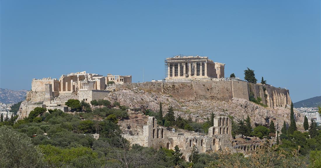
- Acropolis, Athens — Attica — cultural.
- Mount Athos — Mount Athos — mixed.
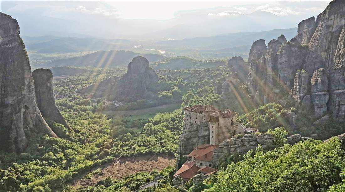
- Meteora — Thessaly — mixed.
- Paleochristian and Byzantine monuments of Thessaloniki — Central Macedonia — cultural.
- Sanctuary of Asklepios at Epidaurus — Peloponnese — cultural.
- Medieval City of Rhodes — South Aegean — cultural.
- Archeological site of Mystras — Peloponnese — cultural.
- Archeological site of Olympia — West Greece — cultural.
- Delos — South Aegean — cultural.
- Monasteries of Daphni, Hosios Loukas and Nea Moni of Chios — Central Greece, Attica and North Aegean — cultural.
- Pythagoreion and Heraion of Samos — North Aegean — cultural.
- Archaeological Site of Aigai, modern name Vergina — Central Macedonia — cultural.
- Archaeological site of Mycenae and Tiryns — Peloponnese — cultural.
- The Historic Centre (Chorá) with the Monastery of Saint-John the Theologian and the Cave of the Apocalypse on the Island of Pátmos — South Aegean — cultural.
- Old Town of Corfu — Ionian Islands — cultural.
- Archaeological Site of Philippi — Eastern Macedonia and Thrace — cultural.
- Zagori Cultural Landscape — Epirus — cultural.
- Minoan Palatial Centres — Crete — cultural.
- The wider area of Mount Olympus — Thessaly and Central Macedonia — mixed.
Greece travel meets two entries that cover groups of places rather than one site. The Minoan Palatial Centres take in six palaces: Knossos, Phaestos, Malia, Zakros, Zominthos and Kydonia. The Zagori Cultural Landscape in the Pindus mountains comprises 45 stone-built villages along the Voidomatis river.
Six entries sit on islands: Rhodes, Delos, Samos, Pátmos, Corfu and Crete. Mount Athos is a peninsula. The Daphni, Hosios Loukas and Nea Moni entry spans three regions, one of them on the island of Chios. Greece travel therefore links island and mainland heritage in one list.
Which ports link Greece travel by sea?
Piraeus, Rafina, Patras and Igoumenitsa carry the sea side of the country. Piraeus serves Athens and Rafina serves the Cyclades. Patras faces Italy. Igoumenitsa joins the northwest to the Ionian Islands.
Piraeus is the chief sea port of Athens. It sits on the Saronic Gulf, on the western coast of the Aegean Sea. Wikipedia calls it the largest port in Greece and one of the largest in Europe. Its passenger terminal has a total quay length of 2.8 kilometres and serves Greece travel by ferry from the capital.
Rafina is a port town on the eastern coast of Attica, 25 kilometres east of Athens city centre. Wikipedia says it serves ferries to the southern part of Euboea and to the Cyclades. It acts as the second port of Athens, after Piraeus. Lavrio lies about 60 kilometres southeast of Athens, on a bay that overlooks the island of Makronisos.
Patras is called the “Gate to the West”. Its port manages more than half of the foreign sea-passenger transport in Greece. It has car-ferry links with the Ionian Islands and the major Adriatic ports of Italy. Ferries to Italy now dock at a newer port in the south of the city. This makes Patras the western door of Greece travel.
Igoumenitsa is the chief port of Thesprotia and Epirus. It connects northwestern mainland Greece with the Ionian Islands and Italy. Wikipedia ranks its New Port second among Greek passenger ports, after Piraeus. Frequent passenger and car ferries sail between Igoumenitsa and Corfu. The Egnatia Odos motorway ends at its quay.
The port of Thessaloniki is the main maritime gateway to Southeast, Central and Eastern Europe. Its passenger terminal is one of the largest in the Aegean basin. The building was a customs house, put up in the last years of Ottoman rule. Greece travel from this port reaches the Northeast Aegean islands, the Cyclades, the Sporades and Izmir.
Heraklion is an important shipping port and ferry dock on Crete. Wikipedia names ferries from there to Santorini, Ios, Paros, Mykonos and Rhodes. It also names daily ferries to Piraeus.
On Rhodes, Mandraki is the oldest port, in the centre of Rhodes city. Cruise boats from Mandraki run day trips to Symi. Akandia is the newer port, south of the central one. These two island ports anchor Greece travel in the southeast.
Booking, routes and seat choice have their own page. Read tips for ferry travel in Greece before you plan a crossing.
How do motorways and tolls shape Greece travel by road?
Four motorways frame the network. The A2 Egnatia Odos crosses the north. The A1 runs from Athens to the northern border. The A5 Ionia Odos serves the west, and Attiki Odos circles Athens. Wikipedia names motorways as the only toll roads in the country, bar one tunnel.
The A2, called Egnatia Odos, is the longest motorway in Greece, at 670 kilometres. It runs from the port of Igoumenitsa in the west to the Kipoi border crossing with Turkey in the east. Wikipedia says it crosses the Pindos and Vermio mountain ranges. That route is the east to west line of Greece travel by road.
The A2 passes through Ioannina, Metsovo, Grevena, Kozani, Veria, Thessaloniki, Kavala, Xanthi, Komotini and Alexandroupolis. It links the ports of Igoumenitsa, Thessaloniki, Kavala and Alexandroupolis, which ties Greece travel by sea to the road. Nine vertical axes join it to roads towards Albania, North Macedonia, Bulgaria and Turkey.
The A1 is the second longest motorway in Greece, at 557 kilometres. It is the principal north to south road link of the country. It starts at Neo Faliro in Attica. It ends at the Evzonoi border station with North Macedonia. Greece travel from Athens to the north follows this line.
On the way the A1 joins Athens with Thessaly, Macedonia and Thessaloniki. It has largely replaced National Road 1, the older road between the two cities.
The A5, called Ionia Odos, starts at Ioannina. It follows the western coast of the mainland down to the Gulf of Corinth. It crosses the gulf at Rio on the Rio–Antirrio bridge and meets the A8 near Patras. The motorway is 196 kilometres long and has 19 interchanges.
Wikipedia calls the A5 the second major north to south connection after the A1. It cut the trip between Antirrio and Ioannina from 3 hours and 30 minutes to 1 hour and 40 minutes. Wikipedia also calls it one of the hardest construction projects in Greece. It shortens Greece travel in the west.
Attiki Odos forms the outer beltways of the Greater Athens area. Wikipedia gives the total length of its motorways as 70 kilometres. The system has five parts: the A6, the A62 Ymittos Ring, the A621, the A64 and the A65 Aigaleo Ring. The A6 runs from Elefsina to Athens International Airport.
Tolls work the same way across the network. Entrances and exits sit only at interchanges, and there are no traffic lights. The A2 carries toll stations at places such as Pamvotida, Malakasi and Polymylos. The A5 has four main toll stations and five lateral ones. Tolls are part of Greece travel by road.
The ring is the road side of Greece travel around Athens. On Attiki Odos you pay once, when you enter the motorway. The toll is the same whatever distance you drive, and it depends on the vehicle category and the payment method. It applies to the A6, A62 and A621. The A64 and A65 branches are toll-free.
Drivers on Attiki Odos can pay by cash, credit or debit card, e-pass or a special account card. The Greek Interoperable Tolling System accepts e-pass transponders from other motorways. Wikipedia says the system has expanded across the whole country. Toll payment is one more part of Greece travel by car.
Which seas surround Greece and shape Greece travel?
Six named seas touch Greece. The Aegean lies between the Balkans and Anatolia. The Ionian lies to the west, and the Libyan lies south of Crete. The Cretan, Thracian and Myrtoan seas are named parts of the Aegean.
The Aegean is an elongated embayment of the Mediterranean. The Greek mainland marks its western boundary, and the Anatolian peninsula marks its eastern one. Kythera, Antikythera, Crete, Kasos, Karpathos and Rhodes delimit it on the south. Nine administrative regions of Greece border the sea, so much of greece travel faces this water.
Four named seas sit inside the Aegean. The Thracian Sea lies in the north and the Icarian Sea in the east. The Myrtoan Sea lies in the west and the Sea of Crete in the south. Athens, Thessaloniki, Heraklion, Volos, Alexandroupolis and Kavala stand on its Greek coast. Its maximum depth is 2,639 m, west of Karpathos.
The Ionian Sea is an elongated bay of the Mediterranean, joined to the Adriatic on the north. Southern Italy bounds it on the west and southern Albania on the north. The west coast of Greece, including the Peloponnese, forms its eastern side. All its major islands belong to Greece: Corfu, Kefalonia, Zakynthos, Lefkada and Ithaca are the main ones.
Calypso Deep, the deepest point in the Mediterranean at 5,109 m, lies in the Ionian Sea. The Greek ports on this sea include Igoumenitsa, Parga, Preveza, Patras, Argostoli, Zakynthos, Pylos and Kalamata. Greece travel on the western side of the country meets this sea along the whole mainland coast.
The Libyan Sea is the part of the Mediterranean north of the African coast of ancient Libya. That coast runs between Tobruk and Alexandria. The part south of Crete has recently also been called the South Cretan Sea. The southern coast of Crete borders it, with the Asterousia Mountains and the Mesara Plain.
Besides Crete, the islands of the Libyan Sea are Gavdos, Gavdopoula, Koufonisi and Chrysi. Greece travel along the south coast of Crete faces this sea.
The Sea of Crete, also called the Cretan Sea, is the southern part of the Aegean. Its surface area is 45,000 km2. It stretches north of Crete, east of Kythera and Antikythera, and south of the Cyclades. Rhodes, Karpathos and Kasos lie on its eastern side. For greece travel, it is the water between Crete and the Cyclades.
Chania, Rethymno, Heraklion, Agios Nikolaos and Sitia are port towns on its Cretan shore. Across the island, on the opposite coast, the Libyan Sea begins.
The Thracian Sea is the northernmost part of the Aegean. Eastern Macedonia, southern Thrace and northwestern Anatolia bound it. Thasos and Samothrace are its Greek islands, and Kavala and Alexandroupoli are among its ports. The Kavala Gulf and the Strymonian Gulf open from it.
The northern part of the Thracian Sea is a habitat for the endangered Black Sea harbor porpoise. Through the Dardanelles, the Marmara Sea and the Bosphorus, it connects to the Black Sea. Greece travel in the north reaches this water at Kavala and Alexandroupoli.
The Myrtoan Sea lies between the Cyclades and the Peloponnese. It is described as the part of the Aegean south of Euboea, Attica and Argolis. The Saronic Gulf, the gulf of Athens, lies between the Corinth Canal and the Myrtoan Sea.
Among the sea names of greece travel, this one carries a myth. According to the story, the enraged Pelops threw the mythical hero Myrtilus into it. To visit these coasts with care, read the guide to sustainable travel in Greece.
Which natural hazards affect Greece travel?
Earthquakes, summer winds, wildfires and heat waves are the natural hazards named here. The Hellenic arc, a zone of plate subduction, is a highly active seismic zone of western Eurasia. The meltemi blows from late spring to mid-September.
Earthquakes belong in any account of greece travel because of the Hellenic arc. The African plate subducts under the Aegean Sea plate along the Hellenic subduction zone. The direction of subduction is northward. The arc has regularly produced magnitude 7 earthquakes in the last hundred years of instrumental recording.
The Hellenic arc runs from the Ionian Islands in the west to just east of Rhodes. There it links to the Cyprus arc.
The arc is mainly marine. Its mountaintops appear as islands in the Ionian Sea, around Crete and in the Dodecanese. It also meets land in the Peloponnese, on Crete, on Rhodes and on the southern coast of Anatolia.
The Ionian Sea is itself a leading seismic area of the world. The Hellenic DataBase of Active Faults is a national database of the active and seismic faults of Greece’s broader area. Its own disclaimer says it cannot replace detailed studies of a specific site.
The meltemi, also called the etesian wind, is a strong, dry north wind of the Aegean. It blows periodically from about mid-spring to mid-September. It is a dominant weather influence in the Aegean basin, and it shapes greece travel by sea in summer. The name etesian comes from the Greek word etos, meaning year.
Direction depends on the place. In the northern Aegean the wind blows from the northeast to north. In the central Aegean it blows from the north. In the southern Aegean it blows from the northwest. The winds are strongest in the afternoon, and they sometimes last for days without a break.
Sailors find these winds dangerous, so they matter to greece travel by boat. They come up in clear weather without warning. They can blow at force 7–8 on the Beaufort scale. The northerly winds also temper the fierce summer heat at times.
The Hellenic Fire Corps is the national fire and rescue service of Greece. It belongs to the Ministry for Climate Crisis and Civil Protection. It took over responsibility for forest fires from the Forestry Service. That makes the Corps the national body for wildfires.
The Corps also responds to car accidents, other natural or man-made disasters and rescue operations. Prevention measures and public education are part of its duties. Its regional services are divided into 300 commands.
The Hellenic National Meteorological Service says there is no common international definition of a heat wave. It cites World Meteorological Organization guidelines. They define a heat wave as intense and unusual heat that persists for at least two or three consecutive days.
Member countries can use different thresholds and criteria to issue heat warnings, depending on the climate of the region. The service analyses temperature data from weather stations across Greek territory. It uses them to identify significant June and July heat waves over the last 65 years. Heat waves add a separate hazard to greece travel.
Which lakes and rivers does Greece travel reach?
The country holds natural lakes, reservoirs and long rivers on the mainland. Prespa lies in the north and Trichonida in the west. Long rivers cross the Pindus Mountains, the Macedonian plains and the Thracian border before they reach the sea.
Lake Prespa sits where North Macedonia, Albania and Greece meet. It is a system of two lakes, Great Prespa and Little Prespa, separated by an isthmus. The system covers 318 square kilometres and reaches 54 metres at its deepest.
Great Prespa covers 259 square kilometres, and only 36.4 of them belong to Greece. Little Prespa covers 46.8 square kilometres, and the larger share lies inside Greece. On Greece travel maps, Prespa is the northern border lake.
Lake Kerkini is an artificial reservoir in Central Macedonia. It is 17 kilometres long, 5 kilometres wide and 35.5 metres deep at its maximum. Birds use it as a stop on their migration route toward the Aegean Sea.
Greece travel also includes Lake Plastiras, an artificial lake in the Karditsa regional unit, fed by the Tavropos river. It is 12 kilometres long and 4 kilometres wide. It covers 24 square kilometres, reaches 60 metres in depth and lies at 792 metres above sea level.
Lake Trichonida is the largest natural lake in Greece. It lies in Aetolia-Acarnania, southeast of the city of Agrinio. The lake covers 98.6 square kilometres and stretches 19 kilometres. Its depth reaches 58 metres, and its surface sits at 15 metres of elevation.
Lake Pamvotida is the largest lake in Epirus and is also called the Lake of Ioannina. It covers 19.4 square kilometres and is 7.9 kilometres long. It holds one island and has no surface outflow. Water leaves through sinkholes in the limestone.
For Greece travel, Lake Vegoritida is one of the largest natural lakes in northern Greece. It lies in Macedonia, 6 kilometres northeast of Amyntaio and 18 kilometres west of Edessa. Its surface area is 54.3 square kilometres, at an elevation of 540 metres.
Rivers show the same range. The Achelous is 220 kilometres long and runs through Epirus in western Greece. It begins in the Pindus range and empties into the Ionian Sea 29 kilometres west of Missolonghi. Greece travel routes in the west cross its lowlands.
The Aliakmon, also spelled Haliacmon, flows entirely on Greek soil in Macedonia. Its total length is 297 kilometres. It rises in the Gramos mountains near the Albanian border and ends in the Aegean Sea.
The Evros, known as the Maritsa in Bulgaria, is 480 kilometres long. It rises in the Rila Mountains and forms the border between Greece and Turkey. The river then flows into the Aegean Sea, 14.5 kilometres east of Alexandroupoli.
On Greece travel maps, the Nestos rises in the Rila Mountains of Bulgaria and enters the Aegean Sea opposite Thasos. It is 230 kilometres long, and 126 kilometres of that length run through Bulgaria. At its mouth, it spreads into a delta with freshwater lakes and ponds.
The Peneus, also called the Pineios, is 205 kilometres long. It flows from the Pindus mountains across the Thessalian plain into the Aegean Sea near Stomio. International environmental treaties protect its large delta.
The Alfeios is 112 kilometres long and flows through the centre of the Peloponnese. It passes near Olympia and empties into the Gulf of Kyparissia. Rail lines also follow river valleys, and the guide to scenic train rides in Greece covers those routes.
Which gorges and caves does Greece travel include?
Limestone shaped by water gave the country deep gorges and caves with underground lakes. The measured range starts with the 16-kilometre Samaria Gorge in Crete. It ends with the 20-metre central chamber of Drogarati Cave on Kefalonia.
Samaria Gorge lies in southwest Crete, in the Chania regional unit. A small river cut it between the White Mountains and Mount Volakias. The gorge is 16 kilometres long. Greece travel guides that quote 18 kilometres measure from Omalos to Agia Roumeli instead.
The gorge starts at 1,250 metres of altitude at its northern entrance. It ends on the shore of the Libyan Sea at Agia Roumeli. It is a national park and a refuge for the rare kri-kri, the Cretan goat.
Vikos Gorge lies in the Pindus Mountains of northwestern Greece, on the southern slopes of Mount Tymphe. It is about 32 kilometres long. Its walls are 120 to 1,350 metres deep. Its width ranges from 2,500 metres to a few metres.
The Guinness Book of Records lists Vikos as the deepest canyon in the world in proportion to its width. The Vikos Stream and the Voidomatis River carved it over millions of years. The Voidomatis is a tributary of the Aoos.
Diros Caves lie on the west coast of the Laconian Peninsula. The organised route is 1,500 metres long, and the first 1,200 metres cover the cave lake. The deepest point, in areas outside the route, reaches 80 metres.
The Diros caves hold the largest deposit of hippopotamus bones in Europe. Ceramics found inside also show human presence. For Greece travel by road, the caves lie 15 minutes from Areopolis.
Greece travel includes Melissani Cave, a cave and cenote on Kefalonia, northwest of Sami. A collapse of the limestone bedrock exposed the groundwater and formed the lake. The water is brackish, a mix of fresh water from inland and sea water pushed in beneath the island.
In Greek mythology, Melissani was the Cave of the Nymphs. Trees and forest surround the lake. Plants grow at the opening of the cave.
Perama Cave stands on Goritsa hill in Ioannina, beside Lake Pamvotida. It lies five kilometres from the city centre. The tourist route is 1,100 metres long, and the tour lasts 45 minutes. The temperature stays at 18 degrees Celsius all year.
The visitor centre at Perama has an exhibition of geological and palaeontological findings. For Greece travel, note that the cave sits in the suburb of Perama, which shares its name.
Drogarati Cave lies near Sami on Kefalonia. The tourism authority dates its formation to about 150 million years ago. People learned of it about 300 years ago, when seismic activity opened its entrance.
The central chamber, the Hall of Apotheosis, rises 20 metres and is full of stalactites and stalagmites. The temperature holds near 18 degrees Celsius. The acoustics are good enough for concerts.
What do travellers ask about Greece travel?
Five facts answer the basic questions. Athens is the capital and the euro is the currency. Greek is the official language, and island counts run from 1,200 to 6,000. Mount Olympus is the highest mountain at 2,918 metres.
What is the capital of Greece travel?
Athens serves as the seat of government and is also the biggest city in Greece. Thessaloniki ranks second, followed by Patras. Greece travel plans that start in the capital begin in the Attica region.
What currency is used during Greece travel?
The euro is the currency of Greece. The country joined the Economic and Monetary Union and then adopted the euro, which replaced the Greek drachma. The currency sign is the euro symbol, €.
What is the main language for Greece travel?
Greek is the official language of Greece. The Greek name of the country is Ellada. The official name of the state in English is the Hellenic Republic.
How big is the island count in Greece travel?
The number depends on the definition. Sources count between 1,200 and 6,000 islands. The country has up to 227 inhabited islands. The inhabited figure is far smaller than the total of islands and islets.
What is the highest mountain on Greece travel maps?
Mount Olympus is the highest mountain in the country. Its Mytikas peak reaches 2,918 metres. The massif stands near the Thermaic Gulf, on the border between Thessaly and Macedonia. Myth makes it the home of the Greek gods.