
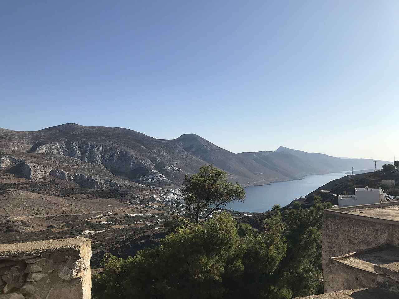
Amorgos is one of the finest hiking islands in the Cyclades, a long, mountainous ridge laced with old stone paths that climb between the sea and the sky. Its waymarked network of trails, the Blue Paths, follows the ancient kalderimia that once linked every village, crossing terraces. Ridges and cliffs high above an intensely blue Aegean and passing the emblematic Hozoviotissa Monastery on the way. Plan the whole trip with Greece Tours.
This guide covers hiking in Amorgos: the trail network and how it is marked, the classic long route between Chora and Aegiali. The easier walks, the mountain trails of the north, the difficulty and the seasons, what to take. The guided hikes on offer. Read it beside the wider Amorgos travel guide and the island’s things to do.
Why is Amorgos good for hiking?
Amorgos is a mountainous island threaded with old stone footpaths, the Blue Paths, that link its villages, monastery and coast.
Walking is one of the defining pleasures of Amorgos. The island is long and steep, its villages strung along a high ridge. For centuries the only way between them was on foot along the kalderimia, the stone-paved mule paths. Many of these have been cleared and waymarked as walking trails, giving the island a network far richer than most in the Cyclades.
The scenery is the great draw. The paths cross a rugged landscape of terraces, ravines and bare ridges, almost always in sight of the sea. With the deep blue of the Aegean falling away below and the white monastery of Hozoviotissa clinging to its cliff. The routes range from gentle valley strolls to demanding mountain crossings, so there is something for every level.
Amorgos offers a long walking season beyond high summer. For visitors the trail network is a chief reason to choose the island. Even a single half-day walk gives a sense of the wild. Dramatic Amorgos that the beaches alone cannot. The reward is out of all proportion to the effort, and the island has become a destination for walkers from across Europe drawn by its trails.
What is the Blue Paths trail network in Amorgos?
The Blue Paths are Amorgos’s signed network of around eight waymarked hiking routes, following the old stone kalderimia between the villages, ports, monastery and coast.
The island’s trails have been organised into a network of roughly eight numbered. Waymarked routes known as the Blue Paths, a name that captures the ever-present blue of the sea beneath them. They follow the historic kalderimia, cleared and signposted, and together they link Chora, the two ports of Katapola and Aegiali, the mountain villages and the Hozoviotissa Monastery.
Katapola makes a natural hub, as routes converge on the central port, while the northern bay of Aegiali is the base for the mountain trails around Langada and Tholaria. The waymarking, in the trademark colours, guides walkers along the paths, though on stretches the markers have faded. A trail map or a hiking app is a useful companion.
The network covers the full range of the island, from short, easy links to the long, demanding crossing between the ports. Choosing routes from the Blue Paths by length and difficulty. Combining them with the buses that link the trailheads. Lets walkers build days to suit their fitness and their time on Amorgos.
What is the Palia Strata, the main trail of Amorgos?
The Palia Strata, meaning the old route, is the classic long trail of Amorgos, the historic path between Chora and the northern bay of Aegiali.
The Palia Strata, the old route, is the great walk of Amorgos. The ancient path that was for centuries the only overland link between the capital Chora and the settlement of Aegiali in the north. It runs the length of the island’s high spine, a full-day hike of dramatic beauty and real effort that rewards walkers with the finest scenery on Amorgos.
From Chora the trail passes below the Hozoviotissa Monastery, then climbs and contours along the ridges high above the sea. Crossing terraces and passing the atmospheric ruined hamlet of Asfontylitis, long abandoned, before descending toward the green bay of Aegiali. The views over the Aegean are constant and spectacular, and the sense of walking an ancient road is powerful.
The full route is long and mountainous, best attempted by fit walkers with an early start. Water and sun protection. Many break it into sections using the villages and the bus. Whether walked whole or in part, the Palia Strata is the essential Amorgos hike and the reason walkers come to the island.
What is the Fotodotis route in Amorgos?
The Fotodotis route is an easy trail from Chora down to the port of Katapola, about 4.5 kilometres and an hour’s walk.
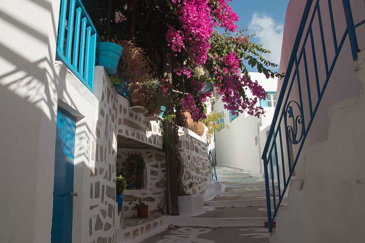
For an easier introduction to the island’s trails, the Fotodotis route links the capital Chora with the central port of Katapola. It is a gentle downhill walk of around 4.5 kilometres, taking about an hour. Following a cobbled path down the valley of the Kato Phylladi stream, one of the fast-flowing watercourses rare on a Cycladic island.
Along the way the path passes the small white church of Panagia Fidopotamiani and opens onto panoramic views over the bay of Katapola and the deep blue sea beyond. Shaded in places and easy underfoot, it is well suited to walkers wanting a taste of the Blue Paths without a demanding climb. It can be done in either direction.
The Fotodotis route is easy to fit into a day and to combine with the bus, walking down from Chora to Katapola and riding back, or the reverse. It is a fine first walk that shows the character of the island’s trails at a relaxed pace.
Can you hike from Chora to the Hozoviotissa Monastery and Agia Anna?
Yes. A short, popular walk drops from the edge of Chora to the Hozoviotissa Monastery in about twenty minutes, and continues down to Agia Anna beach below.
One of the most rewarding short walks on Amorgos links the island’s central icons. A signposted footpath leaves the edge of Chora and descends toward the coast. Reaching the white Hozoviotissa Monastery on its cliff in around twenty minutes, with the dramatic building drawing closer at every step.
From the monastery, the route continues down to Agia Anna, the pebbly cove of Big Blue fame, where a swim in the dazzling clear water is the natural reward. The classic view of the monastery, white on its cliff above the turquoise sea, opens up from the path and the beach below.
This walk packs the essence of Amorgos, its capital, its monastery and its most famous beach, into a short, manageable outing suitable for most walkers. It is the ideal first taste of the island’s trails and its scenery, described also in the guide to the Hozoviotissa Monastery.
What hikes start from Aegiali in the north?
From the northern bay of Aegiali, trails climb to the mountain villages of Langada and Tholaria on a scenic loop, and a demanding route ascends Mount Krikelos, the island’s highest peak, to the remote chapel of Stavros.
The green bay of Aegiali is the base for the island’s northern trails. A much-loved loop climbs from the port to the whitewashed mountain villages of Langada and Tholaria, set on terraced slopes with blue-domed churches. Linking them by old stone paths past chapels, springs and ruins, with sweeping views over the bay and a taverna stop along the way.
For stronger walkers, a demanding trail ascends Mount Krikelos, the highest peak on Amorgos. From Langada up to the lonely chapel of Stavros high on the ridge, counted among the most impressive and difficult paths on the island. The reward is a wild, high mountain landscape and immense views over the Aegean.
These northern hikes, gentler around the villages and tougher up Krikelos, make Aegiali a hiking base in its own right, distinct from the central routes around Chora and Katapola. Basing yourself in Aegiali puts the best of the mountain walking on your doorstep, as the wider Amorgos guide describes.
What villages and sights do the Amorgos trails pass?
The trails of Amorgos pass the Hozoviotissa Monastery, the ruined hamlet of Asfontylitis, the mountain villages of Langada and Tholaria, old chapels and springs, and the ancient city of Minoa above Katapola, weaving the island’s main sights into its walks.
Part of what makes hiking in Amorgos so rewarding is that the trails link the island’s sights rather than merely its scenery. The paths pass the emblematic Hozoviotissa Monastery on its cliff. Thread through the whitewashed mountain villages of Langada and Tholaria above Aegiali. Reach the atmospheric ruined hamlet of Asfontylitis, long abandoned on the old route to the north.
Along the way the routes pass small white chapels, old springs and watermills, terraced fields and the occasional ancient site. Including the acropolis of Minoa, one of the island’s three ancient cities, on a hilltop above the port of Katapola. Each is a natural pause, adding history and culture to the walk.
This weaving together of monastery, villages, chapels and ruins means a day on the trails is also a tour of the island’s heritage. Combining the walks with visits to the sights they pass, above all the Hozoviotissa Monastery, gives the fullest sense of Amorgos on foot. The trails turn a walk into a journey through the island’s past as much as its landscape.
How difficult are the hikes in Amorgos?
Amorgos has trails for every level, from easy hour-long links like the Fotodotis route to the demanding day-long Palia Strata and the tough climb of Mount Krikelos.
The island’s trails span a wide range of difficulty. At the easy end, short routes like the Fotodotis path from Chora to Katapola and the walk down to the monastery are manageable for most walkers in an hour or so, mostly downhill and well made. These are the routes for a gentle first taste of the Blue Paths.
The harder routes demand more. The full Palia Strata between Chora and Aegiali is a long, mountainous day. The ascent of Mount Krikelos from Langada is steep and strenuous. Both calling for fitness, an early start and proper preparation. The paths throughout are stony and often exposed, with steep climbs and descents on the old kalderimia.
Sturdy walking shoes or boots are essential on the rough stone paths, and walking poles help on the steeper descents. By matching the route to your fitness, using the buses to shorten the long trails and starting early to avoid the midday heat. Walkers of most abilities can enjoy the island’s hiking safely.
When is the best time to hike in Amorgos?
Spring, from April to May, and autumn, in September and October, are the best times to hike in Amorgos, when the island is green and cool and the wildflowers are out.
The finest hiking seasons on Amorgos are the shoulder months. Spring, from March to May, brings green hillsides, running streams and wildflowers, with comfortable temperatures ideal for the longer routes, while autumn, from September into October, offers warm but easing weather and the chance to combine walking with a swim in a still-warm sea.
High summer, in July and August, is hot and exposed on the largely shadeless trails. The strong meltemi wind adds to the challenge, so walking is best confined to the early morning and the cooler evening. Carrying plenty of water and sun protection is essential in these months, and the longer routes are better left for the shoulder seasons.
Winter sees the island at its greenest but with a chance of rain and rough seas that limit ferries, so visitors walk then. For most hikers, late spring and early autumn strike the best balance of green landscapes, cool air and settled weather, as the guide to the island explains.
What you take hiking in Amorgos?
For hiking in Amorgos, take sturdy walking shoes, plenty of water, sun protection and a hat, as the stony trails are exposed with little shade.
The island’s terrain calls for proper kit. Sturdy walking shoes or boots are the most important item, as the paths are stony, uneven and often steep, and walking poles ease the descents. Because shade is scarce on the open ridges, a hat, sunglasses, sunscreen and enough water for the whole route are essential, especially in the warmer months.
Navigation deserves care. The Blue Paths are waymarked, but on stretches the markers have faded or worn, so a paper trail map or a dedicated hiking app for Amorgos is a valuable backup, helping you stay on the old route where it is not obvious. Downloading maps in advance covers the patchy phone signal on the trails.
There are shops or tavernas along the longer routes, so carry snacks as well as water, and let someone know your plans on the remoter mountain paths. With sturdy shoes, sun protection, water and a map, walkers are well equipped to enjoy the island’s trails in comfort and safety. A light daypack keeps hands free on the rocky descents, and a swimsuit is worth packing, since routes end at a beach or a cove for a cooling swim.
Can you take a guided hike in Amorgos?
Yes. Guided hikes on Amorgos include a walk to the Hozoviotissa Monastery, the Aegiali Bay villages loop and the demanding ascent of Mount Krikelos.
For walkers who prefer company and local knowledge, guided hikes are available on the island. Popular options include a guided walk to the Hozoviotissa Monastery. A day exploring the mountain villages of the Aegiali bay on foot. The tougher guided ascent along the ridges of Mount Krikelos to the chapel of Stavros, each led by a local guide.
A guide adds the island’s history, botany and legends to the walk. Points out the faded turns where the waymarking is unclear. Brings the reassurance of experience on the steeper, remoter routes. The guided hikes run as small-group day trips and can be booked in advance, a good choice for those new to the island or to hill walking.
Whether guided or independent, the trails are the heart of a visit to Amorgos. Combining a guided route with self-led walks on the easier Blue Paths gives a full experience of the island’s landscape, and pairs naturally with its beaches, monastery and villages for a rounded stay, as the things to do guide sets out.
Frequently Asked Questions
Is Amorgos good for hiking?
Yes, Amorgos is regarded as one of the best hiking islands in the Cyclades. It has a waymarked network of around eight routes, the Blue Paths, following the old stone kalderimia that link its villages. Ports, monastery and coast, with dramatic scenery high above the Aegean at almost every turn. Trails range from easy hour-long walks to the demanding day-long Palia Strata and the climb of Mount Krikelos, and spring and autumn offer ideal cool, green walking conditions.
What is the best hike in Amorgos?
The classic and most beautiful hike in Amorgos is the Palia Strata, the old route between the capital Chora and the northern bay of Aegiali. Passing the Hozoviotissa Monastery and the ruined hamlet of Asfontylitis with constant views over the sea. For an easier walk, the short path from Chora down to the monastery and Agia Anna beach combines the island’s icons, while the Fotodotis route from Chora to Katapola is a gentle hour-long introduction to the trails.
How do you get around Amorgos to reach the trails?
A local bus links the ports of Katapola and Aegiali with Chora and the main trailheads times a day in summer. Which is enough to reach many of the Blue Paths and to walk the long routes one way, riding back. To reach the remoter trailheads freely, a hire car, scooter or quad, collected at Katapola or Aegiali. Is useful, as the island is large and mountainous with its paths spread across it.
Are the Amorgos trails well marked?
The Blue Paths of Amorgos are a signed, waymarked network of around eight routes following the old kalderimia, and the main trails are generally easy to follow. On stretches, however, the waymarking has faded or worn. A paper trail map or a dedicated hiking app for the island is a valuable backup to stay on the old route where it is not obvious. Especially on the longer and remoter mountain paths.