You can visit Greece by road from four neighbouring countries and by sea from Italy, and each way in starts in a different corner of the map. The wider choice of trips sits on the Greece Tours homepage.
This page lists the crossings, the gateway cities, the Ionian ports and the places that pair with a trip when you visit Greece.
What does it take to visit Greece from its four land neighbours?
Greece shares land borders with Albania, North Macedonia, Bulgaria and Turkey, 1,110 kilometres in total. Each neighbour offers its own road approach. The named crossing points tell you where a route enters the Greek mainland.
Greece sits mostly on the Balkan Peninsula of Southeastern Europe. It is bordered to the north by Albania, North Macedonia and Bulgaria, and to the east by Turkey. That gives four neighbours to anyone who plans to visit Greece overland.
The land boundary with Albania measures 212 kilometres. The one with North Macedonia measures 234 kilometres, and the one with Turkey measures 192 kilometres. Bulgaria shares the longest line, at 472 kilometres. The four figures add up to 1,110 kilometres.
Those lengths measure the frontier, not the driving distance between towns. A route depends on the crossing you pick and the places on either side. Crossing names pair a place on each side, such as Kakavijë with Ktismata or Evzonoi with Bogorodica.
Treat the border towns as route anchors. Decide which stretch of frontier you will cross, then plan the Greek stay around the nearest town. The next section names the crossings from Albania and North Macedonia. With a real checkpoint on the map, you can visit Greece overland with a clear plan.
Once you arrive, browse the tours in Greece for guided days on the mainland and the islands.
Which road crossings let you visit Greece by car from Albania and North Macedonia?
Greece has road crossings with Albania at Kakavijë–Ktismata, Kapshticë–Krystallopigi and Tre Urat–Melissopetra. North Macedonia has open crossings at Evzonoi–Bogorodica, Niki–Medžitlija and Doirani–Star Dojran. The Laimos–Markova Noga pair is listed as closed.
Kakavijë is the main road crossing between southern Albania and northwestern Greece. The Greek village beside it is Ktismata, in Delvinaki municipality, Ioannina regional unit. The Albanian side lies in Gjirokastër County. Albania’s own list marks Kakavijë as its main crossing with Greece.
The road from Sarandë and Gjirokastër to Ioannina runs through Kakavijë. On the Greek side, the EO22 road, part of European route E853, links Kakavia with the EO20 at Kalpaki. This is the line to follow when you visit Greece by car from southern Albania.
Kapshticë faces Krystallopigi, a village in Prespes municipality, Florina regional unit. Kapshticë lies 9 kilometres east of Bilisht. The Albanian list calls this pair an important border crossing. Krystallopigi itself holds a major road crossing into Albania.
Tre Urat, also called Three Bridges, lies in the Përmet area of southeastern Albania. Its Greek partner is Melissopetra, in the Konitsa area, another way to visit Greece from Albania. The same list pairs Qafë Botë with Sagiada, in Filiates. Sopik–Drymades and Rips–Ampelonas are pedestrian only and not frequently used.
Evzonoi is a town in Kilkis regional unit, Central Macedonia, and holds the main crossing with North Macedonia. Across the border lies Bogorodica, in Gevgelija municipality. The A1 motorway from Athens, part of European route E75, ends at Evzonoi. Drivers who visit Greece by car on this route meet the motorway right at the border.
At nearby Idomeni, a railway line makes a separate border crossing. Evzonoi–Bogorodica is listed as open. The border table names a Greek checkpoint, a municipality and a road for every pair.
Niki is a village in Florina regional unit, north of Florina, at the Medžitlija–Níki crossing. Its name means victory in Greek. The main road through Niki links the crossing with Kozani and forms part of route E65. Medžitlija lies in Bitola municipality, and the crossing is listed as open.
Doirani sits in Kilkis, opposite Star Dojran in Dojran municipality. This crossing runs on a local road and is listed as open. Together with Niki and Evzonoi, it makes up the three functioning crossings between the two countries. A fourth is in planning.
Two pairs on the same border are closed. Laimos–Markova Noga, in Prespes municipality, has an opening scheduled. Agia Paraskevi–Dragoš lies in Florina regional unit. Markova Noga is a locality near Dolno Dupeni, the southernmost point of North Macedonia. It does not pair with Niki.
Before you visit Greece by car, separate a named crossing from an open one. Then check the status of your pair before you leave. Albania lists three road pairs here, and North Macedonia has three open ones.
Which road and rail crossings let you visit Greece from Bulgaria and Turkey?
Greece has land gates on both borders. Promachonas faces Kulata, Ormenio lies south of Svilengrad, Kipoi faces Ipsala, and Kastanies leads to Karaagac. These crossings give you a road or rail route to visit Greece from the north and the northeast.
Promachonas is a village in the Serres regional unit of Macedonia. A major border crossing with Bulgaria is located there. The Bulgarian side is Kulata. The European route E79 and the railway from Sofia to Thessaloniki pass through Kulata. Together they give a direct way to visit Greece from Bulgaria.
Ormenio is the northernmost place in all of Greece. It lies near the right bank of the Evros river, which forms the border with Bulgaria here. The Bulgarian town of Svilengrad sits at the tripoint of Bulgaria, Turkey and Greece, with Ormenio to its south.
Zlatograd is a town in southern Bulgaria, and its name means gold town. The Greek border is 5 kilometres from the town. A cross-border road links Zlatograd with Thermes in Greece. It opened as a new gate for anyone who plans to visit Greece from Bulgaria.
Kipoi is a village in the Evros regional unit in northeastern Greece, on the right bank of the Evros river. A major motorway border crossing with Turkey is located here. The Turkish town opposite is Ipsala, one of the main border checkpoints between the two countries. It is the way to visit Greece by road from this part of Turkey.
Kastanies is a town in the north of Evros, at the border with Turkey. A smaller road connects the E85 with Edirne by way of the Karaagac crossing, and it passes through Kastanies. Turkish border guards do not permit a crossing into Greece on foot at this gate.
Nea Vyssa is a village in the northeastern part of Evros, near the Turkish border and the river. It lies about halfway between Orestiada and Edirne. Kastanies has a station on the railway between Alexandroupoli and Svilengrad. Read about scenic train rides in Greece before you pick a rail route.
Kastanies is also the last village on the Sultans Trail hiking path inside Greece. One section of that path comes from Svilengrad by way of Ormenio. Walkers can use it to visit Greece slowly, one village at a time.
Which border cities act as gateways when you visit Greece?
Seven northern cities act as gateways: Ioannina, Florina, Kilkis, Serres, Orestiada, Alexandroupoli and Kastoria. Each one is a place to rest, eat and plan the next leg after you arrive by land or sea.
Ioannina serves as the main city of Epirus in northwestern Greece, and it leads the Ioannina regional unit. It lies about 500 metres above sea level on the western shore of Lake Pamvotis. The port of Igoumenitsa is 80 kilometres to the west.
Florina is a town in Western Macedonia and the capital of the Florina regional unit. It sits in a wooded valley about 13 kilometres south of the border with North Macedonia. This is the closest city for anyone who plans to visit Greece from that side.
Kilkis is a city in Central Macedonia and the capital of the Kilkis regional unit. The area was a war theatre in the Balkan Wars, World War I and World War II. A stop here fits a plan to visit Greece through the north.
Serres heads the Serres regional unit and comes second to Thessaloniki by size in Central Macedonia. It lies in a fertile plain 69 kilometres north-east of Thessaloniki. Promachonas belongs to the same regional unit. A traveller who wants to visit Greece through that crossing reaches Serres first.
Orestiada holds three records on the Greek map: it lies furthest north, furthest northeast and is the youngest city. Refugees from Edirne settled it when Greece and Turkey exchanged their populations. Within the Evros regional unit only Alexandroupoli is bigger.
Alexandroupoli works as a harbour town and administrative centre for the Evros unit, in the Thrace part of Greece. It is the largest city in Eastern Macedonia and Thrace. The city sits at the centre of land and sea routes connecting Greece with Turkey. Use it as the base when you visit Greece from the east.
Kastoria is a city in Western Macedonia and the capital of the Kastoria regional unit. Kastoria occupies a headland that reaches into the lake from the west, inside a valley with limestone mountains around it. Byzantine churches, the lake itself and a fur trade define the reputation of the city.
Which sea routes let you visit Greece from Italy?
Ferry routes cross the Adriatic and Ionian seas from Brindisi and Ancona in Italy to Igoumenitsa and Patras in Greece. Bari and Venice also send ships towards Greece, so four Italian ports serve the crossing.
The sea is the oldest way to visit Greece from Italy. The Ionian Sea opens off the Mediterranean and meets the Adriatic Sea to the north. Two Greek ports face two Italian ports across that water. Igoumenitsa and Patras lie on one side, Brindisi and Ancona on the other.
Brindisi is a seaport on the Adriatic Sea in the region of Apulia. Its tourist traffic connects with the Balkan Peninsula, Greece and Turkey. The port names Igoumenitsa in Greece among its passenger destinations.
Ancona is a city and seaport in the Marche region of central Italy, 280 kilometres northeast of Rome. It stands on the Adriatic coast between the slopes of Monte Conero. The Adriatic Sea article names Ancona as the largest Italian passenger seaport on that sea.
Bari is a port and university city, and the capital of Apulia. Wikipedia calls its port Europe’s door to the Balkan Peninsula and the Middle East. Venice has a port that serves northeastern Italy. It has been a major hub for cruise ships.
The Igoumenitsa article lists Ancona, Bari and Venice as the Italian ports that ships reach from the Greek side. So a traveller who plans to visit Greece by water has Brindisi plus those three to choose from.
A crossing is a way to arrive without a flight. Once you land, the guide on how to travel between Greek islands covers the next leg.
Which Ionian ports open the way to visit Greece by ferry?
Igoumenitsa and Patras are the two mainland gateways on the Ionian Sea. Corfu Town, Kefalonia and Zakynthos are the island gateways. Igoumenitsa ranks among the biggest Greek passenger ports, according to Wikipedia, while Patras is the hub of trade with Italy.
Wikipedia names Igoumenitsa as the main port for Epirus and Thesprotia, with links to the Ionian Islands and Italy. The town is built at the easternmost end of the Gulf of Igoumenitsa. Passenger and car ferries sail from there to Corfu.
Only two Greek cities are bigger than Patras. It lies 215 kilometres west of Athens and serves as the seat of Western Greece. Wikipedia dubs it Greece’s Gate to the West. Anyone who chooses to visit Greece through Patras lands in the northern Peloponnese.
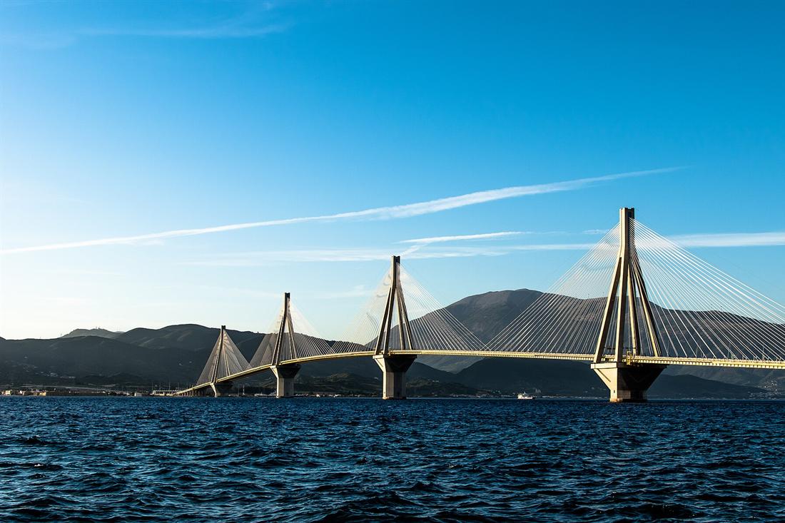
The Rio-Antirrio Bridge links the Peloponnese peninsula with mainland Greece at the edge of the city. Every February, Patras hosts one of the largest carnivals in Europe.
Corfu is the northernmost island on the west coast of Greece. Corfu and the Diapontian Islands mark the border between the Ionian Sea and the Adriatic Sea. Both are part of the same Greek island group.
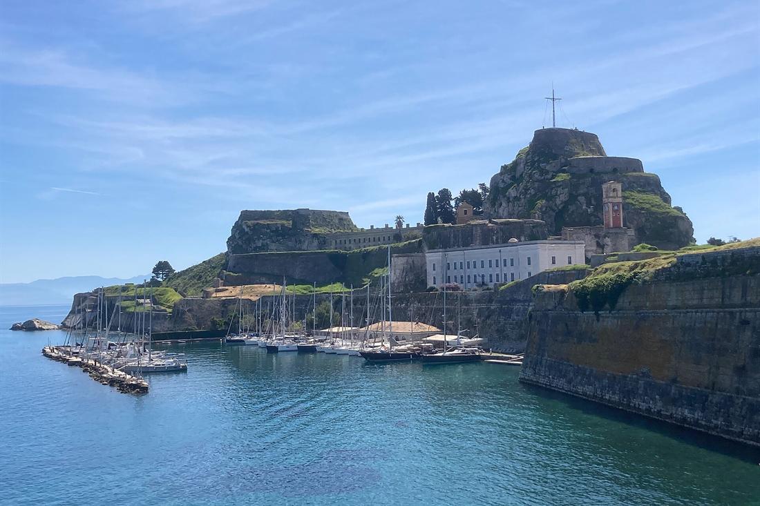
The capital, Corfu Town, is enclosed by two castles. Wikipedia calls it the only city in Greece surrounded in that way. Its old town is a UNESCO World Heritage Site, with narrow lanes and clear Venetian influence. Corfu Town is the natural port to pick when you visit Greece from Italy.
Kefalonia is the largest of the Ionian Islands and the sixth-largest island in Greece. Its main towns are Argostoli and Lixouri. Melissani Lake and the Drogarati caves are natural features of the island.
Mount Ainos rises to 1,628 metres, and its top is a natural park. Wikipedia adds that Italians who visit Greece for a holiday choose Kefalonia, because of its proximity to Italy.
Zakynthos is the third-largest of the Ionian Islands. Its area is 405.55 square kilometres. Its main port lies in the capital and has a ferry link to Kyllini on the mainland. Kyllini is the place of arrival by sea from the mainland. A trip to visit Greece on Zakynthos starts there.
Laganas Bay on Zakynthos hosts the first national marine park of the country. It is also a prime nesting area for loggerhead turtles. Navagio is a cove on the northwest shore, reached by boat only.
Each gateway gives a different start when you visit Greece from the west. Igoumenitsa leads to Epirus, Patras to the Peloponnese, and the islands begin the trip on the sea itself.
Which Balkan neighbours pair with a trip when you visit Greece?
Albania, North Macedonia and Bulgaria each meet Greece in a different landscape. Albania offers an Ionian coast facing Corfu. North Macedonia shares the Prespa lakes. Bulgaria shares the Rhodope mountains and the Mesta-Nestos river.
Plan a Balkan pairing by geography, not by one shared route. When you visit Greece with a neighbour in mind, each country adds a coast, a lake or a mountain range. All three continue across the border.
Albania’s Ionian coast stretches from the southern half of the Karaburun Peninsula to the Lake of Butrint. It passes the city of Sarandë on the way. The Strait of Corfu separates this coast from Greece.
Corfu’s northeastern edge lies off the coast of Sarandë. The straits between them vary from 3 to 23 kilometres in width. A trip to visit Greece on Corfu therefore puts Albania in sight across the water.
To visit Greece and Albania together, start at Butrint. It is an archaeological site in southern Albania, 14 kilometres south of Sarandë and close to the Greek border. It sits on a hill above the Vivari Channel inside Butrint National Park. UNESCO lists it as a World Heritage Site.
The Lake of Butrint, formed in the Quaternary period, marks the southern end of the Albanian coast. A trip to visit Greece on Corfu can add this lake to the plan.
North Macedonia meets Greece at the Prespa lakes. A plan to visit Greece in the north has a ready pairing there. Lake Prespa lies on the tripoint of North Macedonia, Albania and Greece. It is a system of two lakes separated by an isthmus. Great Prespa Lake is divided among the three countries. Little Prespa Lake lies mostly within Greece.
Anyone who plans to visit Greece in the north reaches the highest tectonic lakes in the Balkans. They lie at 853 metres. Lake Ohrid is the next lake along. It straddles the mountainous border between southwestern North Macedonia and eastern Albania.
Lake Ohrid is one of Europe’s deepest and oldest lakes, with more than 200 endemic species. Lake Prespa drains into Lake Ohrid through karstic channels. The two lakes form one water system.
Bulgaria joins Greece through mountains and a river. The Rhodopes are the largest mountain range by area in Bulgaria. Over 83 percent of their area lies in the south of that country, and the remainder lies in Greece. Their highest peak, Golyam Perelik, stands at 2,191 metres.
The Mesta, called the Nestos in Greece, rises in the Rila Mountains of southwestern Bulgaria. Rila is the highest mountain range in Bulgaria and in the Balkan Peninsula. Its highest summit, Musala, reaches 2,925 metres.
Of the 230 kilometres of its course, 126 lie in Bulgaria. It reaches the Aegean Sea near the island of Thasos. A route to visit Greece from the north can follow the river. It runs from the Bulgarian mountains down to the Greek coast.
How do you add Turkey to a trip when you visit Greece?
Match each Greek island to the Turkish town that faces it. Lesbos pairs with Ayvalik, Chios with Çeşme, Samos with Kuşadası, Kos with Bodrum, and Rhodes with Marmaris. Each pair sits across a narrow stretch of sea.
Start from the island and read the pairs from north to south. Each match gives a Turkish coastal town. Anyone who plans to visit Greece can look across the water at the neighbouring shore.
Lesbos is a Greek island in the northeastern Aegean Sea. It faces the Turkish coast across the Gulf of Edremit from the north and east. At its narrowest point, the Mytilini Strait is about 5.5 kilometres wide.
Ayvalik is a seaside town on the northwestern Aegean coast of Turkey. The Ayvalik Islands surround it, and they face Lesbos. This is the northern pair.
Chios is the fifth largest Greek island and lies in the northern Aegean Sea. The Chios Strait separates it from the Anatolian mainland. Çeşme sits on the peninsula opposite Chios.
The two places traded with each other through the Middle Ages. Genoa held Chios then, and the Aydinid beylik controlled the mainland. Goods for western Europe and Asia passed through Çeşme and the island ports.
Samos is a Greek island in the eastern Aegean Sea, south of Chios and off the coast of western Turkey. The Mycale Strait, 1.6 kilometres wide, separates it from Anatolia. Kuşadası is a Turkish town on the Aegean coast, and Samos lies about 16 kilometres offshore from it. If you visit Greece on Samos, Turkey is in sight.
Kos belongs to the Dodecanese chain in the southeastern Aegean Sea, and its coastline is 112 kilometres long. Bodrum is a port town in Muğla Province, at the entrance to the Gulf of Gökova. Bodrum was once Halicarnassus, home to the Mausoleum, one of the Seven Wonders of the Ancient World.
Rhodes is the largest of the Dodecanese islands, and it lies 18 kilometres from the southern shore of Turkey. Marmaris is a port city and tourist resort on the Mediterranean coast, along the Turkish Riviera. Summer visitors to Marmaris can take day trips to the Greek islands of Symi and Rhodes.
A Turkish leg can end any trip when you visit Greece by island. For timing on the Turkish side, read about when to go to Ephesus.
Which Greek islands sit closest to Turkey and Albania when you visit Greece?
Kastellorizo lies closest to Turkey, roughly 2 km from the coast near the town of Kaş. Samos, Lesbos, Chios and Rhodes also face the Turkish shore. Corfu is the island that faces Albania, near the town of Sarandë.
Kastellorizo sits in the Levantine Sea. Rhodes is 125 km to the west, and Athens is about 570 km to the northwest. It lies almost halfway between Rhodes and the Turkish city of Antalya. A trip to visit Greece here ends close to Anatolia.
It measures 6 km by 3 km. A convention between Italy and Turkey fixed the sea border around it. The treaty gave Turkey every islet of the small archipelago except Ro and Strongyli.
Samos lies in the eastern Aegean Sea, off the coast of western Turkey. Travellers who visit Greece on Samos see Anatolia from the shore. Its mountains continue the Mycale range of the Anatolian mainland. The sea gap between the two shores carries the name of that range, the Mycale Strait.
Rhodes sits 363 km away from the Greek mainland, towards the east-southeast. Anyone who wants to visit Greece near Turkey finds the island close to it. The southern shore of Turkey is only 18 km away. Ancient Rhodes ruled a strip of the opposite coast, called the Rhodian Peraia, which ran from near Muğla to Kaunos.
Kos measures 42.1 km by 11.5 km and is the third largest island of the Dodecanese. A Turkish Muslim community lives there, estimated at 2,000 people. Platani, a village near Kos town, has a large Turkish population.
Lesbos covers 1,633 km². Across the water to the north and east lies the Gulf of Edremit. In the late Palaeolithic or Mesolithic age, the island was joined to the Anatolian mainland. That ended with the Last Glacial Period.
Chios is 50 km long from north to south and 29 km across at its widest. Anatolia lies on the far side of the Chios Strait. If you visit Greece through the eastern Aegean, Chios is the island north of Samos.
Corfu covers 592.9 km² in the northwestern corner of Greece. Straits between 3 and 23 km wide divide its north-east tip from the Albanian coast at Sarandë. The south-east side faces Thesprotia, which belongs to Greece.
Which cross-border parks and rivers lie on the line when you visit Greece?
The Evros river marks the Greek border with Turkey, and the Nestos river crosses from Bulgaria into Greece. Dadia Forest, Prespa Park and the Rhodope range complete the cross-border natural areas, each tied to one neighbouring country.
Evros is the Greek name of the Maritsa river, and a trip to visit Greece in Thrace follows it. The river rises in the Rila Mountains in Bulgaria. East of Svilengrad it forms the border between Bulgaria and Greece, and later between Turkey and Greece.
After the Turkish city of Edirne, the river turns south. It then forms the border between Greece on the west bank and Turkey on the east bank. This runs all the way to the Aegean Sea. The river enters the sea near Enez and forms a delta. Only 6.3% of the drainage area lies in Greece.
The Nestos is also called the Mesta. It forms the boundary between Greek Macedonia and Thrace, and between the Kavala and Xanthi regional units. Ptolemy described it as the border of ancient Macedonia and Thrace.
A traveller who wants to visit Greece beyond the islands finds the Nestos delta in the north. On the coastal plain of Chrysoupolis the river spreads into a delta system with freshwater lakes and ponds.
The Dadia Forest lies in the Evros regional unit, northeast of Alexandroupolis and close to the Turkish border. It is a woodland of oak and pine. It is the only forest in Europe where all four native vulture species live. The four are the black vulture, the bearded vulture, the Egyptian vulture and the griffon vulture.
The protected area covers 7,290 hectares and receives about 35,000 visitors each year. A wildfire near Alexandroupolis burned just over 50% of the forest. When you visit Greece for wildlife, this is the northeastern corner of the country.
Prespa Park joins North Macedonia, Albania and Greece around two lakes. Each country holds a national park there. These are Galičica in North Macedonia and a Prespa National Park in both Albania and Greece. The area was declared a Transnational Park.
For a long period the Greek side was an underpopulated, militarily sensitive area. Outsiders needed special permission to enter. Anyone who plans to visit Greece at Prespa finds the island of Agios Achillios. A fortress and a church from the 10th century stand there.
The Rhodopes cover 14,735 km² of Southeastern Europe. The myth tells of Rhodope, a queen of Thrace, whom Zeus and Hera turned into a mountain after she offended the gods. The southern and eastern slopes of the range reach the coastal plains of Greek Thrace.
The eastern end of the Rhodopes lies next to the Dadia Forest. A trip to visit Greece in the northeast links both areas. For a responsible approach to protected areas like these, see our guide to sustainable travel in Greece.
What do travellers ask before they visit Greece by land or sea?
Five questions come up before a trip to Greece. Which countries touch it? Which Greek towns lie near Albania? Which island sits beside Turkey? Which Italian ports have a sea link? Is Cyprus a neighbour? Each answer below rests on a geography page.
Which countries border Greece when you visit Greece overland?
Four countries share a land line with Greece. Albania, North Macedonia and Bulgaria lie to the north, and Turkey lies to the east. Bulgaria holds the longest line at 472 km, and Turkey the shortest at 192 km. Italy reaches Greece only across the sea.
The Albanian line runs 212 km and the North Macedonian line 234 km. Together the four lines form the whole land frontier. Anyone who arrives from another direction crosses water, because the Ionian Sea separates Greece from Italy.
Which Greek towns lie close to Albania on a trip to visit Greece?
Konitsa lies near the Albanian border, north of Ioannina. Krystallopigi sits close to the line as well, 50 km from Florina, beside a major road crossing. On the coast, the north-eastern edge of Corfu faces Sarandë across a strait.
The strait between Corfu and Albania varies in width from 3 to 23 km. The Albanian side of the Krystallopigi crossing is Kapshtica. Wikipedia names no single nearest Greek city. These are the places it sets beside the line.
Ioannina stands 80 km east of the port of Igoumenitsa. Igoumenitsa lies in the north-western corner of Greece and is twinned with Sarandë. A traveller who wants to visit Greece from the Albanian side therefore meets Epirus first.
Which Greek island sits right beside Turkey?
Kastellorizo lies about 2 km off the south coast of Turkey, near the Turkish town of Kaş. It belongs to the Dodecanese. Only the islet of Strongyli lies farther east among the Greek islands.
Kastellorizo is the largest island of an archipelago that shares its name. Anyone who plans to visit Greece through the Dodecanese finds it at the eastern edge of the country. The Aegean islands as a group lie between mainland Greece, Anatolia to the east and Crete to the south.
Which Italian ports link by sea when you visit Greece from Italy?
Patras connects to Ancona, Bari, Brindisi, Trieste and Venice. Igoumenitsa lists Ancona, Venice, Trieste, Bari, Brindisi and Ravenna. The Ionian Sea separates the two countries, so every one of these links is a crossing of that water.
Bari to Igoumenitsa is described as a popular ferry route to Greece. Ancona has regular ferry links to both Igoumenitsa and Patras. Brindisi has always stood at the centre of trade with Greece. In Roman times it was the chief point of embarkation for Greece and the East.
Patras is a port city on the Gulf of Patras, 215 km from Athens. Its port also has car-ferry links with Corfu and Kefalonia. A traveller who plans to visit Greece from Italy can pick the Peloponnese gate or the Epirus gate.
Does Greece border Cyprus?
No. Cyprus is an island country in the eastern Mediterranean, off the Levant coast. It joined the European Union. It lies 280 km from Kastellorizo and 400 km from Rhodes, so it is a separate stop.
Turkey lies 75 km north of Cyprus. Cyprus is the third-largest island in the Mediterranean, after Sicily and Sardinia. Greece and Cyprus meet only at sea. The Greek Exclusive Economic Zone is bordered by Cyprus and Turkey to the east. Plan to visit Greece and Cyprus as two separate stops.
How do you order a multi-country route when you visit Greece?
Run the trip from the Ionian side to the Aegean side, and you visit Greece in one direction. Italy meets Greece on the west coast at Patras and Igoumenitsa, and the Aegean opens east towards Turkey. Cyprus then ends the line, far beyond Kastellorizo.
The reasons come from the map. A plan to visit Greece this way has clear anchors. Igoumenitsa sits in the north-western corner, and Patras overlooks the Gulf of Patras. Corfu and the Diapontian Islands mark where the Ionian Sea gives way to the Adriatic. The Diapontian Islands lie about 40 km from the Italian coast.
A route that starts in Albania fits the same order. Corfu faces Sarandë, Konitsa and Krystallopigi sit by the western line, and Ioannina leads on to Igoumenitsa. From there the route turns east and south across the Greek mainland towards the Aegean.
The other order runs north to south. Bulgaria and North Macedonia hold the northern frontier, so a route that enters there crosses the mainland southward. It finishes at the sea, where Turkey waits to the east and Kastellorizo lies 2 km from its coast.
Each sea leg is its own crossing, so fix those first. Our Greek ferry booking tips explain how to find routes and seats. Read them before you visit Greece with more than one country on the map.