
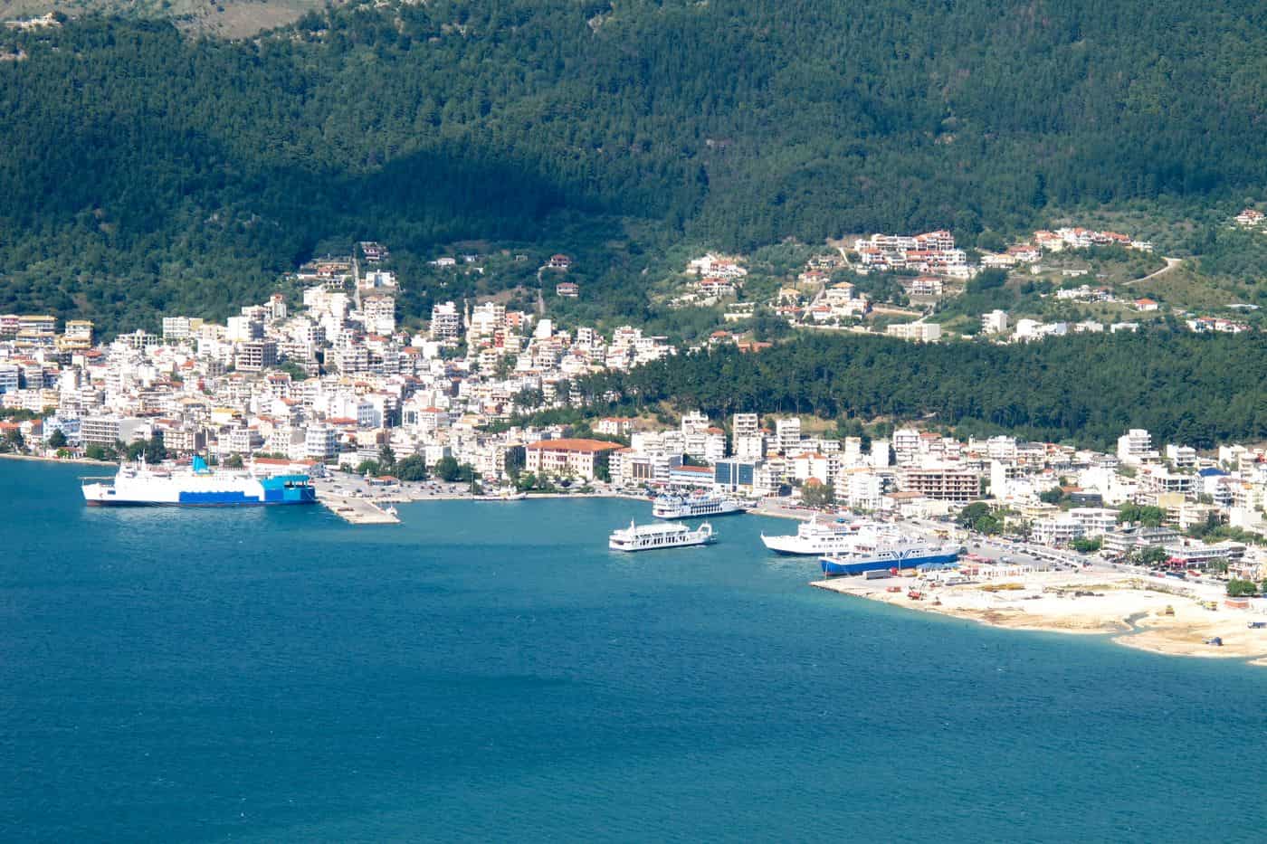
Igoumenitsa tours start in the port town that serves as the capital of Thesprotia in Epirus, where the ferries leave for Corfu, Paxos and Italy. The routes cover the waterfront, the Venetian castle site and the Archaeological Museum, the ancient sites of Thesprotia, the beaches and the Kalamas delta, the inland towns and the day trips into Epirus. Greece Tours lists the ferry trips, day tours and transfers that start in Igoumenitsa.
This page covers what Igoumenitsa tours see in the town and at the archaeological sites, the ferries, the coast from Sagiada to Syvota, Paramythia, Margariti, Filiates, Dodona and Souli, the day trips to Corfu, Parga, Ioannina, Zagori and Meteora, how visitors reach Igoumenitsa and which season suits each route. The tours below are checked on GetYourGuide and leave from Igoumenitsa, Corfu, Syvota, Parga and Ioannina.
What do Igoumenitsa tours cover?
Igoumenitsa tours cover the port town of Igoumenitsa, capital of the Thesprotia regional unit in the Epirus region of northwestern Greece, and the wider municipality around it. The 2021 census counted 10,315 residents in the town and 25,698 in the municipality.
The town sits at the eastern end of the Gulf of Igoumenitsa, on the Ionian Sea. Its streets climb the slopes of a forested mountain and wrap around the bay. Igoumenitsa tours begin on this shore, between the port and the green slopes.
The present municipality took shape in the 2011 local government reform, when five former municipalities merged: Igoumenitsa, Margariti, Parapotamos, Perdika and Syvota. Thesprotia holds three municipalities, Filiates, Igoumenitsa and Souli, and borders Albania to the north, Ioannina to the east and Preveza to the south. The regional unit takes its name from the Thesprotians, an ancient Greek tribe.
- Port: the chief port of Thesprotia and Epirus, linking mainland Greece with the Ionian Islands and Italy.
- Motorway: the 670 km A2, known as Egnatia Odos, crosses northern Greece and ends in the town.
- Municipal unit: 18,562 residents at the 2021 census on 111.752 km² of land.
- Cruise base: a growing cruise destination and a station for Igoumenitsa tours to the archaeological sites of Thesprotia.
What do Igoumenitsa tours see in the town?
Igoumenitsa tours in the town see the waterfront along the gulf, the site of the Venetian castle in the grove behind the Regional Unit building, and the Archaeological Museum of Igoumenitsa, which traces Thesprotia from ancient times to the Byzantine period.
Igoumenitsa tours start on the waterfront, which looks out to Agionisi, the islet in front of the port. Local tradition holds that Agionisi is the rock that Polyphemus threw at Odysseus. The Italians named it Scoglio della Madonna, the Rock of the Virgin.
The Archaeological Museum of Igoumenitsa was built in 1999 and opened in 2009 on the north side of town, next to the fire station. Five sections cover the historical background, settlements of historical times, public life, private life and burial customs. Middle Palaeolithic stone tools show the presence of prehistoric people in the area. Since 2010 the museum also holds the armour of a nobleman from a tomb at Prokopi, near Elea: a silver helmet, a bronze cuirass with gold buckles and a sword.
- Customs house: on the shore, the old customs house stands where a guard post once stood.
- Castle site: the Venetians built a castle in Byzantine style in the grove behind today’s Regional Unit building, with about 20 houses inside.
- Castle end: in 1685 the Venetian Morosini blew the castle up and moved its 12 cannons to Corfu.
- Site network: the museum is the centre and starting point of a network of visitable archaeological sites, and Igoumenitsa tours use it as the first stop.
Which ferries do Igoumenitsa tours use?
Igoumenitsa tours use the domestic ferry lines to Corfu, Lefkimmi and Paxoi, and the international lines across the Adriatic Sea to Ancona, Venice, Trieste, Bari and Brindisi. The New Port ranks as the second busiest passenger port in Greece, after Piraeus.
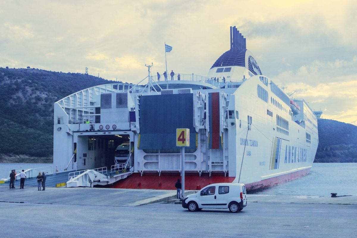
The town has two harbours, the Old Port and the New Port. The Igoumenitsa Port Authority has its base at Terminal Station T3 in the New Port, and its website carries the ferry timetable for domestic and international departures.
Igoumenitsa tours that arrive from Italy share the port with freight traffic. Ships of Hellenic Mediterranean Lines on the Patras to Brindisi route call here, and Superfast Ferries and ANEK Lines sail on to Ancona, Bari and Venice. On the Greece–Italy lines in 2023, Igoumenitsa handled 72.3% of passengers, 72.9% of cars and 72.5% of trucks.
- Corfu: the line opened on 6 June 1955, and its first vessel was the open-deck ferry Serifos.
- Italy: the deepening of the channel in 1960 created the sea link; Ravenna joins on an occasional basis.
- Cruise ships: the second construction phase of the New Port allowed it to serve large cruise ships.
- Marinas: the Port Authority also runs tourist shelters for boats at Plataria, Syvota and Sagiada.
Igoumenitsa tours that continue to Paxoi and Antipaxoi take the island line from the same port; the crossing is set out on the page on how to get to Paxos.
What history do Igoumenitsa tours tell?
Igoumenitsa tours tell the story of a place first recorded in the Middle Ages, known in Ottoman times as Grava or Reşadiye, joined to Greece in 1913 during the Balkan Wars, destroyed in the Second World War and rebuilt around its ferry terminal.
Igoumenitsa tours start with the name. A golden bull of Simeon Uroš mentions the place in 1361, and a 15th-century Greek portolan chart records it as Igoumenitza. One reading links the name to the Greek word igoumeni, a commander or abbot; another traces it to an Old Slavic word for a threshing floor. The Italian form is Gomenizza and the Albanian form is Gumenicë.
In 1909 the Ottomans renamed the town Reşadiye in honour of Sultan Mehmet V. Hamit Bey of Graikochori planned a port town on the site and put up a long building shaped like the Greek letter Gamma, running from today’s 8 Dekemvriou Street to Kyprou Street. After 1913 the name Grava stayed in use, and the 1920 census counted 649 residents in three settlements: Igoumenitsa, Grava and Limani. In 1938 the town became capital of the Thesprotia prefecture and took the name Igoumenitsa.
The Italian army burned Igoumenitsa in November 1940, and the town was destroyed again in 1944 under the Axis occupation. After the war it was rebuilt to a new plan, and a new settlement grew around the ferry terminal in the 1950s and 1960s. Igoumenitsa tours therefore walk through a relatively new town with a long past.
- Roman port: excavations show that the Romans used the site of today’s Courthouse as a harbour.
- Roman cemetery: the necropolis of the Roman settlement lay on the site of the Municipal Stadium.
- Ladochori: a Roman villa, farm buildings, baths and burial chambers northeast of the village show the wealth of the area’s residents.
- Limani: the old harbour hamlet, also called Goumenitsa, once had 15 residents, a small coffee house and a customs house named Dogana.
Which archaeological sites do Igoumenitsa tours visit in Thesprotia?
Igoumenitsa tours visit four walled cities of ancient Thesprotia: Gitana on the Kalamas river, Dymokastro on a hill by Karavostasi bay at Perdika, Elea near Chrysavgi and Doliani beside the Kalamas. Their main walls date to the late 4th century BC.
Gitana was founded around 336–330 BC and replaced Elea as the seat of the Koinon, or league, of the Thesprotians. Livy records that in 172 BC two Roman envoys, Marcius and Atilius, came to Gitana and asked the Epirote League to side with Rome; the Romans destroyed the city in 167 BC. The site lies near the Kalamas dam, and its theatre faces the river with 28 rows of seats. The excavated seats carry carved names, such as Menedamos and Pausanias. On Igoumenitsa tours, a full visit of Gitana takes at least two hours of walking.
Dymokastro is identified with ancient Elina. It overlooks the site of the Battle of Syvota, fought between Corcyra and Corinth at the start of the Peloponnesian War. At its peak the town held an estimated 6,000 people, and a Hellenistic west wall brought its small harbour inside the defences. The view from the top takes in southern Corfu, Paxoi, Antipaxoi and Lefkada.
Elea, founded around 350 BC, served as capital of Thesprotia before Gitana. Its walls are more than 3.5 m thick and still stand up to 7 m high, and inside lie houses, public buildings, stoas, an agora and a theatre. Doliani, ancient Phanote, rises on an 85 m hill between the villages of Agios Georgios and Geroplatanos, 16 km from Igoumenitsa. In 167 BC it surrendered to the Roman general Lucius Anicius Gallus.
- Gitana: the acropolis, the agora, the theatre, houses and 2.5 km of polygonal walls survive.
- Dymokastro: rectangular towers reinforce walls of the 4th century BC.
- Elea: coins inscribed ΕΛΕΑΤΑΝ date to about 360–335 BC.
- Doliani: a double ring of walls, a square Roman tower on the acropolis and remains from early antiquity to the post-Byzantine period.
The finds from Elea and Dymokastro sit in the Igoumenitsa museum, so Igoumenitsa tours link the town and the sites in one story.
Which beaches do Igoumenitsa tours reach?
Igoumenitsa tours reach Drepano and Makrygiali, Blue Flag sands on the north-west edge of the Gulf of Igoumenitsa, 5 km from the town. Plataria, to the south, adds an organised sandy beach, and Kalami offers pebbles beside a campsite.
Along 104 km of coastline, the municipality of Igoumenitsa counts 43 beaches. Its list runs from busy beaches to small, isolated ones that only boats reach, and it marks four with the Blue Flag: Drepano, Karavostasi, Mega Ammos and Agia Paraskevi. Igoumenitsa tours begin at Drepano, a cape and beach of Igoumenitsa itself.
The beach of Drepano and Makrygiali runs for 4 km. Families on Igoumenitsa tours prefer it for its clean, shallow water, and the municipality presents it as a quick escape to a quiet setting, organised with restaurants and sea sports. Sunbeds, showers, changing rooms and access for disabled visitors complete the facilities.
- Plataria: a sandy beach at the fishing village, with sunbeds, showers, changing rooms, a snack bar and a bar.
- Kalami: a pebble beach with a campsite, showers, changing rooms, a snack bar and a bar.
- Nautilos and Sofas: two more pebble beaches with campsites, showers and changing rooms.
- Karavostasi: a sandy Blue Flag beach on the coast of Perdika, 39 km south of Igoumenitsa, with sunbeds and sea activities.
Perdika, the village that Karavostasi belongs to, counts 10 beaches, Arillas, Sofas and Kamini among them, for Igoumenitsa tours further south.
What do Igoumenitsa tours see at the Kalamas delta?
Igoumenitsa tours see the Kalamas delta, one of the main wetlands of Western Greece and of Europe, close to the Albanian border. Its 8,531 protected hectares cover the old and new river mouths, the lagoons of Richo, Vatatsa, Loutsa Papadia and Vontas, and their marshes.
The Kalamas, the ancient Thyamis, is the longest river of Epirus at 115 km and the seventh longest in Greece. It drains 1,800 square kilometres, and Pausanias named it as the boundary between Thesprotis and Kestrine. Igoumenitsa tours meet the river where it enters the Ionian Sea, near the village of Kestrini, between Igoumenitsa and Sagiada.
The flat delta land lies between 0 and 12 metres above sea level. Hills rise out of it like islands, chiefly Mavro Oros, the mountain of Kestrini, at 509 metres, and Mastilitsa, where ruins of a Hellenistic settlement lie south of Asprokklisi. The municipality singles out the sunset over the delta, a closing stop for Igoumenitsa tours.
Greek law protects the delta under Law 1650/86, and the Natura 2000 network lists it twice: as Site of Community Importance GR2120001 and as Special Protection Area for birds GR2120005. The delta forms part of the western migration route of birds, and migrating birds stop in its waters to feed and rest. Igoumenitsa tours in the delta look for these species and places:
- Eastern imperial eagle: individual eagles spend the winter in large Greek wetlands, the Kalamas delta among them.
- Slender-billed curlew: an extinct species of the sandpiper family, common in Greece in the 19th century and regular at the delta until the 1980s.
- Kestrini: the village at the foot of Mavro Oros, at 79 metres, grows mandarins and kiwis for export and went by the name Skoupitsa until 1957.
- Mavro Oros: villagers say the icon of Saint Donatos was found on the hill, where a rock bears the print of his palm beside the Mavromantila cave.
Igoumenitsa tours combine the delta with Sagiada, 4 km north of the river mouth.
What do Igoumenitsa tours see at Plataria and Syvota?
Igoumenitsa tours see Plataria, a fishing village 10 minutes south of Igoumenitsa at the head of its own bay, between the capes of Agionisi and Eremonisi. Syvota follows 20 minutes from Igoumenitsa by road, with green islets that shelter its bay.
Plataria lies between the ports of Igoumenitsa and Syvota, and its bay stretches from close to the start of the Egnatia Odos to close to Syvota. The village had 128 residents in 1928 and 961 at the 2011 census. It is the seat of the Syvota municipal unit.
Two stories explain the name of Plataria. One links it to the plain, a wide place in Greek; the other to a large old plane tree, of which a small part survives. The village church honours the Taxiarchs, and the Cultural Union of Plataria runs a folklore museum and a lending library. Igoumenitsa tours in the village stop at three points:
- Seafront: the municipality sends visitors to Plataria for fresh fish by the sea and a quiet swim at the beach.
- Agia Paraskevi: a small chapel with a view over the bay of Plataria.
- Folklore Museum: founded in 2007, it fills two rooms of the old primary school with local tradition from the pre-industrial period and the 20th century.
Igoumenitsa tours reach Syvota beyond Plataria on the same road. The municipality calls Syvota the Caribbean of Greece, and its islets, beaches and boat trips are set out on the Syvota tours page.
What do Igoumenitsa tours see at Sagiada and the northern coast?
Igoumenitsa tours see Sagiada, a coastal fishing village about 20 km north-west of Igoumenitsa, opposite Corfu. Skala Sagiadas there is the westernmost settlement of mainland Greece, and the Albanian border reaches the mainland in the former municipality of Sagiada.
Sagiada belongs to the municipality of Filiates and had 515 residents at the 2021 census. It lies 4 km south of the Albanian town of Konispol, and the Kalamas meets the sea 4 km south of the village.
In the 14th century, local lords and the Angevins of Corfu fought over the fort of Sagiada and its salt mines. In 1387 the fort passed to Esau de’ Buondelmonti of the Despotate of Epirus, who refortified a ruined tower and built salt pans nearby, and the Venetian Republic took control in 1418. As the port of Filiates, Sagiada hosted consuls of England, Holland and Venice from 1675 to 1706.
In August 1943, German units and collaborators burnt the town to the ground. Survivors built a new village by the coast after the war, and the old town is now a protected area. Igoumenitsa tours climb to Old Sagiada on the mountainside for views over the Ionian Sea, then cover the rest of the north:
- Ftelia Bay: the westernmost point of mainland Greece, on the coast of Thesprotia.
- Fish tavernas: the municipality ends its tour of Thesprotia at Sagiada, with fresh fish in the tavernas of the area.
- Asprokklisi: the seat of the former municipality of Sagiada, north of the Kalamas in the Sagiada valley, where farmers grow mandarins and oranges.
- Ragi: a village 13 km north of Igoumenitsa, with the historic Ragi Monastery of the Dormition of the Virgin nearby.
Which outdoor Igoumenitsa tours go to sea or on foot?
Igoumenitsa tours at sea start from boat shelters at Plataria, Syvota and Sagiada, from the small harbour of Arillas and from beaches with sea sports, such as Drepano. On foot, they follow hiking paths, among them a 2 km woodland path near Perdika.
The Igoumenitsa Port Authority plans a network of marinas and tourist shelters for boats. Shelters already operate at Syvota, Plataria and Sagiada. The authority presents the Plataria shelter as a base for Greek food and excursions to nearby places, and the Sagiada shelter, opposite Corfu, for short stays and fishing as a hobby.
Igoumenitsa also has a Municipal Sailing Club. Igoumenitsa tours on the southern coast reach Arillas, 35 km south of Igoumenitsa by road. A downhill route of 2.5 km among olive trees leads from the village to its amphitheatre-shaped beach and a small harbour for boats and excursion boats, the port of Perdika.
On land, the municipality invites visitors to hike its unexplored paths. The town itself offers walks, jogging on the beach or the mountain, and hiking. Igoumenitsa tours on foot and on the water add four options:
- Agios Athanasios path: a walk of 2 km through woodland beside a river that flows out at Karavostasi, near the monastery of Agios Athanasios, 4 km from Perdika.
- Kayaks and motorboats: the municipality recommends organised day trips by kayak and the hire of small motorboats at Syvota.
- Sea activities: besides Drepano, the municipal beach list marks Karavostasi, Bouka, Mikri Ammos and Bella Vraka for sea activities.
- Sea cave: the same list names a pebble beach with a cave, Mati Kyklopa, the Eye of the Cyclops.
What do Igoumenitsa tours see in Paramythia?
Igoumenitsa tours reach Paramythia, the seat of the Souli municipality, built on the slopes of Mount Gorilla above one of the largest valleys in Thesprotia. The town keeps a Byzantine castle on a hill, Byzantine baths and the church of Panagia Paramythia.
Igoumenitsa tours follow the A2 motorway, the Egnatia Odos, which links Igoumenitsa with Ioannina and runs through the valley north of the town. The Kokytos, a river of the underworld in Greek mythology, flows at the town limits.
The name comes from the Virgin Mary, since Paramythia means comforter in Greek. Through the Byzantine and much of the Ottoman era, the town was called Agios Donatos after its patron saint, and 17th-century Ottoman records list it as Aydonat. The Ottomans took the town in 1449. In 1831 the troops of Emin Pasha of Ioannina besieged its castle for two months. Igoumenitsa tours of the town cover these sights:
- Castle of Paramythia: built in the Byzantine period on one of the highest points of the town and open to visitors today.
- Panagia Paramythia: the Byzantine church of the Dormition of the Virgin, which gave the town its name and survives in excellent condition in the centre.
- Agios Donatos: the metropolitan church of the patron saint, honoured with events on 30 April.
- Voulgaris shop: the jewellery store of Sotirios Voulgaris, founder of the Bulgari company, still stands in the town.
Albanian farmworkers found nineteen bronze statuettes near Paramythia in the 1790s. The hoard went to the collection of Catherine the Great in St Petersburg, and fourteen pieces later reached the British Museum.
What do Igoumenitsa tours see in Margariti?
Igoumenitsa tours reach Margariti, a village 25 km from Igoumenitsa between Paramythia, Parga and the Acheron river. Its sights are the ruined Ottoman castle on a hill at the south edge of the village, a minaret at Katavothra, old mansions and chapels.
The Ottomans began the castle in 1549 on the ruins of an ancient fort, at a site where a Byzantine fortress once stood. In November 1571, after the Battle of Lepanto, 6,000 Venetians and Corfiots under Sebastiano Venier took the fort after a four-day siege and burnt it. Venice commissioned a painting of the event for the Doge’s Palace.
After the peace of 1573, Cham Albanians returned and rebuilt the castle. The Ottoman traveller Evliya Çelebi passed through in 1670. He counted 200 houses inside the citadel and 1,200 in the town around it. The town had two Friday mosques with stone minarets, a hamam and two caravanserais. In 1818, under Ali Pasha, the castle was repaired and served as a base against Parga. Igoumenitsa tours find only its ruins today.
Almost all Cham Albanian monuments of Margariti were destroyed during World War II. Ruined minarets, houses and mosques still stand in the village and the villages around it, and no restoration has reached them. Igoumenitsa tours stop at these points in Margariti:
- Castle hill: the ruins of the Ottoman fort on the southern edge of the village.
- Koutsouro prisons: the castle jail, known for the harsh living conditions of its prisoners.
- Katavothra minaret: a minaret in Katavothra, one of the communities of the Margariti unit.
- Agios Vasileios: the parish church of the village.
What do Igoumenitsa tours see in Filiates and the Thyamis valley?
Igoumenitsa tours reach Filiates, a town about 17 km northeast of Igoumenitsa on a low plateau among olive groves, and the valley of the Thyamis, the longest river in Epirus, with the Giromeri monastery, riverside villages and a delta north of Igoumenitsa.
Filiates is the seat of a municipality in the northernmost part of Thesprotia, on the border with southern Albania. The Mourgana mountains rise to the north. In antiquity the area was called Kestrine, and the Thyamis separated it from Thesprotia. In 1814 the French traveller François Pouqueville counted about 420 houses, three mosques, public baths and large cisterns for rainwater.
Igoumenitsa tours continue 4 km to Giromeri, a traditional village of stone houses and paved, stepped lanes at the foot of Farmakovouni. The hermit Osios Neilos founded the Giromeri monastery next to it between 1311 and 1313, in the years of the Despotate of Epirus.
The Thyamis, also called Kalamas, runs 115 km from its source near Kalpaki in the Ioannina unit to the Ionian Sea. It turns west near Kyparisso in Thesprotia, where its hydroelectric dam stands. Igoumenitsa tours in this area stop at these points:
- Giromeri katholikon: a domed cross-in-square church on four columns, with an 18th-century carved iconostasis and the original 14th-century icon of the Virgin.
- Monastery relics: chalices, reliquaries and manuscripts, among them a 16th-century codex with the service of Osios Neilos.
- River villages: Raveni, Pente Ekklisies, Kyparisso and Parapotamos stand along its course.
- Thyamis delta: the river meets the Ionian Sea near Kestrini, between Igoumenitsa and Sagiada, and migrating birds stop in its waters to feed and rest.
What do Igoumenitsa tours see at ancient Dodona?
Igoumenitsa tours visit Dodona, the oldest Hellenic oracle and a sanctuary of Zeus 22 km south of Ioannina, with a theatre from the reign of King Pyrrhus that held 18,000 to 20,000 spectators. The Egnatia Odos cuts the Igoumenitsa–Ioannina drive to 40 minutes.
Homer gives the earliest account of Dodona as an oracle of Zeus, and in the Iliad Achilles prays to the Zeus of Dodona. The sanctuary ranked second only to Delphi in prestige. Priests and priestesses interpreted the rustling of the leaves of a sacred oak. Over 4,200 oracular tablets, all written in Greek, have come to light at the site.
The site lies in a closed valley at the foot of Mount Tomaros, at 600 m, about 2 km from the village of Dodona. Around 290 BC King Pyrrhus made Dodona the religious capital of his realm. In 391–392 AD Emperor Theodosius closed the pagan temples and cut down the sacred oak. Igoumenitsa tours walk past these remains:
- Theatre: the largest of its time, turned into an arena for fights with wild beasts under Augustus, when the wall before the front rows went up.
- Bouleuterion: the meeting hall of the delegates of the Epirote tribes, with a Doric stoa on its front.
- Sacred House: the Temple of Zeus beside the sacred oak, with porticoes on every side except the side of the tree.
- Temple of Dione: a square temple north of the Sacred House, with four Ionic columns on its porch.
Igoumenitsa tours that go on to Ioannina reach its Archaeological Museum, which gives special place to finds from the Dodona sanctuary.
What do Igoumenitsa tours see at Souli and Zalongo?
Igoumenitsa tours reach the ruins of Kiafa and Kougi, the strongholds of the Souliotes by the Acheron river at Souli, and the monument on Mount Zalongo near Preveza to the Souliote women who died there in December 1803, reached by 410 steps.
Souli lies between the Mourga, Zavroucho and Tourlia mountains, where the Acheron meets its tributary, the Tsangariotiko. The Souliotes settled there around 1550. Their confederation grew from four villages, Souli, Avariko, Kiafa and Samoniva, to eleven. Ali Pasha of Ioannina sent three large campaigns against them, in 1788, 1789 and 1800.
In December 1803, after a four-year siege, the Souliotes surrendered. At Kougi, the gunpowder of the fortified monastery of Saint Paraskevi exploded during the handover, with the monk Samuel and five Souliotes inside. Ali Pasha then built a rectangular fortress on the Kiafa summit. Igoumenitsa tours find it abandoned and in ruin today.
The Monument of Zalongo stands on the mountain above Kamarina, a village 29 km from Preveza. The sculptor George Zongolopoulos designed its abstract female figures holding hands. The work is 18 m long and 13 m high, built of concrete faced with 4,300 whitish limestone blocks, and was unveiled on 10 June 1961. It is the largest statue in Greece and draws 30,000 visitors a year. Igoumenitsa tours on this route cover these points:
- Kiafa fortress: Ali Pasha’s walls on a hilltop at 700 m opposite Kougi, with two arched gates, polygonal corner bastions and gun ports.
- Zalongo steps: a cobbled lane of 410 steps from the Saint Dimitrios Monastery to the monument, a climb of twenty minutes.
- Zalongo Monastery: the 18th-century convent where the Souliote fugitives sought refuge before the climb to the cliff.
Which Igoumenitsa tours cross to Corfu?
Igoumenitsa tours cross to Corfu on the frequent passenger and car ferries to Corfu town, or on the line to Lefkimmi in the south of the island. A day in Corfu town covers the Old Town, the Old Fortress, Spianada and the Liston arcade.
The southeast side of Corfu lies off the coast of Thesprotia. Igoumenitsa tours that take the Lefkimmi line land at the small port on Cape Kavos, at the southern tip of the island. Lefkimmi is the southernmost municipal unit of Corfu and the second-largest settlement on the island.
Corfu town is the capital of the Ionian Islands region, with 23,541 residents. Venetian rule lasted from 1386 to 1797, and the Old Town has stood on the UNESCO World Heritage List since 2007. Two castles gave the city its medieval name, Kastropolis. On Igoumenitsa tours, the walk runs through the kantounia, the narrow cobbled lanes of the Old Town. It ends at Spianada, the esplanade between the city and the Old Fortress, with the Liston arcade on its west side. Stops in town:
- Old Fortress: the Venetian citadel holds the tip of the peninsula, cut off from the town by the Contrafossa, a seawater moat that now serves as a marina.
- Saint Spyridon: the church keeps the tomb of the patron saint of the island, honoured each 11 August with a litany that Venice set up after the siege of 1716.
- Achilleion: Empress Elisabeth of Austria built this summer palace at Gastouri, south of the city, in 1889.
Which Igoumenitsa tours reach Parga and the Acheron river?
Igoumenitsa tours reach Parga, 40 km down the Ionian coast, with its Venetian castle on a rocky peninsula, then turn inland to the Acheron springs near Glyki and to the Necromanteion at Mesopotamos, the oracle of the dead linked with the gates of Hades.
Igoumenitsa tours find Parga built in tiers on the hill of Pezovolos, and the town carries the name Bride of Epirus. It passed to Venice in 1401 and stayed Venetian, apart from brief Ottoman spells, until 1797. In 1819 the British handed it to Ali Pasha of Ioannina, who added a harem and a hammam to the castle. Opposite the town, the islet of Panagia holds a church and medieval Venetian and French buildings. Parga tours cover the town in detail.
Igoumenitsa tours then follow the Acheron, a 52 km river that rises near Zotiko and enters the Ionian Sea at Ammoudia, near Parga. The Acheron springs lie 2 km before Glyki, where karst water rises along a front of over 500 m at 17 °C. The first 2 km below the springs suit an easy walk, and canoe, kayak and rafting trips run on the river. The narrow passages of the river, between rock walls 100 to 200 m high and only 2 m wide, earned the name Gates of Hades.
- Parga Castle: the citadel stands on a rocky peninsula with the sea on three sides, and the winged lion of Saint Mark marks its entrance gate.
- Necromanteion: the ruins crown a hill in Mesopotamos, and Homer’s Odyssey sets the descent of Odysseus to Hades in this area.
- Excavations: the Archaeological Society dug the site under Sotirios Dakaris in 1958–1964 and 1976–1977, and the finds sit in the Archaeological Museum of Ioannina.
- Ammoudia: the last 5 km of the Acheron to its mouth are navigable, and four boatmen based in the village run river trips in summer.
Which Igoumenitsa tours go to Ioannina?
Igoumenitsa tours go to Ioannina, the capital of Epirus, 80 km east of the port and linked to it by the A2 Egnatia Odos motorway. The day covers the castle with its two citadels, the shore of Lake Pamvotida and the inhabited island in the lake.
On the motorway, Igoumenitsa tours cover the drive to Ioannina in 40 minutes, down from almost 2 hours before the A2 opened. The old EO6 road between the two cities, 93 km long, still runs beside the Kalamas river and now carries little traffic.
Ioannina had 64,896 residents in the 2021 census and lies at about 500 m on the western shore of Lake Pamvotida. Its castle, the fortified old town, sits on a rocky promontory in the lake; Ali Pasha rebuilt the walls, and the work ended in 1815. Ali Pasha was killed in January 1822 in the monastery of St Panteleimon on the island; the monastery now houses a museum of his era. Small boats run to the island, home to 187 residents in 2021. For a full day in the city, Ioannina tours add more stops. Highlights on Igoumenitsa tours:
- Its Kale: the southeastern citadel covers about 30,000 square metres and holds the Fethiye Mosque, the tomb of Ali Pasha and the Byzantine Museum, in place since 1995.
- Aslan Pasha Mosque: built in 1618 in the northeastern citadel, it now houses the Municipal Ethnographic Museum.
- Silversmithing Museum: opened in 2016 in the western bastion of Its Kale, it presents the local silver craft.
- Philanthropinon monastery: its katholikon of St Nicholas dates from 1292, and the island is one of only two inhabited lake islands in Greece.
Which Igoumenitsa tours reach the Zagori villages and the Vikos gorge?
Igoumenitsa tours reach Zagori through Ioannina, which borders the southern point of the region. Kipoi and its stone bridges lie 39 km from Ioannina, and Monodendri, above the Vikos gorge, lies 41 km away, at 1,060 m in the Pindus mountains.
Zagori covers about 1,000 square kilometres and holds 46 villages, and in September 2023 UNESCO added it to the World Heritage List as a cultural landscape of stone-built settlements. Until the 1950s, mountain roads and arched stone bridges linked the villages. Local master craftsmen built more than 160 arched bridges in the area, the bulk of them in the 18th and 19th centuries. On Igoumenitsa tours, the three-arched Kalogeriko bridge near Kipoi, also called the Plakidas bridge, dates from 1814 and is 56 m long.
The Vikos gorge, about 32 km long, cuts the southern slopes of Mount Tymphe with walls 120 to 1,350 m deep, and its width falls from 2,500 m to just metres at the narrowest point. A trail descends into the gorge from Monodendri and leads north to the springs of the Voidomatis river, with exits to Papingo or to the village of Vikos; an experienced group needs 4 to 5 hours. Viewpoints for Igoumenitsa tours:
- Oxia: a natural platform over the deepest part of the gorge, 8 km by road from Monodendri.
- Beloi: a viewpoint on the eastern side of the gorge, reached from the village of Vradeto.
- Agia Paraskevi: the monastery on the rim of the gorge at Monodendri was founded in 1412.
- Guinness record: the Guinness Book of Records lists Vikos as the deepest gorge in the world relative to its width.
Which Igoumenitsa tours reach Meteora?
Igoumenitsa tours reach Meteora on the A2 east past Ioannina and Metsovo to the Panagia junction, then on the EO6 to Kalambaka, 212 km from Igoumenitsa by the national road. Six monasteries on the rock pillars form a UNESCO World Heritage Site, listed in 1988.
Between the port and Panagia, Igoumenitsa tours cross the Pindus massif on the A2. The Drisko tunnel, opened in 2008 with the Ioannina–Arachthos section, is the longest on the motorway at 4,600 m, and the Metsovo tunnel runs 3,500 m. The old EO6 crosses the Katara pass instead, an 18 km stretch of narrow road with climbs and bends that tops out at 1,690 m. From Panagia, the EO6 runs 39 km to Kalambaka.
Monks built 24 monasteries on the pillars, mainly from the second half of the 14th century. The rocks consist of sandstone and conglomerate, and steps cut into them in the 1920s replaced the old ladders and nets. Kalambaka stands at the foot of the massif, and the village of Kastraki lies a 20-minute walk away. Monasteries on Igoumenitsa tours:
- Great Meteoron: the oldest and largest monastery, founded by Athanasios the Meteorite from Mount Athos between 1356 and 1372 on the Broad Rock.
- Varlaam: the second largest, rebuilt from 1517 by the brothers Theophanes and Nektarios Apsarades of Ioannina on a cliff of 373 m.
- Holy Trinity: the monastery served as a filming location for the 1981 James Bond film.
- St Stephen: a convent run by nuns since 1961.
How do visitors reach the town for Igoumenitsa tours?
Igoumenitsa tours start at the western end of the A2 Egnatia Odos, the 670 km motorway across northern Greece. The A5 Ionia Odos joins it near Ioannina from the south, and airports at Ioannina, Aktion and Corfu sit within road or ferry reach.
The Egnatia Odos runs from the port of Igoumenitsa to the Greek–Turkish border at Kipoi. Drivers from Thessaloniki head west through Veroia, Kozani, Grevena, Metsovo and Ioannina, and the same road links the port with the airports of Ioannina, Kozani and Thessaloniki. The motorway cut the drive from Ioannina from almost 2 hours to 40 minutes, so Igoumenitsa tours fit easily into a stay in Ioannina.
The tourist guide of the Chamber of Thesprotia puts Igoumenitsa 480 km from Athens. Drivers from the capital cross the Gulf of Corinth on the Rio–Antirrio bridge and take the A5 north. Its 196 km stretch from Antirrio to Ioannina cut that leg from 3 hours 30 minutes to 1 hour 40 minutes.
- Ioannina: the national airport named after King Pyrrhus lies 4 km from the city centre.
- Aktion: also known as Preveza Airport, it serves Preveza and Lefkada, and a national road runs from Igoumenitsa to Aktion along the Ionian coast.
- Corfu: the island airport, named after Ioannis Kapodistrias, the first governor of Greece, lies about 2 km south of Corfu Town, and passenger and car ferries sail between Corfu and Igoumenitsa.
- KTEL buses: coaches use the Igoumenitsa bus station, and Thesprotia has further bus stations at Paramythia, Syvota and Filiates.
From Ioannina, KTEL buses run daily to Athens in 6 to 6.5 hours and to Thessaloniki in 3 hours.
What local food do Igoumenitsa tours taste?
Igoumenitsa tours taste the dairy-based cooking of Epirus: feta and other cheeses, butter and a long line of pies. Thesprotia adds olive oil, a Mandarin Festival in Filiates and fish from Plataria, one of the fish villages of the regional unit.
Epirotic cuisine rests mostly on dairy products, butter and cheese, and Epirus is home to major Greek dairy brands that produce feta. Trahanas, hilopites pasta, kontosouvli, loukaniko sausage and frog legs fill out the savoury side of the menu.
Ladochori, now part of the Igoumenitsa urban area, carries olive growing in its very name, and olive groves frame the landscape around Perdika. The Municipality of Igoumenitsa has held an Oil and Olive Festival in Perdika on 7 and 8 August. Igoumenitsa tours that reach Perdika also find traditional cuisine in the small village taverns.
- Cheese: feta, galotyri, anthotyros, kefalograviera, kefalotyri and vasilotyri.
- Pies: kasiopita, also called kikitsopita, kothropita, kimadopita, pepeki, kasiata and blatsaria.
- Fish: Plataria, 12 km from Igoumenitsa on its own gulf, is one of the fish villages of Thesprotia, with taverns and cafés.
- Fruit: the Municipality of Filiates has held a Mandarin Festival on 16 November.
- Sweets: amygdalopita, klostari and spoon sweets close a meal.
The tourist guide of the Chamber of Thesprotia presents Igoumenitsa as a place for shopping, food and entertainment, so a dinner in town rounds off Igoumenitsa tours along the coast.
Which events do Igoumenitsa tours find?
Igoumenitsa tours find a calendar of village feasts that follow the church year. Agia Marina celebrates its saint on 17 July, Eleftheri holds its feast for Agia Paraskevi on 25 and 26 July, and Nea Selefkeia honours Saint George with a procession of horse riders.
Each feast centres on the church of the village saint. Eleftheri lies in the Margariti unit of the municipality, and Nea Selefkeia stands 1 km northwest of the town, where young people in local dress walk with the horse riders who carry the icon.
- Agia Marina: the feast of the saint falls on 17 July.
- Eleftheri: the traditional feast for Agia Paraskevi runs on 25 and 26 July.
- Nea Selefkeia: the procession for Saint George, the patron of the village, takes place each year.
- Frosyni: the village marks the Transfiguration with a feast on 6 August.
The tourist guide of the Chamber of Thesprotia publishes festival programmes and dates in its events list, so Igoumenitsa tours can match a trip to a feast or a festival.
When do Igoumenitsa tours run best?
Igoumenitsa tours run best from late spring to November, the months when the sea suits swimming. The town has a hot-summer Mediterranean climate, and one year of local records logged only 4 rainy summer days, with an average of 10 hours of sunshine a day.
Winters are mild to cool and rainy, and summers hot and relatively dry (Köppen Csa). Mean annual rainfall reaches 1,100 mm, and winds from the Ionian Sea give Epirus more rainfall than any other part of Greece. The same one-year record counted 65 rainy days, and the lowest and highest readings over 25 years stood at -9 °C and 40 °C.
In that record, the sea stays cooler than the air from late spring through September and turns warmer from October:
- July: air 28 °C, sea 24 °C.
- August: air 27 °C, sea 25 °C.
- September: air 25 °C, sea 24 °C.
- October: air 20 °C, sea 23 °C.
- November: air 18 °C, sea 20 °C.
Summer is also the busy season. The New Port ranks second in Greece for passenger traffic after Piraeus, and in summer Italian visitors and residents of Ioannina head for the beaches of Igoumenitsa. On those figures, Igoumenitsa tours in September and October still meet sea water of 23 to 24 °C.
Frequently Asked Questions
Do drivers pay tolls on the way to Igoumenitsa tours?
Yes. The A2 Egnatia Odos is a tolled motorway with two lanes in each direction, a central reserve and an emergency lane. The A5 Ionia Odos carries 4 main and 5 lateral toll stations on its 196 km between Antirrio and Ioannina, plus 5 rest areas for drivers on Igoumenitsa tours.
What does the Egnatia Odos look like on Igoumenitsa tours?
The A2 carries 76 tunnels with a combined length of 99 km, plus 1,650 bridges. Its Epirus section, from the port of Igoumenitsa to Panagia, has four lanes on a 22 m cross-section and crosses the Pindus range, which made it technically the hardest stretch to build. Igoumenitsa tours from Ioannina use the western part of this section.
Do Igoumenitsa tours work in winter?
Igoumenitsa tours work in winter for walks and events, not swimming. A one-year record shows January at 12 °C air and 16 °C sea, and February at 9 °C air and 15 °C sea. Igoumenitsa has hosted the Festival Pezodromos from 1 to 11 November and a Christmas bazaar on its pedestrian street, and Perdika holds a yearly carnival.
Where do Igoumenitsa tours find local products?
Igoumenitsa tours find local products at fairs and village associations. Igoumenitsa hosted the first fair of local agricultural products of Thesprotia on 9 and 10 August, titled “Discover and taste the treasures of Thesprotia”. In Eleftheri, a women’s association makes traditional products, and Filiates has held a gastronomic tasting evening in its central square on 20 August.
How does the weather change on inland Igoumenitsa tours?
Thesprotia keeps a Mediterranean climate on the coast, while cold semi-alpine winters rule the eastern part and the higher ground. The regional unit is 70% mountainous, 24.7% semi-mountainous and only 5.3% lowland, and the climate of Epirus as a whole is mainly alpine. Igoumenitsa tours that head inland in winter meet that colder air.