
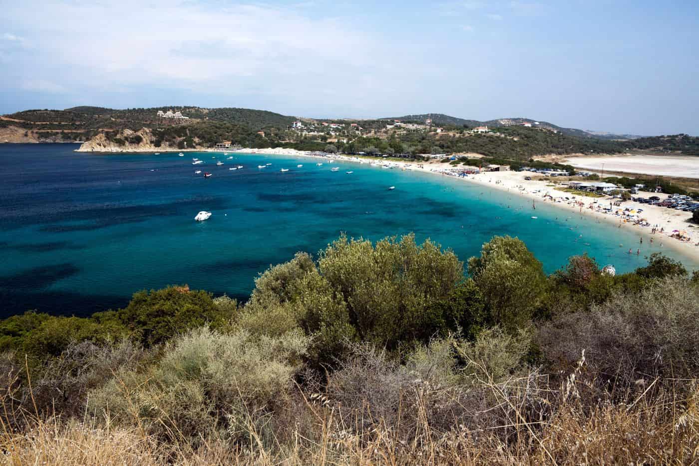
Ammouliani tours start on the only inhabited island of Halkidiki, a small island in the Singitic Gulf a short ferry ride from Tripiti, facing the peninsula of Mount Athos. The routes cover the sandy beaches of Alykes and Megali Ammos, the fishing village and its harbour, the Drenia islets and the coast of the Athos monasteries. Greece Tours lists the cruises and day trips that reach the island.
This page covers what Ammouliani tours see on the beaches and in the village, the history of the island, which islets the boats circle, what the Athos coast shows from the sea, how visitors reach Ammouliani, what the tavernas serve and which season suits each route. The tours below are checked on GetYourGuide and leave from Thessaloniki, Ormos Panagias and the island itself.
What do Ammouliani tours cover?
Ammouliani tours cover the only inhabited island of Halkidiki, with about 4.5 square kilometres of green land in the Singitic Gulf and 521 residents at the 2021 census. Routes join the village and harbour, the sandy beaches, the Drenia islets and the Mount Athos coast.
Ammouliani sits in the north-eastern part of the Singitic Gulf, also called the Mount Athos Gulf, which opens between Sithonia to the west and the Athos peninsula to the east. Ammouliani tours sail a gulf that measures 13 miles across and reaches 26 miles inland. The island lies 2 nautical miles off the harbour of Trypiti and 120 km from Thessaloniki. From Trypiti, a 5 km sandy shore runs to Ouranoupoli, the main gateway to Mount Athos.
The island measures just 6 km from end to end. Olive trees and low vegetation cover the land. Its services include a fishing port, a kindergarten, a primary school, a pharmacy, a supermarket and a butcher’s shop. Ammouliani tours that start on the mainland shore cross to the island in minutes and spend the rest of the day on the water and the sand.
- Population: 542 residents on the island at the 2001 census, 529 in 2011 and 521 in 2021.
- Administration: the municipal unit of Stagira-Akanthos, inside the Municipality of Aristotelis, which has its seat in Ierissos.
- Main church: Agios Nikolaos, built in 1865, with rare artefacts and relics of local saints.
- Feast: the island honours Agios Georgios every April.
Ammouliani tours combine these parts in one trip: the village, a swim on the island, a stop at the islets and a run along the Athos coast.
Which beaches do Ammouliani tours reach?
Ammouliani tours reach Alykes, a Blue Flag beach, along with Megali Ammos, Agios Georgios, Karagatsi and Faka. Mousiou has a pier for boats, and Tratovoli is reached only by sea. All seven rank among the 61 best beaches chosen by the municipality.
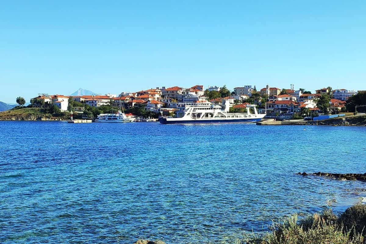
Alykes holds the Blue Flag eco-label, with clear water and fine white sand. The municipal tourism office calls it the best-known beach of Ammouliani and of the whole Mount Athos area. Swimmers on Ammouliani tours find sunbeds, showers, beach bars and tavernas there, plus an organised campsite.
Sandy beaches surround the whole island. Megali Ammos has whitish sand, sculpted rocks and pine shade, with Mount Athos in full view. Agios Georgios forms a double curve of golden sand, with umbrellas, sunbeds and a makeshift wooden pier. Ammouliani tours along the shore also pass Janis, a small beach with a paved pier, and the golden beach beside the main port, which looks across to the Ouranoupoli coast.
- Mousiou: golden sand and a wooden pier where boats and yachts moor.
- Tratovoli: a beach with no land access, known for the quality of its sand and water.
- Faka: white sand, clear water and dense vegetation, with diving off the shore.
- Karagatsi: a quiet cove at the end of a ravine, named after the elm trees that grow nearby.
Ammouliani tours on a rented boat circle the island from cove to cove with no licence needed, and the rocky northern shores suit spear-fishing.
What history do Ammouliani tours tell?
Ammouliani tours tell how the island served as a metochi, or dependency, of Vatopedi monastery on Mount Athos until the early 1900s, and how refugee families from the islands of the Sea of Marmara received it in 1925 and built a fishing community.
Vatopedi ranks second among the twenty monasteries of Mount Athos. Three monks from Adrianople founded it in the second half of the 10th century, on the north-eastern side of the peninsula. Ouranoupoli, on the mainland coast nearby, also belonged to Vatopedi as a metochi. At the harbour, Ammouliani tours pass the arsanas, the type of shore building with a small port and storerooms that Athos monasteries keep. It survives as a typical example of Athonite architecture.
In 1922 the Greek government took the Ouranoupoli area from the monastery to house refugees from Turkey. In 1925, after the Asia Minor Disaster, Ammouliani passed to refugee families from the islands of the Propontis, the Sea of Marmara. The municipal tourism office names Marmara Island, Prikonnisos in Greek, among their homelands. That island, the largest in the Sea of Marmara, is famous for its marble, which gave the whole sea its name.
The Folk Museum in the centre of the island keeps Asia Minor artefacts and religious objects that the refugees carried on their shoulders instead of their belongings. Among them stands an Epitaph, the decorated bier of the Good Friday procession, which families chose to carry over necessities. Ammouliani tours that stop in the village can include the museum.
- Population exchange: after the Treaty of Lausanne of 1923, the remaining Greeks of Marmara Island left for Greece and other countries.
- Livelihood: fishing and tourism employ the residents today.
- Fishing fleet: the second-largest in Central Macedonia.
- Local saying: on Ammouliani, yesterday’s fish is no longer fresh.
Ammouliani tours read this history in the arsanas, the museum and the boats of the fishing port.
Which islets do Ammouliani tours sail around?
Ammouliani tours sail around the Drenia, a group of six main islets south-east of Ammouliani that locals call Gaidouronisia. Boats stop at beaches on Tigani, Penna and Feti, where shallow blue-green water has earned the area the name Blue Lagoon of Halkidiki.
The Drenia take their name from the largest islet of the group. The islets are flat, with dense vegetation, small coves and shallow sandy shores. Nobody lives on them. In winter they stand empty, and in summer they fill with tourists and campers. Rocky shores on part of the islets give a view of Mount Athos in the distance. The group lies opposite Megali Ammos, and Ammouliani tours on a rented boat reach it from there.
Ammouliani tours leave for the Drenia from the quay of Ammouliani and from Ouranoupoli, with daily departures in summer. The largest islet has a shop serving drinks and coffee, a taverna and the only organised beach with umbrellas. The islets have no roads or cars, and the sea floor around them holds rich marine life.
- Tigani: a white-sand beach on the islet of the same name, reached by boats and small yachts.
- Drenia beach: an organised sandy beach on the namesake islet, with shallow water and wooden piers or steps.
- Penna and Feti: golden beaches with Mount Athos across the water.
- Artemi beach: rocks and fine sand facing Mount Athos, reached by small boats.
- Faka islet: a rocky islet north of Ammouliani, where Ammouliani tours stop for snorkelling in clear water.
Diaporos, the third island group of the Singitic Gulf, lies near Sithonia on the western side of the gulf. Departure points, boat types and trip lengths for the Blue Lagoon run appear on the Ammouliani cruise page.
What do Ammouliani tours show of Mount Athos?
Ammouliani tours show Mount Athos from the sea: the 2,033-metre peak, the forested slopes of the peninsula and the monasteries along the Singitic Gulf. Boats stay at least 500 metres off the coast, so women join these trips, while only men with a permit step ashore.
The Athos peninsula runs 50 km into the Aegean Sea and measures 7 to 12 km across. Twenty monasteries share it, and the monastic community governs the mountain and the larger part of the peninsula as an autonomous region of Greece. UNESCO inscribed the community on the World Heritage List in 1988. No road links the peninsula with the rest of Greece, so the ship is the only way in.
On Ammouliani tours along the western shore, the monasteries appear one after the other. Dafni, the main port of Athos, has a daily ferry link with Ouranoupoli. In myth, the port takes its name from Daphne, daughter of the king of Arcadia, who sheltered there from Apollo. Male pilgrims need a diamonitirion, a permit from the Pilgrims’ Bureau offices in Thessaloniki and Ouranoupoli. Article 186 of the Charter of Mount Athos bans the entry of women, under penalty of two months to one year in prison.
- Zografou: the Bulgarian monastery stands inland in a forested valley, and its arsanas, where the boat from Ouranoupoli calls, has a tower and a ruined mill.
- Docheiariou: a seaside monastery dedicated to the Archangels Michael and Gabriel, tenth in the Athos hierarchy, with a main church built and painted in 1568.
- Xenophontos: on the western shore, with an older katholikon near the sea and a newer one begun in 1817.
- St Panteleimon: the Russian monastery, rebuilt on a site closer to the shore in the first two decades of the 19th century.
Ammouliani tours that add this coast show Byzantine architecture from the sea. The Mount Athos cruise from Thessaloniki covers the same shore as a day trip from the city.
How do visitors reach Ammouliani for Ammouliani tours?
Ammouliani tours start from Thessaloniki, whose airport lies 13 km south-east of the city and serves Halkidiki. The road then runs to the small port of Tripiti, 120 km from Thessaloniki, where a ferry crosses 2 nautical miles to the island in less than 15 minutes.
Thessaloniki Airport Makedonia (SKG) is the main airport of Northern Greece and the air gateway for Halkidiki, which has no airport or railway of its own. Car rental offices sit in the departure area of both terminals, and taxis wait outside the terminal day and night. The airport connects directly with the EO16 national road, which runs east from Thessaloniki through Thermi, Agios Prodromos and Arnaia towards Ierissos.
Ammouliani tours without a car use two bus networks. OASTH buses 01X and 01N link the airport with the Thessaloniki KTEL bus station on a 24-hour basis. KTEL Chalkidikis runs the intercity buses of Halkidiki from its station at the 9th km of the Thessaloniki–Nea Moudania road. Its regular daily buses serve Ouranoupoli, the village next to Tripiti.
Tripiti faces the island across the northern part of the Singitic Gulf. In summer the ferry shuttles without a break from morning until night, with a departure every 15 minutes. Distances from Thessaloniki to four towns of the Aristotelis municipality, which also includes Ammouliani:
- Stagira: 73 km, on the main Thessaloniki–Ouranoupoli road at about 500 metres above sea level.
- Olympiada: 90 km, and 35 km from Ierissos, beside the ruins of ancient Stagira.
- Ierissos: 115 km, the seat of the municipality, 10 km from the border of Mount Athos.
- Nea Roda: 115 km south-east of Thessaloniki, on the narrowest point of the Athos peninsula.
The same roads carry a Halkidiki day trip from Thessaloniki, and Ammouliani tours add the ferry at Tripiti as the final leg.
Which day trips combine with Ammouliani tours?
Ammouliani tours combine with mainland day trips to Ouranoupoli and its 14th-century tower, to the Xerxes Canal and ancient Sani beside Tripiti, to ancient Stagira, the birthplace of Aristotle, to the Sithonia peninsula across the gulf, and to Thessaloniki.
Ouranoupoli is the last village before the Mount Athos border. Vatopedi Monastery built the village’s Byzantine tower of Prosforio in the early 14th century to protect monastery land. It remains the largest and best-preserved tower in Halkidiki and now houses the Christian Chalkidiki Exhibition. Summer cruises along the Athos coast start there too, and other sea trips appear among the Halkidiki boat tours.
Ammouliani tours meet two ancient sites near the ferry port. In 483 BC the Persian king Xerxes ordered a canal through the Athos isthmus, finished in 480 BC. It ran 2 km from east of Nea Roda to west of Tripiti, 30 metres wide, and sediment now covers it. A mapped Xerxes trail runs from Nea Roda to Tripiti and the island. Between Tripiti and Develiki beach lie the finds of the sanctuary of ancient Ouranoupoli, built by the people of Sani in the late 6th century BC.
Ancient Stagira covers two hills of the Liotopi peninsula, about 700 metres east of Olympiada. Settlers from Andros founded it around 655 BC, and Aristotle was born there in 384 BC. Philip II of Macedon destroyed the city in 348 BC, then rebuilt it in return for Aristotle’s teaching of his son Alexander. Paths pass the ancient agora, the city wall and the remains of houses, and the village of Stagira keeps Aristotle Park at its entrance.
- Ierissos: boat builders at the traditional yards beside the fishing port, below ancient Akanthos.
- Olympiada: a statue of Aristotle and, since September 2020, a giant mural of his face.
- Arnaia: the cathedral of Saint Stephanos, with ancient finds under a glass floor.
West across the Singitic Gulf lies Sithonia, the middle peninsula of Halkidiki; Sithonia tours cover its coast and villages. Ammouliani tours that begin in Thessaloniki can add the city’s 15 Paleochristian and Byzantine monuments, on the UNESCO list since 1988, and the White Tower.
What local food do Ammouliani tours include?
Ammouliani tours include fresh fish and seafood from the island’s fleet, the second-largest fishing fleet in Central Macedonia. The wider Mount Athos area adds Olympiada mussels, salted orkyni from Ierissos, Athonian olive oil and wine, Halkidiki olives, mountain honey and tsipouro.
The refugee families from the Propontis islands who received Ammouliani knew the sea and turned mainly to fishing. Fishing still employs the residents, beside tourism. A local saying holds that yesterday’s fish no longer counts as fresh, and island tavernas serve fish caught hours earlier.
Eastern Halkidiki has 300 km of coastline and seven traditional fishing ports, with fleets based on Ammouliani and in Ierissos, Nea Roda and Olympiada. Orkyni, a fish of the tuna family, is the culinary trademark of Ierissos. Fishermen catch it in the Akanthios Gulf in late spring and early summer and salt it into a meze for tsipouro. It also comes boiled and marinated in olive oil as a fish salad.
Olympiada ranks among the leading mussel producers of Greece, and visitors at its farms along the coast to Marmari take part in the harvest. Ammouliani tours that stop in Ouranoupoli eat in the village that the municipal tourism office calls the gastronomic point of eastern Halkidiki.
- Olive oil and olives: Athonian extra virgin olive oil sells in Ouranoupoli, and Halkidiki olives come salted, bitter or in vinegar after the October and November harvest.
- Honey: beekeepers on Mount Athos, on the Aristotelian Mountain and around Arnaia produce pine, chestnut, heather (susura), orange, lavender and cotton honey.
- Mountovina: a tsipouro made from beeswax, with Protected Geographical Indication for Arnaia, that tastes of wax and honey at once.
- Wine: visitors taste Athonian wines in Ouranoupoli, and the wine roads of eastern Halkidiki start from Arnaia, with Assyrtiko, Malagousia and Xinomavro grapes.
Ammouliani tours meet local menus that draw on ancient Greek, monastic, Aegean, Asia Minor and Pontic cooking, with herbs from the Aristotelian Mountain, Mount Athos and Mount Holomontas.
When do Ammouliani tours run best?
Ammouliani tours run best from June to September, when the coastal station at Neos Marmaras records mean highs of 28 to 32 °C and mean lows of 20 °C or more. August is the hottest and driest month, and the beach season in eastern Halkidiki lasts six months.
Halkidiki has a Mediterranean climate, Köppen type Csa, with cool, wet winters and hot, relatively dry summers. The National Observatory of Athens station at Neos Marmaras, 6 m above sea level on the Halkidiki coast, records mean highs of 29.3 °C in June, 32.1 °C in July, 32.4 °C in August and 27.8 °C in September, with only 11.6 mm of rain in August. October keeps a mean high of 22.2 °C and a mean low of 15.6 °C.
Spring suits Ammouliani tours that add a walk over the three hills of ancient Akanthos beside Ierissos, which turn green in that season. Autumn brings the tsipouro distilling at Megali Panagia and Gomati. The local calendar gives Ammouliani tours these fixed dates:
- February: Megali Panagia holds its winegrowers’ event on the first Sunday of the month.
- April: Ammouliani celebrates its yearly feast of Saint George.
- July: the Ouranopolitika events fill Ouranoupoli, Olympiada pairs the feast of Agia Kyriaki on 7 July with a two-day mussel festival, and Nea Roda holds a Sardines Feast on the last Monday.
- August: full-moon nights bring events to Ouranoupoli, Nea Roda celebrates the Panagia festival on 23 August, and Olympiada puts on theatre outside ancient Stagira.
- September: Stagira holds its main festival on 8 September at Panagouda, a church built into a rock in 1903.
Frequently Asked Questions
Can Ammouliani tours bring a car to the island?
Yes. The ferry from Tripiti carries vehicles as well as foot passengers, and the municipal tourism office advises car owners to reach Tripiti half an hour before departure. For trips along the coast, Ammouliani tours also have boats for hire on the island, and they need no licence.
Can women join Ammouliani tours to the Mount Athos border?
Yes. Women on Ammouliani tours join the summer cruises from Ouranoupoli along the Athos coast, since the boats stay 500 metres or more offshore. On land, the ruins of Zygou Monastery, 2 km from Ouranoupoli and 40 metres from the border, admit women. Entry to the monastic state requires a diamonitirion, issued only to men.
Do Ammouliani tours run in winter?
Yes. The municipality lists the Tripiti ferry as a daily service, so Ammouliani tours reach the island in every season. Ouranoupoli stays active all year. Halkidiki winters are cool and wet, with short-lived snowfalls, and January brings 62.4 mm of rain at Neos Marmaras. Christmas customs and the Carnival before Lent mark the winter.
Which services support Ammouliani tours on the island?
Ammouliani has a pharmacy, a supermarket, a butcher’s shop, a kindergarten and a primary school. For overnight Ammouliani tours, the island offers rental rooms, hotels and camping areas, plus tavernas, beach kiosks and sunbeds. The municipality reports steady upgrades to this tourist infrastructure.