
Evia Hiking
Evia hiking is walking the marked mountain paths, river gorges and coastal trails of Evia, the large island joined to mainland Greece by the bridges at Chalkida. Evia hiking stretches from the 1,743 m summit of Mount Dirfys to the Dimosaris gorge in the south, and Greece Tours lists the guided treks that start on the island or pick up in Athens.
The main routes cover the Dirfys summit, the Agali and Dimosaris gorges, the Xerovouni loop, the walk from Kymi to St George castle, the Manikiatis waterfall and the coast at Zarakes. Each Evia hiking route here comes with the tours on sale that walk it, grouped by area and by the kind of day they give.
What is Evia hiking?
Evia hiking is walking on foot across Evia, the second largest Greek island, on marked mountain paths, shaded river gorges and coastal trails. The main routes climb Dirfys and Xerovouni in the centre, follow the gorges of Agali and Dimosaris, and end at Aegean beaches.
The island stretches about 180 km from north to south, and a spine of mountains runs down its length. Dirfys reaches 1,743 m, Xerovouni 1,453 m, Pyxarias 1,341 m in the north and Ochi 1,398 m in the south. Evia hiking follows that spine: one day on foot climbs from shaded stream beds through chestnut and fir forest to bare limestone ridges. Chalkida lies within an hour’s drive of Athens and the mountain villages of central Evia within about two, so the island works both as a day out from the capital and as a base for a week of walks.
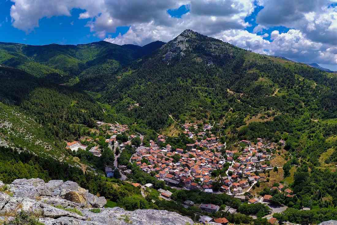
Most Evia hiking in the tour listings gathers in the centre of the island, around Steni, Dirfys, Kymi and the Manikia valley, with the south represented by the Dimosaris gorge above Kallianos beach. Evia belongs to the same administrative region as the mainland ranges in our Central Greece tours, and walkers who know the fir forests and limestone peaks of that region find the same ground on the island. For Chalkida, Eretria and the sights of the lowland coast, the Evia day trip from Athens covers the towns and the ruins.
Which Evia hiking tours can you book?
Eleven Evia hiking tours are on sale: four on Mount Dirfys and around Steni, one on Xerovouni, three around Kymi and the Manikia valley, a coastal walk to Zarakes beach, a wine hike on the Ritsona trail, and a gorge-and-beach hike at Dimosaris in the south.
The Dirfys group is the largest. The Agali gorge trek is a guided private walk up the valley on the western side of the mountain. The Evia Trail signature day hike is a private mountain trek that sets out from the village of Steni Dirfyos. Two more Evia hiking tours aim at the summit and start in Athens: one is a guided summit hike with the transfer included, and the other is a Dirfys day hike built around forest, peaks and views over the Aegean. Those two suit travellers without a car, since the drive to Steni and back is part of the day.
East of the main ridge, the Kymi and Manikia group of Evia hiking tours mixes a town walk with water. The Kymi to St George castle hike is a private walking tour from the coastal town to the castle. The Manikiatis waterfall hike and swim reaches the pool under the waterfall in the Manikia gorge, and the Manikia river trekking tour follows the same stream on foot, as a private booking or in a shared group. The Xerovouni circular hike stands on its own as a private loop on the second highest mountain of the island, facing Dirfys across the pass.
The last three Evia hiking tours sit apart from the mountain core. The private walk to Paralia Zarakon ends at Zarakes beach with a swim in the Aegean. The wine hike follows the Ritsona trail near Chalkida and closes with a visit to an organic winery. The Dimosaris gorge tour is a private guided hike in south Evia that finishes on the beach. Travellers based in the capital who want a shorter outing without the bridge crossing find the trails of Hymettus and Parnitha on our Athens hiking page.
- Dirfys and Steni – Agali gorge trek, Evia Trail signature day hike, Dirfys summit hike with Athens transfer, Dirfys hike from Athens with Aegean views.
- Xerovouni – private circular hike on the second highest peak of the island.
- Kymi and Manikia – Kymi to St George castle walk, Manikiatis waterfall hike and swim, Manikia river trekking tour.
- Coast and vines – Zarakes beach walk with an Aegean swim, Ritsona wine hike with an organic winery visit.
- South Evia – Dimosaris gorge guided hike with beach time at the end.
What is the Mount Dirfys summit hike like?
The Mount Dirfys summit hike is the headline day of Evia hiking: a full-day climb from the forest above Steni, starting by the old mountain refuge and crossing open rocky slopes to Delfi, the 1,743 m top of the island, with both seas in view.
The standard ascent starts near the old refuge on the south-eastern flank of the mountain, above the village of Steni Dirfyos, and follows a marked path that climbs steadily over rock to the summit ridge. The Evia Trail signature day hike on sale also sets out from Steni, the natural base for Evia hiking on the mountain. A second marked path reaches the top from a refuge on the northern side, and longer itineraries join the climb to the Agali gorge. The mountain has a club refuge with 34 dorm beds and camping space beside it, open on set dates, which lets groups start at first light.
The climb passes through clear bands of vegetation. Around Steni the paths run through chestnut forest and shaded ravines with streams; higher up, fir forest takes over; above the tree line the trail crosses open grass and bare limestone. The Steni to refuge loop on the S1 and S2 trails samples both forest belts without the summit and makes a shorter Evia hiking day for groups who want shade rather than altitude. The top section is the most exposed part of the route: the path is not technical, but it is long and steep and asks for sound fitness and settled mountain weather.
From Delfi the view takes in the Aegean side of the island to the east and the gulf with the mainland ranges to the west, with Xerovouni standing directly opposite across the pass. Snow lies on the upper slopes through the winter, and the ridge then turns into winter mountaineering ground, a different outing from the summer walk. Dirfys stands higher than Mount Parnitha above Athens, and the Evia hiking tours that include the transfer from the capital turn the summit into one long day out and back.
- Lower slopes – chestnut forest, streams and shaded ravines around Steni.
- Middle belt – fir forest on the S1 and S2 trails up to the refuge.
- Upper mountain – open grass and rocky slopes above the tree line.
- Summit – the limestone top of Delfi at 1,743 m, with views to both seas.
What is the Agali gorge hike on Dirfys?
The Agali gorge hike is a shaded Evia hiking route up a narrow valley on the western slopes of Mount Dirfys, on a clear marked path under limestone cliffs, through chestnut and plane forest, over wooden bridges and beside streams that run for most of the year.
The gorge cuts into the side of Dirfys that faces the Euboean Gulf, and its walls keep the path in shade for most of the day. That makes Agali the warm-weather choice among the Evia hiking routes on the mountain: the summit trail sits in full sun above the tree line, while the gorge stays cool under the canopy. The path crosses the stream on wooden bridges, and the view changes at each bend of the valley, from open forest to the foot of the cliffs.
The walk works as an out-and-back through the gorge, returning on the same path, or as the first stage of a longer mountain day. The common extension continues up toward the Dirfys refuge, and the strongest groups carry on to the summit. The guided private Agali trek on sale follows the gorge with a guide for your group only; check the tour listing for the start point, the walking time and which of these versions the day covers. Local trekking outfits also run a full crossing of the gorge as a separate Evia hiking day.
Agali also holds a canyon. The stream drops over five waterfalls in a 400 m technical section, with rope descents of 6 to 10 m, and canyoning groups use it as a first waterfall canyon for beginners, after an approach walk of about an hour. That descent is a separate day from the walk: Evia hiking on the Agali trail needs no rope, harness or wetsuit, and the path gives walkers the same forest, cliffs and running water without any abseiling.
What is the Dimosaris gorge hike in south Evia?
The Dimosaris gorge hike is the classic Evia hiking route of the south: a descent from the ridge of Mount Ochi along the Dimosaris stream, under high cliffs and plane trees, past waterfalls, pools and stone bridges, to the beach of Kallianos on the Aegean.
The path counts as the oldest mountain trail on the island, in use for up to two thousand years. The stream crosses a green gorge in the heart of the Ochi range, and the trail runs under plane trees, wild olive, wild pear and large oaks. Along the way it passes the small village of Lenosei. Most Evia hiking visitors see only part of the gorge, walking up from Lenosei through its best-known section and back down the same way.
One guided version of the full descent covers 10 km, with 174 m of climbing and 1,100 m of descent, and about five hours of walking at a moderate grade. The long downhill is hard on knees and hips. Evia hiking parties with more time start on the Ochi ridge, walk the whole gorge, camp on the beach at Kallianos and climb back out the next day, which turns Dimosaris into a two-day route with a night by the sea.
The private Dimosaris tour on sale pairs the guided hike with beach time at the end, so the day closes with a swim in the Aegean. Pick-up and start time are set per booking; check the tour listing for the meeting point and for where on the route the walk begins, the ridge or the village. The south of the island is drier and barer than the forested centre, and Dimosaris keeps its stream and its plane trees green through the summer, which gives Evia hiking in the south a long shaded valley.
- Start – the ridge of Mount Ochi, or the village of Lenosei for the shorter walk.
- Gorge – cliffs, plane trees, waterfalls, pools and stone bridges along the Dimosaris stream.
- Finish – Kallianos beach on the Aegean, with a swim at the end.
- Overnight option – a night camped on the beach and the climb back the next day.
What is the Xerovouni circular hike?
The Xerovouni circular hike is a loop on the second highest mountain of Evia, at 1,453 m directly opposite Dirfys: the Evia hiking route climbs through fir forest to open limestone slopes and a summit reached by a short scramble.
Xerovouni is the quieter neighbour of Dirfys, and its trails stay empty on days when the Dirfys path is busy. Its northern face drops as a sheer cliff onto the forest below, and the upper mountain holds a wild plateau of rock and grass. The standard ascent starts at the mountain pass between the two peaks, so the Evia hiking day begins high, then climbs through fir forest before the trees thin out and the path reaches open ground and bare limestone slopes.
The last section to the summit needs hands on the rock in a few places, a short scramble rather than a climb. From the top the view covers Dirfys across the pass, the surrounding peaks and both seas, the Aegean on one side and the Euboean Gulf on the other. The private circular Evia hiking tour on sale returns to the start by a different path, so the descent shows another side of the mountain; check the tour listing for the length of the loop and the walking time.
Xerovouni suits walkers who have already climbed Dirfys, or who want a mountain day away from the better-known summit. Local trekking programmes list it beside Dirfys among the high peaks of central Evia, and the Tanaida plateau lies close by between Dirfys and Pyxarias, an easy upland walk of meadows, scattered oaks and seasonal ponds. For Evia hiking groups staying at Steni, Xerovouni is a second summit close to the village.
What is the Kymi to St George castle hike?
The Kymi to St George castle hike is a private walking tour on the Aegean side of central Evia: the Evia hiking route leaves the town of Kymi on foot and ends at the castle of St George, with your group walking alone with its guide.
Kymi sits on the east coast of central Evia, on the slope above its harbour at Paralia Kymis, facing the open Aegean. The town is known across Greece for its dried figs, grown on the land above the harbour and split and dried in the sun. A walk that starts here opens in a working town rather than at a forest trailhead, which gives this Evia hiking tour a different feel from the summit and gorge days on Dirfys.
The castle of St George is the goal of the walk. The private format means the pace, the stops and the time at the castle follow your group rather than a fixed schedule, as on the other private Evia hiking tours on the island. The tour title gives the two ends of the route; check the tour listing for the distance, the height gain, the meeting point in Kymi and the way back, since those details are set per booking.
Kymi also works as the base for the Manikia tours. The Manikia gorge lies close to the town, with its waterfall walk and river trekking, and trekking groups run a stream walk from Vromonera along the Karya stream near Kymi. A traveller staying a few nights in the town can join the castle hike, the Manikiatis waterfall hike and a Dirfys day in turn, so one base covers three different Evia hiking days.
What is the Manikiatis waterfall hike and swim?
The Manikiatis waterfall hike and swim is a short Evia hiking route from the village of Manikia near Kymi down through woodland into a narrow gorge, ending at a 25 m waterfall and the blue-green pool beneath it, where the tour stops for a swim.
The Manikiatis river, known in ancient times as the Nedon, flows through the gorge all year. The path descends through Mediterranean woodland to the stream and then follows it between steep walls, over moss-covered rock and past clear pools set among large white boulders. The waterfall runs strongest after rain, and because the river never dries up, the pool under the fall holds water for a swim on any Evia hiking day in the warm months.
The walk to the river is short, about 30 minutes from the edge of the village, but its final part crosses rocky and uneven ground where each step needs care. Two Evia hiking tours on sale cover it. The Central Euboea waterfall hike and swim walks in, stops for a swim in the pool under the fall and walks out. The Manikia river trekking tour goes further along the stream bed, walking and wading between the pools, and runs as a private booking or with a shared group.
The same gorge is the main canyoning ground of the island. Canyoning groups enter the closed upper section, abseil down a chain of falls and finish with the rope descent of the 25 m Manikiatis waterfall before a short walk out. The hiking tours reach the pool on foot, with no rope or harness, so walkers without technical training still see the water and the rock walls; the full rope descent is covered on our Evia canyoning page.
Which Evia hiking routes on the coast end with a swim?
The main coastal Evia hiking route that ends with a swim is the private walk to Paralia Zarakon, Zarakes beach, on the Aegean side of the island, where the tour closes with time in the sea; the Dimosaris and Manikiatis routes also finish in water.
The Zarakes walk is a private tour, so the group sets out with its own guide and walks at its own pace toward the beach at Paralia Zarakon. The route runs down to the shore of the Aegean, the open sea on the east side of the island, and the last stage of the day is a swim off the beach. This Evia hiking tour puts the reward at the finish: the sea is part of the walk, not a separate stop after it.
The Aegean coast of Evia faces open water with the mountains of the island close behind it, so a walk to the sea here ends on a shore far from the gulf towns. The swim works as the cool-down after the walking, and a swimsuit and a towel in the day pack are part of the kit. Check the tour listing for the start point, the distance and the time on the beach, which the booking sets for each group.
Two other Evia hiking routes end in water, one on the same coast and one inland. The Dimosaris gorge ends at Kallianos beach on the Aegean after the descent from Mount Ochi, and the Manikiatis walk ends in the pool under the waterfall. Walkers who want a sea finish without a mountain descent pick Zarakes, walkers who want a gorge first and the sea second pick Dimosaris, and walkers who want fresh water instead of salt pick Manikiatis.
How hard are Evia hiking trails?
Evia hiking trails range from easy plateau and forest walks to demanding summit climbs on Dirfys, the island’s highest peak at 1,743 metres, so the difficulty depends on the route chosen, the height gained and the weather on the day.
At the easy end, the Tanaida plateau between Dirfys and Pyxarias offers rolling meadows and scattered oaks with little climbing, and family walks in central Evia keep to gentle forest paths. Short waterfall walks such as Manikiatis add a few rocky, uneven steps but stay within reach of any walker with steady balance. The middle grade covers gorge walks and mountain loops, including the forest circuit from Steni to the Dirfys refuge on the S1 and S2 trails, which fills a full day and asks for sound fitness rather than technical skill. This middle band suits most visitors on a first Evia hiking trip.
At the demanding end sit the summits. The standard Dirfys ascent from the refuge on the south-eastern side is technically simple, yet it climbs steadily over rocky limestone slopes and needs strong legs and good mountain conditions. Xerovouni, at 1,453 metres, ends with a short scramble where hands touch rock in a few places. Long descents are the quiet strain of Evia hiking: one guided gorge day in the south drops about 1,100 metres over 10 kilometres, and its listing grades it moderate and warns that it is uncomfortable for people with knee or hip problems. Check the tour listing for the grade of each trip.
When is the best season for Evia hiking?
The best season for Evia hiking runs from April to June and from September to November, when temperatures are mild, streams carry water and wildflowers or autumn colours cover the slopes; midsummer suits shaded gorges and coastal walks, and winter brings snow to the highest peaks.
Spring is the fullest season on the trails. Winter rain keeps the streams in the gorges running, waterfalls reach their strongest flow after wet spells, and high meadows such as Tanaida fill with flowers. One guided gorge tour on the island opens its season in April and names April to June as one of its two most comfortable windows. Weather on the high ground changes faster than on the coast, so a warm, windproof layer earns its place in the pack even in late spring. Spring is also the season when Evia hiking and river walks combine best, because the pools below the waterfalls are full.
Autumn is the second prime window. The same tour listing names September to November as comfortable, the chestnut and plane forests turn colour, and mushrooms appear on the damp forest floor around Steni. Midsummer is harder. July and August bring heat to the exposed ridges and dry up some streambeds, including the lower gorge at Stropones, which runs dry in summer. Evia hiking in those months works best on shaded gorge trails such as Agali, on short walks that end with a swim, and with a start at first light before the heat builds on the open slopes.
Winter is a specialist season. Late snow lies on the upper slopes of peaks such as Pyxarias, the central mountains draw a loyal winter sports crowd, and guides run winter hiking and mountaineering days that need extra gear and experience. Unsurfaced roads on the outer north-east coast turn difficult during and after storms, so check road conditions and the tour listing before booking a winter date. Lower forest walks remain an option in the cooler months for walkers who pack warm layers and watch the forecast.
What terrain and waymarking do Evia hiking routes have?
Evia hiking routes cross limestone slopes, fir, chestnut and pine forest, stream beds with wooden and stone bridges, and open alpine plateaus; the main trails around Dirfys carry clear waymarks and coded paths such as S1 and S2, while remote routes need a map.
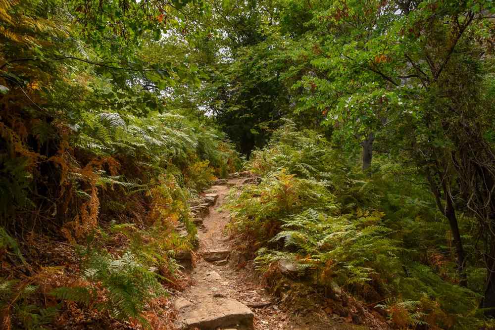
The ground underfoot changes with height. Low down, paths run through Mediterranean woodland and along streams lined with plane trees, where moss-covered rocks and wet stones call for care. Higher up, fir and chestnut forest gives way to open limestone slopes, loose rock and alpine grassland, and on Xerovouni the final stretch turns into a short hand-on-rock scramble. Gorge routes add wooden footbridges, old stone bridges and stretches of riverbed, and the path through the Dimosaris valley in the south ranks among the oldest mountain paths on the island. Every Evia hiking day mixes at least two of these surfaces.
Waymarking is strongest in central Evia. The standard Dirfys summit trail, the Agali gorge path, the route up Olympus Euboicus from Gymno and the Pyxarias trail are all well marked, and the forest loop from Steni follows coded trails signed S1 and S2. Beyond these marked routes, quieter peaks such as Kandyli and Xiron feel wild and see few hikers, and the outer north-east coast is reached on unsurfaced roads. Walkers heading out on their own carry a printed map: a 1:25,000 sheet covers the Dirfys area, and a 1:100,000 map with a 1:50,000 inset covers Mount Ochi in the south.
- Forest paths – shaded dirt trails under fir, chestnut, pine and plane trees on the lower slopes.
- Gorge floors – stream crossings, wet rock, pools and wooden or stone bridges.
- Limestone summits – open, rocky ground with loose stones and short scrambles near the top.
- Mountain plateaus – meadows, scattered oaks and seasonal ponds between the high peaks.
What do you wear and pack for Evia hiking?
For Evia hiking, wear shoes with ankle support and grip for uneven rock, and pack a windproof and waterproof jacket, your own refillable water bottle, energy snacks, sun protection and, on routes ending at a beach or pool, a swimsuit and towel.
Footwear matters most. Guides on the island ask for shoes that suit uneven ground and protect the ankle, and the rocky limestone of the summits, the wet stones of the gorges and the loose gravel on descents all test the sole. Light hiking boots or sturdy trail shoes both work on the marked paths. For gorge and waterfall routes where feet get wet, local operators ask walkers to bring a second pair of shoes and a change of clothes for the drive home. A small backpack carries the rest of the kit on any Evia hiking day, with room for a jacket and lunch.
Water and food come next. Operators on the island ask each walker to carry a personal refillable bottle instead of plastic bottles, and a long summit day or a gorge descent in warm weather calls for more water than a short forest walk. An energy snack and a packed lunch keep the pace steady, and one guided day in the south starts with a stop at a village bakery. Sun protection covers the open ridges: a hat, sunglasses and sunscreen. In winter, warm layers for the top and bottom half go in the pack, and a warm hat and gloves join them on the high peaks.
- Footwear – hiking shoes or boots with ankle support and firm grip.
- Clothing – breathable layers plus a windproof and waterproof jacket.
- Water – a personal refillable bottle, filled before the start.
- Swim kit – swimsuit, towel and dry clothes for beach or waterfall finishes.
- Navigation – a printed map and a charged phone for self-guided routes.
How do you reach Evia hiking trailheads from Athens?
You reach Evia hiking trailheads from Athens by road over the bridges at Chalkida, which lies within about an hour to an hour and a half of the capital; the mountain villages of central and northern Evia sit about two hours from Athens.
The road route is the direct way in. From Athens, the national road north leads to Chalkida, where the island’s capital sits on the narrow channel and road bridges carry traffic onto Evia. From Chalkida, roads fan out: north-east into the Dirfys foothills at Steni and on towards Kymi and Manikia, north towards Istiaia and Edipsos, and south towards Eretria and Karystos. Manikia, one of the central bases for walkers, sits about two to two and a half hours from Athens by car. The island measures about 175 to 180 kilometres from end to end, so long transfers eat into walking time.
Public transport reaches the island but not the trails. Regional buses and trains link Athens with Chalkida, and long-distance buses run on from Chalkida to the Karystos, Kymi and Istiaia areas. Trailheads sit beyond those lines, so a hire car or a taxi covers the last stretch. Walkers who want to pair a hike with an hour in the capital join a Chalkida walking tour on the way back to Athens. Ferry crossings from the mainland also reach the island, but for Evia hiking the bridges at Chalkida are the direct road link to the central mountains.
Guided tours remove the driving altogether. The Dirfys summit tour on sale includes a transfer from Athens, and a second Dirfys hike is sold as a trip from Athens with nature, peaks and Aegean views. Other trips meet walkers at the start: the signature Evia Trail day hike begins in Steni, the village at the foot of Dirfys. For travellers weighing a full day on the island against other excursions, our list of day trips from Athens sets Evia beside the other routes out of the city. Check each tour listing for its pickup point and start time before booking.
Is guided or self-guided Evia hiking the better choice?
Guided Evia hiking suits first-time visitors, walkers without a car and anyone heading for the summits or gorges, while self-guided walking suits experienced hikers with a map, a hire car and time to read the weather on the marked routes around Dirfys.
A guide solves the three hard parts of Evia hiking for a visitor: transport, route choice and timing. Most tours on sale are private treks, so the group is only your own party and the pace follows the slowest walker. Guides pick the final route on the day to suit the weather, bring local knowledge of the paths, and arrange one-way walks with a vehicle waiting at the far end, which suits gorge descents that finish at the sea. Some tours add a swim, a waterfall pool or, on the Ritsona trail, a visit to an organic winery, which turns the walk into a full day out.
Self-guided walking works on the marked trails of central Evia. The Steni forest loop on the S1 and S2 paths, the standard Dirfys ascent and the Agali gorge path all carry clear marks, and a 1:25,000 map covers the area. Independent walkers need a car, since buses stop in the towns, and they carry all their own water, food and warm layers. The quieter peaks such as Kandyli, Xiron and Pyxarias see few other hikers, which rewards experience but leaves no one nearby to help after a fall or a wrong turn.
The choice comes down to experience and logistics. A walker new to Greek mountains, short on time or travelling without a car gets more from a guided Evia hiking day, because the transfer, the route and the timing are all handled. A seasoned hiker with a car, a map and a flexible schedule enjoys the freedom of the marked central trails and the chance to link routes over two or three days. Either way, leave the planned route and return time with someone before setting out.
What safety rules apply on Evia hiking trails?
The main safety rules on Evia hiking trails are to start early, check the weather and turn back when it changes, carry enough water, stay on marked paths, tell someone your route, and take extra care on wet gorge rock, loose descents and summit scrambles.
Weather is the first risk. The central peaks rise above 1,400 metres, and conditions on the summit ridges differ from those on the coast. Local guides cancel or switch routes for safety when the forecast turns, and independent walkers follow the same rule: turn back early instead of pushing on into wind, cloud or storm. After heavy rain, the streams in the gorges rise and wet rock turns slick, and unsurfaced roads on the north-east coast become difficult to drive. In summer, heat on the exposed ridges is the bigger danger, so Evia hiking in July and August starts at first light.
Terrain brings the second set of risks. Long descents load the knees, and one gorge tour on the island warns walkers with knee or hip problems about its drop of about 1,100 metres. Wet, moss-covered rock in the gorges and at waterfalls causes slips, and the scramble near the top of Xerovouni needs both hands free, so poles go on the pack for that stretch. Fire is the third risk: the large fires in the north of the island showed how fast a summer blaze spreads through pine forest, so walkers light no fires and leave no glass or cigarette ends behind.
- Plan – leave the route and return time with someone who stays behind.
- Start – set off early to finish before the afternoon heat or cloud.
- Navigate – keep to waymarked trails and carry a printed map.
- Protect – light no fires and carry out every piece of litter.
Which forests, plants and wildlife line Evia hiking trails?
Evia hiking trails pass through fir forest on the high slopes of Dirfys and Xerovouni, chestnut and plane woods in the valleys, pine forest in the north and west, oak on the plateaus, and spring wildflowers, mosses and autumn mushrooms along the paths.
The forests change with height and region. On Dirfys and Xerovouni, fir trees cover the upper slopes and give the paths a cool, scented shade before the tree line opens onto bare limestone. Lower down, chestnut groves fill the valleys around Steni and on Mount Telethrio, and plane trees crowd the stream banks in the Agali, Stropones and Dimosaris gorges. The mountains of the north and the slopes of Kandyli carry dense pine forest, and oaks stand on the Tanaida plateau and, as a single tree, on the summit of Olympus Euboicus. A single Evia hiking day on Dirfys passes from plane and chestnut shade to fir forest and then to open rock.
Plant life peaks in spring. Wildflowers fill the Tanaida meadows and the slopes of Telethrio, and the Dimosaris gorge in the south is known for wild flowers and rare plants under its plane, wild olive, wild pear and oak trees. In the wet gorges, moss covers the rocks around the pools, and Mediterranean woodland lines the descent to the Manikiatis waterfall. Autumn brings the second show: chestnut and plane leaves turn gold and brown, and mushrooms push up through the damp forest floor around Steni. Walkers leave plants and fungi where they grow, so the next group sees the same slopes.
Wildlife on the trails is small and shy. Birdsong fills the forests, and on Kandyli the path passes the remains of old shepherd settlements and abandoned mountain huts, a sign of the flocks that grazed these slopes for generations. Mount Telethrio above Edipsos is valued for its rich biodiversity, with springs, chapels and old chestnut groves along its network of trails. Parts of the northern pine forest burned in the large fires, and walkers on those routes cross open, regrowing slopes where young plants now return. A quiet voice and a slow pace reveal more of the animal life on any Evia hiking route.
How does Evia hiking compare with other hikes in Greece?
Evia hiking takes walkers onto the second-highest Greek island after Crete, through forested gorges and past sea views, all within about two hours of Athens, while the famous hikes at Vikos, Samaria, Meteora and Olympus lie farther from the capital and draw more international walkers.
Gorge walking is the closest match. The Samaria gorge on Crete is the best-known gorge hike in Greece, and reaching it from Athens means a flight or an overnight ferry before the walk begins. The Vikos gorge hike in the Zagori villages of Epirus runs between deeper cliffs in a remote corner of the north-west. Most Evia gorges are shorter, but they share the plane trees and the stream crossings, and some finish at the sea just as Samaria does. A day of Evia hiking in a gorge fits between two nights in Athens.
Mountain summits make the second comparison. Hiking Mount Olympus, the highest mountain in Greece at 2,918 metres, is a climb of two days or more with a night in a mountain refuge for most walkers, while the Dirfys summit at 1,743 metres fits into a single day. Evia even has its own Olympus, the 1,172-metre Olympus Euboicus just south of Dirfys. For rock scenery on shorter trails, Meteora hiking follows old paths between the monasteries on their rock pillars in Thessaly, which feels closer to a cultural walk than a mountain day.
Access and quiet give Evia its edge. The central trailheads lie within a day’s round trip of Athens, and the trails stay quieter than the famous names, since the island draws more Greek weekend walkers than international visitors and remains little known to mass tourism. Evia hiking also packs mountain, forest and sea into one outing, with routes that start among firs and end with a swim in the Aegean. For visitors based in Athens with one spare day, that mix of summit, gorge and beach is hard to match anywhere else in Greece.
Frequently Asked Questions
Can beginners join a guided Evia hiking tour?
Yes, beginners join guided Evia hiking tours on the easier routes, such as forest loops and short waterfall walks; private tours set the pace to the group, while summit climbs and long gorge descents suit walkers with good fitness.
How long does a guided Evia hiking day last?
Most guided Evia hiking tours on sale are single-day trips; one listed south Evia gorge day covers 10 kilometres in about five hours of walking, with an early pickup and a mid-afternoon return, and trips from Athens add up to two hours of driving each way.
Is there drinking water along the trails?
Do not count on it: the streams in the Agali gorge flow for much of the year and Mount Telethrio has springs, but lower streambeds dry out in summer, so every walker carries a full refillable bottle from the start of each Evia hiking day.
Is Evia hiking possible in July and August?
Yes, with an early start and the right route: shaded gorge trails such as Agali, forest walks and coastal paths that end with a swim work in midsummer, while exposed summit ridges grow hot by late morning and suit spring or autumn dates instead.
Do you need a guide to climb Mount Dirfys?
No, fit and experienced walkers climb Dirfys without a guide on the well-marked standard route from the refuge, which is technically simple; a guide adds transport from Athens, route choice by weather and company on the rocky upper slopes, which helps first-time visitors.