
Kefalonia is the largest of the Ionian Islands, a green and mountainous island in the Ionian Sea off western Greece. The island covers about 773 square kilometres, and Mount Ainos rises to about 1,628 metres as the highest peak in the Ionian group. Deep bays and a spine of limestone split Kefalonia into distinct regions, each with its own draw. Argostoli, the capital, sits on a southwest bay, while Sami faces east toward Ithaca and Fiskardo marks the far north. This guide sets out the top things to do in Kefalonia, from Myrtos beach and the caves near Sami to the harbour town of Argostoli and the northern villages. Plan the whole trip with Greece Tours.
The best things to do in Kefalonia spread across the coast and the interior. Swimmers head to Myrtos beach, Antisamos and the red sand of Xi, while boats cross the underground lake of the Melissani cave and walk the stalactites of Drogarati near Sami. Argostoli offers the De Bosset bridge, the Katavothres sea mills and loggerhead turtles in the harbour. Assos and Fiskardo hold Venetian-era harbours in the green north, and Mount Ainos and the Omala wine valley fill the centre. The sections below cover each of these in turn, with distances, routes and clear details for planning a trip.
What makes Kefalonia worth visiting?
Kefalonia is the largest of the Ionian Islands, a mountainous green island off western Greece that pairs Myrtos beach and the Melissani cave with the harbour town of Argostoli and mountain villages such as Assos and Fiskardo.
Kefalonia covers about 773 square kilometres, which makes it the largest of the seven main Ionian Islands. The island sits in the Ionian Sea off the west coast of Greece, south of Lefkada and north of Zakynthos. A spine of limestone mountains runs down its centre, and Mount Ainos rises to about 1,628 metres as the highest peak in the Ionian group. Deep bays cut into the coast, so the driving distances feel longer than the map suggests. Argostoli, the capital, sits on a southwest bay, while Sami faces east toward Ithaca. Fiskardo lies about 50 kilometres north of Argostoli by road. The airport, coded EFL, sits about 9 kilometres south of Argostoli.
This scale gives Kefalonia room for beaches, caves, wine country and forest within one island.
The Kefalonia landscape stays green because the mountains catch rain and feed springs, unlike drier Cycladic islands. Mount Ainos national park protects the endemic Cephalonian fir, Abies cephalonica, and a herd of semi-wild horses grazes its slopes. The high Omala valley grows Robola, a white wine grape, near the monastery of Agios Gerasimos, the island patron saint. Robola wine tasting runs at the cooperative in the Omala plain, about 20 kilometres from Argostoli. A major earthquake destroyed towns across the island, so villages were rebuilt low and plain. Fiskardo escaped that damage and kept its older harbour houses. Loggerhead sea turtles, Caretta caretta, feed in Argostoli harbour, and monk seals use quiet coves.
These features set Kefalonia apart from its neighbours and give each region a separate character worth a full day.
Kefalonia connects to the mainland by ferry from Kyllini, Patras and Astakos, and by air through Kefalonia Airport. Kyllini ferries reach Poros and Argostoli, while Sami handles boats from Ithaca and the Peloponnese. A car helps most visitors, since the mountain roads link scattered villages and remote beaches. Argostoli to Sami runs about 24 kilometres over a low pass, and takes around 30 minutes. Argostoli to Fiskardo covers about 50 kilometres and needs over an hour on winding roads. Buses run between the main towns, but the timetable thins outside the summer months. A short ferry crosses the bay from Argostoli to Lixouri in about 20 minutes.
These links let travellers base themselves in one town and reach the rest of Kefalonia on day trips.
Kefalonia rewards a stay of five to seven days, because the island splits into distinct regions. The southwest holds Argostoli, the De Bosset bridge and the beaches of Makris Gialos and Lourdas. The northwest strings together Myrtos beach, Assos and Fiskardo along a cliff-lined coast. The east centres on Sami, the Melissani and Drogarati caves, and Antisamos beach. The Paliki peninsula, across the bay at Lixouri, adds Xi and Petani beaches and quiet farmland. Mount Ainos and the Omala wine valley fill the green interior. A first-time visitor can pair one coast with the caves, then keep a day for Argostoli and the Katavothres sea mills.
Drivers who stay near Sami cut the distance to both the caves and the northwest, which shortens the daily loops across Kefalonia.
Which beaches in Kefalonia are worth seeing?
Myrtos beach ranks as Kefalonia’s most photographed shore, a curve of white pebbles below cliffs on the northwest coast. Antisamos, Petani and Xi round out the list, spanning green bays, deep water and red-orange sand across the island.
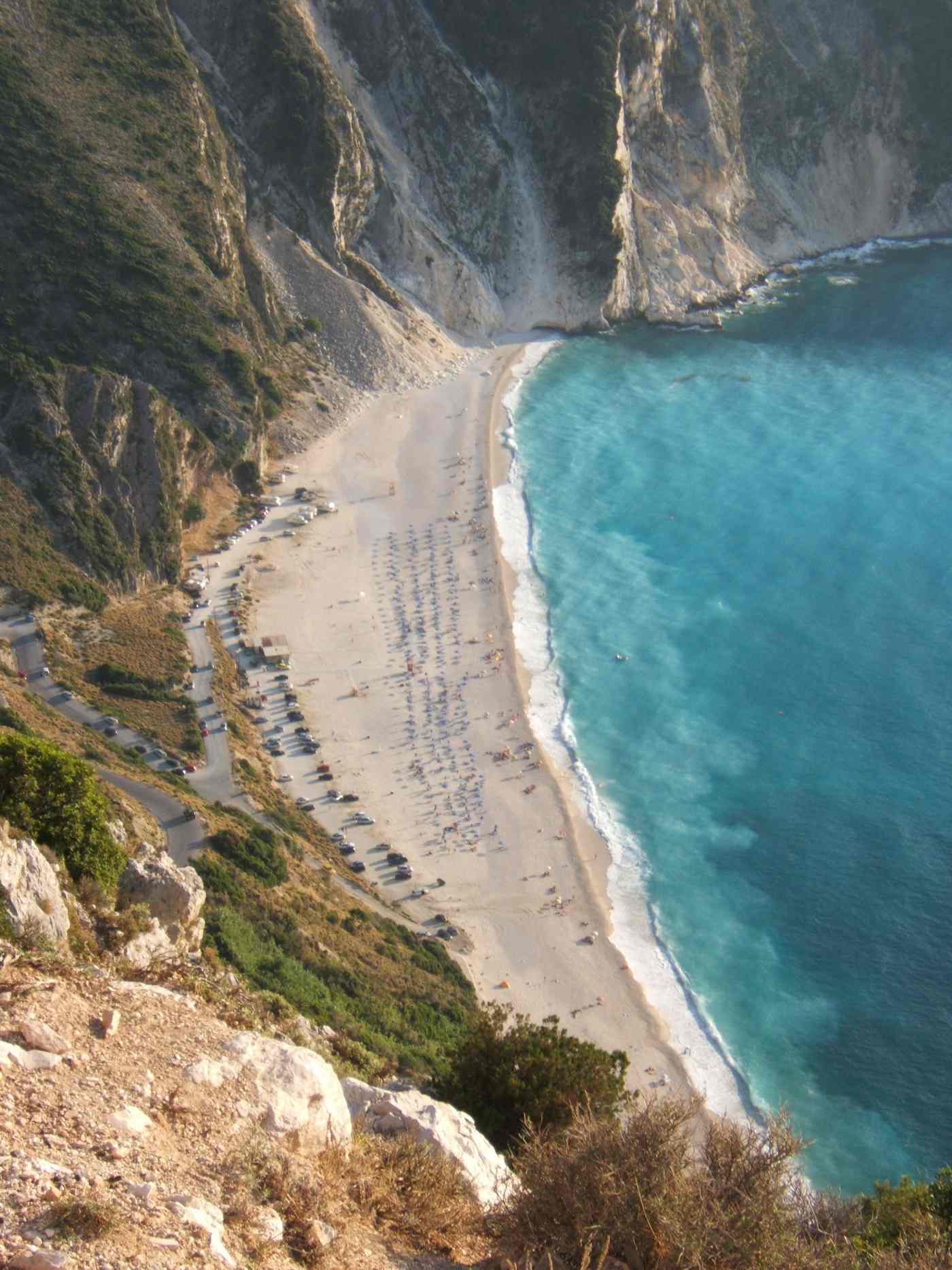
Myrtos beach sits on the northwest coast between Assos and the village of Divarata, below cliffs that drop about 200 metres to the sea. A steep switchback road descends to the shore, and a viewing point above the bay draws drivers along the Assos route. The beach itself is a long curve of white pebbles and pale sand, and the water shades from turquoise to deep blue. Among the Kefalonia beaches, Myrtos is the one most often photographed for postcards and posters. The pebbles shelve quickly, so the water turns deep within about three metres of the shore.
Sunbeds, umbrellas and a small canteen operate in summer, but the bay has no village, so most visitors drive in for a half day from Argostoli or Fiskardo.
Antisamos beach lies about 4 kilometres east of Sami, past a headland on a road that climbs and drops to the bay. Green hills covered in scrub and pine wrap around the shore, which sets it apart from the bare cliffs of Myrtos. The beach mixes white pebbles and clear water, and the deep bay stays sheltered from the open sea. Antisamos served as a filming location for the Captain Corelli’s Mandolin film, and the set once stood on the slopes above. Sunbeds, two beach bars and a car park serve the summer crowd, and the water suits swimmers and snorkellers.
Sami harbour, about 10 minutes away by car, adds tavernas and the ferry to Ithaca, so visitors often pair the beach with the caves.
Petani beach sits on the west side of the Paliki peninsula, about 12 kilometres from Lixouri by road. Steep green slopes frame a bay of white pebbles and bright blue water, in a shape that echoes Myrtos on the far coast. Two tavernas stand at the back of the beach, and sunbeds line the shore in summer. The road down from the village of Kontogourata gives a high view over the whole bay. Petani faces west, so it catches the sunset over the Ionian Sea, and the light draws evening visitors. Reaching Petani means crossing to Lixouri by the short ferry from Argostoli, then driving over the peninsula, which keeps the crowds smaller than at the eastern beaches.
The calm water suits families and longer swims.
Xi beach lies on the south side of the Paliki peninsula, about 8 kilometres from Lixouri, and stands out for its red-orange sand. Low clay cliffs of the same colour rise behind the shore, and the shallow water stays warm and calm for a long stretch out. Sunbeds, beach bars and a car park serve Xi through the summer. Near Argostoli, Makris Gialos and Platis Gialos offer golden sand about 5 kilometres south of town, while Lourdas spreads below a green hillside farther east. Skala, in the southeast, pairs a long sandy beach with Roman-villa mosaics in the village. Emblisi and Foki sit near Fiskardo in the north as small pebble coves.
This spread means Kefalonia offers a different beach for each base and each type of swimmer.
What can visitors see at the Melissani and Drogarati caves near Sami?
Melissani cave holds an underground lake of blue water under a collapsed roof, reached by rowing boat near Sami. Drogarati cave, close by, opens into a large stalactite chamber used at times as a concert hall for its acoustics.
Melissani cave sits about 5 kilometres northwest of Sami, near the village of Karavomylos. A section of the cave roof collapsed long ago and left an open oval above an underground lake. Small rowing boats carry visitors across the water, which runs brackish where seawater mixes with the flow from the Katavothres sink at Argostoli. When the midday sun stands high, it strikes the lake and turns the water bright blue. Guides point out the stalactites in the darker inner chamber beyond the open pool. A visit to the Melissani cave lasts about 20 minutes on the water, and queues build in the middle of the day.
Arriving before noon or in the late afternoon shortens the wait and still catches the light near the open roof.
Drogarati cave lies about 4 kilometres south of Sami, off the road toward Argostoli. A stairway descends about 60 metres below ground into a single large chamber hung with stalactites and stalagmites. The formations grow slowly, about one centimetre a century, so the columns record a long span of dripping water. The temperature inside holds around 18 degrees Celsius through the year, which makes a warm-weather visit a cool break. One hall, called the Chamber of Exaltation, carries sound so well that singers have performed there. Lit paths and railings guide visitors through the cave on a route of about 20 minutes.
Pairing Drogarati with Melissani works well, since the two caves sit within 10 kilometres of each other and both open near Sami on the east coast.
Both caves open daily through the main season, with shorter hours in spring and autumn. Each charges a separate entry fee, paid at the gate, and the caves do not sell a joint ticket. Guided boat crews at Melissani speak enough English to point out the main features during the short crossing. Comfortable shoes help on the wet stone steps at both sites, which stay slick from the damp air. Sami makes a natural base for the caves, since the town sits between them and holds tavernas and the Ithaca ferry. Drivers from Argostoli reach the caves in about 30 minutes over the low pass.
A morning visit to Melissani, a stop at Drogarati and a swim at Antisamos fill one full day on the east side of the island.
The caves belong to a karst landscape, where rainwater dissolves the limestone slowly and carves hollows over long ages. Kefalonia’s largest karst feature is the Katavothres, where seawater pours into the rock near Argostoli. Dye tests showed that this water travels about 15 kilometres underground across the island and rises again at Karavomylos and inside Melissani. This link explains the brackish water in the Melissani lake and the steady flow through the cave. Drogarati grew along the same limestone beds, though it sits above the water table as a dry chamber. An earthquake opened part of Drogarati, and later tremors shifted its passages and closed one section.
Together the two caves and the Katavothres show how underground water shapes the whole eastern half of Kefalonia.
What is there to do in Argostoli, the capital of Kefalonia?
Argostoli spreads along a bay in the southwest, where the De Bosset stone bridge crosses the lagoon and the Katavothres sea mills draw in seawater. Loggerhead turtles feed at the fish market, and a waterfront square anchors the town.
Argostoli sits on the east shore of the Koutavos lagoon, a shallow inlet closed off by a long stone causeway. The De Bosset bridge, also called the Drapano bridge, crosses the lagoon on stone arches and runs about 700 metres. Which makes it the longest stone bridge over seawater in the world. A stone obelisk stands on a small island midway along the span. Walkers and cyclists use the bridge, since traffic now follows a newer road nearby. The lagoon shelters birds and fish, and a shaded path circles the Koutavos wetland from the town side. Sunset over the water draws crowds to the bridge.
The walk links the centre of Argostoli with the far shore in about 15 minutes on foot from the central square.
The Katavothres lie at the northern tip of the Argostoli peninsula, about 2 kilometres from the town centre. Here seawater flows off the open sea and disappears into cracks in the rock, running inland instead of out. Mills once used this current to grind grain, and one restored mill house with a waterwheel still stands at the site. The flow feeds the underground channel that surfaces about 15 kilometres away at Karavomylos and the Melissani lake. A lighthouse in the shape of a round Doric rotunda, the Agioi Theodoroi light, stands a short walk along the same shore. An earthquake changed the rock and cut the water flow, though it later returned at a lower rate.
A café and a short walking loop now serve visitors at the point.
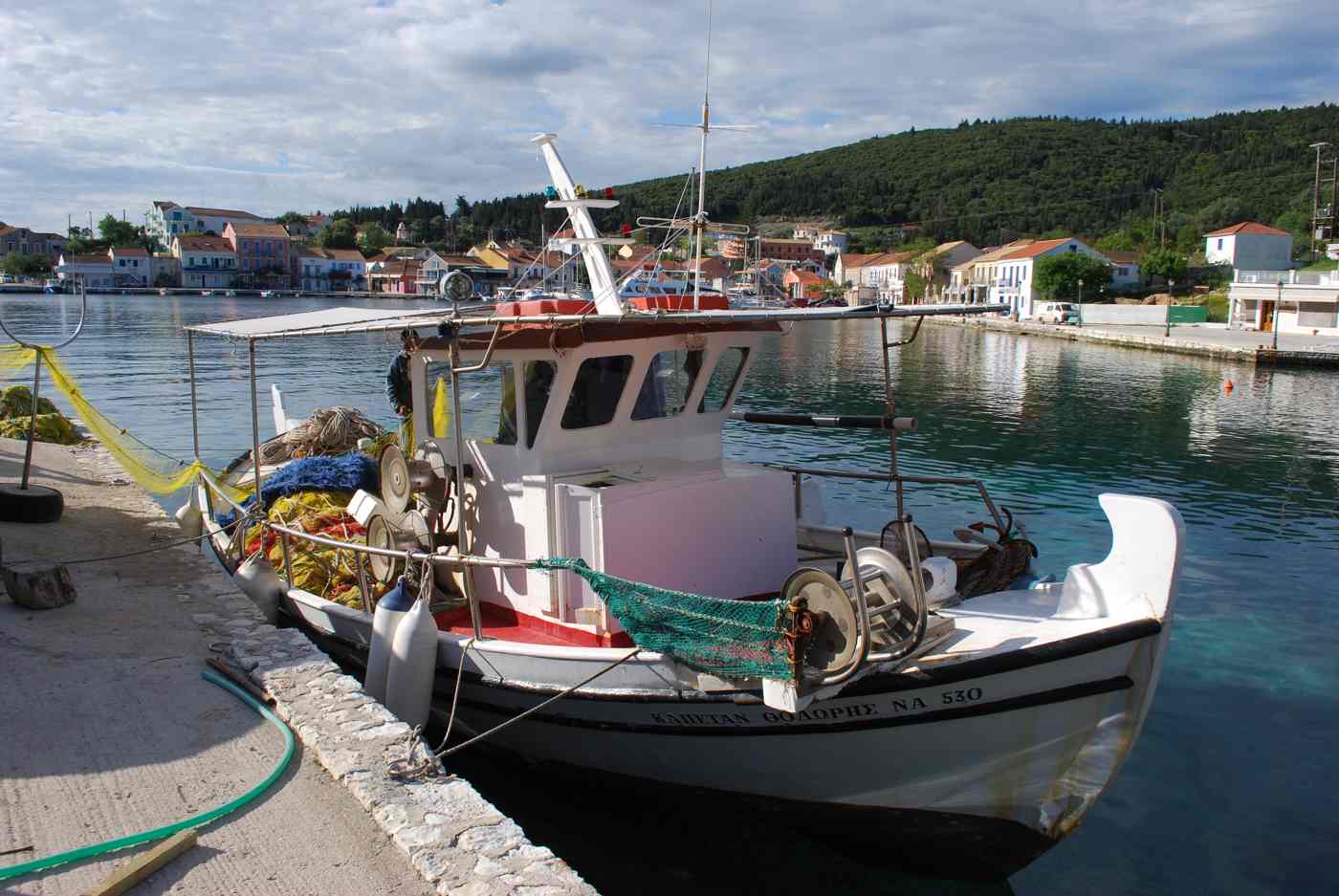
Loggerhead sea turtles, Caretta caretta, gather in Argostoli harbour, especially near the fish market on the town quay. The turtles feed on scraps thrown from the fishing boats, and swim slowly below the surface where visitors watch from the edge. Argostoli lies close to the nesting beaches of the south coast, so the turtles stay in the sheltered bay through the warmer months. A local rule asks people not to feed or touch them, since the turtles keep hunting wild food. Early morning gives the best view, when the boats come in and the water stays calm. The same waterfront holds the Napier Garden, a shaded public park, and the central Vallianos square with cafés.
A stroll along the quay ties together the harbour, the market and the town centre of Kefalonia.
Argostoli works as the main base for a Kefalonia trip, since the town holds the airport road, banks, shops and the bus station. The Archaeological Museum and the Korgialenios History and Folklore Museum display finds and photographs, including images of the town before the earthquake rebuilt it low. Ferries cross the bay to Lixouri from the town quay about every hour in summer, and the trip takes around 20 minutes. Beaches at Makris Gialos and Platis Gialos lie about 5 kilometres south, within a short drive of the centre. Tavernas around Vallianos square serve local dishes such as kreatopita, the Kefalonian meat pie.
From Argostoli, drivers reach Myrtos beach in about 40 minutes and Sami in about 30, which makes the capital a practical hub for the whole island.
What makes the villages of Assos and Fiskardo worth visiting in Kefalonia?
Assos clings to a narrow isthmus below a Venetian castle on a pine-covered headland on the northwest coast. Fiskardo, in the far north, keeps a Venetian-style harbour of pastel houses that survived the earthquake that flattened most of the island.
Assos sits on the northwest coast, about 36 kilometres north of Argostoli and 10 kilometres south of the Myrtos viewpoint. The village fills a narrow isthmus that joins the main island to a round, pine-covered peninsula. A Venetian castle from the late sixteenth century crowns the peninsula, and its walls ring the wooded hill above the bay. A footpath climbs from the village to the castle gate in about 30 minutes, and the top gives a view over both sides of the isthmus. Pastel houses line the small harbour, where fishing boats and three tavernas face a sheltered cove. A pebble beach curves along the bay, calm enough for a swim between meals.
Assos stays smaller and quieter than Fiskardo, and the winding approach road keeps large tour coaches away.
Fiskardo sits at the northern tip of Kefalonia, about 50 kilometres from Argostoli by a coastal road. The village kept its Venetian-style houses because the earthquake spared the far north while it flattened towns across the rest of the island. Pastel two-storey houses line the harbour, and yachts and small ferries tie up along the quay. A ruined Norman-era church and a lighthouse stand on the headland across the water, reached by a short coastal path. Tavernas and cafés fill the ground floors along the waterfront, and the harbour stays busy through the evening in summer. Boats leave Fiskardo for Ithaca and Lefkada, and the port links the sailing routes of the northern Ionian.
Emblisi and Foki, two pebble coves, lie within 2 kilometres of the village for a quiet swim.
The northwest coast road links Assos and Fiskardo along a cliff-lined route above the Ionian Sea. Between them, the Myrtos viewpoint looks down on the white curve of the beach from a car park beside the road. Divarata village, just above Myrtos, holds tavernas and the turn-off down to the shore. The drive from Argostoli to Fiskardo runs about 50 kilometres and passes Agia Efimia, a small east-coast harbour, on one route. Agia Efimia offers a quiet quay, tavernas and boats to nearby coves, about 10 kilometres north of Sami. Drivers often combine Assos, Myrtos and Fiskardo in one day, since the three sit along the same 20-kilometre stretch of coast.
Starting early avoids the midday coaches at the Myrtos viewpoint and the narrow lanes of Fiskardo.
Assos and Fiskardo suit travellers who want a base in the green north rather than near Argostoli. Both villages hold small hotels, rooms and studios, though the choice is smaller than in the capital, so booking ahead helps in high summer. Fiskardo has more tavernas, boat rentals and evening life, while Assos stays calmer and closer to Myrtos beach. A car is close to essential here, since buses to the north run only once or twice a day. Drivers reach the caves near Sami from Fiskardo in about an hour along the east coast. Walkers find marked paths around both villages, including the climb to the Assos castle and the coastal loop at Fiskardo.
This northern base pairs the two villages with Myrtos, the north beaches and the sailing coast of Kefalonia.
What can you do in the Mount Ainos national park in Kefalonia?
Mount Ainos national park protects the endemic Cephalonian fir and a herd of semi-wild horses across the highest range in the Ionian Islands. A paved road climbs toward the summit ridge, around 1,628 metres above sea level.
Mount Ainos, also spelled Enos, rises about 1,628 metres and forms the highest peak in the Ionian Islands. The national park covers the dark fir forest that gives the mountain its old name, Monte Nero, or Black Mountain. A narrow asphalt road turns off the main Argostoli to Sami route and climbs about 15 kilometres to a cluster of antennas near the summit. The drive takes around 30 minutes from the junction and gains roughly 1,000 metres of altitude through tight bends. From the top the view reaches Zakynthos, Ithaca and the Gulf of Patras on clear mornings. Bring water and a jacket, because the ridge stays about 8 degrees cooler than the coast.
Semi-wild horses graze in the clearings near the road, so drive slowly.
The Cephalonian fir, Abies cephalonica, grows across the higher slopes and takes its scientific name from this island. The tree reaches about 30 metres and once supplied timber for Venetian and later navies. A short marked trail begins near the park gate and loops through the forest in about 45 minutes. Wooden signs explain the endemic plants, the black earth and the fire-scarred trunks left by past summer blazes. The park sits inside a wider protected zone that also shelters wild boar, foxes and birds of prey circling the ridge. Rangers ask walkers to stay on the paths, because the thin mountain soil recovers slowly after damage.
The best light for the forest falls in the early morning, before the afternoon haze rises off the plain below.
The semi-wild horses of Ainos number around a dozen and roam the plateau near the summit road. Local tradition links them to animals left behind by shepherds and farmers generations ago. The herd moves between the fir clearings and the open grassland below the antennas, following the shade and water. Sightings are common in the cooler hours, near the meadow known as the Pilaros basin on the northern side. The horses stay wary of people, so watchers keep back about 20 metres and avoid feeding them. Conservation groups monitor the herd and count the foals each spring to track its slow recovery.
Drivers on the summit road slow to about 20 kilometres per hour on the blind bends where the animals cross. The plateau frames a wide view toward Sami and the eastern coast.
The drive up Ainos pairs well with a morning in the Omala valley, which sits at the western foot of the range. Most visitors reach the park from Argostoli in about 40 minutes, following signs for Frangata and then the summit road. The last section has no fuel, shops or shade, so fill the tank in the valley first. Winter snow closes the top for short spells, while spring brings wildflowers across the lower meadows. A basic map board stands at the gate, though the single road makes the route hard to miss. Photographers favour the ridge at sunset, when the fir line turns black against the Ionian Sea.
Allow about half a day for the mountain, including the walk, the viewpoints and the slow descent back to the coast road.
Where can you taste Robola wine and see the Agios Gerasimos monastery in Kefalonia?
The Omala valley in central Kefalonia holds both the Robola wine cooperative and the monastery of Agios Gerasimos, the island’s patron saint. The high plain sits about 20 kilometres east of Argostoli, ringed by the slopes of Mount Ainos.
Robola is the white grape that Kefalonia is best known for, grown on the stony high ground of the Omala valley. The vines root in limestone scree at about 300 to 600 metres, where cool nights slow the ripening. The local cooperative, founded by growers from the surrounding villages, presses the fruit into a dry, mineral white. A visitor room at the winery near Frangata explains the harvest and the crush without any book far ahead. The grape also grows on other Ionian islands, yet the Kefalonian bottling carries its own protected name. Tastings usually pour two or three wines, paired with local bread and cheese from the valley farms.
The setting frames the vineyards against the fir wall of Ainos, about 1,628 metres above.
The monastery of Agios Gerasimos stands on the Omala plain, dedicated to the monk who became the island’s patron saint. Two churches share the site, an older chapel above the cave where the saint prayed and a large modern church beside it. Pilgrims descend a narrow ladder into that small cave, which stays cool and quiet under the nave. The saint’s feast days, in mid-August and late October, draw crowds from across Kefalonia for processions and all-night services. A tall plane tree that the saint is said to have planted still shades the courtyard. Women visiting the church cover their shoulders and knees, as at other working Greek monasteries.
The vineyards of the Robola cooperative begin about three hundred metres away, so the two sights pair in a single morning.
The Omala valley spreads across a flat basin between low ridges, planted with vines, olives and vegetable plots. A loop of about 12 kilometres links Frangata, Valsamata and the smaller hamlets, each rebuilt low after the earthquake. Roadside stalls sell valley honey, thyme and the hard local cheeses that pair with the Robola white. The cooperative winery and the monastery sit within about two kilometres of each other, joined by a straight lane. Cyclists ride the quiet roads here, since the gradient stays gentle compared with the climb up Ainos. A single petrol station and two or three tavernas serve the villages, so plan fuel and lunch around them.
The valley works as a half-day trip from Argostoli, paired with the beaches on the way back down.
Robola tastings run through the warmer half of the year, when the winery keeps its visitor room open daily. The pour is dry and fresh, with a lemon edge that suits the island’s grilled fish and cheese pies. Groups larger than about ten call ahead, though pairs and small families arrive without notice. The cooperative also sells sweet Mavrodaphne and a rosé, alongside olive oil pressed in the same valley. Drivers taste in small measures and use the spittoon, since the mountain roads back to the coast demand a clear head. Buses reach Frangata from the capital on a limited schedule, so most visitors come by hire car.
A stop here rounds out a Kefalonia trip that runs beyond the beaches into the working countryside.
How do you reach Lixouri and the Paliki peninsula in Kefalonia?
A short car and passenger ferry crosses the Argostoli bay to Lixouri, the second town of Kefalonia, on the Paliki peninsula. The trip takes about 20 to 30 minutes and saves a long road detour around the lagoon.
The ferry between Argostoli and Lixouri runs across the inner bay about every hour through the day in summer. The crossing covers about 4 kilometres of calm, sheltered water and lands close to the Lixouri seafront. By road the same journey loops around the lagoon and the Paliki hills, about 35 kilometres and roughly 45 minutes. Foot passengers, cars and scooters all board, so day trippers often leave the car and walk on. The boat passes close to the harbour where loggerhead turtles feed, and gulls follow the wake across the bay. Service thins in winter and pauses in rough southerly weather, when the coast road becomes the only link.
The short hop makes Lixouri an easy half-day trip from the capital, even without a hire car.
Lixouri spreads along a flat waterfront, rebuilt low after the earthquake that levelled its old mansions. A central square opens behind the ferry quay, lined with cafés, a statue of the local poet Andreas Laskaratos and shade trees. The Iakovatios library and museum hold old books and icons in one of the grand houses that survived. Streets run in a simple grid, easy to walk end to end in about 20 minutes. The town serves the farms of Paliki, so its market sells valley produce, bread and fish landed at the quay. A long shingle beach called Lepeda lies about 3 kilometres south, backed by low red cliffs.
Lixouri feels quieter than the capital, and most visitors treat it as a calmer base on the western side of the bay.
Xi beach stretches along the south coast of Paliki, about 8 kilometres from Lixouri by a well-signed road. The sand here glows red-orange, and the shallow water stays warm and calm far from the shore. Low clay cliffs rise behind the beach, and bathers coat themselves in the grey mud dug from their base. A line of tavernas and sunbed rows backs the eastern end, while the western sand stays open and quiet. The gentle slope suits families, since children can wade out about 30 metres before the water reaches waist height. Sunset falls straight down the coast here, one reason the beach fills in the last hour of daylight.
Xi ranks among the island’s flagship beaches, alongside Myrtos and Antisamos, though its colour and shallows set it apart.
Petani beach sits on the northwest side of Paliki, a curve of white pebbles below green hills. The water shifts from pale turquoise to deep blue, much like Myrtos across the bay on the main island. A steep road drops to the shore, where two tavernas and a short row of sunbeds mark the centre. Swimmers find the pebbles give way to sand underfoot, and the bay stays sheltered from the southerly wind. Petani lies about 15 kilometres from Lixouri, an easy drive across the peninsula’s farmland and low ridges. The far northern tip of Paliki holds the lighthouse at Cape Gero Gombos and quiet coves reached on foot.
Together Xi and Petani make Paliki a full beach day, best paired with the short ferry back to the capital.


Can you take a day boat trip from Kefalonia to Ithaca?
Day boats and scheduled ferries link Kefalonia with neighbouring Ithaca, the small island tied to Homer’s Odysseus. The ferry from Sami reaches Ithaca in about 40 minutes to an hour, and summer cruises run from Fiskardo as well.
Ithaca lies just east of Kefalonia, across a strait about 4 kilometres wide at its narrowest point. The main car ferry crosses from Sami on the east coast to Piso Aetos, a bare quay on Ithaca. The trip takes about 40 minutes to an hour, depending on the boat and the swell in the channel. In summer smaller day boats also sail from Fiskardo in the north, landing at Frikes or the capital, Vathy. Foot passengers pay less than drivers, and most day trippers cross without a car and rent a scooter on arrival. The first boat leaves in the morning and the last returns in the early evening, so a full day fits easily.
Booking ahead helps in peak season, when cars fill the deck fast on the Sami service.
Vathy, the capital of Ithaca, wraps around one of the deepest natural harbours in the Ionian Sea. Pastel houses climb the slopes above the quay, rebuilt low after the same earthquake that struck Kefalonia. A small archaeological museum near the waterfront holds finds linked to the island’s Mycenaean and Homeric past. Tavernas line the harbour, and fishing boats unload the morning catch a short walk from the ferry berth. Above the town, the hill of Aetos carries the ruins that tradition ties to the palace of Odysseus. The bay is calm enough for a swim off the town beach, about 1 kilometre from the square.
Half a day in Vathy suits a slow lunch and a wander, before the afternoon return boat back to Sami.
The north of Ithaca holds Kioni and Frikes, two small harbours ringed by green hills and old windmills. Kioni curves around a sheltered inlet, its stone houses stepped above a quay where yachts moor for the night. Frikes sits about 3 kilometres away, a smaller port where the Fiskardo day boats tie up. A coast road links the two in about 10 minutes, passing coves such as Aspros Gialos on the way. Both villages survived the earthquake better than the capital, so their older houses still stand along the water. Tavernas here serve fish and the island’s honey, olive oil and wild greens from the terraced hills.
Day trippers from Fiskardo often land at Frikes, lunch in Kioni and swim before the return boat north.
A day trip to Ithaca works best with an early start from Sami, timed to the first ferry across. Drivers who bring a car reach both Vathy and the northern villages in one day, about 60 kilometres of narrow road. Foot passengers do better basing the day around one harbour, since buses on Ithaca run on a thin schedule. The crossing can pause in strong northerly wind, so check the boat before committing to a long drive to Sami. Bring water, a hat and a swim stop in mind, because shade is scarce on the open Ithaca quays. Fuel is limited on the smaller island, so top up on Kefalonia before boarding the ferry.
The trip adds a second island to a Kefalonia holiday for the cost of one ferry ticket.
What food and practical tips help you plan a Kefalonia trip?
Kefalonia rewards a hire car, a week’s stay and an appetite for local food, from meat pie to Robola wine. Roads are winding but paved, distances stay under about 50 kilometres, and the airport sits about 9 kilometres from Argostoli.
Kefalonian cooking centres on kreatopita, a rich meat pie of beef or lamb baked with rice, herbs and a little garlic. Cooks season it with cinnamon and cloves, a legacy of the island’s Venetian and British past. Aliada, a strong garlic and potato dip, comes with salt cod and grilled vegetables across the island. The sea sends up octopus, sardines and the small fish that tavernas fry whole along the harbours of Argostoli and Sami. Thyme honey, hard cheeses and the sweet Mavrodaphne wine round out most menus in the villages. Bakeries sell rovani, a rice-and-honey sweet, and the almond biscuits served at name-day tables.
Pair the food with a chilled Robola white, and a full Kefalonian meal runs long and slow into the evening.
Reaching the island takes a short flight or a ferry, and the details of how to get to Kefalonia shape the rest of a trip. Kefalonia Airport, code EFL, sits about 9 kilometres south of Argostoli and handles summer charters from across Europe. Ferries dock at Sami from Patras and at Poros and Argostoli from Kyllini on the Peloponnese mainland. Smaller boats link the island with Ithaca, Zakynthos and Lefkada, so island hopping needs little planning. A hire car waits at the airport and the ports, since the bus network runs thin outside the capital. Drivers stay on the right, mind the goats on hill roads, and allow extra time on the coast bends.
The airport transfer to Argostoli takes about 15 minutes by road.
The season runs from about May to October, with July and August the hottest and busiest months. Spring brings green hills, wildflowers and quiet beaches, while September keeps warm sea with thinner crowds. A week suits the island, long enough to mix Myrtos, Melissani, Fiskardo, Ainos and a boat to Ithaca. Base yourself near Argostoli or Lassi for the south, or around Fiskardo and Assos for the greener north. Beaches such as Myrtos have no shade, so bring an umbrella, water and reef-safe sunscreen. Cash still helps in the villages, though cards work in the towns and larger tavernas.
Distances stay short, under about 50 kilometres end to end, yet the winding roads make journeys feel longer than the map alone suggests, so pad each drive with extra minutes.
Kefalonia carries the marks of the earthquake that levelled its towns, so most buildings look low and modern. Fiskardo, spared the worst, shows how the old Venetian harbours looked, which explains its pull for visitors. The island stays greener than most Aegean islands, thanks to the fir forests and winter rain off the Ionian. Pack sturdy sandals for the pebble beaches, since Myrtos and Antisamos have no soft sand underfoot. Drive with a full tank on the mountain and Paliki roads, where fuel stations sit far apart. Respect the sea turtles in Argostoli harbour by keeping boats and hands away from the feeding animals.
A week here blends beaches, caves, wine, a high mountain and a second island into one unhurried trip across the largest of the Ionian Islands.
Frequently Asked Questions
How high is Mount Ainos and can you drive to the top?
Mount Ainos rises about 1,628 metres, the highest peak in the Ionian Islands, and a paved road climbs most of the way up. The route turns off the main Argostoli to Sami road and gains roughly 1,000 metres over about 15 kilometres of bends. The drive from the junction takes around 30 minutes, and the last stretch ends near a cluster of antennas below the true summit. A national park protects the endemic Cephalonian fir and a small herd of semi-wild horses that graze the plateau. From the top, clear mornings open views to Zakynthos, Ithaca and the Gulf of Patras.
The ridge stays about 8 degrees cooler than the coast, so a jacket and water help even in high summer. Winter snow closes the upper road for short spells. Most drivers pair the mountain with the Omala valley below, home to the Robola vineyards and the monastery of Agios Gerasimos, in a single half-day trip.
What is Robola wine and where does it come from?
Robola is the white wine grape that Kefalonia is best known for, grown mainly in the high Omala valley. The vines root in limestone scree at about 300 to 600 metres, where cool nights protect the fruit’s acidity. The result is a dry, mineral white with a lemon edge that pairs with the island’s grilled fish and cheese pies. A growers’ cooperative near Frangata presses most of the harvest and keeps a visitor room open through the warmer half of the year. Tastings there pour two or three wines, often with local bread and cheese from the valley farms. The grape also grows on other Ionian islands, yet the Kefalonian bottling carries its own protected name.
The cooperative sits about 20 kilometres east of Argostoli, close to the monastery of Agios Gerasimos, so the two make one easy morning. Drivers taste in small measures and use the spittoon, since the roads back to the coast twist and climb.
Who is Agios Gerasimos, the patron saint of Kefalonia?
Agios Gerasimos is the patron saint of Kefalonia, a monk who settled in the Omala valley and founded the monastery that carries his name. Pilgrims visit the site on the flat Omala plain, about 20 kilometres east of Argostoli, below the slopes of Mount Ainos. Two churches share the grounds, an older chapel above the cave where the saint prayed and a large modern church beside it. Visitors descend a narrow ladder into that small cave, which stays cool under the main nave. A tall plane tree the saint is said to have planted still shades the courtyard. The feast days, in mid-August and late October, draw crowds from across the island for processions and all-night services.
Women cover their shoulders and knees inside the church, as at other working Greek monasteries. The Robola vineyards begin about three hundred metres away, so the monastery and a wine tasting fit into the same short visit to the valley.
How do you get from Argostoli to Lixouri?
A short car and passenger ferry links Argostoli with Lixouri across the inner bay, and it runs about every hour through the summer day. The crossing covers around 4 kilometres of sheltered water and takes about 20 to 30 minutes. Foot passengers, cars and scooters all board, so most day trippers leave the car in Argostoli and walk on. By road the same journey loops around the lagoon and the Paliki hills, about 35 kilometres and roughly 45 minutes. Service thins in winter and pauses in rough southerly weather, when the road becomes the only route. Lixouri is the second town of Kefalonia, on the Paliki peninsula, with a flat waterfront rebuilt low after the earthquake.
From there, Xi beach lies about 8 kilometres south and Petani about 15 kilometres to the northwest. The ferry makes Lixouri and its beaches an easy half-day trip out of the capital, even for visitors without a hire car of their own.
Is Xi beach on the Paliki peninsula worth visiting?
Xi beach stands out for its red-orange sand and warm, shallow water, on the south coast of the Paliki peninsula about 8 kilometres from Lixouri. Low clay cliffs rise behind the sand, and bathers coat themselves in the grey mud dug from their base. The seabed slopes gently, so children wade out about 30 metres before the water reaches waist height. A row of tavernas and sunbeds backs the eastern end, while the western sand stays open and quiet. Sunset falls straight down the coast here, which fills the beach in the last hour of daylight. Reaching Xi means a short ferry from Argostoli to Lixouri and then a well-signed 8-kilometre drive south.
The colour and the calm water set it apart from the island’s pebble beaches, such as Myrtos and Antisamos. Paired with Petani, about 15 kilometres to the northwest, Xi turns the Paliki peninsula into a full beach day out of Argostoli and Lixouri.
How far is Ithaca from Kefalonia and how do you get there?
Ithaca sits just east of Kefalonia, across a strait about 4 kilometres wide at its narrowest, and a car ferry links the two. The main boat crosses from Sami on the east coast to Piso Aetos on Ithaca in about 40 minutes to an hour. In summer smaller day boats also sail from Fiskardo in the north, landing at Frikes or the capital, Vathy. Foot passengers pay less than drivers, and most cross without a car, then rent a scooter on arrival. The first boat leaves in the morning and the last returns in the early evening, so a full day fits with room to spare.
Vathy wraps around a deep natural harbour, while Kioni and Frikes hold quieter northern ports. The crossing can pause in strong wind, so check the schedule before a long drive to Sami. A day on Ithaca adds a second island to a Kefalonia trip for the cost of one ferry fare.
What food is Kefalonia known for?
Kefalonia is known for kreatopita, a rich meat pie of beef or lamb baked with rice, herbs and a touch of garlic. Cooks season it with cinnamon and cloves, a taste that traces back to the island’s Venetian and British rule. Aliada, a strong garlic and potato dip, comes with salt cod and grilled vegetables across the tavernas. The sea sends up octopus, sardines and small fish that kitchens fry whole along the harbours of Argostoli and Sami. Thyme honey, hard cheeses and the sweet Mavrodaphne wine round out most village menus. Bakeries sell rovani, a rice-and-honey sweet, and almond biscuits served at name-day tables.
Robola, the dry white from the Omala valley, is the wine that most locals pour with these dishes. Meals here run long and slow. A full table blends pie, fish. Dips and wine into the heart of a Kefalonian evening by the harbour, one that often lasts long past dark.