
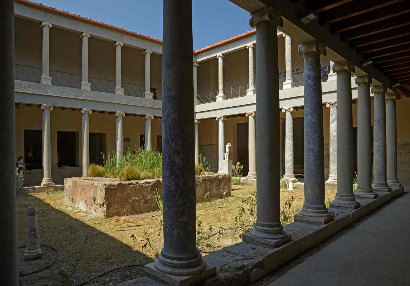
The Castle of Nerantzia stands at the harbour mouth of Kos Town, a double-walled fortress built by the Knights Hospitaller of Rhodes to guard the port. Its round and square bastions, deep moat, and carved gateways make it the defining medieval monument of the island. The name Nerantzia means bitter-orange in Greek, after the trees that once grew around its walls. A stone bridge across the former moat links the castle to Plateia Platanou and the Plane Tree of Hippocrates, joining medieval defence to classical memory in one short crossing. Plan the whole trip with Greece Tours.
This guide examines the Castle of Nerantzia across five subjects: what the fortress is and how it commands the harbour, the Knights Hospitaller who raised it and the meaning of its name. The double circuit of outer and inner walls with the moat between them, the round and square bastions that shaped its defence. The carved coats of arms and reused ancient stone set into its ramparts. Each section reads the castle as a layered record of Kos, from the classical city and the Asklepion to the medieval order that fortified the port.
What is the Castle of Nerantzia and where does it stand in Kos Town harbour?
The Castle of Nerantzia is a medieval fortress guarding the entrance to Kos Town harbour, built by the Knights Hospitaller. Its double walls, bastions, and moat crown the northeast headland where the main port meets the Aegean.
The Castle of Nerantzia occupies the rocky headland at the northeast tip of Kos Town, directly commanding the harbour mouth. Ships entering the port pass beneath its seaward walls, exactly the sightline the builders intended. The fortress sits at the edge of the island of Kos, the third-largest of the Dodecanese, roughly 4 kilometres northeast of the Asklepion. From the ramparts the water channel toward the Turkish coast near Bodrum stays in full view. The castle forms one corner of a compact monumental zone that includes the ancient agora and the harbour quay.
Its low, broad profile hugs the shoreline rather than rising as a tall keep, a shape dictated by cannon warfare and the flat coastal ground. A stone bridge over the former moat carries visitors across from the landward side.
The harbour setting explains the castle’s whole purpose. The Knights needed a fortified gateway to seal the port against raiders and rival fleets. The seaward bastions carried guns aimed across the anchorage, while the landward walls closed the fortress off from the town. Water once filled the moat on the town side, turning the castle into a near-island linked only by a bridge. The quay outside the walls handled cargo, pilgrims, and reinforcements arriving from Rhodes. Fishing boats and ferries still tie up along the same waterfront today, just metres from the medieval stone.
The odeon, the ancient agora, and the Casa Romana lie a short walk inland, so the castle anchors a dense band of ruins beside one working harbour. Cyclists reach it in minutes along the flat town grid.
A stone bridge spans the dry moat and connects the castle to Plateia Platanou, the small square that holds the Plane Tree of Hippocrates. Tradition says the physician taught his students beneath that tree, so the bridge joins a medieval fortress to a classical memory in one short crossing. The square sits at the heart of Kos Town, ringed by an Ottoman fountain, a mosque, and cafe tables. Visitors cross the bridge to reach the main gate on the castle’s landward flank. The moat below once held seawater and served as an extra barrier.
From the bridge the double line of walls becomes clear, the outer rampart standing lower and broader than the tall inner circuit rising behind it toward the sea. The bitter-orange trees that gave the castle its name once grew here.
The fortress divides into two concentric parts, an outer enceinte wrapping an inner enceinte, with a moat between the town and the walls. Round bastions mark the seaward corners, while square towers reinforce the angles facing land. Carved marble panels above the gateways display the coats of arms of the Grand Masters who ordered the work. Much of the building stone came from the ancient city and the nearby Asklepion, so columns, cornices, and inscribed blocks sit embedded in the ramparts. This reuse of classical material, called spolia, turns the walls into a record of the island’s older monuments.
The overall plan measures a compact rectangle, easy to walk in under an hour, yet dense with gateways, courtyards, gun platforms, and vaulted chambers built for a long siege.
Who were the Knights Hospitaller of Rhodes who built the Castle of Nerantzia in Kos?
The Knights Hospitaller, a military-religious order based on Rhodes, built the Castle of Nerantzia to defend Kos, their forward outpost in the Dodecanese. Their Grand Masters funded successive building phases, and the name Nerantzia means bitter-orange in Greek.
The Knights Hospitaller began as a medieval order caring for sick pilgrims in Jerusalem, then grew into a naval and military power. The order left the Holy Land, seized Rhodes, and ruled a chain of Dodecanese islands from that base. Kos became their second stronghold, guarding the sea lanes between Rhodes and the Anatolian coast. Understanding this order sits at the centre of the history of Kos during the later medieval centuries. The Knights garrisoned the harbour castle with brothers drawn from noble families across Europe, organised into national groups called langues. Each langue answered to the Grand Master on Rhodes, who directed defence across the whole island network.
Kos supplied grain, wine, and a forward watch against fleets approaching from the east. Their rule left carved arms and stone gateways still visible today.
Construction unfolded across two main phases under successive Grand Masters of the order. An earlier inner circuit rose first, a compact walled keep guarding the harbour entrance. A later, wider outer wall then wrapped around it, adding thick ramparts and corner bastions shaped for artillery. This second phase answered the spread of gunpowder cannon, which battered tall thin walls and forced engineers to build low and thick. The gateways of each phase carry the personal arms of the Grand Master who paid for that stretch of stone. Masons cut and set blocks quarried partly from ancient ruins nearby, saving effort and time.
The result reads as two castles nested together, an older core inside a younger shell, each generation strengthening the defences of the harbour.
The name Nerantzia comes from the Greek word for the bitter-orange tree, nerantzia. Groves of these trees once grew around the fortress and the harbour square, scenting the air near the gates. Locals attached the tree’s name to the whole castle, and Nerantzia stuck as the common Greek title. Older records and guidebooks also call it the Castle of the Knights, naming the order that raised it. Both names describe the same fortress at the harbour mouth of Kos Town. The bitter-orange, distinct from the sweet eating orange, yields a hard, sour fruit used for marmalade and spoon sweets across Greece.
This small botanical detail links the military stone to the everyday life of the island, where the same trees still line streets and courtyards in the old town.
The Knights held Kos and its castle until an Ottoman siege forced the order out of the Dodecanese in the early sixteenth century. The garrison withdrew to the western Mediterranean, and Ottoman forces took over the harbour fortress. Under Ottoman rule the castle stayed in military use, and later the Italian administration of the early twentieth century restored parts of the walls and cleared the moat. Each era left marks, from Knights’ coats of arms to Ottoman repairs and Italian consolidation. The castle therefore records four powers in one structure, the medieval order, the Ottomans, the Italians, and modern Greece. Archaeologists have studied the reused ancient blocks and the layered masonry to trace this sequence.
Visitors today walk through a fortress that changed hands yet kept its commanding position over the port.
How are the double walls and moat of the Castle of Nerantzia arranged?
The Castle of Nerantzia carries two concentric wall circuits, an inner enceinte enclosing an older core and a broad outer enceinte wrapped around it. A moat once filled with seawater separates the fortress from Kos Town on the landward side.
The inner enceinte forms the older heart of the castle, a compact walled quadrilateral raised in the first building phase. Its walls stand taller and narrower than the outer ring, matching a period before heavy cannon dominated siege warfare. Corner towers on this inner circuit once served as the main strongpoints and lookout posts over the harbour. A central courtyard inside these walls held stores, cisterns, and quarters for the garrison. This core protected the most valuable functions, command, munitions, and water supply, behind the strongest early defences. Gateways through the inner wall carry carved arms of the Grand Master who ordered this first phase.
From the inner parapet the whole outer circuit and the moat spread out below, giving defenders a clear field of fire in every direction.
The outer enceinte belongs to the later phase, a wide circuit built for the age of gunpowder artillery. Its ramparts run low and thick, sloped to deflect cannonballs and mounted with platforms for the castle’s own guns. This outer wall stands well beyond the inner circuit, creating a broad defended zone between the two rings. Attackers who breached the outer rampart faced a killing ground before ever reaching the inner walls. Bastions at the corners of this outer ring project outward, letting defenders fire along the wall faces at anyone approaching. The seaward side of the outer enceinte rises straight from the rocks above the water, blocking any landing beneath the guns.
Together the two circuits gave the harbour of Kos Town a defence in depth rarely matched on smaller islands.
The moat runs along the landward flank, separating the outer enceinte from Plateia Platanou and the town beyond. Seawater once filled this channel, turning the fortress into a near-island cut off from any direct assault. Only the stone bridge across the moat gave access to the main gate, and defenders controlled that crossing. The moat forced attackers to expose themselves in open water under fire from the walls above. Drained in later centuries, the ditch today lies dry and green, crossed by the same bridge visitors use. The Italian-era clearing of debris reopened much of the channel and revealed the base of the outer wall.
Walking the bridge, visitors read the defensive logic at a glance, the water barrier, the gatehouse, and the layered walls rising one behind the other toward the sea.
The space between the two enceintes forms a walkable corridor that rings the inner castle. Visitors follow this passage past gun embrasures, stairways, and vaulted rooms set into the thickness of the walls. Openings in the outer parapet frame views of the harbour, the anchored boats, and the channel toward the Turkish mainland. The corridor widens at the bastions into open platforms where cannon once stood behind stone merlons. Narrow stairs climb from the lower outer level to the higher inner parapet, marking the two building phases underfoot. This layout let defenders shift quickly between the outer guns and the inner keep during an attack.
The route makes the double-wall system tangible, a clear lesson in medieval and early-gunpowder fortification standing at the entrance to the port of Kos Town.
What role do the round and square bastions play in the defence of the Castle of Nerantzia?
Round bastions guard the seaward corners of the Castle of Nerantzia, while square towers brace the landward angles.
The round bastions anchor the corners of the outer enceinte facing the sea and the harbour mouth. Their curved faces deflect cannon fire, since a rounded surface turns shot aside better than a flat wall. Cannon mounted on these bastions covered the water approaches, the anchorage, and the base of the adjoining walls. A round tower gives gunners a wide arc, sweeping the sea in a broad half-circle without blind spots. The largest of these bastions dominates the seaward angle, its low bulk rising straight from the coastal rocks. Thick masonry inside the tower absorbed the recoil and the impact of enemy shot alike.
These rounded strongpoints mark the outer, gunpowder-era circuit, the part of the castle designed to fight ship-mounted and shore artillery across the harbour of Kos.
The square towers reinforce the landward angles and the older inner circuit of the fortress. A square plan suited the earlier phase, when walls stood tall and defenders relied on height rather than deflection. These towers rise above the inner enceinte, giving lookouts a clear view over the moat and the town approaches. Straight walls and right-angled corners made the square towers simpler to build from cut ancient blocks. Chambers inside each tower stored weapons and sheltered the garrison during bombardment. Arrow slits and small windows in the square towers command the bridge, the gate, and the landward ground. The contrast between rounded seaward bastions and square landward towers records the two eras of construction.
The medieval keep and the later artillery shell, standing side by side in one castle.
The defensive design relies on flanking fire, the principle that every wall face stays covered by guns from a projecting corner. Bastions set at the angles let defenders shoot along the walls, catching attackers at the base in a crossfire. No stretch of rampart stands beyond the reach of a neighbouring tower or bastion. The low, thick outer walls present a small target to enemy cannon while carrying heavy guns of their own. Sloped bases, called talus, thicken the walls at ground level and make undermining and battering harder. The seaward guns controlled the harbour entrance, so no hostile ship passed without running the gauntlet.
This integrated scheme, walls, moat, bastions, and gun platforms, turned the harbour corner of Kos Town into one of the strongest points in the Dodecanese.
Visitors walking the ramparts can trace each bastion in turn and read its purpose from its shape. The seaward round bastion offers the widest view, sweeping from the harbour breakwater to the open Aegean. Gun ports and platforms on this bastion once held the castle’s heaviest cannon aimed across the water. The square landward towers, reached by short flights of steps, look inland over the bridge and Plateia Platanou. Between the bastions the connecting walls carry a parapet walk sheltered by stone merlons. The stone underfoot mixes rough medieval blocks with reused ancient marble, visible in the tread of the ramparts. Circling the whole outer wall takes well under an hour.
Each corner reveals another angle on the harbour, the town, and the mountains rising behind Kos Town toward Mount Dikeos.
What do the carved coats of arms and reused ancient stones reveal at the Castle of Nerantzia?
Carved coats of arms above the gateways of the Castle of Nerantzia name the Grand Masters who funded each phase. Reused columns and inscribed blocks from the ancient city and the Asklepion stand set into the walls as spolia.
The coats of arms carved above the gateways served as signatures in stone, recording who ordered each part of the castle. Each Grand Master of the Knights bore his own heraldic shield, and masons set these shields over the gates he funded. A visitor reading the arms in sequence follows the chain of leaders who strengthened the harbour fortress across the medieval period. Marble panels carry the crosses, bands, and emblems of the order alongside the personal devices of the Grand Masters. Weathering has softened parts of the carving, yet the shields above the main gate and the inner doorway stay legible.
These heraldic panels tie the anonymous stone to named individuals and a datable sequence of building work. Reading them turns the walls of Kos into a public register of the order’s rule.
The reused ancient stone gives the castle a second layer of history built into its fabric. Masons of the Knights quarried marble columns, capitals, and cut blocks from the ruins of the ancient city of Kos. These pieces, set sideways or upright inside the walls, show up as round column drums bonded into square masonry. This practice, known as spolia, saved the labour of cutting fresh stone and reused durable ancient marble. A close look at the ramparts reveals fluted column shafts, moulded cornices, and blocks bearing worn Greek letters. Each fragment once belonged to a temple, a stoa, or a public building of the classical and Roman city.
The walls therefore carry the physical remains of ancient Kos, recycled into a medieval defence at the harbour edge.
The nearby Asklepion supplied part of the ancient stone worn into the castle walls. That terraced healing sanctuary of Asclepius stands about 4 kilometres southwest of Kos Town, above the plain. Over the medieval centuries its marble columns and blocks became a convenient quarry for builders working at the harbour. Column drums and cut stones taken from the sanctuary now sit bonded into the ramparts of Nerantzia. This link joins the two principal monuments of the island, the ancient medical shrine and the Knights’ fortress, in a single chain of stone. The removal stripped material from the Asklepion, yet it also preserved fragments inside the sturdy castle walls.
Studying which blocks came from the sanctuary helps archaeologists reconstruct the original buildings and understand how later builders reused the classical heritage of Kos.
A visitor looking closely at the walls of Nerantzia reads three histories at once in the stone. The medieval masonry of the Knights forms the main structure, cut and laid for defence. The carved coats of arms above the gates name the Grand Masters and date the phases of work. The reused ancient columns and inscribed blocks carry the memory of classical and Roman Kos into the fortress. Together these elements make the castle a layered document, not a single-period monument. The best places to spot spolia lie around the gateways, the bastion bases, and the lower courses of the outer wall.
Slowing down at these points rewards the eye, turning a walk along the ramparts into a reading of the long, connected story of the island and its harbour town.
How does the stone bridge link the Castle of Nerantzia to Plateia Platanou in Kos Town?
A stone bridge spans the former moat and joins the Castle of Nerantzia to Plateia Platanou in Kos Town. The crossing carries visitors from the harbour fortress straight into the square beside the Plane Tree of Hippocrates.
The stone bridge over the former moat forms the main link between the Castle of Nerantzia and Plateia Platanou. Builders under the Knights of Saint John raised the fortress at the harbour mouth, and the moat once separated it from the town. The bridge now carries foot traffic across that gap in about twenty paces. Plateia Platanou sits at the western end of the crossing, a small square paved in worn stone slabs. From the bridge deck, walkers see the outer bastion on one side and the shaded square on the other. The short route connects the harbour defences directly with the civic heart of old Kos Town.
Cyclists and pedestrians reach the square along the flat waterfront in under five minutes from the ferry quay near the port.
Plateia Platanou takes its name from the enormous plane tree at its centre. Tradition holds that Hippocrates taught his students in the shade of this tree, and the square honours that story beside the harbour. The trunk has grown hollow and wide, propped now on stone and iron supports around its base. Visitors walk beneath the branches on their way between the castle bridge and the town centre, and travellers pause here to read the Plane Tree of Hippocrates story on the nearby marker. The tree stands only a short step from the fortress bridge, so the two sights connect in one brief walk.
Its wide canopy shades the fountain and the mosque that share the square, drawing a steady stream of walkers through the day.
An Ottoman-era fountain stands at the edge of Plateia Platanou, close to the plane tree. The structure dates from the centuries when Kos lay under Ottoman rule, and its carved spouts once served the townspeople and their animals. A domed canopy and a shaded basin mark the design, set against the wall of the square. Water once flowed here for the market crowds who gathered under the plane tree. The fountain faces the castle bridge across the paved space, so the Knights’ fortress and the Ottoman waterwork sit within one view. Stone benches and low walls edge the square around the basin.
The fountain records the Ottoman phase of Kos Town in plain sight, only steps from the medieval harbour walls of Nerantzia at the port entrance.
The Loggia Mosque completes the trio of monuments around Plateia Platanou. Built during the Ottoman period, it rises on an arcaded base beside the plane tree and the fountain. Its minaret stands above the square, visible from the castle bridge and the harbour front. A stairway climbs from the loggia arches to the prayer hall on the upper level. The mosque shares its stone square with the Knights’ bridge, so medieval and Ottoman Kos meet in one compact space near the port. Together the plane tree, the fountain and the Loggia Mosque form the western gateway to the Castle of Nerantzia.
Walkers cross the bridge and reach all three sights within a single short circuit of the harbour edge, steps from the ferry quays and the town waterfront.
What did the later Ottoman and Italian-era phases add to the Castle of Nerantzia?
The Castle of Nerantzia passed from the Knights of Saint John to the Ottomans, who held it for centuries, and later the Italian administration carried out repairs and studies of the double-walled harbour fortress at Kos Town.
The Knights of Saint John built the Castle of Nerantzia in two main rings of walls. An inner enceinte rose first, and an outer wall with round bastions followed, giving the fortress a double line of defence. Coats of arms carved in stone still mark the gates and towers, recording the grand masters who ordered the work. The castle guarded the harbour entrance of Kos Town, paired across the water with the crusader castle at Bodrum on the Turkish coast. Its position let the Knights control shipping through the narrow strait. Thick curtain walls and corner towers enclosed a wide inner court.
The layout shows the military engineering of the Knights before the Ottomans took the island and its fortress at the harbour mouth of the port.
The Ottomans captured Kos and its castle after the fall of the Knights across the Dodecanese. The fortress then served the Ottoman garrison for centuries, holding the harbour and the town under close control. The rulers of that era left their mark on Kos Town in the Loggia Mosque and the fountain by the plane tree, close to the castle bridge. Nerantzia stayed a working defence through the Ottoman centuries, holding cannon along its seaward walls. The name Nerantzia, from the bitter-orange trees of the area, carried on through this period. The garrison watched the strait toward Bodrum, where an Ottoman fortress faced Kos across the water.
The castle thus stands as a record of the long Ottoman presence on the island, layered over the earlier work of the Knights.
The Italian administration took the Dodecanese, including Kos, in the early twentieth century and turned attention to Nerantzia. Italian archaeologists and engineers studied the fortress, cleared debris, and recorded its walls and towers as a historic monument. Their broader works reshaped Kos Town, adding the wide avenues, the market hall and public buildings of the Italian-era grid around the harbour. A strong earthquake struck Kos during this period, and the reconstruction that followed exposed the ancient agora beside the castle. The Italians framed the medieval fortress as part of a planned townscape, linking it to the excavated ruins nearby. Their surveys form much of what visitors read about the castle today.
The Italian phase thus set the fortress within the modern layout of Kos Town at the harbour, as a preserved landmark.
Three eras stack together in the walls of Nerantzia today. The Knights raised the double ramparts and carved their coats of arms. The Ottomans held the fortress and shaped the square beyond the bridge. The Italians studied and framed the site within a new town plan. Visitors reading the stones can trace each phase in the masonry, the blazons and the gun positions. The castle sits at the harbour entrance, a short walk from the ancient agora, the Casa Romana and the town beaches of Lambi. Its layered history mirrors the layered history of Kos Town itself, where Greek, Roman, medieval, Ottoman and Italian marks overlap.
The double walls of Nerantzia hold that long record in one compact fortress at the edge of the harbour, guarding the old port.
What can visitors see from the walls of the Castle of Nerantzia in Kos?
The walls of the Castle of Nerantzia give wide views over the harbour of Kos Town, the marina and the strait toward Bodrum. Ramparts and towers open sightlines across the port, the waterfront and the eastern Aegean channel.
The seaward walls of Nerantzia look straight over the harbour of Kos Town. Fishing boats, ferries and yachts fill the marina below the ramparts, and the curved mole reaches out to the harbour mouth. The castle sits at the entrance, so the walls frame every vessel that passes into the port. From the towers, the view runs along the waterfront promenade lined with cafes and the Italian-era buildings of the town. The domed roof of the Loggia Mosque and the plane tree square lie just inside the bridge. Ferry routes to Nisyros, Kalymnos, Pserimos and Bodrum begin from these quays under the walls.
The harbour panorama from Nerantzia shows the working heart of Kos Town, where sea traffic gathers at the northeast corner of the island beside the old fortress.
Beyond the harbour, the walls open a clear line across the strait toward Bodrum on the Turkish coast. The channel here narrows to roughly 4 kilometres at its tightest, so the hills of Asia Minor rise plainly on the horizon. Day boats cross this water from Kos Town to Bodrum in under an hour, and the castle once guarded exactly this approach. From the ramparts, watchers can follow the wake of each vessel across the strait. The paired crusader castles of Nerantzia and Bodrum once controlled the same passage from opposite shores. Travellers planning things to do in Kos often climb the walls first to read the coastline and the sea lanes.
The strait view ties the fortress to its old role at the frontier between the Aegean and the Anatolian mainland.
The walls of Nerantzia face north and east, so the morning sun lights the harbour and the strait. Early risers on the ramparts watch the sky brighten over the Anatolian hills across the water. In the evening, the low sun warms the stone of the outer walls and the masts in the marina below. The flat coast of northern Kos stretches west toward Tigaki and Lambi, with the town beaches close under the fortress. Mount Dikeos, the island’s high ridge at about 846 metres, rises inland behind Kos Town. From a single walkway on the walls, visitors can turn from the open sea to the mountain in one slow sweep.
The castle offers the widest all-round view over the northeast corner of Kos from any point in the town centre.
The wide sightlines from Nerantzia were the reason the Knights built here. Control of the harbour mouth and the strait meant control of the sea road between the Aegean islands and the Anatolian coast. Cannon set along the seaward walls reached ships in the channel below. The towers gave lookouts a long warning of any fleet approaching from the direction of Bodrum. The double walls faced the most exposed side, toward the open water and the enemy shore. This same commanding view now serves visitors rather than gunners, turning a fortress of war into a viewpoint over Kos Town.
The harbour, the marina, the ferry lanes and the far coast all lie within one glance from the ramparts, exactly as the castle’s builders intended at the harbour entrance.
How do visitors reach the Castle of Nerantzia on foot and combine it with nearby Kos Town sights?
Visitors reach the Castle of Nerantzia on foot from the harbour front, crossing the stone bridge at Plateia Platanou. The fortress sits within a short walk of the ancient agora, the Casa Romana and the town beaches of Lambi.
The Castle of Nerantzia stands at the northeast edge of Kos Town, right on the harbour. Visitors arriving by ferry step off at the quays and reach the fortress within minutes on foot along the waterfront. The entrance lies across the stone bridge from Plateia Platanou, beside the plane tree and the Loggia Mosque. The flat, walkable grid of Kos Town makes the approach easy, and the port, the square and the castle line up within 300 metres of each other. Cyclists find racks near the harbour, since Kos is known across the Dodecanese for cycling. The bridge delivers walkers straight to the outer gate of the fortress.
No steep climb stands between the town and the walls, which sit almost at sea level by the water.
The ancient agora of Kos lies just inland from the castle bridge, a two-minute walk from the harbour. This open field of ruins holds the marketplace, temple foundations and colonnades of the ancient city, exposed after the earthquake of the Italian period. A stroll south from Plateia Platanou leads directly through the excavation. The agora connects the medieval fortress with the Greek and Roman town that grew around the same harbour. Broken columns and mosaic fragments line the paths among the ruins, open to walkers without a gate between them and the street. The site sits at the meeting point of ancient and medieval Kos Town.
Visitors combining the castle with the agora cross barely 200 metres between the two, tracing the layers of the city beside the port in one short walk.
The Casa Romana lies a short walk south of the castle and the agora, deeper into Kos Town. This restored Roman villa recreates a wealthy house of the imperial city, with courtyards, mosaic floors and reconstructed rooms around interior gardens. The walk from the harbour fortress to the villa runs about 600 metres through the town grid. Together the Casa Romana, the agora and the odeon nearby show the Roman layer of Kos beside the Greek and medieval remains. Visitors often pair the castle with the Casa Romana in one morning, moving from the harbour walls to the inland ruins. The route passes cafes, squares and Italian-era streets on the way.
This cluster of sites within walking distance makes Kos Town a compact open-air record of the island’s long history at the northeast harbour.
The town beaches of Lambi lie along the coast just north of the castle, within walking or cycling distance. After the fortress, the agora and the Casa Romana, visitors reach sand and shallow water at the edge of Kos Town in about fifteen minutes on foot. The flat seafront path connects the harbour, the beaches and the marina in one continuous line. Bicycles rented near the port cover the same ground in minutes, since Kos rewards two wheels. The castle thus anchors a walking circuit that pairs history with the sea in a single day.
Visitors climb the walls, cross the bridge to the plane tree, trace the agora and the Casa Romana, then finish at the Lambi shore. The harbour fortress stands at the centre of this compact route through northeast Kos Town.
Why is the Castle of Nerantzia a symbol of Kos Town and its harbour skyline?
The Castle of Nerantzia stands at the harbour entrance as the defining landmark of Kos Town, its double walls and towers shaping the skyline that greets every arriving ferry. The fortress marks the port in photographs and in memory alike.
The Castle of Nerantzia is the first sight for travellers arriving by sea at Kos Town. Ferries from Piraeus, Rhodes and the neighbouring Dodecanese islands round the mole and pass directly beneath its walls. The low, wide fortress fills the northeast point of the harbour, its round bastions rising straight from the water. Passengers on the deck see the double ramparts before the town behind them comes into view. The castle frames the port the way a gate frames a courtyard, marking the threshold between the open Aegean and Kos Town. This arrival view has fixed Nerantzia as the emblem of the island’s capital.
The fortress at the harbour mouth tells every visitor at once that Kos is an old island of the Knights, guarding its port from the sea.
Nerantzia binds together the varied townscape of Kos Town around the harbour. The medieval walls sit next to the ancient agora, the Roman remains, the Ottoman mosque and fountain, and the Italian-era waterfront. This single fortress gathers the island’s whole history at one point of the port. Visitors reading the skyline see the castle, the plane tree square and the domed mosque in one frame. The fortress gives Kos Town a clear centre, a fixed landmark against which the flat modern grid and the seafront cafes arrange themselves. Postcards, maps and guidebooks of the island place Nerantzia at the front. The castle serves as the visual shorthand for Kos Town.
The image that stands for the capital in the same way the Asklepion stands for the island’s ancient fame beyond the harbour.
The name Nerantzia, meaning bitter orange, ties the castle to the land around Kos Town. Bitter-orange trees once grew near the fortress, and the tree lent its name to the medieval stronghold. This local name sets Nerantzia apart from the crusader castles of the Aegean. The fortress carries the coats of arms of the grand masters of the Knights of Saint John, cut into its gates and towers. These blazons record the international order that ruled Kos and Rhodes, yet the local name keeps the castle rooted in its own island. Nerantzia thus belongs to Kos in both stone and word.
The fortress stands as the island’s own castle, named for its own trees, guarding its own harbour at the northeast edge of the town by the sea.
The Castle of Nerantzia holds its place at the heart of Kos Town through every era. Greeks, Romans, Knights, Ottomans and Italians each left a layer, yet the fortress at the harbour still frames the port as it did for the Knights. Visitors cross the bridge past the plane tree, climb the walls, and look out over the same strait toward Bodrum that the garrison once watched. The castle joins the Asklepion and the Plane Tree of Hippocrates as one of the three images that define the island. It stands at the harbour entrance, a short walk from the agora, the Casa Romana and the beaches of Lambi.
Nerantzia remains the fixed point of Kos Town, the stone fortress on the water that marks the island’s capital for every arriving traveller.
Frequently Asked Questions
Where is the Castle of Nerantzia in Kos?
The Castle of Nerantzia stands at the entrance of the harbour in Kos Town, on the northeast coast of the island. The fortress sits right on the water, guarding the port mouth where ferries and yachts enter. A stone bridge over the former moat links the castle to Plateia Platanou, the square with the Plane Tree of Hippocrates, the Ottoman fountain and the Loggia Mosque. From the bridge, the ancient agora lies about 200 metres inland, and the Casa Romana about 600 metres further into the town grid. The town beaches of Lambi run along the coast just north of the walls.
Kos Town, the capital and main port, occupies the northeast corner of the island, opposite the Turkish coast near Bodrum. The castle marks the point where the sea road meets the town. Visitors arriving by ferry pass directly beneath the walls, since the fortress fills the harbour entrance at the front of the capital.
Who built the Castle of Nerantzia?
The Knights of Saint John built the Castle of Nerantzia to guard the harbour of Kos Town. This military order, based on Rhodes, raised fortresses across the Dodecanese, and Kos held one of the strongest. The Knights built the castle in two rings, an inner enceinte and an outer wall with round bastions, giving it a double line of defence. Coats of arms of the grand masters, cut into the gates and towers, still record the men who ordered the work. The name Nerantzia comes from the bitter-orange trees that grew near the site. After the Knights, the Ottomans captured Kos and held the fortress for centuries, adding the mosque and fountain to the square beyond the bridge.
The Italian administration later studied and repaired the walls and set them within a new town plan. The castle thus carries the mark of Knights, Ottomans and Italians alike, but the Knights of Saint John gave it its double-walled form at the harbour entrance.
Why is the castle called Nerantzia?
The castle is called Nerantzia after the bitter-orange trees, nerantzia in Greek, that grew near the fortress at Kos Town. The word points to the local landscape rather than to a ruler or a saint. Bitter oranges, grown across the Mediterranean for their fruit and blossom, gave the medieval stronghold its Greek name. This sets Nerantzia apart from the crusader castles named for their orders or towns. The Knights of Saint John built and held the fortress, and their coats of arms mark the gates, yet the island kept its own name for the place. The name has stayed through the Ottoman and Italian eras to the present.
Visitors still know the harbour fortress of Kos Town as the Castle of Nerantzia. The name ties the double walls to the soil of the island, naming a fortress of an international order for a common local tree. Nerantzia thus reads as the island’s own name for its own castle by the harbour.
How do I get to the Castle of Nerantzia?
You reach the Castle of Nerantzia on foot along the harbour front of Kos Town. Ferries dock at the quays steps from the fortress, and the entrance lies across a stone bridge from Plateia Platanou. The flat, walkable grid of Kos Town makes the approach easy, with no steep climb between the streets and the walls. Kos International Airport near Antimachia sits about 25 kilometres from the town, linked by bus and taxi. From the town centre, the castle, the plane tree square and the ancient agora line up within 300 metres of each other. Cyclists find the harbour easy to reach, since Kos is known across the Dodecanese for its flat, bike-friendly terrain.
The bridge over the former moat delivers walkers straight to the outer gate. The fortress sits almost at sea level by the water, so the visit needs only a short, level walk from the port or the town centre of Kos.
What is Plateia Platanou next to the castle?
Plateia Platanou is the square at the western end of the castle bridge in Kos Town. Its name means Plane Tree Square, after the enormous plane tree at its centre. Tradition holds that Hippocrates taught his students in the shade of this tree, which ties the square to the island’s most famous doctor. The trunk has grown hollow and wide, propped now on stone and iron supports. An Ottoman-era fountain stands at the edge of the square, with a domed canopy and a carved basin that once served the town. The Loggia Mosque rises beside the tree on an arcaded base, its minaret marking the skyline.
The stone bridge over the former moat joins this square directly to the Castle of Nerantzia. Plateia Platanou thus gathers the plane tree, the fountain and the mosque in one paved space at the harbour. Forming the western gateway to the fortress and a meeting point of Greek, Ottoman and medieval Kos.
What can I see near the Castle of Nerantzia?
Near the Castle of Nerantzia you find most of the historic sights of Kos Town within a short walk. Across the bridge lies Plateia Platanou, with the plane tree, the Ottoman fountain and the Loggia Mosque. About 200 metres inland the ancient agora spreads its marketplace ruins, temple foundations and colonnades in an open field. The Casa Romana, a restored Roman villa with mosaic floors and courtyards, sits about 600 metres further into the grid, near the odeon. The town beaches of Lambi run along the coast just north of the walls. Cafes, squares and Italian-era buildings line the waterfront between these sites.
The harbour itself fills with ferries and yachts, with boats leaving for Nisyros, Kalymnos, Pserimos and Bodrum. All of these lie within walking distance of the fortress, which makes Kos Town a compact circuit of Greek. Roman, medieval, Ottoman and Italian remains gathered around one harbour at the northeast of the island.
What views does the Castle of Nerantzia offer?
The Castle of Nerantzia offers wide views over the harbour of Kos Town and the strait toward Bodrum. From the seaward walls, visitors look down on the marina, the ferries and the curved mole at the harbour mouth. The channel to the Turkish coast narrows to roughly 4 kilometres, so the hills of Asia Minor rise plainly across the water. Day boats crossing to Bodrum pass beneath the ramparts within view. West of the fortress, the flat coast runs toward Tigaki and Lambi, with the town beaches close under the walls. Inland, Mount Dikeos rises to about 846 metres behind Kos Town.
From a single walkway, the eye turns from the open sea to the mountain in one sweep. The castle gives the widest all-round view over the northeast corner of the island. The same sightlines that once guarded the harbour now serve visitors reading the coast, the port and the far Anatolian shore from the walls.