
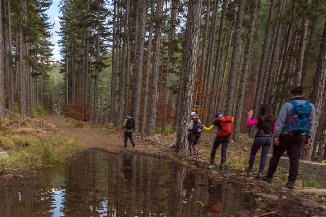
A Grevena hiking tour follows marked mountain paths in Western Macedonia, where the Pindus range meets the Aliakmonas valley and limestone ridges rise above oak and pine forest. To browse trips in every region, open our Greece Tours homepage.
Below are the guided hike you can book, the Mount Orliakas route, how hard the walking is, the longer trails, the plants and animals, the right season and the questions hikers ask.
What is a Grevena hiking tour?
It is a guided walk through the mountains of Grevena, a regional unit of Western Macedonia. The Pindus range covers its western part, and each seller sets its own route, length, group size and meeting point.
Wikipedia states that the Pindus mountains cover the western part of the regional unit. The Aliakmon is its longest river. Mount Orliakas, the mountain named in the GetYourGuide Grevena hiking tour, stands in the same unit.
Villages on the mountain include Ziakas, Spileo and Perivolaki, according to Topoguide. Ziakas lies at 900 m of altitude, 19 km south-west of Grevena town. Spileo stands at 960 m, 4 km south of Ziakas.
Every seller writes its own terms. Route, length, group size and start point differ from one Grevena hiking tour to the next. Compare those four details before you book.
Walkers can also go without a seller, because Topoguide publishes a route description for Orliakas. Our Grevena tours page lists the other outdoor activities of the regional unit, while this page covers the walking side.
Which Grevena hiking tour can you book?
GetYourGuide sells the five-hour private outing “Grevena: Mount Orliakas and Portitsa Canyon Hike” in English and Greek. The booking form takes one to four people, the calendar lists Saturdays and Sundays, and cancellation is free.
The title names two places, Mount Orliakas and Portitsa Canyon. The listing text invites guests to explore the mountain and discover the canyon in the Grevena region. GetYourGuide files the activity under Grevena.
GetYourGuide labels this Grevena hiking tour a private tour and a small group. The booking form accepts between one and four participants.
The listing sets one booking rule: guests must book at least 10 hours in advance. It carries a free cancellation label. The calendar lists only Saturdays and Sundays. English is the default language, and Greek is the second option.
Other sellers run a different Grevena hiking tour with their own terms. Each line below comes from the seller’s own page.
- Greek Adventure runs an easy Grevena hiking tour from Spileo of around two and a half hours. The group meets at the village square at 10.00 am. An English-speaking guide and a light snack are included.
- Trekking Hellas sells a Grevena hiking tour with via ferrata, titled “Grevena: Hiking and Via Ferrata”, in Keli Kalogrias. It lasts 3 hours, meets at 09.30 am, runs throughout the year and needs at least two participants.
- Trekking Hellas also sells a jeep safari with a hike of 1 to 3 hours in Valia Calda. The whole outing takes 4.5 to 6 hours and runs from March to November.
- Active Leisure lists a jeep tour with soft hiking in Valia Calda National Park. It starts from Perivoli, a village 43 km west of Grevena. The same page lists canyoning at the roots of Orliakas.
Choose the seller by activity first. Options are a mountain walk, a valley walk, a jeep trip with a short hike and a via ferrata climb. Then compare the dates, because each Grevena hiking tour runs on its own schedule.
The Trekking Hellas via ferrata outing includes an English-speaking guide, first aid kits and a snack. It also includes liability insurance, taxes and other necessary equipment. Anything the page does not mention is excluded.
What does Mount Orliakas show on a Grevena hiking tour?
Orliakas is a small limestone mountain with a 4 km ridge and summits of 1,432 m and 1,453 m. Oak and pine woods cover it. The summit looks toward Olympus, and a Natura protected area includes it.
A Grevena hiking tour on Orliakas climbs a mountain of small extent, says Topoguide. Its two highest summits reach 1,453 m and 1,432 m, and its ridge is 4 km long. Liagkouna, the next peak to the west, reaches 1,526 m.
The mountain branches off the central masses on the eastern side of the northern Pindus. It spreads between two branches of the Venetikos river, a tributary of the Aliakmon. The ridge ends where the two branches meet, just downstream of the Portitsa gorge.
Rock gives the mountain its shape. Topoguide describes the Liagkouna and Orliakas complex as the largest of the limestone scales of the north-east Pindus. These limestone blocks rise like islands inside a pocket of rock fragments and conglomerate from the neighbouring molasse.
Large springs break out where the limestone meets the impermeable rock below, such as the spring of Ziakas. It lies above the village. Other springs rise at Kerasia and Perivolaki. Topoguide calls these springs anchor points of settlement and farming.
Oak woods cover the edge of the mountain, led by the Macedonian oak. The higher slopes carry a mix of black pine and fir, with clearings between them. Maples, lindens and hornbeams grow among the broadleaf trees, together with single yew trees.
Wild cherry and dogwood grow in clearings that were once farmed. Beech begins on Liagkouna. Along the two rivers, plane, willow, ash and alder trees line the banks.
The flora account of Topoguide lists three lily species in the wet clearings of the mountain forest. In open ground it records two crocuses, and on stony ground the yellow tulip and mountain tea. Every Grevena hiking tour on this mountain walks through that plant cover.
The same account names twelve orchid species, sorted by habitat. They grow in mountain forest, cool streams, meadows and open woods, and on rocky slopes. One orchid, Himantoglossum jankae, hides in shady places.
From the summit, walkers on a Grevena hiking tour see Olympus, Vasilitsa, Smolikas, Pieria and other mountains, says Topoguide. Its Ziakas page adds a view toward Spileo, Ziakas, Lavda and the whole plain from higher up.
The ground of a Grevena hiking tour here lies in the Natura site Ori Orliakas kai Tsourgiakas, code GR1310004. The site covers 9,848 hectares in the municipality of Grevena. It holds the status of a Special Protection Area and is listed for 13 bird species.
The standard data form describes two rocky mountains with oaks, other broadleaf trees and black pine forest. It adds abandoned fields and an abundance of cliffs. Topoguide also states that Orliakas now belongs to the enlarged Northern Pindus National Park.
How hard is a Grevena hiking tour?
The effort depends on the seller. Orliakas is not an easy mountain, says Topoguide, because cliffs and steep slopes ring it. The easier option is the Greek Adventure walk from Spileo: easy, 5 km, 410 m of altitude difference.
Topoguide adds a surprise: the path to the summit is easier to walk than the edge of the mountain. Dense vegetation covers the edge.
The Topoguide route starts at the camp sites just outside Ziakas. A spring above the main camp entrance marks the start. A mountaineering sign points toward Spileo, and the path is clear. It climbs until it meets a forest road.
There the walker turns left toward the old woman’s cell, then reaches a plateau with benches for a rest. The road narrows into a path. The mountaineering mark is yellow and blue spray paint. Other marks on the trees look like leftovers of a motorbike race.
The path then crosses a mixed pine and maple wood, which Topoguide singles out. It turns steep, with rock on both sides, and reaches a saddle. The way continues left to the summit, and walkers return by the same path.
Topoguide also describes a descent to Spileo and does not recommend it to inexperienced walkers. The path is unclear and closed in places, so walkers follow animal tracks. Four or five sheepdogs guard a sheepfold near the village.
Greek Adventure rates its Grevena hiking tour as easy hiking for beginners and families with children. It gives ages 5 to 80 and a minimum of two participants. Its terms ask for a participation document, prepayment and good physical and mental health.
Trekking Hellas sets a stricter bar for its via ferrata outing. The page lists ages 11 to 80, a basic fitness level and no fear of heights. It gives the outing difficulty level 1.
Each Grevena hiking tour comes with its own packing list. Greek Adventure asks for water, a hat and sport shoes that are comfortable. Trekking Hellas lists a small backpack, quick-drying clothes of cotton or polycotton, not denim, and a waterproof jacket.
The same Trekking Hellas list names a hat or beanie, sunglasses, eco-friendly sunscreen and a personal water bottle. Hiking poles are optional. Compare these lists before you join a Grevena hiking tour.
Which mountain trails extend a Grevena hiking tour?
The Northern Pindos trail booklet lists five Valia Kalda routes, numbered 30 to 34, that extend a Grevena hiking tour. Routes 31 to 33 carry E6 signs, and route 34 carries them on its first half.
The park’s management agency publishes a booklet of 39 hiking trails. Five of them sit under its Valia Kalda heading, a name also spelled Valia Calda. Each entry gives length, walking time, altitude, signs and difficulty. Anyone planning a Grevena hiking tour can compare these entries before choosing a day.
Perivoli, a village in the Grevena regional unit, stands at 1,280 metres and has 93 residents, according to Wikipedia. The same source names Perivoli as the access village on the north side of the Valia Kalda park. The booklet gives 1,300 metres as the starting altitude of routes 31 and 34.
Route 31 runs from Perivoli through the Stavros (cross) position to Valia Kalda. It is 20 kilometres long and takes seven hours. The booklet calls it a forest path with E6 signs, good signage and medium difficulty. Its altitude scale reads 1,300, 1,600 and 1,350 metres.
Route 32 starts at the Stavros position and ends at the Arkoudorema waterfalls. It covers seven kilometres in two hours, the shortest time of the four. The booklet rates it medium, with E6 signs and good signage. The altitude falls from 1,600 to 1,250 metres.
Route 33 begins at Arkoudorema and passes the Flega Lakes on its way to Flega peak. It is five kilometres long and takes four hours. The altitude scale reads 1,350, 1,960 and 2,160 metres. The booklet rates it medium to high and warns of lightning at the top in rainy or cloudy weather.
Route 34 climbs from Perivoli to Avgo peak. It is eight kilometres long and takes four hours, rising from 1,300 to 2,177 metres. E6 signs cover the first half, and the booklet rates the signage as poor. It lists a view from Avgo down to the Arkoudorema ravine.
Route 30 also ends at Avgo, but it starts from Vovousa, a village in the Ioannina regional unit. The booklet gives it six kilometres and four hours, with high difficulty. Routes 31 to 33 have drinking water in the booklet, and route 34 has it only rarely.
Wikipedia calls the E6 one of the European long-distance paths. Its second section starts in Greece and finishes in Turkey. An Anavasi map of Valia Kalda also notes a section of the E6 inside its area.
The core of Valia Kalda is a Nature Protection Area. On a Grevena hiking tour there, the handbook bans camping, fires, swimming and staying after sundown. It also bans fishing in Arkoudorema and Valia Kalda. Entry on foot is open from sunrise to sunset throughout the year.
The agency runs an information centre in Mavranaioi, a Grevena village at 766 metres. Stop there before a Grevena hiking tour: visitors get free leaflets and advice on hiking trails. The handbook asks walkers to consult the centre staff before choosing a path.
Which plants and animals live along a Grevena hiking tour?
The Northern Pindos National Park records 30 habitat types and more than 2,000 plant species. It hosts about 60 mammal species and 180 bird species. Brown bear, wolf, Balkan chamois, black pine and beech lead that list for a Grevena hiking tour.
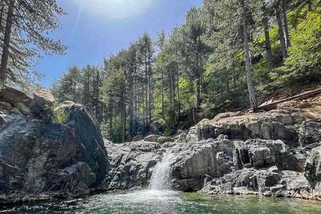
Black pine and common beech cover the Valia Kalda park between 1,000 and 1,600 metres, according to Wikipedia. Bosnian pine takes over from 1,600 to 1,900 metres. Above 1,900 metres only bushes grow in treeless meadows. The forest holds trees older than 700 years.
The park body counts 30 habitat types. Fifteen are forest habitats built from black pine, beech, fir and oak. The rest are four shrub types, five meadow types, three rocky types, two river types and one peatland. Seven types rank as high priority at European level.
The booklet names dense forests of black pine, beech and Bosnian pine for routes 31 to 34. Route 34 ends at 2,177 metres, above the 1,900 metres where Wikipedia places the treeless meadows. A Grevena hiking tour on route 34 therefore ends in open ground.
On a Grevena hiking tour in the park, walkers share it with about 60 mammal species, says the park body. They include almost all of Greece’s endangered mammals. The list names the brown bear, wolf, wildcat, otter, Balkan chamois, roe deer and wild boar. Smaller species include the fox, badger, hare, hedgehog, squirrel and marten.
The booklet names the brown bear and the roe deer for routes 31 to 34. It adds the golden eagle for route 34. Wikipedia says the Valia Kalda park is one of three places in Greece that hold brown bears.
Wikipedia places roe deer and wildcat in the Flega forest. It says the Balkan chamois lives on steep, rocky ground and in beech forest. Wolves, beech martens, wild boars and red squirrels stay in the park all year.
A Grevena hiking tour passes through habitat for 180 bird species, according to the park body. The park body singles out the Egyptian vulture and the golden eagle among its birds of prey. It also names the black woodpecker, Balkan woodpecker, wallcreeper, dipper, black stork and snowfinch. Wikipedia adds the shore lark in the alpine meadows.
The park counts 30 reptile species, including ten snakes, and 14 amphibian species. Alpine newts form small colonies in high ponds and lakes. The park body names the dragon lakes on Mount Flega, and route 33 passes the Flega Lakes.
The park body records more than 2,000 plant species. Five wild lilies grow there: the Madonna lily, red lily, Heldreich’s lily, orange Turk’s cap lily and martagon. It also names the poet’s daffodil, the spring gentian and the houseleek. Orchids grow in valleys and on mountain slopes.
Wikipedia records 415 plant types and 86 mushroom species for the smaller Valia Kalda park. It names the northern slopes of Aftia, Flega and Kapetan Kleidi as the main sites for rare plants. Serpentine soil favours rare endemic plants there.
Never pick lilies or orchids on a Grevena hiking tour. The handbook allows herb and flower picking across the park, except in Nature Protection Areas. It limits mushrooms to 2 kilograms per person per day, cut above the ground. It also says to change path if your presence annoys a bird of prey or a large mammal.
When is the season for a Grevena hiking tour?
Late spring to October is the booklet’s recommended window for a Grevena hiking tour on routes 31 to 34. The Grevena weather station records average January lows of minus 5.8 degrees Celsius and average August highs of 32.4 degrees.
Wikipedia describes the Grevena climate as Mediterranean continental, with a large gap between day and night temperatures. Winters are cold with frequent snowfall. Summers are hot by day and cool at night.
The weather station stands at 510 metres. Its average highs run from 7.4 degrees Celsius in January to 32.4 degrees in August. Its average lows run from minus 5.8 degrees in January to 14.5 degrees in July.
Precipitation peaks at 87 millimetres in December and 80 in November. It falls to 10 millimetres in August and 20 in June and July. Summer is the driest season at the station.
WeatherSpark puts the snowy period from December 8 to February 23. December is the snowiest month, with an average snowfall of 1.4 inches. These figures describe the town, and routes 31 and 34 start 790 metres higher.
The Valia Kalda park has a mountain climate. Wikipedia gives its annual rainfall as 1,000 to 1,800 millimetres. It gives monthly mean temperatures of 0.9 to 21.4 degrees Celsius. The park spans 1,076 to 2,177 metres of altitude.
A trekking operator’s page on Valia Kalda says snow covers the valley for seven months of the year. The booklet gives route 30 a shorter window than routes 31 to 34: June to October.
The booklet warns of lightning at the top of routes 33 and 34 when the weather is rainy or cloudy. It gives route 30 a high lightning risk in rainy weather. Check the forecast before a Grevena hiking tour on the peaks.
Wikipedia says the dirt roads to the park are in good condition except in winter. The handbook tells drivers to carry chains in winter, because bad weather can last long.
The handbook allows walking from sunrise to sunset all year. In the fire protection period, limits on the time you stay in wooded areas can apply. Ask the Mavranaioi information centre about current limits.
What do travellers ask about a Grevena hiking tour?
The park handbook and the trail booklet answer the practical questions on a Grevena hiking tour. They cover route choice, dogs, phones, bears and guides. They name the information centre in Mavranaioi as the place to ask.
Can children join a Grevena hiking tour?
The booklet rates none of routes 31 to 34 as easy. Route 32 is the shortest at seven kilometres and two hours, rated medium. The handbook says to avoid reaching the limits of your strength, so choose the route by the slowest walker.
Can I bring a dog on a Grevena hiking tour?
The handbook gives one dog rule: keep off the shepherd dogs, because their job is to guard the flock. It also says to avoid approaching herds. Ask the Mavranaioi information centre before bringing a pet dog.
Will my phone have a signal on a Grevena hiking tour?
The handbook says nothing about mobile coverage. It lists 112 as the European emergency number and tells walkers to carry a map. Avenza says its offline app locates you on any map without WiFi or network connectivity.
What do I do if I meet a bear on a Grevena hiking tour?
The bear must not feel threatened, says the Greek wildlife group Arcturos. Stay calm and still. Do not pick up stones or branches. Back away slowly and do not run. If the bear is in clear view, try to look larger. In a narrow place, leave it room to pass.
Do I need a guide for a Grevena hiking tour?
The handbook advises an experienced companion or mountain guide if you are unsure of your skills. It says to stay on marked paths without experience. The booklet rates signage as good on routes 31 to 33 and poor on route 34.