
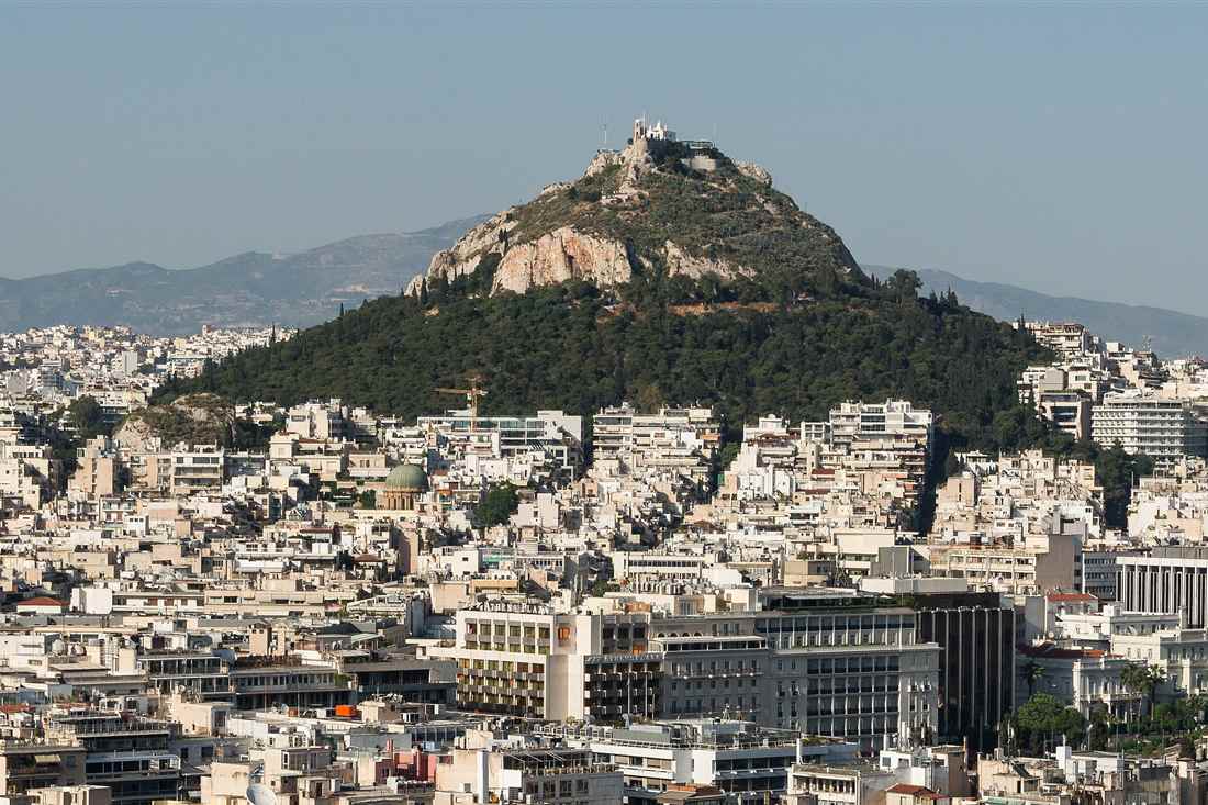
Free parks and hills Athens keeps open start at Victoria station, where Pedion tou Areos covers about 221 acres. Strefi Hill in Exarchia rises about 155 metres, and Tritsi Park in Ilion is open all day with free entry.
Forest edges such as Kaisariani on Mount Hymettus close at sunset, so a daylight visit works best. If a hill walk leaves you wanting an island next, the Greece Tours homepage shows the regions to try after a day on the hills.
Which free parks and hills Athens keeps open without a ticket?
Free parks and hills Athens keeps open fall into three groups. These are flat city parks, urban hills and green edges at the city border. Entry stays free when a municipality, the Attica Region, a forest service or a national park authority manages the land.
Flat parks provide level paths, lawns, playgrounds, sports areas, and planted shade within built-up districts. Pedion tou Areos belongs to the Attica Region and covers about 221 acres. Its grounds contain over 70 tree species.
Urban hills rise inside neighbourhoods rather than beyond the city. Strefi Hill in Exarchia is a municipal park with paved paths, a playground, a basketball court, and a small theatre. The city received the hill as a public park.
Forest and mountain edges form the third group. Attiko Alsos lies across Tourkovounia in Athens, Galatsi, and Psychiko. The park covers about 47.4 hectares and includes two hills, groves, a cave, and unmarked paths.
The free parks and hills Athens residents enter have a public management link. A municipality, regional authority, or public management body keeps the land available. A private operator, paid facility, or fenced attraction falls outside this page.
Entry is not free when a gate leads to a ticket booth or an operator charges for access. A park can contain paid buildings or activities while its public paths remain open. The free parks and hills Athens list covers the open land only.
Opening rules depend on the place. A park with gates follows its stated operating hours. A park without a gate has no entry check. Daylight is the sensible time for hills, rough paths, and unmarked routes.
Choosing among these parks needs a simple check. Confirm the public manager, identify the open entrance, and separate outdoor land from paid facilities. This keeps the list focused on public green space rather than attractions inside it.
Which city parks are free parks and hills Athens residents use every day?
The free parks and hills Athens residents use every day start with Pedion tou Areos and Eleftherias Park. Alsos Veikou, Pikrodafni, Goudi Park and Tritsi Park follow. Each offers public outdoor space, with access linked to a city, regional, or metropolitan park authority.
Pedion tou Areos sits beside Victoria station in the central Athens district. The park covers about 221 acres, with 203 acres of greenery and more than 70 tree species. Its official page lists access from Victoria on Metro Line 1.
This central park has operating hours, but the official page does not publish a clock schedule. Gates stay open during those hours. Plan a daylight visit, especially when walking across the park’s wider paths.
Eleftherias Park stands on Petrou Kokkali Street near Megaron Mousikis station. The Region of Attica says the park itself remains open. Four stone buildings stand among its planted areas, and the Athens Municipality Art Centre occupies part of the site.
Eleftherias Park suits a short city walk. Metro Line 3 serves Megaron Mousikis. The public park remains separate from the museum and art spaces, which have their own access arrangements.
Alsos Veikou lies in Galatsi at Veikou Avenue and Anagenniseos Street. The Galatsi municipality gives its size as 256 stremmata. Bus stops named Grove and Olympic Gym of Galatsi sit about two minutes away. Bus 608 also serves the park.
Alsos Veikou adds sports and recreation areas for families. The municipal page describes the land as a green park for exercise, leisure, and rest. Its public page does not state a daily closing hour.
Pikrodafni follows the coastal stream corridor in the southern Athens area. The official transport guide lists Pikrodafni as a tram station. No enclosed park schedule appears in that guide, so visitors reach the public strip through the coastal transport network.
The free parks and hills Athens entry for Pikrodafni refers to open stream-side land rather than a gated attraction. The stream is one of the remaining surface-water bodies in the Athens area. Keep to public paths and avoid treating the water channel as a swimming place.
Goudi Park lies in the Goudi district beside the former Olympic complex. The complex occupies a former military camp and was planned for municipal park use after the Olympic events. The park area connects with sports grounds and open urban land.
The free parks and hills Athens route through Goudi has public access around the open grounds. The municipal sports facility page lists weekday public use from 08:00 to 21:00 for its swimming facility. That schedule applies to the facility, not every outdoor path.
Tritsi Park sits in Ilion beside Agioi Anargyroi-Kamatero. The official park body states that it is open and accessible all day, with free entry. The park covers about 1,200 stremmata and contains six artificial lakes joined by a canal.
The free parks and hills Athens residents visit at Tritsi also support urban wildlife. The Region of Attica records 175 bird species there. Bus routes serving the park include A10, B10, B12, 704, 711, 735, and 892.
Which hills inside the city are free parks and hills Athens lets you climb?
The free parks and hills Athens lets you climb inside the city start with Strefi Hill. Ardettos Hill and the Hill of the Nymphs come next. Tourkovounia and Mount Aigaleo lie farther out. Public paths reach each one, but surfaces, access points, and walking times differ.
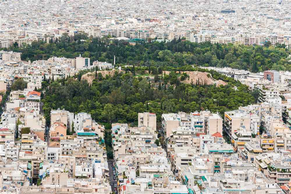
Strefi Hill rises between Exarchia and Neapoli. Paths start on the western side near Themistokleous Street, with six entrances around the hill. Omonia and Victoria are the nearest metro stations, each about a 20-minute walk away.
Strefi is a municipal park about 155 metres high. The top has a triangulation pillar. The slopes hold paved paths, dirt trails, benches, a playground, a basketball court and a small theatre.
Ardettos Hill stands beside the Panathenaic Stadium, between the stadium and the Ilisos area. The approach starts near the stadium’s outer streets. Evangelismos is the nearest metro station named for this side of central Athens.
The free parks and hills Athens route over Ardettos is a short urban climb from the stadium area. The Panathenaic Stadium authority identifies the hill as the ground beside the stadium. Its upper slopes form the natural setting around the stadium rather than a fenced ticketed route.
The Hill of the Nymphs stands in Thissio above the city centre. Paths start from Pnikos and Otrineon streets. Thissio on Metro Line 1 and Monastiraki on Line 3 are the nearest stations. The National Observatory visitor centre is about a 10-minute uphill walk from either station.
The Hill of the Nymphs holds the Observatory grounds and the surrounding public paths. The hill sits opposite the Parthenon and north of the Pnyx. The Observatory visitor centre occupies the Sina building on the hill.
Tourkovounia stretches across Galatsi, Filothei, Psychiko, and the southern Athens municipality. The clearest walking start is the ring road in Polygono. Bus 224 serves Attiko Alsos, while the nearest metro connection is farther away through central Athens.
The free parks and hills Athens hikers use in Tourkovounia include Attiko Alsos. A mapped loop starts at the Polygono ring road and takes about 1.5 to 2 hours. The route climbs through paths and roads toward the Tourkovounia peak.
Mount Aigaleo reaches across Kamatero, Petroupoli, Peristeri, Chaidari, Korydallos, Aigaleo, and Aspropyrgos. Public dirt roads start from the eastern slopes around Neapoli. Egaleo and Agia Marina are the nearest metro stations for the municipality named Aigaleo.
The free parks and hills Athens walkers reach on Mount Aigaleo include a protected wildlife refuge. The mountain covers about 2,025 hectares, with dirt roads for hiking and mountain biking. A mapped Neapoli route reaches almost the top in about 3 to 3.5 hours.
Filopappos Hill has its own page because its paths and protected landscape need separate detail.
Lycabettus Hill has its own page because its climb, access routes, and summit facilities differ.
Areopagus has its own page because its rock steps and access setting require separate guidance.
The free parks and hills Athens climbers choose inside the city range from paved municipal paths to rough mountain tracks. Strefi suits a short neighbourhood climb. Tourkovounia and Aigaleo require longer walking time and firmer footwear.
Which forests and mountain edges are free parks and hills Athens reaches by bus or metro?
Bus routes reach multiple green edges, although published stops do not all mark trail entrances. Four of the free parks and hills Athens reaches by bus are woodland at Kaisariani, Tourkovounia, Aigaleo and Parnitha. These places trace the city’s edge toward the mountain slopes.
The Kaisariani Aesthetic Forest lies on Mount Hymettus, east of Athens. Philodassiki manages it under Forest Service supervision. Woodland paths, not a gated city garden, make up the free parks and hills Athens residents reach here. Plan for forest paths rather than paved park walks. This is a mountain-forest outing.
OASA lists line 224 under the Kaisariani–El. Venizelou route name. Philodassiki places its terminus at Kaisariani Cemetery, a walk from the monastery area. Bus 204 serves the Aeroporia stop beside the Agios Georgios Koutalas recreation-area entrance. The cemetery stop is 2.1 km from the monastery.
Philodassiki describes a trail network of about 9 km and names the Monastery and Botanical Trail area. Brutia pine dominates, with cypress and broadleaf trees in mixed stands. For more on the mountain’s setting, see Mount Hymettus. The eastern forest edge of Hymettus belongs to the free parks and hills Athens offers on that side. Check the forest authority’s visitor page before leaving.
Attiko Alsos covers southern Tourkovounia across Athens, Galatsi, and part of Psychiko. The Attica Region presents it as a metropolitan parks project, with cypress and pine woods. OASA lists line 622 from Goudi to Ano Galatsi, with Agios Glykerias stops. Its wooded paths are informal and unmarked. A proposed walking network adds to the free parks and hills Athens offers on these slopes.
Mount Aigaleo has recreation access from its western, northern, and eastern sides, according to PESYDAP. OASA lists bus 803 between Piraeus and Dasos Chaidariou, including stop Dasos B. PESYDAP reports extensive Aleppo pine stands in the mountain’s western area. The Ministry lists the Aigaleo Forestry Office and its public-forest remit. Check OASA route information on the day of travel.
Parnitha National Park is managed by NECCA’s park management unit. In the strict-protection zone, public passage is limited to specified hiking paths. A former visitor guide names the Thrakomakedones–Flampouri trail. A refuge operator describes its yellow trail marks. NECCA identifies red deer as a key animal there. Follow NECCA’s posted guidance before entering the strict zone.
What rules, hours and fire-season closures apply in free parks and hills Athens keeps?
Forest access follows each site’s visitor guidance and any dated closure order. The free parks and hills Athens keeps open follow no single blanket fire rule. Check the daily risk map and the local order before setting out on a forest route.
Civil Protection’s map shows the day’s fire-risk category, but it is not a closure notice for every forest. Regional authorities can restrict movement or stays in mapped forest and protected areas. Parks and forests can sit under different local orders and boundaries. Check both the risk level and any order for the same date.
For Attica, check the Region’s civil-protection decisions and their maps. The Region posts local preventive access orders for named areas. Read the dates and boundary before setting out. The announcement and map define where access limits apply. Use the linked map to plan a path around a closed area. Check the return route against it too.
A category 4 or 5 warning can lead to preventive closures in sensitive places. The exact restriction comes from the local decision and its map. A walk in the free parks and hills Athens offers on a dry day needs a same-day check. The risk map alone does not show the closure boundary. Check a route boundary before entering side paths.
Civil Protection warns against outdoor fire use and burning plant waste during fire-prevention periods. Treat an open flame or barbecue as unsafe in forest and park areas unless the competent authority gives clear permission. Choose food that needs no cooking flame during a woodland walk. Leave charcoal and fire-starting gear at home.
Greek government pet guidance allows dogs in common public spaces such as parks and groves. A lead is required during walks. Children’s playgrounds are an exception, apart from assistance dogs. These green routes are shared spaces, so keep a dog close and allow room for other walkers; see dog-friendly Athens.
During heat, the Health Ministry advises avoiding direct sun and strenuous activity from 11:00 to 17:00. Civil Protection recommends shade, fluids, light clothing, and a ventilated hat. The National Meteorological Service offers local forecasts, though model displays can differ from official forecasts. Plan a shaded route and shift climbs to cooler hours.
What do travellers ask about free parks and hills Athens offers?
Outer green spaces differ in location, access, terrain, and shade. The free parks and hills Athens offers sit beyond the central garden network. Match a route to the day’s weather, transport, group needs, and walking pace before setting off. Check local access before travel.
Which outer hill is closest to Syntagma Square for this visit?
For a city-edge outing near Syntagma, Attiko Alsos sits on the southern Tourkovounia slopes in Athens. The park spans Athens, Galatsi, and part of Psychiko. OASA lists route 622 with Agios Glykerias stops. Use an Athens metro guide for connections. Check the stop before travel.
Are the city-edge parks and forests open after dark in summer?
The Kaisariani Aesthetic Forest is a daylight visit. Its schedule permits entry from sunrise until sunset. Each of the free parks and hills Athens keeps has its own local rules. Check the authority notice for the place and planned time. Check with the authority before a late visit.
Can children use the parks and mountain trails?
Yes. Kaisariani, one of the free parks and hills Athens lists, has forest areas used for school and non-school environmental education. The visitor guide notes level areas for gatherings and safe public movement. Choose paths that fit the child’s ability.
Are dogs allowed in these public green spaces?
Dogs can enter common public spaces such as parks and groves with their guardians. Keep them on a lead during walks. Public-space guidance excludes children’s playgrounds, except for assistance dogs accompanying people with disabilities. A short lead also helps keep control on shared woodland paths.
Are forests closed across Athens in summer during fire alerts?
Summer alone does not close every forest. Fire orders name the places and dates that face access limits. Read the local notice before choosing a route. Two of the free parks and hills Athens covers can follow different instructions on the same day.
Which green park suits a morning run or walk?
Hymettus offers a 3.2 km moderate circuit at Kalopoula, listed for a 60-minute walk. The other free parks and hills Athens offers have different terrain. The Region classifies this route as hiking. It is a measured early morning outing, not a designated running course.