
Andros is the finest walking island in the Cyclades, its green, mountainous interior laced with hundreds of kilometres of old stone footpaths that once linked every village. Fed by springs and streams rare in the Aegean, the island stays green and cool when its neighbours are parched. Its restored trail network. Crowned by the long-distance Andros Route, has earned it a European reputation as a hiker’s island. Plan the whole trip with Greece Tours.
This guide covers hiking in Andros in full: the Andros Route and the wider trail network, the finest individual walks and gorges. What the paths are like, the best seasons, what to bring. How to walk the island over days. Read it beside the wider guide to things to do in Andros to weave walking into a stay.
Is Andros good for hiking?
Andros is the best hiking island in the Cyclades, with around 240 kilometres of restored, signposted trails through a green, mountainous interior of springs, waterfalls and villages. Its cool, watered landscape makes walking comfortable well beyond the summer.
Where most Cycladic islands are bare, sun-baked and short on shade, Andros is green, fertile and mountainous, with springs and streams that keep its valleys wooded and cool. This makes it uniquely suited to walking. The island has embraced its trails. Restoring and waymarking the old paths that once linked its villages into one of the finest hiking networks in Greece.
The scale is impressive: around 240 kilometres of paths have been cleared and signposted to European standards. Drawn from an even larger web of historic footpaths that criss-crossed the island before roads arrived. The routes range from gentle valley strolls to demanding mountain crossings, so the island suits every level, from families and beginners to serious long-distance walkers.
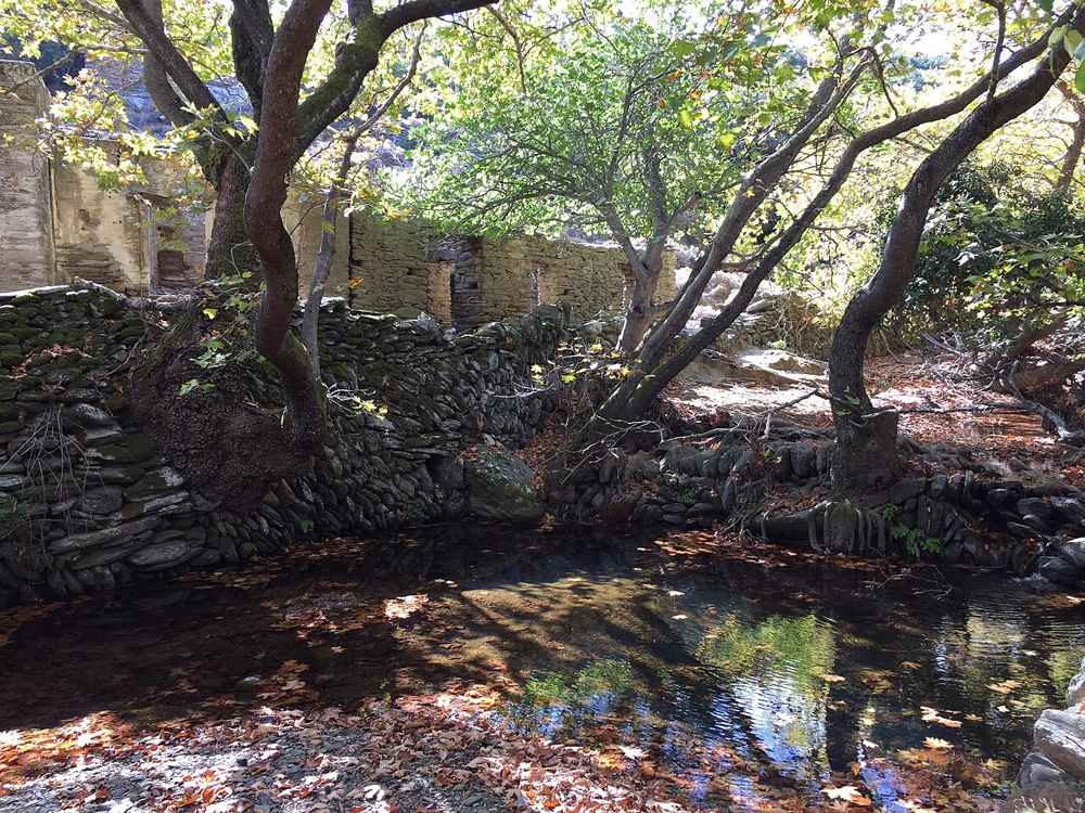
The green interior is the great reward. Trails pass waterfalls, springs, old watermills, arched stone bridges, chapels and terraced fields. The shade of the plane trees and the running water make walking pleasant in spring and autumn. And even bearable in summer near the streams, when the rest of the Cyclades is uncomfortably hot and shadeless. For visitors the hiking is the main reason to choose Andros over its famous neighbours.
What is the Andros Route?
The Andros Route is a continuous long-distance hiking trail of about a hundred kilometres running the length of the island from north to south. It is the centrepiece of the network, usually walked in ten daily sections over days.
The Andros Route is the island’s flagship trail, a continuous path of roughly a hundred kilometres that runs the full length of Andros from the north to the south. It threads together the finest of the island’s old footpaths, linking villages, valleys. Gorges and coasts. It can be walked in about ten daily sections at a reasonable pace, making it a classic multi-day trek.
The route is demanding in total. With a very large cumulative ascent as it climbs and descends across the island’s mountainous spine. Each daily section is a manageable day walk in its own right. This lets walkers tackle the whole trail over a week or more, or pick individual sections as day hikes from a base, according to their time and fitness.
Along its length the Andros Route showcases the best of the island: the springs and waterfalls of the interior. The stone bridges and watermills of the gorges, the mountain villages and the wild coasts. It is the single greatest reason that Andros has become a genuine destination for walkers from across Europe. Even a single day section of the route gives a deep sense of the green. Watered island that the beaches alone cannot convey.
How long is the Andros hiking network?
Andros has around 240 kilometres of restored, waymarked trails, drawn from a historic network of some 500 kilometres of old footpaths. Volunteers began restoring the ancient paths in recent years, clearing and signposting them to European standards.
The island’s trail network is far larger than the Andros Route alone. Historically, a web of five hundred kilometres of footpaths linked every village, spring and field on Andros, the main means of getting around before roads arrived. Of these, around 240 kilometres have been cleared, restored and waymarked, giving walkers an extensive choice of routes across the island.
The restoration was the work of a dedicated initiative that began the task of reopening the island’s ancient paths. Carried out largely by groups of volunteers who cleared the overgrown trails, repaired the stonework and signposted the routes to European standards. Their effort transformed a neglected heritage into one of the best-marked trail networks in the Greek islands.
The result is a network that offers routes for every taste and level, from short village loops and gentle gorge walks to the full long-distance Andros Route. Maps and route descriptions are available to plan a walk, and the density of the network means most villages and beaches can be reached on foot along a marked trail.
Is the Andros Route certified?
Yes. The Andros Route is certified as a Leading Quality Trail, Best of Europe, by the European Ramblers Association, one of the first Greek trails to earn the distinction.
The Andros Route holds a rare distinction for a Greek island trail: certification as a Leading Quality Trail under the Best of Europe scheme run by the European Ramblers Association. This recognises trails that meet high standards of waymarking, path quality, scenery and infrastructure, and it placed Andros on the map as a serious walking destination among European hikers.
Earning the certification required not only restoring the paths but maintaining them and the signposting to a consistent standard. A real and ongoing commitment that the island’s dedicated trail initiative has sustained over the years. It is a mark of quality that reassures visiting walkers they will find well-marked, well-kept trails rather than the faint, overgrown paths common on other Greek islands.
For the walker, the practical benefit is a network that is genuinely easy to follow and enjoyable to use, with clear waymarks, repaired stone paths and route descriptions. The certification is a large part of why Andros has drawn walkers from across Europe and why it stands out from the rest of the Cyclades for hiking.
What are kalderimia and stenes on the Andros trails?
Kalderimia are the old stone-paved mule paths that form much of the Andros trail network, and stenes are the paths walled on both sides with dry stone. Together they give the island’s trails their distinctive, historic character.
Much of the Andros Route follows kalderimia, the centuries-old stone-paved paths that were the main routes between villages before roads. Skilfully built of fitted stone to carry mules and villagers across the mountains. They wind through the terraced landscape. Walking them is a journey through the island’s rural past as much as its scenery.
Many of the paths are also stenes, the local term for trails walled on both sides with dry stone, which once kept livestock in and marked the way between properties. These walled lanes are a characteristic feature of the Andros landscape. Threading between the terraced fields and giving the trails an enclosed, intimate feel unlike the open paths of other islands.
Restoring these kalderimia and stenes, with their stonework and their arched bridges, was central to reviving the island’s trail network. It is what gives walking on Andros its particular texture. Following a paved mule path across a green gorge on an old arched stone bridge. Worn smooth by centuries of feet and hooves, is one of the distinctive and timeless pleasures of hiking here.
What is the best hike on Andros?
The most celebrated hike on Andros runs from Chora through Syneti and the Dipotamata gorge to the bay of Korthi, a demanding and beautiful route linking coast, gorge and villages. It is often rated the finest walk on the island.
The classic Andros walk is the route from the capital, Chora, down the east coast through the village of Syneti. Into the dramatic Dipotamata gorge and on to the bay of Korthi. It is one of the more demanding sections of the network. It packs in the island’s finest scenery: coastal paths. A green river gorge full of watermills, and traditional villages, earning it top ratings among walkers.
The Dipotamata gorge is the highlight, a protected landscape of running water, plane trees and dozens of old stone watermills strung along the river, crossed by arched bridges. Walking down through it feels like entering a lost world, cool and green, before the trail emerges near the wide bay of Korthi and its famous beach of Tis Grias to Pidima.
This route showcases why Andros is the walker’s island of the Cyclades, combining coast, gorge and village in a single day. It rewards reasonable fitness and a full day. It can be walked as a linear route with transport arranged at each end. Or broken into shorter stretches for those wanting a gentler day.
What is the Dipotamata gorge trail in Andros?
The Dipotamata gorge trail follows a green river valley in the south-east of Andros, past dozens of old stone watermills and arched bridges.
The Dipotamata gorge is one of the natural jewels of Andros, a deep, green river valley in the south-east of the island, protected for its landscape and its heritage. A trail runs down through it alongside the running water, shaded by plane trees, passing an extraordinary concentration of old stone watermills. Once powered by the river, along with arched stone bridges and terraced slopes.
The gorge feels a world away from the sunlit Cyclades above, cool and lush with the sound of water throughout. The watermills. Some restored, tell the story of a self-sufficient rural past when the river ground the island’s grain. Walking the trail is as much a journey through history as through nature, and it is a highlight of the island’s network.
The Dipotamata trail can be walked on its own as a there-and-back or a through route, or as part of the longer Chora-to-Korthi hike. Its combination of running water, watermills and greenery makes it one of the most rewarding and distinctive walks on Andros, and a fine introduction to the island’s green interior.
What is the Pythara waterfall walk in Andros?
The Pythara walk leads through a shaded valley of plane trees, pools and small waterfalls near the village of Apoikia, above Chora.
Near the village of Apoikia, above Chora, the Pythara valley is a small green paradise of plane trees, rock pools and little waterfalls fed by the island’s springs. A short, easy trail follows the stream through the shaded gorge, and after the spring rains the waterfalls flow strongly and the valley comes alive with frogs, dragonflies and birdsong.
The walk is one of the most accessible on Andros, a gentle route suitable for families and casual walkers. Its cool. Watered greenery makes it a welcome retreat from the summer heat. It pairs naturally with a visit to the springs of nearby Menites and the source of the Sariza mineral water at Apoikia, for a green half-day in the interior.
Pythara captures in miniature what makes Andros special: running water and lush greenery in the heart of the arid Cyclades. It is an easy introduction to walking on the island for those not ready for the longer trails, and a delight in spring when the water is at its fullest.
Can you walk to Achla beach in Andros?
Yes. A coastal trail leads down to Achla, the celebrated emerald beach on the remote north-east coast, backed by a river and plane trees.
Achla, on the wild north-east coast, is among the most beautiful beaches in Greece, an emerald cove of sand and white pebbles backed by a river valley of plane trees. Reached only by a rough road or by boat for most visitors. It can also be approached on foot along a coastal section of the island’s trail network, turning the journey into part of the adventure.
The walk down to Achla passes through wild, green scenery. Following old paths toward the coast. It rewards the effort with a swim at an idyllic, unspoiled beach far from any development. Combining a hike with a swim at Achla is one of the classic Andros experiences, marrying the island’s two great pleasures, the trails and the beaches.
Walking there suits reasonably fit hikers prepared for a longer route. It is worth checking the trail and carrying water and supplies. For the full picture of the beach and its other approaches, see the guide to Andros beaches, and carry everything you need, since Achla has only a seasonal taverna and no shops.
Can beginners and families hike on Andros?
Yes. Alongside its demanding routes, Andros has many gentle, easy trails suitable for beginners and families, such as the Pythara waterfall walk and short village loops. The waymarked network offers options for every level.
Its network also includes many gentle, easy walks well suited to beginners and families with children. The short Pythara waterfall trail, easy village-to-village loops and the flatter stretches of the gorge trails offer green scenery, running water and wildlife without steep climbs or long distances.
These easier routes let families and casual walkers sample the island’s celebrated trails without committing to a full day’s trek. The shade and streams make them comfortable even with children. Spotting frogs and dragonflies at Pythara or crossing an old stone bridge on a short walk is an easy, rewarding introduction to the island on foot.
The clear waymarking and the available maps make choosing a suitable route straightforward, and the network’s range means there is always a walk to match the group’s ability. For families, mixing a short trail with a beach day is an easy way to enjoy the green side of Andros alongside the sea.
Can you do multi-day trekking on Andros?
Yes. The Andros Route is designed for multi-day trekking, walked in about ten daily sections over a week or more. Inn-to-inn itineraries let walkers stay in villages along the way, carrying only a day pack.
The full Andros Route is a genuine long-distance trek, and it is designed to be walked over days in about ten daily sections, each a manageable day walk. Tackling the whole trail from north to south over a week or so is a rewarding way to experience the island in depth. Crossing its mountains, gorges, villages and coasts on foot.
Inn-to-inn trekking makes this practical and comfortable: walkers stay in guesthouses and small hotels in the villages along the route. Moving on each day and carrying only a day pack, with luggage transferred between stops on organised itineraries. This lets you walk the island without camping, ending each day with a village taverna dinner and a bed.
Multi-day trekking suits reasonably fit walkers with time to spare, and self-guided itineraries with maps and route notes make it accessible without a guide. For those with less time, basing in one or two villages and walking individual sections as day hikes captures much of the experience of the Andros Route.
When is the best time to hike in Andros?
The best time to hike in Andros is spring, from March to May, and autumn, in September and October, when the island is green, the waterfalls flow and the temperatures are comfortable. High summer is hot for long walks.
Spring is the finest season for walking on Andros. From March into May the island is at its greenest, the wildflowers are out, the springs and waterfalls flow strongly. The temperatures are ideal for long walks in the sun. The gorges and valleys are at their lushest, and the running water that sets Andros apart is at its fullest.
Autumn, from September into October, offers a second window, as the fierce heat of summer fades and the walking becomes pleasant again, with the added bonus of a warm sea for a swim afterward. These shoulder seasons are when Andros is at its best for hiking, comfortable and green when the rest of the Cyclades is still parched.
High summer, in July and August, is the least comfortable time for long walks, as the heat and strong sun make the climbs demanding despite the island’s greenery. Summer hikers start early, keep to shorter or shadier routes near water, and carry plenty of water. For a walking holiday, though, spring and autumn are the clear choices.
What you bring for hiking in Andros?
Bring sturdy walking shoes, plenty of water, sun protection and a hat, and a map or the trail app. Even on the green interior, shade is uneven and the sun strong, so prepare as for any mountain walking.
Good footwear matters most: sturdy walking shoes or boots handle the stone paths, the loose ground and the gorge trails far better than sandals. Carry plenty of water, since although Andros has springs, they cannot always be relied on for drinking. Bring sun protection and a hat, as the shade along the trails is uneven and the Aegean sun strong even in spring.
A map or a downloaded trail app is worth having despite the good waymarking. Both for planning and for confidence at junctions. Route descriptions help judge the length and difficulty of a walk. A light layer is useful for the higher, breezier sections, and for the longer routes it is wise to carry some food and to tell someone your plan.
Beyond the gear, a little planning goes a long way: check the length and difficulty of the route against your fitness. Start early in the warmer months. Allow time for the stops, the swims and the views that make walking on Andros a pleasure rather than a march. With sensible preparation, the trails are safe and hugely rewarding.
Do you need a guide or map for hiking in Andros?
The Andros trails are well waymarked, so a guide is not essential, and a map or the trail app is enough for most walks. Guided and self-guided itineraries are available for those wanting support on the longer routes.
Thanks to the certified waymarking, most walks on Andros can be done independently with a map or a trail app. The clear signposting makes the routes genuinely easy to follow. Unlike the faint paths of many Greek islands. For day walks from a base, a good map and a route description are all most walkers need.
For the full Andros Route or a multi-day trek, self-guided itineraries provide maps, route notes and pre-booked accommodation with luggage transfer, letting you walk independently with the logistics handled. Guided walks and tours are also available for those who prefer the reassurance and the local knowledge of a guide, or who want a themed walk.
Whichever you choose, the quality of the network means hiking on Andros is accessible and safe for competent walkers, with support available for the longer or more remote routes. Carrying a map, planning the route and checking the weather remain sensible even on the well-marked trails, especially for the demanding mountain sections.
What will you see on the Andros trails?
The Andros trails pass waterfalls, springs, old stone watermills and arched bridges, terraced fields and dovecotes, chapels and traditional villages, all in a green landscape rare in the Cyclades. Running water is a constant companion.
Walking on Andros is a feast of rural heritage and green scenery. The trails follow running streams past waterfalls and springs. Cross rivers on graceful old stone bridges. Pass the watermills that once ground the island’s grain, especially in the Dipotamata gorge. The terraced slopes, the dry-stone walls and the ornate dovecotes tell the story of a self-sufficient farming past.
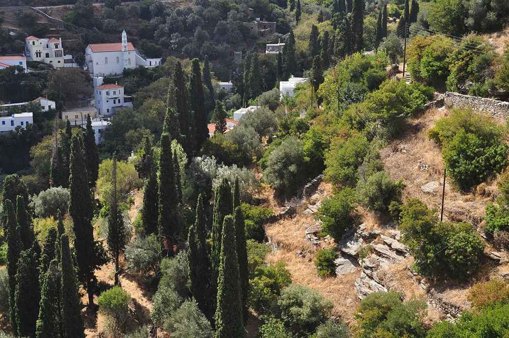
The paths link the island’s traditional villages. From the springs of Menites and Apoikia to the captains’ mansions of Stenies and the highland hamlets of Vourkoti and Arnas. A walk is also a tour of the island’s living culture. Little whitewashed chapels dot the routes, and the green valleys shelter frogs, dragonflies, birds and wildflowers.
Above all, it is the running water and the greenery, so unexpected in the Cyclades, that define the experience. Crossing a shaded gorge full of watermills, or arriving at a village spring after a climb. Gives Andros walking a character all its own. Reveals a side of the island that visitors tied to the beaches never see. Every gorge, spring and village along the way adds to the sense of an island best discovered slowly, on foot, along the paths its people walked for centuries.
How do you reach the trailheads in Andros?
Most Andros trailheads are reached by car from Chora, Batsi or the villages, and some by the local bus.
The trails of Andros start from the capital, Chora, from the villages of the interior, and from points along the coast, and reaching them usually means a short drive. A hire car is the most flexible way to get to the trailheads. Especially the remoter ones. It makes it easy to arrange linear walks by leaving a vehicle at one end or arranging a pick-up.
For walkers based in Chora or Batsi, routes start within reach of the towns or a short drive away. The local bus service between the main towns and villages can reach trailheads, though its infrequency makes it less reliable for walking logistics. Taxis are an option for one-way walks where a car cannot be left.
Planning the transport is part of planning a walk on Andros, particularly for the linear sections of the Andros Route. A car, or a self-guided itinerary that handles transfers, removes the difficulty, letting you focus on the walking. For getting to and around the island, see the guide to Andros as a whole.
Which villages do the Andros trails link?
The Andros trails link the capital Chora with the villages of Apoikia, Menites, Stenies, Vourkoti, Arnas and the bay of Korthi, among others. Walking the network is a tour of the island’s traditional settlements and their springs.
The old footpaths of Andros were built to connect its villages. The restored network still does, linking the capital, Chora. With the spring villages of Apoikia and Menites, the captains’ village of Stenies, and the highland hamlets of Vourkoti and Arnas in the green heart of the island. The Andros Route strings many of these together on its way across the island.
This means a walk on Andros is as much a cultural tour as a nature one, passing through living villages with their churches, springs, tavernas and mansions. Reaching a village on foot along an old kalderimi, as the islanders once did. Stopping for water at a spring or a meal at a taverna, is one of the pleasures of hiking here.
The density of the network means the villages are genuinely connected on foot, so walkers can plan routes from one to another and use them as bases or waypoints. Combining the trails with time in the villages, described in the guide to things to do in Andros, gives the fullest sense of the island.
What is the Vourkoti to Achla trail in Andros?
The trail from the highland village of Vourkoti down to Achla beach is one of the island’s classic walks, descending through green slopes and a river valley to an emerald cove.
Starting from Vourkoti, one of the highest and greenest villages of Andros, this celebrated route descends the north-east slopes toward the coast. Following old paths through terraced hillsides and a wooded river valley. The walk drops from mountain scenery into the lush valley that backs Achla beach, a sustained descent that rewards fit walkers with constantly changing views.
The great reward at the end is Achla itself, an emerald cove of sand and white pebbles fed by the river and shaded by plane trees. Among the finest beaches in Greece and all the sweeter for being reached on foot. Arriving at the beach after the descent, for a swim in its clear water, is one of the classic Andros hiking experiences.
The route is demanding, chiefly for the long descent and the return. It suits reasonably fit walkers who plan their transport. Often arranging a pick-up at the beach rather than climbing back. It captures the island’s signature combination of green mountains, river valley and idyllic coast in a single memorable walk.
What is the walk from Chora to Apoikia and Menites?
The walk from Chora up to the spring villages of Apoikia and Menites follows old paths through the green interior to the marble lion-head fountains of Menites and the source of the Sariza water. It is a gentle, rewarding half-day.
One of the most popular shorter walks on Andros climbs from the capital, Chora. Into the green hills to the spring villages of Apoikia and Menites, following the old kalderimia through terraces and past chapels. It is a gentler route than the mountain crossings, rewarding walkers with the running water and greenery that make the island’s interior so distinctive.
The highlight is the village of Menites, where spring water pours year-round from a row of carved marble lion-head spouts beneath a canopy of plane trees. A cool, green scene at the walk’s turning point. Nearby Apoikia is the source of the well-known Sariza mineral water. Bottled across Greece. The two villages together make a cool, green and fitting reward for the climb up from Chora.
This walk pairs the culture of the capital with the springs of the interior in an easy half-day. It can be extended toward the Pythara waterfalls for more running water and greenery. It is an ideal introduction to walking on Andros for those based in Chora who want a taste of the trails without a full day’s trek.
Can you hike from Batsi and the west of Andros?
Yes. Trails from the resort of Batsi and the west coast lead inland to villages, monasteries and viewpoints, and along the coast to quiet beaches. They give walkers based on the popular western side easy access to the island’s paths.
The west coast around Batsi has its own trails, giving walkers based in the main resort easy access to the network. Paths climb inland from Batsi to nearby villages, chapels and viewpoints over the sea, and coastal routes lead to quieter beaches along the western shore.
One rewarding option from the west is the walk toward the important Panachrantou monastery, set high on the mountain slopes, or routes linking the west-coast villages through the green foothills. These give a sense of the island’s landscape and culture without the long transfer to the eastern trailheads, convenient for visitors staying near the beaches.
For walkers whose base is Batsi, these western trails mean the island’s celebrated hiking is within reach without a car for every walk, though a vehicle still opens up the finest routes in the east and the interior. Mixing a west-coast walk with the beaches makes an easy, active day on the popular side of Andros.
Are there guided walking tours on Andros?
Yes. Guided walking tours and full-day hiking excursions are available on Andros, led by local guides who share the island’s nature, history and villages. They suit walkers wanting expertise, company or a themed route without planning the logistics.
Alongside the self-guided options, Andros offers guided walking tours led by local guides who know the trails, the flora and the history intimately. A guided full-day hike takes the planning and navigation off your hands and adds the depth of local knowledge. Pointing out the plants, the watermills, the old customs and the stories that a solo walker miss.
These tours range from gentle village and gorge walks suitable for most visitors to more demanding routes for keen hikers. They can be booked for individuals joining a group or as private outings. For visitors with limited time, a single guided walk is an efficient way to experience the best of the island’s trails and to learn about its unique green landscape.
Guided hikes also suit those who prefer company and reassurance on the trails, or who want a themed walk focused on the watermills, the wildflowers or the villages. Combined with the self-guided network, they make the island’s walking accessible to every kind of visitor, whatever their experience or appetite for planning.
Where you stay for a walking holiday in Andros?
For a walking holiday, base yourself in a village or town near the trails, such as Chora, Apoikia or the highland villages, or use inn-to-inn itineraries along the Andros Route. A car helps reach the more remote trailheads.
Where to stay for a walking holiday depends on the routes you want. Basing in the capital, Chora, gives easy access to the eastern trails, the gorge walks and the spring villages, along with the town’s culture for rest days, while the green interior villages such as Apoikia put you closer to the springs, waterfalls and mountain paths of the heart of the island.
For walking the full Andros Route, inn-to-inn itineraries let you stay in a different village each night along the trail. Moving on each day with your luggage transferred. You need not base in one place at all. This is the classic way to walk the long-distance route, ending each day in a new village with a taverna dinner and a bed.
Whichever base you choose, a hire car remains useful for reaching the more remote trailheads and for arranging linear walks, unless you are on an organised inn-to-inn trek. The guide to Andros as a whole compares the bases and helps match your accommodation to your walking plans.
What wildlife and plants will you see hiking in Andros?
Hiking in Andros, you will see wildflowers, plane trees and terraced greenery, and wildlife including frogs, dragonflies, tortoises and birds. The island’s springs and streams support a richer natural world than the arid Cyclades.
The green, watered landscape of Andros supports a far richer natural world than the bare Cyclades, and walking its trails brings you close to it. In spring the slopes and valleys are bright with wildflowers. The shaded gorges and stream banks are lined with plane trees. Oleander and ferns, a lush contrast to the sunlit terraces above.
The running water attracts wildlife rare on other islands: frogs and dragonflies gather at the pools of Pythara and the gorges. Tortoises move through the scrub. Lizards bask on the stone walls. The island’s varied habitats, from wetland gorges to mountain ridges, make it a rewarding place for spotting the natural life of the Aegean on foot.
Birdwatchers do well on Andros, which lies on migration routes and shelters resident and passing birds among its valleys, cliffs and wetlands. Walking quietly along the trails in the early morning, especially near water, gives the best chance of encounters. Adding a natural-history dimension to the island’s hiking that its bare, arid neighbours in the Cyclades simply cannot match. A further reason the trails reward an unhurried pace.
Why is Andros the best Cyclades island for walking?
Andros combines a certified, well-marked trail network of 240 kilometres with a green, watered landscape of springs, gorges and waterfalls unique in the Cyclades. No other island in the group offers walking of this quality and variety.
The Cyclades are famous for their beaches and their bare, sunlit beauty, but they are mostly poor for walking, short on shade, water and marked trails. Andros is the exception, and dramatically so: its green, mountainous interior, watered by springs. Offers the cool, varied landscape that makes for great hiking, unmatched by any other island in the group.
On top of the landscape, the island has invested in its trails as no other Cycladic island has, restoring and certifying a 240-kilometre network to European standards. The result is walking that is not only beautiful but genuinely accessible and well-marked, from easy family strolls to the demanding long-distance Andros Route, all clearly signposted and mapped.
For anyone who wants to combine the beauty of the Cyclades with real walking, Andros stands alone. Offering the beaches and the sea of its neighbours alongside a hiking network they cannot match. It is why the island has earned its reputation as the walker’s island of the Aegean. Why hikers return to it season after season to walk new sections of its network. Few destinations in Greece reward a walking holiday as fully. Marrying the green trails and running water of the interior with the beaches and clear sea of the coast in a single, compact island close to Athens.
Frequently Asked Questions
What is the Andros Route?
The Andros Route is a continuous long-distance hiking trail of about a hundred kilometres running the length of Andros from north to south. It is the centrepiece of the island’s 240-kilometre trail network. Usually walked in around ten daily sections over a week or more. It is certified as a Leading Quality Trail, Best of Europe, by the European Ramblers Association.
Is Andros good for hiking?
Yes, Andros is the best hiking island in the Cyclades. Its green, mountainous interior, watered by springs and streams, offers a cool, varied landscape rare in the Aegean. Around 240 kilometres of old stone paths have been restored and waymarked to European standards. With routes for every level from easy family walks to the demanding long-distance Andros Route.
When is the best time to hike in Andros?
The best months for hiking in Andros are spring, from March to May. Autumn, in September and October, when the island is green, the waterfalls flow and the temperatures are comfortable. High summer is hot for long walks, so summer hikers start early, keep to shorter or shadier routes near water, and carry plenty of water.
What is the best hike on Andros?
The most celebrated hike runs from the capital, Chora, through the village of Syneti and the beautiful Dipotamata gorge, with its old stone watermills, to the bay of Korthi. It is a demanding route that combines coast, gorge and villages, and is often rated the finest walk on the island. Shorter, easier options include the Pythara waterfall trail near Apoikia.