
Ohrid tours start in Ohrid, the largest town on Lake Ohrid in south-western North Macedonia, listed by UNESCO with the lake for both its nature and its culture. The routes cover the old town, the Church of St. John at Kaneo, Samuel’s Fortress, the boat trips to Saint Naum and the Bay of Bones, Galičica and Struga. Greece Tours lists the trips that cross into North Macedonia from Florina and Thessaloniki.
This page covers what Ohrid tours see in the town and on the lake, which boat trips and day trips leave from the harbour, how visitors reach Ohrid from Greece and Skopje, and which season suits each route. The tours below are checked on GetYourGuide and Viator and leave from Ohrid, Skopje and Tirana.
What do Ohrid tours cover?
Ohrid tours cover the old town of Ohrid and the lake beside it, a UNESCO site listed for nature in 1979 and for culture in 1980. Walks link churches, a Hellenistic theatre and a hilltop fortress, and boats sail from the town harbour.
Ohrid stands on the shore of Lake Ohrid in south-western North Macedonia, and with 38,818 residents at the 2021 census it is the largest city on the lake. Ohrid tours trace a town that once had 365 churches, one for each day of the year, and that carries the name “Jerusalem of the Balkans”.
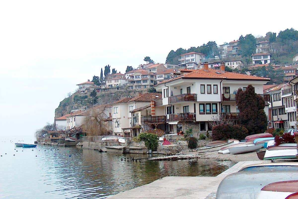
The old town is compact, so Ohrid tours run on foot. A walking loop starts at the main square, visits St Sophia and the ancient theatre, climbs the hill to Samuel’s Fortress and returns past Plaošnik and St John at Kaneo.
On the Greek side of the border to the south, Florina sits about 13 km from the frontier and serves as the gateway to the Prespa Lakes, the start point for Florina tours.
- Art: more than 2,500 square metres of frescoes and more than 800 icons.
- Basilicas: seven basilicas from the 4th, 5th and early 6th centuries.
- Houses: late-Ottoman homes of the 18th and 19th centuries on narrow streets.
What do Ohrid tours see in the old town?
Ohrid tours in the old town visit the Church of St Sophia, the ancient theatre built in 200 BC, the Plaošnik hill with the Church of Saints Clement and Panteleimon, and the icon gallery at the Church of St Mary Peribleptos.
Ohrid tours stop first at St Sophia, which Tsar Samuil rebuilt in the last decade of the 10th century as a patriarchal cathedral in the form of a dome basilica; the Ottomans later turned it into a mosque. Frescoes from the 11th, 12th and 13th centuries survive inside, and the church, known for its acoustics, hosted the first concert of the Ohrid Summer Festival in 1961.
The ancient theatre is the only Hellenistic-type theatre in North Macedonia; the theatres at Scupi, Stobi and Heraklea Lynkestis date from Roman times. Locals buried it after the fall of the Roman Empire, and building work uncovered it by accident in the 1980s, when stone blocks carved with Dionysus and the muses came to light. Ohrid tours see only the lower section, which has hosted plays, concerts and operas since the late 1980s.
Plaošnik lies 250 metres south of Samuel’s Fortress. St Clement built a church there in 893 on the foundation of an earlier Christian basilica and dedicated it to St Panteleimon; he was buried inside after his death in 916, and his tomb still exists. Workers rebuilt the church by hand between 8 December 2000 and 10 August 2002.
- Icon gallery: in the complex of St Mary Peribleptos, a church erected in 1295.
- Robev House: an archaeological display with a 3rd-century BC alabaster statue of Isis.
- Mančevci basilica: an early Christian basilica of the 4th or 5th century with floor mosaics.
What do Ohrid tours see at Kaneo and Samuel’s Fortress?
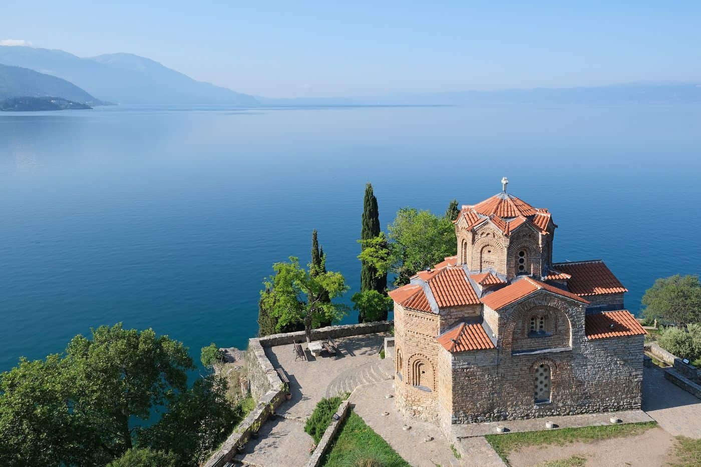
Ohrid tours climb to Samuel’s Fortress, the stronghold of Tsar Samuel that crowns the old town walls, then descend through the Kaneo quarter to the Church of St John at Kaneo, which stands on a cliff over Kaneo Beach above Lake Ohrid.
Samuel’s Fortress was the capital of the First Bulgarian Empire under Tsar Samuel at the turn of the 11th century. Excavations place it on an earlier fortification of the 4th century BC, which Macedonian archaeologists link to King Philip II of Macedon. The fortress was heavily restored in 2003, with entirely new battlements where none had survived, and its hilltop gives views of the town, the lake and the mountains.
Ohrid tours also follow the city walls, which once had four gates: the Lower Gate, the Upper Gate, the Front Gate and the Water Gate. A portico linked the Upper Gate to the ancient theatre in antiquity, and 16th-century reinforcements keep it well preserved.
Ohrid tours reach Kaneo from St Sophia through the old Kaneo settlement, the quarter of the poor fishermen. Property documents show the church stood before 1447, and archaeologists date it to the 13th century.
- Dedication: John of Patmos, the writer of Revelation.
- Plan: a cruciform church on a rectangular base.
- Dome: frescoes uncovered in 1964 and an image of Christ Pantocrator.
- Wall fresco: St Clement of Ohrid beside St Erasmus of Ohrid.
- Roof: a zigzag dome line that shows Armenian influence.
Which Ohrid tours sail on the lake?
Ohrid tours on the water board boats at the main harbour of Ohrid town and sail on Lake Ohrid, one of the deepest and oldest lakes in Europe, which North Macedonia shares with Albania across a mountainous border and which holds over 200 endemic species.
Daily boats leave the main harbour for the Monastery of Saint Naum and interim beaches, and in the tourist season a daily boat crosses to Pogradec in Albania; boats from the port also stop at the Bay of Bones. Small boats from Trpejca or Ljubaništa carry Ohrid tours to Zaum Monastery, built in 1299 and reachable only by water.
Over 20% of the lake’s water arrives through underground karst channels from Lake Prespa, 10 km to the south-east and 150 m higher; Lake Prespa sits on the tripoint of North Macedonia, Albania and Greece. Thanks to filtered spring inflows, Ohrid tours look into water that stays clear to a depth of 22 metres, home to two endemic trout, Salmo letnica and Salmo ohridanus.
- Depth: 288 m at the deepest point, the deepest lake in the Balkans.
- Area: 358 square kilometres, 30.4 km long and 14.8 km wide.
- Shoreline: 87.53 km, 64% in North Macedonia and 36% in Albania.
- Age: Pliocene sediments, possibly 3 to 5 million years old.
What do Ohrid tours see at the Monastery of Saint Naum?
Ohrid tours reach the Monastery of Saint Naum 29 kilometres south of Ohrid, on the lake shore at Ljubaništa. Saint Naum founded it in 905 and lies buried in its church, and the springs of the Black Drin rise beside its grounds.
Saint Naum was canonized and became one of the first Bulgarian saints. Guides on Ohrid tours explain that a Greek school worked in the monastery from the 16th century. The area belonged to Albania from 1912 until 28 June 1925, when President Ahmed Zogu gifted it to the Kingdom of Yugoslavia.
Boat-based Ohrid tours leave the main harbour of Ohrid daily for the monastery, and the Ohrid Swimming Marathon covers the 30 km of water between the two. Hired boats then circle the springs, which hold two small islands and shelter endemic species unrelated to those in the lakes. Rebecca West gave her 1937 visit a chapter of Black Lamb and Grey Falcon.
- Side chapel: the only part of the first church still standing, it holds the grave of Saint Naum.
- Icon screen: made in 1711, it is the oldest completely preserved wooden high icon screen in the country.
- Frescoes: painted in 1806, they show the life and miracles of the saint in the side chapel.
- Saint Petka chapel: it holds holy water and stands beside the springs.
What do Ohrid tours see at the Bay of Bones?
Ohrid tours stop at the Bay of Bones, a prehistoric pile-dwelling site between Peštani and Trpejca. A reconstructed village of wooden houses stands on piles over the water, with a museum on land and a restored Roman fort rising above it.
Ohrid tours find the bay beside the Gradište peninsula and campsite, about 15 km south of Ohrid. The site was found in 1997, during the first underwater archaeological research in Macedonia, and the research ran until 2005. The nearest pile stands 12 metres out in the lake, and researchers think it belonged to the bridge that connected the settlement.
Finds include whole and broken pottery, stone and flint objects, bronze, animal bone fragments with bone tools, and deer antlers. The museum reconstruction went up in 2007–2008 and belongs to the Institute for the Protection of Cultural Monuments and Museums of Ohrid. Boats on Ohrid tours stop at the site, which also has a scuba diving centre.
- Period: late Bronze Age and early Iron Age.
- Piles: about 6,000, found at a depth of 3 to 5 metres.
- Platform: about 8,500 square metres, by the estimate of researchers.
- Roman castrum: restored, with military buildings of its time, at the site called Gradište.


Which Ohrid tours hike in Galičica National Park?
Hiking Ohrid tours climb Galičica, the limestone mountain between Lake Ohrid and Lake Prespa, the two largest lakes in North Macedonia. Its national park covers 227 square kilometres, and the range tops out at 2,265 metres in Stara Galičica, the southern high zone.
The park was established in 1958 and takes in parts of the eastern shore of Lake Ohrid, the western shore of Lake Prespa and Golem Grad, the biggest island in Great Prespa. To the south it borders the Prespa National Park of Albania. From the ridges, walkers on Ohrid tours look down on the villages of Ljubaništa and Stenje.
Lake Prespa lies at 853 metres on the tripoint of North Macedonia, Albania and Greece, about 150 metres above Lake Ohrid, and its water drains through underground karst channels into springs that feed Lake Ohrid. Greece holds 36.4 square kilometres of Great Prespa and the larger share of Little Prespa, which travellers reach on a Prespes lakes day trip from Thessaloniki. Longer Ohrid tours on foot follow trails from Elšani village to Konjsko and Peštani.
- Magaro peak: 2,254 metres, with isolated Pinus peuce pines growing up to 2,150 metres near it.
- Glacial cirques: two in Stara Galičica, the upper one with its floor at 2,030 to 2,070 metres.
- Forest line: around 1,600 metres on average, reaching 1,880 metres on the northern slopes.
- Woody plants: 180 taxa, 56% of the dendroflora of North Macedonia.
- Rare flower: Erodium guicciardii, first discovered in Macedonia on Galičica.
Which Ohrid tours visit Struga and the Black Drin?
Ohrid tours along the northern shore reach Struga, where the Black Drin flows out of Lake Ohrid and divides the town into two parts. Every August, Struga hosts the Struga Poetry Evenings, the largest poetry gathering in the world, at the Poetry Bridge.
On Ohrid tours to Struga, guides explain that the name is of Slavic origin and means “river bed”. The Black Drin is the only outlet of Lake Ohrid: it runs 149 km, flows 56 km through North Macedonia, crosses into Albania west of Debar and joins the White Drin at Kukës to form the Drin, which reaches the Adriatic Sea. Three beaches, Male, Female and Galeb (Gull), lie just before the river mouth.
The festival began in 1961 with Macedonian poets only and turned international by 1966, when the Golden Wreath award was founded; Robert Rozhdestvensky received it first. Laureates include the Nobel winners Joseph Brodsky, Eugenio Montale, Pablo Neruda and Seamus Heaney. For Ohrid tours, two festival events sit closer to base: the Portrait of the Laureate in the church of St. Sofia in Ohrid and a daily poetry picnic at the Sveti Naum springs. Struga is also the birthplace of the poets Konstantin and Dimitar Miladinov, whose house is one of the town’s attractions.
- Kališta Monastery: on the lake shore outside the town, with frescoes from the 14th and 15th centuries.
- Radožda: a rock church with frescoes from the 13th and 14th centuries.
- St. George Church: from the 13th century, built on top of the church of Samuel.
- Park of Poetry: memorial boards to each laureate, near the Struga Cultural Center.
How do visitors reach Ohrid on Ohrid tours?
Ohrid tours from northern Greece cross at Níki–Medžitlija, 14 km north of Florina, and reach Bitola 14 km further on. Air travellers land at Ohrid St. Paul the Apostle Airport, 9 km northwest of the town, or come overland from Skopje and Tirana.
Drivers on Ohrid tours from Greece take the A27 motorway, whose section from Florina to the border opened in 2016. The main road through Níki links the crossing with Kozani and forms part of the E65 route. By public transport, the easiest way from Thessaloniki is the train to Skopje and then a bus to Ohrid.
Bitola has daily buses to Ohrid. Resen, the only town in the Prespa Lake area, lies midway between Bitola and Ohrid at 880 metres above sea level. Ohrid itself lies west of both towns, on the eastern shore of Lake Ohrid.
- By air: the airport (IATA: OHD) stays open all year, handles up to 400,000 passengers annually and has no bus link to the city centre.
- From Skopje: buses run about once an hour by way of Kičevo and take about 4½ hours.
- From Tirana: buses leave the international bus station for Ohrid, and Tirana International Airport Nënë Tereza is Albania’s only airport with scheduled passenger flights.
When do Ohrid tours run best?
Ohrid tours run best from June to August, the driest months, with around 30 mm of rain each. July and August bring the busiest beaches, the swimming marathon and the Ohrid Summer Festival, held every year from 12 July to 20 August.
Ohrid sits at 695 metres above sea level and has a warm-summer Mediterranean climate. August is the warmest month, with an average range of 14.2 °C to 27.7 °C, and January, the coldest, averages 2.5 °C. November is the rainiest month, with 90.5 mm, so Ohrid tours in late autumn meet the wettest weather.
Lake swimming on Ohrid tours peaks in July and August, when the beaches are at their busiest; they stay quiet the rest of the year. The Ohrid Swimming Marathon takes place in the second half of July, over a 30 km course that finishes at the Ohrid harbour. The first race, in 1952, covered 2.5 km from Gorica to Ohrid.
The Ohrid Summer Festival was founded on 4 August 1961. The President of North Macedonia is its patron, and the festival has belonged to the European Festivals Association since 1994. José Carreras, Mstislav Rostropovich and Zubin Mehta have performed there.
- Balkan Folklore Festival: folk music and dance at the beginning of July.
- Ohrid Fest: four August days of music, split into Debutant, Folk, Pop and International nights.
- Ohrid Choir Festival: an international choir festival at the end of August.
What history do Ohrid tours tell?
Ohrid tours tell a story that starts at ancient Lychnidos, a town on the Roman Via Egnatia, and runs through Saints Clement and Naum, Tsar Samuel’s capital and the UNESCO listing of the lake in 1979 and the town in 1980.
Greek documents first mention the town in 353 BCE as Lychnidos, “the city of light”, the capital of the Illyrian Dassaretii. In Roman times it stood on the Via Egnatia, a road built in the 2nd century BC that ran about 1,120 km from Dyrrachion, now Durrës, to Byzantium. Bishops from Lychnidos took part in multiple ecumenical councils.
On Ohrid tours, the medieval chapter begins in 886, when Saint Clement founded the Ohrid Literary School on the order of Boris I of Bulgaria. Between 886 and 893 he taught about 3,500 disciples in the Slavonic language and the Glagolitic alphabet. Naum took over the school in 893, when Clement became a bishop, and Clement, who died in 916, is the patron saint of Ohrid.
Ohrid tours then reach Tsar Samuel, who ruled the First Bulgarian Empire from 997 until his death on 6 October 1014. He moved the capital from Skopje to Ohrid and made the city the seat of the Bulgarian Patriarchate. After Basil II retook the city in 1018, the patriarchate became the Archbishopric of Ohrid, which lasted until 1767.
- Cultural grounds: the town’s architectural, artistic and religious values.
- Natural grounds: the lake’s refuge for relict and world-unique freshwater species.
- Albanian extension: the rest of the lake, in Albania, joined the listing in 2019.
- Icons and frescoes: more than 800 Byzantine-style icons and more than 2,500 square metres of frescoes.
Frequently Asked Questions
What names does the town carry on Ohrid tours?
Ohrid tours meet the town as Ohrid (Охрид) in Macedonian, Ohër or Ohri in Albanian, Ochrida or Achrida in modern Greek and Ohãrda in Aromanian. The name Ohrid is traced to the phrase “vo hridi”, meaning “in the cliff”, from the time the town stood on a cliff above the lakeshore.
Which ancient city lies on the Bitola leg of Ohrid tours?
Heraclea Lyncestis lies 2 km from central Bitola. Philip II of Macedon founded it by the middle of the 4th century BC. The Romans conquered this part of Macedon in 148 BC. Its remains on view today include a portico, thermae and a theatre that once held around 2,500 people.
Does a train reach the town on Ohrid tours?
No. Until 1966 the Ohrid line, a 167 km narrow-gauge railway with a 600 mm gauge, linked Ohrid with Skopje. Rail travellers on Ohrid tours can take the train to Bitola. Bitola has had a train connection with Thessaloniki since 1894, and its station has services as far north as Belgrade.
Which Ottoman-era events do Ohrid tours recall?
The Ottoman chapter of Ohrid tours opens in 1395, when the Ottomans under Bayezid I captured the city. On 14–15 September 1464, 12,000 Albanian troops of the League of Lezhë and 1,000 from the Republic of Venice defeated a 14,000-man Ottoman force there. Ottoman rule lasted until 29 November 1912.