
Tinos hiking follows a restored network of around 150 kilometres of marked stone footpaths that link villages, dovecote valleys, chapels and the Venetian fortress of Exomvourgo. The trails range from a 40-minute village stroll to a half-day ridge walk, most shaded by terraces and rich in the island’s marble and farming heritage. This guide maps the best routes, the difficulty, the season and what to bring.
Tinos rewards walkers more than almost any Cycladic island, thanks to its green interior, its old paved paths and its dense scatter of dovecotes and chapels. The marked network connects the marble villages of the north with the plateau and the coast. The sections below set out Tinos hiking trail by trail, with practical advice on grading, timing and trailheads.
Where can you hike in Tinos?
You can hike Tinos on a 150-kilometre network of marked footpaths that link villages, dovecote valleys, chapels and the fortress hill of Exomvourgo. Routes run from short village walks to half-day ridge crossings, most on old paved paths.
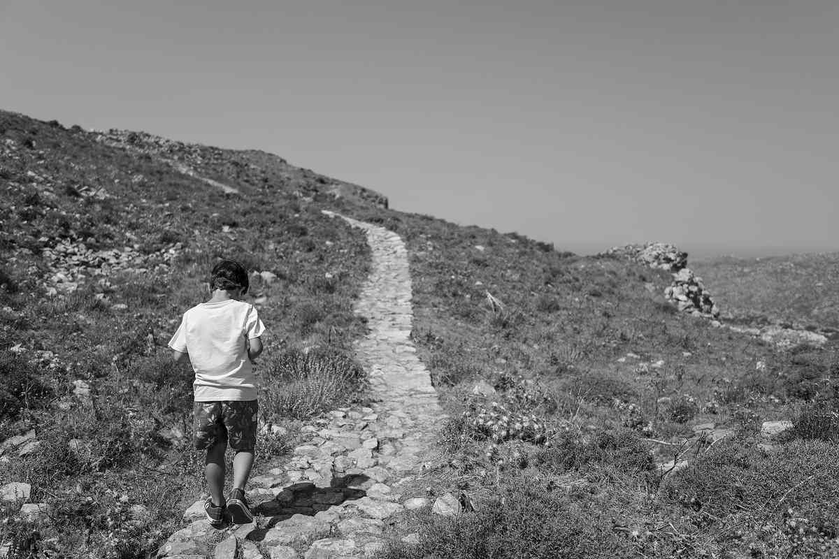
Hiking exposes the parts of Tinos that cars never reach. The marked network threads the green interior, connecting Pyrgos and the marble villages of the north with the plateau villages of Volax, Falatados and Steni and the coast. Old stone-paved kalderimi paths, built for mules, climb between terraces, past dovecotes and chapels, and up to the island’s high points. The walking ranges from gentle, near-level marble paths to steep mountain climbs. This variety makes Tinos hiking suit families and serious walkers alike, complementing the wider things to do in Tinos. Unlike the bare, sun-baked trails of many Cyclades islands, the green, watered interior of Tinos offers shade, streams and scent along the way. The dense scatter of villages means a walk rarely runs far from a taverna or a water source. Walkers can choose a single short route or chain several paths into a full day across the island. A dedicated trail project maintains the network.
What is the Tinos trail network like?
The Tinos trail network is a waymarked system of restored footpaths, signed and maintained by a local trails project. Around 150 kilometres of paths connect the villages, marked with red signs and cairns, and mapped for walkers of every level.
The network turns scattered old paths into a coherent system. Volunteers and a dedicated trails initiative have cleared, paved and signed the routes, restoring the kalderimi that once linked every village. Trailheads carry signboards with distances and grades, and red waymarks guide walkers along the way. Printed and digital maps cover the full system, so independent hikers can plan loops and point-to-point routes. The restoration has made Tinos one of the best hiking islands in the Cyclades. The waymarks combine colour-coded paint blazes, signposts and traditional cairns, so the paths stay easy to follow even where they cross open ground. Many routes are circular, returning to the starting village, while others run point to point between settlements linked by bus or a short drive. The trail maps grade each route by distance and difficulty, which helps walkers plan a day that matches their fitness. This infrastructure underpins the headline trails. Several routes stand out above the rest.
What are the best hiking trails in Tinos?
The best hiking trails in Tinos are the Exomvourgo climb, the Volax to Falatados dovecote route, the Kardiani to Isternia marble path, the Tarambados dovecote loop, and the wild descent to Livada Bay. Each shows a different face of the island.
A handful of routes capture the island’s variety. The Exomvourgo climb delivers the widest view, the Volax to Falatados path crosses dovecote and chapel country, and the Kardiani to Isternia marble path stays shaded with sea views. The Tarambados loop focuses on the finest dovecotes, while the Livada descent reaches a dramatic, empty bay. Together they sample the marble villages, the plateau and the coast. The trail-by-trail guide below details each, drawing on the villages described in the guide to the villages of Tinos. Beyond these headline routes, dozens of shorter paths link neighbouring villages, ideal for an hour’s stroll before lunch. The beauty of the network is that walks can be combined or shortened to suit the day and the weather. A walker can spend a single morning on one path or a full week sampling the whole island on foot. The island’s high point anchors the network.
How do you climb Exomvourgo in Tinos?
You climb Exomvourgo, the 640-metre fortress hill, on a marked path from the villages of Xinara or Mesi, a steady ascent of about an hour. The summit, crowned by a ruined Venetian castle, gives a 360-degree view across the Cyclades.
Exomvourgo is the island’s classic climb. The rocky peak, the highest accessible point on Tinos, carried the island’s medieval capital under Venetian rule, and ruined walls still cling to its slopes. A waymarked path climbs from the Catholic villages on its flanks, steep in places but short, reaching the summit in around an hour. The reward is a sweeping panorama over the villages, the sea and the neighbouring islands of Mykonos, Syros and Andros. A cross and chapel mark the top. The ruins include the remains of the medieval town, churches and gates, layered over an ancient acropolis, so the climb is a walk through history as well as a workout. The path can be slippery on the loose upper rock, so good shoes matter, and the exposed summit catches the full force of the meltemi. Early morning offers the clearest air and the coolest climb. The climb suits reasonably fit walkers and ranks among the highlights of Tinos hiking. The plateau holds a gentler classic.
What is the Volax to Falatados trail?
The Volax to Falatados trail is a gentle walk across the central plateau, linking the boulder village of Volax with the raki village of Falatados in about an hour. The route passes dovecotes, chapels and open country dotted with granite rocks.
This plateau crossing is among the most rewarding easy walks. Starting in Volax, set among its giant round boulders, the path runs across open farmland scattered with the same granite rocks, passing dovecotes and small white chapels. It ends in Falatados, a village of vineyards and raki distillers with tavernas for a well-earned lunch. The walking is mostly level and clearly marked, suiting families and casual hikers. The surreal landscape and the village endpoints make it a favourite. Along the way, walkers pass small chapels and the painted poetry on the doors of Volax, and the open ground gives long views across the plateau. The path can be walked in either direction, though starting in Volax keeps the gentle gradient in the walker’s favour. A taverna lunch in Falatados, with local raki, rounds off the route perfectly. It connects naturally to the dovecote routes nearby. The coast offers a shaded alternative.
What is the Kardiani to Isternia marble path?
The Kardiani to Isternia marble path is a shaded, nearly level walk between two mountainside villages on the west coast, taking about an hour. The old paved path offers sweeping sea views, springs and the marble fountains of both villages.
This west-coast path is the island’s most scenic gentle walk. The old kalderimi links Kardiani and Isternia, two villages draped over a steep, green slope above the Aegean, staying mostly level and shaded by trees and terraces. Springs, marble fountains and views toward Syros line the route, and the villages at each end reward a pause at a café or taverna. The gentle grade and the scenery suit walkers of all levels. It pairs the island’s marble heritage with its finest coastal views, a craft detailed in the guide to the marble craft of Tinos. The path can be extended down to the fishing cove of Ormos Giannaki below Kardiani for a swim and a seafood lunch. Timed for late afternoon, the walk catches the golden light that makes these west-facing villages glow. Buses and a short drive link the two villages, so walkers need not retrace their steps. The dovecote valleys deserve their own walk.
What are the dovecote hiking routes in Tinos?
The dovecote hiking routes in Tinos centre on the Tarambados valley, where a short marked path passes the island’s finest ornate pigeon houses. The Agapi and Komi valleys offer further dovecote walks among streams and gardens.
Dovecote walks combine easy hiking with the island’s signature structures. The Tarambados valley holds the best-preserved cluster of these two-storey stone towers, decorated with geometric marble latticework, viewable from a short, gentle path. The Agapi valley, lush with streams and gardens, links several dovecotes between villages. These routes stay easy and family-friendly, rewarding slow walking and photography in the soft light of late afternoon. They show how the island’s marble craft shaped even its farm buildings. The Tarambados valley alone holds dozens of dovecotes, many still home to pigeons, set among gardens and streams. Information boards explain the symbolism of the carved patterns, from suns to cypresses. The walk is short and almost level, which makes it ideal for families and casual strollers. The wild east coast offers a tougher reward.
Are there coastal and gorge hikes in Tinos?
Yes, coastal and gorge hikes in Tinos include the descent to Livada Bay on the wild east coast and the green Livada gorge. These rougher routes reach dramatic, near-empty shores backed by cliffs and unusual rock formations.
The coast adds drama to the island’s walking. The descent to Livada Bay drops through a green valley to a wind-swept, near-empty arc of sand framed by striking eroded rocks. The route is rougher and less shaded than the village paths, rewarding the effort with solitude and wild scenery. Other coastal paths link the northern villages to hidden coves reachable only on foot. These hikes suit confident walkers who carry water and good shoes. The Livada area is known for its strange, sculpted rock formations, shaped by wind and water over millennia, which give the bay an otherworldly feel. Few people make the effort, so the reward is near-total solitude even in high season. There are no facilities, so walkers carry everything they need and allow time for the climb back up. Knowing the difficulty helps in planning.
How difficult are Tinos hikes?
Tinos hikes range from easy to moderate. Village-to-village marble paths are gentle and nearly level, while the Exomvourgo climb and the coastal descents are moderate, with steep, rocky and exposed sections that demand sturdy footwear.
Difficulty varies widely across the network. The shaded plateau and marble paths, such as Kardiani to Isternia or Volax to Falatados, stay easy and suit families. The Exomvourgo climb and the rough descents to the east coast count as moderate, with steeper, rockier ground and little shade. None require technical skill, but the exposed, treeless terrain and the summer sun raise the effort. Good walking shoes, water and sun protection turn a hard route into an enjoyable one. Distances on the island are short by mainland standards, with most routes running two to six kilometres, so even moderate walks fit into a half-day. The main challenges are the sun, the wind and the rocky ground rather than length or altitude. Beginners should start with the shaded marble paths before attempting Exomvourgo or the coastal descents. Matching the trail to fitness keeps Tinos hiking rewarding. The season matters as much as the route.
When is the best time for hiking in Tinos?
The best time for hiking in Tinos is spring and autumn, from April to June and September to November. Mild temperatures, green scenery and gentle wind make these months ideal, while the summer heat makes midday walking uncomfortable.
Season shapes every walk on the island. Spring brings wildflowers, flowing streams and comfortable temperatures, the prime time for the full trail network. Autumn offers warm but milder days, clear light and the colour of the harvest. Summer is too hot for midday hiking, so walkers start at dawn or keep to short, shaded village paths. Winter is walkable but wet and windy. Choosing the right month transforms the experience, a pattern the guide to the best time to visit Tinos explains. The right kit makes any season safer.
What should you bring hiking in Tinos?
For hiking in Tinos you should bring sturdy shoes, plenty of water, a sun hat, sunscreen and a windproof layer. The exposed, treeless terrain offers little shade or water, and the meltemi wind can be strong on the ridges.
Packing well keeps a walk safe and comfortable. Sturdy walking shoes or boots handle the rocky, paved paths, and plenty of water covers the dry, shadeless stretches between villages. A hat, sunglasses and sunscreen guard against the strong island sun, while a windproof layer handles the meltemi on high ground. A paper or offline map and a charged phone help with navigation, since signal drops in the interior. Snacks and a small first-aid kit round out the essentials. Trekking poles help on the steeper, looser descents such as Exomvourgo and Livada, and a light fleece is welcome on windy ridges even in summer. In spring, a thin waterproof guards against passing showers. Starting early, before the heat and wind build, makes the longer routes far more comfortable. With the right kit, the island’s trails are a pleasure rather than a trial. Some walkers prefer expert company.
Can you take a guided hike in Tinos?
Yes, you can take a guided hike in Tinos with local guides who lead routes past dovecotes, chapels and the Exomvourgo fortress. A guide reads the trail, the history and the wild plants, and handles navigation on the less obvious paths.
Guided hikes add depth and reassurance. Local guides lead walks tailored to the group, from a gentle marble path to the Exomvourgo climb, explaining the dovecotes, the terraced farming, the chapels and the wildflowers along the way. A guide removes the worry of navigation on the fainter trails and shares stories that a map cannot. These walks suit travellers who want context and company, and they can combine with a village or food experience, as the guide to Tinos tours and guided experiences shows. Guides also adapt the pace and the route to the group, choosing an easy marble path for families or a tougher ridge for keen walkers. They carry water and first-aid, and know which tavernas and springs lie along the way. For visitors with limited time, a guided half-day delivers the island’s best scenery without the planning. The trails reveal the island’s hidden character. A trail-by-trail summary helps with planning.
Which Tinos trails should you not miss?
The Tinos trails you should not miss are the Exomvourgo climb, the Volax to Falatados path, the Kardiani to Isternia marble path, the Tarambados dovecote loop, the Livada Bay descent and the Loutra to Volax route, each a distinct half-day or shorter walk.
The shortlist below gathers the standout routes. Pick by mood, from a gentle stroll to a demanding climb.
Exomvourgo climb
A steady one-hour ascent to the 640-metre fortress peak, the island’s highest accessible point. Steep but short, it rewards walkers with a ruined Venetian castle and a 360-degree view across the Cyclades. It is the classic Tinos summit walk and the single best viewpoint on the whole island.
Volax to Falatados
A gentle, near-level hour across the central plateau, linking the boulder village of Volax with the raki village of Falatados. The path passes dovecotes, chapels and granite rocks, ending at tavernas. It is ideal for families and casual walkers seeking an easy first taste of the island’s trails.
Kardiani to Isternia
A shaded, mostly level marble path between two mountainside villages, about an hour with sweeping sea views. Springs, marble fountains and terraces line the route, with cafés at each end. The island’s most scenic easy walk.
Tarambados dovecote loop
A short, easy walk through the Tarambados valley, home to the island’s finest ornate dovecotes. The gentle path and the marble-patterned pigeon houses make it a rewarding stroll, best in the soft light of late afternoon.
Livada Bay descent
A moderate, rougher walk down a green valley to a wild, near-empty bay on the east coast, framed by eroded rocks. Less shaded and steeper than the village paths, it rewards confident walkers with solitude and dramatic scenery.
Loutra to Volax
A pleasant route linking the historic village of Loutra, with its Jesuit monastery and folklore museum, to the boulder village of Volax. The path crosses open plateau country with dovecotes and chapels, an easy-to-moderate walk rich in island heritage. It connects the island’s Catholic and farming history with its strangest landscape, and tavernas at Volax reward the finish.
How do you reach the Tinos trailheads?
You reach the Tinos trailheads by rental car or scooter, or by KTEL bus to the larger villages such as Volax, Falatados and Pyrgos. A car gives the most flexibility for point-to-point routes and remote starting points.
Access shapes which trails a walker can tackle. A rental car or scooter reaches every trailhead, including the remote starts for the coastal and ridge routes, and allows point-to-point walks with a short drive back. KTEL buses serve the larger villages on a limited timetable, which suits loops that begin and end in the same place. Some routes start within walking distance of Tinos Town. Planning the transport around the chosen trail avoids long road-walks, and a guided hike removes the logistics entirely. For point-to-point routes, two cars or a taxi pickup at the far end saves a long return walk, while circular trails simplify the logistics. The KTEL bus timetable is limited, especially outside high season, so check return times before relying on it. Many walkers base themselves in Tinos Town and drive out to a different trailhead each day. With access sorted, the island’s full trail network opens up. The questions below cover the points walkers ask most.
What is the history of the Tinos trails?
The Tinos trails follow old stone-paved kalderimi paths built over centuries to link the villages by mule and on foot. A local trails project later cleared, restored and waymarked them, reviving the routes for modern Tinos hiking.
The paths carry centuries of island history. Before roads, the villages were connected only by these stone-paved kalderimi, walked daily by farmers, traders and pilgrims and built to endure the steep, rocky terrain. As cars arrived, many paths fell into disuse and grew over. A dedicated trails initiative, supported by volunteers and the local community, has since cleared, repaired and signed the network, returning it to use. Walking these routes today retraces the everyday journeys of past generations. This restoration turned a fading heritage into a living asset for Tinos hiking. The trails also pass through rich natural surroundings.
What plants and wildlife will you see hiking in Tinos?
Hiking in Tinos, you will see wildflowers, wild herbs, terraced fields and migrating birds, especially in spring. Thyme, oregano and sage scent the paths, while the wetlands behind Kolimbithra and the valleys draw birdlife.
The trails reveal the island’s natural life as much as its heritage. Spring covers the slopes in wildflowers, and the air carries the scent of wild thyme, oregano and sage growing along the paths. Terraced fields, dry-stone walls and grazing goats line the village routes, while springs feed green, watered valleys such as Agapi. Migrating birds pause at the wetlands behind Kolimbithra and in the gorges, rewarding quiet walkers. The varied landscape, from boulder fields to coastal cliffs, supports a richer flora than the bare neighbouring islands. This living backdrop makes Tinos hiking a pleasure for nature lovers. The paths are also studded with human landmarks.
What chapels and landmarks do the trails pass?
The Tinos trails pass hundreds of small white chapels, ornate dovecotes, marble fountains, ruined windmills and the Venetian fortress of Exomvourgo. These landmarks mark the routes and tell the story of the island’s faith and farming.
Human landmarks give the walks their rhythm and meaning. The island is dotted with countless tiny chapels, many reached only on foot, where walkers pause in the shade. Ornate dovecotes rise from the valleys, marble fountains flow at the villages, and ruined windmills crown the ridges. The fortress of Exomvourgo, the medieval capital, looms over the central trails. Together these features turn a walk into a journey through the island’s history, from Venetian rule to its marble craft and Orthodox faith. They make every route on the Tinos hiking network distinct and memorable. The questions below cover the points walkers ask most.
Frequently Asked Questions
Is Tinos good for hiking?
Tinos is one of the best hiking islands in the Cyclades, with around 150 kilometres of marked footpaths. The green interior, old marble paths, dovecotes, chapels and the Exomvourgo fortress give walkers more variety than most Aegean islands. Spring and autumn are ideal, the routes range from easy to moderate, and a taverna or village is rarely far away, which makes the island welcoming for casual and serious walkers alike.
How long is the Tinos trail network?
The Tinos trail network covers around 150 kilometres of waymarked footpaths, restored and signed by a local trails project. The paths link the villages, dovecote valleys, chapels and high points across the green interior of the island. Most individual routes run two to six kilometres, so walkers combine them into longer days or pick a single short trail, with maps grading each by distance and difficulty.
How hard is the Exomvourgo hike?
The Exomvourgo hike is moderate, a steady climb of about an hour to the 640-metre summit. The path is steep and rocky in places but short, and the ruined Venetian castle and the 360-degree view across Mykonos, Syros and Andros reward the effort, making it the most popular climb on the island.
When is the best time to hike in Tinos?
The best time to hike in Tinos is spring and autumn, from April to June and September to November, when temperatures are mild and the hills are green. Summer is too hot for midday walking, so hikers start early or keep to short, shaded routes. Spring brings wildflowers and flowing streams, while autumn offers stable, dry weather and the colour of the grape and raki harvest.
Do you need a guide to hike in Tinos?
You do not need a guide for the well-marked main trails in Tinos, but a guide helps on the fainter paths and adds history and context. Guided hikes suit travellers who want company, navigation and stories about the dovecotes and villages, and they handle the transport logistics for point-to-point routes, leaving walkers free to enjoy the scenery.
Are Tinos hikes suitable for families?
Many Tinos hikes suit families, especially the gentle, near-level marble paths and dovecote walks such as Kardiani to Isternia or the Tarambados loop. Steeper routes like Exomvourgo and the coastal descents are better for older children and adults. Short distances, village endpoints with tavernas, and features like the boulders of Volax and the carved dovecotes keep younger walkers engaged along the way.