
Kefalonia covers about 773 square kilometres, which makes it the largest of the Ionian Islands and the hardest one to see in a hurry. Roads climb over ridges and curve around bays, so map distance rarely matches clock time. Argostoli sits in the southwest. Sami lies about 25 km east and Fiskardo about 50 km north. Lourdas sits about 16 km south, Skala about 40 km southeast. Each of those numbers translates into 25 to 90 minutes behind the wheel, not the 20 minutes a straight line suggests. A trip planned around one or two bases works far better here. Three or four driving days carry the sightseeing, and the rest of the days stay short. Plan the whole trip with Greece Tours.
A plan that treats the island as compact runs out of daylight. This guide sets out how days Kefalonia needs and what belongs in each of them.
Days on Kefalonia divide naturally into six blocks. Argostoli and Lassi hold the southwest corner. The northwest run links Myrtos, Assos and Fiskardo along one coastal road. The east coast around Sami carries two caves and the beach at Antisamos. The Paliki peninsula sits across a short ferry from the capital, and the mountain interior holds Mount Ainos, Agios Gerasimos and the Robola vineyards. The south at Skala and Lourdas makes the sixth block. Three days cover two of those blocks, five days cover four, and seven days cover all six with a boat to Ithaca on top. The sections below work through each trip length in order.
They then walk day by day through the routes that build them, starting with the capital and the beaches at its door.
How days does Kefalonia need for a first visit?
Kefalonia rewards seven days for a full circuit, five days for a solid first visit, and three days for the headline sights only. The island measures about 773 square kilometres, and its mountain roads slow every transfer between regions.
Distance on Kefalonia behaves differently from distance on a flat island. Argostoli to Sami measures about 25 km on the map. The road climbs over the ridge behind the capital and takes around 35 minutes. Argostoli to Fiskardo covers about 50 km and needs 75 to 90 minutes, because the coastal road north of Divarata bends around every inlet. Argostoli to Skala runs about 40 km southeast and takes around 50 minutes. Lourdas sits closer, about 16 km south of the capital and roughly 25 minutes away. Add parking time above Myrtos, a swim, and lunch in a village, and a single sightseeing loop fills six hours. Three regions in one day never works here.
Two regions in one day works, and one region in one day works better than both.
Argostoli and the Lassi peninsula make the practical base for a first trip. The capital sits within 60 minutes of the south, the east and the Paliki ferry. Lassi puts Makris Gialos and Platis Gialos within a 10-minute drive, and the De Bosset bridge within 10 minutes the other way. Travellers who want the north closer choose Fiskardo or Assos instead. That cuts the drive to Myrtos down to 20 or 30 minutes. It also adds 90 minutes to every trip south. Sami suits arrivals by ferry from Ithaca or the mainland, with the Melissani and Drogarati caves within 10 minutes of the port.
Splitting a week between two bases, four nights near Argostoli and three nights in the north, removes the longest repeated drives from the plan. One base suits a short trip, two suit a full week.
Water routes shorten the map in two directions. The Argostoli to Lixouri ferry crosses the bay in 20 to 30 minutes. That saves a road loop of about 35 km around the head of the gulf. The Paliki peninsula turns from a half-day drive into a short hop across to Xi and Petani. A day boat runs east from Sami to Ithaca. A full day of harbours at Vathy and Kioni then fits inside a Kefalonia week without a second base. Planning around those two crossings changes what fits into five days, and both of them take driving out of the itinerary rather than adding it. Water beats tarmac on this island whenever the two compete.
Grouping the Paliki beaches behind the ferry, instead of the road, buys back half a day of daylight.
Arrival eats part of day one and departure eats part of the last day. Kefalonia Airport sits about 9 km south of Argostoli. The drive takes 15 minutes to the capital and about 10 minutes to Lassi, so a morning flight leaves the whole afternoon free. Ferries land at Sami from the mainland ports of Patras and Astakos. Boats from Kyllini reach Poros in the southeast. Those arrivals start on the east coast rather than the west. A car matters on Kefalonia more than on a small island. Buses link the main towns, and they never reach Myrtos, Assos, Petani or the Mount Ainos road. Hiring a car for the whole stay beats hiring one for two days.
Counting a half day at each end, a seven-night trip delivers six usable days.
What fits into a 3-day Kefalonia itinerary?
Three days on Kefalonia cover Argostoli with the Lassi beaches, the northwest run to Myrtos, Assos and Fiskardo, and the caves at Sami with a swim at Antisamos. That plan skips Paliki, Mount Ainos and the south.
Day one starts in Argostoli and stays there. The De Bosset bridge runs about 700 metres across the Koutavos lagoon. The Katavothres sea mills sit 2 km north, at the tip of the peninsula. The Napier Garden lies inside the town grid. Three sights inside 2 km need no car at all. The fish quay on the waterfront draws loggerhead turtles that follow the boats in, and the sighting takes minutes rather than a whole excursion. Lassi begins 3 km west, so an afternoon at Makris Gialos or Platis Gialos costs a 10-minute drive. Ending the day back on the Argostoli waterfront keeps the car parked from mid-afternoon onwards.
A first day built this way absorbs the flight, the car pickup and the first supermarket run without wasting the daylight.
Day two runs north and covers the coast that carries the island postcards. The road leaves Argostoli, climbs past Agkonas and Zola, and reaches the Divarata viewpoint above Myrtos after about 30 km and 40 minutes. The descent to the shore adds 10 minutes of switchbacks. Assos waits 12 km further north, on an isthmus below a Venetian castle whose walls circle a pine-covered headland. Fiskardo closes the day about 50 km from Argostoli, with a harbour of pastel houses and a working quay. Turning back at 18:00 puts the car in Argostoli around 19:30. The whole loop covers about 100 km. Compressing the northwest into one day works.
It leaves 20 minutes at each stop rather than an hour, which is the trade a three-day plan accepts. Swimming happens at Myrtos on this version rather than at Assos.
Day three heads east to Sami and the caves. Argostoli to Sami covers about 25 km and 35 minutes over the ridge. The Melissani cave holds an underground lake with a collapsed roof, and the rowing-boat circuit inside lasts around 10 minutes. Drogarati sits 4 km back towards Argostoli, a stalactite chamber reached by a stairway that drops below ground. Both caves sit within 10 minutes of each other on the same road. Antisamos lies about 4 km east of Sami port, a bay of white pebbles under wooded slopes. The bay served as a filming location for the Captain Corelli Mandolin film.
Two caves and one beach fill the day without pressure, and the drive back to the capital takes 35 minutes. A late flight home still fits after a final morning at Antisamos.
Three days work as a stopover rather than a holiday. The plan leaves out the Paliki peninsula, which needs the Lixouri ferry and half a day for Xi and Petani. It leaves out Mount Ainos, whose summit stands at about 1,628 metres and takes 60 minutes to reach from Argostoli. It leaves out Skala and Lourdas in the south, and it leaves out the Ithaca boat from Sami. Three days also load the plan with driving, at around 200 km across two of them. Visitors arriving by ferry from Zakynthos or Lefkada for a short break get the headline coastline and nothing beyond it.
Anyone with one week in the Ionian sees more by giving Kefalonia five days and cutting a neighbouring island. Kefalonia carries more inland ground than any other Ionian island.
What does a 5-day Kefalonia itinerary add to the plan?
Five days add the Paliki peninsula behind the Lixouri ferry and the mountain interior at Mount Ainos, Agios Gerasimos and the Robola vineyards. The three-day core stays intact, and every driving day gains an unhurried swimming stop.
Day four crosses the bay to the Paliki peninsula. The ferry from Argostoli to Lixouri sails in 20 to 30 minutes. It removes a road loop of about 35 km around the head of the gulf. Xi beach lies 8 km south of Lixouri, a shallow bay of red-orange sand backed by pale clay cliffs. Petani sits on the west coast, about 12 km from Lixouri over the spine of the peninsula. The bay runs deep and pebbled, facing the open Ionian. Driving between the two takes 25 minutes. Sunset lands on Petani rather than on Xi, since one faces west and the other south.
Lixouri itself holds a wide central square and a waterfront rebuilt low after the earthquake. A late-afternoon crossing puts the day back in Argostoli for dinner.
Day five turns inland to the Omala valley and Mount Ainos. Agios Gerasimos, the monastery of the island patron saint, stands on the plain about 15 km east of Argostoli, a 25-minute drive through Valsamata. The Robola cooperative sits beside it, where the white Robola grape grows on high limestone terraces. Wine tasting and a monastery fit into one morning here. The road up Mount Ainos leaves the valley and climbs into a national park. The park protects the endemic Cephalonian fir and a herd of semi-wild horses. The summit reaches about 1,628 metres, the highest point in the Ionian Islands, and the drive from Argostoli takes about 60 minutes.
Temperatures at the top run 6 to 8 degrees below the coast, so a fleece belongs in the car even in August.
Five days change the rhythm of the coastal days more than they add new stops. The northwest day gains a full hour at Myrtos. It also gains the walk up to the Assos castle gate, 25 minutes each way on a stone path. The Sami day gains lunch at Karavomylos beside the small coastal lake and an unhurried afternoon on the pebbles at Antisamos. Neither day forces the 18:00 turnaround that a three-day plan demands. Two of the five days involve under 40 minutes of driving in total. The other three run 90 minutes or more behind the wheel.
Alternating a driving day with a short day keeps a family trip workable from the first morning to the last. Five days also leave room for a second swim after the caves.
One swap suits travellers who prefer beaches to mountains. Replacing the Mount Ainos day with the south sends the car 40 km southeast to Skala. Roman-villa mosaics sit under a shelter at the edge of the village, and a pine-backed beach runs for about 3 km. Lourdas lies about 16 km south of Argostoli on the way back, below the slopes of Ainos. A long shingle bay runs under tavernas set on the terraces above it. The return through Peratata passes Kastro Agiou Georgiou, the Venetian castle that guarded the old capital. That version trades the fir forest and the summit view for a full swimming day. Total driving stays near 90 minutes.
Families with young children tend to pick this version over the mountain. Skala and Lourdas both hold long beaches with shallow entry.
How does a 7-day Kefalonia itinerary slow the island down?
Seven days split the northwest across two days, add the southern coast at Skala and Lourdas, and leave one day for the Ithaca boat out of Sami. Driving drops to about 90 minutes on the busiest day.
Seven days let the northwest split in two. The first of those days takes the coast road to Divarata, the beach below it, and Assos. The afternoon then covers the castle circuit and a swim beside the isthmus. The second continues to Fiskardo, Emblisi and Foki, three points within 3 km of each other at the northern tip. The pastel harbour at Fiskardo repays a whole evening rather than a 30-minute stop. The village kept its houses through the earthquake, while the rest of the island was rebuilt low. Splitting the northwest also removes the worst driving of the week.
One day covering Argostoli to Fiskardo and back runs about 100 km and close to three hours behind the wheel. Two shorter days replace it at no cost in sights.
A second base in the north makes the seven-day plan work better than a single base does. Four nights near Argostoli cover the capital, Lassi, Paliki and the interior. Three nights at Assos, Fiskardo or Agia Efimia cut the drive to Myrtos to 20 or 30 minutes. Emblisi and Foki then sit within 10 minutes. Moving on the fourth morning costs 90 minutes and one packing session. It saves roughly four hours of repeated coastal driving across the rest of the week. Agia Efimia sits about halfway, 30 km from Argostoli and 25 km from Fiskardo, which puts the Sami caves 10 km away.
The list of things to do in Kefalonia divides cleanly along that same north-south line. Argostoli and Fiskardo sit 50 km apart, which is the whole argument for two bases.
The south fills a day that a five-day plan leaves out entirely. Skala sits about 40 km southeast of Argostoli, 50 minutes by road through Peratata and Vlachata. Roman-villa mosaics lie at the village edge, and 3 km of pine-backed sand runs beside it. Poros lies 12 km north of Skala, a working ferry port for Kyllini set below a gorge in the cliffs. Katelios, between Skala and Lourdas, keeps a small fishing harbour and a bay where loggerhead turtles nest on the sand. Mounda, next to Katelios, carries the main nesting beach of the island. Lourdas closes the loop 16 km from the capital.
The full southern circuit covers about 90 km, spread across a day with three swimming stops, so wheel time stays near 100 minutes. The rest of that day belongs to the water.
The seventh day belongs to Ithaca. A day boat runs east from Sami across a strait of about 25 km. Vathy, the harbour town of Ithaca, wraps around a deep inlet on the southeast coast. Kioni and Frikes sit on the northeast coast, two small ports with quayside tavernas and clear water off the rocks. The crossing takes under an hour, and the day needs no car on the far side when the boat calls at more than one harbour. Sami lies 25 km from Argostoli, so an early start from the capital still catches a morning departure. Anyone based at Agia Efimia reaches the port in 15 minutes.
One day on Ithaca costs no driving at all, which balances a week of mountain roads. A second island inside one week needs no extra planning.
What fills days one and two in Argostoli and Lassi?
Argostoli fills a first day with the De Bosset bridge, the Katavothres sea mills, the Napier Garden and the harbour turtles, while day two belongs to Makris Gialos and Platis Gialos, 10 minutes west at Lassi.
Argostoli reads as a rebuilt town rather than an old one, and that shapes the walk through it. The earthquake flattened the capital, so the streets carry low blocks around a regular grid instead of tall Venetian facades. Lithostroto, the paved main street, runs one block behind the waterfront with shops and the bell tower of Agios Spyridon. Vallianou Square opens at its northern end, ringed by cafes that fill from 20:00 onwards. The Korgialenios museum and the archaeological collection sit within 400 metres of that square. Walking the whole centre takes about 90 minutes at a slow pace. Cafes and tavernas concentrate along the waterfront and around the square.
The promenade runs south past the port to the foot of the De Bosset bridge, which makes an obvious first evening loop.
The De Bosset bridge crosses the Koutavos lagoon in a straight stone line about 700 metres long. A Swiss engineer built it during the British period, and it now carries walkers alone. A stone obelisk stands on a small platform near its midpoint. Crossing on foot takes 15 minutes and delivers the standard view back over the town and the hills behind it. Katavothres sits 2 km north at the tip of the Lassi peninsula. Seawater pours into cracks in the limestone there. The flow travels underground across the island and resurfaces near Karavomylos on the east coast. A restored mill wheel turns in the inflow beside the road.
The two sights sit 10 minutes apart by car and fit either side of a morning coffee. The lagoon fills with birdlife at either end of the day.
Loggerhead sea turtles gather at the Argostoli fish quay because the boats clean their catch there. The animals arrive with the returning fleet, usually before 09:00. They circle in water about 2 metres deep, within a metre of the quay wall. Adult loggerheads reach about 90 cm in shell length. Watching from the promenade costs nothing and takes 20 minutes. Feeding them by hand harms the animals, and local wardens discourage it. The rule is to look rather than lean over the edge with food. The same species nests on the southern beaches at Katelios and Mounda, where marked nests sit behind rope lines from June onwards.
Seeing turtles in the harbour forms part of an Argostoli morning rather than a paid tour. Morning light on the quay also suits photographs of the animals.
Lassi carries the beaches closest to the capital. Makris Gialos and Platis Gialos sit side by side about 3 km west of Argostoli. A rocky spur separates the two crescents of pale sand. Both carry sunbeds, and both sit 10 minutes from town by road. The water shelves gently at each of them, which suits children. Fanari, the round lighthouse of Agioi Theodoroi, stands 2 km north on the same peninsula and works as a sunset stop. Sunset arrives over open sea on this side of the island. Beyond Lassi the coast road continues to Gradakia and Tourkopodaro, two smaller coves within 5 minutes of the same base.
Two days built around Argostoli and Lassi need under 20 km of driving in total. That total is why the pair belongs at the front of any itinerary.
How do Myrtos, Assos and Fiskardo fit into one northwest day?
Myrtos, Assos and Fiskardo line up along one northwest road, about 20 km apart end to end from Divarata. A single day covers all three with a morning swim, a castle walk and an evening on the harbour front.
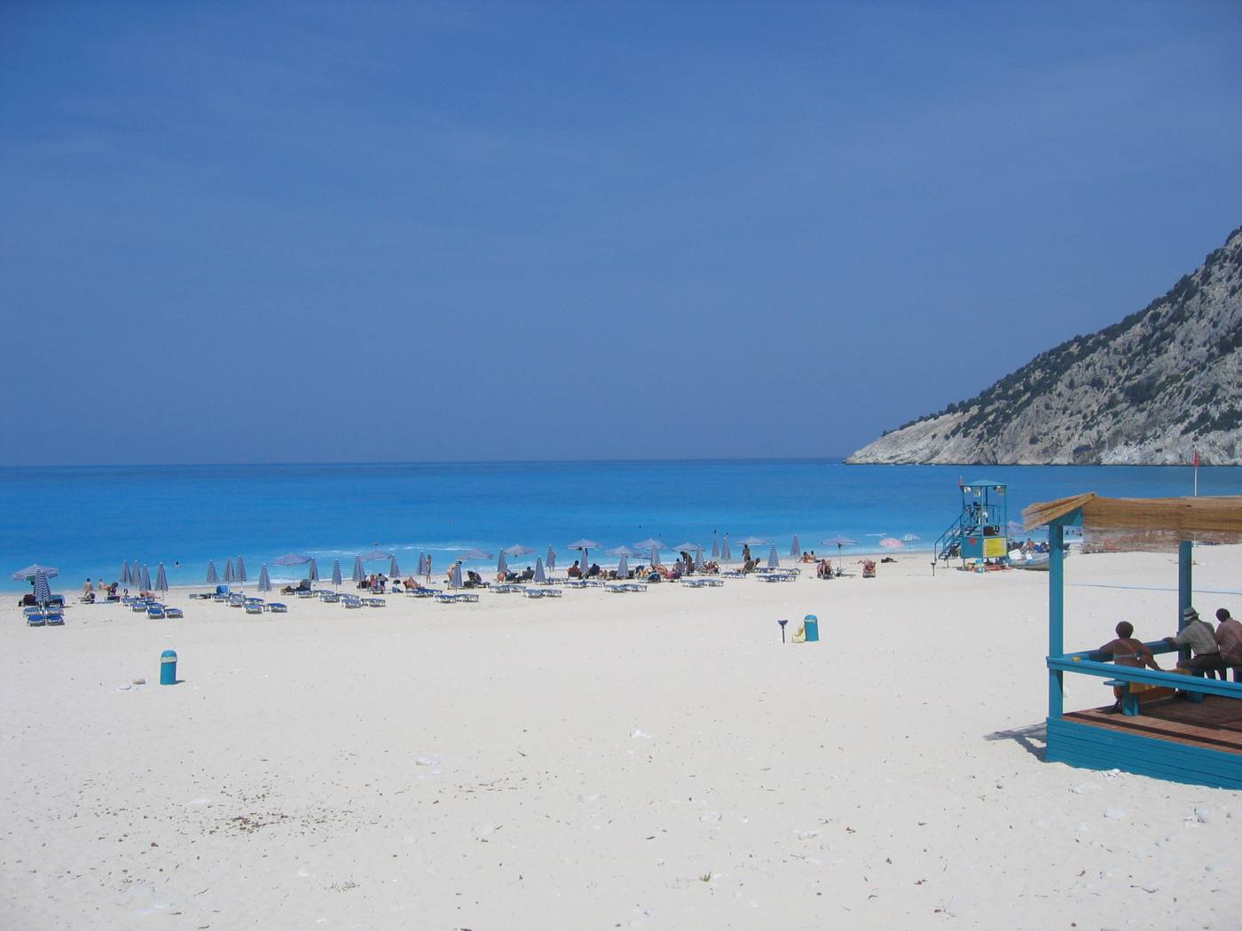
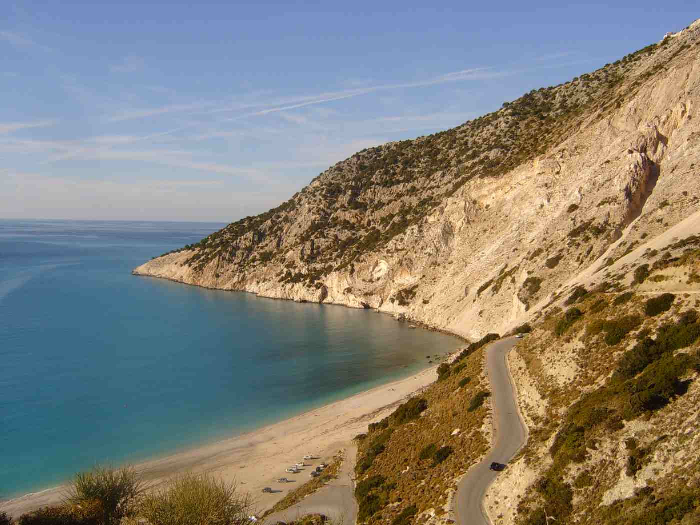
The northwest day begins with the climb out of Argostoli towards Divarata. The road covers about 30 km in 40 minutes, passing Agkonas and Zola. It reaches a roadside viewpoint where the coast drops away in white cliffs. The viewpoint itself costs nothing and takes 5 minutes. Myrtos beach lies below, a curve of white pebbles about 900 metres long between two headlands. A paved switchback road reaches it in 10 minutes, and slightly longer coming back up. Parking sits at beach level and fills by 11:00 in high summer. The water deepens within three metres of the shore and the shelf drops steeply, so strong swimmers get the most out of it.
Arriving before 10:00 gives clear light and a parking space. A single canteen serves the beach, so a full lunch comes back up the road.
Assos sits 12 km north of Divarata, reached by a narrow road that drops through switchbacks to the bay. The village occupies a low isthmus joining the coast to a pine-covered headland. Around 40 houses in ochre and red sit behind a small harbour. A Venetian fortress crowns the headland, its walls running roughly 2 km around the summit, built to guard the channel against corsairs. The path from the village to the castle gate climbs for 25 minutes on stone and packed earth. The walls inside enclose pine woods, a ruined governor house and open ground. The castle walk needs water and a hat in July and August. Swimming happens off the pebble strip beside the harbour.
Two hours covers the walk, a swim and lunch at the waterfront tables.
Fiskardo closes the northwest at about 50 km from Argostoli and 20 km from Assos. The village kept its pastel houses through the earthquake, which destroyed most other settlements on the island. The quay carries two-storey Venetian-style facades in ochre, pink and blue instead of low concrete. Yachts moor stern-to along the front and the tavernas sit one step behind them. Fiskardo takes its name from the Norman leader Robert Guiscard. A Venetian lighthouse and the ruins of a Norman-era basilica stand on the headland north of the harbour. A 15-minute walk from the quay reaches both.
Emblisi lies 2 km west and Foki 1 km south, two pebble coves in clear water and both quieter than the village. Agia Efimia lies 25 km south of the village along the coast road.
Timing decides how the northwest day feels from start to finish. Leaving Argostoli at 08:30 puts the car at Myrtos by 09:30, at Assos by 12:00 and in Fiskardo by 14:30. The afternoon and the early evening then belong to the northern tip. Driving back after dinner takes 80 to 90 minutes on a dark coastal road with tight bends. Travellers who dislike that either turn around by 18:00 or book a night in the north. The alternative runs the loop in reverse. Starting at Fiskardo beats the tour buses, and finishing at Myrtos catches late-afternoon light on the cliffs. Fuel stations cluster around Argostoli rather than along the north coast.
Both versions cover about 100 km, and neither leaves room for the Sami caves. A night in the north removes that decision entirely.
What does the east-coast day at Sami and Melissani cover?
Sami anchors an east-coast day built on the Melissani cave boat ride, the stalactite chamber at Drogarati 4 km away, and an afternoon on the white pebbles of Antisamos beach, about 4 km beyond the port.
Sami lies 25 km east of Argostoli, a 35-minute drive over the saddle behind the capital. The Melissani cave sits 2 km north of the port near Karavomylos. The roof of the underground lake collapsed and left an open shaft above the water. Visitors walk down a tunnel cut into the rock and board a wooden rowing boat that circles the lake for around 10 minutes. Tickets go on sale at the entrance above the tunnel. Light entering the shaft turns the water an intense blue between roughly 12:00 and 14:00, when the sun stands high enough to reach it. The lake connects underground with the Katavothres sink near Argostoli.
Queues build after 11:00, so an early arrival or a late one saves waiting time. The cave sits close enough to the port for a walk of 25 minutes.
Drogarati sits 4 km southwest of Sami on the Argostoli road, a chamber reached by a stairway that drops about 60 steps below ground. The cave holds stalactites and stalagmites across a hall known for its acoustics, which has carried concerts inside the rock. Air temperature stays around 18 degrees through the year, so the cave works as a break from an August afternoon on the coast. The floor stays damp and the steps stay slippery, which makes closed shoes the sensible choice. Handrails run the length of the stairway. A visit takes 30 minutes, including the descent and the climb back up. Pairing Drogarati with Melissani in one morning costs 10 minutes of driving.
The two caves differ completely, one flooded and open to the sky, the other dry and enclosed.
Antisamos lies about 4 km east of Sami port, over a headland on a road that climbs and then drops into the bay. The beach runs as a curve of white pebbles below slopes covered in cypress and holm oak. The water reads deep green rather than pale blue, because the trees stand close behind it. The bay served as a filming location for the Captain Corelli Mandolin film, and a village set stood on the flat ground behind the shore. Sunbeds, two canteens and the parking area sit at the northern end, while the southern end stays free of them. Water shoes help on the pebbles.
The bay faces east, so the slopes throw shade across it late in the day. Argostoli lies 40 minutes away by the same road over the ridge.
Sami itself works as the practical anchor of the east coast. The port takes ferries from Patras and Astakos on the mainland, and from Vathy on Ithaca. Sami counts as the second port of the island after Argostoli. The waterfront runs about 600 metres with tavernas facing the quay. Karavomylos sits 1 km north, where a small coastal lake fed by the Katavothres water meets the sea beside a taverna terrace. Agia Efimia lies 10 km north, a fishing and yacht harbour with clear water off the rocks beside it. Travellers arriving by ferry start their itinerary here rather than in Argostoli. That reverses the whole plan and puts the northwest within 45 minutes on day one.
The caves then become a first-day loop. Arrival point therefore shapes the order of the whole week.
How does a Paliki day from Argostoli work, and what do you see at Xi and Petani?
The Lixouri ferry crosses Argostoli bay in about 20 to 30 minutes and lands you within 10 kilometres of Xi beach and Petani, which makes Paliki a compact day rather than a long drive.
Ferries leave the Argostoli waterfront for Lixouri through the day and cross the bay in about 20 to 30 minutes. Cars board the same boats, so drivers keep their vehicle for the rest of the Paliki day. The road alternative loops around the head of the bay through Kardakata and covers roughly 35 kilometres, which takes about 50 minutes of steady driving. Foot passengers ride the same crossing and then depend on taxis, which limits how far the day reaches. The ferry saves around half an hour in each direction and turns a scattered peninsula into one compact loop. Parking beside the Argostoli ramp fills by mid-morning in July and August, so an early start protects the schedule.
Drivers who reach the queue 15 minutes before departure board without trouble on most sailings.
Xi beach sits about 8 kilometres south of Lixouri on the sheltered south coast of Paliki, a 12 minute drive from the ferry ramp. The sand runs red-orange, coloured by the clay cliffs behind it, and the water stays shallow for 30 to 40 metres offshore. Families with young children use that shallow shelf, and the low cliffs give the beach its unusual colour band. Sunbeds occupy the central stretch, while the western end stays open. Visitors coat themselves in the grey clay from the cliff face and rinse it off in the sea, a habit repeated along this shore. Tavernas sit behind the sand, and parking runs along the access road.
Shade is thin, so an umbrella earns its rental. An hour and a half at Xi leaves the afternoon free for the west coast.
Petani lies on the west coast of Paliki, about 12 kilometres northwest of Lixouri and about 20 minutes away by road. The approach drops through switchbacks with the bay open below, and the last bend reveals white pebbles between two headlands. The water shelves quickly and reads deep blue rather than turquoise. Cliffs enclose both ends, which keeps the bay quiet when the north wind blows across the island. Tavernas stand at the back of the beach and on the road above. The western aspect makes Petani one of the two reliable sunset points on Kefalonia, with Assos the other.
Sunset falls late in high season, so drivers who wait for it check the last Lixouri crossing before committing to the ferry. The road return around the bay adds about 50 minutes.
Lixouri holds the second largest population on Kefalonia and rebuilt itself low after the earthquake, so its streets run wide and flat around a central square. The waterfront faces Argostoli across two kilometres of water, and cafes line the ferry quay. The Iakovatios library and the town museum occupy a stone mansion that survived the shaking, one of the rare pre-earthquake buildings left in the town. Most visitors spend 40 minutes here before or after the beaches. A workable order runs the morning ferry, Xi until early afternoon, Petani for late light, and a walk through Lixouri while waiting for the return crossing.
Both beaches sit within 20 minutes of the ferry ramp, which keeps the driving under an hour for the whole day. Drivers who prefer beaches over towns skip the square and use the extra hour at Petani instead.
What does a mountain day on Kefalonia cover between Mount Ainos, Agios Gerasimos and the Robola vineyards?
Mount Ainos, the Agios Gerasimos monastery and the Robola cooperative sit within 15 kilometres of each other southeast of Argostoli, which packs a summit road, a pilgrimage church and a wine tasting into one half-day loop.
The Ainos road leaves the Argostoli to Sami highway near Frangata and climbs about 12 kilometres to a ridge at roughly 1,600 metres. A telecommunications station marks the top of the drivable section. The surface is paved and narrow, with passing places rather than barriers on the outer edge, and the climb takes about 30 minutes from the junction. Cephalonian fir covers the slopes from around 700 metres upward. The endemic species gave the mountain its old name of Monte Nero, the black mountain, from the dark canopy seen from the sea. The national park gate sits partway up, and a small car park serves walkers at the top.
Temperatures at the ridge run about 8 degrees below Argostoli, and a light layer earns its space in the bag even in August.
Semi-wild horses graze the plateaus below the summit, a small herd protected inside the national park, and drivers meet them on the verges in the early morning. Marked paths run from the car park along the ridge toward Megas Soros, the 1,628 metre high point and the highest ground in the Ionian Islands. The walk takes about 40 minutes on foot each way. The view opens west over Argostoli bay and Paliki, east to Ithaca and the mainland mountains, and south toward Zakynthos on clear days. Wind on the ridge stays strong through the afternoon. Walkers who prefer shade stay on the forest track below the ridge, where the fir canopy blocks the sun until midday.
Two hours covers the drive up, the walk and the descent, which leaves the rest of the morning for Omala.
The monastery of Agios Gerasimos stands in the Omala valley about 12 kilometres southeast of Argostoli, a 20 minute drive through Valsamata. Agios Gerasimos is the patron saint of Kefalonia, and his relics rest inside the older church, where a narrow shaft leads down to the cave he used for prayer. A large modern church stands beside it, built after the earthquake damaged the complex, and its dome carries painted work across the interior. The plane tree in the courtyard is tied to the saint by local tradition. Two feast days each year fill the valley with pilgrims and close the surrounding roads to normal traffic.
Modest dress covers shoulders and knees for entry, and wraps hang at the door for visitors who arrive in beach clothes. Visits take about 30 minutes.
Robola vines grow on the limestone slopes of the Omala valley at around 600 to 800 metres, and the cooperative winery sits within two kilometres of the monastery. The grape produces a dry white with citrus acidity, tied to Kefalonia in the way that Assyrtiko is tied to Santorini. The cooperative runs a visitor room where tastings and bottle sales operate through the summer season, and the vineyard rows climb the slope directly behind. Growers here work stony ground that holds little soil, which keeps yields low. The valley floor sits about 15 minutes from the Ainos junction. The mountain, the monastery and the winery link into a loop of under 40 kilometres from Argostoli and back.
The full loop occupies about five hours with stops. Drivers who taste appoint a passenger to finish the driving.
Is a south Kefalonia day around Skala and Lourdas worth the drive from Argostoli?
Skala sits about 40 kilometres from Argostoli and Lourdas about 16, so the southeast coast fills one relaxed day of long beaches, Roman mosaics and coastal driving with almost no queueing.
The southern road leaves Argostoli through Peratata. Passes below the castle of Agios Georgios and runs east through Markopoulo before dropping to Skala, about 40 kilometres and 55 minutes of driving. The route crosses the southern foothills of Ainos with the sea on the right for most of the second half. Kastro, the medieval capital under Venetian rule, stands above Peratata at about 320 metres and adds 40 minutes to the outward leg for anyone who climbs to the walls. Markopoulo draws attention each August for the harmless snakes that appear near its church. The road surface is good, and the bends are wide compared with the northern coast, which makes this the easiest long drive on Kefalonia.
Buses reach Skala from Argostoli on a thin daily schedule, which leaves a car as the practical option.
Skala spreads behind a beach of fine pebble and sand that runs about three kilometres northeast along the coast, backed by pine woods that reach close to the water. The village centre holds a single main street of tavernas and shops, rebuilt after the earthquake on the flat ground behind the shore. Mosaic floors from a Roman villa sit at the southern edge of the village under a protective shelter, with geometric panels and a scene of sacrifice still legible. The remains of a temple stand on the headland above, dated to the archaic period.
Loggerhead turtles nest on the sand between Skala and Katelios, so marked nests appear above the tide line through the summer and stay roped off. The site takes 20 minutes to walk, and the beach absorbs the rest of the morning.
Lourdas lies about 16 kilometres from Argostoli, a 25 minute drive, on a long strip of sand and pebble below the green southern slopes of Ainos. The access road drops steeply for two kilometres from Lourdata village to the shore, and the gradient rewards low gear on the way back up. Tavernas line the beach road, and the sand runs wide enough that walkers reach quiet ground within 10 minutes in either direction. Trapezaki beach sits three kilometres west with a similar profile and a smaller crowd. The southern coast faces away from the summer meltemi, which keeps the water flatter here than at Petani or Myrtos on windy days.
Katelios, east of Lourdas along the same coast, adds a working fishing harbour and a row of fish tavernas. Half a day at Lourdas pairs with a late return over Kastro.
Poros sits on the east coast about 12 kilometres north of Skala and runs ferries to Kyllini on the mainland. That role makes it a practical arrival or departure point rather than a beach stop. The coastal road between Skala and Poros threads the Poros gorge, a narrow cut through vertical rock that opens to the sea. Drivers who start the south day early reach Skala by mid-morning, spend the middle hours on the beach, and swing back through Lourdas in the late afternoon. The full loop covers about 95 kilometres and stays under two and a half hours of driving.
The east coast north of Poros continues to Sami, which lets a south day finish with the Melissani cave for anyone willing to add 30 kilometres. Anyone based at Skala or Lourdas reverses the order and treats Argostoli as the outing instead.


How do you fit an Ithaca day trip into a Kefalonia itinerary?
Ferries from Sami reach Ithaca in about 30 to 45 minutes, and Sami sits 24 kilometres from Argostoli, so the crossing turns a neighbouring island into a full day with a car or on foot.
Sami handles the Ithaca crossing from its main quay, and the boats land at Piso Aetos on the west coast of Ithaca after about 30 to 45 minutes. Sami sits about 24 kilometres from Argostoli, a 35 minute drive over the pass at Agkonas, and about 20 kilometres from Fiskardo. Cars and foot passengers both board, and the sailings cluster in the morning and late afternoon, which sets the shape of the day. Piso Aetos is a landing point rather than a village, with a quay, a car park and no services, so anyone crossing on foot arranges transport before boarding.
Seasonal boats also run north from Fiskardo to Frikes in summer, which suits visitors staying in the north of Kefalonia. Checking the current timetable at the Sami quay the day before removes the guesswork.
Vathy, the capital of Ithaca, lies about 6 kilometres from Piso Aetos around a deep natural harbour lined with rebuilt neoclassical houses. The road north climbs to Stavros, then drops to the fishing harbours of Frikes and Kioni, about 25 kilometres from Vathy and roughly 45 minutes of narrow coastal driving. Homeric sites carry the island’s older reputation, including the Cave of the Nymphs above Vathy and the Arethusa spring on the southern slopes. Distances on Ithaca stay short, and the island measures about 26 kilometres end to end, so driving eats little of the day. A compact plan takes Vathy in the morning, Kioni for lunch and a swim at Filiatro or Gidaki.
That fills the hours between the crossings comfortably, and the Ithaca day trip works with a rental car carried over on the ferry.
Foot passengers face a thinner day, since Piso Aetos has no bus stand and taxis meet the boats without a fixed schedule. Excursion boats from Fiskardo and from Sami sell day trips that include a coach or a small boat tour of the Ithaca coast, which removes the transport problem. Sailing trips from Fiskardo circle the strait and stop for swims at Kioni without landing for long. Drivers who bring a car pay a vehicle fare on top of the passenger fare and keep full control of the timing. The strait between the two islands narrows to about 4 kilometres, so the crossing stays sheltered in most conditions and rarely cancels outside strong winter weather.
Booking a vehicle place in advance protects the return leg in July and August. The ticket booth on the Sami quay handles both.
An Ithaca day works best on a seven day itinerary rather than a four day one, where the hours are better spent on Myrtos, Melissani and Assos. Visitors based in Sami lose no driving time at all and step onto the boat 200 metres from their accommodation. Anyone based in Argostoli adds about 70 minutes of return driving to the day, which still leaves six hours on Ithaca with a morning crossing. The trip suits travellers who want a second island stamp, a quieter harbour scene and a Homeric layer that Kefalonia does not carry in the same way. Late September and early June give the calmest crossings and the emptiest harbours on both islands.
Skipping Ithaca costs nothing on a short trip, since Kefalonia holds more than four days of sights on its own.
Does a Kefalonia itinerary work better from one base or from two?
One base covers Kefalonia for trips of four nights or fewer, while a week rewards splitting between the Argostoli area and the north around Fiskardo or Assos, which cuts the longest drives roughly in half.
Kefalonia measures about 773 square kilometres, and the road from Argostoli to Fiskardo runs 50 kilometres with a driving time near 75 minutes because of the mountain bends. That single figure decides the base question. A traveller who stays in Lassi or Argostoli reaches Myrtos in 45 minutes, Sami in 35, Skala in 55 and the Lixouri ferry in 5. Those figures keep every part of the island inside a day trip. The airport lies 9 kilometres south of Argostoli, so arrival and departure transfers stay short. One base also removes two packing days from a seven night trip. Argostoli holds the widest choice of tavernas, shops and evening life, which matters more on a longer stay.
Lassi adds beach walking distance to Makris Gialos and Platis Gialos, three kilometres from the town centre.
A seven night trip splits cleanly into four nights around Argostoli or Lassi and three nights in the north at Fiskardo, Assos or Agia Efimia. The northern half puts Myrtos 20 minutes from Fiskardo, Assos 15 and Sami 45, which turns the longest drives of the first half into short hops. Agia Efimia sits midway on the east coast and reaches both Sami and Fiskardo in under 30 minutes. That position makes it the compromise base for people who want one move instead of two. Skala works as a southern alternative for beach-led trips, with Poros ferries close by for a mainland departure.
Assos and Fiskardo both fill early in summer, so the northern leg is the half to book first. Two bases cost one hotel change and about an hour of transfer driving on the switch day.
Base choice follows the shape of the trip more than the map. Beach-led travellers pick Lassi, Skala or Lourdas, where the sand starts at the door. Sightseeing travellers pick Argostoli for the museums, the De Bosset bridge and the bus links, or Sami for the caves and the Ithaca boat. Harbour evenings pull people to Fiskardo and Agia Efimia, where the waterfront carries the whole social life of the village. A full comparison of the areas, distances and trade-offs sits in the guide to where to stay in Kefalonia, which lines the bases up against driving times. Car access matters at every base, since bus routes thin out beyond the Argostoli corridor.
Families with young children weigh the shallow water at Xi and Makris Gialos against the pebble drop at Myrtos and Petani.
Moving bases costs more than the drive itself. Check-out at 11 and check-in at 15 remove the middle of a day, so a move works best when it doubles as a sightseeing leg. A transfer from Argostoli to Fiskardo passes Myrtos, Assos and the Divarata viewpoint, which converts the dead hours into the best coastal drive on the island. Trips of three or four nights stay in one place, since a second check-in eats a quarter of the holiday. Trips of ten nights or more support three bases, adding Skala or Lourdas in the south for the final stretch before an airport departure.
The airport sits 9 kilometres from Argostoli and 55 kilometres from Fiskardo, which decides where the last night belongs. Early flights argue for a final night within 20 minutes of the terminal.
What are the driving distances on Kefalonia, and how do you sequence the days?
Argostoli sits 24 kilometres from Sami, 32 from Myrtos, 40 from Skala and 50 from Fiskardo, and mountain bends hold average speeds near 45 kilometres per hour, so days group by geography rather than by sight.
Distances on Kefalonia read short and drive long. Argostoli to Sami covers 24 kilometres in about 35 minutes over the Agkonas pass, and Argostoli to Fiskardo covers 50 kilometres in about 75 minutes along the northwest coast. Argostoli to Myrtos runs 32 kilometres in about 50 minutes, with the final descent on a switchback road to the beach. Argostoli to Skala covers 40 kilometres in about 55 minutes through Peratata and Markopoulo, while Sami to Fiskardo runs 34 kilometres in about 45 minutes through Agia Efimia. Those four legs cover almost every drive a visitor makes on the island, and each figure assumes daylight, dry roads and one stop for photographs rather than a racing average.
Journey times stretch by 15 minutes in August, when coaches and rental cars share the same narrow bends.
Roads on Kefalonia climb, turn and drop within short distances, and the surfaces are paved on every main route. Average speed settles near 45 kilometres per hour outside the Argostoli plain, which is the figure to use when planning a day. Crash barriers are absent on the northwest coast road above Myrtos, where the drop is steep. Coaches use the same bends, so pulling in at the wider points saves reversing. Public buses run from Argostoli to Sami, Fiskardo, Skala, Poros and Lixouri, with one or two departures a day on the outer routes. That thin service is why car rental in Kefalonia carries nearly every itinerary.
Fuel stations cluster around Argostoli, Sami, Lixouri and Skala rather than along the coast roads. A small car pays off on the village lanes at Assos and Fiskardo, where parking runs tight.
Geography sets the order of the days, not the ranking of the sights. The east day pairs Sami with Melissani, Drogarati and Antisamos inside a 10 kilometre radius, while the north day strings Myrtos, Assos and Fiskardo along one coastal road. The Paliki day sits behind the Lixouri ferry, and the mountain day links Ainos, Agios Gerasimos and the Robola valley on a single climb southeast of Argostoli. The south day joins Kastro, Lourdas and Skala on the way out and back. Argostoli itself fills a half day of the De Bosset bridge, the Katavothres mills, the harbour turtles and the archaeological collections, which pairs with a beach afternoon at Makris Gialos.
Six groups fill six days, and a seventh covers Ithaca or a repeat beach visit. Mixing sights across these groups adds 40 to 60 kilometres a day for no gain.
Timing inside each day matters as much as the order. Melissani takes the light between 11 and 13, when the sun stands over the open roof and turns the lake blue. Myrtos holds its colour through the middle of the day and loses the sun behind the cliff in the late afternoon. Petani and Assos face west, which places them at the end of a day rather than the start. Caves and museums absorb the hottest hours, while walking on Ainos belongs to the first two hours after sunrise in July and August. Tour coaches reach Melissani and Myrtos from mid-morning, so a nine o’clock start buys an emptier hour at both.
Ferry legs anchor the day at both ends. The Lixouri and Ithaca crossings set their own start times and leave the rest of the plan to fill in around them.
How do you adapt a Kefalonia itinerary for beaches, sights, walking or a slower pace?
Four versions of the same Kefalonia week exist, built by weighting beaches, monuments, trails or rest, and each keeps the geographic day groups while changing what fills the middle hours of each day.
The beach version drops the caves to one visit and spreads the days across the coasts. Myrtos and Assos fill the north, Antisamos and Makris Gialos the east and the Argostoli side, Xi and Petani the Paliki day, and Skala, Lourdas and Trapezaki the south. Emblisi and Foki near Fiskardo add two small pebble coves within 10 minutes of the harbour. Beach-led travellers base at Lassi or Skala, where the sand starts within walking distance, and use the car for one long coastal run every second day. Swimming conditions vary by aspect, so the south coast serves the windy days and the west coast the calm ones.
Water shoes handle the pebble entries at Myrtos, Petani and Emblisi, where the stones roll underfoot. Six beaches a week is the practical ceiling before the driving outweighs the water time.
The sights version front-loads the monuments and the museums. Melissani, Drogarati and the Roman mosaics at Skala anchor three separate days, and the castle of Agios Georgios above Peratata adds a medieval layer with views across the southern plain. Argostoli holds the archaeological and folklore collections, the Korgialenios library, the De Bosset bridge across the lagoon and the Katavothres sea mills where seawater disappears into the rock. Fiskardo carries the pre-earthquake architecture that the rest of the island lost, together with the ruined Norman church by the harbour. Cyclopean walls at Krani outside Argostoli and Mycenaean tombs near Lakithra fill the gaps for anyone tracking the older layers.
Argostoli suits this version as a single base, since four of the six days start there. Sight-led weeks need six full days, since the sites sit on opposite corners of the island.
The walking version uses the mountain and the coast paths. Marked trails climb Ainos from the park gate to Megas Soros at 1,628 metres, with the fir forest holding shade for most of the route. The path to the Venetian castle above Assos climbs about 20 minutes from the isthmus and circles walls that enclose a pine-covered headland. A coastal walk from Fiskardo passes the Venetian lighthouse and the older Norman ruins in a loop of about 45 minutes. Steps and paths link Myrtos to the Divarata viewpoint above it, and the coast between Lourdas and Trapezaki gives a flat two kilometre walk at sea level.
Water, a hat and closed shoes cover the Ainos ridge, where shade disappears above the treeline. Walking here runs in the early morning from June to September, when the ground temperature stays workable.
The slower version cuts the day count and lengthens the stops. Three sights a week replace ten, and the driving drops to one leg every second day. A slow week from Agia Efimia covers Melissani and Sami on one morning. Myrtos and Assos on another. Leaves four days for swimming, reading and long lunches on the same waterfront. Retired travellers and families with toddlers gain most from this shape, since the heat between 13 and 17 in July and August makes touring uncomfortable anyway. Two evening walks in Argostoli or Lixouri deliver the town life without a daily commitment. Rain days in October and April shift the plan indoors to Drogarati, the Argostoli museums and a Robola tasting.
The island rewards a slow week as much as a full one, because the distances that make Kefalonia varied also make it tiring at speed.
Frequently Asked Questions
How days do you need for a Kefalonia itinerary?
Five to seven days cover Kefalonia at a comfortable pace. Four days handle the headline sights: Melissani and Drogarati caves near Sami, Myrtos beach, Assos and Fiskardo in the north. Argostoli with the De Bosset bridge and the Katavothres mills. Adding a fifth day brings the Paliki peninsula, reached by the 20 to 30 minute ferry from Argostoli to Lixouri, with Xi beach and Petani. A sixth day covers Mount Ainos at 1,628 metres, the Agios Gerasimos monastery and the Robola vineyards of the Omala valley, about 12 km southeast of Argostoli. A seventh day reaches the south at Skala, roughly 40 kilometres from Argostoli, or crosses to Ithaca from Sami in about 30 to 45 minutes.
Three days force hard cuts, since the island measures about 773 square kilometres and the mountain roads hold average speeds near 45 kilometres per hour. Ten days suit travellers who want beach time rather than a longer sight list, since the touring content runs out after seven. Most visitors land on a week, which fits the flight patterns into Kefalonia Airport.
Do you need a car for a Kefalonia itinerary?
A rental car carries almost every Kefalonia itinerary. Public buses connect Argostoli with Sami, Fiskardo, Skala, Poros and Lixouri, but the outer routes run one or two departures a day. That schedule leaves no room for a return trip with time at the destination. Myrtos beach, Assos, Petani, Antisamos and the Ainos summit road have no scheduled service at all. The island covers about 773 square kilometres, and the driving legs from Argostoli reach 24 kilometres to Sami, 32 to Myrtos, 40 to Skala and 50 to Fiskardo. Taxis cover single transfers, and the cost of two or three long taxi runs matches a week of rental.
Organised excursions from Argostoli, Lassi and Skala reach Melissani, Myrtos, Assos and Fiskardo for travellers without a licence, and boat trips run from Sami and Fiskardo. Roads are paved and well signed, though narrow and steep on the northwest coast. A small car handles the village lanes at Assos and Fiskardo better than a large one. Booking a car before arrival secures the smaller models in July and August.
Is the Paliki peninsula worth a day on a Kefalonia trip?
Paliki earns a day on trips of five nights or longer. The ferry from Argostoli to Lixouri crosses in about 20 to 30 minutes and carries cars. Which replaces a road loop of roughly 35 kilometres around the head of the bay. Xi beach sits about 8 kilometres south of Lixouri. With red-orange sand from the clay cliffs behind it and water that stays shallow well offshore, which suits families with young children. Petani lies about 12 kilometres northwest of Lixouri on the west coast, a bay of white pebbles between cliffs with tavernas at the back and a west-facing sunset.
Lixouri itself rebuilt low after the earthquake and holds a wide central square, a waterfront and the Iakovatios library in a surviving stone mansion. Shorter trips of three or four nights skip Paliki in favour of Myrtos, Assos, Fiskardo and the Sami caves, which carry the island’s reputation. Foot passengers reach Lixouri easily and then depend on taxis, which limits the beaches. The whole Paliki day involves under an hour of driving once the ferry lands.
Can you visit Ithaca from Kefalonia in one day?
Ithaca works as a day trip from Kefalonia through the Sami ferry. The crossing takes about 30 to 45 minutes and lands at Piso Aetos on the west coast of Ithaca, a quay with a car park and no village attached. Sami sits about 24 kilometres from Argostoli, a 35 minute drive, so travellers based in Argostoli add around 70 minutes of return driving to the day. Bringing a car pays off, since Vathy lies about 6 kilometres from the landing and Kioni and Frikes sit roughly 25 kilometres north through narrow coastal bends. Foot passengers depend on taxis meeting the boats, so organised excursions from Sami and Fiskardo suit them better.
Seasonal boats also cross north from Fiskardo to Frikes in summer. A workable day covers Vathy harbour in the morning, a swim at Filiatro or Gidaki, and lunch at Kioni before the afternoon return. Short trips of four nights skip Ithaca, since Kefalonia fills those days on its own. Checking the current sailing times at the Sami quay the day before keeps the plan intact.
Which base suits a first Kefalonia itinerary?
Argostoli and its beach suburb Lassi suit a first Kefalonia itinerary. The town sits 9 kilometres north of Kefalonia Airport and holds the widest range of tavernas, shops and evening life. Driving reaches Sami in 35 minutes, Myrtos in 50, Skala in 55 and the Lixouri ferry in 5. Lassi adds walking access to Makris Gialos and Platis Gialos, about three kilometres from the centre. Sami works for travellers focused on the caves, Antisamos and the Ithaca ferry, with quieter evenings. Fiskardo and Assos put the north coast within 20 minutes and carry the strongest harbour atmosphere, at the cost of a 75 minute run to the airport. Skala and Lourdas serve beach-led trips in the south.
Agia Efimia sits midway on the east coast and reaches Sami and Fiskardo in under 30 minutes, which suits one move instead of two. A seven night trip splits four nights around Argostoli and three in the north, which cuts the longest drives in half. Trips of four nights or fewer stay in one place, since a second check-in removes a quarter of the available hours.
What is a sensible order for a five day Kefalonia itinerary?
A five day Kefalonia itinerary groups the days by geography rather than by ranking. Day one covers Argostoli: the De Bosset bridge, the Katavothres sea mills, the harbour turtles and an afternoon at Makris Gialos or Platis Gialos. Day two runs east to Sami, 24 kilometres away. For the Melissani cave between 11 and 13 when the light hits the open roof, Drogarati cave and a swim at Antisamos. Day three heads north for Myrtos, 32 kilometres from Argostoli, then Assos on its isthmus and Fiskardo for the evening, returning past the Divarata viewpoint. Day four takes the Lixouri ferry for Xi beach and Petani, ending with the western sunset.
Day five climbs to Mount Ainos, stops at the Agios Gerasimos monastery and finishes with a Robola tasting in the Omala valley, about 12 km southeast of Argostoli. Each day stays inside one corner of the island, which holds the driving under two hours and leaves the middle hours for swimming. A sixth day adds Skala and Lourdas in the south, and a seventh crosses to Ithaca.
How much driving does a Kefalonia itinerary involve each day?
Most Kefalonia days involve 60 to 100 kilometres and one and a half to two and a half hours behind the wheel. The east day to Sami covers about 50 kilometres return from Argostoli with the caves and Antisamos inside a 10 kilometre radius. The north day to Myrtos, Assos and Fiskardo runs about 110 kilometres return and needs two and a half hours of driving, which makes it the longest of the week. The Paliki day drops to under 40 kilometres of road once the Lixouri ferry replaces the loop around the bay. The mountain loop to Ainos, Agios Gerasimos and Omala covers under 40 kilometres. The south day to Skala and Lourdas reaches about 95 kilometres.
Average speeds settle near 45 kilometres per hour outside the Argostoli plain because of the bends and gradients, and August traffic adds about 15 minutes to each long leg. Drivers who dislike exposed bends take the Sami route north through Agia Efimia rather than the coast road above Myrtos. Splitting the week between two bases cuts the north day by half.