
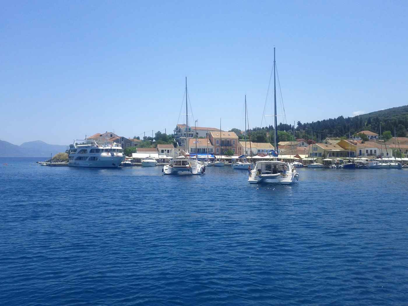
Car rental in Kefalonia solves a problem the island creates by its own geography. Kefalonia stretches about 773 square kilometres of mountain and coast, the largest of the Ionian Islands, and its beaches, caves and villages sit at opposite ends of that landmass. Myrtos hangs below cliffs in the northwest, Melissani opens inland from Sami on the east, Skala fills the southeast corner and Fiskardo caps the north. The KTEL bus network connects the towns between them on a thin timetable and skips the coastline almost entirely. A car closes those gaps, and the decisions that matter are where to collect it, how long each drive really takes, and which size of vehicle fits the roads. Plan the whole trip with Greece Tours.
Kefalonia Airport (EFL) sits about 9 km south of Argostoli and holds the densest cluster of rental desks. With town offices in the capital and counters in Skala, Lassi, Sami, Lixouri and Fiskardo. Distances read short on the map and drive long on the ground: Argostoli to Sami covers about 25 km. To Skala about 40 km. To Fiskardo about 50 km, over roads that climb and bend through the Ainos range and along the Myrtos cliffs. This guide works through why a car beats the bus here, where to pick one up, what each drive demands, and the class of car that suits narrow village lanes.
Why does getting around Kefalonia work better with a rental car than with the KTEL bus?
A rental car covers Kefalonia’s spread-out coastline in a way the KTEL bus network cannot. Buses link Argostoli with Sami, Skala, Poros and Fiskardo on limited daily runs, and leave the beaches and mountain villages off the timetable.
Kefalonia covers about 773 square kilometres, which makes it the largest of the Ionian Islands and the hardest to cross without your own wheels. The places visitors come for sit far apart. Myrtos beach lies on the northwest coast, Melissani cave sits inland from Sami on the east, Skala closes the southeast corner, and Fiskardo caps the far north. A single ridge of mountains runs down the middle and pushes every route around the edges. Driving between two of those points takes 45 minutes to 90 minutes, and no bus links them directly.
A car turns the island into one destination rather than four separate bases, and it lets you reach a beach at the hour the light is best.
The KTEL Kefalonias network runs from the Argostoli terminal on the waterfront and covers the main towns only. Services reach Sami, Poros, Skala, Lixouri and Fiskardo, with a small number of departures each day and a thinner pattern outside the summer months. Buses to the north leave in the morning and return in the afternoon, so a day at Assos or Fiskardo runs on the timetable rather than on your plans. Sunday service drops further. Nothing runs to Myrtos, Petani, Antisamos or Xi, and nothing climbs to the Omala valley or Mount Ainos. Planning a week around Kefalonia by bus alone leaves out the beaches, caves and viewpoints that fill most itineraries on the island.
Taxis and pre-booked transfers fill part of the gap, but the arithmetic turns against them quickly. A transfer from Kefalonia Airport to Skala, about 40 km away, is a one-off ride. Repeating that pattern for a beach day. A cave visit and a dinner in Lixouri means booking three separate cars. Drivers on the island cover long distances and return empty, which is reflected in what a private ride costs. Organised excursions solve the same problem for a fixed route and a fixed group, and they leave at set hours from the larger resorts.
A rental car sits between the two: one vehicle for the whole stay, parked outside your accommodation, ready at seven in the morning for Myrtos before the crowd.
One base changes the calculation. Visitors who stay in Argostoli walk to the De Bosset bridge, the Katavothres sea mills and the Lassi beaches. Three or four days pass on foot and by local bus. The same holds for a short stay in Fiskardo, where the harbour, Emblisi and Foki sit within walking range. Everyone else gains from a car. Families reaching Antisamos with beach gear, walkers heading for the Mount Ainos national park road, and wine visitors driving up to the Omala valley all depend on a vehicle. Renting for part of a stay works too: three days of driving from a week in one resort covers the island’s headline sights without paying for idle parking.
Where do you pick up a rental car in Kefalonia — the airport, Argostoli or the resorts?
Kefalonia Airport (EFL) holds the largest concentration of rental desks, about 9 km south of Argostoli. Argostoli town adds walk-in offices near the waterfront, and smaller counters operate in Skala, Lassi, Sami, Lixouri and Fiskardo.
Kefalonia Airport sits about 9 km south of Argostoli, and the rental desks stand inside a single small terminal. Collecting on arrival removes the transfer problem entirely: you land, sign, and drive straight out towards the south coast or the capital. The exit road feeds onto the main artery north to Argostoli in around 15 minutes and east towards Poros and Skala. Peak-season arrivals bunch together because charter flights land in waves, so the counter queue after a full aircraft runs longer than the walk from the gate. Booking ahead with a confirmed reservation keeps a car reserved in your name, which matters in July and August when the airport fleet empties.
Argostoli concentrates the island’s walk-in rental offices along and behind the Lithostroto and the harbour front. Picking up in town suits arrivals by ferry from Kyllini or Patras into Sami or Poros, and anyone who spends the first two nights in the capital before touring. Town collection also avoids paying for a car that stands still while you explore the lagoon, the Napier Garden and the turtle-watching quay. The trade-off is the transfer from the airport, roughly a 15-minute drive, and Argostoli’s own parking pressure in the evening. Streets around the square fill early, and the free parking strips along the seafront and near the De Bosset bridge take the overflow on summer nights.
Resort counters spread the fleet around the coast so you collect where you sleep. Skala, about 40 km southeast of the capital, has offices on its main street a short walk from the beach. Lassi keeps agencies along the Makris Gialos road, close enough to the airport for a delivery on arrival. Sami serves ferry passengers stepping off the Ithaca and mainland boats. Lixouri covers the Paliki peninsula for Xi and Petani. Fiskardo handles the north where the drive back to Argostoli runs about 50 km. Resort fleets stay smaller than the airport pool, and the choice of automatics narrows first. Local agencies deliver a car to your hotel and collect it at the end.
Paperwork stays the same wherever you collect. Agencies ask for a driving licence held for a set minimum period, a passport or identity card, and a credit card in the main driver’s name for the security hold. Drivers licensed outside the European Union are usually asked for an international permit alongside the home licence, so check the requirement with your own licensing authority before travelling. Insurance is quoted as a basic cover with an excess, with the option to reduce that excess for a daily supplement. Read what the policy excludes, because tyres, glass and the underside are the parts a Kefalonia mountain road tests. Confirm in writing whether the car is allowed on the Lixouri ferry.
How long does driving take between Argostoli, Sami, Skala and Fiskardo in Kefalonia?
Kefalonia’s road distances stay short while the driving times stretch. Argostoli to Sami covers about 25 km in around 35 minutes, Skala about 40 km in about an hour, and Fiskardo about 50 km in around 75 minutes.
The Argostoli to Sami road is the island’s main cross-country link and the easiest drive on Kefalonia. It climbs out of the capital, crosses the saddle below the Ainos range past the Agios Gerasimos turn, then drops through pine and olive terraces to the east coast. The 25 km take around 35 minutes at a steady pace, longer behind a coach heading for the caves. Melissani and Drogarati sit on this stretch, both signposted within three kilometres of Sami, and Antisamos lies beyond the port over a low headland. The surface is wide by island standards with a painted centre line for most of its length.
Which makes it the route to take on your first morning behind the wheel.
The northwest coast road delivers the drive people picture and demands the most attention. From Argostoli it runs north through Agkonas and Divarata, hanging on the cliff edge above Myrtos with a low wall between the tarmac and a long drop. The Myrtos access lane leaves Divarata and switches back down to sea level in a series of tight hairpins, single-track in places, with passing bays cut into the rock. Assos follows about 10 km further north, reached by another descent to the isthmus below the Venetian castle. Fiskardo closes the road about 50 km from the capital. Budget around 75 minutes each way, and add stops, because the pull-outs above Myrtos are where every car slows.
The south and southeast run flatter and faster than the north. The airport road continues east along the coast towards Lourdas. Then over a shoulder of hills to Poros and down to Skala, about 40 km from Argostoli and close to an hour. The Poros gorge road cuts inland through a limestone cleft to the ferry port, a short section with rock walls on both sides. Mount Ainos has its own approach: a signed turn off the Argostoli to Sami road climbs through the fir forest towards the summit ridge, which stands at 1,628 metres. Drivers gain the widest view over the Ionian from that road.
That climb is paved but narrow, and the last kilometres carry loose gravel after rain.
Road habits on Kefalonia reward patience more than speed. Local drivers overtake on short straights and pull in to let a faster car past. A flash of headlights from an oncoming vehicle usually warns of livestock or a hazard ahead. Goats stand on the tarmac on the Ainos and Paliki roads at any hour. Fuel stations cluster around Argostoli, Lixouri, Sami, Poros and Skala, and the north thins out beyond Divarata, so fill up before a Fiskardo run rather than after it. Night driving on the coast roads gets harder because the outer edge is unlit and the reflective posts stop where the tarmac narrows. Leaving Myrtos or Assos before dusk keeps the return simple.
What size of car handles Kefalonia’s village lanes and mountain roads best?
Small hatchbacks handle Kefalonia best. A compact car threads the lanes of Assos, Fiskardo and Argostoli’s old grid, parks in the short bays above Myrtos, and climbs the Ainos road without straining, while a large saloon fights every hairpin.
Width decides more on Kefalonia than power does. Fiskardo’s harbour lanes and the streets behind Assos beach were laid out for carts, and two cars meeting there means one reverses to the last gap. Skala and Lourdas keep narrow one-way loops behind the beach road. A car in the small hatchback class measures under 1.7 metres across the body, which leaves room to pass an oncoming van on the Myrtos descent without folding a mirror. Larger vehicles clear the same roads, yet every passing manoeuvre becomes a negotiation. Groups who need the space split into two small cars more often than they take one estate, because parking in the villages is measured in single spaces rather than bays.
Engine size matters on the climbs even though the distances stay short. The smallest 1.0-litre cars carry two adults and hand luggage up the Ainos road and the Divarata hill without complaint. The same car loaded with four people, four suitcases and the air conditioning running works far harder on the same gradient. A 1.2 to 1.4-litre petrol car covers the island comfortably for a family of four. Manual gearboxes dominate the island fleets, and drivers who need an automatic book early because those cars sell out first in high summer. Engine braking on the descents from Divarata and the Ainos turn-off saves the brakes, so drop a gear rather than riding the pedal down.
Ground clearance earns its keep on the tracks rather than the main roads. Every route named on the tourist map is surfaced, including the descent to Myrtos and the climb into the Ainos forest. Unsurfaced sections appear on the approach to Petani’s upper viewpoints, on the Paliki cliff tracks near Kipoureon monastery, and on short beach spurs in the south. A standard hatchback reaches those points slowly if the driver takes the ruts at walking pace, and most rental contracts exclude damage caused off a paved road. A small crossover with slightly more clearance answers that problem without the width of a full four-wheel drive.
Convertibles and open jeeps look right for the coast and store nothing safely at a beach.
Booking early controls the choice more than the price does. Kefalonia’s fleets are finite, and the airport pool empties across July and August when charter arrivals stack up, leaving late bookers with whatever remains. Reserve a small hatchback with air conditioning as the default, upgrade one class for four adults with luggage, and treat an automatic as a booking made months ahead. Check the boot against your bags rather than the brochure class, because a beach day for four with a cool box fills a small car fast. Inspect the body, wheels and windscreen with the agent before leaving. Photograph what you find.
Confirm the fuel policy so the return at the airport or the Argostoli office runs without argument.
Does the Argostoli-Lixouri ferry save driving time to the Paliki peninsula?
The Argostoli-Lixouri ferry crosses the bay in about 20 to 30 minutes and carries cars on an open deck. That short hop replaces a long road loop, and drivers bound for Xi or Petani avoid the detour.
The crossing links the Argostoli waterfront with the Lixouri quay across the Gulf of Argostoli. Cars drive onto an open deck and roll off at the far side. The rental car stays with you the whole way. Water distance measures about 3 kilometres. The boat covers it in roughly 20 to 30 minutes from ramp to ramp. Foot passengers and vehicles board in one line, which keeps loading simple. Sailings run through the day and stop at night. Arrival routes to the island are set out in how to get to Kefalonia. That guide covers Kefalonia Airport and the mainland ferry ports at Kyllini, Patras and Astakos.
Those ports feed the traffic that later uses this local shuttle across the bay.
Driving around the bay instead means climbing north out of Argostoli. The road crosses the neck of the island near Kardakata. It then turns south down the Paliki peninsula into Lixouri. That route runs about 35 kilometres and takes around 45 to 50 minutes without stops. The ferry therefore wins on time for a direct Argostoli to Lixouri hop. The road wins in two cases. The first is a day that breaks at Agia Kiriaki or at the west-coast viewpoints above Petani. The second is a late return, after the boats stop running. Fuel costs favour the water crossing as well, since the loop burns a full 35 kilometres of climbing and descending each way.
Xi beach sits about 8 kilometres southwest of Lixouri. Its shore of red-orange sand lies below low clay cliffs, and the drive from the ferry ramp takes around 15 minutes on paved road. Petani lies about 11 kilometres northwest of Lixouri, on the opposite coast of the peninsula. A winding descent drops to parking at beach level. Combining both beaches in one day works from a single ferry crossing. Roughly 25 minutes of driving separates them, through the farming villages of the Paliki interior. Lixouri itself has a broad central square, a waterfront strip and fuel stations. Filling the tank there starts the peninsula day without a detour back towards Argostoli.
Rental agreements on Kefalonia treat this internal crossing differently from an inter-island ferry to Ithaca or Zakynthos. Confirm at the desk that the car travels on the Argostoli-Lixouri boat before you queue. Staff at the pick-up point state those terms in plain language. They also note any paperwork the crew asks for at the ramp. Vehicle tickets are bought at the quayside booth or on board. The car queue forms on the Argostoli waterfront beside the ferry ramp, in view of the De Bosset bridge. Arriving about 20 minutes before departure secures a place on the next sailing. Day-trippers and local traffic fill the deck faster in high summer than in spring.
Where does parking work well on Kefalonia, from Argostoli to Myrtos beach?
Parking stays free and informal in most Kefalonian villages, on gravel verges and open squares. Argostoli’s waterfront and the small car park above Myrtos are the two pressure points, and both fill early on summer mornings.
Argostoli concentrates its parking on the harbour front near the De Bosset bridge. The Lithostroto side streets take the overflow, along with open ground behind the market area. Spaces along the water turn over quickly during the morning shopping hours. Streets nearest the central square carry restrictions, marked by local signage in Greek and English. Leaving the car about 400 metres out and walking in solves the problem in five minutes. Evening brings a second squeeze, when the pedestrianised centre fills for the volta. Drivers then circle the same three or four blocks. The Katavothres sea mills sit 2 kilometres north along the coast road, with open roadside parking beside the lighthouse route.
The access road to Myrtos beach leaves the main Argostoli to Fiskardo road at Divarata. It drops about 2.5 kilometres through tight hairpins cut into the cliff. A flat area behind the pebbles holds a limited number of cars. That lower car park fills by mid-morning in July and August. Drivers arriving later stop on the verges of the descent and walk down. Reaching the beach before 10am gives the best chance of a space near the sand. The hour after 4pm works as a second window, once the first wave leaves.
Three or four bends on the descent carry no barrier on the seaward side, so reversing out of a tight parking spot needs care and a spotter.
Village parking across the island follows an informal pattern rather than marked bays. Assos leaves cars along the approach road above the isthmus, since the tiny waterfront cannot absorb them. The walk down to the harbour takes about five minutes. Fiskardo closes its quay to traffic in the evening. Drivers there use the gravel area at the entrance to the village, roughly 300 metres from the water. Sami spreads parking along the port road, and Skala uses the streets behind its beachfront. Blocking a driveway or a field gate causes real problems in these small settlements. One tractor route often serves three or four properties, and a parked hire car stops the working day.
Beach parking beyond Myrtos ranges from generous to minimal. Antisamos, about 4 kilometres east of Sami, ends in a broad flat area behind the pebbles. That space absorbs summer traffic without difficulty. Makris Gialos and Platis Gialos near Lassi have organised parking beside the road, a short walk above the sand. Petani and Xi both park at beach level, about 20 metres from the water. Foki and Emblisi near Fiskardo hold around a dozen cars each. Their approach lanes are narrow enough that meeting an oncoming vehicle means reversing to a passing place. Choosing a base with its own parking removes the daily hunt, and the areas are compared in where to stay in Kefalonia.
How do fuel stops and mountain roads shape driving on Kefalonia?
Fuel stations cluster around Argostoli, Lixouri, Sami and Skala, then thin out across the north and the mountain interior. Road surfaces range from smooth coastal highway to potholed village lanes, and long descents demand low gears.
Argostoli holds the densest run of fuel stations on Kefalonia. They spread along the approach roads and the coast road towards Lassi and the airport. Lixouri covers the Paliki peninsula on the far side of the bay. Sami serves the east coast and the traffic heading for the Melissani and Drogarati caves. Skala fuels the southern resorts. North of Divarata the network thins out. The stretch through Assos and Fiskardo has very limited options, and opening hours contract outside the summer months. Filling the tank in Argostoli or Sami before a northern day removes the risk. The loop from Argostoli to Fiskardo and back measures about 110 kilometres, which sits inside one tank in a small hire car.
The main artery runs from Argostoli north through Kardakata and Divarata to Fiskardo. That road covers about 50 kilometres of two-lane asphalt, with long sightlines above the sea. The Argostoli to Sami road crosses the island in about 25 kilometres and 35 minutes. It climbs over a saddle before dropping to the east coast. Argostoli to Skala runs roughly 40 kilometres through Peratata and Vlachata, taking around 50 minutes. These three corridors carry the bulk of the island traffic and stay in sound condition. Journey times still exceed what the distances suggest. Gradients and bends hold average speeds near 45 kilometres per hour, so an hour of driving covers less ground than on the mainland.
Village roads and beach approaches tell a different story. Surfaces break up at the edges, and potholes gather after winter rain. The last stretch to smaller coves turns to gravel and loose stone. The climb towards Mount Ainos national park leaves the asphalt near the forest gate. A graded track continues from there towards the ridge at about 1,628 metres. Roads around Assos, Foki and the western Paliki coast narrow to a single lane with passing places. Drop-offs sit close to the edge, and no barrier stands between the tarmac and the slope. A small car handles these lanes far better than a saloon. A slow pace protects the tyres and the underside from stone damage.
Long descents define the driving here, and engine braking does the work that brakes alone cannot sustain. The drop into Myrtos, the run down from Kardakata towards Lixouri and the descent off the Ainos road all hold sustained gradients. Second gear keeps the speed controlled and the pads cool. Hairpins on the northwest coast tighten without warning. Tour coaches heading for Assos and Fiskardo take the full width on those turns, so slowing early and holding the inside line prevents trouble. Goats stand in the road across the mountain sections at dawn and dusk. Night driving loses the sea-cliff views and adds unlit bends, which makes an early start the practical choice.


Do scooters, quads or buses replace a rental car on Kefalonia?
Scooters and quads work for short hops inside one resort area, and buses connect the main towns on limited daily runs. A rental car remains the practical way to cross Kefalonia and reach the smaller beaches.
Rental outlets in Lassi, Skala, Sami, Lourdas and Fiskardo hire scooters, quads and buggies alongside cars. These machines suit distances of 10 to 15 kilometres. A run from Skala to Katelios or from Lassi into Argostoli falls inside that range, and they park anywhere the pavement widens. Crossing the island on two wheels is a different proposition. The 50 kilometres from Argostoli to Fiskardo cross exposed ridges, and the wind on the northwest cliffs pushes hard at a light vehicle. Quads sit low on power for long climbs and labour on the gradients out of Divarata. Riders also carry luggage and beach gear with far less capacity than a small hatchback holds.
Licence requirements apply to scooters and quads, and rental staff check documents at the counter. Helmets are mandatory and come supplied with the machine. Gravel on the village lanes raises the risk on two wheels well above the risk in a car. Loose stone on the beach approaches has the same effect. The descents to Petani, Foki and the western Paliki coast concentrate both hazards on one narrow lane. Sun exposure over a full day in the saddle adds fatigue that drivers in an air-conditioned cabin avoid. Families with young children weigh that against a boot. Anyone carrying cool boxes, umbrellas and snorkelling gear across the island settles the question on practical grounds alone.
The KTEL bus network links Argostoli with Sami, Poros, Skala, Fiskardo and Lixouri. Its daily pattern is built around local needs rather than sightseeing. Services run more often in summer than in winter, and a trip between two villages usually routes back through Argostoli. Buses reach the towns but stop short of Myrtos, Antisamos, Petani, Assos and the Ainos forest road. Those places are the reason most visitors want their own wheels. A single bus day between Argostoli and Sami covers the caves comfortably. Building a whole week around the timetable cuts out roughly half the island. Each beach then becomes a fixed-return commitment, with the last departure setting the end of the afternoon.
Booking a car ahead of the summer peak matters more on Kefalonia than the island’s size suggests. The fleet is finite, and July and August absorb it. Reserving two or three weeks out secures a small automatic, the scarcest category on a Greek island. Pick-up happens at Kefalonia Airport, about 9 kilometres south of Argostoli. Offices in Argostoli and Lixouri form the alternative, and delivery to an accommodation address is a standard arrangement. Airport desks carry the longest queues in the hour after a flight lands. Check the tyres, the spare and the existing scratches with a member of staff before leaving. Photographing the car at pick-up keeps the return straightforward and quick.
Frequently Asked Questions
Do you need a car to get around Kefalonia?
A car is the practical way to get around Kefalonia. The island covers about 773 square kilometres, and its best-known places sit away from the bus routes. Myrtos beach, Assos, Antisamos, Petani and the Mount Ainos forest road have no public transport at all. Taxis over those distances add up quickly across a week. The KTEL network connects Argostoli with Sami, Poros, Skala, Lixouri and Fiskardo. That covers town-to-town travel and the caves near Sami, yet it leaves the coastline in between untouched. Distances also run longer than the map implies. Argostoli to Fiskardo measures about 50 kilometres and takes around an hour and a quarter on winding road.
Visitors staying in one resort for a beach holiday manage without a car for two or three days. They then hire one for the touring days. Anyone planning to see both the north and the south uses a car daily.
What size of car works best on Kefalonia roads?
A small hatchback handles Kefalonia best. Village lanes narrow to a single vehicle width, and beach approaches end in tight gravel turnarounds. Assos, Foki, Emblisi and the descents on the western Paliki coast all reward a compact footprint. Parking in Argostoli’s side streets works the same way. Engine size matters as much as body length. The climbs out of Divarata, over the Kardakata saddle and up towards the Ainos national park gate demand pulling power with four people aboard. A 1.0-litre car loaded with luggage labours on those gradients. Automatic gearboxes are the scarcest category in Greek island fleets and disappear first for July and August, so book weeks ahead if you need one.
Larger SUVs bring comfort on the main corridors between Argostoli, Sami and Skala. They become a liability on the last kilometre to a small cove, where reversing is the only way out.
Is the drive to Myrtos beach difficult?
The drive to Myrtos is straightforward with attention, not technically difficult. The turn leaves the main Argostoli to Fiskardo road at Divarata. From there the access lane drops about 2.5 kilometres to the beach through hairpins cut into the cliff. Gradients are steep, and three or four bends carry no barrier on the seaward side. Second gear on the descent keeps speed controlled and stops the brakes overheating. The lane is wide enough for two cars on most of its length. Tighter squeezes come at the corners, where meeting a coach means waiting. Parking at the bottom is limited and fills by mid-morning in July and August. Cars then line the verges of the descent.
Arriving before 10am or after 4pm avoids the worst of it. The climb back up is easier than the descent, needing low gear and steady throttle rather than braking discipline.
How long does the Argostoli to Lixouri ferry take with a car?
The crossing takes about 20 to 30 minutes from ramp to ramp. It covers roughly 3 kilometres of the Gulf of Argostoli, with cars carried on an open deck. Driving the same journey by road means heading north from Argostoli and crossing near Kardakata. The route then turns down the Paliki peninsula, about 35 kilometres and around 45 to 50 minutes without stops. The boat therefore saves time as well as fuel for a direct trip to Lixouri, Xi beach or Petani. Vehicle queues form on the Argostoli waterfront beside the ramp. Arriving about 20 minutes before departure secures a place in high summer, when day-trippers fill the deck.
Sailings stop at night, so a late return from Petani or Xi means taking the road around the bay through Kardakata. Confirm at the rental desk that the car is permitted on this internal crossing, since terms differ from inter-island ferries.
Where do you pick up a rental car on Kefalonia?
Kefalonia Airport, about 9 kilometres south of Argostoli, is the main pick-up point. Desks sit inside the small terminal, and the cars wait in the adjacent lot. Argostoli town offices form the second cluster, useful for anyone arriving on a mainland ferry or staying in the capital. Lixouri covers the Paliki peninsula on the far side of the bay. Delivery to an accommodation address in Lassi, Skala, Sami, Lourdas or Fiskardo is a standard arrangement. The car is handed over at the door and collected the same way. Airport desks carry the longest waits in the hour after a flight lands, particularly on summer changeover days.
Bring the driving licence, passport or identity card, and a payment card in the driver’s name, since that card secures the deposit. Walk around the vehicle with a member of staff before signing. Check the tyres and the spare, then photograph existing marks before you drive away.
Are fuel stations easy to find on Kefalonia?
Fuel stations concentrate around Argostoli, Lixouri, Sami and Skala. They thin out noticeably across the north and the mountain interior. The road between Divarata, Assos and Fiskardo offers very limited options. Opening hours also contract outside the summer months, which turns a late-afternoon low tank into a real problem. Filling up in Argostoli or Sami before heading north removes the risk for the whole day. Distances on the island stay modest in absolute terms, which keeps the planning simple. The full loop from Argostoli to Fiskardo and back runs about 110 kilometres, well inside one tank in a small car. An attendant usually serves the pump and takes payment at the driver’s window.
Keep cash as well as a card, since terminals in the smaller villages go offline at times. Mountain driving on Ainos and the coastal hairpins burns more fuel than the flat kilometres between Argostoli and Skala suggest.