
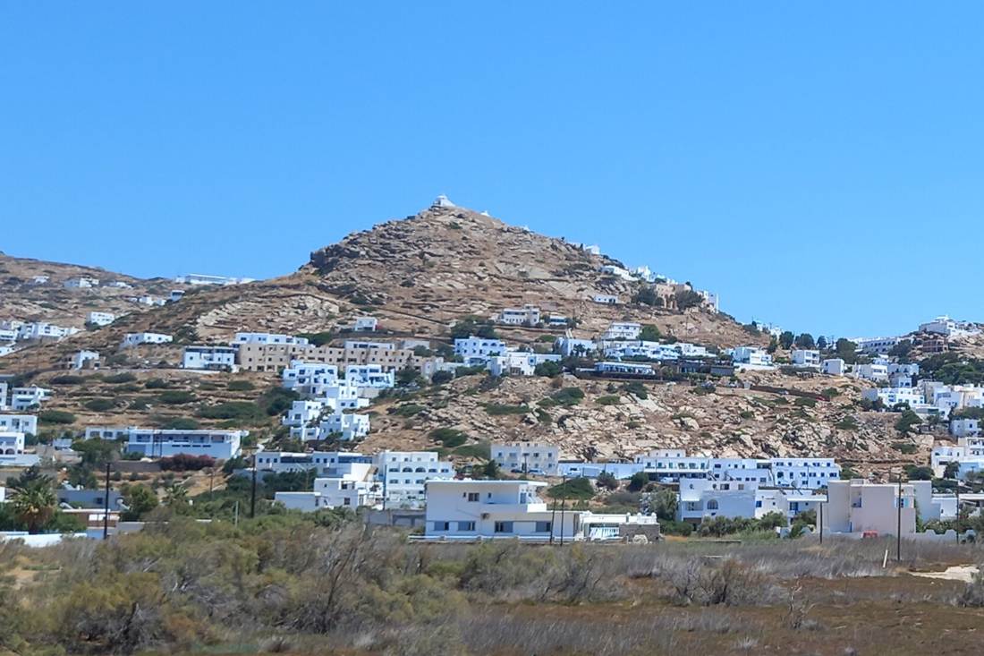
An Ios hiking tour follows the stone paths that once linked the farms, chapels and beaches of this Cycladic island, far from its nightlife. Explore more island walks and day trips with Greece Tours.
Inside are the guided hikes, the marked trails, Skarkos and Paleokastro, routes for beginners and strong walkers, the history, the festivals and how to plan without a car.
What is an Ios hiking tour?
An Ios hiking tour is a walk on the old stone paths of Ios, the Cycladic island halfway between Naxos and Santorini. Routes link Chora with the prehistoric town of Skarkos, country chapels, quiet beaches and the castle of Paleokastro. You can walk with a local guide or alone with a GPS app.
The path network behind every Ios hiking tour is old and still in use. Greeka notes that locals walk it for their farm work, not only visitors in hiking boots. The paths once joined settlements, fields, beaches and chapels, long before roads reached the interior.
The island has a clear shape for an Ios hiking tour. Ios covers about 108 square kilometres, with 86 km of coastline, and 32 km of that coast is sandy beach. Its highest peaks are Pyrgos at 713 metres, Prophet Elias at 541 metres and Hermitis at 417 metres.
The Municipality of Ios has marked a set of hiking paths, and the local project Ios Paths maintains and promotes the network. The marked routes carry numbers, and maps are free at the Citizen Service Centre in Chora, next to the Archaeological Museum.
An Ios hiking tour shows a side of the island that the party image hides. Ios Paths describes a landscape shaped by prehistoric settlement, farming, footpaths, chapels and windmills, with stories kept alive by local families.
Distances stay short by mainland standards. The marked routes in the sources run from about 1 hour 20 minutes to 4 hours, and the main ones start in Chora or at the port, so a walker can reach the trailhead on foot. Longer routes cross the island for experienced hikers.
The variety is wide for a small island. In a single week, an Ios hiking tour can take in a Bronze Age town, a Venetian castle, a cheese farm, a lighthouse and beaches that only a path or a boat can reach. Our Ios page covers the island beyond the trails.
Which Ios hiking tour can you book?
Ios Paths runs four guided hikes, from a 3-hour walk from the port to Chora via Skarkos to a hike to the Diaseli cheesery. Viator sells “Ios Island Trekking Tours”, and Ios Adventure runs a historical hike through the churches of Chora.
Ios Paths lists its suggested hiking experiences on its website. The first goes from Gialos beach to Skarkos, Chora and the windmills, and returns to the port by the old route. The second explores the churches of Chora, with an optional visit to the folklore or archaeological museum.
The third Ios hiking tour from Ios Paths is a circular route for nature lovers, from Chora past Skarkos to Ellinika, Agia Triada, Agios Prokopios and Agios Spyridon. The fourth is the hardest: Chora to the Odysseas Elytis Theatre and on to the Diaseli cheese factory for a tasting, then back.
Viator sells “Ios Island Trekking Tours: Discover Ios Unexplored” for travellers who book through that platform. It suits walkers who want a guide for the remote parts of the island. Viator also lists e-bike tours to the Homeric sites and the Ios valley for days when the legs need a rest.
Manawa lists a historical hike through Chora organised by Ios Adventure. It covers about 1 km on foot, starts at the church of Agia Aikaterini on the main square and visits the old churches of the village.
The same platform lists an easy hike to Gialos beach and the lighthouse, a circular hike from Chora to Skarkos, and a hike with a cheese tasting at Diaseli.
The Swiss firm Hospitality Stories also sells private walks on Ios. One follows an Ios path along the remote beaches of the island, and another pairs old trails with a tasting at a local cheesery.
A self-guided Ios hiking tour is easy to arrange as well. Ios Paths offers a free app for iPhone and Android that follows each route with your phone’s GPS, and the travel agency Acteon hands out a free hiking map of Ios at its offices.


Who leads a guided Ios hiking tour?
Ios Paths is run by George Dimitropoulos and Flora, a couple who have worked for years to maintain and promote the hiking network of Ios. George is also the author of “Island of Echoes”, which traces the history, maps and traditions of the island.
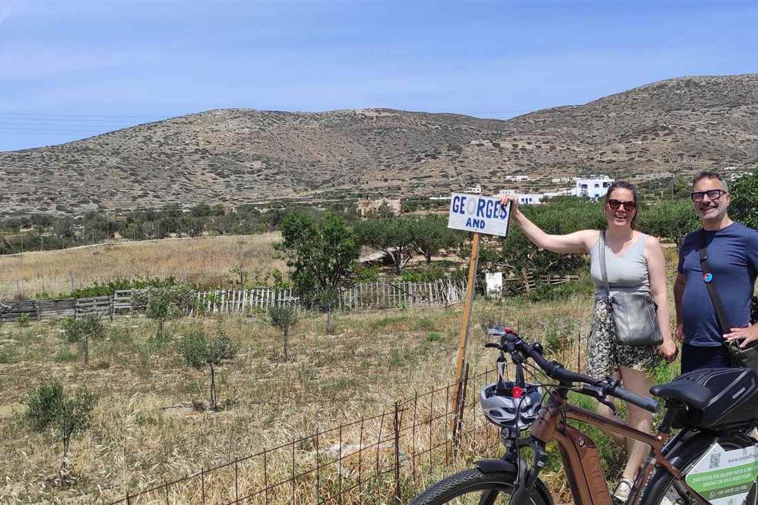
The couple manage the cultural, farming and eco-tourism side of the Ios Paths project together. Their work includes information points around the island, which help visitors read the landscape as they walk.
George writes the history pages on the Ios Paths website. Guests on his tours describe a guide who has not only read about the island but written about it, and who draws on stories gathered from local families.
His book “Island of Echoes: A Journey through History, Maps and Traditions of Ios” grew out of local interviews, maps and years of research.
The couple also keep George’s and Flora’s Perivoli, two small cultivated gardens in Pano Kampos. On selected private tours, an Ios hiking tour stops here among olive trees, vines, figs and fruit trees, and guests can pick fresh figs and grapes in season.
Each Ios hiking tour from Ios Paths is private, and the firm runs three kinds of tour. The hikes follow the old paths at a slow pace. The e-bike tours cover more ground with less effort, and the vehicle tours, for up to 6 people, suit families and mixed-age groups.
Groups get a better deal on foot. Ios Paths gives a discount to groups of 5 or more on its hikes and e-bike tours, and children up to 16 join the hikes free. Vehicle tours include free transport from the village, the port or Mylopotas beach.
Other names appear on the booking platforms. Ios Adventure leads the historical hike through Chora on Manawa, and Hospitality Stories sells private walks for small groups. The choice depends on whether you want history, beaches or a tasting at the end of your Ios hiking tour.
What does the port to Chora hike via Skarkos show?
This 3-hour guided hike climbs from Gialos beach at the port to the prehistoric settlement of Skarkos, continues to Chora and the windmills, and returns to the port on the traditional path. A visit inside the Skarkos site is optional.
The route is the classic first Ios hiking tour. It starts at sea level, where the ferries dock, and climbs through the valley that links the harbour with the main village. Ios Paths uses the walk to explain the history, traditions and customs of the island.
Travel.gr describes a similar self-guided loop. The circular route from Ormos to Skarkos, Chora and back to Ormos measures 3.7 km. It visits the hill where archaeologists found a settlement from the middle of the 3rd millennium BC.
Look at the walls on this Ios hiking tour. Around the Skarkos hill, the locals built a complex network of dry stone walls that curl like the spirals of a snail. The snail is karavola in the local speech, and the walls carry the same image.
The walk then climbs into Chora. The village sits between two small hills, with stairs instead of roads leading to the top. Almost every building is whitewashed, with doors and window frames painted sea blue.
At the top stand the windmills, where the village once met the farmed countryside. From there, the old route drops back to the port, so the whole Ios hiking tour forms a loop that never needs a car.
The route fits into a morning. Ios Paths advises proper shoes, water and avoiding the hottest hours of the day on the walk between the port, Skarkos and Chora.
What will you see at Skarkos on an Ios hiking tour?
Skarkos is an Early Bronze Age town on a hill just outside Chora, dating from the middle of the 3rd millennium BC. Its stone houses stood two storeys high, and walls still rise 3 to 4 metres. It ranks among the key prehistoric sites of the Cyclades.
The settlement lies near the west coast of Ios. Wikipedia notes that Ios has a deeply sheltered natural harbour, at the crossroads of the island sea routes. Skarkos made Ios part of the wider story of the Aegean.
Archaeologists dug the site from 1984 to 1997, on the north and east sides of the hill. They found a well-preserved early Cycladic town and, above it, a cemetery from the middle of the 2nd millennium BC.
The town was large for its time. It covers 1.1 hectares and is the largest and finest surviving site of the Keros-Syros culture. Between 200 and 300 people lived here, in houses of different sizes that point to differences in wealth.
The streets are still easy to follow on an Ios hiking tour. They run 1 to 2 metres wide between rectangular stone houses built on terraces. Each house had a ground floor, a first floor and an enclosed yard. Food was prepared on the ground floor, while the upper floor served for living, storage and work.
The finds tell of daily life. Excavators uncovered marble figurines, obsidian tools, seals, pottery, stone vessels, animal bones and seashells. Large storage jars stood up to 1.30 metres tall. A selection of the finds is now on show at the Archaeological Museum in Chora.
The planning was advanced. Wikipedia compares the town plan of Skarkos with that of Poliochne on Lemnos, and clay seals on pottery show that the community controlled how farm produce was stored and shared out.
The restoration won an award. Skarkos received the Europa Nostra prize for the quality of its conservation, which left the landscape around the hill untouched. An Ios hiking tour that pauses here sees a key prehistoric site of the Aegean.
Which marked trails start in Chora?
The main marked trails on Ios start at the Upper Square of Chora, called Ano Piatsa. Greeka lists five numbered routes, to Skarkos and Agios Prokopios, Agia Theodoti, Prophet Elias, the Pyrgos area and the beaches south of Mylopotas.
The trails of an Ios hiking tour carry numbers on the ground. Path 1 leads through the rural area of Kambos to Skarkos, and path 4 follows the coast south of Mylopotas. Signs at junctions show the way to churches, beaches and archaeological sites.
Ios Paths sorts its routes into two groups. The hikes of cultural interest include Chora to Skarkos, Agia Triada and Agios Prokopios; Chora to Agios Spyridon, Perivolia and Agia Theodoti; Agia Theodoti to Paleokastro; Chora to the theatre and Prophet Elias; and Chora to Agios Georgios and the Pyrgos area.
The coastal routes fill out the network for an Ios hiking tour by the sea. They link Chora with Mylopotas, Sapounochoma, Klima and Pikri Nero; Chora with Valmas, Agia Eirini and the port; Chora with Kolitsani beach; Koumbara with the lighthouse; Psathi with Domino and Vryses; and Loretzena with Diamoudia.
The marks vary in condition through the year. Acteon, a travel agency on the island, warns walkers to expect this and to wear proper shoes. Download the routes before you set off.
Ios Paths offers each route in its free app. You choose a route, open it on your phone and follow it with GPS, so a self-guided Ios hiking tour does not depend on worn signposts. Greeka also notes that the routes can be downloaded from the Ios Paths website, along with three routes for runners.
Pick a route that suits your fitness. Ios Paths reminds walkers to check the weather, carry enough water and choose a route that matches their level before every Ios hiking tour.
What does the Skarkos and Agios Prokopios loop cover?
This 10 km loop starts and ends in Chora. It follows path 1 through the farmland of Kambos to Skarkos, continues to Ellinika and the chapel of Agios Prokopios, and returns over the slopes of Prophet Elias. Acteon rates it moderate, at about 4 hours.
Greeka calls this Ios hiking tour Trail 1 and starts it at the Upper Square of Chora, where a sign points to the ancient settlement of Skarkos. After the site, the route passes three country churches, dedicated to the Virgin Mary, Agia Triada and Agios Prokopios.
A choice comes after Agios Prokopios. Turn left and the path heads down to Agia Theodoti beach on the east coast. Turn right and it loops back to Chora, which closes the circle of this Ios hiking tour.
This Ios hiking tour mixes history and farmland. Acteon describes a moderate hike with a blend of history, nature and Cycladic scenery, through the quiet area of Ellinika and back over the hills. It is open all year.
Ios Paths guides a similar loop for nature lovers. Its third suggested hike goes from Chora past Skarkos to Ellinika, Agia Triada, Agios Prokopios and Agios Spyridon, then back to Chora. Along the way, the guide shares local customs and old stories from the people of the island.
Kambos is the farming heart of this Ios hiking tour. Between the mountains lie the lowland areas of Epano and Kato Kampos, where islanders grow trees that need little water, such as olives and vines. Travel.gr calls the plain of Kampos, north-west of Chora, the largest on the island and full of crops.
Plan about half a day for this Ios hiking tour. Start early in summer, carry plenty of water, and leave time at Skarkos, because the loop passes right by the site.
How do the old paths reach Agia Theodoti and Paleokastro?
An old 7.4 km path with dry stone walls links Chora with Agia Theodoti, via the church of Agios Spyridon and the farmland of Perivolia. From the beach, a coastal path runs on to the ruined castle of Paleokastro.
Greeka calls the first route Trail 2. It starts at the Upper Square of Chora. About 300 metres before Skarkos, a path branches off to the church of Agios Spyridon. From there the trail runs almost parallel to the main road to the church of Agios Prokopios, then descends to a sign for Agia Theodoti.
Travel.gr explains why the path exists. It is an old route with dry stone walls that once connected Chora with the area of Agia Theodoti. The church there is the oldest on the island, built in the 16th century on the ruins of an ancient temple of Apollo.
The bay at the end of this Ios hiking tour holds more history. Across from the church, archaeologists found traces of an ancient aqueduct and a Hellenistic tower, and the area is a declared archaeological site. Easy Hiker calls the aqueduct the only visible remain of the Roman past of Ios.
The second leg starts on the right side of Agia Theodoti beach. Greeka describes a path that follows the edge of the rocks. An old path, visible from Paleokastro, ends at a stream, and locals say it once reached Psathi.
Paleokastro crowns this Ios hiking tour. Its ruined walls and the church of Panagia Paleokastritissa stand on a hill above the sea, with views to Naxos, Amorgos and Paros. Sources date the castle differently: travel.gr links it to the Venetian Markos Crispos in 1397, Ios Paths to the Byzantine Komnenos dynasty, and Easy Hiker to the 10th century.
For a full day, travel.gr lists a 25 km route from Paleokastro to Mylopotas beach for experienced hikers with endurance. It is the longest Ios hiking tour on the island and crosses from the east coast to the west.
What do the theatre, Prophet Elias and Pyrgos trails show?
Two trails leave Chora past the windmills and the Odysseas Elytis Theatre. One climbs to the chapel of Prophet Elias and on to Agios Prokopios. The other heads north past Agios Georgios and the monastery of Agios Ioannis to the antennas on Pyrgos, the highest peak of Ios.
Each Ios hiking tour here starts at the Upper Square of Chora. Walkers take the road on the right side of the church, towards the windmills. After crossing the road and climbing, they reach the Odysseas Elytis Theatre and the Gaitis Simosi Museum, named after the painter Giannis Gaitis and his wife, the sculptor Gavriela Simosi.
The theatre is a sight in its own right on an Ios hiking tour. Named after the Greek poet who won the Nobel Prize for Literature in 1979, it was designed by the German architect Peter Haupt and stands at the top of the village hill. Easy Hiker notes that Elytis came to Ios to write.
The trails split near the church of Agios Dimitrios. Greeka’s Trail 3 takes the left path to the chapel of Prophet Elias and the church of Agios Prokopios. Travel.gr describes the short section from the theatre to Agios Dimitrios and Prophet Elias as a pleasant 2.3 km walk, partly between dry stone walls.
Trail 4 takes the right path, which is well signposted. Mylopotas bay stays in view on the right until the path meets an asphalt road after a sheep shed. A short climb up the road leads to a local dairy farm that welcomes walkers to try its cheese.
The path continues opposite the farm entrance. It passes the church of Agios Georgios and the monastery of Agios Ioannis, then ends at the antennas on Pyrgos. Greeka gives this Ios hiking tour a duration of 1 hour and 45 minutes.
The monastery hosts a summer feast. The festival of Agios Ioannis Prodromos takes place on 24 June at the monastery of Pyrgos, with a meal for pilgrims, island music and dance. Diaseli Estate adds that the route to the monastery opens wide views of terraces, stone walls and the Aegean.
Pyrgos rises to 713 metres, the highest point of the island. Start this Ios hiking tour early, before the heat builds.
What is the Diaseli hike from Chora?
The Diaseli hike is the toughest guided walk of Ios Paths. It runs from Chora past the Odysseas Elytis Theatre, with views over Mylopotas, to the Diaseli cheese factory for a tasting of fresh cheese and wine, then back to Chora on foot.
Ios Paths calls it a challenging route that rewards the walker with the landscape and the visit to the dairy. The path moves in a circle past old houses and churches, which the guide calls witnesses of another era.
The cheesery sits on high ground. Ios Paths describes Diaseli as built at the highest point of Ios, next to the family farm, where cheese was once made in a cauldron over a fire. The farm has since modernised and gained quality certification.
The tasting is part of this Ios hiking tour. Guests try fresh cheese and wine before the return, and a visit to the cheesery carries a small extra charge on top of the walk.
Diaseli lies at the junction for Psathi. GetYourGuide also sells a 1.5-hour cheese and wine tasting there, with a guided tour of the folklore museum, for walkers who reach the farm on their own. Our Ios cooking class page covers the cooking lessons at the same estate.
Manawa lists a second version of this Ios hiking tour, a hike with a Greek cheese tasting at Diaseli from Chora. It offers a second way to book the walk.
Which beaches does the Mylopotas coastal trail reach?
Trail 5 runs from Chora down to Katsiveli and Mylopotas, then follows path 4 south along the coast to Sapounochoma, Klima and Pikri Nero. Travel.gr measures the route at 7.6 km, and the Mylopotas to Klima section alone takes about 3.5 hours there and back.
Greeka starts this Ios hiking tour outside the Scorpion Bar in Chora. Walkers turn right at the sign for Kolitsani and reach a junction. After a downhill stretch, a path on the left leads to a beach, where you can swim or climb the stairs on the left towards Mylopotas.
Mylopotas is the busiest stop. Travel.gr calls it a scenic and fun beach of the Cyclades, known for its all-day clubbing scene. The beaches beyond it suit walkers who want to leave the crowds behind.
The second half is the quiet part of this Ios hiking tour. Acteon describes an 8 km out-and-back trail from Mylopotas to Klima along path 4. It crosses the dry, rocky hills of western Ios, with sweeping views of the Aegean on one side and hillsides on the other.
The ground is open, with sparse plants and an unbroken view of the sea. The trail ends at Klima, a small sandy cove with clear water for a swim before the walk back. Acteon rates the route moderately challenging.
Sapounochoma and Pikri Nero lie along the same stretch. Greeka notes that a relatively easy path leads from the edge of Mylopotas to two secluded beaches, which makes a short version of this Ios hiking tour possible for families.
Bring a swimsuit. The coastal trail has no shade for long sections, so the swim at the end matters as much as the walk. Start in the morning, as Acteon advises, to avoid the heat on the open hillside.
Which short walks start from the port and the east coast?
From the port, easy walks lead to the Fanari lighthouse, Koumbara, Valmas and Kolitsani. On the east coast, short paths link Psathi with Domino and Vryses, and Loretzena with Diamoudia. The lighthouse walk from the port takes about 1 hour 20 minutes.
The lighthouse walk is the easiest Ios hiking tour from the port. Acteon describes a 5.1 km out-and-back route from Gialos beach south-west along the coast to Cape Fanari. It mixes asphalt, dirt road and a short footpath, has very little traffic and takes about 1 hour and 20 minutes at a relaxed pace.
A second lighthouse route starts at Koumbara. Travel.gr suggests walking from Ormos to Koumbara and the restored lighthouse in the late afternoon, to watch the sunset over the Aegean.
Valmas makes a short loop. The trek starts in Chora and follows signs to Kolitsani and Valmas. From Valmas beach, the path continues past small rocky coves to the church of Agia Irini and the port, a short Ios hiking tour of about 1.6 miles.
An Ios hiking tour on the east coast feels remote. Psathi is a small seaside village with a small port, a large sandy beach and smaller coves nearby. Travel.gr describes a 1.4 km sea-view path from Psathi to Domino, and Ios Paths adds routes from Psathi to Vryses and from Loretzena to Diamoudia.
These walks pair well with a swim. Psathi beach suits windsurfers when the wind blows, and a taverna and rental rooms serve the village. The east coast also lies within reach of Paleokastro, so a longer Ios hiking tour can combine both.
Which Ios hiking tour suits beginners?
The easiest walks are the 1 km historical hike through Chora, the 1.4 km sea-view path from Psathi to Domino, the 3.7 km loop from the port to Skarkos and Chora, and the 5.1 km lighthouse walk from Gialos to Cape Fanari. All fit easily into a morning.
Start in the village. The guided historical walk of Ios Adventure covers about 1 km through the alleys and churches of Chora, from the square of Agia Aikaterini. It makes a gentle first Ios hiking tour on the day you arrive.
The lighthouse walk comes next. Acteon rates the 5.1 km route from Gialos beach to Cape Fanari as easy. It uses asphalt, dirt road and a short footpath, sees very little traffic and stays open all year. At a relaxed pace it takes about 1 hour and 20 minutes.
The short port loop adds history. Travel.gr measures the circle from Ormos to Skarkos, Chora and back at 3.7 km. A beginner on this Ios hiking tour sees a Bronze Age town, the windmills and the whitewashed village in a single morning.
The east coast offers the shortest coastal walk. The 1.4 km path from Psathi to Domino follows the sea, and the village of Psathi has a taverna for lunch afterwards. The route from Chora to Valmas, Agia Irini and the port, about 1.6 miles, is another short option.
Families can bring children. Ios Paths lets children up to 16 join its hikes free, and Greeka describes an easy path from the edge of Mylopotas to two secluded beaches. A beginner’s Ios hiking tour can end with a swim on almost any of these routes.
Keep the basics in mind. Even on short routes, Greeka advises water, sun protection and proper shoes, and Acteon suggests the morning or late afternoon in the warm months.
Which Ios hiking tour suits experienced walkers?
Strong walkers can take on the 25 km route from Paleokastro to Mylopotas, the 10 km Skarkos and Agios Prokopios loop, the 11 km round trip from Chora to Epano Kampos and the climb towards Pyrgos, the highest peak at 713 metres.
The Paleokastro route is the big day. Travel.gr recommends the 25 km walk from the Venetian castle on the east coast to Mylopotas beach on the west only for experienced hikers with endurance. It crosses the width of the island.
The Skarkos loop is a solid half day. Acteon rates the 10 km circuit from Chora as moderate and gives it about 4 hours, through the farmland of Kambos, past Skarkos and Ellinika to Agios Prokopios, and back over the hills of Prophet Elias.
The plain of Kampos makes a longer farm walk. Travel.gr describes an 11 km round trip from Chora to Epano Kampos and back to Ormos. Kampos, north-west of Chora, is the largest plain on Ios and full of crops, and the small settlement there rents houses and rooms to visitors who want quiet.
The climb to Pyrgos tests the legs. Greeka’s Trail 4 leaves Chora past the theatre, climbs to the monastery of Agios Ioannis and ends at the antennas on the summit area. Combine it with the Diaseli hike, which Ios Paths calls challenging, for a full Ios hiking tour of the north.
The Mylopotas to Klima trail adds coastal distance. Acteon gives this 8 km out-and-back route about 3.5 hours and rates it moderately challenging, on open, rocky ground with little shade.
Experienced walkers can link routes too. The marked network joins Chora, Skarkos, Agios Prokopios, Agia Theodoti and Paleokastro, so a long self-guided Ios hiking tour can cross from the west coast to the east in a day, with the Ios Paths app for navigation.
Can an Ios hiking tour reach Homer’s tomb?
The grave of Homer stands at Plakotos, on a hill at the northern tip of Ios, far from the marked trails around Chora. Walkers reach it by car, e-bike or a private vehicle tour, then walk the last stretch on foot to a simple grave above the sea.
The legend behind this Ios hiking tour is old. Herodotus wrote that Homer was buried on Ios, his mother’s home island, on a mountain that looks across to Naxos. Pausanias recorded the story that the poet died after failing to solve a riddle posed by local children.
The riddle is about lice. Homer asked young fishermen what they had caught. They replied that what they caught they left behind, and what they did not catch they carried with them. The poet failed to work it out and, in one version of the tale, slipped on the muddy path and died.
The site has drawn searchers for centuries. In 1771, the Dutch traveller Pasch van Krienen came to Ios looking for the grave. With local help, he opened three tombs, and the last carried an inscription naming Homer, though grammar mistakes on the stone made him doubt it.
In 1884, the travellers Theodore and Mabel Bent visited the alleged tomb during their tour of the Cyclades.
Easy Hiker sums up the mood of a visit. Whatever the evidence, the tomb feels right: a simple monument of austere grandeur on a windswept cliff, the kind of grave Homer deserved.
Getting there takes planning. Ios Paths runs e-bike tours from Chora to Skarkos and Homer’s tomb, and vehicle tours to Plakotos for up to 6 people. Its windy-day advice warns that Homer’s tomb is not an automatic choice when the wind is strong.
The route back passes through Pano Kampos. Ios Paths returns its riders to Chora through this farming valley, so an Ios hiking tour on the way home can stop at the olive trees, vines and figs of the island’s interior.
The tradition lives on each spring. The cultural events called “Homeria” take place every spring under the auspices of UNESCO, with theatre, concerts and art exhibitions. A walking trip timed for the festival adds a cultural layer to the island.
What does the historical walk through Chora show?
The historical walk climbs the alleys of Chora from the church of Agia Aikaterini on the main square and visits the old churches of the village. Ios Adventure runs it as a guided hike of about 1 km, with stories about life in Chora in earlier times.
Chora, the start of nearly every Ios hiking tour, is the main town and largest settlement of Ios. It sits between two small hills on the ruins of the ancient city of Ios. Only small roads serve cars, and a network of paths is open to walkers only. Shops, cafés and restaurants fill the ground floors, and residents live upstairs.
Churches fill the village on this Ios hiking tour. Wikipedia counts at least 24 small churches in Chora. Local tradition says the island once had 365 churches, one for every day of the year, and Ios Paths notes that 19 of them are listed monuments.
The emblem church of the village crowns the cliff. Panagia Gremniotissa dominates the village, with two palm trees in its courtyard. According to tradition, islanders found its icon on the rocks of Mylopotas beach, where it had drifted from Crete.
The story continues on the hill. The islanders first tried to build a church near the present cathedral, but every morning they found the walls knocked down and the icon standing on the cliff, facing south towards Crete. So they built Panagia Gremniotissa where it stands today.
Street names carry family histories. Ios Paths explains that Lorentzou Kassimati street, behind the church of Panagia Kountoutiani, is named after the great-grandson of Kosmas Kassimatis, who settled on Ios in 1820.
The walk works in any wind. Ios Paths calls Chora the safest start on a windy day, because its narrow alleys give more shelter than the open coast. An evening Ios hiking tour through the village also catches the softer light of late afternoon.
Manawa lists the hike with super flexible cancellation, including free rescheduling or a refund if bad weather cancels it.
What countryside does an Ios hiking tour cross?
The interior of Ios is dry and mountainous, cut by farmed valleys such as Epano and Kato Kampos. Paths pass dry stone walls, threshing floors, old wine presses, dovecotes and chapels, with wild oregano, thyme and savory on the slopes.
The island has three main peaks. Pyrgos rises to 713 metres, Prophet Elias to 541 metres and Hermitis to 417 metres. Ios Paths describes the land as barren and mountainous, with no large crops, except in the lowland plains between the peaks.
The valleys of an Ios hiking tour grow hardy trees. In Epano and Kato Kampos, farmers grow olives and vines that need little water. Ios Paths points to the small family gardens of Pano Kampos as a lesson in how islanders worked with limited soil and water.
Farm buildings mark the paths of every Ios hiking tour. Ios Paths lists the rural structures that walkers pass: damia, the stone field huts, wine presses, dovecotes and threshing floors. Corners of the island, it says, have not seen a visitor’s footstep for decades.
Spring changes the colours of an Ios hiking tour. Diaseli Estate describes an island that blooms in every corner in spring, among terraces, dry stone walls and aromatic plants such as thyme and oregano. Easy Hiker noticed wild oregano in abundance near Agia Theodoti.
Herbs grow everywhere on an Ios hiking tour. Travel.gr names wild saffron, mint, sage, basil, rosemary and marjoram among the island herbs, with sea fennel near the coast. Locals gather wild greens with the first cold weather for pies and salads.
The coast frames every view. Ios has 86 km of coastline, and Ios Paths counts 32 km of sandy beaches and four blue flags. The marked trails tend to end at a beach or pass close to one, so a swim and an Ios hiking tour fit in the same day.
Chapels dot the hilltops. From Agios Dimitrios to Prophet Elias, small whitewashed churches mark the end of the paths. They once served the farmers who worked the fields around them.
Which season suits an Ios hiking tour, and what if the wind blows?
Spring is the classic walking season, when the island blooms and the heat is mild. In summer, walk in the morning or late afternoon, as Acteon advises. On windy days, Ios Paths moves the plan inland to Chora, Skarkos and Diaseli.
Spring brings colour and calm. Diaseli Estate describes Ios quietly awakening in spring, with scents and colours on every route, away from the lights of summer. The marked trails are open all year.
Summer calls for timing. Acteon recommends hiking in the morning or late afternoon to avoid the heat, and Ios Paths advises walkers to avoid the hottest hours near Skarkos and Chora. The coastal trails have little shade.
Wind is the other factor on an Ios hiking tour. Strong wind can cancel boat trips and make exposed beaches and long rides uncomfortable. Ios Paths suggests moving the day towards culture and inland landscapes rather than waiting indoors.
Chora is the safest choice on a windy Ios hiking tour. Its narrow alleys give shelter, and a route past churches, windmills and viewpoints can be shortened or extended to suit the conditions.
Skarkos and Diaseli are the next options. Skarkos lies close to the valley and the village, so it pairs with Chora and the port without a long exposed walk. The cheesery offers an indoor or semi-sheltered visit.
Two sites need care. Ios Paths warns that Homer’s tomb and Paleokastro, both on exposed northern ground, are not automatic choices in strong wind. Local advice on the day beats any fixed plan for an Ios hiking tour.
Summer feasts add a reason to walk. On 15 August, Chora celebrates Panagia Gremniotissa, and on 7 and 8 September, Agia Theodoti and Paleokastro mark the birth of the Virgin Mary. These panigyria end with a shared meal, island music and dance.
What history will you meet on an Ios hiking tour?
The trails of Ios pass through 4,500 years of history: the Bronze Age town of Skarkos, the legendary tomb of Homer, the Byzantine and Venetian castle of Paleokastro, and a harbour the Ottomans called Little Malta. Ios joined the Greek state in 1829.
The name itself has a story. Ios Paths gives a range of older theories, from the Ionians to a Phoenician word for stones, but favours the view that the island took its name from a plant called ia, which once grew here in large numbers. Locals still call the island Nios.
The prehistoric past sits at Skarkos. Ios lies on the southern edge of the Cyclades, on the sea route to Crete, and Ios Paths credits that position with a key role in the growth of Cycladic civilisation. An Ios hiking tour to Skarkos walks straight into that story.
The classical island honoured Homer. In the 3rd and 2nd centuries BC, Ios minted its own coins, and 28 different types are known. They show Homer, a palm tree or Athena, and carry the letters of the people of Ios.
The Middle Ages brought walls. Ios Paths links the fortified settlement of Paleokastro, on a hill in northern Ios, with the Komnenos dynasty, who ruled the Byzantine Empire from 1057 to 1185. Under Venetian rule, Paleokastro guarded the sea routes to the Aegean and Crete.
Pirates and Ottomans followed. Ios Paths describes the island as a den of French pirates in the Ottoman years. It fell to the Turks in 1537, which began a period of heavy taxes and further pirate raids. The Ottomans called it Little Malta, for the safety of its natural harbour.
The island joined the struggle for independence and has belonged to the Greek state since 1829. An Ios hiking tour that links the port, Chora, Skarkos and Paleokastro passes through every one of these chapters.
Today Ios belongs to the regional unit of Thira. Its population fell from about 3,500 in the 20th century to around 2,300 now, and the bulk of the islanders live in Chora.
Which festivals can you join on a walking trip to Ios?
Ios holds country festivals called panigyria through the summer, at chapels that the trails reach on foot. Pilgrims share a meal cooked in the church courtyard, followed by island music and dance. Dates run from June to December.
The custom is old. Ios Paths explains that a group of locals gathers the offerings of the faithful, such as meat, and supervises the cooking and serving in the courtyard of the church. After the service, every pilgrim shares the meal.
The summer calendar is full. On 29 August, the feast of Agios Ioannis takes place in Psathi and Kalamos at the same time. On 21 August, the festival of Mersinia honours the Virgin Mary, and the festival of Agios Georgios at Vourlidakia falls on the saint’s feast day.
Winter has one date too. The festival of Agios Nikolaos takes place on 6 December at Koumbara, at the end of the coastal walk from the port. An Ios hiking tour in early winter can end at the feast.
Plan the walk around the feast. Psathi and Kalamos lie on the east and south coasts, and Koumbara at the end of the port walk, so a festival day can start with an Ios hiking tour and end at the table.
Respect the occasion. These are religious feasts first, held in honour of a saint or the Virgin Mary, so dress modestly for the church service.
How do you plan an Ios hiking tour without a car?
Base yourself in Chora or at the port, where the main trails start. Walk the Chora, Skarkos and port loop on foot, use an e-bike or a private vehicle tour for Homer’s tomb and Paleokastro, and carry water, sun protection and trekking shoes.
Ios Paths argues that an Ios hiking tour needs no car at all. Visitors who plan around walking, e-bikes and selected transfers spend less time on parking, navigation and summer traffic, and see more of the island.
Plan by area, not by attraction. One day can cover Chora, Skarkos and the port on foot. Another can cover the northern and eastern sites by e-bike or private vehicle. This cuts wasted travel and leaves time to understand each place on an Ios hiking tour.
Buses serve the beaches more than the hills on an Ios hiking tour. Easy Hiker found that public transport mainly links the port and Chora with the popular beaches, and that services to remote parts of the island are sparse, especially outside the high season. Manganari, 25 km from Chora, has a regular bus in summer.
E-bikes extend the range of an Ios hiking tour. Ios Paths runs e-bike tours of about 30 km and 3 to 4 hours from Chora to Skarkos and Homer’s tomb, and a 40 km version of 5 to 6 hours that adds the Diaseli cheesery.
Each ride includes a short walk on a traditional path. Our Ios e-bike tour page covers these rides in detail.
Vehicle tours suit families. Ios Paths drives groups of up to 6 people to Homer’s tomb, Paleokastro and Diaseli, with a walk through the alleys of Chora at the end.
Pack for the conditions of an Ios hiking tour. Greeka advises enough water, sun protection and shoes suitable for trekking, plus food and basic first aid on long trails. A hat and sunglasses help on the open coastal paths.
Reaching the island takes a ferry. Ios lies about 108 to 110 nautical miles from Piraeus, a journey of 4 to 8 hours depending on the ship, and it also has links with Rafina and the nearby islands. There is no airport, only a heliport.
Beds come in every style. The island offers camping, rooms to let and luxury hotels, so walkers can base themselves at the port, in Chora or at Mylopotas, close to the trailheads.
The ferry docks at the port, called Ormos or Gialos, at the northern end of the harbour. A footpath climbs from there straight to Chora, so the first Ios hiking tour of your stay can start the moment you step off the boat.
What do travellers ask about an Ios hiking tour?
How long is an Ios hiking tour?
The guided port to Chora hike via Skarkos lasts 3 hours. The marked trails take from about 1 hour 20 minutes for the lighthouse walk to 4 hours for the Skarkos loop.
Are the hiking trails on Ios marked?
Yes. The main trails carry numbers and signs, but the marks vary in condition, so carry the free Ios Paths app or a paper map.
Where can you get a hiking map of Ios?
Free maps are available at the Citizen Service Centre in Chora, next to the Archaeological Museum, and at the Acteon office.
Can children join an Ios hiking tour?
Yes. Ios Paths lets children up to 16 join its hikes free of charge.
What is the longest hike on Ios?
The 25 km route from Paleokastro to Mylopotas beach, which travel.gr recommends for experienced hikers with endurance.
Can you hike to Skarkos from Chora?
Yes. A sign at the Upper Square of Chora points the way, and the site lies on the path between the village and the port.
Is there a lighthouse hike on Ios?
Yes. The 5.1 km walk from Gialos beach to Cape Fanari ends at a lighthouse, and a second route leads from Ormos to Koumbara and its restored lighthouse.
Can you swim on an Ios hiking tour?
Yes. The coastal trails end at beaches such as Klima, Agia Theodoti and Kolitsani, so pack a swimsuit.
Do you need a guide to hike on Ios?
No. The main trails are marked and the free Ios Paths app guides you by GPS, but a guide adds the history and local stories.