
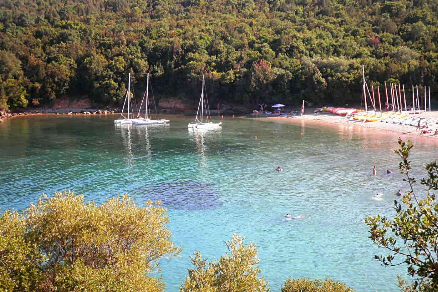
Syvota tours start in a small harbour village on the Ionian coast of Thesprotia in Epirus, south of Igoumenitsa, set behind a chain of wooded islets. The routes cover the islets and the shallow sand strip of Bella Vraka, the coves of the coast, the site of an ancient sea battle and the boat trips to Paxos and Parga. Greece Tours lists the cruises, kayak trips and day tours that reach the village.
This page covers what Syvota tours see on the islets, the beaches and the coast, the history of ancient Sybota, which day trips combine with the village, how visitors reach Syvota, what the coast offers in nature and food and which season suits each route. The tours below are checked on GetYourGuide and leave from Syvota and from Corfu.
What do Syvota tours cover?
Syvota tours cover a fishing village in the south of Thesprotia, on a small bay of the Ionian Sea in Epirus. The village had 1,089 residents at the 2021 census, and four uninhabited islets lie offshore: Agios Nikolaos, Mavro Oros, Megalo Mourtemeno and Mikro Mourtemeno.
Syvota was a municipality of its own until the 2011 local government reform. Since then it has formed a municipal unit of the municipality of Igoumenitsa, which has its seat in Igoumenitsa, the capital of Thesprotia. The unit has four main settlements: Syvota, Argyrotopos, Faskomilia and Plataria. Plataria held the seat of the old municipality.
Syvota tours start from a village that has grown from a fishing settlement into a resort, with green hills around the bay. Its stone-built houses look out over the blue-green water of the Ionian. Syvota ranks among the main seaside resorts of Epirus, and every summer it draws crowds of visitors from Greece and abroad. The municipality of Igoumenitsa calls the area the Caribbean of Greece.
- Village population: 875 residents at the 2011 census and 1,089 at the 2021 census.
- Municipal unit: 72.4 square kilometres, with 2,693 residents in 2021.
- Former municipality: four municipal districts with 3,010 residents at the 2001 census.
- Region: Thesprotia, a regional unit of Epirus that borders Albania to the north and faces the Ionian Sea to the west.
Syvota tours on this coast combine the harbour, the islets, the beaches and the waters of an ancient sea battle.
What do Syvota tours see on the islets?
Syvota tours see the green islets that wrap around the bay: Agios Nikolaos, Mavro Oros, Megalo Mourtemeno, Mikro Mourtemeno and Choironisi. Dense vegetation covers them, and their beaches have blue-green water. At Bella Vraka, the sea is shallow enough to wade across.
Visit Greece counts four uninhabited islets opposite the village, and the municipality of Igoumenitsa lists Choironisi as a fifth. The municipality calls the group a green Polynesia that shelters the bay a short distance from the village. Syvota tours sail among the islets that gave the village its present name.
Bella Vraka is the beach of Mourtemeno, with coarse white sand and pebbles. A narrow strip of sand joins it to the land, so swimmers cross on foot through the shallows or arrive by boat. The beach is not organised.
- Agios Nikolaos: one of the three main islets of the bay, in view of DEH beach on the shore of Syvota.
- Mavro Oros: the islet also known as Mourtos, Syvota or Fesi.
- Pisina: a beach on Mavro Oros, in a small cove of clear turquoise water that only boats reach, with natural shade until midday.
- Mourtemeno: two islets, Megalo and Mikro Mourtemeno, and the smaller one also goes by Gourouni.
Syvota tours that circle the islets by boat are covered on the Sivota blue lagoon cruise page.
Which beaches do Syvota tours reach?
Syvota tours reach Mega Ammos, a Blue Flag beach, along with Mikri Ammos, Zavia, Gallikos Molos, Zeri and Agia Paraskevi. A rented boat adds Pisina, Diapori and Alati, and Bella Vraka is reached by boat or on foot through the shallows.
The municipality of Igoumenitsa counts 43 beaches along 104 km of coastline. Around Syvota, the choice runs from busy beaches near the village to small isolated beaches that only boats reach, and the municipality presents the village as a base for a swim at a different beach every day. Syvota tours combine both kinds.
Mega Ammos took its name in contrast to its neighbour, Mikri Ammos. Families favour it, and it holds the Blue Flag, with sunbeds, showers, changing rooms, sea activities and access for disabled visitors. Mikri Ammos is a small cove with clear water, umbrellas, sunbeds and a beach bar. Gallikos Molos sits next to the harbour of Syvota and also has a beach bar.
- Zavia: a small cove where trees reach the sea and shade the beach, and underground springs keep the water cold.
- Zeri: an organised sandy beach with shallow, warm water that suits families with small children.
- Agia Paraskevi: an organised pebble beach in green surroundings, named after the chapel on its left, with a small islet that swimmers reach.
- DEH: a beach with warm water, named after a pole of the DEH power company.
On Syvota tours by hired boat, the municipality points to Pisina, Bella Vraka, Diapori and Alati. Visit Greece also names Diapori and Alati among the beaches of the area.
What history do Syvota tours tell?
Syvota tours tell the story of the Battle of Sybota, fought in 433 BC between the fleets of Corcyra and Corinth off these islets. The clash was one of the immediate causes of the Peloponnesian War. The village took the ancient name in 1940.
The Thesprotians, a Greek tribe of Epirus, are the earliest recorded inhabitants of the area. Corinth was in dispute with Corcyra, modern Corfu, an old Corinthian colony. In 435 BC the Corcyraeans beat the Corinthians in a sea battle at Lefkimmi, and Corinth began to build a large fleet. Pericles then persuaded the Athenians to form a defensive alliance with Corcyra.
Syvota tours point to the islands that the Corcyraean fleet used as its base. Corcyra had 110 ships plus 10 from Athens, and Corinth had 150 under Xenoclides. Hoplites, archers and javelin throwers fought from the decks. Both sides boarded enemy ships instead of ramming them, in a manner Thucydides calls old-fashioned. The Corinthians won the first battle, destroyed 70 Corcyraean ships and captured 1,000 men. Then 20 more Athenian ships under Glaucon arrived, and the Corinthians withdrew. Both sides set up trophies and claimed victory.
Strabo placed the islets very close to the coast of Epirus, opposite Lefkimmi. In the Middle Ages the area belonged to the Byzantine Empire, the Despotate of Epirus and the Republic of Venice, and in the 15th century it became part of the Ottoman Empire. Syvota tours at the harbour recall the Greek War of Independence, when it served as an Ottoman naval base. In June 1822, 500 revolutionaries under Kyriakoulis Mavromichalis attacked it and captured 150 Ottomans. Syvota became part of Greece in 1913, after the Balkan Wars.
- Former names: Volia before 1927, then Mourtos from 1927 to 1940.
- 13 August 1944: EDES partisans clashed with occupation forces in the area and seized two German fuel boats.
- Vrachonas: about 50 ruined stone houses of the 18th and 19th centuries on a ridge south-east of the village, listed as a historic monument in 1993.
- Church of the Ascension: the church of the Ascension of the Saviour stands beside the central square of the village.
Which Syvota tours sail the coast?
Syvota tours sail the coast in small motorboats hired in the village, on organised day trips by kayak and on sailing yachts, for which Syvota is an essential stop in the Ionian. Routes link the harbour, the islets and beaches that only boats reach.
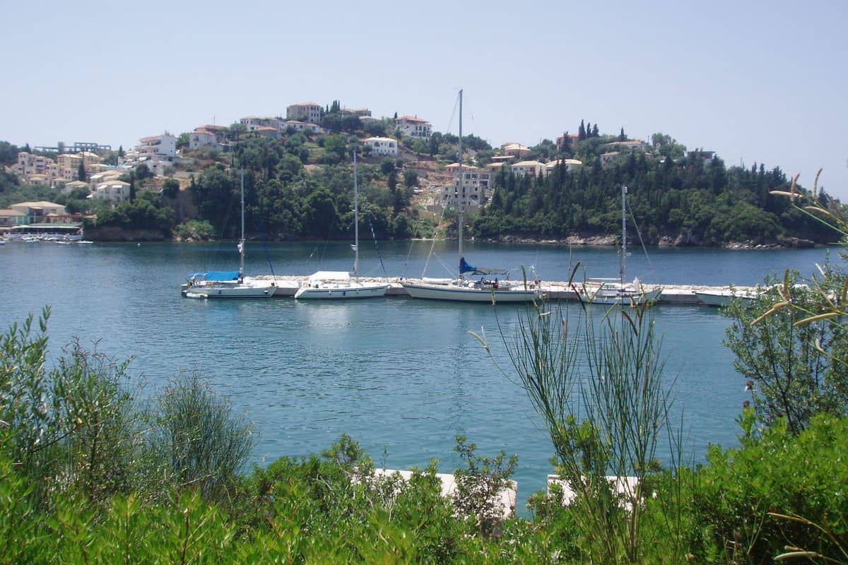
The small harbour of Syvota is lined with cafes, bars and restaurants, and the village has boat hire points and water sports. The municipality of Igoumenitsa compares the green islets to the Norwegian fjords and calls the area the fjords of Syvota. Visit Greece points sailors to the small hidden harbours of this shore.
Between the ports of Igoumenitsa and Syvota, the coast opens into the bay of Plataria. Plataria, a fishing village, sits at the head of the bay, between the capes of Agionisi and Eremonisi, also called Cheronisi. The bay stretches from near the start of the Egnatia highway to close to Syvota. Syvota tours along this shore pass both capes.
- Motorboats: the municipality recommends small motorboat hire to visitors who want more than rest.
- Kayaks: organised day trips by kayak, the second activity in the same municipal advice.
- Agionisi: a small pine-covered islet at the entrance of the bay of Igoumenitsa, with the main church of the Monastery of Zoodochos Pigi, a dependency of Giromeri Monastery.
Syvota tours on a private yacht are set out on the Sivota yacht charter page.
Which day trips combine with Syvota tours?
Syvota tours combine with five day trips: Igoumenitsa, 20 minutes away by road; Parga, 40 km from Igoumenitsa; the islands of Paxos and Antipaxos; Corfu, across the Corfu Channel; and the Acheron, the river that Greek myth made the entrance to the underworld.
Igoumenitsa, the capital of Thesprotia, keeps a late Roman castle and an Ottoman tower in the Ragio plain. Parga lies 40 km from Igoumenitsa and faces Paxos and Antipaxos. It passed to Venice in 1401 and was run as a mainland exclave of Venetian Corfu, and Parga tours cover the town.
Paxos lies 15 km from the southern tip of Corfu and about the same distance from Parga. Ferries from Igoumenitsa reach its port, Gaios, in 1.5 hours, and a sea taxi from Gaios reaches Antipaxos in 15 minutes; trips to Paxi and Antipaxi cover both islands. Syvota tours that cross to Corfu use the Igoumenitsa–Corfu ferry line, which opened on 6 June 1955. The Old Town of Corfu joined the UNESCO World Heritage List in 2007.
The Acheron runs 52 km to the Ionian Sea, and a day trip follows it in four stops:
- Springs of the Acheron: karst springs 2 km before the village of Glyki release water at 17 °C along a front of more than 500 metres.
- River sports: canoe, kayak and rafting trips run on the river, and the descent to the sea at Ammoudia starts at the Straits.
- Mesopotamos: a hill beside the river holds the site that excavations from 1958 identified as the Necromanteion, the Oracle of the Dead.
- Ammoudia: the last 5 km of the river to its mouth are navigable, and a 4 km riverside path runs beside the Forest of Persephone.
Syvota tours reach the Mesopotamos bridge on the Preveza–Igoumenitsa national road.
How do visitors reach Syvota for Syvota tours?
Syvota tours start at Igoumenitsa, the chief port of Epirus, less than half an hour from Syvota. Flights land at Corfu, Ioannina or Aktion, the Egnatia Odos and the Ionia Odos bring drivers from Thessaloniki and Patras, and KTEL Thesprotias buses link Igoumenitsa with Syvota on weekdays.
The New Port of Igoumenitsa ranks second in Greece for passenger traffic, after Piraeus. It handles 2.5 million passengers and about 250,000 trucks a year. Ferries sail to Ancona, Venice, Trieste, Bari and Brindisi in Italy, and domestic lines run to Corfu, Lefkimmi and Paxos.
The Egnatia Odos runs 670 km from Igoumenitsa to the Turkish border at Kipoi, through 76 tunnels and across 1,650 bridges. The Ionia Odos covers 196 km from Antirrio to Ioannina and, since its completion in August 2017, links the Rio–Antirrio bridge with the Egnatia Odos. Syvota tours by car from Preveza follow the EO18, which runs along the north Ionian coast from the Preveza–Aktio undersea tunnel to Igoumenitsa port.
Three airports serve Syvota tours:
- Corfu (CFU): Ioannis Kapodistrias airport lies 2 km south of Corfu Town and serves scheduled and charter flights from European cities.
- Ioannina (IOA): the King Pyrrhus airport sits 4 km from the centre of Ioannina, and the Egnatia Odos cut the drive to Igoumenitsa from almost 2 hours to 40 minutes.
- Aktion (PVK): the airport on the Aktion peninsula serves Preveza and Lefkada, and Parga lies 65 km from Aktio.
What nature and food do Syvota tours show?
Syvota tours show three Natura 2000 wetlands: the Kalamas Delta north of Igoumenitsa, the lake and marshes of Kalodiki, and the Acheron estuary at Ammoudia. Local tables add fish from Plataria and Sagiada, mussels and citrus from the delta, and olive oil from Perdika.
The Kalamas, the ancient Thyamis, is the longest river of Epirus at 115 km and the seventh longest in Greece. Its delta lies close to the Albanian border and covers 8,531 hectares of protected land, with the old and new river mouths and the lagoons of Richo, Vatatsa, Loutsa Papadia and Vontas. It holds two Natura 2000 listings, as Site of Community Importance GR2120001 and as Special Protection Area for birds GR2120005, because it sits on the western migration route of birds.
The marshes of Kalodiki, known for the lake with water lilies, form Special Protection Area GR2120006 together with Margariti, Karteri and Lake Prontani, 22 km south-east of Igoumenitsa. The Acheron estuary lies in Natura 2000 site GR2140001, where the delta holds 449 plant species and 19 habitat types, and a goby found only in the Acheron lives in the river. Syvota tours meet the same coast and plain at the table:
- Fish: Plataria, 10 minutes from Igoumenitsa, is a fishing village that serves fresh fish by the sea, and Sagiada has fish tavernas.
- Lagoon catch and mussels: fishing cooperatives work the delta lagoons, fish farms operate in the sea, and mussel farms grow near the Kalamas mouth.
- Citrus and maize: the delta plain, farmed intensively since the building of the Kalamas dam and irrigation works, grows citrus fruit, maize and alfalfa.
- Olive oil: the people of Perdika produce olive oil, and olive groves cover much of the hills of Paxos.
- Spoon sweets: Corfu grows kumquat and bergamot for its spoon sweets and liqueurs.
When do Syvota tours run best?
Syvota tours run best from June to September. A year of readings at nearby Igoumenitsa gave air temperatures of 25 to 28 °C and sea temperatures of 22 to 25 °C in those months, with only four rainy days across the summer.
The coast has a hot-summer Mediterranean climate, Köppen type Csa, with mild to cool, rainy winters and hot, relatively dry summers. Mean annual rainfall at Igoumenitsa is 1,100 mm. The same readings counted 65 rainy days in the year and an average of 10 hours of sunshine a day in summer, and the extremes over 25 years reached −9 °C and 40 °C.
The sea held 23 °C in October and 20 °C in November, the last month fit for swimming, so Syvota tours keep swimming stops into autumn. Air traffic at Corfu airport peaks from April to October. The calendar of Syvota tours carries these events:
- Carnival: Perdika holds its traditional carnival, the Perdikiotiko Karnavali, every year, and Corfu stages Ta Karnavalia, a parade of Venetian origin.
- Easter: on Holy Saturday, Corfiots throw clay pots, the bótides, onto the streets of the old town, and the city bands then parade with the Graikoí march.
- June to September: the Paxos International Music Festival, run by the Guildhall School of Music and Drama in London, holds its events in the old school of Longos.
- 15 August: the municipality of Parga holds its yearly cultural events, the Parginá or Kanáreia.
Frequently Asked Questions
Do Syvota tours need a car?
No. KTEL Thesprotias runs two buses each way on its Igoumenitsa–Syvota–Perdika line from Monday to Friday, with no service on Saturday or Sunday. From Igoumenitsa, the same company sends four buses a day to Ioannina and three a day to Athens, two of them via Plataria, so Syvota tours start without a car.
Which Syvota tours suit a rainy day?
Two museums suit wet days on Syvota tours. The Archaeological Museum of Igoumenitsa, opened in 2009, shows Thesprotia from prehistoric times to the Byzantine period in five sections. The Folklore Museum of Plataria, founded in 2007, fills two rooms of the old primary school with tools of traditional trades, kitchenware and woven textiles.
What sea life do Syvota tours meet near Antipaxos?
Antipaxos and its surrounding sea form a Natura 2000 site. Its protected fauna includes loggerhead and green turtles, bottlenose, common and striped dolphins, fin whales and Cuvier’s beaked whales. Mediterranean monk seals breed in the sea caves, Posidonia meadows grow on the seabed, and coral reefs lie deeper than 30 metres.
Do Syvota tours run in winter?
Yes. The car ferry from Igoumenitsa to Paxos sails all year, while the hydrofoil from Corfu runs less frequently outside the tourist season and depends on the weather. A year of readings at Igoumenitsa gave 12 °C in the air and 16 °C in the sea in January, and February, the coldest month, fell to 9 °C.