
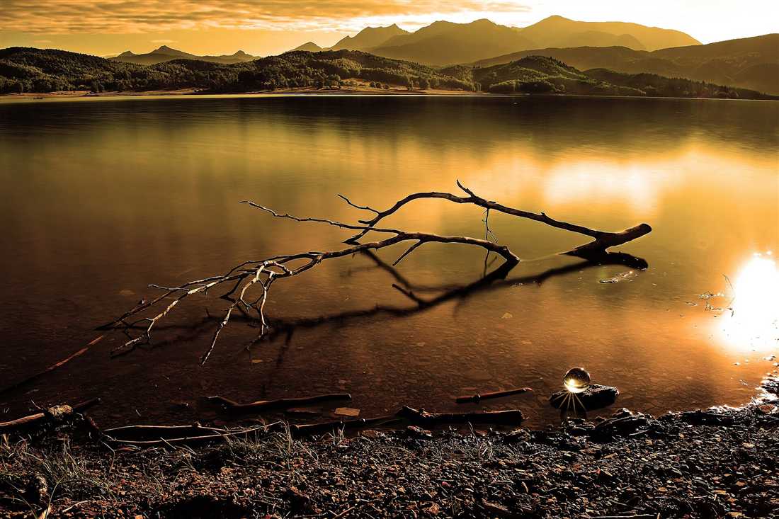
Karditsa tours cover the south-western unit of Thessaly: Lake Plastira on its plateau at 800 m with a shore road of 60 km, the dam at Kalyvia Pezoulas, the Agrafa mountains rising to 2,184 m behind it, the stone villages of Neochori, Fylakti and Morfovouni, the monastery of Koroni, the vineyards of Mesenikolas and the flat cycling town on the plain below. Plan the rest of the trip with Greece Tours.
This page covers the Karditsa tours you can arrange from the town and the lake villages, what each part of the unit holds, the water and the mountains, the food and the wine, the history of the unregistered Agrafa, and how the roads and the seasons shape the route.
What do Karditsa tours cover?
Karditsa tours cover Lake Plastira on its plateau at 800 m, the Agrafa mountains behind it, the stone villages of Neochori, Belokomiti and Fylakti, the monastery of Koroni, the town of Karditsa with its bicycles and park, and the Pili bridge on the Trikala border.
Karditsa is the south-western unit of Thessaly, half flat plain and half mountain. The plain grows cotton and cereals, the Agrafa rise behind it to 2,184 m, and between them sits Lake Plastira, the reservoir built in the 1950s that turned the unit into a weekend destination.
- Lake Plastira – the 24 square kilometre reservoir at 800 m, ringed by a 60 km road.
- Agrafa – the mountain range the Ottomans never fully registered, hence the name.
- Karditsa town – the grid plan, the Pafsilypo park and the cycling culture.
- Mountain villages – Neochori, Belokomiti, Fylakti and Kalyvia Pezoulas.
- Koroni monastery – the 16th-century house above the lake shore.
- Kalyvia Pezoulas dam – the wall that holds the lake, with the view down the valley.
Our Thessaly tours page covers the wider region. Karditsa tours work as a long weekend round the lake, with a car, from Karditsa town or a lakeside village.
What do Karditsa tours see at Lake Plastira?
Karditsa tours at Lake Plastira see a reservoir of about 24 square kilometres at 800 m under the Agrafa, a 60 km road round its shore, the dam at Kalyvia Pezoulas, the viewpoint chapel of Agios Nikolaos, and the fir and chestnut forest that comes down to the water.
The lake is named for Nikolaos Plastiras, the general from a nearby village who proposed damming the Tavropos in the 1920s; the dam was built between 1955 and 1959 and the water now supplies the plain, generates power and carries the region’s tourism.
The shore road is the trip. It runs 60 km round the water through fir forest and villages, with tavernas and guesthouses on the western side, canoe and pedal-boat hire at Lampero and Neochori, and viewpoints that open suddenly on the whole basin.
- The shore road – 60 km round the lake, about two hours with stops.
- Kalyvia Pezoulas dam – the wall and the view down the Tavropos gorge.
- Neochori and Lampero – the boat hire, the beaches and the lakeside tavernas.
- Agios Nikolaos viewpoint – the chapel on the eastern rim above the water.
- Koroni monastery – the 16th-century monastery on the northern shore.
- Water sports – canoeing, kayaking and pedal boats from April to October.
The water stays cold through the summer because it is fed from the Agrafa snowmelt. Karditsa tours drive the circuit in a morning and walk one of the marked paths in the afternoon.
What do Karditsa tours see in the Agrafa mountains and the villages?
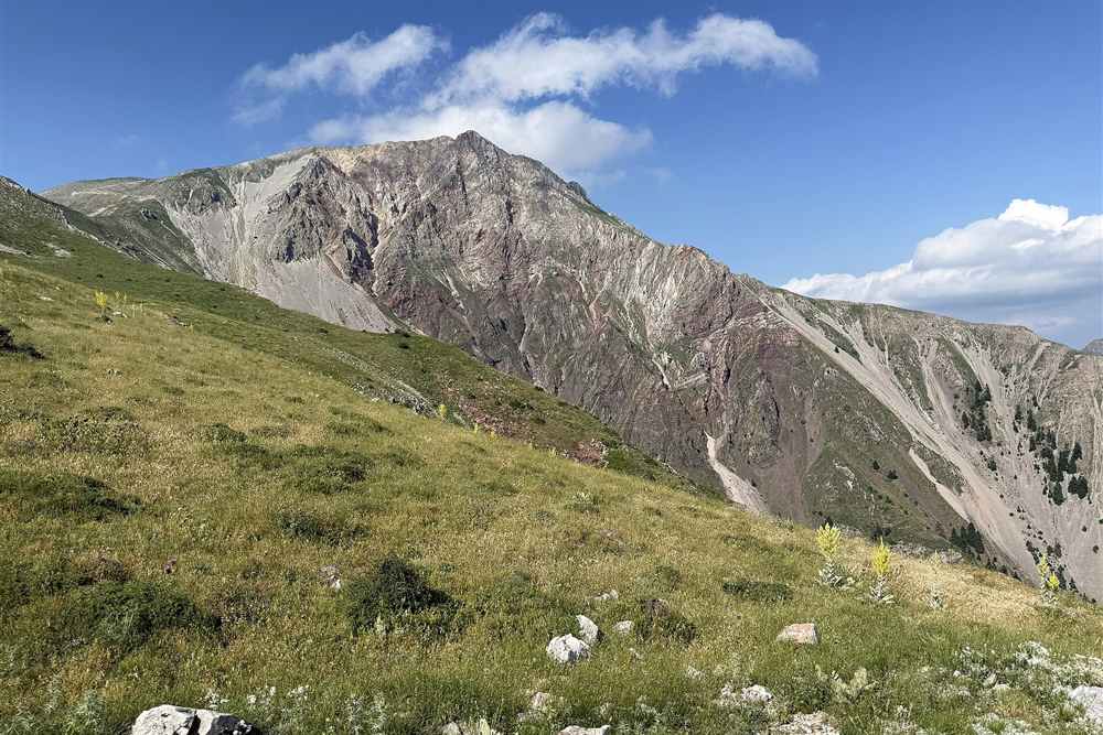
Karditsa tours in the Agrafa see a range rising to 2,184 m at Karava, the villages of Neochori, Belokomiti, Fylakti and Petrilo, stone bridges and watermills, the gorges above the lake, and paths that carry walkers from the shore to the ridge.
The Agrafa take their name from being unwritten: the Ottoman administration never entered the villages in its tax registers, and the range kept a degree of independence through the occupation, which is why it carried armed bands and, much later, the wartime resistance.
The villages sit between 800 and 1,200 m on the slopes above the lake, stone-built with slate roofs and plane-shaded squares, and they fill at weekends and holidays. Beyond them the road deteriorates and the range empties into fir forest, summer pasture and a few shepherds’ huts.
- Neochori – the largest lakeside village, with the guesthouses and the tavernas.
- Belokomiti and Fylakti – the stone villages on the western shore road.
- Petrilo and Vlasi – the deeper Agrafa villages under the ridge.
- Karava – the 2,184 m summit at the head of the range.
- Stone bridges – the old crossings on the Tavropos tributaries.
- Walking paths – the marked routes from the shore to the forest and the ridge.
The walking season runs from April to November, with the high ground under snow from December. Karditsa tours base in a lakeside village and reach every path from the shore road.
What do Karditsa tours see in the town, and how do visitors reach the unit?
Karditsa tours in the town see the grid of streets laid out in the 19th century, the Pafsilypo park, the archaeological collection and the bicycle culture that gives the town more cycles per resident than anywhere in Greece. Visitors reach it from Athens in three and a half hours.
Karditsa is flat and compact, which is why it cycles: the municipality counts more bicycles than cars, the streets carry marked lanes, and the town runs a hire scheme for visitors. The Pafsilypo park on its southern edge is the green space, with a lake, an open-air theatre and cafes.
- Karditsa to Lake Plastira – 25 km, about 40 minutes up to the plateau.
- Athens to Karditsa – 300 km, about three and a half hours by motorway.
- Thessaloniki to Karditsa – 220 km, about two and a half hours.
- Karditsa to Meteora – 60 km, about 50 minutes through Trikala.
- Karditsa to Lamia – 110 km, about an hour and a half.
- Where to stay – Neochori or Kalyvia Pezoulas for the lake, Karditsa for the town.
Spring fills the lake and the waterfalls, autumn turns the chestnut forest, winter brings snow to the Agrafa with the lake grey and empty, and summer works the water sports at about 25 degrees. Karditsa tours take the lake circuit, one mountain village and the town in two days.
What do Karditsa tours eat and drink?
Karditsa tours eat trout from the Plastira streams, goat and lamb from the Agrafa, hand-rolled pies, chestnuts and walnuts from the mountain villages, the vegetables of the cotton plain, and drink tsipouro with meze in the town.
The lakeside tavernas cook what the plateau raises. Trout comes from farms on the feeder streams, goat and pork are grilled or baked in the village ovens, and the pies are rolled by hand with cheese, greens or pumpkin depending on the season.
- Trout – farmed on the streams that feed Lake Plastira.
- Agrafa meat – goat, lamb and pork from the mountain flocks.
- Village pies – cheese, greens and pumpkin, rolled by hand.
- Chestnuts and walnuts – gathered above the lake in October.
- Tsipouro – the spirit drunk with meze plates in the town bars.
- Honey and mountain tea – from the Agrafa slopes above 1,200 m.
The western shore carries most of the tavernas and the town’s tsipouradika fill after seven. Karditsa tours eat on the plateau at lunch and in the town at night.
Which outdoor trips run in Karditsa?
Karditsa tours kayak and canoe on Lake Plastira, walk the marked paths from the shore into the Agrafa, ride the forest roads by bike or jeep, raft the Tavropos and the upper Acheloos in spring, and find snow on the range from December.
The lake is the base for everything. Hire points at Lampero and Neochori put canoes, kayaks and pedal boats on the water from April to October, the shore road carries road cyclists round the 60 km circuit, and the tracks above it take mountain bikes into the fir forest.
- Kayaking and canoeing – on the lake from April to October.
- Walking – the marked routes from the shore villages into the Agrafa.
- Cycling – the 60 km shore circuit and the forest tracks above it.
- Rafting – the Tavropos and the upper Acheloos in spring.
- Horse riding – the stables on the western shore.
- Winter – snow on the Agrafa from December, with sledging above Neochori.
Spring carries the most water and the strongest colour, autumn the chestnuts. Karditsa tours combine a morning on the water with an afternoon in the villages.
What history do Karditsa tours tell?
Karditsa tours tell of the Agrafa villages the Ottomans never registered, of Nikolaos Plastiras who was born at Morfovouni and pressed for the dam, of the resistance bases in the mountains during the occupation, and of the flooding of the Tavropos valley in 1959.
The name Agrafa means unwritten. The Ottoman administration failed to enter the mountain villages in its tax registers, so they paid nothing and kept their own arms, and the range stayed a refuge for four centuries and again for the resistance between 1941 and 1944.
Plastiras, born at Morfovouni above the plain, commanded in Asia Minor, led the revolution of 1922 and served three times as prime minister. He pressed for the dam that now carries his name, and the lake that replaced the upper Tavropos valley was filled in 1959.
- Agrafa – the unregistered villages that escaped Ottoman taxation.
- Nikolaos Plastiras – born at Morfovouni, the general the lake is named for.
- The dam – built between 1955 and 1959, flooding the upper Tavropos.
- Resistance – the mountain bases of the occupation years.
- Karditsa town – laid out on a grid in the 19th century on the plain.
- Koroni monastery – the 16th-century house above the new shoreline.
The museum at Neochori and the Plastiras house at Morfovouni carry the record. Karditsa tours take both on the lake circuit without adding driving.
Which villages ring Lake Plastira, and what does each hold?
The lake is ringed by Neochori with the guesthouses, Kalyvia Pezoulas at the dam, Belokomiti and Fylakti on the western shore, Pezoula above the water, Morfovouni on the eastern rim and Mesenikolas in its vineyards below.
Each village takes a different part of the shore. Neochori sits highest on the western side with the largest cluster of rooms and tavernas, Kalyvia Pezoulas stands at the dam wall with the view down the gorge, and Pezoula and Fylakti look across the water from terraces of walnut and chestnut.
Mesenikolas, below the lake on the eastern side, grows the black grape that carries its name and makes the appellation wine of the unit; its cellars take visitors, and the village keeps a square of plane trees above the plain.
- Neochori – the main lakeside village, with rooms, tavernas and boat hire.
- Kalyvia Pezoulas – the dam wall, the viewpoint and the gorge below.
- Belokomiti and Fylakti – the western shore villages in the forest.
- Pezoula – the terrace village looking across the water.
- Morfovouni – the birthplace of Plastiras on the eastern rim.
- Mesenikolas – the wine village and its black-grape appellation.
The circuit road links all six in about two hours of driving with stops. Karditsa tours sleep in one of them rather than in the town, since the lake is the reason to come.
Which trips combine with Karditsa tours?
Karditsa tours combine with Meteora 60 km north through Trikala, the Pili bridge and the Pertouli fir forest an hour away, Evrytania and Karpenisi over the Agrafa, Lamia an hour and a half south and Larissa an hour east across the plain.
The unit sits between the Thessalian plain and the Pindus, so it pairs naturally with Meteora on one side and the mountain roads on the other. The crossing south to Karpenisi runs through the Agrafa on slow road and takes about two and a half hours.
- Meteora – 60 km north by Trikala, about 50 minutes.
- Pertouli and Elati – the Trikala fir-forest villages, an hour north-west.
- Karpenisi – over the Agrafa into Evrytania, about two and a half hours.
- Larissa – an hour east across the plain.
- Lamia – an hour and a half south on the motorway.
- Athens – 300 km, about three and a half hours.
Our Evrytania tours page covers the unit over the ridge. Karditsa tours pair the lake with Meteora in a three-day route, which is how most visitors from Athens use it.
Frequently Asked Questions
Where is Karditsa?
In south-western Thessaly, with the plain to the east and the Agrafa mountains to the west, Trikala to the north and Evrytania beyond the ridge to the south.
What is Lake Plastira?
A reservoir of about 24 square kilometres at 800 m under the Agrafa, created by damming the Tavropos between 1955 and 1959 and named for the general Nikolaos Plastiras.
How long is the shore road?
About 60 km round the lake, which takes two hours by car with stops and is used by road cyclists as a full-day circuit.
What are the Agrafa?
The mountain range behind the lake, rising to 2,184 m at Karava. The name means unwritten, because the Ottoman administration never entered its villages in the tax registers.
Which villages do the tours include?
Neochori for the rooms and the boat hire, Kalyvia Pezoulas at the dam, Fylakti and Belokomiti on the western shore, Morfovouni on the eastern rim and Mesenikolas for the wine.
What can you do on the water?
Canoe, kayak and pedal-boat hire work from Lampero and Neochori from April to October, and the water stays cold because it is fed by Agrafa snowmelt.
Why is Karditsa known for bicycles?
The town is flat and compact and counts more bicycles than cars, with marked lanes through the centre and a hire scheme for visitors.
How do you reach Karditsa?
By motorway from Athens in about three and a half hours or from Thessaloniki in two and a half, with the lake 25 km and 40 minutes above the town.
When is the best time for Karditsa tours?
Spring for full water and waterfalls, October for the chestnuts and the colour, summer for the water sports at about 25 degrees, and December to March for snow on the Agrafa.