
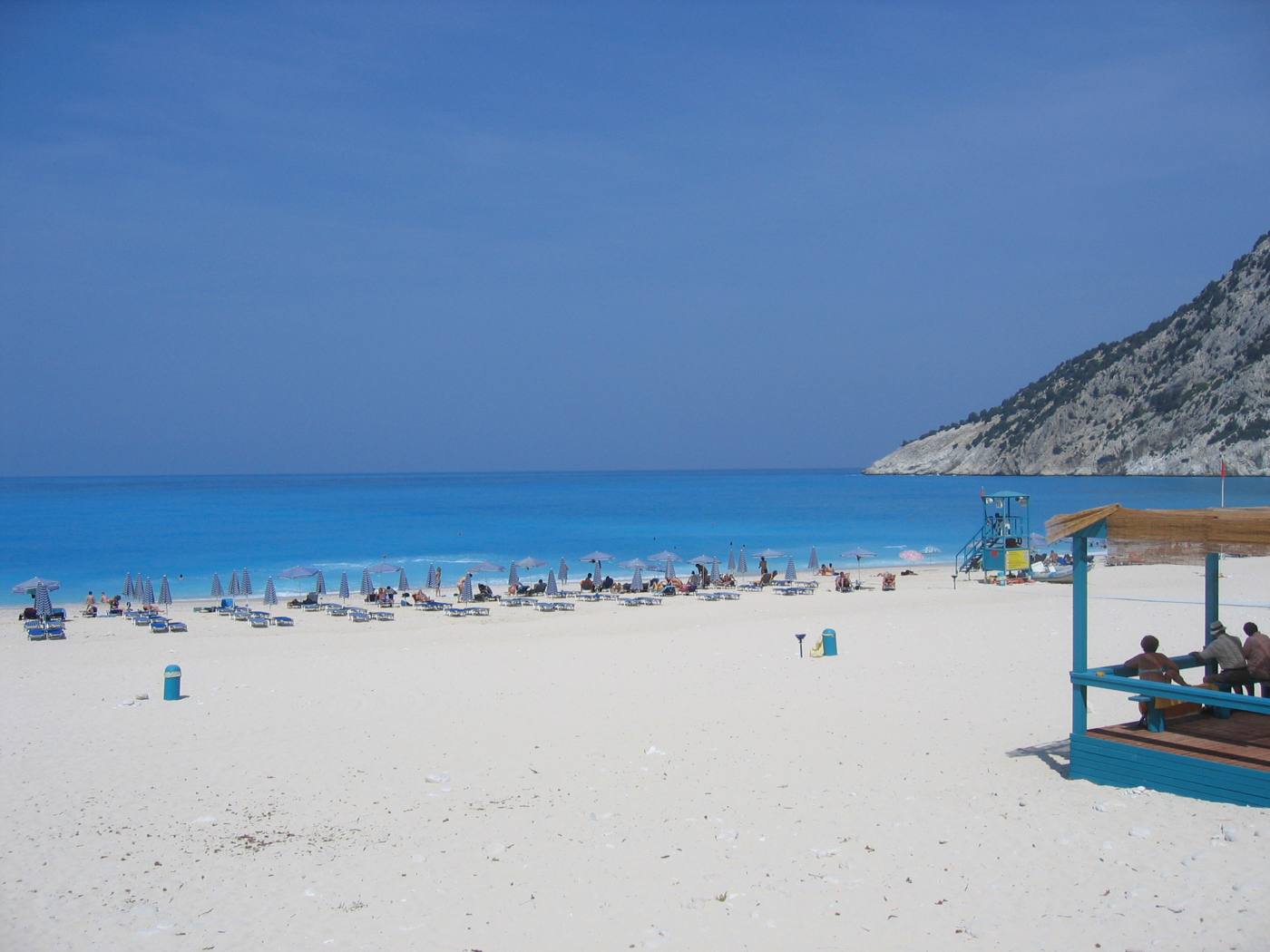
Kefalonia gives walkers a range that few Greek islands match. A fir-covered mountain rises to about 1,628 metres, coastal headlands carry Venetian ruins, a castle crowns a pine peninsula, and old mule tracks link the inland villages. The island is the largest of the Ionian group and stays green through spring, fed by winter rain. Its paths run through forest and olive terrace rather than open rock. Routes stretch from a 45-minute harbour loop in the far north to a ridge walk inside Ainos National Park. Most of them finish within reach of a beach, a taverna or a village square. Plan the whole trip with Greece Tours.
This guide works through the walking areas one by one. It covers the Ainos massif and the summit of Megas Soros, then the waymarked headland paths at Fiskardo. The castle climb at Assos follows. Inland come the tracks of the Omala valley, the Ainos foothills and the Sissia ruins above Lourdas. It sets out the seasons that work and the state of the waymarking. It also lists the kit that earns its weight and the driving times to each trailhead. Distances, gradients and conditions appear in concrete terms, so a walking day fits a wider Kefalonia itinerary.
Why does Kefalonia suit walkers more than the drier Aegean islands?
Kefalonia carries forest, water and altitude that most Aegean islands lack, so its walking mixes fir woodland, ridge lines and coastal headlands. Paths climb from sea level to about 1,628 metres inside a single island.
Kefalonia is the largest of the Ionian Islands, and its interior stays green long after the Cyclades have dried out. Winter rain feeds fir forest, plane trees and springs, so walking here runs through shade rather than bare rock. A single day on Kefalonia moves from a pebble cove to a forested ridge above 1,000 metres. The island covers about 773 square kilometres. That area holds four distinct walking zones: the Ainos massif, the northern headlands, the Assos peninsula and the inland valleys around Omala. Each zone has its own surface, gradient and outlook, and none of them repeats another.
Limestone shapes the walking. Rain sinks into the rock instead of running off. That drainage produces the caves near Sami, the underground lake at Melissani, and the sea mills at Katavothres west of Argostoli, where seawater vanishes into the ground. Walkers meet the same geology underfoot: pale rock, shallow gullies and dry stream beds that carry water only after storms. Grip matters more than stamina on this surface, because polished limestone turns slick when wet. The compensation is speed of drying. A Kefalonia path sheds heavy rain within hours, so the walking season stretches into late autumn and restarts early in spring.
Old mule tracks still form the backbone of the inland network. Villages across the island were rebuilt low and plain after the mid-century Ionian earthquake. The stone-paved lanes between them survived, and walkers now follow routes that once carried grain, olives and Robola grapes. Sections run between drystone walls, past cisterns, chapels and abandoned terraces. The tracks connect settlements rather than viewpoints, so they read differently from a signed nature trail. Gradients stay steady, junctions come often, and the reward at the far end is a village with a water tap. The northern headland above Fiskardo keeps the same working network of lanes.
Short driving distances hold the whole network together. Argostoli sits about 24 kilometres from Sami and roughly 50 kilometres from the far north. A walker based in one town reaches any trailhead within about 90 minutes. That compactness allows a morning on the ridge and an afternoon swim at Myrtos or Antisamos on the same day. Route planning follows the same logic: point-to-point walks work when two drivers cooperate, and circular routes work everywhere else. Buses link the main towns on a limited timetable. Trailheads sit well away from the bus stops, so timings across this network depend on a car.
What does the walk to Megas Soros on Mount Ainos involve?
Mount Ainos holds the highest ground in the Ionian Islands, and a marked route crosses its endemic fir forest to the summit ridge. Megas Soros stands at about 1,628 metres, roughly three hours return from the park entrance.
Ainos National Park protects the forest across the upper mountain. Mount Ainos carries the endemic Cephalonian fir, Abies cephalonica, in dense stands that turn the crest dark from a distance. A surfaced road climbs from the Argostoli to Sami route toward the ridge. It ends near the park entrance at about 1,300 metres, which removes most of the ascent. Walkers park there and continue on foot along forest tracks and marked paths. The park keeps an information point at the entrance, with a sketch map of the network. The boundary reads clearly on the ground, because the fir wall begins where the lower scrub stops.
The main walk follows the ridge to Megas Soros, the summit at about 1,628 metres. The route runs mostly on a broad track through fir, with rocky ground near the top. It takes about two to three hours there and back from the upper parking area. Ascent stays modest, around 300 metres, so the effort suits anyone comfortable on uneven terrain. The final metres cross open limestone and low scrub, with the ridge falling away on both sides. From the summit the view opens over Argostoli bay and the Paliki peninsula. Ithaca lies north-east, Zakynthos south, and the mainland mountains rise east across the channel.
Semi-wild horses roam the upper slopes, grazing the clearings between the firs. They move in small groups, keep their distance from walkers, and belong to a free-ranging herd. The herd has lived on the mountain for generations and needs no feeding from walkers. Ravens and buzzards work the thermals above the ridge, and spring brings orchids and violets into the open glades. The forest floor stays dry, and no spring or tap exists along the crest. Every litre of water therefore comes up in the pack. Fire risk runs high in the fir stands through summer, and open flame is prohibited inside the park boundary.
Conditions on the ridge differ sharply from the coast. Temperature drops roughly 6 degrees between sea level and the summit. Wind funnels along the crest, and cloud closes over the top while Argostoli stays clear below. Snow lies on the upper slopes through parts of winter, and the access road ices in cold spells. Forest tracks fork at intervals without signs, which makes an offline map worth carrying even on the main line. Mobile coverage up there is patchy, and the ridge holds no shelter of any kind. The last stretch to Megas Soros crosses loose limestone, where footing needs attention rather than speed.
Where do the coastal paths from Fiskardo lead on the northern headland?
Fiskardo sends short waymarked paths onto its headland, one reaching a ruined Venetian lighthouse and the remains of an early-Christian basilica. Other routes run west to Emblisi beach and inland toward the Drapanitika direction.
Fiskardo survived the mid-century earthquake that flattened most of the island. Its harbour keeps Venetian-style houses in pastel plaster above the quay. Walking starts at the water, where a lane leaves the northern end of the waterfront. The lane passes the boatyards and climbs gently into cypress and olive on the headland that shelters the bay. Distances stay short, because the whole headland measures under two kilometres across. The paths are cleared and waymarked with paint flashes and wooden signs. Two loops leave from the same point. That combination makes the northern village the easiest base for a first self-guided walk.
The headland loop reaches two ruins within about 45 minutes of the harbour, with under 80 metres of climb. A round Venetian lighthouse stands roofless on the point, its stonework open to the sea. The working modern light stands beside it, guiding boats into the channel toward Ithaca. A short distance inland lie the foundations of an early-Christian basilica, with column bases and floor outlines readable in the grass. The path links both, then returns along the far side of the headland with the channel in view. Sturdy shoes matter here, because the surface is bare rock and loose stone rather than made path.
West of the village the coast breaks into small pebble coves. A marked route drops to Emblisi, about one kilometre from the harbour, where white pebbles meet clear water below a cypress slope. Foki lies south of the village in an olive-shaded inlet, reached by a lane and a short footpath. Both make natural turning points for a walk that ends in a swim. Gradients stay gentle, under 100 metres of climb in each direction, and shade holds until late morning. Swimming shoes help on the coarse pebbles at both coves. Carry water, since neither cove has a dependable tap outside summer.
Longer waymarked routes run inland toward the Drapanitika direction. They follow farm tracks between drystone walls and abandoned olive terraces. These paths climb the low spine behind the village and cross open scrub of cistus and lentisk. Viewpoints along the way look over the channel and the north coast. Sections pass through grazing land, so gates get closed again behind walkers. Waymarking thins on the outer loops, and vegetation grows across the track in late summer, which slows progress. Two to three hours covers the longer circuits at a steady pace. The return leg drops back to the harbour on a clear lane.
How hard is the climb from Assos to its Venetian castle?
A stone-and-concrete lane climbs from Assos village to the gate of the Venetian castle, gaining about 170 metres in roughly 30 minutes. A soft woodland track then loops through pines around the fortified peninsula.
Assos occupies a narrow isthmus on the north-west coast, with a horseshoe harbour on one side and open sea on the other. The pine-covered peninsula beyond the village carries a Venetian castle. Its walls run for roughly two kilometres around the headland. The approach starts in the village, where a signed lane leaves the last houses and switchbacks up the neck of the isthmus. The harbour square makes the natural start point. Parking sits in one small area above the houses and fills by mid-morning through summer. Walkers arriving later leave the car on the main road, adding about one kilometre each way.
The climb to the castle gate takes about 30 minutes at a walking pace. The lane is surfaced in stone and concrete and holds a steady gradient. It demands no scrambling, and it gains around 170 metres from the harbour. Pines line the upper half, which keeps the route shaded through most of the day. Gaps in the trees look straight down onto the red roofs of the village and the turquoise shallows of its bay. The gateway itself stands intact, a Venetian arch in pale masonry. The interior opens immediately beyond it into a wide wooded enclosure with no buildings in use.
Inside the walls the peninsula reads as woodland rather than fortress. Paths wander between pines to the ruined church of Agios Markos and the remains of the Venetian governor’s residence. Later prison buildings and long stretches of curtain wall stand above the cliffs. A full loop of the enclosure covers about two kilometres on soft ground with gentle rises. The far side looks north toward the tip of the island and west into open sea. The drop below the ramparts runs vertical, so the edges stay unfenced. Shade covers most of the loop. Allow around 90 minutes for the climb, the circuit and the descent.
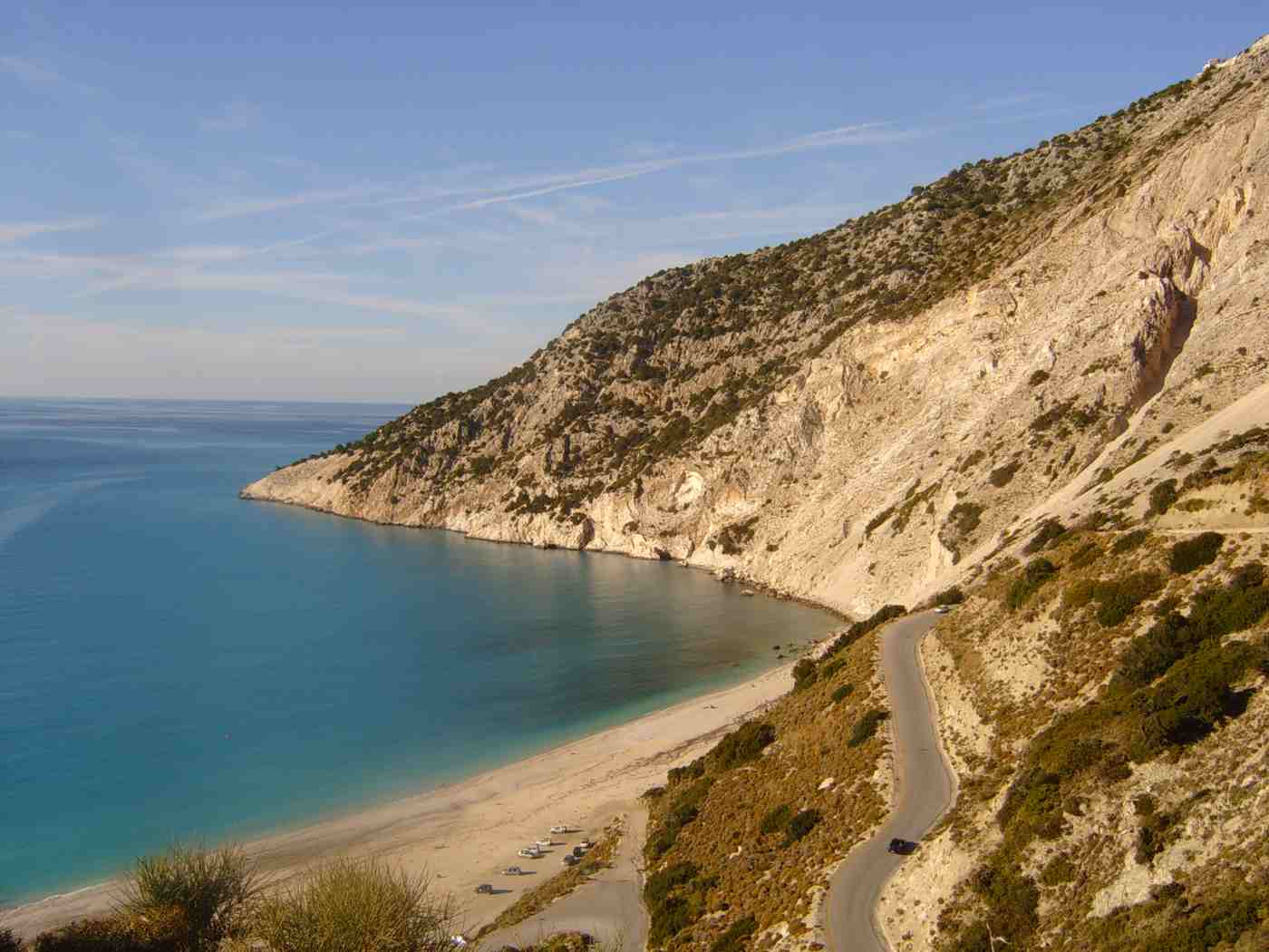
The castle walk pairs with the Myrtos viewpoints on the road above Divarata, six kilometres south. Laybys there look down on the white curve of the beach. Drivers combine the two in a half day. They walk the peninsula in the morning, while the pines still hold cool air, then drop to Myrtos for the afternoon. The village keeps a shaded square by the water for the return. The road north runs narrow and winding throughout. Anyone continuing that way reaches the harbour of the far north in about 25 minutes by car, so both walking areas fit one day.
Which inland paths link the Omala valley, the Ainos foothills and the Sissia ruins near Lourdas?
Inland Kefalonia keeps old mule tracks between the villages of the Omala valley and the Ainos foothills. A stony path above Lourdas climbs through olive groves to the ruined Sissia monastery near the coast.
The Omala valley sits in a high basin under the western flank of Ainos. Its floor gives the flattest walking anywhere on the island. Robola vines cover the plain in low unstaked rows, and the farm lanes between them carry almost no traffic outside harvest. The monastery of Agios Gerasimos stands at the centre of the valley, dedicated to the island’s patron saint. The Robola growers’ cooperative sits a short distance away. A circuit of the plain runs about six kilometres on level ground. It links the monastery, the vineyards and the villages of Valsamata and Frangata at the edges.
Above the valley, mule tracks climb into the Ainos foothills and connect the settlements ringing the mountain. The tracks are stone-laid in places and cut into the slope elsewhere. They pass cisterns, threshing floors and chapels left from the farming economy that built them. Gradients stay steady rather than steep, because pack animals set the original design. Waymarking is sparse on these routes, and junctions with newer farm roads blur the old line. Village tavernas at either end make useful turning points. The practical approach is to walk out and back on a track you can see, rather than chase a full traverse.
South of the mountain, a path leaves the Lourdas area and climbs through olive groves and cypress toward the ruins of the Sissia monastery. The old buildings stand roofless above the coast, abandoned after the mid-century earthquake. Arches, walls and a paved court remain traceable among the undergrowth, and a newer monastery operates nearby. The walk gains about 150 metres over roughly two kilometres, and the ground is stony with loose sections near the top. Olive shade covers the lower half of the climb. The site looks south over Lourdas bay, where the plain drops in terraces to a long shingle beach.
Inland walking works best as one part of a wider day. These villages sit close to the caves, beaches and towns that fill most itineraries. A morning on the Omala lanes fits with an afternoon at the Melissani underground lake. The Drogarati cavern near Sami sits close by, each about 20 kilometres from the valley. Anyone planning a full week slots the walking between the other things to do in Kefalonia. Those run from the De Bosset bridge in Argostoli to the Xi and Petani beaches on Paliki. Two walking days across a week still leave room for the rest.
When is the best season for hiking in Kefalonia, and how good is the waymarking?
Spring and autumn deliver the workable walking conditions on Kefalonia, with mild temperatures, green ground and long daylight. Midsummer heat pushes coastal routes into the first hours after sunrise, and waymarking ranges from formal to faint.
April through early June gives the strongest walking window. Daytime temperatures sit around 18 to 25 degrees, and the fir forest on Ainos holds moisture. The foothill terraces fill with orchids, cyclamen and broom. Streambeds still carry water in April, and daylight lasts past eight in the evening by the end of spring. Walker numbers stay low on the north-coast paths, so the headland loops and the Assos peninsula remain quiet even at midday. Sea temperatures still sit low for swimming in April and warm through June. Vegetation has not yet closed across the outer tracks, which keeps the faint paint marks visible.
September to early November forms the second window. Sea temperatures stay high enough for a swim after a walk, and the heat drops into the low twenties. The first rains settle the dust and clear the air toward Ithaca and Zakynthos. Trade-offs come with the second window. Two of them matter. The ground is at its driest in September, the inland tracks are at their most overgrown, and dry grass keeps fire risk high. Village festivals and the grape harvest fill the Omala valley in early autumn. Daylight shortens quickly through October, so a ridge walk on Ainos starts before noon.
Midsummer walking demands an early start and a short route. July and August push coastal temperatures above 30 degrees. The northern headland, the Assos lane and the Sissia path carry limited shade once the sun climbs. Walkers on those routes leave at first light and finish by ten. The Ainos ridge stays roughly 6 degrees cooler than the coast. That difference makes it the one route that works through a summer afternoon, although wind on the crest blows harder. Beach cafes at Lourdas and Emblisi handle the recovery hour. Water consumption doubles, and three litres a person suits a half-day walk.
Waymarking across the island ranges from formal to improvised. Ainos National Park signs its main paths with wooden posts and painted marks. The northern headland routes carry paint flashes on rock and trees. Inland mule tracks and the Sissia approach rely on cairns, worn ground and occasional faded paint. Rain and grazing erase marks, and farm-road construction cuts the old lines in places. Walking poles help on the eroded sections, where loose stone rolls underfoot. An offline map with the route drawn on it removes most of the guesswork. The park sketch map covers the Ainos network well enough for the main ridge.
What do walkers bring, and how do they reach the trailheads in Kefalonia?
Walkers on Kefalonia need grip, water and sun protection above everything else, plus an offline map for the unmarked sections. A hire car reaches every trailhead, because buses serve the towns rather than the paths.
Footwear decides comfort on these paths. Limestone, loose stone and pine needles all cut traction. A shoe or boot with a lugged sole and ankle support handles the ground far better than a trainer. Two litres of water a person covers a morning walk in spring, and three litres suits summer. No tap or spring stands along the Ainos ridge, the northern headland or the Sissia path. A hat, sunglasses and high-factor sunscreen earn their place on the open coastal sections. Long trousers save the legs on overgrown inland tracks. A light windproof layer pays for itself on the Ainos crest.
Navigation and communication round out the kit for a full day on the paths. An offline map application with the track downloaded works where mobile coverage fails. That gap appears along parts of the Ainos ridge and inside the Assos walls. A power bank keeps the phone alive across a long walking day. The European emergency number 112 reaches the Greek services, and the coastguard covers the shoreline sections. A small first-aid kit covers the scrapes that loose stone produces. Leaving a route plan and a return time at the accommodation is a basic step, because a walker on the inland tracks meets nobody for hours.
Reaching the trailheads is a driving job. Kefalonia Airport sits about 9 kilometres south of Argostoli. Ferries arrive at Sami from the mainland and at Poros in the south-east. From Argostoli the Ainos turn-off leaves the Sami road after about 12 kilometres, and a narrow surfaced road then climbs to the park entrance. Assos lies roughly 40 kilometres north of the capital on a winding coast road, with the northern headland a further 10 kilometres beyond. Parking at the trailheads is informal roadside space. Allow more time than the distances suggest, because bends hold average speeds near 40 kilometres an hour.
Pacing turns these walks into a holiday rather than an endurance exercise. A ridge walk on Ainos in the morning, lunch in Frangata and an afternoon swim at Myrtos fills a day without pressure. Self-guided walking covers every route described here, with no permit needed. The headland loops and the castle circuit are short, and the Ainos ridge follows one clear line. Guided walking operates on the island for anyone wanting the botany, the fir forest or the Venetian history explained on the ground. An early start and a finish before the afternoon heat remains the most useful habit on this island.
Frequently Asked Questions
How long does the hike to Megas Soros on Mount Ainos take?
The return walk to Megas Soros takes about two to three hours from the upper parking area near the Ainos National Park entrance. The road ends at roughly 1,300 metres, and the summit stands at about 1,628 metres. The climb therefore involves around 300 metres of ascent, spread over a broad forest track. Rocky ground appears in the final stretch, where the fir thins and the ridge opens out. Most walkers add 30 minutes at the top for the view over Argostoli bay, the Paliki peninsula, Ithaca, Zakynthos and the mainland range. Timing depends as much on the road as the path, since the drive up from the Argostoli to Sami junction is narrow and slow.
A morning start avoids afternoon cloud on the crest. No water source exists along the route, so carry two litres a person.
Are the hiking trails in Kefalonia waymarked?
Waymarking varies sharply from one walking area to the next. Ainos National Park marks its main paths with wooden posts and painted flashes. The network around the park entrance is clear enough to follow without a map. The Fiskardo headland paths carry paint marks on rock and trees, with signs at the harbour end. Those signs point toward the lighthouse, the basilica and Emblisi beach. The Assos castle approach needs no marking at all, because one lane runs from the village to the gate. Inland routes are the weakest. The Omala mule tracks, the Ainos foothill lanes and the Sissia path above Lourdas rely on cairns, worn ground and faded paint that grazing and rain erase.
Downloading the route into an offline map application closes those gaps. Walking out and back on a visible track beats attempting an unmarked traverse.
Can you walk from Fiskardo to the lighthouse and the basilica without a guide?
Yes. The headland loop from Fiskardo is a straightforward self-guided walk of about 45 minutes to an hour. It starts at the northern end of the waterfront and climbs gently into cypress and olive. Paint flashes and wooden signs mark the way, and the whole headland measures under two kilometres across. The village stays in view or within easy reach throughout. The route passes the roofless Venetian lighthouse on the point, beside the working modern light, then reaches the foundations of an early-Christian basilica a short distance inland. Ground conditions are the main consideration, because bare rock and loose stone replace made path in places. Closed shoes with grip work far better than sandals on that surface.
Carry water and start early in summer, since shade disappears on the outer point once the sun climbs.
Is the walk up to Assos castle difficult?
The climb is moderate rather than technical, and it suits anyone walking at an ordinary pace. A stone-and-concrete lane leaves the village and gains about 170 metres to the Venetian gate. It takes roughly 30 minutes at a steady pace, with no scrambling and no exposure on the way up. Pines shade the upper half, which keeps the ascent workable in warm weather. Inside the walls the ground softens into woodland paths. A full loop of the peninsula adds about two kilometres on gentle gradients, past the ruined church of Agios Markos and long stretches of curtain wall. The edges above the cliffs stay unfenced, so keeping back from the drop matters, particularly with children.
Total time for the climb, the circuit and the descent runs near 90 minutes. Parking in the village fills by mid-morning through summer.
When is the best time of year for hiking in Kefalonia?
Spring and autumn deliver the workable conditions for walking on Kefalonia. April to early June brings temperatures around 18 to 25 degrees, green ground and wildflowers across the Ainos foothills. Daylight lasts into the evening, and the north-coast paths stay quiet. September to early November offers the low twenties, sea warm enough for a swim after a walk, and clear air toward Ithaca and Zakynthos. July and August push coastal temperatures above 30 degrees. That heat restricts the Fiskardo headland, the Assos lane and the Sissia path to the first hours after sunrise. The Ainos ridge stays roughly 6 degrees cooler and handles an afternoon.
Wind on the crest stays noticeable in every season, so a light layer travels with the pack. Winter suits low-level walking only, since rain, mud and snow close the ridge and daylight shortens to under ten hours.
Do you need a car to reach the trailheads in Kefalonia?
A car handles the walking network far better than public transport, and most walkers hire one on arrival. Buses connect Argostoli with Sami, Lixouri, Skala and Fiskardo. The trailheads sit away from the stops, however. The Ainos park entrance lies at the top of a narrow mountain road with no service, and the Sissia path starts above the Lourdas turn-off. Driving distances stay short in kilometres and long in minutes, because bends hold average speeds near 40 kilometres an hour. Argostoli to Sami runs about 24 kilometres, Argostoli to Assos about 40 kilometres, and Assos to Fiskardo a further 10.
Taxis cover a one-way drop for a point-to-point walk, and boat services along the north coast open two or three coastal combinations. Hiring at Kefalonia Airport, about 9 kilometres south of Argostoli, is the simplest arrangement.